Calabasas was once a promising Arizona frontier settlement that evolved from Tohono O’odham territory to Spanish mission, Mexican presidio, and American trade outpost before its abandonment. Following the 1853 Gadsden Purchase, it briefly thrived as a commercial gateway until Apache conflicts, competition from Nogales, anti-Chinese riots, and land disputes caused its decline. Today, you’ll find only scattered ruins and a historic cemetery absorbed into Rio Rico’s suburban landscape. The ghostly remnants tell a complex multicultural story of desert borderland ambitions.
Key Takeaways
- Calabasas became a ghost town after economic decline triggered by the U.S. Customs House relocation to Nogales and an anti-Chinese riot.
- Originally established in 1756 with Mission San Cayetano, Calabasas later housed military installations including Camp Moore and Fort Mason.
- The Gadsden Purchase created territorial disputes, while Apache raids and harsh environmental conditions deterred sustained settlement.
- Only ruins of Mission San Cayetano and a cemetery remain visible today, with most historical structures absorbed into Rio Rico’s modern development.
- Initially envisioned as a major U.S.-Mexico trade gateway, Calabasas’s ambitions collapsed due to mining closures, agricultural struggles, and invalid land purchases.
The Rise and Fall of a Tohono O’odham Territory
Before the name Calabasas became associated with a ghost town, this land was part of the vast territory of the Tohono O’odham people, whose ancestral domain stretched across what’s now southern Arizona and northern Mexico.
You’ll find their footprints etched across the Sonoran Desert landscape, where they mastered survival in temperatures reaching 120°F through sophisticated water management and deep environmental knowledge. The Tohono O’odham, meaning “desert people” in their native language, rejected the exonym “Papago” used by colonizers. Their seasonal migrations followed natural cycles, allowing them to thrive where others couldn’t.
The 1853 Gadsden Purchase violently disrupted this rhythm, slicing their homeland with an artificial border that restricted movement and fractured communities. The tribe’s ability to move freely within Papagueria region was severely compromised by this political division.
Despite these challenges, Tohono O’odham resilience prevailed through cultural adaptation. While governments seized lands for mining and railroads, the O’odham preserved their identity, maintaining traditional crafts and environmental wisdom that continues to connect them to this territory today.
Spanish Colonial Footprints: Mission San Cayetano De Calabazas
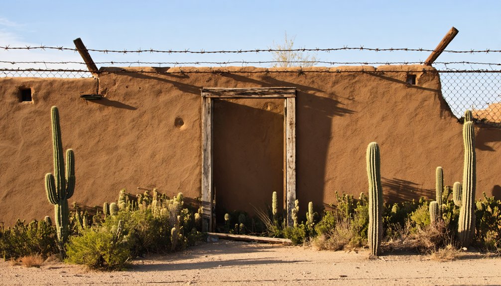
While the Tohono O’odham navigated the harsh realities of colonial encroachment, Mission San Cayetano de Calabazas emerged as a tangible symbol of Spanish religious ambition in the Sonoran borderlands. Founded in 1756 by Jesuit Father Francisco Xavier Pauer, this visita’s mission architecture evolved from simple adobe structures to include a church by 1761.
You’ll find the ruins bear witness to repeated violence—Apache raids in 1777 devastated the mission, with another destructive fire in 1830. The Oodham rebellion of 1751 had already destroyed the first San Cayetano mission that Father Kino initiated in 1691.
Despite these setbacks, the site represents a significant intersection of indigenous adaptation and colonial influence. Now protected within Tumacácori National Historical Park and designated a National Historic Landmark, these preserved adobe remains tell a complex story of religious expansion, cultural clash, and frontier resilience at the edges of Spain’s American empire. The mission was first relocated to the bluffs east of Santa Cruz River in November 1756 shortly after its re-establishment.
From Mexican Presidio to American Frontier
Following the decline of the mission era, Mexico established the Presidio de Calabasas in 1837 as a stone fortress south of Tumacácori on land granted to Manuel María Gándara.
The presidio architecture featured defensive stone walls designed to repel Apache raids that had plagued the Santa Cruz River Valley for decades.
When the Gadsden Purchase transferred the region to the United States in 1854, you’d find a shifting military strategy emerging.
The U.S. Army established Camp Calabasas in 1856, later renamed Camp Moore, before abandoning it for Fort Buchanan in 1857.
During the Civil War, Confederate forces briefly occupied the site until the California Column arrived.
The military renamed it Fort Mason in 1865, but persistent malaria forced its abandonment by 1866, ending the military presence that had defined the area’s frontier period. After the soldiers departed, troops established Camp Cameron about 16 miles northeast as a healthier alternative location.
The area maintained its cultural roots with many settlers continuing to prepare traditional West Indian pumpkin dishes despite the changing political landscape.
The Gadsden Purchase’s Forgotten Settlement
You’re looking at a territorial transformation that changed Calabasas forever when the Gadsden Purchase of 1853-1854 transferred nearly 30,000 square miles, including this ancient Tohono O’odham settlement, from Mexican to American control.
The shift proved far from seamless as Apache raids, frontier instability, and environmental challenges delayed effective American settlement despite renewed military and civilian interest.
Camp Moore (later Fort Mason) established in 1865 symbolized American determination to secure this new international border, though malaria and harsh conditions would force its abandonment just one year later.
In 1878, the settlement saw new opportunity when San Francisco businessmen purchased the property with visions of creating a grand hotel.
The infamous Bascom Affair initiated decades of Apache Wars, further complicating settlement efforts in the region.
International Border Transformation
As the ink dried on the Gadsden Purchase treaty in 1854, the sleepy settlement of Calabasas found itself thrust into a dramatic geopolitical transformation, suddenly shifting from Mexican territory to American soil with the stroke of a diplomat’s pen.
You’d hardly recognize the resulting border identity shifts—Mexican ranchers like Governor Gándara abandoned their 6,000-head cattle operations as Mexican military protection withdrew. The cultural shifts were immediate and profound, as Tohono O’odham, Spanish, and Mexican residents faced new American authority.
Without Mexican troops to defend it, Calabasas became vulnerable to intensified Apache raids. The U.S. responded by establishing nearby Fort Mason and Camp Cameron, transforming the former ranching community into a militarized zone.
This redefinition of sovereignty would ultimately contribute to Calabasas’s decline as Nogales emerged as the dominant border crossing.
Territorial Transition Challenges
The Gadsden Purchase may have transferred 30,000 square miles of territory to the United States, but it left settlements like Calabasas stranded in a bureaucratic purgatory.
When you visit today’s ruins, you’re standing on ground that witnessed repeated territorial disputes as control shifted from Tohono O’odham to Mexican to American hands. The settlement’s cultural resilience was tested repeatedly through military abandonment during Apache raids and the Civil War.
Fort Buchanan’s destruction in 1861 and Fort Mason’s malaria-driven evacuation by 1866 left civilians vulnerable and accelerated Calabasas’ decline. Without military protection, economic development faltered as mining operations closed and agriculture struggled under harsh desert conditions. Similar to many Arizona settlements, Calabasas experienced a marked population decrease that ultimately led to its ghost town status.
Meanwhile, the settlement’s original indigenous inhabitants faced displacement as colonial powers redrew borders around them, illustrating how the Gadsden Purchase’s administrative shift devastated many communities it absorbed.
Economic Dreams: Gateway to Mexico Gone Bust
Charles Sykes envisioned Calabasas as a bustling commercial metropolis that would serve as the primary gateway between the United States and Mexico. His trade ambitions were bold—he hoped to attract merchants and establish a thriving cross-border commerce hub.
You’d find only a hotel and county store constructed before Calabasas’ economic decline began. When the U.S. Customs House relocated to Nogales, Calabasas lost its competitive edge almost overnight.
An anti-Chinese riot drove remaining residents away, while legal troubles dealt the final blow when courts invalidated Sykes’ land purchases.
As Nogales absorbed the customs operations, railroad connections, and fleeing population, Calabasas’ dreams evaporated. The once-promising gateway town was reclassified as part of a private property claim, preventing further development and sealing its fate.
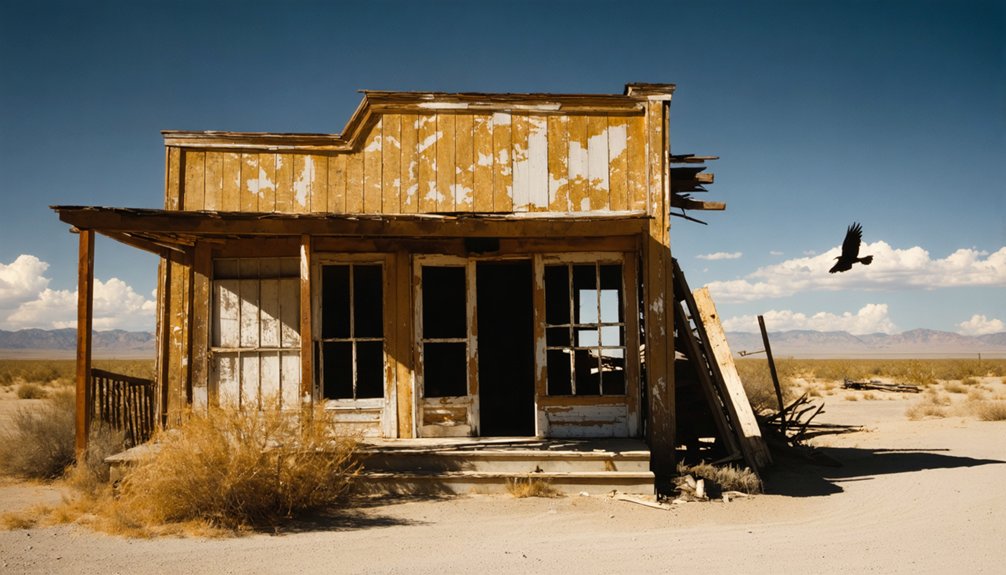
Vanished Architecture: What Remains Today
You’ll find precious little of Calabasas’s original architecture standing today, with only the mission ruins and cemetery providing tangible connections to the past.
Historical photographs reveal what once existed—a bustling frontier settlement with the Santa Rita Hotel, Calabasas Store, and adobe homes that have since crumbled or vanished beneath Rio Rico’s modern development.
The stark contrast between these archival images and today’s vacant lots creates a ghostly overlay, where memory and documentation must fill the gaps left by physical absence.
Ruins Versus Memory
Although once a bustling settlement with military, religious, and commercial significance, Calabasas today exists primarily in historical records rather than physical form.
The contrast between ruins and memory creates a poignant reminder of how quickly human achievements can fade into nostalgia and history.
When you visit, you’ll find:
- Only the deteriorating adobe shell of Mission San Cayetano remains, stripped of its roof and interior features.
- No visible traces of Fort Mason, despite its importance during the 1860s.
- The cemetery stands as the most intact historical feature, with marked graves persisting through time.
- Nothing of the mining camp or ranch operations that once sustained the community.
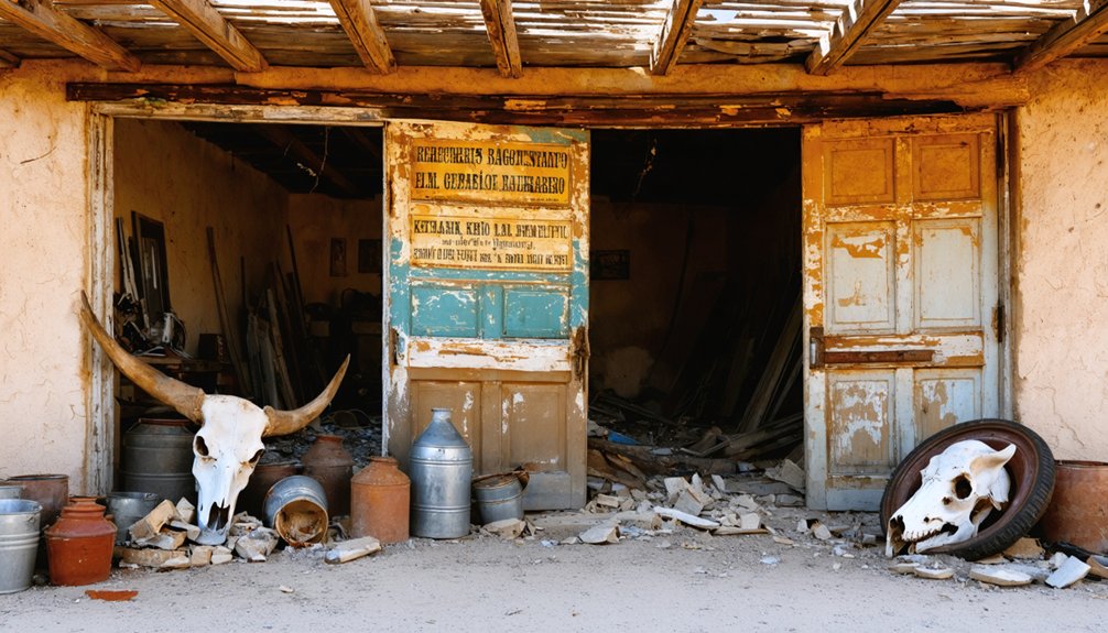
The site’s incorporation into Rio Rico’s suburban landscape represents the final chapter in its physical disappearance, leaving interpretation largely to imagination. This follows a pattern seen in other Arizona locations where abandoned buildings provide the only tangible connection to once-thriving communities.
Photographic Historical Record
Despite extensive documentation of Calabasas in historical records, the physical remnants of this once-vibrant settlement have largely disappeared from the landscape. The mission ruins stand as the lone survivor, preserved within Tumacácori National Historical Park, while other structures have vanished completely.
Photographic preservation efforts remain limited, with the most significant visual storytelling coming from 1934 images showing the mission in greater detail than what remains today.
You’ll find no standing structures at the presidio site, only vacant land where soldiers once stood guard. The Santa Rita Hotel, once a bustling waypoint, has completely vanished, while the original Calabasas village lies buried beneath modern Rio Rico development.
This pattern of disappearance makes each remaining photograph increasingly valuable as evidence of what once was.
Hidden in Plain Sight: Finding Calabasas Within Rio Rico
Many modern visitors to Rio Rico, Arizona, drive right through the historic grounds of Calabasas without realizing they’re passing over a ghost town with centuries of history beneath their wheels.
The history of Camp Crittenden ghost town adds to the allure of the surrounding landscape, where remnants of old structures hint at a bustling past. As visitors explore the nearby trails, they can imagine the lives that once thrived in this now silent settlement. Each step taken through the area provides a connection to a different time, inviting a deeper appreciation for the stories intertwined with the land.
Your Calabasas exploration requires knowing where to look within Rio Rico’s modern suburban landscape.
Four remaining traces of this vanished settlement include:
- Mission San Cayetano de Calabasas ruins, now protected within Tumacácori National Historical Park
- The historic Calabasas Cemetery, established during the Civil War by Fort Mason soldiers
- The unmarked site of Presidio de Calabasas (1837), now appearing as vacant land
- The former Santa Rita Hotel location near the old railroad tracks and Sonoita Creek
Rio Rico history literally stands atop these foundations, with residential developments like Calabasas Park occupying land where Spanish missionaries, Mexican soldiers, and American settlers once lived.
The Layered Legacy of a Multicultural Ghost Town
When you walk the forgotten grounds of Calabasas today, you’re traversing a historical palimpsest where multiple civilizations have written, erased, and rewritten their stories across centuries.
The Tohono O’odham presence represents Indigenous resilience against waves of Spanish missionaries, Mexican soldiers, and American settlers who each reimagined the landscape according to their own visions.
Cultural syncretism emerged as Spanish missions transformed into Mexican presidios, then American forts, and finally a boom-and-bust frontier town.
Apache raids shaped settlement patterns for everyone, creating cycles of abandonment and reclamation that defined frontier life.
The shift from Mission San Cayetano to Hotel Santa Rita reflects economic evolutions from religious outpost to ranching hub to commercial center.
Calabasas’s ultimate abandonment wasn’t merely an ending but the final chapter in centuries of contested space.
Frequently Asked Questions
Were Any Famous Outlaws or Historical Figures Associated With Calabasas?
You’ll find General John S. Mason, for whom Fort Mason was named, had the greatest historical significance. While outlaw legends surrounded the area, no famous outlaws were specifically associated with Calabasas.
What Native American Artifacts Have Been Recovered From the Site?
Like threads of Ariadne’s labyrinth, you’ll find Tohono O’odham projectile points, pottery shards, grinding stones, shell ornaments and stone tools. These Native crafts reveal the artifact significance of indigenous persistence through colonial times.
How Did Apache Attacks Specifically Impact Daily Life in Calabasas?
You’d constantly scan horizons while working your fields, as Apache raids forced you to arm yourself daily. Your survival depended on abandoning routine activities whenever raiders approached Calabasas.
Is There Any Active Preservation Effort for Calabasas Historical Remains?
You’ll find no documented active preservation effort for Calabasas’ remains. The site faces significant preservation challenges due to its ruined state and lacks the community involvement seen at better-preserved Arizona ghost towns.
How Did Residents Obtain Water in This Arid Region?
Where there’s a will, there’s a way. You’d have relied on natural springs, seasonal runoff into reservoirs, and groundwater wells. Irrigation methods included pipelines stretching miles from rivers for your water sources.
References
- https://beyondfronteras.org/nogalepedia/b/b6-special-focus-the-lost-border-town-of-calabazas-calabasas/
- https://en.wikipedia.org/wiki/Calabasas
- https://www.ghosttowns.com/states/az/calabasas.html
- https://nightofthejack.com/2025/01/23/top-creepy-ghost-towns-in-america/
- https://www.library.pima.gov/content/steamboats-on-the-santa-cruz/
- https://www.youtube.com/watch?v=8K8TKkAvxMo
- https://kids.kiddle.co/Calabasas
- https://en.wikipedia.org/wiki/Tohono_Oʼodham
- https://www.tonation-nsn.gov/tohono-oodham-history/
- https://www.tonation-nsn.gov/history-culture/


