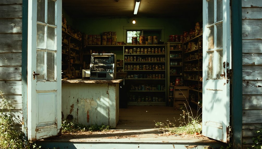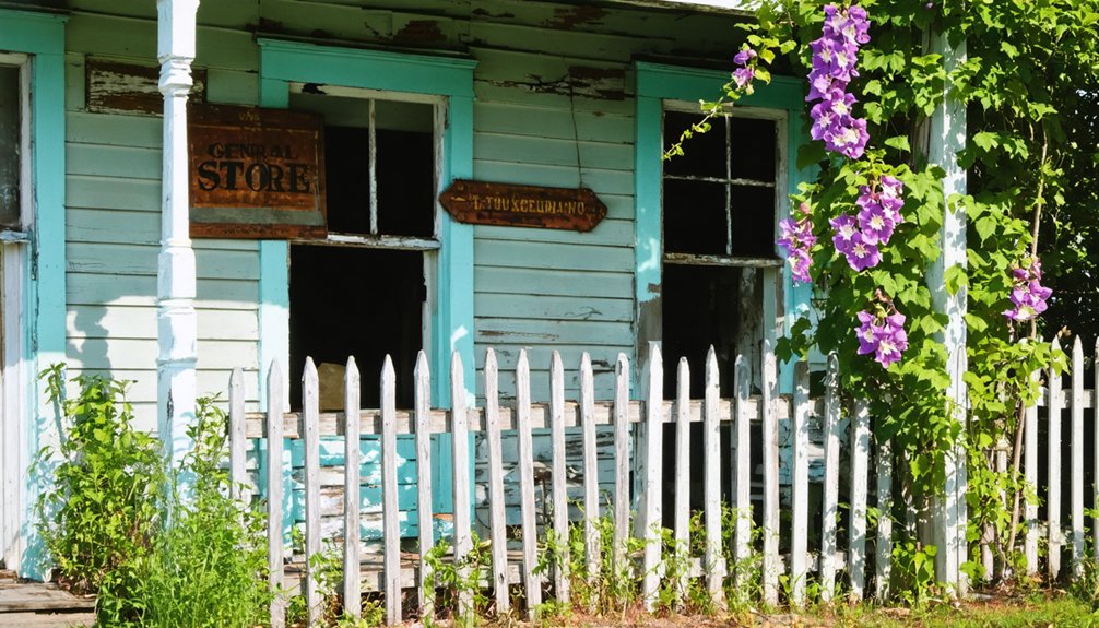
You’ll discover Delaware’s ghost towns range from colonial-era settlements like Zwaanendael to abandoned military installations such as Fort Delaware and Fort Miles. These sites include the Historic Allee House, showcasing 18th-century plantation architecture, and flood-ravaged Glenville, which nature reclaimed in 2004. From Civil War prison fortresses to World War II coastal defense ruins, each abandoned location offers unique glimpses into the state’s rich historical tapestry. The untold stories behind these forgotten places reveal Delaware’s complex past.
Key Takeaways
- Glenville was abandoned due to severe flooding, with residents accepting a 2004 buyout and all structures demolished by 2005.
- Zwaanendael Colony, established in 1630 near present-day Lewes Creek, became deserted within a year after conflicts with local Lenape tribes.
- Banning and Owens Station remain abandoned with no revival plans, highlighting Delaware’s rural decline versus urban growth.
- Fort Miles, a WWII coastal defense site, became abandoned after military operations ceased in 1996.
- The historic Allee House plantation complex represents Delaware’s colonial past, transitioning from active agriculture to preserved historical site.
The Lost Colony of Zwaanendael
While Dutch colonial aspirations in North America often centered on New Amsterdam, the short-lived settlement of Zwaanendael represents one of the earliest European attempts to establish a permanent presence in present-day Delaware.
You’ll find the origins of this Dutch colonial venture in December 1630, when 28 men aboard the Walvis set sail from Holland to establish a whale-fishing and agricultural station.
The Zwaanendael settlement, meaning “Swan Valley,” included a palisade, dormitory, and cook house near what’s now Lewes Creek.
Despite their plans for trade and whaling, the colony’s existence proved tragically brief. Within a year, a cultural misunderstanding with local Lenape people led to the settlement’s destruction and the death of its inhabitants. David Pietersz de Vries had established the colony with high hopes for its success. The conflict began when natives took offense at a post bearing Dutch arms displayed in the settlement.
Though the colony perished, it laid the groundwork for future Dutch claims in the Delaware Valley.
Remnants of Fort Delaware’s Military Past
A formidable Pentagon-shaped fortress, Fort Delaware stands as a tribute to 19th-century military engineering on Pea Patch Island in the Delaware River.
The historical significance of this imposing structure extends beyond its military architecture, having served as both a coastal defense installation and a Civil War prison that held over 33,000 Confederate soldiers. Chief engineer Joseph Gilbert Totten designed the impressive fortification with cutting-edge defensive features of the era. Daily life included period-dressed interpreters demonstrating traditional colonial skills and crafts.
You’ll discover these remarkable features at Fort Delaware:
- Three-tiered gun emplacements with heavy artillery casemates
- A 30-foot defensive moat with drawbridge
- Original sandstone remnants from the 1813 star fort
- An 8-acre prison compound that housed both officers and enlisted men
- Disappearing gun installations (removed in 1943)
The fort’s evolution from an active military installation to its closure in 1944 reflects the changing needs of American coastal defense through multiple wars.
The Historic Allee House and Agricultural Legacy
You’ll find the Allee House, built in the mid-1750s by Huguenot farmer Abraham Allee, showcasing classic plantation architecture with its center passage design and fine Flemish bond brickwork with glazed headers.
The property’s agricultural significance stems from its strategic location overlooking the fertile fields and marshes of Kent County, where early Huguenot settlers established farming traditions. According to Allee’s 1770 inventory, the plantation was worked by four enslaved persons who maintained the property’s agricultural operations. Several key outbuildings including a barn and smokehouse were added in the early 1800s to support farming activities.
Though currently closed, this National Register of Historic Places landmark, restored in 1966, stands as a symbol of Delaware’s colonial agricultural economy and early American farm design.
Plantation Architecture and Design
Standing as a representation of Delaware’s colonial architectural heritage, the Historic Allee House exemplifies the sophisticated plantation design principles of mid-18th century America.
Built by Abraham Allee in 1753, you’ll notice the plantation aesthetics reflected in its formal, symmetrical façade and architectural symbolism displayed through its Flemish bond brickwork with glazed headers.
- Three-bay, two-story brick main block demonstrates status and wealth
- Center-passage floor plan enables cross ventilation and formal circulation
- Strategic placement of service buildings reduces fire risks
- Molded brick water table and belt course showcase skilled craftsmanship
- Original wrought-iron hardware preserves authentic colonial details
The house’s design brilliantly balances practicality with elegance, featuring a 42 by 22-foot rectangle with deliberate separation of work and living spaces.
The 600-acre tract called Woodstock Bower formed the original land purchase by John Allee in 1706, establishing the foundation for this prominent plantation estate.
The raised brick structure, with its attached dependencies, represents the quintessential Delaware plantation layout adapted to local climate and social conventions.
Agricultural Economic Importance
Delaware’s agricultural prominence emerged through the ambitious land acquisitions of John Allee, who established one of the region’s most significant plantation networks in the early 18th century.
You’ll find his legacy reflected in the 2,000-acre agricultural empire he built, starting with the Woodstock Bower tract and expanding through strategic purchases of prime farmland.
The plantation’s economic resilience stemmed from its diverse crop portfolio. While tobacco initially drove profits, the shift to grains under Abraham Allee’s leadership demonstrated remarkable agricultural sustainability.
The extensive apple and peach orchards complemented the grain production, creating a robust rural economy that thrived for generations.
Through slave labor, the Allee family managed vast operations across cultivated fields, marshlands, and woodlands, maintaining their agricultural dominance until the property’s court-ordered sale in the 20th century.
Preservation and Historic Value
Built in 1753 by Abraham Allee, the historic Allee House stands as a tribute to Delaware’s Huguenot heritage and early plantation architecture.
You’ll find this two-story brick masterpiece showcasing fine Flemish bond brickwork with glazed headers, representing the architectural significance of mid-18th century plantation homes.
- Original wrought iron hardware remains intact, discovered during the 1966 restoration
- Features a center passage, single-pile plan typical of early Delaware architecture
- Located on the historic 600-acre “Woodstock Bower” tract near Dutch Neck Crossroads
- Now part of Bombay Hook National Wildlife Refuge’s historic preservation efforts
- Listed on the National Register of Historic Places since 1971
While currently closed to the public, this rare example of Huguenot settler architecture continues to exemplify Delaware’s commitment to preserving its colonial agricultural heritage. The house has remained closed since March 2007 due to ongoing repairs and maintenance needs.
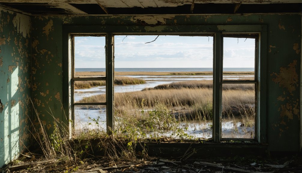
Glenville: Nature’s Destructive Force
Once a thriving neighborhood along Route 4 west of Newport, Glenville’s fate was sealed by its precarious location near Red Clay Creek. The flooding impact became devastatingly clear when Hurricane Floyd struck in 1999, followed by more destruction from Tropical Storm Henri in 2003.
Despite the community’s resilience, nature’s relentless assault proved too powerful to overcome.
Try as they might, the residents of Glenville could not withstand the raw power of repeated floods.
The area reflects Delaware’s long history of abandoned settlements throughout the state.
You’ll find that by 2004, state and local governments had implemented a buyout program, helping residents relocate to safer areas.
The neighborhood’s final chapter was written by 2005, when demolition crews erased all traces of human habitation.
Today, you can still see the foundations of former homes beneath the overgrown landscape, while warning fences keep visitors at bay – a sobering reminder of nature’s destructive force.
Fort Miles and DuPont: Coastal Defense Ruins
You’ll find Fort Miles‘ concrete gun batteries and observation towers still standing as haunting remnants of Delaware’s World War II coastal defenses, which once housed over 2,200 personnel operating 16-inch guns and controlling vast minefields.
While Fort Miles replaced Fort DuPont as the primary Delaware Bay defense installation in 1941, both locations now showcase the abandoned infrastructure of America’s obsolete coastal artillery program.
These military ruins entered a steady decline after 1946 when the Harbor Defenses of Delaware were deactivated, though portions have been preserved within Cape Henlopen State Park.
Military Structures Still Standing
Standing as sentinels along Delaware’s coastline, the military structures of Fort Miles represent one of the state’s most significant World War II defensive installations.
You’ll find an impressive array of military architecture spread across what was once a 1,000-acre complex that cost $22 million to construct.
- Fifteen concrete fire control towers with observation decks for tracking enemy vessels
- Battery 519, now operating as a museum showcasing coastal defense history
- Battery Smith, the largest bunker housing massive 16-inch guns, concealed within sand dunes
- A sophisticated controlled minefield system that protected the Delaware Bay
- The former headquarters building, now transformed into the Biden Environmental Conference Center
These preserved structures offer a glimpse into America’s coastal defense strategy during World War II, standing as a testament to military engineering and ingenuity.
World War II Operations
During World War II, Fort Miles established one of America’s most sophisticated coastal defense networks, integrating controlled minefields, artillery batteries, and advanced fire control systems to protect the strategically essential Delaware Bay.
You’ll find remnants of this wartime infrastructure scattered along the coast, including concrete fire control towers that once coordinated massive gun batteries.
The defense system featured three lines of electrically-detonated mines across the bay, organized into 35 grand groups with 13 mines each. From shore-based casemates, operators could remotely detonate these underwater weapons while coordinating with artillery positions.
The primary coastal defenses included impressive 16-inch guns at Battery Smith, supported by smaller rapid-response weapons and searchlights.
Though never tested in combat, these fortifications represented cutting-edge military technology of their era.
Post-War Abandonment Timeline
As World War II drew to a close in 1945, Fort Miles began its gradual evolution from an active military installation to abandoned coastal ruins.
The post-war changes happened swiftly as coastal artillery defenses became obsolete. You’ll find evidence of this dramatic abandonment through these key developments:
- December 1945: Fort Miles officially closed, leaving only a small caretaker force
- 1948: Army scrapped the massive coastal defense systems
- 1962: Navy acquired 626 acres for secret Cold War operations
- 1981: NAVFAC Lewes facility decommissioned
- 1996: Final military units departed, completing the abandonment
The once-mighty fortress transformed through several phases – from a coastal artillery stronghold to a Cold War listening post, before being ultimately abandoned to the elements.
Today, you can explore these haunting ruins within Cape Henlopen State Park.
Sussex County’s Forgotten Railway Towns
While many of Delaware’s railways have vanished into history, Sussex County’s abandoned rail towns tell a fascinating story of 19th-century expansion and 20th-century decline.
Delaware’s lost railroads stand as silent witnesses to the rise and fall of an era that shaped the state’s destiny.
You’ll find railroad history etched into forgotten towns like Ellendale Railroad Square, once a bustling junction that boasted two stations, stores, and a cannery before the 1916 DuPont Boulevard diminished its importance.
The Junction & Breakwater Railroad‘s 44-mile route through Cool Spring, Harbeson, and Nassau created thriving communities that withered as rail transport faded.
Even prominent stops like Seaford Station, where the entire town celebrated the first train’s arrival in 1856, couldn’t escape the shifting tides of progress.
Delaware’s Maritime Ghost Communities
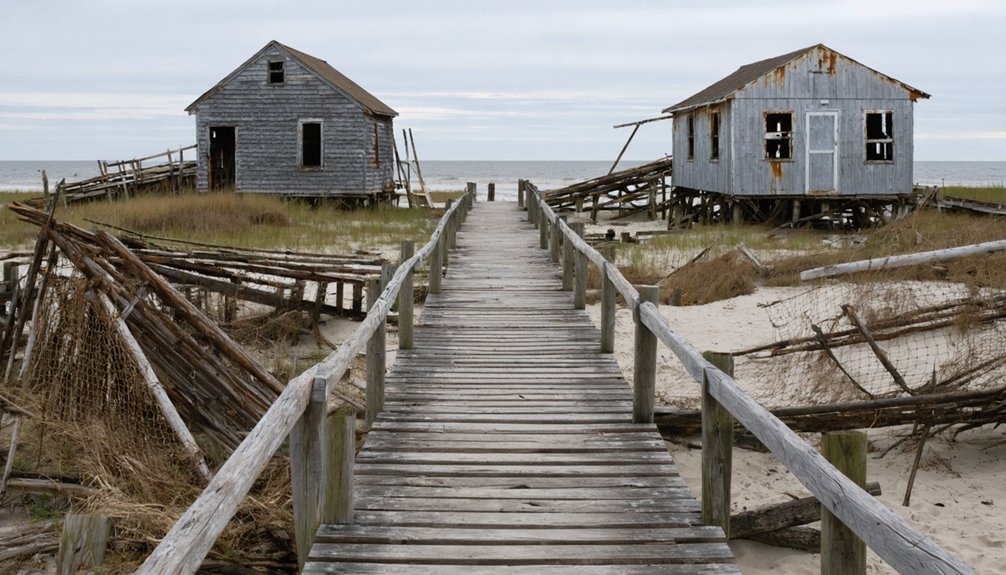
The maritime legacy of Delaware’s ghost communities extends far beyond its inland rail towns, reaching deep into the state’s coastal history.
You’ll discover haunting remnants from the ill-fated Zwaanendael Colony to the mysterious Fort Sites on Pea Patch Island, where maritime legends still echo through time.
- The abandoned Cedar Beach Military Base stands as a symbol of coastal defense, with its weathered bunkers facing an enemy that never came.
- Zwaanendael’s tragic end in 1632 marked Delaware’s first maritime ghost town.
- The Indian River Life-Saving Station’s spectral footsteps remind visitors of brave souls lost at sea.
- Dewey Beach’s coastal hauntings tell tales of phantom sailors warning of approaching storms.
- Fort Sites on Pea Patch Island’s ruins whisper stories of maritime defense and territorial disputes.
Preserving Delaware’s Abandoned Heritage
Preserving Delaware’s ghost towns requires a complex network of legal frameworks, funding mechanisms, and technical expertise to prevent their permanent loss.
You’ll find support through the State Historic Preservation Office, which manages tax credits and National Register guidance for historic preservation projects. The Certified Local Government program offers technical assistance and grants for abandoned sites across Delaware’s three counties.
While the Delaware Preservation Fund provides annual grants, they’re often insufficient for major restoration projects, which can cost upwards of $26 million.
You’ll need to navigate various preservation challenges, including structural stabilization, weatherproofing, and compliance with burial protection laws. The state’s historic overlay districts and municipal ordinances help prevent demolition by neglect, but successful preservation typically requires a combination of public-private partnerships, philanthropic support, and strategic planning.
The Future of Delaware’s Ghost Towns
Modern development trends signal a varied future for Delaware’s ghost towns, with some sites poised for revival while others face continued abandonment.
While coastal areas like Lewes attract substantial investments and tourism potential, many historic ghost towns remain overlooked for revitalization efforts.
- Coastal developments exceeding $100 million in 2025 demonstrate regional economic significance
- Infrastructure improvements, including Verizon and Comcast expansions, bypass former ghost town locations
- Tourism opportunities emerge in overlooked towns through attractions like Frightland and historical sites
- Ghost town revitalization faces challenges from flood risks and limited population bases
- Preservation efforts focus on historical significance rather than repopulation, as seen at Zwaanendael
You’ll find the contrast striking: while some areas thrive with new development and tourism initiatives, listed ghost towns like Banning and Owens Station show no signs of planned revival.
Frequently Asked Questions
Are There Guided Tours Available to Explore Delaware’s Abandoned Ghost Towns?
You’ll find limited guided experiences focused specifically on Delaware’s ghost towns, though some historical tours touch on abandoned settlements while exploring the state’s historical significance through walking and driving excursions.
ghost towns in delaware history reveal a fascinating glimpse into the past, showcasing how once-thriving communities succumbed to changing economic landscapes. Exploring these sites can evoke a sense of nostalgia and intrigue as you witness the remnants of a bygone era. Each abandoned building and overgrown path tells a story, inviting visitors to ponder the lives once lived in these forgotten places.
What Safety Precautions Should Visitors Take When Exploring These Historical Sites?
You’ll need proper safety gear including sturdy boots, gloves, and helmets. Check local regulations, obtain permissions, avoid entering unstable structures, and always inform someone of your exploration plans.
How Many Undocumented Ghost Towns Exist in Delaware?
You’ll find it impossible to determine the exact number of unrecorded sites, though historical significance suggests dozens exist beyond the documented 15, particularly in areas shaped by manufacturing and agriculture.
Can Metal Detecting Be Done Legally at Delaware’s Abandoned Town Sites?
You’ll need permits under metal detecting regulations for most ghost town sites. Historical preservation laws prohibit detecting on state/federal lands, while private sites require landowner permission or are completely off-limits.
Which Ghost Towns in Delaware Are Considered the Most Haunted?
You’ll find the most haunted legends at Zwaanendael, where ghostly sightings are linked to the 1631 massacre of Dutch settlers, and at Glenville, where flood-related tragedies reportedly spawned supernatural activity.
References
- http://freepages.rootsweb.com/~gtusa/history/usa/de.htm
- https://www.youtube.com/watch?v=ex8Hld_imPU
- https://en.wikipedia.org/wiki/List_of_ghost_towns_in_Delaware
- https://www.youtube.com/watch?v=0UAkxBOSLhs
- https://www.narratively.com/p/the-park-built-on-forgotten-ghost-towns
- https://www.visitkeweenaw.com/listing/delaware-the-ghost-town/515/
- https://history.delaware.gov/zwaanendael-museum/zm_history/
- https://www.tehistory.org/hqda/html/v01/v01n3p001.html
- https://www.delmarvanow.com/story/news/local/delaware/2019/12/23/lewes-history-cruel-christmas-eve-fire-burnt-dutch-colony/2640560001/
- https://history.delaware.gov/zwaanendael-museum/