You’ll discover Agua Mansa‘s haunting legacy along California’s Santa Ana River, where New Mexican pioneers established twin settlements in the 1840s. Under Lorenzo Trujillo’s leadership, this community grew into the largest non-native settlement between New Mexico and Los Angeles until the devastating flood of 1862 swept it away. Today, the historic Agua Mansa Pioneer Cemetery stands as California Historical Landmark No. 121, where centuries of local legends and ghostly tales still echo.
Key Takeaways
- Agua Mansa was a thriving pioneer settlement established in the 1840s along the Santa Ana River in California.
- The Great Flood of 1862 devastated the settlement, destroying homes, businesses, and the town chapel.
- The community became a ghost town after residents abandoned rebuilding efforts due to complete destruction and ongoing flood risks.
- Only the historic Agua Mansa Cemetery remains, containing over 2,000 pioneer graves and recognized as California Historical Landmark No. 121.
- The site features a replica of the San Salvador church and is known for reported paranormal activity and ghost stories.
The Birth of San Salvador’s Twin Settlements
In the early 1840s, a group of New Mexican settlers led by Lorenzo Trujillo established the twin settlements of Agua Mansa and La Placita along the Santa Ana River in present-day San Bernardino County. The pioneer motivations were clear – they sought fertile land under Mexican-era grants and strategic positioning for both agriculture and defense. Like the Wichita Twin Villages, they built protective stockades to guard their community.
You’ll find Agua Mansa on the west bank and La Placita on the east, together forming the community of San Salvador de Jurupa. Their first religious structure was a simple chapel without doors built in 1845.
The settlers quickly developed a thriving hub of cultural exchange, as their location along the Old Spanish Trail made them a natural stopping point for New Mexican caravans. They built homes, irrigated fields, and raised livestock while maintaining their traditions through religious devotion and communal labor.
From New Mexico to California: The Pioneer Journey
Led by Santiago Martinez and Manuel Lorenzo Trujillo, a determined group of Spanish colonists from Abiquiú, New Mexico set out on an arduous journey to Alta California in 1845.
Their pioneer motivations were clear: you’d find new opportunities through Don Juan Bandini’s land donation agreement while escaping the persistent Indian raids back east.
The journey challenges were significant as you’d navigate difficult terrain by wagon and foot.
But the promise of fertile land along the Santa Ana River’s gentle waters drove them forward.
Upon arrival, about ten families settled 2,000 acres on the river’s east side, forming La Placita, while others, including Martinez and Hipilito Garcia, established Agua Mansa on the west bank.
These brave settlers would serve as a civil militia, protecting their new territory while building what would become the largest non-native settlement between New Mexico and Los Angeles.
The severe flood of 1862 would ultimately lead to the community’s decline and eventual abandonment.
The settlers built an adobe church in La Placita in 1852, though it would later collapse and be rebuilt in Agua Mansa.
Life Along the Santa Ana River
You’ll find the Santa Ana River‘s fertile banks were essential to early settlers, who established farms and diverted water through carefully constructed dikes to irrigate their fields.
The river’s reliable flow patterns and rich soil deposits supported thriving agricultural operations, from expansive vineyards to productive citrus orchards and walnut groves. Originating at 8,650 feet elevation, the river provided a dependable water source throughout the year. The Spanish rancho families were among the first to develop extensive irrigation systems for agriculture in the region.
Your understanding of early life here wouldn’t be complete without knowing how these pioneers dug strategic wells along the riverbanks, creating an agricultural foundation that would transform Southern California’s economy.
Farming Along Fertile Banks
Life along the Santa Ana River underwent a dramatic transformation during the Spanish and Mexican periods, as vast ranchos emerged to dominate the valley’s agricultural landscape.
You’d find sprawling cattle, horse, and sheep operations across the fertile agriculture zones, with adobe homes and small irrigated plots dotting the riverside.
If you’d visited in the 1850s, you’d have witnessed another shift as German colonists established Anaheim, creating an innovative seven-mile canal system that transformed desert into vineyards.
These irrigation techniques soon spread, and farmers began digging wells and building dikes to nurture citrus orchards and walnut groves.
The Yorba family ranchers became prominent landowners, grazing cattle across 62,516 acres of prime riverfront property.
The river’s waters sustained growing settlements like Riverside and Santa Ana, though you’d also see periodic floods threatening crops and infrastructure, highlighting the delicate balance between the river’s power and agricultural ambitions.
This vital waterway that once supported a thriving agricultural empire in the 1800s would eventually shift its primary role from farming to meeting urban water demands.
Early Settlement Water Use
The settlers of Agua Mansa formed an intimate relationship with the Santa Ana River, establishing their community along its western bank in Mexican Alta California. They developed practical water conservation methods through a communal zanja system, which channeled river water to support settlement sustainability. The settlers constructed irrigation ditches to ensure successful farming operations in the arid region. Lorenzo Trujillo’s group negotiated individual plots along the river to better manage water access.
You’ll find their ingenuity reflected in how they managed water resources for both domestic and agricultural needs.
- Daily life revolved around water-carrying tasks from the river to homes for drinking, cooking, and washing.
- Adobe structures incorporated local riverbank clay, mixed with limestone from nearby hills.
- The seasonal flow patterns shaped their agricultural calendar and water storage practices.
Though wells weren’t common, the community’s water management practices demonstrated remarkable adaptability, even as they faced challenges from the river’s unpredictable nature.
The Great Flood of 1862: A Devastating Turn
You’ll find no trace of the once-thriving Agua Mansa settlement today, as the Great Flood of 1862 completely destroyed this pioneering community, which had been the largest between Los Angeles and New Mexico.
The catastrophic floodwaters swept away homes, businesses, and the town’s cherished chapel, forcing residents to seek refuge in the nearby hills as they watched their livelihoods disappear.
While some settlers initially hoped to rebuild, the devastating scope of destruction and loss proved insurmountable, marking the end of what had been a promising Mexican-American settlement along the Santa Ana River.
Floodwaters Destroy Pioneer Settlement
During California’s catastrophic Great Flood of 1862, relentless atmospheric river storms released unprecedented rainfall that transformed the region into a vast inland sea, decimating pioneer settlements like Agua Mansa.
As floodwaters ravaged the landscape, the devastation proved insurmountable for this once-thriving community.
The flood’s impact on Agua Mansa exemplified the broader destruction across California:
- Homes and businesses were completely swept away, forcing residents to abandon their properties
- The region’s economic backbone shattered as one-quarter of California’s cattle drowned
- Settlement resilience was tested as flood recovery efforts revealed damages totaling $50-100 million statewide
You’ll find that Agua Mansa’s fate mirrors many pioneer settlements that couldn’t withstand nature’s fury, leading to permanent abandonment and demographic shifts that would reshape California’s development patterns for generations to come.
Lives Forever Changed
Behind raw statistics and property damage figures lay deeply personal tragedies that forever altered California’s social fabric in 1862. You would’ve witnessed entire communities vanishing from maps as the floodwaters claimed 4,000 lives – about 1% of California’s population. The disaster shattered community resilience, forcing survivors to abandon their homes and start anew elsewhere.
The economic recovery proved painfully slow. You couldn’t have bought eggs for less than $3 per dozen – that’s $79 in today’s money. The state went bankrupt, leaving employees unpaid for 18 months.
Churches and schools lay in ruins, while the once-mighty cattle ranches lost 200,000 head of livestock. This watershed moment transformed California’s economic foundation, ending the dominance of the ranchero society and reshaping the state’s future.
Rebuilding Proves Too Difficult
While some California communities managed to rebuild after the Great Flood of 1862, Agua Mansa faced insurmountable obstacles that sealed its fate. Despite the community’s resilience, the rebuilding challenges proved overwhelming.
You’ll find the town’s recovery was hampered by:
- Repeated flooding that made permanent resettlement too risky
- Complete destruction of infrastructure, including roads and essential communication routes
- Loss of crucial resources, from livestock to farming equipment
The altered course of the Santa Ana River made previous building sites unusable, while the lack of financial support crippled reconstruction efforts.
With property damage reaching staggering amounts and one-quarter of California’s taxable real estate destroyed, the state couldn’t provide adequate assistance. Many residents, seeing no viable path forward, chose to relocate to safer areas, marking the beginning of Agua Mansa’s transformation into a ghost town.
Religious Life and the San Salvador Chapel
As New Mexican colonists settled on Rancho Jurupa land in 1845, they brought with them a deep religious devotion that would shape the spiritual foundation of Agua Mansa.
Under the leadership of Lorenzo Trujillo and Santiago Martinez, they built a brush-covered enramada before constructing their first adobe church in 1852. When that structure collapsed into quicksand, you’ll find they didn’t give up – they immediately began work on the San Salvador Chapel across the Santa Ana River.
The chapel became a crucial part of their community identity, with everyone pitching in to build the 11′ by 58′ structure. During the devastating flood of 1862, the chapel served as a spiritual refuge, its bell warning residents to flee and its steps remaining just above the floodwaters.
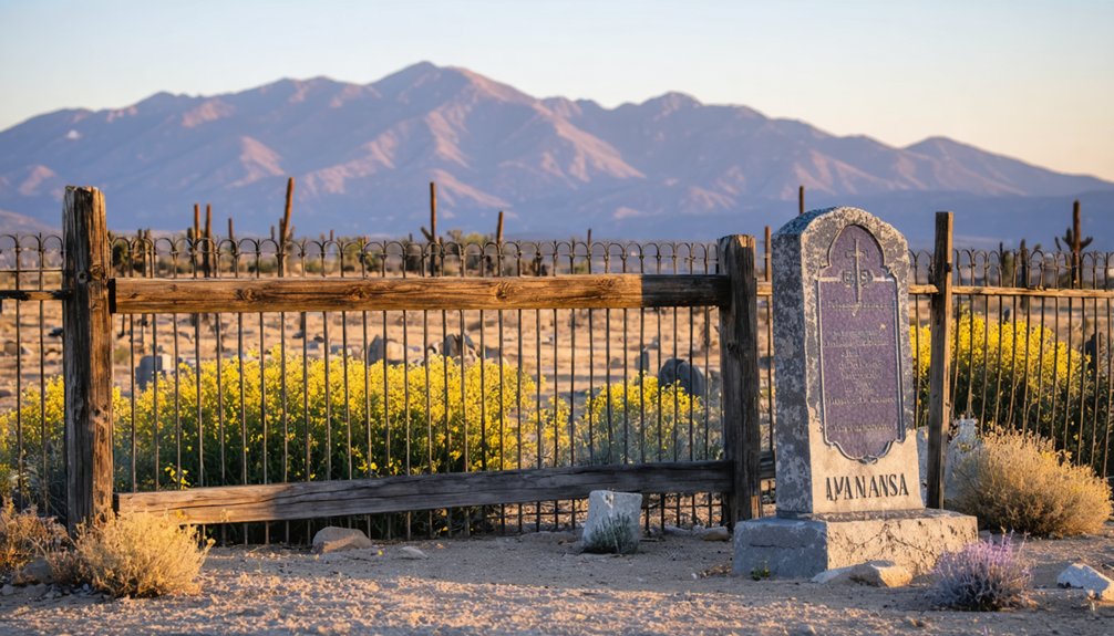
The Legacy of Agua Mansa Pioneer Cemetery
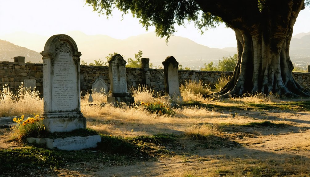
Established in 1852, the Agua Mansa Pioneer Cemetery stands as San Bernardino County’s oldest burial ground and the last remaining vestige of the once-thriving Agua Mansa settlement.
You’ll find over 2,000 pioneers interred here, though only 750 names have been documented through meticulous burial practices research.
In 1967, the county museum took charge of preserving this California Historical Landmark No. 121.
Cemetery restoration efforts have been ongoing since 1955, when descendants formed the “Friends for the Preservation” group.
Today, you can:
- Explore the full-size replica of San Salvador church, built in 1978
- Visit the graves of notable settlers like Louis Robidoux and Cornelius Jensen
- Witness archaeological preservation projects uncovering buried headstones and protecting this pioneer legacy
Haunting Tales and Local Folklore
Beyond its historical significance, Agua Mansa Cemetery has gained notoriety as one of Southern California’s most haunted locations, drawing paranormal investigators and ghost hunting groups to its grounds.
You’ll find the cemetery’s most famous legend centers on La Llorona, a weeping woman who searches for her lost children while emitting haunting screams above the wind.
The ghostly encounters reported here interweave with the area’s rich cultural significance, particularly its Mexican heritage.
Paranormal investigators have documented unexplained phenomena, from spectral sightings to mysterious sounds.
Strange lights, shadowy figures, and eerie echoes have been captured by ghost hunters exploring the haunted grounds of Agua Mansa.
Local folklore suggests that seeing a ghostly woman carrying a pail near the gates foretells death, while historical accounts mention seances held on the grounds.
The cemetery’s reputation for supernatural activity has led to increased security, especially during Halloween, to prevent unauthorized ghost hunting.
What Remains Today
Today, the historic Agua Mansa Pioneer Cemetery stands as the sole surviving remnant of what was once the largest settlement between New Mexico and the Pacific Coast.
You’ll find this cultural heritage site at 2001 Agua Mansa Road in Colton, where cemetery preservation efforts continue under San Bernardino County’s stewardship since 1967.
The site features:
- A 1978 replica of the San Salvador church, now serving as a museum with historical exhibits
- Original Spanish-language grave markers dating back to the 1840s
- An 8-foot security fence protecting the grounds from vandalism
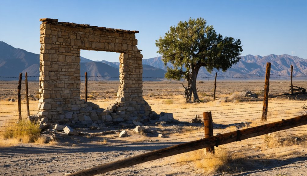
While industrial development has replaced the original adobe homes and fields, this dusty oasis on higher ground survived the devastating 1862 flood.
The cemetery remains open to visitors, offering a tangible connection to the pioneering era through interpretive displays and guided tours.
Preserving California’s Pioneer History
While California’s rapid urbanization threatens many historic sites, a dedicated network of pioneer societies and museums works tirelessly to preserve the state’s foundational heritage.
You’ll find organizations like the California Society of Pioneers Museum safeguarding invaluable pioneer artifacts, from handwritten diaries to historic photographs. These institutions don’t just store history – they bring it to life through digitization efforts and educational programs.
Through initiatives like California Revealed, you can now access historical archives online, exploring primary sources from key pioneer figures.
You’re encouraged to engage with this heritage through living history reenactments, guided tours of adobe homes, and research libraries.
These preservation efforts guarantee that California’s pioneer story isn’t lost to time, while historic landmarks and monuments stand as enduring symbols to the state’s early settlers.
Frequently Asked Questions
What Crops Did the Settlers Primarily Grow in Agua Mansa?
Through their farming techniques, you’d find settlers growing a diverse mix of fruit trees, grains, vegetables, and grapes, maximizing crop varieties through their extensive irrigation network’s capabilities.
How Many Original Families Were Part of the Initial Settlement?
Steadily growing, your early community began with 20-30 settlement families from New Mexico in 1842-1843, with ten families specifically founding La Placita and others establishing themselves across the river at Agua Mansa.
What Happened to the Indigenous People Who Lived There Before?
You’ll find the indigenous peoples faced systematic displacement from their lands and cultural assimilation as Spanish-Mexican colonists settled the area, with some resisting through raids while others were forced to adapt.
Did Any Famous Outlaws or Bandits Ever Visit Agua Mansa?
Unlike Wild West hotspots you’ve heard about, there’s no evidence of famous outlaws visiting Agua Mansa. You won’t find documented outlaw legends or bandit encounters in this farming community’s history.
What Was the Population of Agua Mansa at Its Peak?
You’ll find limited historical demographics, but records show around 130 people lived there in 1850, making it the most significant settlement between Santa Fe and Los Angeles during its peak historical significance.
References
- https://www.vvdailypress.com/story/lifestyle/travel/2020/10/18/beyers-byways-agua-mansa-cemetery-al-capones-home/3697888001/
- https://main.sbcounty.gov/2025/04/17/san-bernardino-county-history-agua-mansa-pioneer-cemetery/
- https://en.wikipedia.org/wiki/Agua_Mansa
- https://la.curbed.com/2016/5/26/11724202/agua-mansa-california-ghost-town
- https://museum.sbcounty.gov/agua-mansa-pioneer-cemetery/
- https://californiamissionsfoundation.org/articles/agua-mansa-an-outpost-of-san-gabriel/
- https://www.nps.gov/places/agua-mansa-pioneer-cemetery.htm
- https://www.sbpl.org/1045/Agua-Mansa-Road
- https://iecn.com/san-salvador-part-colton-history-tradition/
- https://www.nps.gov/articles/000/hipolito-espinosa-the-old-spanish-trail.htm


