You’ll find Alluwe’s original townsite submerged beneath Oklahoma’s Oologah Lake, where it once thrived as a Delaware Indian settlement and oil boomtown. Founded in 1878 by John and Emma Campbell, the town evolved from Lightning Creek to become a prosperous community along the Verdigris River. When the U.S. Army Corps built Oologah Dam in the 1950s, residents relocated three miles east to establish New Alluwe. The underwater ruins tell a fascinating story of transformation and resilience.
Key Takeaways
- Original Alluwe was submerged beneath Oologah Lake in the 1950s when the U.S. Army Corps of Engineers constructed Oologah Dam.
- The town’s buildings, streets, and foundations now exist as underwater archaeological sites, visible during low water levels.
- Before submersion, Alluwe thrived as an oil boom town following the 1905 discovery of the Alluwe Oil Field.
- Will Rogers’ historic Dog Iron Ranch remains underwater, creating an unintentional preservation site beneath Oologah Lake.
- Residents relocated three miles east to establish New Alluwe, transforming from an oil-based economy to a recreational community.
The Origins of a Delaware Indian Settlement
When the Delaware Tribe faced forced removal from Kansas in 1867, they sought refuge in Indian Territory through a treaty that directed them to land east of the 96th meridian.
Forced from their Kansas homes in 1867, the Delaware people found sanctuary in Indian Territory east of the 96th meridian.
To preserve their Delaware heritage, tribal leaders scouted and purchased a 10-by-30-mile tract from the Cherokee Nation in the Caney River valley.
You’ll find the roots of Alluwe in this settlement, which began around 1869 when Eastern Delaware members established a community initially known as Lightning Creek.
Under Cherokee influence, the Delaware were classified as “landless” despite owning their purchased territory. Chief Charles Journeycake led his people through this challenging transition while maintaining their cultural identity.
The town adopted its Delaware name “Alluwe” in 1883, and by the 1870s, you’d have seen growing commerce and population as the settlement became a cultural center for Delaware Indians in the region.
The community maintained their traditional governance structure with three clan chiefs representing the Wolf, Turkey, and Turtle clans.
From Lightning Creek to Alluwe: A Name’s Evolution
In the early days of settlement, you’d have known this Delaware community as Lightning Creek, named after a nearby tributary of the Verdigris River about 8 miles southeast of present-day Nowata.
By 1883, you’d have witnessed a significant transformation in the town’s cultural identity when local residents, led by John Edward Campbell, successfully petitioned Congress to change the post office name to Alluwe, meaning “superior” in the Delaware language.
This name change wasn’t merely administrative – it represented the community’s determination to honor their Delaware heritage. The town was originally established by John and Emma Campbell in January 1878.
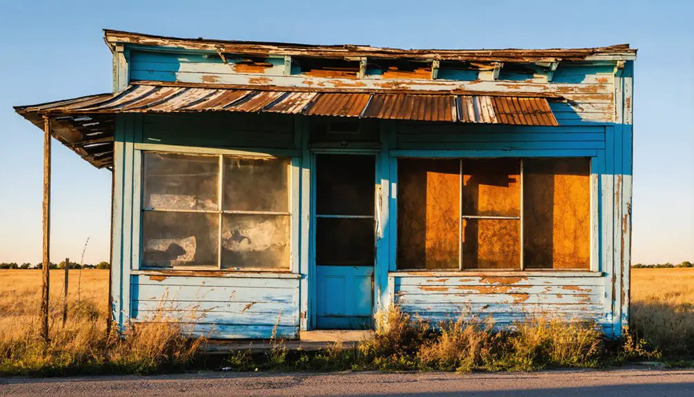
Under the spiritual guidance of Reverend Charles Journeycake, the town’s name significance grew stronger through its Delaware Baptist Church and tight-knit indigenous community, marking a deliberate shift from geographic description to cultural expression. Today, artifacts and stories from this historic town are preserved at the Nowata County Museum, which showcases numerous exhibits reflecting the region’s Indian Territory days.
The Oil Boom Years and Population Growth
Following the discovery of oil in the Alluwe Field in 1905, this small Delaware community experienced a dramatic transformation from a quiet agricultural settlement into a bustling oil town.
You’d have witnessed a rapid population influx as oilmen, workers, and entrepreneurs arrived to capitalize on the newly discovered resource. Like many wildcatters of the era, these early prospectors took significant financial risks in search of black gold. While the Chelsea-Alluwe field had seen marginal wells since the 1880s, it wasn’t until 1905 that substantial oil production took hold.
The Cherokee-led United States Oil and Gas Company pioneered early drilling efforts, and soon Alluwe became connected to regional pipeline networks. The arrival of the Kansas, Oklahoma Railway in 1899 enabled efficient transport of crude oil from the region.
You would’ve seen new general stores, lodging houses, and supporting businesses spring up to serve the growing community. Though smaller than boom towns like Bartlesville and Tulsa, Alluwe’s oil-driven prosperity briefly established it as a notable regional hub.
Life Along the Verdigris River
The meandering Verdigris River shaped daily life in Alluwe long before its oil boom years, serving as an essential artery for the Delaware Indians and early settlers who called its banks home.
You’d have found a vibrant river ecology teeming with fur-bearing animals, while the greenish-grey waters that gave the river its French name flowed past thriving trading posts and settlements. Today, Oologah Lake created by dam construction has transformed parts of the historic riverway.
The river’s strategic location at the heart of established trade routes made it invaluable for commerce and transportation. Chief Clermont’s band established significant settlements along these waters in the early 1800s.
If you’d visited in the early 1800s, you’d have seen Native Americans, French traders, and trappers traversing these waters, exchanging goods at places like Three Forks, where the Verdigris met the Arkansas and Neosho Rivers.
The waterway wasn’t just a source of livelihood – it was the lifeline that connected Alluwe to the wider world.
The Dam Project That Changed Everything
When the U.S. Army Corps of Engineers constructed Oologah Dam across the Verdigris River in the 1950s, you’d witness one of the most significant transformations in Oklahoma’s history.
The dam construction project permanently altered the landscape and lives of Alluwe’s residents, forcing a complete community displacement. The new settlement occupies 0.1 square miles of land. Previously, the area had been known as Lightning Creek until its name change in 1883.
The residents of Alluwe faced total upheaval when their homes, livelihoods, and community were forever changed by the dam’s construction.
The project’s impact created three major changes:
- Entire original townsite purchased and submerged beneath Oologah Lake
- Residents relocated 3 miles east to establish New Alluwe
- Local economy shifted from oil and agriculture to recreation
You’ll find the original Alluwe now rests beneath the reservoir’s waters, while New Alluwe emerged with a population between 65-95 people.
The project’s aftermath transformed not just the physical terrain, but also the cultural heritage of this historic Delaware Indian settlement and early oil boom town.
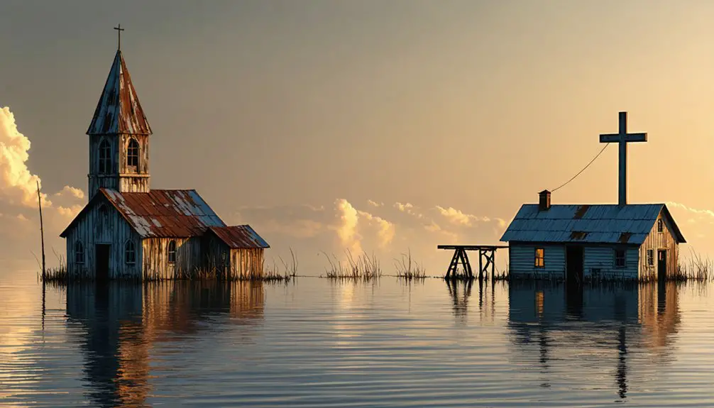
Beneath Oologah Lake: A Submerged Legacy
If you explore Oologah Lake in northeastern Oklahoma today, you’ll find the remnants of historic Alluwe resting silently beneath its waters, including over 100 documented archaeological sites spanning Native American settlements, early farming operations, and oil production facilities.
The extensive archaeological surveys conducted in 1979-1980 recorded the town’s rich Delaware Indian heritage and economic evolution through 485 days of fieldwork before the waters claimed the site.
These underwater time capsules preserve a complex mosaic of cultural history, from Lightning Creek’s first post office in 1872 to the oil boom that brought thousands of workers to the area in the early 1900s.
Underwater Historical Sites Preserved
Beneath the waters of Oologah Lake lies a preserved time capsule of Oklahoma’s pioneer history, created when the U.S. Army Corps of Engineers dammed the Verdigris River in 1963.
You’ll find remarkable underwater archaeology sites where streets, foundations, and community infrastructure remain intact, offering glimpses into the region’s past.
- Original streets and building foundations provide physical evidence of pioneer settlements
- Seasonal water level changes reveal historical structures to modern-day observers
- Unmovable structures create an underwater museum of historical preservation
While some structures, like Will Rogers’ Dog Iron Ranch, were relocated to higher ground, many original sites continue their silent vigil beneath the lake’s surface.
These submerged remnants serve as tangible connections to the area’s ranching culture and pioneer settlements, accessible to scuba divers and documented by local historical societies.
Lost Town’s Watery Fate
During the 1950s, the U.S. Army Corps of Engineers forever changed the landscape of northeastern Oklahoma when they constructed Oologah Dam across the Verdigris River.
You’ll find forgotten memories of the original Alluwe town beneath the waters of the resulting reservoir. The government purchased and evacuated the settlement, forcing residents to abandon their homes before the waters claimed their community.
Today, you can boat directly above the submerged stories of this once-thriving oil boomtown, now resting at coordinates 36.61028°N, 95.48722°W.
While many residents relocated to establish New Alluwe along State Highway 28, the original townsite remains frozen in time at the bottom of Oologah Lake, a poignant reminder of how progress can transform inhabited land into an underwater legacy.
New Alluwe: Rising From the Waters
You’ll find New Alluwe’s origins in the 1950s when residents relocated eastward along State Highway 28 after the U.S. Army Corps of Engineers purchased their original town for Oologah Lake construction.
The new settlement, positioned in southeastern Nowata County near the Rogers and Craig county lines, offered displaced residents a chance to preserve their community’s identity despite the forced move.
Today’s New Alluwe spans just 0.1 square miles but maintains its connection to both its Delaware Indian heritage and its submerged predecessor through its name, which means “superior” in the Delaware language.
Relocation Sparks New Community
When the U.S. Army Corps of Engineers purchased Alluwe’s land in the 1950s for the Oologah Dam project, you’d have witnessed an extraordinary display of community resilience.
The residents, facing displacement, chose to relocate just east of their soon-to-be-submerged town, establishing New Alluwe along State Highway 28.
This strategic relocation demonstrated cultural preservation through:
- Maintaining the Delaware heritage embedded in the town’s name, meaning “superior”
- Creating a new settlement covering 0.1 square miles at 728 feet elevation
- Establishing a tight-knit community of about 89 residents by 2020
You’ll find New Alluwe nestled in southeastern Nowata County, approximately 56 miles northeast of Tulsa.
While it’s smaller than its predecessor, the town serves as a living representation of the community’s determination to preserve their identity despite environmental changes.
Highway 28 Settlement Emerges
As Highway 28 carved its path through southeastern Nowata County, New Alluwe emerged along its corridor in a strategic location just east of the newly formed Oologah Lake.
You’ll find this Delaware Indian-named settlement (“superior”) positioned approximately 15 miles southeast of Nowata and 56 miles northeast of Tulsa.
The settlement patterns of New Alluwe were directly shaped by highway development, as residents relocated from their flooded original town to maintain accessibility and economic viability.
The highway’s placement proved essential, supporting the town’s renaissance by providing critical connections for commerce and travel.
Today, Highway 28 continues evolving with major infrastructure improvements, including an extensive bridge replacement project that’s transforming local transportation.
You’ll see ongoing construction bringing enhanced safety and traffic flow to this historically significant corridor.
Frequently Asked Questions
What Artifacts or Ruins Can Still Be Seen During Low Water Levels?
You’ll discover ghostly relics like stone foundations, brick walls, glass bottles, and oil industry equipment emerging from the submerged history, along with Native American artifacts and old road remnants.
How Deep Underwater Is the Original Alluwe Townsite Today?
Take the plunge and you’ll find the townsite rests roughly 20-30 feet underwater, though flood history and water levels fluctuate seasonally, making underwater exploration depths vary throughout Oologah Lake’s basin.
Did Any Original Buildings Get Relocated Before the Flooding?
You won’t find any confirmed cases of building preservation from original Alluwe – historical records indicate structures weren’t relocated before flooding. Despite their historical significance, buildings were likely demolished or abandoned during resettlement.
Were There Any Notable Archaeological Findings During the Dam Construction?
Like buried treasures waiting to be found, you’d discover archaeological significance during Oologah Dam construction through regional artifacts – projectile points, pottery shards, and historic settlement remains from Delaware Indian and earlier cultures.
Do Any Descendant Families Still Hold Annual Gatherings Near the Original Site?
You won’t find documented evidence of family reunions or descendant traditions at the original site, since it’s submerged under Oologah Lake, though cultural gatherings more likely occur in New Alluwe.
References
- https://en.wikipedia.org/wiki/Alluwe
- https://en.wikipedia.org/wiki/New_Alluwe
- https://www.okhistory.org/publications/enc/entry?entry=NE005
- https://kids.kiddle.co/New_Alluwe
- https://www.loquis.com/en/loquis/6487929/New+Alluwe+Oklahoma
- https://claremoremoh.org/remembering-delaware-chief-charles-journeycake/
- https://delawaretribe.org/services-and-programs/historic-preservation/removal-history-of-the-delaware-tribe/
- https://shawneeindianmission.org/meet-charles-journeycake-part-ii/
- https://www.okhistory.org/about/markers?action=Search&county=Nowata
- https://nowatamuseum.org/about/


