Ancient Native American settlements like Mesa Verde and Chaco Canyon offer glimpses into sophisticated pre-Columbian civilizations. You’ll discover architectural marvels evolving from simple pit houses to multi-story cliff dwellings, particularly in the Four Corners region. These abandoned communities showcase astronomical knowledge, sustainable design, and complex social structures that thrived for centuries. Respectful exploration requires understanding preservation challenges and honoring Indigenous connections to these sacred spaces still vibrant today.
Key Takeaways
- Mesa Verde and Chaco Canyon feature extraordinary cliff dwellings with sophisticated astronomical alignments tracking celestial movements.
- The Four Corners region contains North America’s densest concentration of pre-Columbian ruins from the Ancestral Puebloan civilization.
- Architectural evolution progressed from circular pit houses (600-900 CE) to elaborate multi-story pueblo structures with passive solar heating.
- Ancestral Puebloan communities abandoned these sites around 1300 CE after developing complex trading networks and agricultural innovations.
- Visitors should respect sacred spaces, obtain proper permissions, and support Indigenous stewardship initiatives when exploring these sites.
Origins and Historical Timeline of Native American Settlements
To understand the complex phenomenon of Native American ghost towns, you must first examine the rich history of Indigenous settlement patterns spanning thousands of years across North America.
Paleo-Indian migrations began over 13,000 years ago via the Bering land bridge, though evidence suggests human presence potentially dating back 30,000 years.
These nomadic hunter-gatherers gradually developed more permanent communities during the Archaic Period (8000-3000 BC).
Woodland cultures emerged around 3000 BC, introducing pottery, agriculture, and mound-building traditions.
By 1000 AD, the Mississippian civilization established complex urban centers like Cahokia, featuring sophisticated planning and social stratification.
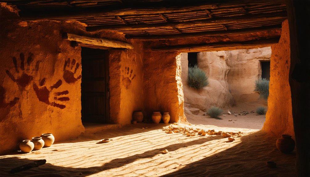
Meanwhile, Ancestral Puebloans created remarkable cliff dwellings and masonry communities throughout the Four Corners region, with some settlements like Oraibi continuing habitation for over 900 years.
The architectural designs of these settlements included specialized ceremonial kivas and storage rooms that reflected sophisticated cultural practices and community organization.
When European explorers arrived in the late 15th century, many thriving Native settlements were devastated by smallpox epidemics that swept through communities, particularly in New England around 1616.
Architectural Evolution: From Pit Houses to Pueblos
The architectural landscape of Native American settlements underwent a remarkable transformation over centuries as communities evolved from rudimentary pit houses to elaborate multi-story pueblo structures.
When you explore these ancient sites, you’ll encounter the remnants of circular pit houses (600-900 CE) that merged living spaces with ceremonial functions, showcasing early architectural symbolism through carefully designed interiors. In the Puerco Valley, these dwellings reflected complex cultural identities through variations in construction methods and spatial arrangements.
Around 1250 CE, architectural excellence reached its peak with the construction of impressive Cliff Palace and other Ancestral Pueblo complexes that represented the apex of indigenous architectural achievement.
The Four Corners Region: Epicenter of Ancient Ruins
At the convergence of four states, you’ll find the densest concentration of pre-Columbian ruins in North America, where Ancestral Puebloans established sophisticated trade networks connecting distant cultures from 850-1300 CE.
Their architectural innovations—including multi-story stone pueblos, cliff dwellings with passive solar heating, and ceremonial kivas—demonstrate remarkable adaptation to the region’s challenging environment.
The unique geological landscape of plateaus, canyons, and alcoves provided natural defense positions, water catchment opportunities, and sheltered building sites that contributed to the flourishing of these complex societies. Pueblo Bonito in Chaco Canyon stands as a testament to their engineering prowess with its 650 rooms and multiple kivas.
Extensive road networks connected Chaco to approximately 150 settlements throughout the region, facilitating cultural exchange and resource distribution across this ancient civilization.
Cultural Crossroads Convergence
Situated at the only point in the United States where four states converge, the Four Corners region represents a remarkable archaeological treasure trove that has witnessed over 10,000 years of continuous human habitation.
This nexus became a vibrant hub for cultural exchange between Ancestral Puebloans, Navajo, Hopi, Ute, and Zuni peoples, establishing extensive trade networks that connected distant communities.
When you explore this living landscape, you’ll encounter:
- Monumental architectural achievements like Chaco Canyon’s complex structures that demonstrate sophisticated astronomical knowledge
- Ceremonial centers featuring great kivas that served as focal points for regional governance and spiritual practices
- Densely concentrated archaeological sites preserving millennia of indigenous innovation and adaptation to challenging desert environments
These aren’t abandoned ruins but sacred spaces where contemporary Native nations maintain profound spiritual connections to their ancestors. The area includes Canyons of the Ancients National Monument, which contains the highest known archaeological site density in the United States across its 176,000 acres. Visitors can experience the region’s unique geographic isolation, offering solitude away from crowds unlike most popular tourist destinations.
Adaptive Architectural Wonders
Rising from the arid mesas and canyon walls of the Four Corners region, ancient indigenous structures demonstrate remarkable engineering prowess that enabled human survival in one of North America’s most challenging environments.
You’ll discover masterful adaptive reuse in cliff dwellings where natural alcoves provide passive solar heating and protection. South-facing orientations maximize winter warmth while minimizing summer heat—sustainable practices predating modern green building by centuries.
The Ancestral Puebloans’ multi-story constructions efficiently utilized limited space, with precisely aligned Great Houses incorporating celestial orientations for both practical and ceremonial purposes. These indigenous builders created check dams to manage storm runoff for their agricultural needs in the arid landscape.
Examine the sophisticated masonry techniques evident at sites like Aztec Ruins, where builders incorporated decorative green stone bands.
The architectural influence spread throughout the region as communities shared construction knowledge, resulting in similar designs across Chacoan outliers, Hovenweep’s towers, and ceremonial kivas—all examples of indigenous innovation. At Navajo National Monument, visitors can observe how Keet Seel dwelling stands as the second largest cliff dwelling in the United States, showcasing extraordinary preservation of ancient architectural techniques.
Geological Setting Advantages
The ancient indigenous architectural settlements thrived within the Four Corners region‘s exceptional geological foundation—a high-elevation tectonic block known as the Colorado Plateau, uplifted approximately 20 million years ago.
This remarkable geological setting provided critical advantages for Ancestral Puebloan communities, with elevations ranging from 5,000-7,000 feet creating natural fortifications and strategic vantage points.
When you explore these sites, you’ll witness how inhabitants maximized geological advantages through:
- Defensive positioning in alcoves and cliff faces that required minimal construction while providing maximum protection
- Abundant natural resources including high-quality sandstone building materials and lithic deposits for tool crafting
- Microclimatic benefits from the elevated terrain, supporting passive solar heating and creating diverse ecological zones for resource procurement
This geological complexity facilitated the development of sophisticated interconnected communities across a challenging landscape.
Lost Cities Beneath the Waters: Submerged Archaeological Sites
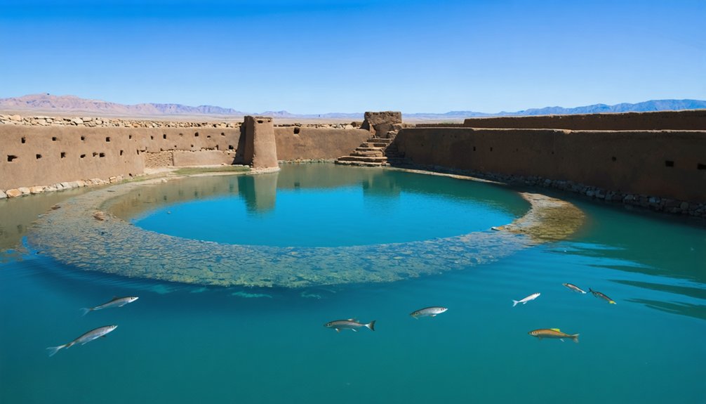
As sea levels have risen dramatically over the past 10,000 years, numerous Native American settlements and archaeological sites now lie submerged beneath coastal waters, lakes, and springs across North America.
These submerged cities offer extraordinary archaeological discoveries preserved by water.
You’ll find remarkable examples like the Manasota Key Offshore site—America’s first preserved prehistoric underwater burial ground—where researchers identified six individuals in what was once a freshwater pond.
The Lake Mendota ancient canoe sites reveal sixteen vessels spanning thousands of years, while Warm Mineral Springs conceals a 148-foot debris cone with late Pleistocene artifacts.
Scientists employ non-invasive underwater survey techniques to explore these sites without disruption.
From California’s submerged La Jolla village to Florida’s Miami Circle, these underwater time capsules continue revealing ancient Native American life patterns.
Exploring Major Ghost Town Sites and Archaeological Parks
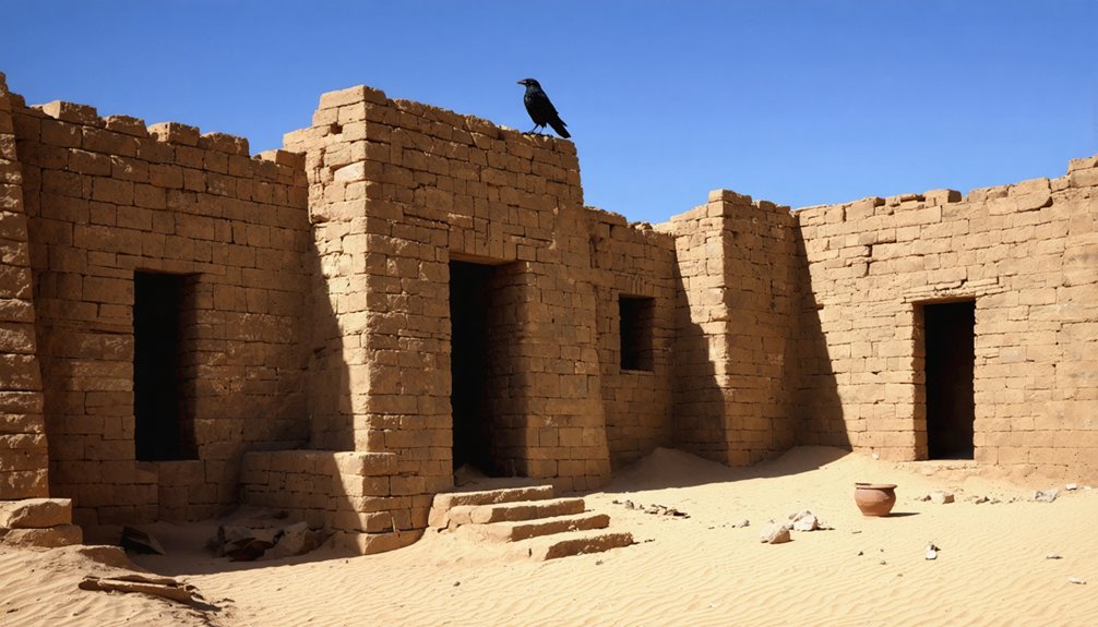
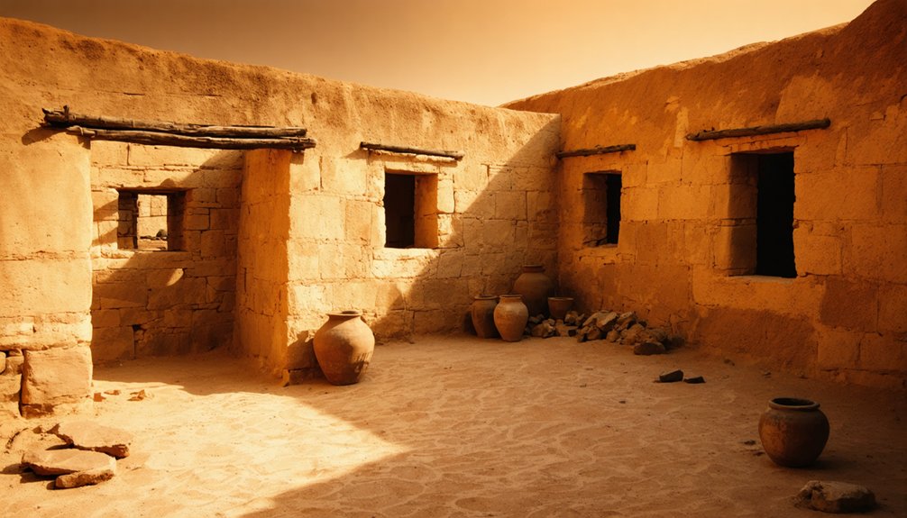
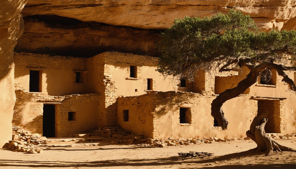
You’ll discover Mesa Verde‘s extraordinary cliff dwellings nestled within protective alcoves, representing some of North America’s most sophisticated pre-Columbian architecture.
At Chaco Canyon, you’ll observe precise astronomical alignments in buildings that tracked celestial movements through strategic window and doorway placements.
The submerged archaeological sites of Lost City in Lake Mead contain valuable artifacts that document the shift from hunter-gatherer societies to settled agricultural communities in the Southwest.
Mesa Verde’s Hidden Alcoves
Nestled within the steep canyon walls of southwestern Colorado, Mesa Verde‘s hidden alcoves house some of North America’s most sophisticated pre-Columbian architectural achievements.
These ancient secrets reveal a civilization that thrived for nearly a millennium before mysteriously abandoning their homes around 1300 CE.
You’ll encounter over 600 cliff dwellings, where sandstone and mud mortar structures demonstrate remarkable engineering prowess at elevations exceeding 8,500 feet.
These hidden treasures showcase the Ancestral Puebloans‘ mastery of their environment.
Explore the essence of Mesa Verde through:
- Cliff Palace – a 150-room multi-story complex with 21 ceremonial kivas
- Balcony House – requiring ladder climbs that hint at defensive considerations
- Square Tower House – exemplifying the diverse architectural styles adapted to natural alcoves
Chaco’s Astronomical Alignments
While Mesa Verde reveals the architectural genius of the Ancestral Puebloans, Chaco Canyon demonstrates their profound astronomical knowledge.
You’ll find twelve major Chacoan structures with precise celestial alignments within two degrees of lunar standstill events.
Pueblo Bonito exemplifies these Chaco alignments with its east-west exterior wall matching equinox sunrises and sunsets, while its interior midwall aligns perfectly north-south.
As you explore, note how the Great Houses form a regional astronomical pattern spanning 5,000 square kilometers.
The celestial significance extends beyond buildings—the Great North Road commemorates Chaco’s relationship with celestial north.
These alignments weren’t mere construction coincidences but reflect a sophisticated cosmology integrating heavenly order with earthly existence.
For the Ancestral Puebloans, Chaco served as a center place where heaven and earth converged.
Lost City Underwater Treasures
Several extraordinary underwater archaeological sites have transformed our understanding of Native American settlements lost to rising waters.
The Puebloan Lost City in Nevada’s Moapa Valley, submerged by Lake Mead, represents a civilization dating to 300 AD where scientists have studied artifacts relocated to the Lost City Museum.
In Florida, the Manasota Key Offshore Site presents the first preserved prehistoric burial site discovered in American waters, disclosing ancestral practices from 7,000 years ago.
Underwater archaeology techniques have revealed these hidden histories through:
- Magnetometry that detects subsurface anomalies and metal artifacts
- Sub-bottom profiling that visualizes buried remains beneath the seafloor
- Side-scan sonar technology that maps underwater terrain without destructive excavation
These ancient artifacts provide vital evidence of prehistoric environments, settlement patterns, and burial traditions previously lost to history.
Mystery of Abandonment: Why Ancient Peoples Left Their Homes
Throughout the American landscape, abandoned Native settlements stand as silent testimonials to complex historical processes that forced entire communities to leave their established homes.
When you explore these sites, you’re witnessing the aftermath of multifaceted abandonment scenarios rather than simple evacuations.
Environmental stressors—including prolonged droughts, deforestation, and climate change—often triggered agricultural failures that made continued occupation impossible.
These ecological challenges intertwined with social dynamics, as competition for dwindling resources heightened inter-group conflicts and altered community structures.
You’ll find evidence of ritual closures at many sites, where inhabitants conducted ceremonial burnings before departure.
The collapse of trade networks and resource depletion further destabilized settlements.
Some communities migrated strategically to reconnect with kin or allied groups—a deliberate adaptation rather than mere flight from hardship.
Preservation Challenges and Visiting Ancient Sites Today
Despite substantial cultural and historical significance, Native American ghost towns face unprecedented preservation challenges in the modern era.
Photography tips for ghost towns can enhance the experience of those who visit these unique sites. Capturing the haunting beauty and intricate details of abandoned structures requires a keen eye and an understanding of lighting, textures, and atmosphere. Additionally, exploring the stories behind these towns can provide context that makes each photograph more meaningful.
When you visit these sites, you’ll encounter a complex web of regulatory frameworks designed to balance preservation with accessibility. NAGPRA and the National Historic Preservation Act provide essential protections, yet site accessibility remains complicated by land ownership disputes and physical barriers.
Consider these fundamental realities:
- Your access to sacred sites often requires maneuvering through bureaucratic permissions, as Indigenous communities have lost 99% of their ancestral lands.
- Resource extraction, urbanization, and border wall construction continue to destroy irreplaceable archaeological treasures.
- Tribal reclamation efforts through land purchases and conservation partnerships represent the most promising preservation strategy.
The responsibility falls on visitors to respect these sacred spaces while supporting Indigenous stewardship initiatives.
Frequently Asked Questions
Can Visitors Take Artifacts Found at These Sites?
No, you’re legally prohibited from removing artifacts. Federal and tribal regulations protect these sites for artifact preservation and scientific study. Violations carry severe penalties including fines and imprisonment.
Did Ancient Native Americans Have Written Language at These Settlements?
As silent as ancient stones, you won’t find true written language at these settlements. Ancestral Puebloans utilized pictographic symbols instead, primarily relying on rich oral traditions to transmit their cultural knowledge and history.
How Did These Peoples Manage Water Resources in Arid Environments?
You’ll find they employed hierarchical water management systems, V-shaped earthen channels, and strategic site selection. Their water conservation practices included dryland farming techniques while irrigation techniques maximized limited water through simple yet effective infrastructure designs.
What Spiritual Beliefs Influenced the Design of These Settlements?
Like sacred blueprints from the stars, you’ll find circular layouts reflecting unity, with spiritual architecture honoring ancestral reverence. Settlements mirrored cosmological beliefs, integrated natural elements, and featured ceremonial spaces designed for community rituals.
Are There Undiscovered Sites Archaeologists Suspect Exist but Haven’t Found?
Yes, archaeologists suspect numerous undiscovered settlements exist in remote canyon systems and riverbanks. You’ll find they’re employing advanced archaeological techniques like satellite imagery and carbon isotope analysis to locate these hidden sites.
References
- https://nvtami.com/2022/03/27/lost-city-ghost-town/
- https://en.wikipedia.org/wiki/Wikipedia:WikiProject_Ghost_towns
- https://www.scmp.com/lifestyle/travel-leisure/article/3254037/ultimate-us-ghost-towns-exploring-ancient-native-americans-settlements-and-culture-and-camping-under
- https://m.dresshead.com/files/scholarship/Documents/Ghost_Towns_Lost_Cities_Of_The_Old_West_Shire_Usa.pdf
- https://www.legendsofamerica.com/na-ancientcities/
- https://dot.ca.gov/-/media/dot-media/programs/environmental-analysis/documents/ser/townsites-a11y.pdf
- https://www.youtube.com/watch?v=Z-rNZU3vIzU
- https://en.wikipedia.org/wiki/Ghost_town
- https://www.christywanders.com/2024/08/top-ghost-towns-for-history-buffs.html
- https://noospheregeologic.com/blog/tag/ghost-towns/