You’ll find Anderson Flat, formerly known as Verona, about 30 miles south of Harrison near the Buffalo River. This ghost town emerged in the early 1900s but faced devastating Dust Bowl conditions that led to its abandonment. Today, you can explore its 1.7-acre cemetery with 521 documented burials, weathered schoolhouse remains, and scattered rock walls. The site’s transformation from bustling settlement to nature-reclaimed landscape holds countless stories within its stone-marked graves and foundational remnants.
Key Takeaways
- Anderson Flat was an early 1900s settlement in Arkansas, located 30 miles south of Harrison near the Buffalo River.
- The town suffered severe decline during the Dust Bowl periods, leading to its eventual abandonment and ghost town status.
- The Anderson Flat Cemetery contains 521 documented burials and features unique stone arrangements reflecting early settler burial practices.
- Remnants include a weathered schoolhouse, cemetery, scattered rock walls, and evidence of its role as a Butterfield mail stop.
- The ghost town remains accessible year-round via 2WD roads, with nature reclaiming most of the former settlement area.
The Rise and Fall of Verona’s Legacy
As the dust settled over the Arkansas frontier in the early 1900s, a small settlement called Verona emerged roughly 30 miles south of Harrison, near the Buffalo River.
You’ll find traces of community resilience in the town’s early development, where settlers and Native American groups established a modest but thriving rural hub for agriculture and local trade.
The settlement’s identity shifted when it was renamed Anderson Flat, though the reasons remain unclear.
Despite the community’s determination, environmental challenges would ultimately seal its fate. The devastating dust bowl struck twice – first in the early 1900s, then again in the 1930s. Modern visitors can still access the area via 2WD roads year-round.
Like many abandoned settlements throughout Arkansas, local residents were drawn to nearby mining opportunities in places like Rush Ghost Town.
These disasters ravaged the land, destroying crops and forcing both settlers and native inhabitants to abandon their homes.
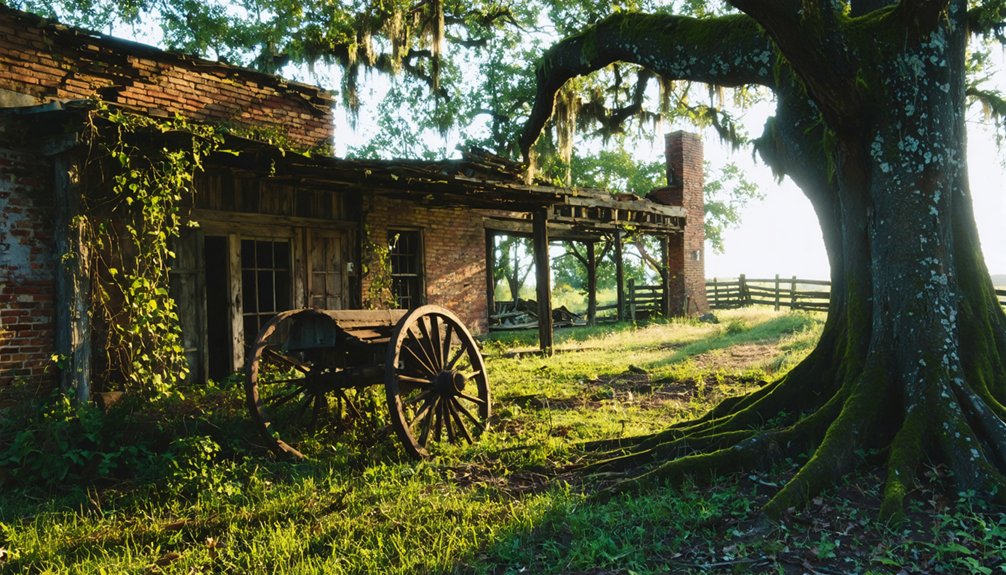
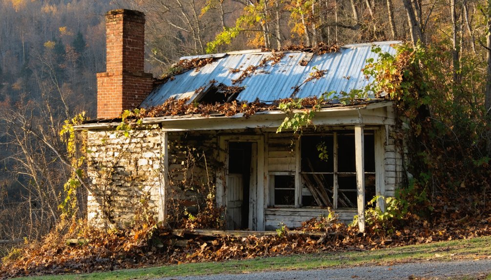
Today, only a weathered schoolhouse and cemetery stand as silent witnesses to Verona’s legacy.
Discovering the Remnants of Anderson Flat
When you venture south of Harrison, Arkansas today, you’ll find the haunting remains of Anderson Flat scattered across the rural landscape. You can easily access the site by driving south on Highway 235 until you spot the white cemetery sign. The old schoolhouse stands immediately to your right, while the cemetery lies a mile further up the road.
As you explore Anderson Flat’s artifacts, you’ll discover scattered rock walls and remnants of earlier settlements a few miles from the main site. Like many abandoned rural sites throughout Arkansas, the area stands as a testament to the shifting economic and social landscapes that reshaped communities. The town originally flourished as a Butterfield mail stop during its early days of settlement.
While the schoolhouse and cemetery remain the most intact structures, the area’s historical significance extends beyond these visible ruins. The site bears silent witness to the devastating effects of two Dust Bowl periods that ultimately forced both settlers and Native Americans to abandon their homes in this once-thriving community.
Life Along the Butterfield Mail Route
The historic Butterfield Mail Route brought unprecedented connectivity to Arkansas communities through its network of 141 stations stretching from Fort Smith to Memphis.
You’d find stagecoach operations running like clockwork, with coaches covering about 100 miles daily and swapping fresh horses at stations to maintain their ambitious pace. The route, operating from 1857 to 1869, established vital transportation links across challenging terrain. Local farmers and their wives managed these essential stops, providing lodging and meals while collecting mail from designated points around their properties.
At each station, tired horses were exchanged for fresh ones as farmers and their families kept the mail moving westward.
As you traveled the route, you’d encounter a bustling ecosystem of hotels, saloons, and eateries that sprung up to serve passengers and workers. Mail delivery transformed isolated rural areas into connected communities, while the constant flow of travelers and commerce helped local businesses thrive. Passengers paid ten cents per mile for their journey along the route.
This crucial transportation artery served as Arkansas’s lifeline until the Civil War disrupted operations in 1861.
Nature’s Reclamation of a Lost Town
Mother Nature has steadily reclaimed the once-vibrant Anderson Flat, located 30 miles south of Harrison near the Buffalo River.
You’ll find native forests and grasses have overtaken former homesteads, while urban wildlife has returned to this abandoned settlement. What remains is a compelling study in historical ecology – where you can witness how natural processes reshape a landscape when human activity ceases.
Originally known as Verona, the town’s name changed in the early 1900s before its eventual abandonment. The old schoolhouse and marked cemetery stand as the last visible structures, while scattered artifacts and weathered rock walls downstream tell of the town’s past.
The site’s transformation, hastened by devastating Dust Bowl conditions, offers a rare glimpse of nature’s resilience.
Today, typical Ozark woodland species thrive where people once lived, creating an untamed sanctuary free from modern development.
The Devastating Impact of Dust Bowl Years
During America’s most devastating ecological disaster, Anderson Flat faced unprecedented challenges as massive dust storms ravaged the region throughout the 1930s.
You’d have witnessed towering walls of dust reaching 600 feet high, moving at speeds up to 60 mph, completely blocking out the sun for days.
The community’s agricultural practices, like many others across the region, had left the soil vulnerable – deep plowing and burning stubble had stripped away nature’s protective barriers. By 1936, these conditions caused economic losses reaching $25 million daily. The dust storms became so severe that an estimated 350 million tons of soil from Kansas, Texas, and Oklahoma were ultimately deposited across eastern states.
Exploring the Historic Cemetery Grounds
When you explore Anderson Flat Cemetery today, you’ll find over 521 gravesites arranged across the grounds, marking the final resting places of the area’s pioneer families.
The cemetery’s layout reflects early 1900s burial practices, with family plots often grouped together and simple headstones bearing witness to the hardships of frontier life. Like the historic Pioneer Cemetery in Mena, many of the original grave markers were made from native rocks rather than carved headstones.
While time has taken its toll on some of the older markers, the cemetery remains a crucial historical record of the community’s earliest settlers, preserved through generations of local families who maintained these sacred grounds through annual decoration days and community workings.
Notable Pioneer Gravesites
Deep within the 1.7-acre Anderson Flat Cemetery lie the remains of 23 pioneer settlers, each grave telling a unique story of the community’s early days.
Pioneer burial customs are reflected in the native rock markers and distinctive gravestone craftsmanship, though most inscriptions have faded with time.
You’ll discover these fascinating elements of pioneer heritage:
- The cemetery’s first grave dates to the 1890s, marking the final resting place of a hanged horse and chicken thief.
- James A. Anderson’s family plot, with descendants still living nearby.
- Unique stone arrangements including stacked-stone graves and stone-table crypts.
- Various styles of grave markers, from necked discoid headstones to triangle-shaped footstones.
The site stands as a tribute to the area’s Civil War-era settlers who sought refuge in this peaceful corner of Arkansas.
Cemetery Layout and Design
The sprawling 1.7-acre Anderson Flat Cemetery reveals a typical rural pioneer layout, carved from a larger 40-acre tract deeded to the community.
You’ll find over 521 documented burial sites scattered across the grounds, reflecting generations of local cemetery history. The earliest markers consist of simple fieldstones, including a jagged rock at the road-corner boundary that’s said to mark the grave of a hanged horse thief from the 1890s.
While you won’t encounter formal plot maps or numbered sections common to urban cemeteries, you’ll discover the burial traditions of Ozark settlers through the markers.
The Anderson and Swafford family plots anchor the grounds, with descendants still living nearby.
The cemetery’s natural boundaries and accessibility from public roads maintain its connection to the surrounding rural landscape.
Preservation Through Time
Standing resilient through decades of change, Anderson Flat Cemetery serves as a living chronicle of Marion County’s pioneer heritage.
You’ll find this historical treasure nestled on 1.7 acres, where cemetery preservation efforts have documented 521 memorials, with 94% photographed for future generations.
While the surrounding community has dispersed, the cemetery’s historical significance endures through:
- Original grave markers dating to the 1890s, including the infamous horse thief’s jagged rock
- Headstones of the founding Anderson family and early settlers
- Physical remnants of the nearby schoolhouse that once doubled as a church
- Ancient rock walls and artifacts that hint at earlier Native American settlements
Today, though Anderson Flat’s residents are gone, dedicated volunteers and descendants maintain this sacred ground, ensuring its story lives on.
Architectural Remains and Hidden Treasures
Located 30 miles south of Harrison, Arkansas, Anderson Flat‘s architectural legacy persists through the weathered remains of its schoolhouse and cemetery.
If you explore the area, you’ll discover hidden artifacts scattered across the landscape, requiring a keen eye to spot historical treasures. You’ll find ancient rock walls a few miles from the main site, offering glimpses into the town’s architectural significance and early construction methods.
The cemetery, which still stands as a tribute to the community’s resilience, may hold undiscovered historical inscriptions and artifacts.
Once known as Verona, this settlement faced devastating dust bowl conditions twice, yet its remaining structures continue to tell the story of early Arkansas pioneers and the nearby Native American settlement that shared similar challenges.
Seasonal Guide to Visiting Anderson Flat
You’ll find the best conditions for exploring Anderson Flat during the summer months when temperatures are warm and vegetation is full, though early morning visits help avoid the peak heat.
Winter visits require careful preparation due to potential snow and ice accumulation, so pack appropriate cold-weather gear and check road conditions before departing.
If you’re planning a winter journey, it’s crucial to notify someone of your plans and bring emergency supplies, as the remote location can be treacherous during harsh weather.
Best Summer Visiting Times
When planning your visit to Anderson Flat Ghost Town, summer months provide the most reliable access and comfortable exploration conditions. The hot, dry weather conditions make dirt roads easily navigable, and you’ll find the site perfect for summer activities like exploring the old schoolhouse and cemetery.
- Visit early morning hours to avoid peak afternoon heat while examining the historical remnants.
- Plan your route along Route 235, following the white cemetery sign for easiest navigation.
- Pack essential supplies, as there are no facilities or water sources on-site.
- Allow time to carefully explore both the schoolhouse and Anderson Flat Cemetery, which are about a mile apart.
Remember to bring a camera and map, as cell service can be limited in this remote area of north-central Arkansas.
Winter Weather Safety Guidelines
While summer offers ideal exploration conditions, winter visits to Anderson Flat Ghost Town require careful planning and preparation.
You’ll face average temperatures between 37-41°F, with lows potentially dropping below zero. For winter preparedness, pack insulated layers, traction devices for icy surfaces, and emergency supplies including food, water, and blankets.
Watch for cold hazards like hypothermia and frostbite, especially when wind chills amplify the subfreezing temperatures. The ghost town’s remote location means emergency services aren’t readily available.
Monitor weather forecasts closely, as conditions can change rapidly with snowfall reaching 6+ inches and visibility dropping below 10 miles during storms. Keep your cell phone charged and bring a portable charger.
If you encounter icy roads or heavy snowdrifts, postpone your visit until conditions improve.
Buffalo River Region’s Forgotten Settlement
Hidden among the rugged terrain of Arkansas’s Buffalo River region, Anderson Flat stands as a poignant reminder of early 20th-century rural hardship. Originally named Verona, this forgotten settlement tells stories of rural resilience against environmental challenges that ultimately proved insurmountable.
Nestled in Arkansas’s untamed Buffalo River country, Anderson Flat echoes with tales of perseverance against nature’s harsh trials.
You’ll find evidence of the community’s determination in:
- The weathered foundations and rock walls scattered across the landscape
- An old schoolhouse ruin marking the turnoff from Highway 235
- The preserved Anderson Flat Cemetery, located one mile up the road
- Traces of both Euro-American and Native American settlements
Located 30 miles south of Harrison and 15 miles from the Buffalo National River, the site succumbed to devastating dust bowl conditions twice – first in the early 1900s and again in the 1930s, leading to its complete abandonment.
Preserving Arkansas’ Ghost Town Heritage

You’ll find Arkansas’s commitment to ghost town preservation exemplified through the Arkansas Historic Preservation Program‘s detailed documentation of sites like Anderson Flat, which includes mapping ruins, collecting oral histories, and creating digital reconstructions.
Through community education programs, you can participate in “Walks Through History” tours and preservation workshops that connect you directly with local heritage sites.
The protection of these historic locations relies on a combination of physical safeguards, such as conservation easements and interpretive signage, alongside digital preservation techniques that help future generations understand Arkansas’s vanishing towns.
Historical Documentation Methods
Through extensive archaeological investigations and methodical documentation, Arkansas has developed thorough approaches to preserving its ghost town heritage since the late 1880s.
Historical methodologies and archaeological techniques have evolved to capture the essence of these lost communities, with researchers employing various methods to document their existence.
You’ll find these primary documentation approaches used across Arkansas:
- Archaeological surveys that uncover physical evidence, like the foundational remains at Davidsonville Historic State Park.
- Analysis of historical newspapers and written records, particularly valuable for towns like Pinnacle Springs.
- Preservation of architectural elements, including historic cemeteries and landmarks that tell stories of past communities.
- Collaborative research between institutions like the National Park Service and University of Arkansas to guarantee thorough documentation.
Community Education Programs
Arkansas’ commitment to preserving ghost town heritage shines through its diverse community education programs, which actively engage residents and visitors alike.
You’ll find immersive experiences like “Sandwiching in History” tours and educational workshops focused on cemetery and barn preservation, ensuring essential aspects of rural history aren’t forgotten.
Through the Arkansas Historic Preservation Program, you’ll discover grant-supported initiatives that bring history to life.
Local organizations like CORE enhance your experience with costumed guides and thematic presentations.
You can explore ghost towns via trolley rides, interpret historical murals, and follow self-guided tours with strategically placed signage.
These programs, supported by preservation tax credits and CLG grants, help you connect deeply with Arkansas’ past while fostering a strong sense of community engagement and place attachment.
Site Protection Strategies
To effectively protect Arkansas’ ghost town heritage, an extensive system of legal designations and financial incentives works in tandem with physical preservation strategies.
You’ll find site conservation efforts strengthened through partnerships between local governments and preservation societies, while preservation funding comes from various sources including tax credits and grants.
Here’s what you need to know about protecting ghost town sites:
- Apply for National Register listing to gain recognition and access preservation benefits
- Secure conservation easements to guarantee permanent protection regardless of ownership changes
- Utilize Arkansas Historic Rehabilitation Income Tax Credits for restoration projects
- Implement physical security measures like fencing and surveillance while maintaining historic integrity
Frequently Asked Questions
Are There Any Documented Paranormal Activities at Anderson Flat?
You won’t find documented ghost sightings or haunted locations at this site. Despite having ruins and a cemetery that might suggest paranormal potential, no verified reports of supernatural activity exist here.
What Happened to the Original Residents After Leaving Anderson Flat?
Like leaves scattered in a mighty wind, you’ll find the residents migrated primarily to Harrison and other Boone County towns, seeking better life after Anderson while maintaining their community ties nearby.
Is Special Permission Required to Explore the Anderson Flat Site?
You’ll need to verify land ownership before exploring, as specific site regulations aren’t posted. While no formal permits exist, respect exploration guidelines by obtaining permission if it’s on private property.
Were There Any Notable Crimes or Outlaws Associated With Anderson Flat?
You won’t find any documented outlaw legends or significant crime history associated with this location. The town’s story centers on environmental hardships and the challenges faced by its farming community.
Do Any Historical Photographs of Anderson Flat During Its Prime Exist?
Despite searching through thousands of archived images, you won’t find any historical photographs from Anderson Flat’s prime. While the town’s historical significance lives on through artifacts and stories, its visual past remains undocumented.
References
- https://www.ghosttowns.com/states/ar/andersonflat.html
- https://arkansasfrontier.com/ghost-towns-in-arkansas/303766/
- https://www.onlyinyourstate.com/experiences/arkansas/abandoned-ar
- https://www.thetravel.com/ghost-towns-in-arkansas/
- https://en.wikipedia.org/wiki/List_of_ghost_towns_in_Arkansas
- https://kids.kiddle.co/List_of_ghost_towns_in_Arkansas
- https://en.wikipedia.org/wiki/Butterfield_Overland_Mail_in_Arkansas_and_Missouri
- https://www.nps.gov/articles/000/butterfield-site-bulletin.htm
- https://www.vintagebentonville.com/the-butterfield-overland-mail-northwest-arkansas.html
- https://www.nps.gov/buov/learn/historyculture/index.htm