
You’ll find Arthur, Oklahoma’s ghost town remnants about 15 miles east of Duncan, where Wild Horse Creek once sustained this vibrant postal community. Established in 1890 with William H. Mershon as its first postmaster, Arthur thrived briefly as a hub for local farmers and ranchers in the Chickasaw Nation. Though the post office’s closure in 1934 marked the town’s decline, Arthur’s story captures the spirit of frontier life and the cultural blending that shaped Oklahoma’s early years.
Key Takeaways
- Arthur was established as a postal town in the Chickasaw Nation in 1890, located 15 miles east of Duncan, Oklahoma.
- The town developed around Wild Horse Creek and served as a hub for local agricultural activity and postal services.
- Arthur’s post office closure in 1934 marked the beginning of its decline, leading to eventual abandonment.
- No visible structures remain today, with the site now consisting of agricultural fields near Wild Horse Creek.
- The town’s brief existence in the 1890s ended due to lack of railroad access and agricultural mechanization.
The Rise of a Postal Town
Three pivotal events marked Arthur’s emergence as a postal town in Indian Territory: its strategic location near Wild Horse Creek, its establishment within the Chickasaw Nation, and most importantly, the opening of its post office in 1890.
You’ll find that Arthur’s postal significance began when William H. Mershon became the first postmaster on May 14, 1890. The post office wasn’t just a mail station – it served as the heartbeat of community connectivity, drawing settlers and traders to this promising location 15 miles east of Duncan. Like the Welsh-Latin texts that first documented place names, the establishment of Arthur’s post office marked its official entry into recorded history.
Positioned four miles west of Velma, Arthur was ideally situated for travelers and commerce along the developing frontier routes.
As part of the shift from tribal territory to organized Oklahoma counties, Arthur’s post office represented federal recognition and infrastructure development. The town’s position within Township 1S, 5W, section 9 made it an ideal hub for communication and commerce, attracting those seeking opportunities in the expanding frontier.
Life in Indian Territory
As you’d discover while visiting Arthur’s early postal stops, mail routes connected far-flung Chickasaw settlements to the wider world, bringing news and trade opportunities to isolated communities.
Similar to the settled Pueblo farmers, families adapted traditional ways to new circumstances, with women tending gardens of corn and squash while men hunted deer and smaller game across the territory’s rolling hills. Skilled craftspeople created pottery and baskets that helped store their harvested foods and trade goods.
Living within the Chickasaw Nation meant participating in a rich cultural tapestry, where ancient customs blended with modern innovations like frame houses and coal-oil lamps that slowly transformed daily life.
Postal Routes Opened Opportunities
When the Butterfield Overland Mail established its routes through Indian Territory in 1858, it opened a vital lifeline that would transform the region’s development.
The mail routes of 1883 would grow to connect Kansas, Nebraska, and Indian Territory through an intricate network of post offices. You’d witness postal expansion reaching across 2,800 miles, with 192 miles cutting through what would later become Oklahoma. These communication networks connected remote settlements to the bustling world beyond.
- You could’ve sent mail from Fort Smith through Choctaw Nation, crossing at Colbert’s Ferry near present-day Durant.
- You’d find stagecoach stations sprouting up along natural valleys and indigenous trails.
- You’d see post offices becoming centers of commerce and community life.
- You’d notice bridges and ferries developing to guarantee year-round postal service.
The routes you’d travel weren’t just paths for mail – they were corridors of freedom, connecting you to opportunities that stretched from St. Louis to San Francisco. Railroad lines ran parallel to many postal routes, as shown in the 1884 map created by W. L. Nicholson.
Daily Chickasaw Nation Life
Life in the Chickasaw Nation revolved around carefully planned communities where you’d find distinct seasonal dwellings and a rich tapestry of cultural practices.
You’d notice families maintaining three separate structures – a rectangular summer house with woven mat walls, a circular winter dwelling partially underground, and a storage building for crops. At the heart of these communities stood the council house where you’d gather for ceremonies and important meetings.
Chickasaw traditions emphasized clear roles, with men hunting and building while women managed agriculture and household duties. The two head priests called hopaye presided over religious gatherings and ceremonies. The community practiced a matrilineal clan system where children belonged to their mother’s family line.
You’d witness the importance of communal living during the Green Corn Festival, when the entire community joined together for purification ceremonies, traditional dances, and ball games to honor Aba’ Binni’li’, their supreme deity above the clouds.
Geographic Setting and Location
You’ll find Arthur’s ghost town site nestled in the rolling plains of Stephens County, approximately 15 miles east of Duncan and 4 miles west of Velma along State Highway 7.
Like towns across Oklahoma, Arthur’s location was carefully plotted with precise geographic coordinates to aid in mapping and navigation.
The town’s strategic position near Wild Horse Creek made it an attractive frontier settlement in Indian Territory during the late 19th century.
While nothing remains of the original settlement today, you can still trace its location to Township 1S, 5W, section 9 in what was once the Chickasaw Nation‘s Pickens County.
Regional Position and Access
Nestled in the rural expanses of Stephens County, Oklahoma, the ghost town of Arthur once thrived approximately 15 miles east of Duncan and 4 miles west of Velma.
You’ll find this historic site positioned near Wild Horse Creek, in what was formerly Pickens County of the Chickasaw Nation before Oklahoma statehood. The area’s development accelerated during the Great Plains settlement that brought rapid population growth to Oklahoma Territory.
The town’s transportation history and ghost town significance are marked by these key features:
- Direct access to State Highway 7, which served as the main transportation artery
- Strategic location in Township 1S, Range 5W, Section 9
- Proximity to Wild Horse Creek, which likely influenced early settlement patterns
- Historical connection to both Duncan and Velma via rural routes
Today, though Arthur’s structures are gone, you can still trace its location through these geographical markers.
Landscape Near State Highway
Following State Highway 7 toward Arthur’s former location, the gentle rolling prairie stretches as far as the eye can see.
You’ll notice the untamed spirit of Oklahoma’s heartland in the landscape features that unfold – open fields and pastures that merge with the horizon, broken only by scattered patches of riparian vegetation along Wild Horse Creek.
From your highway views, you’ll witness the raw beauty of agricultural plains that now dominate where Arthur once stood, with elevations subtly shifting between 900 and 1,000 feet.
The winds sweep freely across this exposed terrain, rustling through seasonal grasses and fallow fields.
The former townsite has surrendered to nature’s reclamation, leaving behind an empty expanse that speaks to the transient nature of human settlement in this wide-open country.
Arthur’s Early Settlement Years
Located within the Chickasaw Nation in what was then Indian Territory, Arthur emerged as a small frontier settlement approximately 15 miles east of present-day Duncan, Oklahoma.
Following typical settlement patterns along waterways, the community took root near Wild Horse Creek, where a mix of Native American and non-Native settlers forged their independence.
- The establishment of a post office in 1890, with William H. Mershon as postmaster, marked Arthur’s transformation into a recognized community.
- The township, designated as 1S, 5W, 9, served as a hub for local agricultural activity.
- Early community formation reflected the cultural blend characteristic of Indian Territory settlements.
- Families carved out their living through farming and small-scale trade, creating a self-reliant frontier atmosphere that defined Arthur’s early years.
The Town’s Brief Heyday
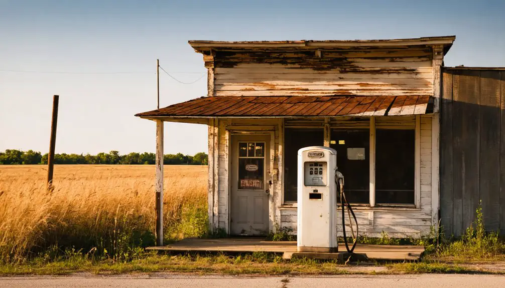
As Arthur established its presence in the Chickasaw Nation during the 1890s, the town enjoyed a modest but vibrant period of growth centered around its newly established post office.
You’d have found a typical frontier community where settlers gathered to collect mail, trade goods, and strengthen their social bonds. The community dynamics revolved around agricultural pursuits and ranching, with local businesses catering to the needs of nearby farmers and ranchers.
While Arthur never experienced the dramatic boom times that oil brought to other Oklahoma towns, its strategic location near Wild Horse Creek and proximity to Duncan helped sustain steady economic influences.
The town’s heyday reflected the independent spirit of Indian Territory, where small communities carved out their own identities through determination and mutual support.
Notable Figures and Residents
You’ll find William H. Mershon’s appointment as Arthur’s first postmaster in 1890 marked a significant milestone in the town’s early development.
Under his leadership, the post office became an essential hub for the community, connecting residents to the outside world through mail service and news distribution.
While specific details about early settlers’ daily lives remain sparse in historical records, it’s understood they operated under Chickasaw Nation jurisdiction and primarily engaged in agricultural pursuits and small-scale commerce.
First Postmaster Details
William H. Mershon established himself as Arthur’s pioneering force when he accepted postmaster responsibilities on May 14, 1890.
You’ll find his appointment marked a pivotal moment in Arthur’s history, as he became the federal government’s primary representative in this Indian Territory settlement.
- He’d oversee all postal operations from Arthur’s founding until changes in leadership, managing communication lines that connected residents to the broader world.
- His community impact extended beyond mail delivery, serving as a key administrative figure during the complex jurisdiction of both tribal and territorial authorities.
- The post office under his leadership operated from a time when Arthur was part of Chickasaw Nation, Pickens County.
- You can trace his legacy through Arthur’s peak development period, though the town eventually faded into Oklahoma’s ghost town history by 1934.
Early Settlers’ Experiences
Despite their pioneering spirit, early settlers of Arthur faced considerable isolation in this remote corner of Indian Territory’s Chickasaw Nation.
You’ll find these resilient homesteaders dealt with significant settler hardships, including lengthy trips to Duncan or Velma for basic supplies – often 15 miles or more over rugged terrain.
While they didn’t leave behind grand structures or extensive records, their community resilience showed in how they maintained a functioning settlement for decades, anchored by their post office from 1890 to 1934.
They were primarily farmers and ranchers who forged informal social bonds, united by the challenges of frontier life.
Without railroads or major trade routes nearby, these pioneers had to rely on their own resourcefulness and determination to survive in this unforgiving landscape.
Decline and Abandonment
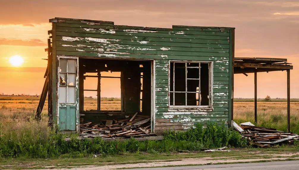
When Arthur’s post office closed its doors on September 29, 1934, after serving the community for 44 years, it marked the beginning of the town’s inevitable decline.
You can trace the town’s fate through population migration and economic shifts that transformed many Oklahoma communities during this period.
- The loss of postal services isolated remaining residents, pushing them to seek opportunities in larger towns like Duncan.
- Without railroad access or major highway traffic, Arthur’s businesses couldn’t sustain themselves.
- Agricultural changes, including mechanization and consolidation, eliminated local farming jobs.
- Nature gradually reclaimed the settlement until, by 2010, you’d find nothing but an empty field where Arthur once stood.
The town’s story mirrors countless other Oklahoma ghost towns, where changing times spelled the end of once-thriving communities.
Legacy in Oklahoma History
Although Arthur has long since vanished from Oklahoma’s landscape, its legacy endures as a poignant example of territorial-era settlement patterns in Stephens County.
You’ll find its story woven into the broader tapestry of over 2,000 ghost towns that reflect the state’s economic resilience through cycles of growth and decline.
As a former Chickasaw Nation settlement, Arthur’s cultural significance extends beyond its brief existence, offering valuable insights into the shift from tribal governance to state jurisdiction.
While only empty fields remain where this community once thrived, Arthur’s impact lives on through historical records and academic studies.
The town’s 44-year lifespan, marked by its post office’s operation from 1890 to 1934, continues to inform scholars about the crucial role of postal-dependent communities in shaping rural Oklahoma’s development.
Modern-Day Site Analysis
Today, as you travel along State Highway 7 about 15 miles east of Duncan, Oklahoma, you’ll find little evidence that Arthur once stood proudly in these fields.
Time and nature have erased Arthur’s footprints, leaving only empty fields along Oklahoma’s Highway 7 where a community once thrived.
This ghost town has surrendered to nature’s reclamation, leaving behind only memories and untold stories beneath the soil.
If you’re planning to explore this historic site, here’s what you’ll discover:
- Open agricultural fields have replaced any remaining structures, with Wild Horse Creek still meandering nearby.
- The site is privately owned, accessible only from public roadways.
- While no visible remnants exist, archaeological potential lies in possible subsurface artifacts.
- Local navigation skills are essential, as GPS coordinates aren’t precisely mapped for this location.
The site now serves as a reflection of Oklahoma’s ever-changing landscape, where yesterday’s bustling communities become tomorrow’s quiet farmland.
Historical Preservation Efforts
Despite Arthur’s physical disappearance from Oklahoma’s landscape, dedicated preservation efforts have focused on maintaining its memory through historical documentation and archival records.
You’ll find the town’s legacy preserved primarily through the Oklahoma Historical Society, which maintains critical records like its post office operations from 1890 to 1934.
While preservation challenges include the absence of physical structures and GPS landmarks, archival strategies have evolved to protect Arthur’s history.
You can explore its story through ghost town exhibits, including features at the Oklahoma Route 66 Museum. Local history groups continue gathering oral histories and documentation, ensuring that Arthur’s place in Oklahoma’s heritage isn’t forgotten.
The town’s inclusion in broader ghost town surveys helps contextualize its role in the state’s development and transportation history.
Frequently Asked Questions
What Was the Population of Arthur at Its Peak?
While you’d love to know the exact peak numbers, like many ghost towns of Oklahoma, Arthur’s population trends weren’t officially recorded, though it’s likely numbered in the hundreds before declining.
Were There Any Churches or Schools Established in Arthur?
You won’t find any documented church history or education legacy in Arthur – historical records don’t show evidence of established churches or schools during the town’s brief existence before vanishing.
What Businesses and Industries Operated in the Town?
From 1890-1934, you’d find a post office as the town’s anchor business. Local farming practices dominated the economy, with general stores and agricultural services. Unlike others, Arthur lacked mining operations.
Did Any Significant Events or Disasters Contribute to Arthur’s Decline?
You’ll find no documented historical accounts of major disasters, but the post office’s closure in 1934 signaled the town’s death knell. Local ghostly sightings remain unconfirmed through reliable sources.
Are There Any Photographs or Maps of Arthur Still in Existence?
Like searching for a needle in a haystack, you won’t find much photographic evidence of Arthur. Historical maps show its location near Velma, but physical documentation’s scarce in public archives.
References
- http://blogoklahoma.us/place/776/stephens/arthur-i-t
- https://en.wikipedia.org/wiki/Arthur
- https://www.okhistory.org/publications/enc/entry?entry=GH002
- https://www.youtube.com/watch?v=-jYN1_E2VV0
- https://kids.kiddle.co/List_of_ghost_towns_in_Oklahoma
- https://wikipedia.nucleos.com/viewer/wikipedia_en_all/A/Arthur
- https://www.okhistory.org/publications/enc/entry?entry=PR008
- https://murals.info-ren.org/artist_info.php?artist=Arthur+Covey
- https://www.encyclopedia.com/history/news-wires-white-papers-and-books/everyday-life-native-americans
- https://www.historymuseumsb.org/early-history-of-indiana-to-1779/


