For abandoned Appalachian trails, you’ll discover Virginia’s original AT route with ghostly white blazes along the Great Escarpment. Don’t miss the narrow Firescald Ridge in the Tennessee-North Carolina border, featuring quartzite formations at White Rocks Cliff. Explore Pennsylvania’s abandoned “Rocksylvania” outcrops, Pre-1952 AT segments with faded markers, the remote Lincoln Brook Trail, Mountain Pond Loop, and the unblazed Black Angel Trail. These forgotten paths reveal a hiking history most travelers never experience.
Key Takeaways
- Virginia’s original AT route followed the Great Escarpment with visible white blazes near Pinnacles of Dan, abandoned in 1952.
- Firescald Ridge along the Tennessee-North Carolina border offers pristine ridge walking with quartzite formations and minimal traffic.
- The Blue Rocks boulderfield in Pennsylvania contains former AT segments with scattered industrial artifacts among challenging terrain.
- Lincoln Brook Trail’s northern section in the White Mountains features old-growth forest and wildlife viewing in a secluded setting.
- Black Angel Trail in Wild River Wilderness remains unblazed and rarely traveled, offering authentic wilderness immersion.
Virginia’s Lost Original AT Route: Following Pioneer Paths
While most hikers today flock to Virginia’s iconic McAfee Knob along the Appalachian Trail, few realize they’re walking a completely different path than the original AT pioneers.
Before 1952, the trail ran about 50 miles east of today’s route, traversing the stunning Great Escarpment rim.
The original Appalachian Trail carved its way along the majestic Great Escarpment, revealing vistas now lost to modern hikers.
This abandoned pathway followed existing pioneer paths and mountain roads rather than cutting fresh trails. You’d have crossed the Pinnacles of Dan, navigated Farmer Mountain’s 360-degree vistas, and ferried across the New River.
These historical trails vanished rapidly after relocation, disappearing from guides despite comprising 15% of the entire AT.
Navigating by paint blazes and tin markers, early hikers relied on detailed written directions, encountering just one shelter along the route—a stark contrast to today’s shelter system.
The original trail was conceptualized by Benton MacKaye in 1921 as a socialist project aimed at providing urban workers access to nature and fresh air.
Many of the original trail segments have been absorbed by developments like the Blue Ridge Parkway, causing significant relocations throughout the Appalachians.
The Hidden Ridge Walks of Tennessee-North Carolina Border
The hidden ridge walks along the Tennessee-North Carolina border offer some of the most spectacular yet underutilized trail experiences in the Appalachian range.
You’ll find eight miles of pristine lollipop loop along the Bald Mountains Range crest, where hidden quartzite formations at White Rocks Cliff provide expansive valley views into Tennessee with minimal crowds.
Cross Firescald Ridge for nearly two miles of narrow ridge walking and rock hopping, then discover Blackstack Cliffs overlooking North Carolina’s Pisgah National Forest.
The trail’s remoteness from population centers naturally limits traffic, while its elevation keeps you perched above surrounding valleys with visibility across multiple states. Even during peak seasons, when Great Smoky Mountains National Park sees around one million visitors, these hidden paths remain peaceful alternatives.
Unlike crowded northern sections, this corridor delivers authentic wilderness immersion.
Quartzite outcroppings, ladder-aided scrambles, and stone steps create a technical challenge that rewards you with panoramic vistas few day hikers ever witness.
The dramatic ridge walk experience on Firescald Ridge features expansive views that rival those found on more popular trails.
Firescald Ridge: the Forgotten Narrow Trail With Panoramic Views
You’ll feel like you’re walking on a knife’s edge as you scramble across Firescald Ridge‘s narrow, rocky spine that barely separates Tennessee from North Carolina.
The trail demands your full attention as you hop from boulder to boulder, with sheer drops offering heart-stopping views of the valleys flanking both sides.
Your effort is richly rewarded with some of the most spectacular panoramas in the Southern Appalachians, stretching from Greeneville’s distant lights to the wilderness expanses of two national forests. As you traverse this exposed ridgeline, you’ll witness expansive views with Cherokee National Forest visible to your left and Pisgah National Forest to your right. While hiking, you’ll pass Howard’s Rock, an ideal spot for resting and enjoying a snack about 3.5 miles into your journey.
Teetering Above Twin Valleys
Dramatically perched along the North Carolina/Tennessee border, Firescald Ridge offers hikers one of Appalachia’s most thrilling yet overlooked trail experiences.
You’ll find yourself literally teetering between two states as you traverse this narrow, two-mile stretch of untamed wilderness. The quartzite outcropping creates a natural balcony where you can gaze simultaneously into Cherokee National Forest and Pisgah National Forest below.
This hidden gem was deliberately rerouted by the Carolina Mountain Club to maximize its dramatic impact. The trail follows blue-blazed markers that guide hikers away from the look-over before joining the Appalachian Trail. Make sure your device has JavaScript enabled to access interactive trail maps and navigation tools available on hiking websites.
As you rock-hop across the ridge’s spine, White Rocks Cliff reveals Tennessee’s valleys to your west while Blackstack Cliffs showcases North Carolina’s rugged beauty to your east.
Despite being on the Appalachian Trail, you’ll often have these panoramic vistas all to yourself—a perfect escape for those seeking both adventure and solitude.
Scrambling Across Narrow Ridgeline
Stepping onto Firescald Ridge’s narrowest sections requires both nerve and nimble footwork as the trail dramatically narrows to just a few feet wide in places.
You’ll find yourself maneuvering challenges like rock hopping and traversing precarious ledges while sheer drop-offs beckon on both sides. This forgotten gem along the Appalachian Trail demands your full attention.
Ridge safety becomes paramount as you scramble across exposed sections between Blackstack Cliffs and White Rocks Cliff. The upcoming October 13 hike will showcase this challenging terrain during peak fall foliage season.
The payoff? Spectacular 360-degree panoramas stretching across North Carolina and Tennessee wilderness. Few hikers venture to this remote stretch, making it one of the AT’s last truly wild experiences.
When you reach Little Firescald Knob’s rock ledge, pause to appreciate the solitude that’s increasingly rare on more traveled sections of America’s most famous footpath.
Pre-1952 Appalachian Trail Segments: Tracing Historical Markers
You’ll find ghostly white blazes from the original Appalachian Trail route lingering on trees between Floyd and Galax, Virginia, where hikers traversed for a quarter century before the 1952 relocation.
This forgotten path once showcased the spectacular Pinnacles of Dan and wound through communities that lost their trail-town status when the route shifted 50 miles westward.
Locating these historical trail markers requires careful observation of older trees and stone structures along former alignments, especially near Rocky Knob Park where the Blue Ridge Parkway later replaced much of the original footpath.
The economic consequences for small towns along the original route exemplified the boom and bust cycle that has historically characterized Southwest Virginia’s relationship with outside industries.
Discovering Faded Blazes
Before the modern Appalachian Trail came to define long-distance hiking in eastern America, a network of pioneering routes carved different paths through the mountains, many of which have now faded into obscurity.
You’ll find these forgotten pathways revealed through faded blazes on aging trees and remnants of trail clearing from the 1930s. The CCC’s original work remains visible if you know where to look.
Search near landmarks like Pinnacles of Dan or Farmer Mountain, where 360-degree views once rewarded hikers on the pre-1952 alignment. Historical markers aren’t official—they’re rustic lodges, abandoned crossroads, and natural features documented in early trail guides.
The hand-drawn maps in the 1931 *Guide to Paths in the Blue Ridge* can serve as your treasure map to these lost routes, leading you to spectacular vistas that modern hikers rarely experience.
Virginia’s Lost History
While modern hikers admire McAfee Knob‘s iconic silhouette on Virginia license plates, they’re unknowingly celebrating a landmark that wasn’t even part of the original Appalachian Trail.
Before 1952, the AT followed a drastically different path through southwestern Virginia, traversing Bent Mountain, the Pinnacles of Dan, and communities like Galax and Fancy Gap.
This lost trail vanished after the Appalachian Trail Conference relocated 300 miles westward—15 percent of the entire trail. The Blue Ridge Parkway‘s development claimed much of the original route, while historical landmarks like Lover’s Leap and Rocky Knob Park were once centerpieces of the hiking experience.
Trail guides published after 1952 erased this history entirely, leaving white blazes and tin markers to fade into wilderness.
Today, you’ll find only ghostly remnants of what Earl Shaffer described as the trail’s “most spectacular” section.
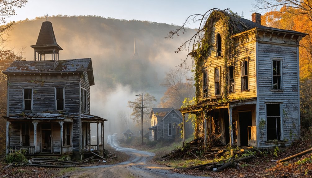
These ghost towns in the United States serve as poignant reminders of past boomtowns that once flourished with life. Each decaying structure tells a story of the people who called these places home and the dreams that faded away. Exploring these sites can evoke a sense of nostalgia and wonder about the history that shaped the culture of the American West.
Pennsylvania’s Abandoned Rocky Outcrops and Vista Points
Pennsylvania’s rugged terrain has earned the nickname “Rocksylvania” among hikers for good reason.
The Appalachian Trail’s rocky outcrops reveal thousands of years of erosion history, with bedrock exposed in challenging pathways that test even experienced trekkers.
When you venture off the main trail, you’ll discover abandoned routes leading to forgotten scenic vistas that few modern hikers ever witness.
Three abandoned vista points worth exploring:
- Eagle’s Edge Vista – accessible via an unmarked 1.8-mile loop from Hawk Rock, offering secluded views of the Susquehanna River
- Blue Rocks boulderfield – a dramatic formation along former trail sections with scattered industrial artifacts
- St. Anthony’s Wilderness overlooks – providing panoramic views of abandoned coal mining communities and mill ruins dating back 100+ years
White Mountains’ Lesser-Known Alternate Paths
The White Mountains of New Hampshire harbor secret pathways that even veteran hikers often miss.
Lincoln Brook Trail’s northern section rewards you with 4.5 miles of old-growth forest and frequent moose sightings without the crowds. For an effortless escape, Mountain Pond Loop’s 2.7-mile circuit delivers remote wilderness views with virtually no elevation gain.
The untrodden paths of the Whites await, where moose roam ancient forests and hidden ponds mirror wilderness in perfect stillness.
Seeking true isolation? Black Angel Trail in the Wild River Wilderness remains unblazed and seldom traveled, while Coppermine Trail leads to a secluded swimming hole beneath Bridal Veil Falls, plus offers overnight shelter options.
Don’t overlook Mt. Tremont Trail—this 3.5-mile path to a ledgy summit provides stunning valley vistas yet remains neglected due to nearby famous peaks.
These trails deliver authentic mountain freedom without the boot-worn paths of their popular counterparts.
Blue Blaze Treasures: Former AT Segments Now Serving as Side Trails

Hiking along the abandoned segments of the original Appalachian Trail offers you a unique window into hiking history that most trekkers miss entirely.
These blue-blazed paths, once part of the main AT before relocations forced by development pressures and land disputes, now serve as quieter alternatives to the heavily trafficked white-blazed trail.
Blue blaze history reveals the evolving nature of America’s first long-distance footpath:
- Many blue trails originated during the 1950s when post-WWII development forced significant AT relocations up to 150 miles in length.
- Trail maintenance challenges increase on these less-traveled paths, with volunteer crews battling faster overgrowth.
- Former AT routes near the Blue Ridge Parkway offer glimpses of the original trail builders’ vision before highway construction altered their course.
Frequently Asked Questions
Are Permits Required for Hiking Abandoned at Segments?
No federal permits are needed for hiking abandoned AT segments, but you’ll need to check local trail access regulations since state parks or private land may require specific permits or permissions.
How Dangerous Are Wildlife Encounters on Less-Traveled Trail Sections?
Nature’s wild theater poses minimal danger if you’re practicing proper trail etiquette. You’ll rarely face aggressive wildlife—most animals avoid you! Always maintain distance, secure food, and make noise for ideal wildlife safety.
What Specialized Gear Is Needed for Abandoned Trail Exploration?
You’ll need robust hiking essentials like durable boots, seam-sealed tents, and navigation tools. Don’t forget safety equipment including first-aid kits, water filters, and repair tape for self-sufficient adventures on overgrown paths.
No, GPS isn’t fully reliable on abandoned paths. You’ll face accuracy issues under dense canopy, and trail maintenance loss creates discrepancies between digital waypoints and actual ground conditions. Always bring backup navigation tools!
Do Any Abandoned Segments Connect to Current at Shelters?
No, you won’t find direct connections between abandoned segments and current AT shelters. Abandoned trail history reveals these shelter connectivity issues developed as relocations prioritized new routes, leaving old paths disconnected and forgotten.
References
- https://www.blueridgeoutdoors.com/hiking/undiscovered-hikes-on-the-appalachian-trail/
- https://npshistory.com/publications/appa/use-users-2000.pdf
- https://uncommonwealth.lva.virginia.gov/blog/2022/05/20/the-lost-appalachian-trail/
- https://en.wikipedia.org/wiki/Appalachian_Trail
- https://thetrek.co/appalachian-trail/top-5-fear-mongered-sections-of-the-appalachian-trail-and-why-you-shouldnt-be-worried-about-them/
- https://npshistory.com/publications/appa/froats-2021.pdf
- https://www.secrethike.com/post/10-incredible-blue-blazes-of-the-appalachian-trail
- https://www.hikingtheappalachians.com
- https://www.outsideonline.com/adventure-travel/destinations/haunted-hikes/
- https://libfiles.clemson.edu/image.php?bid=20200204165335&f=appalachiantrail00nati&oid=OPN_NS:98025CBDE0E03CED1FF733C529E44748&t=download