
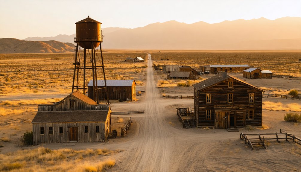
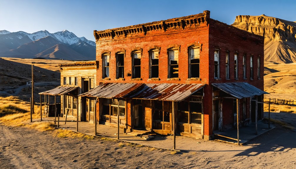
You’ll find California’s best drone photography ghost towns scattered across the Eastern Sierra region and Mojave Desert. Standout locations include Bodie State Historic Park, with its perfectly preserved 1880s architecture, and Cerro Gordo’s hilltop mining remnants. For dramatic aerial shots, target the golden hour at these sites and make certain you’ve secured necessary permits through the California Film Commission. Pack multiple batteries and high-speed SD cards – these remote locations demand thorough preparation for capturing their haunting stories from above.
Key Takeaways
- Bodie State Historic Park offers exceptional drone photography opportunities with over 100 preserved buildings and unrestricted airspace above 400 feet.
- Calico Ghost Town near Barstow provides dramatic desert landscapes and well-maintained mining structures perfect for aerial compositions.
- Cerro Gordo Ghost Town features panoramic views of Owens Valley and historic silver mining architecture ideal for golden hour shots.
- Bombay Beach at Salton Sea combines abandoned structures with striking water elements for unique aerial perspectives.
- Darwin Ghost Town’s remote Mojave Desert location ensures minimal interference while capturing weathered mining equipment and desert textures.
Essential Gear for Ghost Town Drone Photography
When venturing into abandoned ghost towns with your drone, you’ll need to carefully select equipment that can handle challenging conditions while delivering professional-quality results.
Start with a drone featuring a 1-inch or larger sensor, 4K video capabilities, and RAW shooting options. Proper drone battery management is vital – pack at least 3-4 batteries and safe-transport containers for extended shoots. Always bring bright headlamps to navigate through dark structures and ruins during early morning or dusk drone flights. Consider having a backup signal booster for maintaining stable connections in remote locations.
Professional drone work demands high-end gear – invest in quality sensors, 4K resolution, and multiple batteries for lasting power in the field.
For image stabilization techniques, guarantee your drone has a 3-axis gimbal and carry dampers for smooth footage in challenging conditions. Pack high-speed microSD cards (64GB minimum) and maintain redundant backups using portable SSDs.
Don’t forget essential accessories like landing pads to protect from debris, ND filters for exposure control, and propeller spares for quick repairs. A flight log will help track battery cycles and shooting conditions at each location.
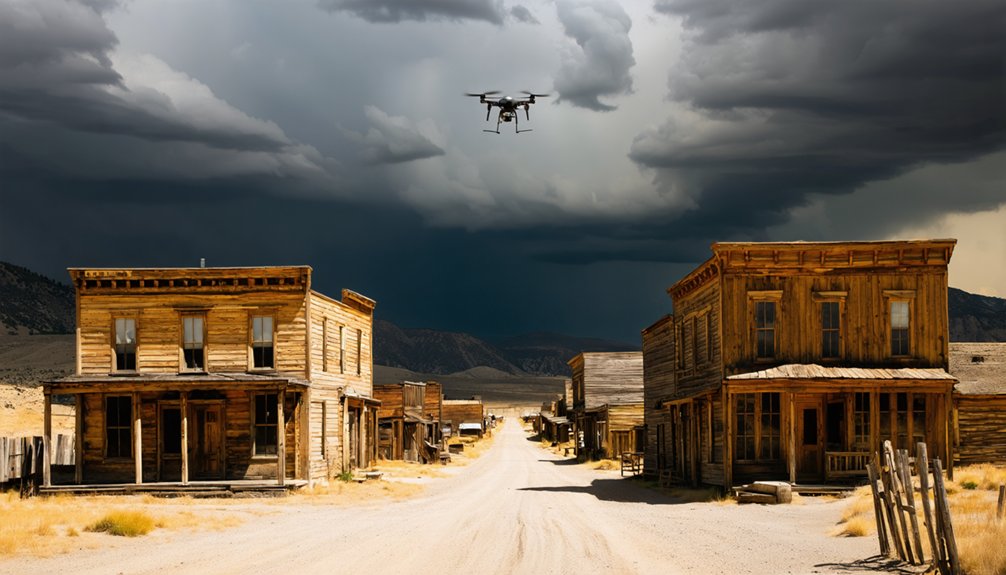
Safety and Legal Guidelines for Aerial Ghost Town Shoots
Before launching your drone at any ghost town site, you’ll need to obtain proper permits and verify FAA clearances, especially since many historic locations fall under protected land management.
You’ll need to ensure you’ve passed the TRUST Test for recreational flying and have proof available during your ghost town photography sessions.
You’ll want to guarantee your equipment meets all safety requirements, including registration for drones over 250g, visible ID numbers, and functioning Remote ID capability.
Keep your drone within visual line of sight while watching for hazards like unstable structures, overhead wires, or sudden wind gusts that could compromise your flight safety.
First responders have legal immunity if they need to disable your drone during emergency operations at ghost town locations.
Drone Permits and Clearance
To capture stunning aerial photographs of ghost towns legally and safely, you’ll need to navigate a complex web of federal, state, and local drone regulations.
First, make certain you’ve obtained your FAA Part 107 Remote Pilot Certificate for commercial photography and checked local airspace restrictions through LAANC or FAA DroneZone.
For California ghost towns, you’ll need specific permits depending on the location’s jurisdiction.
If your target site lies within state park boundaries, submit a UAS/Drone Use Questionnaire to the California Film Commission.
Many abandoned mining towns sit on county or city property, requiring written permission and proof of insurance.
Before launching your drone, verify any facility-specific bans and respect posted signage. Flying too close to private residences near ghost towns can result in civil privacy violations under California law.
Remember to maintain visual line of sight and stay below 400 feet unless you’re near a structure. For nighttime shoots, ensure your drone has anti-collision lights installed.
Equipment Safety Essentials
Safety-conscious drone pilots know that proper equipment preparation forms the foundation of successful ghost town aerial photography. Your pre-flight checklist should prioritize battery maintenance, ensuring charge levels exceed 80% capacity and carrying spares sized for your planned flight duration.
Keep your gear’s firmware updated, including flight controller, gimbal, and camera systems, to maintain peak performance and compliance. Before launching, complete on-site compass and IMU calibrations, inspect props for damage, and verify your Remote ID broadcasting functionality. Operating within airspace restrictions is essential for legal compliance in California.
Pack essential backup equipment like spare propellers, filters, and tools. Establish a clear takeoff zone with your visual observer, and brief your team on emergency procedures. To comply with Santa Clara County regulations, be sure to obtain a proper permit before conducting any aerial photography sessions at ghost town locations.
Remember to secure your drone registration, Part 107 certificate, and site permits before arriving at these historic locations.
Hazard Awareness Protocol
When exploring ghost towns from above, you’ll need to navigate a complex web of regulations and safety protocols that protect both historic sites and drone operators. Using the B4UFLY Mobile App is essential to check for any airspace restrictions before your flight.
Start with thorough hazard identification: scan for overhead power lines, unstable structures, and wildlife that could interfere with your flight path. Your risk assessment must account for sudden wind gusts common in abandoned areas.
Keep your drone in visual line-of-sight at all times and stay under 400 feet. You’ll need your TRUST certification for recreational flights or Part 107 license for commercial shooting.
Don’t forget to register drones over 0.55 pounds and display your FAA number. Maintain 25 feet from structures, respect privacy laws when capturing footage, and ascertain you’re not flying over restricted state land or wilderness areas without proper permits.
Best Times of Day to Capture Abandoned Structures
The art of capturing abandoned structures through drone photography hinges critically on selecting the perfect time of day for your shoot. You’ll find your best results during golden hour, both at sunrise and sunset, when warm light bathes weathered facades in rich, atmospheric tones.
For east-facing structures, launch your drone 30-60 minutes after sunrise; for western exposures, time your flight an hour before sunset. Consider using HDR bracketing techniques to manage the challenging lighting conditions you’ll encounter at these times.
Don’t overlook midday shoots on clear, sunny days – they’re perfect for capturing dramatic light rays streaming through broken roofs and windows.
Bright afternoon sun transforms abandoned spaces into dramatic stages, where light beams pierce through structural gaps like nature’s spotlights.
Overcast conditions offer their own advantages, providing even lighting that reveals intricate textures without harsh shadows.
For truly dramatic shots, venture out at dusk when the fading light creates moody silhouettes, or experiment with full moon illumination for haunting nighttime perspectives.
Finding the Perfect Launch Points at Ghost Towns
Before launching your drone at any ghost town, you’ll need to carefully scout both a stable takeoff area and multiple backup landing zones clear of hazards like unstable structures or overhead wires.
You must also determine whether the site requires special permissions, as locations like Cerro Gordo need private property access while state parks like Bodie prohibit drone flights entirely.
Consider ground conditions at your chosen launch point, as desert locations offer firm dirt pads while wetland sites like Drawbridge may require portable platforms for stable deployment.
Scout Safe Landing Areas
Selecting ideal launch points at ghost towns requires methodical site reconnaissance to ascertain both drone safety and photographic success.
You’ll need to identify safe zones with prime surfaces of at least 1.5m × 1.5m, free from debris and hazards. Walk a complete 360° survey, marking GPS coordinates of suitable landing spots while scanning for electromagnetic interference from old mining equipment or deteriorating structures.
Establish two emergency landing sites – one on soft terrain and another on a firm, flat surface. Test your GPS and compass reliability at each potential landing zone, as ghost towns often harbor buried metal that can disrupt signals.
Keep an eye out for unstable building elements and establish exclusion zones at 1.5 times the height of any surrounding structures to guarantee safe vertical descent options.
Local Access and Permissions
Successfully maneuvering drone permissions at ghost towns demands thorough research across multiple jurisdictional layers, from federal airspace rules to local property rights.
You’ll need to navigate through various authorities while respecting property boundaries and local regulations to find your perfect launch point.
To secure legal access for your drone photography:
- Check state park regulations first – many California ghost towns fall under State Parks jurisdiction where drones are typically prohibited.
- Contact county planning offices to verify local ordinances and permit requirements specific to your chosen location.
- Obtain written permission if your target site sits on private land – research property ownership through county records.
- Scout public access points like BLM lands or designated parking areas that offer legal launch sites outside restricted zones.
Creative Composition Techniques for Aerial Decay
Mastering aerial composition transforms ghost town photography from simple documentation into compelling visual narratives of decay.
When you’re capturing abandoned sites from above, use the rule of thirds to position crumbling structures at intersecting points, creating dynamic tension in your aerial perspectives.
You’ll find powerful visual storytelling opportunities by incorporating leading lines like forgotten roads and power lines to guide viewers through the emptiness.
Let negative space frame your subject, emphasizing the isolation of these deserted places.
Watch for natural patterns in architectural ruins, and time your shots during golden hour when long shadows add depth to weathered textures.
Position your drone to capture symmetrical formations in abandoned buildings while allowing nature’s reclamation to create striking contrasts against man-made geometry.
Weather Considerations for Ghost Town Drone Work
Weather plays a pivotal role in capturing compelling drone footage of ghost towns, since harsh conditions can threaten both your equipment and image quality. Understanding weather patterns and seasonal considerations will help you nail those epic shots while keeping your gear safe.
- Plan your flights during late spring through early fall when high desert air is driest, especially in mountainous locations like Bodie where winter storms can block access.
- Take advantage of calm morning conditions before afternoon thermal updrafts develop, particularly in valley locations.
- Watch for atmospheric rivers and storm fronts that can trigger sudden wind shifts and flooding near coastal ghost towns.
- Schedule golden hour shoots for dramatic lighting, but pack ND filters for snow-covered scenes that risk overexposure.
Capturing the Story of Abandonment From Above
When you’re shooting ghost towns from above, your primary mission is to convey the poignant story of abandonment through thoughtful composition and purposeful imagery.
Your aerial perspectives should emphasize scale contrasts between human structures and the surrounding wilderness, using leading lines from old roads and rooftops to guide viewers through the abandonment narratives.
Frame your shots during golden hour to cast dramatic shadows that highlight structural decay, or catch the harsh midday sun for documentary-style documentation of artifacts and graffiti.
Capture the site at multiple altitudes – from intimate 30-foot passes revealing textural details to sweeping 400-foot overviews that showcase the town’s isolation.
Look for pattern disruptions like a lone standing building or solitary tree to create focal points that speak to survival amid desertion.
Successful drone photography in ghost towns demands careful navigation of multiple challenges that can derail even experienced pilots.
When venturing into California’s remote desert landscapes with your drone technology, you’ll need to master these critical elements:
- Weather monitoring – check road closures and conditions before departing, especially for high-elevation locations like Bodie where snow and rain can block access.
- Environmental preparation – plan for 110+ degree temperatures, intense sun exposure, and minimal moisture that can affect both you and your equipment.
- Legal compliance – verify current drone regulations, as many ghost towns fall under state park jurisdictions that prohibit unmanned flights.
- Technical readiness – prepare for harsh conditions that stress batteries and electronics, plus bring backup gear since recovery options are scarce in remote areas.
Post-Processing Tips for Ghost Town Drone Photos
Once you’ve captured stunning aerial footage of ghost towns, mastering the post-processing workflow will transform your raw images into compelling visual narratives.
Start by defining your target mood – whether it’s eerie abandonment or nostalgic decay – to guide your color grading decisions. Use exposure blending techniques to balance bright skies with shadowed building interiors, employing luminosity masks to preserve essential architectural details.
Masterful post-processing begins with your creative vision – let the desired mood shape every adjustment while preserving the authentic details of forgotten places.
For authentic weathered aesthetics, desaturate distracting vegetation while boosting rust and wood tones through targeted HSL adjustments.
Apply drone-specific lens corrections to maintain straight lines in your architectural compositions, and use perspective tools to fix converging verticals from oblique angles.
Finally, add subtle film grain and controlled vignetting to enhance the timeworn atmosphere while keeping your ghost town subjects as the clear focal point.
Frequently Asked Questions
Are There Any Inhabited Ghost Towns Where Residents Might Object to Drone Photography?
You’ll find residents in Hornitos, Randsburg, and parts of Calico who might object to drone photography over their properties, so it’s best to request permission before launching your flight.
How Do You Handle Unexpected Wildlife Encounters While Flying Drones in Ghost Towns?
Land your drone immediately if you spot wildlife, maintain a respectful distance, and don’t resume flight until animals retreat. You’ll protect both your equipment and nature’s residents through proper drone etiquette.
Which Ghost Towns Require Advance Permits or Permission From Private Landowners?
With 70% of California ghost towns on mixed public-private land, you’ll need to file permit applications for Calico Ghost Town through San Bernardino County and secure landowner agreements for privately owned sites.
Exploring abandoned towns in California can be a fascinating adventure, as each location offers a glimpse into the past, showcasing unique architecture and history. As you wander through the remnants of these forgotten places, be sure to respect any local regulations and preserve the integrity of the sites. This journey not only reveals the story of California’s growth but also highlights the impact of time on human habitation.
Can Drones Capture Paranormal Activity or Unusual Phenomena in Ghost Towns?
While you might use drone technology for paranormal exploration, there’s no scientific evidence that drones capture supernatural activity. They’ll document physical ruins and decay, but not ghostly phenomena in abandoned towns.
Are There Seasonal Closures or Restricted Access Periods for These Locations?
You’ll find weather impacts access more than formal closures. Bodie’s open year-round, Cerro Gordo requires owner permission, Drawbridge floods seasonally, and Salton Sea sites remain accessible despite summer’s intense heat.
References
- https://www.travelrealizations.com/best-ghost-towns-in-california/
- https://www.youtube.com/watch?v=29POPXLs4Ew
- https://www.katherinebelarmino.com/2016/07/photographing-salton-sea-ghost-towns.html
- https://www.youtube.com/watch?v=CWJx6Fc9SVw
- https://www.youtube.com/watch?v=i32GGKP2pj0
- https://www.parks.ca.gov/bodie
- https://store.bandccamera.com/blogs/how-to/photographing-ghost-towns
- https://www.youtube.com/watch?v=Ec72UKlZy6Y
- https://petapixel.com/2022/07/15/spectacular-drone-footage-of-an-8th-century-italian-ghost-town/
- https://airbuzz.one/drone-photos-of-abandoned-places/


