You’ll find Connecticut’s most photogenic ghost towns nestled throughout the state’s rolling hills and forests. Capture haunting aerial shots of Johnsonville’s Victorian-era buildings, the crumbling cottages of Colchester’s Grand View Hotel resort, and Bara-Hack’s mysterious stone foundations in Pomfret. The submerged remnants near Saville Dam offer uniquely atmospheric compositions, especially during misty dawns and golden hour. With proper drone permits and gear, these forgotten places reveal stories that most visitors never discover.
Key Takeaways
- Johnsonville ghost town features an 1846 Victorian homestead and relocated historical structures, offering diverse architectural subjects for aerial photography.
- Bara-Hack’s stone walls and Mashomoquet Brook provide stunning compositions, though landowner permission is required for drone access.
- Colchester’s Grand View Hotel ruins span 400 acres with decaying cottages and overgrown trails, perfect for capturing nature’s reclamation.
- Barkhamsted Hollow near Saville Dam reveals foundation stones and cellar holes, best photographed during lower water levels.
- Gay City State Park contains mill ruins and stone foundations, but requires a Special Use License for drone operations.
Ghost Towns and Drone Regulations in Connecticut
While Connecticut’s ghost towns offer hauntingly beautiful subjects for aerial photography, you’ll need to carefully navigate the state’s drone regulations before launching your camera into the skies.
As of March 2024, you must have your drone registered with the FAA if it weighs over 0.55 pounds and guarantee it’s equipped with Remote ID broadcasting capabilities. When capturing those weathered buildings and overgrown streets, keep your flights under 400 feet in Class G airspace. Recreational pilots must also complete the TRUST Test before conducting any flights.
Be mindful that many ghost towns lie near critical infrastructure – power plants or correctional facilities require a 250-foot buffer zone. Violators who breach these restricted areas could face up to one year in jail and substantial fines.
You’ll also need to secure a Special Use License if your chosen ghost town sits within state park boundaries, as drone flights are typically prohibited in these areas to protect wildlife.
Essential Gear for Capturing Abandoned Places
When you’re exploring abandoned places with your drone, you’ll need the Fatshark HDO2 goggles paired with reliable propeller guards to navigate safely through decaying structures.
Your DJI Mavic 3‘s low-light capabilities combined with the Sony A7S III for ground shots will capture the haunting atmosphere of these forgotten locations.
Flying at a lower altitude helps manage the squirrely behavior that can occur when batteries run low during exploration.
Carrying the Fly More Plus combo and multiple Ovonic 1300 6S batteries guarantees you won’t miss essential shots due to power limitations while documenting these remote sites.
The unobstructed views at these locations make them ideal spots for clear drone signals, allowing for smooth and interference-free flight operations.
Drone Safety Equipment Basics
Before venturing into ghost towns with your drone, equipping yourself with essential safety gear can mean the difference between a successful shoot and a costly disaster.
Always check the local airspace rules and any flying restrictions around historic sites before launching your drone. You’ll need impact-resistant safety glasses to protect against debris and bright Connecticut sunlight. Secure your controller with an adjustable neck strap or chest harness – you don’t want to drop it while maneuvering through old mill ruins. Consider using the DJI 360 Propeller Guard for added protection during indoor exploration.
Store your LiPo batteries in safety bags and keep a fire blanket handy for emergencies. Install propeller guards to protect against collisions with crumbling buildings and overgrown vegetation.
Finally, invest in a padded carrying case like the Lowepro DroneGuard BP 250 to transport your gear safely through rough terrain. A landing pad is vital for takeoffs and landings on uneven historic grounds.
Low-Light Performance Gear
Low-light performance gear separates average ghost town drone shots from breathtaking twilight captures that reveal hidden details in abandoned structures.
You’ll want a drone equipped with at least a 1-inch CMOS sensor to tackle Connecticut’s shadowy mill ruins and forgotten factory complexes. Look for models featuring high native ISO ranges and RAW capture capability – these let you pull rich detail from the shadows while maintaining image quality. Consider upgrading to cameras like the DJI O4 Pro with its impressive ISO 25,600 capability for superior nighttime exploration. Advanced night vision drones now include thermal imaging sensors that can detect heat signatures through walls and dense foliage.
When planning your nighttime shoots, make sure to identify the best astrophotography spots in Connecticut to get the most stunning views of the night sky. Areas with minimal light pollution, such as state parks and rural locations, will enhance your imaging experience. Investing time in scouting these locations can greatly improve the quality of your photos and provide breathtaking compositions.
For the best low light techniques, prioritize drones with 3-axis gimbals and fast aperture lenses (f/2.8 or better).
These sensor upgrades help you nail those moody dusk shots of Johnsonville Village or the Norwich State Hospital without introducing excessive noise. Multi-frame stacking modes and built-in HDR features prove invaluable when balancing exposure between dark interiors and bright windows in abandoned buildings.
Backup Power Solutions
Reliable power becomes your lifeline when shooting abandoned locations far from the grid. When exploring Connecticut’s remote ghost towns, you’ll want a portable power station with 500-1000Wh capacity to keep your drone batteries, cameras, and gear running all day. The lithium iron phosphate battery cells ensure long-term reliability and safety during your ghost town explorations.
Consider pairing it with a 160-220W solar panel for extended shoots, especially in less accessible locations like the old mining sites near Mine Hill. The DJI Power 2000’s ability to achieve 80% charge in 45 minutes ensures you can quickly replenish your power supply during brief sunny periods.
- Choose a power station with multiple charging ports (AC outlets, USB-C PD, USB-A) to simultaneously charge your drone batteries, controller, and other devices.
- Set up a centralized charging station using a multi-bay charger that can handle 2-4 batteries in rotation.
- Pack backup charging methods since New England’s dense forest canopy can limit solar charging effectiveness.
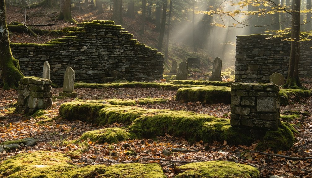
Bara-Hack: The Lost Village of Pomfret
You’ll want to carefully study the foundations and stone walls marking Bara-Hack’s historical mill site, which spreads across private land in Connecticut’s Quiet Corner near a winding brook.
While access requires advance permission from landowners, your drone can capture compelling aerial views of the ruins’ footprint and old cemetery from approved launch points along public roads.
The site offers unique seasonal photography opportunities as spring wildflowers bloom among the foundations and autumn foliage creates striking contrasts with the weathered stonework.
Historical Mill Site Layout
Nestled along a small brook in Pomfret, the remains of Bara-Hack’s mill site reveal a thoughtfully planned 18th-century settlement.
You’ll find a linear brookside settlement pattern where two homesteads flanked the waterway, with the mill foundation features positioned for ideal water access.
While the mill’s stone footprint is now barely detectable, you can still trace its relationship to nearby structures through surviving stone walls and worked pillars.
- The mill’s strategic placement between two houses suggests a shared resource, highlighting the community’s collaborative spirit.
- Stone wall alignments mark clear paths between homes, barn, and mill – creating an efficient workflow.
- The modest scale of mill foundations indicates a self-sufficient operation rather than commercial ambitions.
Access and Flying Tips
While the mill site’s layout offers fascinating historical insights, reaching Bara-Hack today requires careful planning and respect for private property restrictions.
The site’s drone accessibility is limited due to its remote location and private status. You’ll need to secure landowner permission before flying, as the area is strictly off-limits to visitors.
If granted access, follow FAA Part 107 rules carefully. Keep your drone under 400 feet and maintain visual line of sight while maneuvering through the dense forest canopy.
The terrain presents unique challenges – watch for stone walls, towering trees, and Mashomoquet Brook. Scout the area during daylight hours, checking weather conditions and maintaining a safe distance from the cemetery and structures.
Flying restrictions are particularly important here, given the site’s sensitive historical nature and current private status.
Seasonal Photography Opportunities
Throughout the changing seasons, Bara-Hack offers distinct drone photography opportunities that showcase the abandoned village’s haunting beauty.
You’ll capture stunning seasonal contrasts as autumn’s vibrant foliage photography frames ancient stone walls and weathered foundations. Winter’s snow blankets create ethereal scenes around the Randall-Botham Cemetery, while spring reveals the meandering brook cutting through renewed greenery. Summer’s dense canopy provides perfect overhead shots of the village’s layout.
- Dawn and dusk flights yield dramatic lighting across the foundations, particularly when mist rises from the brook.
- Position your drone to capture both house foundations on either side of the water, emphasizing the settlement’s strategic placement.
- Time your shoots during peak fall colors when the forest’s transformation highlights centuries-old stonework against nature’s reclaim.
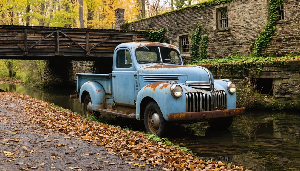
Exploring the Remnants of Johnsonville
Hidden within Connecticut’s Moodus region, the abandoned village of Johnsonville stands as a haunting reminder of America’s industrial past.
Once the thriving “Twine Capital of America,” you’ll find the remnants of this 62-acre ghost town just 30 minutes from Hartford. The village’s centerpiece, an 1846 Victorian homestead built by mill owner Emory Johnson, still showcases its original fireplaces and pillared porches.
As you explore these remnants, you’ll also encounter intriguing storytelling of ghost towns in Connecticut cinema, which often highlight the haunting beauty of such places. This cinematic portrayal adds a layer of mystery that draws visitors and filmmakers alike to uncover the forgotten tales within these deserted landscapes. Historic photographs and film snippets can evoke a sense of nostalgia, inviting people to imagine the lives that once filled these now-silent streets.
You’ll discover a fascinating blend of authentic and relocated structures throughout the property.
In the 1960s, Raymond Schmitt added historical buildings from Massachusetts, including a church, general store, and even a steamboat that now rests in the village pond.
While the property’s now owned by Iglesia ni Cristo, the abandoned structures create perfect compositions for drone photographers seeking to capture America’s forgotten industrial heritage against Connecticut’s natural landscape.
Hidden Resort Ruins of Colchester
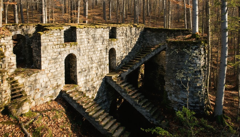
Deep in Connecticut’s wooded landscape, the crumbling remains of the Grand View Hotel tell a story of America’s bygone resort era. Once a thriving destination spanning 400 acres, this abandoned structure now stands as a haunting reminder of Colchester’s “Catskills of Connecticut” glory days.
You’ll find exceptional drone photography opportunities among the decaying cottages, overgrown trails, and forgotten lakeside views that showcase the property’s historical significance.
- Five historic guest cottages create a compelling aerial composition against the dense forest backdrop
- The main lodge’s architectural remnants offer dramatic angles that capture the resort’s former grandeur
- Natural reclamation by surrounding woodland provides striking seasonal contrasts perfect for drone footage
This hidden gem lets you document a piece of Connecticut’s resort history while exploring the eerie beauty of nature’s slow takeover.
Saville Dam’s Forgotten Infrastructure
While Colchester’s ruins showcase nature’s reclamation of forgotten leisure spots, Connecticut’s Saville Dam presents a different kind of abandoned infrastructure waiting to be captured by your drone.
Beneath the reservoir’s surface lies the ghostly remains of Barkhamsted Hollow, where foundation stones and cellar holes tell stories of the 1,000 residents who once called this valley home.
Deep beneath these still waters, a drowned village whispers tales of the thousand souls who once lived here.
You’ll find prime shooting locations along Route 318, where the dam’s impressive 135-foot height and 1,950-foot span create dramatic compositions against the water.
For the most haunting shots, focus your lens on the granite gatehouse tower rising from the reservoir – it’s just the tip of a massive structure that plunges 115 feet below the waterline, guarding the forgotten infrastructure of a community that vanished beneath the waves.
Planning Your Ghost Town Drone Flight
Before launching your drone above a ghost town‘s weathered remnants, you’ll need to navigate a maze of regulations and safety protocols that protect both historic sites and your equipment. Start by securing flight permissions from property owners and checking local ordinances – Connecticut’s abandoned places often have complex ownership.
Conduct a thorough site assessment using satellite imagery to spot hazards like power lines and unstable structures.
- Carry all documentation, including Part 107 certification if you’re shooting commercially, and written landowner approval to avoid trespass issues.
- Scout your launch zones in advance, noting wind patterns and checking for radio interference that could affect your drone’s performance.
- Mark off-limits areas like cemeteries and fragile ruins on your flight map, and always maintain visual line of sight.
Frequently Asked Questions
What Happens if My Drone Encounters Paranormal Activity During Filming?
Keep flying safely while documenting any unusual events. You’ll want to maintain control, record all telemetry data, and follow FAA regulations regardless of paranormal encounters. Your drone’s safety comes first.
Are Night Flights Permitted for Capturing Ghost Town Atmospheres?
You’ll need FAA Part 107 night training and anti-collision lights visible for 3 miles to fly legally. Check ghost town accessibility and local ordinances, as many Connecticut sites restrict after-dark drone operations.
How Do Seasonal Changes Affect the Structural Integrity of Ruins?
While ruins may look solid, you’ll see dramatic seasonal deterioration as freeze-thaw cycles crack walls, spring rains rot timbers, and weather impact gradually destabilizes foundations year after year.
Which Lenses Work Best for Capturing Potential Orbs and Anomalies?
You’ll want wide angle lenses for capturing large areas where orbs might appear, while telephoto lenses let you zoom in on specific anomalies without disturbing the energy field around them.
What Weather Conditions Create the Most Mysterious and Ethereal Drone Footage?
Don’t let clear skies discourage you – foggy mornings and overcast skies create your most ethereal shots. You’ll capture mysterious layered landscapes when mist hugs abandoned structures, especially during dawn’s first diffused light.
References
- https://thedronelifenj.com/places-to-fly-a-drone-in-connecticut/
- https://www.atlasobscura.com/places/the-abandoned-village-of-barahack-pomfret-connecticut
- https://i95rock.com/the-abandoned-ghost-town-of-johnsonville-ct-then-now/
- https://www.youtube.com/watch?v=7X7TXuB8Pk4
- https://www.youtube.com/watch?v=PMJ_m0-NVdI
- http://www.onlyinyourstate.com/experiences/connecticut/dudleytown-ct
- https://www.ctpost.com/travel/article/Abandoned-Connecticut-11094295.php
- https://www.airsight.com/en/news/foreign-made-drone-ban-connecticut-critical-infrastructure
- https://drone-laws.com/drone-laws-in-connecticut/
- https://pilotinstitute.com/drones/states/connecticut/