You’ll find Florida’s most photogenic ghost towns scattered across diverse landscapes, from SUMICA’s industrial ruins threading through pristine hammocks to Centralia’s mill remnants in Chassahowitzka Wildlife Refuge. Capture haunting aerial compositions at Marineland’s Old A1A against Atlantic backdrops, or document Bulow Plantation’s moss-draped coquina ruins. Morning mist and golden hour create atmospheric conditions perfect for drone photography, while abandoned coastal settlements offer compelling narratives of boom-and-bust cycles waiting to be discovered.
Key Takeaways
- SUMICA offers dramatic aerial shots of abandoned railroad remnants stretching four miles through pristine hammocks and historic mill foundations.
- Centralia ghost town features well-preserved mill foundations, drying yards, and tram lines within Chassahowitzka National Wildlife Refuge.
- Eldora’s abandoned coastal settlement provides stunning drone opportunities of historic citrus groves against manatee-rich waterways.
- Bulow Plantation ruins offer exceptional aerial photography of coquina sugar mill remains and slave quarter foundations.
- The Place at Alafaya presents striking aerial views of abandoned neighborhoods with intact street grids being reclaimed by nature.
Exploring SUMICA’s Historic Railroad and Mill Foundations
While much of Florida’s industrial heritage has vanished beneath modern development, SUMICA’s abandoned railroad and mill foundations offer drone photographers a compelling window into the state’s logging past.
You’ll discover railroad remnants stretching four miles through pristine hammock, where linear clearings mark historic track alignments that once transported timber to the bustling sawmill.
The mill infrastructure tells an impressive story through its surviving concrete piers and foundation fragments. The Société Universelle Company established this impressive operation, transforming the wilderness into a thriving industrial center.
Weathered concrete relics whisper tales of Florida’s industrial might through crumbling foundations and stalwart piers rising from the earth.
Your aerial shots can capture the rectilinear patterns of these industrial ruins, which once supported a facility producing 35,000 board feet of lumber daily.
The former railroad grade provides perfect flight paths for documenting the spatial relationships between mill foundations, loading platforms, and support buildings – creating dramatic long-perspective images of this forgotten industrial landscape.
Located off State Road 60, this historic site preserves a remarkable example of early 20th-century industrial development in Florida.
Discovering Centralia’s Hidden Industrial Heritage
Just north of Weeki Wachee lies another proof of Florida’s vanished lumber empire – the ghost town of Centralia.
The industrial relics of this once-bustling mill town now rest within the Chassahowitzka National Wildlife Refuge, where foundations and artifacts tell the tale of ambitious mill operations that processed over 15,000 acres of cypress and pine. At its peak, the town supported over 4,200 people including laborers and their families. The area’s transformation began when Turner Lumber Co. initiated extensive reforestation efforts in the 1960s.
For the drone photographer seeking to capture Florida’s industrial heritage, Centralia offers three distinct features:
- A sprawling 160-acre drying yard where timber once seasoned for up to four years
- Remnants of 18 miles of narrow-gauge tram lines that transported logs through the wilderness
- The preserved foundation of a mill that once cut 100,000 board feet daily with double-banded saws
Remember: Artifact removal is strictly prohibited, preserving this site’s historical integrity.
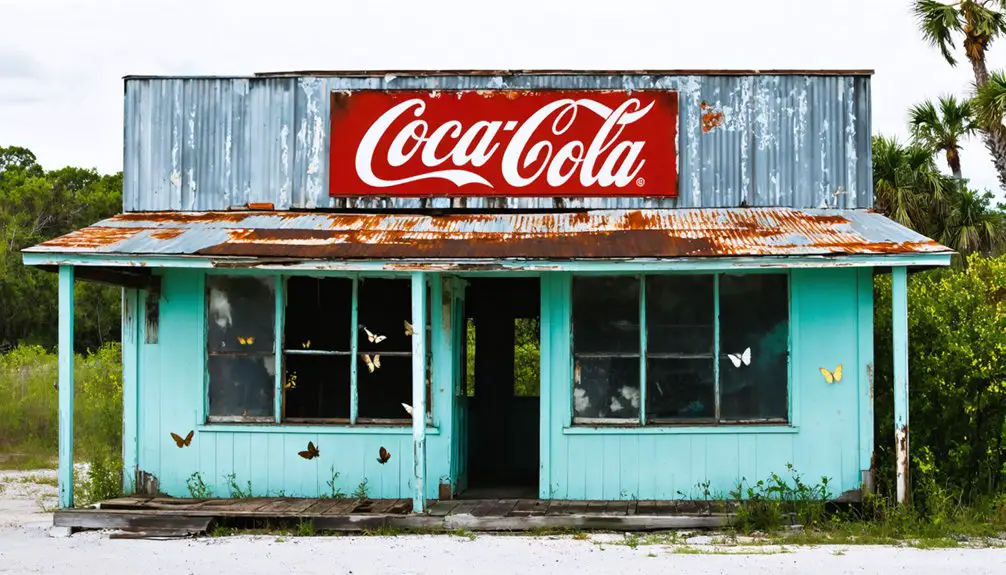
Urban Decay Through the Lens: Abandoned Florida Neighborhoods
In the eerie calm of Florida’s forgotten neighborhoods, drone photography reveals the stark reality of coastal decay and suburban abandonment. These desolate spaces often create an environment where intrusive thoughts persist, haunting visitors and photographers alike.
You’ll find prime shooting locations at places like Marineland’s Old A1A, where collapsed roofs and encroaching vegetation create haunting aerial compositions against the Atlantic backdrop. Despite the desolation, some locations still maintain pristine golf courses visible from aerial views, much like the abandoned Shallow Creek course.
For urban exploration enthusiasts, The Place at Alafaya offers a stark reflection of nature’s reclamation, with its intact street grid forming geometric patterns from above.
Along the coastline, forgotten marina neighborhoods showcase derelict docks mirrored in still waters, while abandoned developments on Hutchinson Island present striking contrasts between sand and scrub.
Your drone can capture the raw poetry of these sites – from storm-damaged beachfront parcels to vacant retirement communities, each telling its own story of Florida’s boom-and-bust cycles through compelling aerial perspectives.
Legacy of Plantations: Aerial Views of Historic Ruins
As you ascend above Bulow Plantation’s 150-acre expanse, your drone’s camera reveals the haunting geometry of coquina sugar mill ruins emerging from a moss-draped canopy of live oaks.
Your aerial perspective captures how dawn’s first light traces the foundations of slave quarters and the plantation house, illuminating a complex narrative of frontier agriculture and human bondage preserved in stone.
The site’s history stretches back to 1821 founding date, when the original plantation was established before meeting its fate during conflicts with the Seminole tribe.
Over 300 slaves worked the vast fields of this once-thriving agricultural empire, cultivating crops like corn and sweet potatoes until its destruction in 1836.
Through strategic drone flight paths around the towering mill walls and along Bulow Creek’s winding course, you’ll document essential archaeological evidence that connects Florida’s colonial past to modern preservation efforts.
Structural Remnants Tell Stories
While Florida’s plantation ruins stand as silent witnesses to a complex past, their weathered structures offer drone photographers unique opportunities to document historical narratives from above.
Through storytelling photography, you’ll discover how each architectural remnant reveals layers of the past while adhering to artifacts preservation guidelines.
For the most compelling aerial compositions that respect historical significance:
- Focus on sugar mill chimneys and coquina stacks from 30-60 feet altitude, capturing their imposing verticality against the landscape.
- Document slave quarter foundations and subfloor pits at 120-200 feet to reveal spatial relationships and settlement patterns.
- Track remnant canals and drainage systems that showcase the engineered transformation of Florida’s wetlands.
The Elliot Plantation site spans an impressive 2,585 acres within Kennedy Space Center’s grounds, offering extensive opportunities for aerial documentation.
You’ll find these structural elements create powerful visual stories, especially when photographed during golden hour when shadows emphasize architectural details and ground patterns.
The plantation’s twin chimneys still tower over 30 feet high, providing dramatic vertical elements for aerial photographers seeking to capture the site’s industrial heritage.
Dawn Light Reveals History
Dawn’s first rays transform Florida’s plantation ruins into a photographer’s paradise, where low-angle sunlight reveals intricate details often hidden during regular daylight hours.
You’ll capture compelling aerial narratives as golden light rakes across coquina walls and sugar mill remnants, particularly at sites like Bulow Plantation where sunrise contrasts emphasize centuries-old textures.
From above, you’ll discover how morning dew and coastal mist create atmospheric layers that accentuate the scale of these historic complexes.
The oblique light exposes subtle landscape modifications – tree-lined colonial roads, drainage canals, and foundation outlines that tell stories of both engineering achievement and human bondage.
Linear shadows cast by chimney stacks and cabin rows offer stark visual evidence of plantation life, while early light illuminates micro-topographical features that align with archaeological records.
Preserving Through Aerial Documentation
The enduring legacy of Florida’s plantation ruins demands meticulous aerial documentation to preserve their archaeological significance. Through aerial preservation, you’ll capture essential historical evidence that might otherwise be lost to time, from geometric patterns of former slave quarters to the stark silhouettes of mill chimneys against the landscape.
When you’re documenting these sites, focus on:
- Structural integrity – use varying altitudes to record masonry conditions and preservation states
- Site patterns – capture field boundaries and foundation layouts visible only from above
- Cultural context – frame ruins within their natural surroundings to show how these sites interact with Florida’s ecosystem
You’ll need proper permits for historical documentation, but the reward is contributing to a deeper understanding of these significant sites while creating compelling visual narratives that honor their complex past.
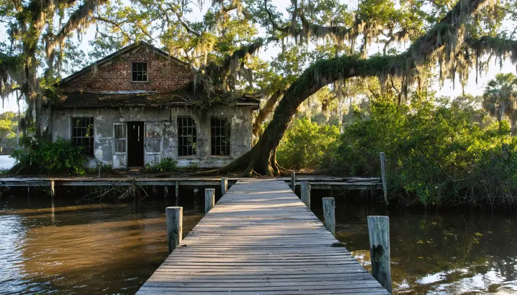
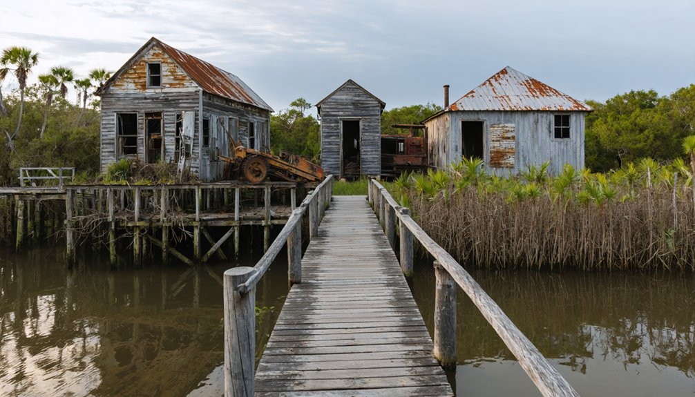
Waterfront Ghosts: Capturing Florida’s Lost Coastal Towns
Along Florida’s sun-drenched coastline, abandoned settlements tell stories of devastating freezes, military expansions, and failed land schemes through their weathered ruins.
Time-worn ruins along Florida’s shores whisper tales of nature’s fury, wartime growth and dreams turned to dust.
You’ll discover prime coastal photography opportunities at Eldora, where nature reclaims citrus groves beside manatee-rich waters, and at Yukon’s forgotten naval town, where lonely pavements stretch toward the waterfront.
For compelling drone mapping subjects, explore Quay’s unincorporated remains along Indian River Lagoon, or capture Fort Mose’s military remnants from strategic angles above the waterways.
The New Smyrna Sugar Mill ruins offer perhaps the most dramatic aerial compositions, with its exposed 1830s structures standing sentinel against the maritime backdrop.
These lost coastal communities provide unique perspectives on Florida’s past, each site offering distinct vantage points for aerial documentation.
Off-the-Beaten-Path: Small Settlement Remnants
Hidden across Florida’s interior, small settlement remnants offer drone photographers a treasure trove of compelling compositions at former railroad junctions, agricultural hamlets, and roadside commercial sites.
You’ll discover ghostly traces of the past through your drone’s lens – from overgrown rail beds to crumbling citrus grove patterns that tell forgotten settlement stories.
- Scout abandoned railroad spurs using historic maps, looking for raised beds and platform remains that create dramatic leading lines at sunrise.
- Capture geometric patterns of old agricultural settlements from above, where tenant housing foundations and field terraces reveal human-land relationships.
- Document roadside relics like vintage service stations and general stores during golden hour, when long shadows emphasize architectural details.
Remember to secure property access permissions and follow preservation guidelines while exploring these atmospheric locations.
Frequently Asked Questions
What Weather Conditions Are Best for Drone Photography of Ghost Towns?
Perfect, peaceful mornings provide your ideal weather: winds under 10 mph, golden-hour lighting, and clear visibility. You’ll want low humidity, stable temperatures, and overcast skies for balanced exposures.
How Do I Avoid Trespassing Charges When Photographing Abandoned Locations?
You’ll avoid trespassing laws by sticking to public preserves like Sumica, securing proper permits, respecting posted signage, and following photography ethics. Don’t hop fences or enter restricted private property.
Which Drones Are Most Reliable for Photographing in Coastal Environments?
You’ll want DJI Air 3 or Mavic 3 Pro for their IP54 ratings and coastal stability, while Autel Evo II Pro’s magnesium frame provides extra saltwater protection during your shoreline adventures.
Are Night Drone Shots of Ghost Towns Legal in Florida?
You’ll need proper anti-collision lighting and Remote ID for night photography, plus landowner permission if the ghost town’s privately owned. Don’t fly within 500 feet of any remaining critical infrastructure.
Should I Publish Exact GPS Coordinates of Lesser-Known Ghost Towns?
You shouldn’t publish exact coordinates due to ethical considerations and privacy concerns. Instead, share general area descriptions to protect these sites from vandalism, looting, and overuse while still enabling exploration.
References
- https://www.youtube.com/watch?v=DKesRivP9VU
- https://www.youtube.com/watch?v=OWy7bai2Hws
- https://www.youtube.com/watch?v=Lv9sIPn3NgU
- https://www.youtube.com/watch?v=0XuNR0AOlQU
- https://www.clickorlando.com/features/2025/01/06/this-crazy-florida-ghost-town-was-built-on-the-water-heres-where-to-find-it/
- https://www.airial.travel/attractions/united-states/hermanas-ghost-town-69SboQSx
- https://www.hmdb.org/m.asp?m=112124
- https://en.wikipedia.org/wiki/Sumica
- https://www.ghosttowns.com/states/fl/sumica.html
- https://www.youtube.com/watch?v=2uH02z9JEGc