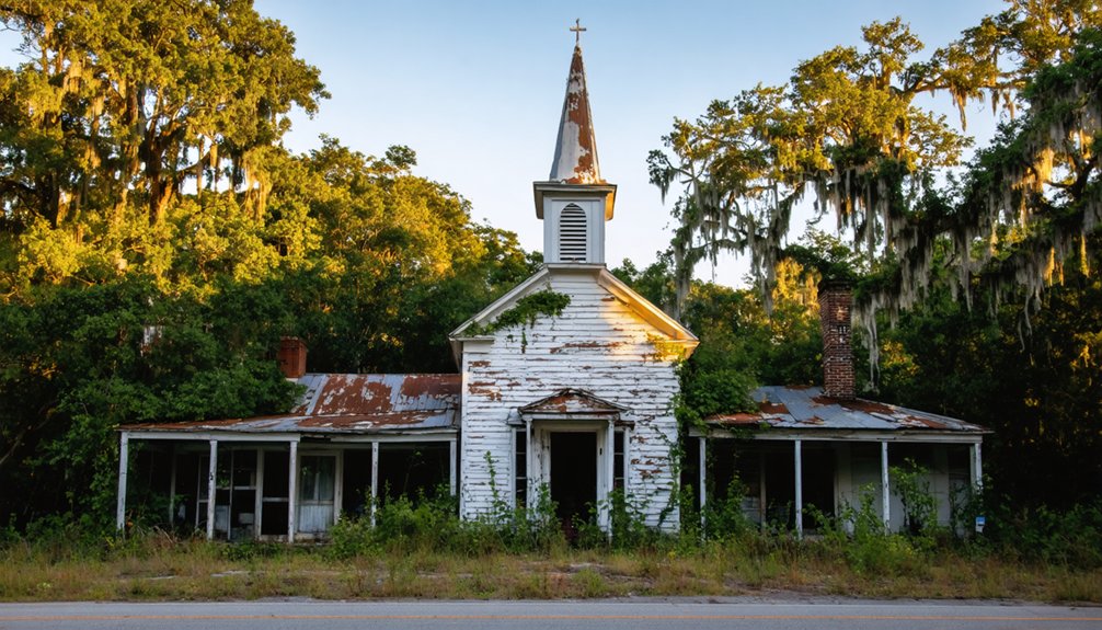
You’ll find exceptional drone photography opportunities at three distinctive Southern ghost towns. Rodney, Mississippi offers dramatic shots of its 1832 Presbyterian Church with its Civil War-embedded cannonball, while Cahaba, Alabama’s flood-carved ruins and St. Luke’s Church create striking compositions from above. For industrial archaeology, head to Buffalo City, North Carolina where abandoned railway beds and logging paths reveal America’s timber heritage. The deep South’s forgotten towns hold countless aerial treasures waiting to be discovered.
Key Takeaways
- Rodney, Mississippi offers dramatic aerial shots of its 1832 Presbyterian Church with a Union cannonball still embedded in its facade.
- Cahaba, Alabama’s St. Luke’s Church ruins and historic street grid create compelling compositions, especially during seasonal flooding periods.
- Buffalo City, North Carolina’s abandoned logging paths and railway beds provide unique patterns visible from aerial perspectives.
- Golden hour flights at 60-150 meters altitude capture optimal lighting and detail of ghost town structures and archaeological features.
- Winter photography missions reveal the most ground detail, while late summer showcases dramatic contrasts between ruins and vegetation.
The Haunting Beauty of Rodney, Mississippi
Although time has reclaimed much of Rodney’s once-bustling streets, this Mississippi ghost town‘s haunting ruins provide drone photographers with uniquely atmospheric compositions.
You’ll find the 1832 Federal-style Presbyterian Church rising above hollow buildings and lifeless roads, its legendary silver-cast bell occasionally echoing across the bluffs. A Union cannonball remains lodged in the church’s facade from an 1863 Confederate raid.
The forgotten history of this former river port, which nearly became Mississippi’s capital, adds depth to every frame you’ll capture. By the 1850s, the town reached its peak as the busiest port on the Mississippi River.
Your drone can soar above the three-acre cemetery where 200 graves tell tales of yellow fever epidemics and Civil War raids.
The isolated location off Natchez Trace Parkway, accessible via a solitary gravel road, creates the perfect backdrop for haunting legends that still linger in the heavy air of this abandoned town.
Exploring Ancient Cahaba’s River-Shaped Ruins
You’ll discover how recurring floods shaped Cahaba’s distinctive ruins, as the Alabama and Cahaba rivers’ devastating 1821-1822 inundations hastened the capital’s abandonment and left an indelible mark on its architectural remains.
To aid visitors seeking specific historic sites, this location functions as a disambiguation point for various Cahaba-related destinations in Alabama.
The presence of St. Luke’s Church stands as the most prominent surviving structure among the scattered ruins, offering a compelling focal point for aerial photography.
From your drone’s vantage point, you can trace the rivers’ historic paths through geometric patterns in the remaining street grid and foundation outlines.
The waterways’ influence becomes most apparent during seasonal flooding, when your aerial shots can capture the stark contrast between submerged lowlands and the elevated ruins that have withstood two centuries of river reshaping.
Floodwater’s Historic Impact
While the ancient Cahaba settlement once thrived at the strategic confluence of the Cahaba and Alabama Rivers, its location proved to be both a blessing and a curse.
Early flood resilience strategies, including a defensive wall and moat system, couldn’t protect the settlement from nature’s relentless force. Archaeological evidence shows that the indigenous inhabitants built flat-topped earthen mounds between 1500-1600 AD as central features of their village. After becoming Alabama’s capital in 1818, the town experienced seasonal flooding that plagued residents with health issues. You’ll witness how historical flood patterns shaped this ghost town’s destiny, particularly during the devastating 1865 flood that accelerated its decline.
As you fly your drone over the site, you’ll notice how floodwaters have carved the landscape, leaving visible traces of streets and foundations.
The ruins tell a compelling story – from the collapsed Crocheron Mansion‘s brick columns to the flood-sculpted remnants of Castle Morgan prison. These water-worn structures now create hauntingly beautiful compositions for aerial photography.
Aerial River Pattern Views
Ancient river patterns weave through Cahaba’s archaeological landscape, creating a mesmerizing aerial canvas for drone photographers.
You’ll spot the ghostly traces of former Cahaba River channels through meandering oxbows preserved in soil discoloration and foundation alignments that follow historic river bends.
For the best shots, fly between 60-150 meters during golden hour or overcast conditions.
You’ll want to capture both straight-down and angled views to emphasize the archaeological features. Set your drone’s overlap to 75-85% frontlap and 60-70% sidelap for detailed orthomosaics.
Winter flights reveal the most ground detail, while late summer showcases striking vegetation contrasts along old riverbanks.
The haunting sight of Spanish moss draping from trees adds an ethereal quality to aerial footage of the ruins.
Remember to check park regulations and secure necessary permissions before launching – these preserved river patterns tell stories that deserve careful documentation.
The site’s transformation from a bustling state capital city to an abandoned archaeological park offers unique opportunities for documenting historical change through aerial photography.
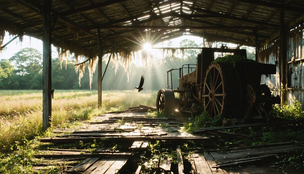
Buffalo City: Hidden Treasures in North Carolina’s Marshlands
Deep in North Carolina’s marshlands, the haunting remains of Buffalo City offer drone photographers a rare glimpse into America’s logging past.
You’ll discover the perfect ghost town exploration site where a once-thriving lumber operation employed 300 workers across 100,000 acres. While no structures remain from Buffalo City’s history, your drone can capture the mysterious patterns of old railway beds and logging paths through the dense canopy.
During its peak, the town supported a population of over 3,000 residents before its eventual abandonment.
The site’s remote location in Alligator River National Wildlife Refuge creates ideal conditions for atmospheric aerial photography.
Your drone will reveal the contrast between dark waterways and thick vegetation, highlighting where this bustling community once stood. The swampy terrain that once challenged bootleggers now provides you with dramatic perspectives of nature reclaiming this forgotten piece of post-Civil War industry.
The site shares similarities with historic Buffalo near Lake Lure, where Ledbetter Store once served as a vital community hub before flooding submerged the town.
Movie Magic Meets History at Spectre Ghost Town
You’ll need $5 per person or $10 per car to access this unique film set where you can capture striking aerial shots of the remaining six homes, church, and iconic Styrofoam trees from Tim Burton’s *Big Fish*.
The deteriorating structures and freely roaming goats create compelling compositions, especially when photographed from above to showcase the Southern Gothic atmosphere against the Alabama River backdrop.
Your drone footage can help document this piece of cinematic history as owners work to preserve the remaining structures, which include Jenny’s house columns and the famous hanging shoes that mark the town’s entrance.
Film Set Access Requirements
While film sets typically disappear after production wraps, Spectre Ghost Town offers photographers a rare opportunity to access and document a preserved movie location.
To capture this unique Tim Burton creation, you’ll need to follow specific visitor requirements and obtain proper filming permits.
Getting your drone shots at Spectre requires:
- Access through a private gate on the Bright family’s 60-acre property along the Alabama River
- Payment of admission fees ($5 for adults, $3 for children over 2)
- Advance coordination through Jackson Lake Island’s management at 334-430-7963
You’ll find the deteriorating set provides compelling aerial perspectives, from the iconic hanging shoes at the entrance to the six remaining homes and church structure where goats now roam freely among the Styrofoam trees and weathered porches.
Cinematic Camera Angles
As cinematic drone photography transforms ghost town documentation, mastering key camera angles at Spectre reveals powerful storytelling possibilities.
You’ll want to start with low, rising reveal shots that showcase the town’s scale, using the main street’s natural leading lines to guide viewers toward decaying focal points like the iconic saloon.
Create drama through high-angle establishing shots paired with sudden cuts to architectural details. You’ll achieve striking aerial compositions by implementing Dutch tilts during shifts, adding an unsettling edge without disorienting your audience.
For maximum impact, capture symmetrical shots of building facades from directly above or head-on. These cinematic techniques work best during golden hour when lateral light accentuates textures and peeling paint, transforming Spectre’s abandoned structures into compelling visual narratives that preserve its haunting history.
Preservation Through Photography
Since its construction as a movie set in 2003, Spectre’s weathered facades have evolved from fictional backdrop to cultural touchstone, creating unique preservation challenges for drone photographers.
When capturing this Southern Gothic masterpiece, you’ll need to balance preservation ethics with storytelling opportunities. The site’s rapid deterioration means your images serve as vital documentation of this cultural landmark.
- Focus on contrasting the artificial “styrofoam” trees against encroaching natural vegetation for a compelling narrative about nature reclaiming fantasy.
- Document the remaining church and houses from multiple angles to showcase both architectural details and decay patterns.
- Capture the resident goats interacting with movie set elements to illustrate how reality has merged with fiction.
Your drone footage becomes part of Spectre’s ongoing preservation story, helping maintain its cinematic legacy through visual documentation.
Uniontown’s Architectural Legacy From Above
Uniontown’s historic district showcases a stunning collection of architectural treasures best captured through aerial photography.
You’ll find the district’s most dramatic architectural contrasts in its Neo-Classical Revival mansions – particularly the Hardie-Coleman House and Co-Nita Manor. Their imposing porticos and classical columns create striking visuals against the surrounding Uniontown decay.
From above, you can capture the full scope of these abandoned properties, where fluted Ionic columns and Corinthian capitals stand proud despite decades of neglect.
The district’s diverse architectural styles, from Greek Revival’s Westwood to Gothic Revival’s Fairhope Plantation, offer unique perspectives through drone photography. The overgrown yards and partial collapses of once-grand estates tell a powerful story of the town’s cotton-era prosperity and subsequent decline.
Deep South Ghost Town Trail: A Photographer’s Guide
The Deep South’s abandoned settlements offer photographers a rich network of historic locations, each with its own compelling narrative. Your drone photography techniques will capture stunning perspectives at sites like Auraria, Georgia’s “City of Gold,” where silent structures tell tales of Cherokee heritage and gold rush fever.
For ideal ghost town exploration through the region’s remote wilderness, consider:
- Begin at Buffalo City, NC – the former “Moonshine Capitol” provides dramatic aerial compositions of abandoned structures.
- Navigate to Auraria’s GPS coordinates (34.47263, -84.023781) for sweeping shots of the historic settlement.
- Capture dawn light at remote crossroads, ensuring you’ve verified property access and drone regulations.
Remember to check weather conditions and pack backup batteries. The Deep South’s ghost towns demand technical precision and careful planning for the best aerial shots.
Essential Drone Photography Tips for Abandoned Southern Sites
While capturing haunting images of abandoned Southern sites demands technical expertise, mastering essential drone photography techniques will dramatically improve your results.
Master the art of drone photography to transform your abandoned Southern site images from ordinary to extraordinary.
Start with drone safety by scouting locations through Google Earth and securing necessary permissions. When on-site, maintain constant awareness of structural hazards and unstable flooring.
For compelling compositions, execute 360-degree orbits without the horizon and capture oblique shots from all cardinal points. You’ll want to master manual exposure control, as auto-metering often fails in low-light conditions.
Use your drone’s light-painting capabilities to illuminate structures while taking separate exposures for the sky. In post-processing, combine your light-painted sections using Photoshop’s Lighten blend mode, and carefully mask out any visible drone light trails to create seamless, atmospheric final images.
Frequently Asked Questions
What Are the Best Seasons to Avoid Snakes While Filming?
Like an old-school Polaroid capturing winter’s stillness, you’ll find ideal snake avoidance from November through March when temperatures stay below 60°F, making seasonal filming safest during these colder months.
Can I Legally Sell Prints or Footage From These Ghost Towns?
You’ll need permits for federal lands and property owner permission for private sites. Always verify copyright considerations and check local regulations before selling any ghost town imagery commercially.
Are There Any Reported Paranormal Activities During Drone Flights?
Like whispers in the wind, you’ll find claims of paranormal encounters during drone flights, but there’s no verified evidence – just EMI issues, GPS glitches, and environmental factors causing unusual equipment behavior.
Which Drones Perform Best in High Humidity Environments?
You’ll get ideal humidity resistance from DJI Matrice 300/350, Matrice 30, or SwellPro SplashDrone 4. Their IP-rated seals and conformal-coated electronics require less drone maintenance in damp conditions.
How Do Locals Typically Respond to Drone Photographers in These Areas?
You’ll find local perceptions vary widely – while remote sites see minimal interference, active communities may raise privacy concerns. It’s best to engage respectfully and seek permission before launching your drone operations.
References
- https://airial.travel/attractions/united-states/rodney-ghost-town-mississippi-6g7l5mw_
- https://quirkytravelguy.com/ghost-towns-of-the-deep-south/
- https://deepsouthurbex.com/2020/01/02/6-south-alabama-ghost-towns/
- https://www.youtube.com/watch?v=hTe8F-_3-hY
- https://www.youtube.com/watch?v=n5uUCFyJpYI
- https://www.geotab.com/ghost-towns/
- https://www.youtube.com/watch?v=e3O7r4r9AHo
- https://www.youtube.com/watch?v=ONGpYZW4u_g
- https://www.youtube.com/watch?v=WnCExMF567Q
- https://www.legendsofamerica.com/ms-rodney/


