You’ll find exceptional drone photography opportunities at Alabama’s atmospheric ghost towns like Old Cahawba, Spectre, and Historic Bellefonte. These sites feature moss-draped ruins, enchanted canopies, and preserved cemetery grounds that create stunning aerial compositions during golden hour. For best results, shoot in early morning or late afternoon when the air is clear and shadows are long. Pack your ND filters and extra batteries – there’s much more to discover about capturing these haunting historical locations from above.
Key Takeaways
- Old Cahawba offers stunning aerial perspectives of moss-draped ruins and historic streets along the Alabama River.
- Spectre’s abandoned movie set features moss-covered trees creating natural canopies perfect for overhead cinematography.
- Bellefonte’s preserved cemetery grounds provide dramatic contrasts between historical structures and encroaching wilderness.
- Historic Blakeley State Park combines Civil War ruins with natural landscapes, ideal for golden hour drone photography.
- Prairie Bluff ghost town presents riverside ruins and architectural remnants that cast compelling shadows during late afternoon flights.
Why Alabama’s Ghost Towns Make Perfect Drone Subjects
While many states offer ghost town photography opportunities, Alabama’s abandoned settlements present uniquely compelling subjects for drone pilots thanks to their dramatic mix of historical ruins and natural reclamation.
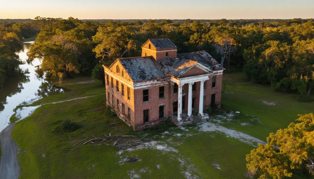
You’ll capture ghostly landscapes where nature steadily consumes once-thriving communities, from Old Cahawba’s moss-draped ruins to Blakeley’s fort-turned-hillside. The convergence of rivers at Old Cahawba creates stunning aerial perspectives, while Spectre’s moss-covered trees form an enchanted canopy perfect for overhead shots. Visitors can explore the site thoroughly with free bike rentals available at the welcome center.
These sites offer unmatched abandoned beauty, especially during golden hour when long shadows accent architectural remnants. In Bellefonte, the preserved cemetery grounds provide stark visual contrasts between weathered headstones and surrounding wilderness.
When sunlight fades to gold, shadows stretch across decaying walls, transforming abandoned structures into hauntingly beautiful landscapes frozen in time.
Your drone can document everything from 200-year-old street layouts at Old St. Stephens to the haunting silhouette of Fort Morgan’s coastal fortifications. The sites’ isolation and minimal modern intrusion guarantee clean, historically authentic compositions.
Essential Gear and Permits for Ghost Town Aerial Photography
Before you launch your drone over Alabama’s ghost towns, you’ll need to secure your FAA Part 107 certification, LAANC airspace authorization, and any required local permits for commercial photography.
You’ll want to pack essential gear including a camera-equipped drone with gimbal stabilization, multiple batteries, and backup GPS tools for remote locations without power access.
Written permission from property owners and documentation of your registration, Remote ID compliance, and liability insurance coverage should be organized in advance to guarantee smooth, legal operations at these historic sites. Be sure to conduct thorough pre-flight checks before each ghost town photography session. If flying for commercial purposes, ensure you’ve obtained your Remote Pilot Certificate by passing the required FAA aeronautical test.
Required Gear Checklist
Once you’ve secured the necessary permits for ghost town drone photography, assembling the right gear becomes critical for capturing these abandoned locations from above.
Your primary setup should include a high-resolution camera drone with gimbal stabilization and wide-angle capabilities, plus at least three spare batteries for extended flight sessions. Remember to pack a DJI Air 2S as your main aerial camera for optimal image quality.
Pack essential drone techniques gear like spare propellers, landing pad, and ND filters to handle bright Alabama sunlight. A high-visibility vest is crucial for maintaining safety and ensuring you’re visible to others who may be exploring the ghost town sites.
For gear maintenance in the field, you’ll need a lens cleaning kit, portable power station, and protective guards when maneuvering overgrown ruins.
Don’t forget high-capacity SD cards and backup storage options.
Round out your kit with practical items like insect repellent, sunscreen, and a cart for hauling equipment through remote ghost town terrain.
Permits and Access Rules
Capturing aerial photos of ghost towns starts with proper legal compliance.
You’ll need to complete your TRUST certification for recreational flights or obtain a Part 107 license for commercial photography. Register your drone if it weighs over 0.55 pounds and display the FAA registration number clearly.
Before launching at any abandoned site, verify you’re following current Remote ID requirements unless flying in a designated FRIA.
You’ll need to maintain visual line-of-sight during your shoot and only fly during daylight or civil twilight hours with proper lighting.
While there aren’t specific statewide drone regulations for ghost towns, always secure property owner permission and check local ordinances. In Orange Beach areas, you must obtain a special permit to fly within 500 feet of any location. For insurance purposes, ensure your aerial imagery is clear and current to document site conditions accurately.
If you’re planning to sell your photos or use them commercially, remember that Part 107 certification is mandatory.
Safety Guidelines for Drone Operations at Historical Sites
When you’re capturing aerial footage of ghost towns, you’ll need to strictly follow both FAA regulations and site-specific historical preservation guidelines.
You must obtain proper permits, maintain visual line of sight with your drone, and stay clear of restricted airspace zones around these sensitive locations.
Before launching your drone, carefully assess the surroundings for hazards like deteriorating structures, overhead power lines, and dense vegetation that could interfere with your flight path or emergency landing options.
With approximately 350 ghost towns documented across Alabama, you’ll want to thoroughly research each location’s accessibility and conditions before planning your shoot.
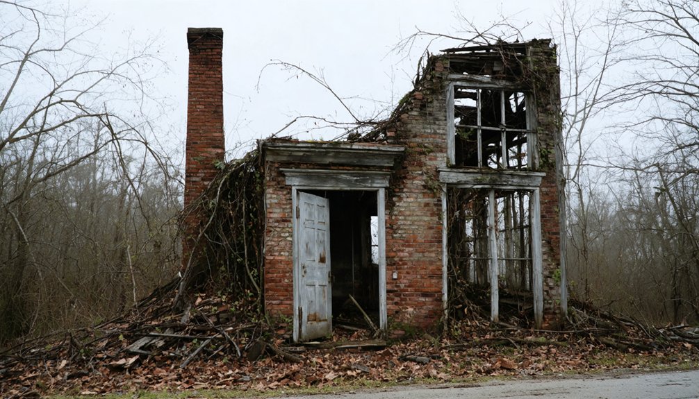
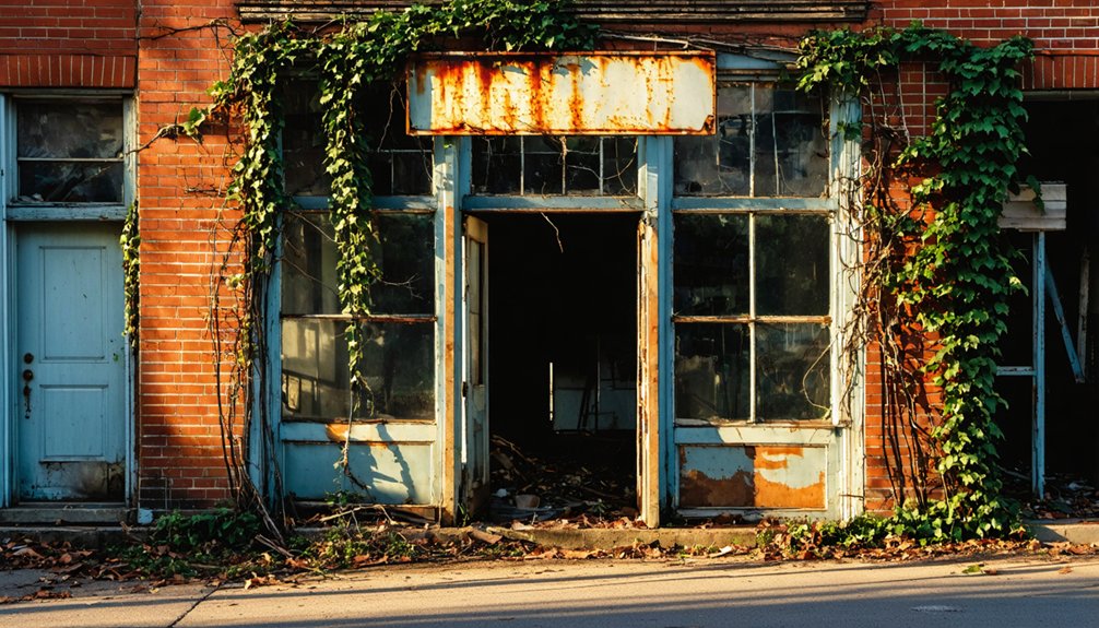
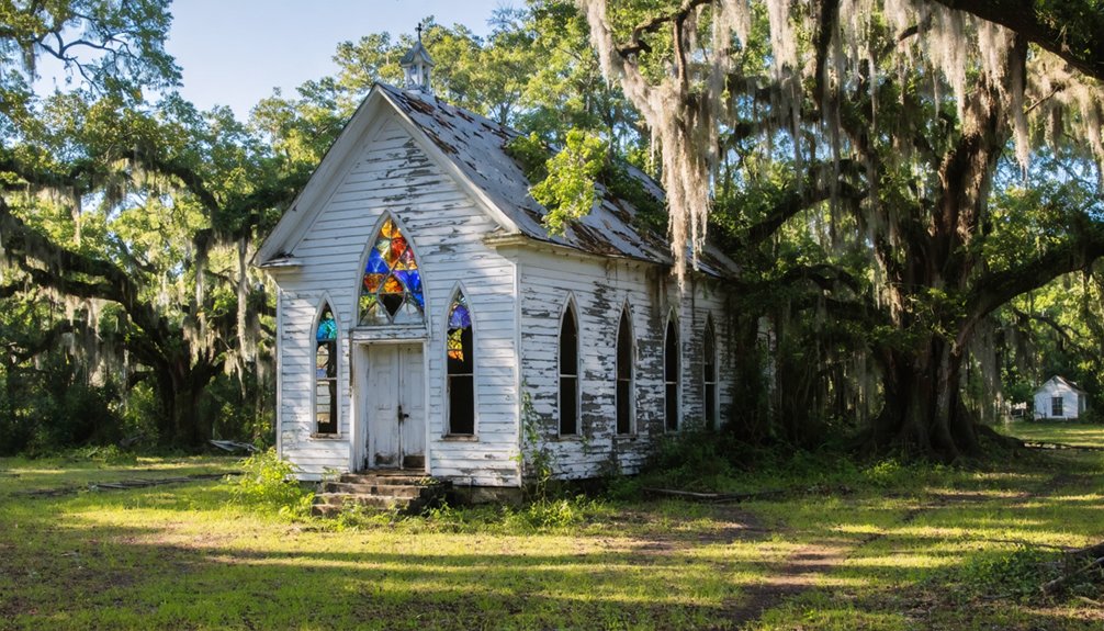
Some of the best ghost towns in Alabama offer unique historical insights and stunning views of abandoned architecture. Exploring these sites can provide excellent photo opportunities, especially during golden hour when the lighting enhances the eerie atmosphere. Be sure to capture the stories hidden within the ruins as you delve into Alabama’s forgotten past.
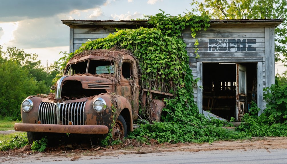
In addition to their historical significance, many of the ghost towns in Alabama movies serve as backdrops for cinematic storytelling, capturing the imagination of filmmakers and audiences alike. As you explore these haunting locations, keep an eye out for familiar scenes that may have been featured in popular films, creating a unique blend of reality and fiction. This fusion of history and film can inspire your own creative projects, allowing you to weave the rich narratives of Alabama’s past into your work.
Be mindful of the Civil War sites when filming around Historic Blakeley Park, as these areas require special consideration for preservation.
Preserve Historical Site Integrity
To protect irreplaceable historical structures during drone photography, you’ll need to follow strict operational guidelines that safeguard both visible and hidden elements of ghost town sites.
Keep your drone at conservative distances from historic structures – much farther than you might for typical photography. This guarantees historical preservation while preventing rotor wash from damaging fragile masonry.
Never take off or land near ruins, as this can compress and damage archaeological deposits beneath the surface. When capturing footage, limit repeated passes over any single feature to minimize vibration impact.
Stay mindful of archaeological sensitivity by using lightweight drones and minimal gear configurations. Before launching, scout the site thoroughly to identify structural weak points and potential hazards.
Document your flight paths and maintain detailed logs of each session to support responsible site management.
Flight Regulations and Permits
Before launching your drone at any ghost town site, you’ll need to navigate a complex web of federal, state, and local regulations.
Verify you’ve obtained your FAA Part 107 certification if you’re shooting commercially, and register any drone over 0.55 pounds with the FAA. You’ll also need to secure written permission from the site owner or manager.
Watch for flight restrictions – keep your drone below 400 feet and maintain a 100-foot buffer around historical structures.
Many ghost towns fall under municipal ordinances that require specific permits and drone insurance coverage. Check if you’re in controlled airspace, as you’ll need LAANC authorization before takeoff.
Exploring abandoned towns to explore in Alabama can reveal fascinating remnants of history and architecture. Ensure you research each location’s history to uncover captivating stories and potential safety considerations. Additionally, be mindful of local laws and respect private property rights as you venture into these forgotten places.
Night photography requires additional FAA waivers, so plan accordingly.
Remember that local historic preservation rules may impose stricter limits than federal regulations.
Top Lighting Conditions for Haunting Aerial Shots
Mastering ghost town drone photography hinges on understanding the interplay of light throughout the day.
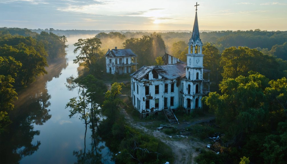
You’ll find the most haunting aerial perspectives during golden hour, when warm reddish tones sculpt abandoned structures and cast long, dramatic shadows across deteriorating facades.
For ideal lighting techniques, launch your drone during early morning hours when the air’s clearest, or late afternoon when the sun’s intensity softens.
You’ll capture sharper details and richer textures while avoiding harsh midday glare. Overcast conditions work surprisingly well, providing even illumination that reveals intricate architectural features without intense shadows.
During blue hour, you can frame eerie silhouettes against deep navy skies, creating moody compositions that emphasize the ghostly atmosphere.
Position your drone to maximize sidelight, which adds depth and dimension to your abandoned town captures.
Mapping Your Ghost Town Photography Route
You’ll want to plot your ghost town photography route as a strategic loop that connects sites like Cahawba and St. Stephens while maximizing golden-hour shooting windows at each location.
Your timing should factor in seasonal changes that affect both access and aesthetics, from spring wildflowers to winter’s revealing leaf-off periods.
Pack essential navigation tools including FAA maps, property access permits, and backup GPS devices to handle the mix of paved highways and remote backroads you’ll encounter.
Strategic Loop Planning
While mapping the perfect drone photography route through Alabama’s ghost towns requires careful planning, an optimized loop starting at Old Cahawba can reduce the original 400-mile journey to a more manageable 280 miles.
Your first scenic shift takes you to Blakeley’s river-wrapped ruins, followed by the archaeological wonders of Old St. Stephens.
For maximum loop optimization, you’ll want to hit Byrne’s Lake and Searcy Mental Hospital before heading north to Spectre’s moss-draped movie set.
This condensed route lets you capture all six locations during prime daylight hours. You’ll find ideal drone launch points at each stop – from Cahawba’s riverfront ruins to Blakeley’s overgrown fortifications.
Plan your battery changes around the clustered sites, and you’ll complete the circuit with plenty of stunning aerial footage.
Best Time Windows
Once your route is mapped, the timing of your ghost town drone shoots becomes the next critical layer of planning.
You’ll want to target golden hour – those precious 20-40 minutes during sunrise and sunset – for the most dramatic shots of ruins bathed in warm, directional light. For wider scenes at places like Old Cahawba, mid-morning offers balanced light that’s perfect for HDR blending.
Consider seasonal factors when scheduling your flights. Winter’s lower sun angles create stronger side-lighting on vertical ruins, while summer calls for earlier morning sessions to beat the heat haze.
Watch for those magical misty mornings in fall and spring along the Cahaba River – they’re ideal for capturing ethereal drone footage. Just remember to check the wind forecast and plan around the calmest windows, typically within two hours after sunrise.
Successful ghost town drone photography hinges on a robust navigation toolkit anchored by high-accuracy GNSS receivers and extensive offline mapping resources.
You’ll want to equip yourself with multi-constellation receivers that maintain accuracy under tree canopy and among ruins, while ensuring your mapping software can handle offline topographic and satellite imagery downloads for areas with spotty cell coverage.
Load your navigation apps with cached basemaps, property boundaries, and no-fly zones before heading out.
Your drone’s flight-planning software should integrate with real-time airspace tools to identify restrictions near sensitive sites.
Don’t forget to download parcel maps from county GIS portals to verify land access rights.
Pack backup power for your devices and store plenty of offline map data – you’ll need at least 16GB of space for thorough site coverage.
Capturing Nature’s Reclamation From Above
As abandoned settlements surrender to nature’s persistent advance, drone photography reveals compelling narratives of ecological succession from above.
At Old Cahawba, you’ll capture striking nature contrasts where moss-draped ruins and spring wildflowers create textural compositions against brick foundations. Urban decay takes on new meaning as the Alabama River’s seasonal flows expose submerged street grids and root-tangled infrastructure.
In Blakeley’s fortifications, forest growth softens military earthworks into organic sculptures best captured in late-day light.
At St. Stephens, your drone can track marsh migration patterns through NIR sensors, documenting how tidal waters reclaim former streets. Time your flights during leaf-off seasons to reveal hidden linear features, and always check park regulations for permitted windows.
These sites offer unmatched opportunities to document nature’s transformative power from the air.
Best Angles for Historic Structure Documentation
Documenting historic structures through drone photography requires precise angles and methodical flight patterns to capture every architectural detail.
For ideal historic documentation, you’ll want to keep your drone’s sensor parallel to building façades at 10-30 feet altitude, using ND filters to preserve masonry textures.
When shooting from above, maintain 70-90% image overlap at consistent heights between 50-120 feet for clear orthomosaic mapping.
For detailed architectural elements, position your drone at 20-60° angles from horizontal to capture cornices, lintels, and foundation features.
Don’t forget to include scale markers in your shots. Plan multiple passes with increasing zoom levels for high-resolution inspection of decorative elements.
Record GPS coordinates and camera settings for each flight to guarantee accurate archival documentation of these irreplaceable structures.
Seasonal Changes and Their Impact on Ghost Town Footage

Seasonal variations dramatically influence the quality and character of ghost town drone footage across Alabama’s historic sites.
You’ll find winter’s golden hour offers extended periods of dramatic contrast, casting long shadows that emphasize structural details and weathered textures. In autumn, peak foliage creates stunning warm tones against abandoned buildings, particularly from late October through mid-November as the color wave moves south.
Consider the seasonal ghost town dynamics when planning your shoots.
Spring’s rapid vegetation growth can obscure architectural features, while summer’s harsh midday sun flattens textures. Winter brings fewer drone operators and visitors but requires careful battery management in cold conditions.
Watch for spring nesting restrictions near riverine ruins like Cahawba and Blakeley. For ideal results, take advantage of overcast winter days for balanced exposure in both exterior and interior shots.
Tips for Creating Atmospheric Drone Videos
While advanced drone pilots often focus on technical precision, creating truly atmospheric ghost town footage requires mastering both flight mechanics and visual storytelling.
You’ll want to shoot in log profile for maximum flexibility in color grading, allowing you to enhance the moody, abandoned feel of these historic sites.
Combine slow, deliberate movements with strategic shot composition – use leading lines from dilapidated buildings and overgrown paths to draw viewers into the scene.
Add depth by incorporating fog overlays and atmospheric soundscapes in post-production. Film during golden hour when long shadows create dramatic contrast, and consider using hyperlapse techniques to capture clouds moving over weathered structures.
For maximum impact, vary your shot types between wide establishing shots and intimate close-ups of architectural details, while maintaining smooth, cinematic movements through Acro mode control.
Weather Considerations for Ghost Town Aerial Photography
Weather conditions can make or break your ghost town aerial shoot, particularly in Alabama’s diverse climate zones.
You’ll find your best flight windows during late October through early November and late February through April, when cooler temperatures reduce battery stress and improve visibility.
Watch out for summer’s intense heat that can drain batteries and create heat shimmer in your footage.
During winter months, you’ll need to warm your batteries before flight to maintain peak performance.
Keep an eye on weather patterns, especially near rivers where wind channeling can create unexpected gusts.
Morning fog and prescribed burns present visibility challenges, so time your shoots carefully.
For best results, plan your flights during sunrise or sunset when lighting is ideal and thermal turbulence is minimal.
Frequently Asked Questions
Are There Local Legends or Paranormal Stories Associated With These Ghost Towns?
You’ll encounter rich local folklore at Old Cahawba’s haunted cemetery, Blakeley’s legendary hanging tree, and Spectre’s moss-draped facades. These sites draw ghost hunters seeking EVP recordings and paranormal photography opportunities.
Which Ghost Towns Require Advance Permission From Private Landowners for Drone Access?
While you’d expect strict drone regulations at these haunted spots, none explicitly require private landowner agreements. You’ll just need to follow standard FAA rules and any posted park guidelines.
What Wildlife Encounters Should Drone Operators Prepare for at These Locations?
You’ll need to watch for nesting birds at OldCahawba, free-roaming goats at Spectre, coastal wildlife at FortMorgan, and forest creatures at Blakeley. Keep safe drone distances for wildlife interactions.
Can Overnight Camping or Ghost Hunting Be Combined With Drone Photography?
You’ll need special permits to combine camping, ghost hunting, and drone flights. Pack night-vision gear, FAA-compliant drone lights, and secure landowner permissions before setting up your paranormal investigation basecamp.
Are There Nearby Facilities for Emergency Drone Repairs and Equipment Maintenance?
You’ll find emergency drone repair shops in Vinemont at North Alabama Quad and Gardendale’s CPR Cell Phone Repair. DDS Drone Repair in Hillside offers specialized DJI services with discount options.
References
- https://alabamabucketlist.com/ghost-towns-in-alabama/
- https://airial.travel/attractions/united-states/orrville/old-cahawba-archaeological-park-R2IUt73m
- https://deepsouthurbex.com/2020/01/02/6-south-alabama-ghost-towns/
- https://www.youtube.com/watch?v=hTe8F-_3-hY
- https://freepages.history.rootsweb.com/~gtusa/usa/al.htm
- https://www.youtube.com/watch?v=n5uUCFyJpYI
- https://www.youtube.com/watch?v=xgKM2O88mII
- https://www.onlyinyourstate.com/experiences/alabama/11-places-in-alabama-nature-is-reclaiming
- https://www.drone.contractors/articles/alabama-drone-laws.html
- https://uavcoach.com/drone-laws-alabama/