You’ll find exceptional drone photography opportunities at Arkansas’s most atmospheric ghost towns. Monte Ne offers dramatic partially submerged ruins with mirror-like reflections, while Rush Historic District presents compelling geometric patterns from its mining-era foundations. Don’t miss Peppersauce in Calico Rock for its vine-draped structures, or Booger Hollow’s isolated buildings against forested ridgelines. Before launching your drone, you’ll need to secure proper permits and follow specific height restrictions – but the visual rewards are worth the extra preparation.
Key Takeaways
- Monte Ne offers striking drone photography opportunities with its partially submerged ruins and reflective water surfaces creating unique compositions.
- Rush Historic District presents geometric mining foundations and dramatic mountain backdrops ideal for architectural drone shots.
- Peppersauce ghost town in Calico Rock features vine-covered structures and textural elements perfect for aerial photography.
- Booger Hollow’s isolated structures against forested ridgelines provide compelling aerial perspectives during golden hour lighting.
- Best drone photography results come during spring and fall, with early morning or late afternoon shoots avoiding harsh midday light.
Capturing Arkansas’s Forgotten Past From Above
While Arkansas’s abandoned settlements quietly decay on the ground, their stories unfold dramatically from above through the lens of a drone camera.
A bird’s-eye view reveals the hidden narratives of Arkansas’s ghost towns, their secrets unveiled by soaring cameras.
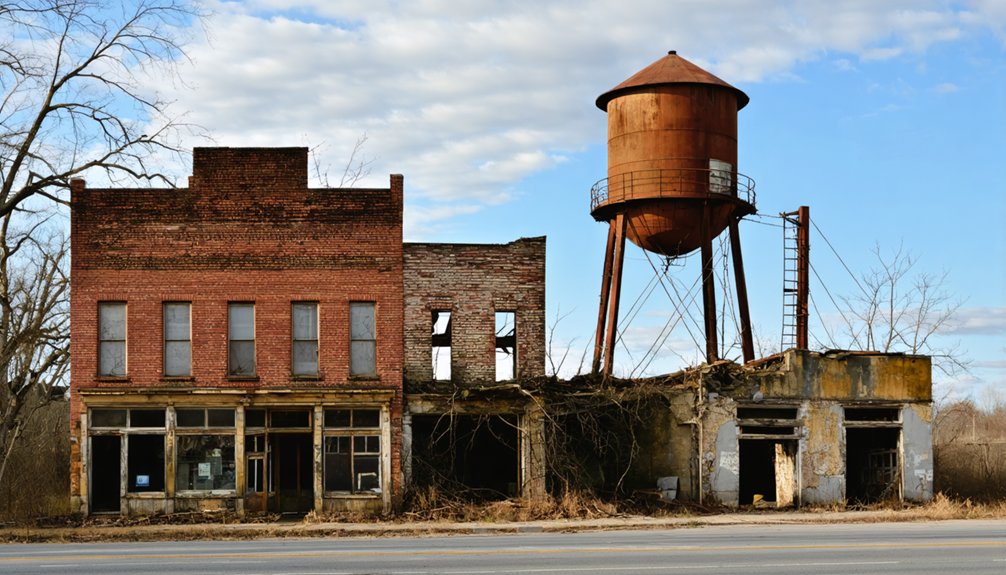
You’ll discover Monte Ne’s partially submerged ruins creating mesmerizing water reflections, and Rush Historic District’s geometric patterns of mining-era foundations telling tales of industrial ambition. Once producing zinc for World War I, Rush became Arkansas’s most productive mining operation before its eventual decline.
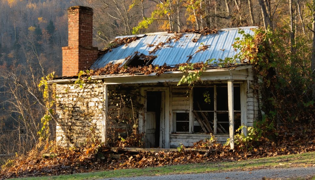
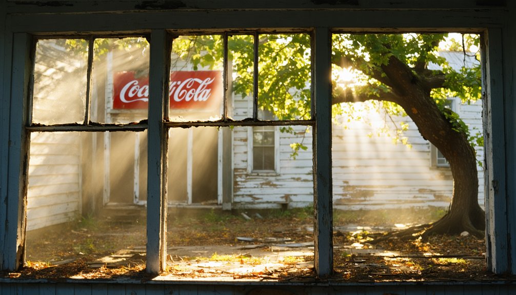
For compelling visual storytelling, explore Peppersauce’s vine-covered rooftops in Calico Rock, where abandoned commercial buildings provide rich textural details at low altitudes. Since the railroad’s closure in the 1960s, these historic structures have remained frozen in time, offering unique aerial perspectives.
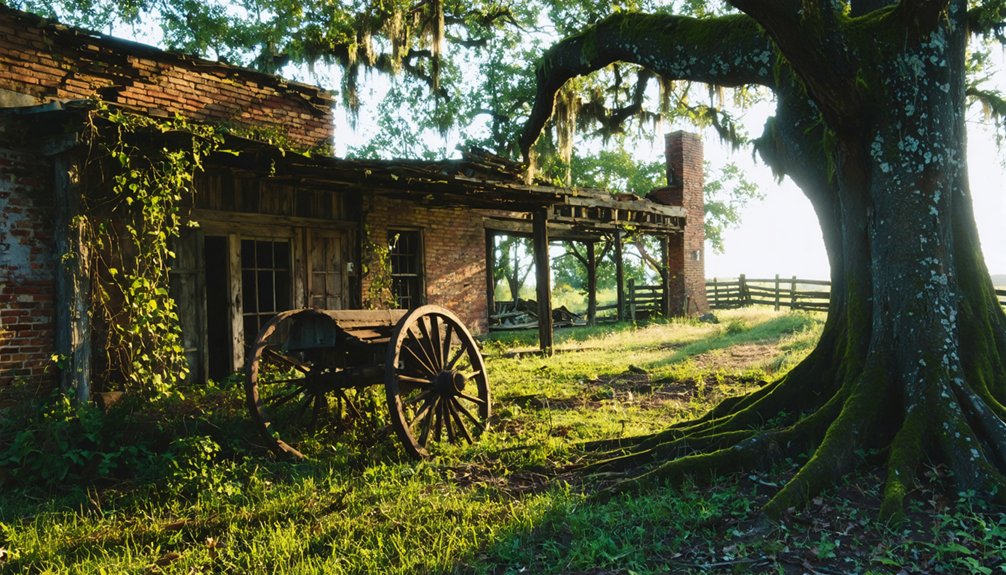
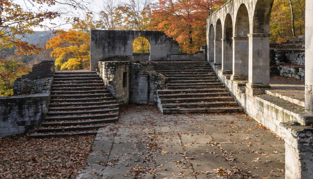
The historical context deepens at Booger Hollow, where isolated structures stand boldly against forested ridgelines.
In the Ozarks, scattered remains of Eros and similar settlements reveal the grid-like patterns of early farming communities.
Launch during golden hour to capture these sites in their most evocative light, when long shadows emphasize architectural details and enhance aerial compositions.
Essential Drone Photography Equipment and Settings
You’ll need a drone with at least a 1-inch sensor and mechanical shutter to capture the nuanced details and textures of Arkansas’s weathered ghost town structures in varying light conditions.
For safe and legal operation, make certain you’re equipped with spare batteries, ND filters, and proper documentation including Part 107 certification and site permissions. Consider bringing a DJI Battery Charging Hub to keep multiple batteries ready during extended shoots.
Set your camera to shoot in RAW at the lowest native ISO, and consider bracketing your exposures by ±1-2 EV to preserve both highlight and shadow details in these historically significant locations. The 5K resolution capabilities of modern drones like the DJI Mavic 3 CINE will ensure you capture the finest architectural details in these historic sites.
Drone Camera Selection Tips
Selecting the right drone camera for ghost town photography requires carefully weighing sensor size, resolution, and flight capabilities against your creative vision.
You’ll want to take into account drones with larger sensors like the 1-inch CMOS in the DJI Air 3S or the Micro Four Thirds in the Mavic 4 Pro for capturing fine architectural details in low light. These sensor types excel at revealing subtle textures in weathered buildings and abandoned structures.
For maximum creative freedom, look at models offering multiple focal lengths, like the DJI Mavic 3 Pro’s triple-camera system. The variable aperture lens on the Mavic 4 Pro’s wide-angle camera provides additional control over exposure and depth of field. The 360° obstacle avoidance on the Mini 4 Pro proves invaluable when navigating tight spaces between deteriorating buildings.
You’ll appreciate the versatility of switching between wide-angle shots of entire town layouts and telephoto views of specific building features.
Don’t overlook the importance of flight time – the Air 3S’s 45-minute endurance lets you explore extensive ghost town sites without frequent battery changes.
Flight Safety Essentials
Safe drone photography starts with an extensive pre-flight equipment checklist and reliable safety protocols.
You’ll need to pack essential gear including spare propellers, fully charged batteries, and high-speed microSD cards. A reliable portable power station will ensure you can recharge batteries in remote ghost towns. Don’t forget your neutral density filters and circular polarizers for ideal light control. Starting your preparation 24 hours before flight allows proper time to organize and check all equipment.
Your risk assessment must include checking UAV Forecast and B4UFly apps to verify airspace clearance. Weather preparedness is critical – monitor wind speeds, storm potential, and bright conditions that might affect visibility.
Always carry your Part 107 license or Trust certificate, and make certain your anti-collision lights are visible for three miles during night operations.
Before takeoff, calibrate your compass, set home points, and inspect all equipment thoroughly.
Post-flight, examine your gear for issues, back up your footage immediately, and review flight logs to maintain top safety standards.
Best Camera Settings Guide
While modern drone cameras offer impressive auto settings, mastering manual controls reveals your creative potential for professional-quality aerial shots.
Switch to Pro mode and set your base ISO to 100 for crisp, noise-free images of abandoned structures. Follow the exposure triangle principles: control light with aperture (f/2.8-f/11), motion blur with shutter speed, and sensitivity with ISO. Record in RAW format to preserve maximum detail and editing flexibility in post-processing. Using a balanced histogram helps prevent loss of detail in highlights and shadows.
For ghost town photography, you’ll want your camera settings optimized for various lighting conditions.
During golden hour, use manual white balance at 5600K to capture warm tones on weathered buildings. In bright sunlight, increase shutter speed to 1/1000s while maintaining low ISO.
For dimly lit interiors or dusk shots, bump ISO to 800 and slow your shutter to 1/30s.
Enable your histogram and grid lines for precise composition and exposure control.
Legal Guidelines for Ghost Town Aerial Photography
Before launching your drone at Arkansas ghost towns, you’ll need to navigate a complex web of regulations spanning FAA rules, National Park Service restrictions, and private property rights.
You must maintain flights below 400 feet in uncontrolled airspace, stay 500 feet from structures and people, and secure explicit permission from landowners for sites like Booger Hollow Outpost.
National Park Service locations like Rush Historic District completely prohibit drone operations, with violations carrying fines up to $5,000.
Permits and No-Fly Zones
Understanding permit requirements and no-fly zones stands as your first critical mission for drone photography in Arkansas ghost towns.
You’ll need a Special Use Permit from Arkansas State Parks, approved by the Parks Director, before launching your drone. Don’t forget to include your drone registration, pilot certification for commercial flights, and liability insurance in your application package.
Watch out for critical infrastructure – power plants, rail facilities, and military sites are off-limits without explicit permission.
When your target ghost town sits near these facilities, you’ll need written consent from facility owners. Always check FAA maps for TFRs and permanent restricted airspace before each flight.
For ghost towns on private land, secure written permission that covers flight corridors, altitudes, and image capture rights to protect yourself from legal issues.
Flight Height Restrictions
With permits secured, you’ll face another key challenge: mastering the strict altitude limits for drone photography over Arkansas ghost towns.
You’re bound by the FAA’s 400-foot altitude limitation when flying in uncontrolled airspace, measured from ground level. However, when photographing abandoned structures, you can leverage the structure proximity rule – allowing flight up to 400 feet above the highest point of a building, provided you stay within a 400-foot horizontal radius.
This means if you’re capturing a 200-foot-tall abandoned mill, you can legally fly up to 600 feet above ground level while staying within that structure’s radius.
Just remember, these height extensions don’t apply in controlled airspace where LAANC authorization sets your maximum ceiling. Always check B4UFLY before launching to verify local restrictions.
Property Owner Permission
For successful ghost town drone photography in Arkansas, securing proper property owner permissions stands as your critical first legal hurdle.
You’ll need to verify property boundaries through county parcel maps or GIS records before reaching out to landowners. Don’t assume abandoned means unowned – these sites typically have legal property holders.
Get written permission that clearly outlines your allowed takeoff and landing zones, flight times, and any restricted areas.
Carry printed proof of this consent during your shoots – it’s your protection if law enforcement questions your presence.
Even if you’ve spotted the perfect ghost town composition, proceeding without permission can result in trespass charges.
Prime Seasons and Times for Ghost Town Shots
Since timing can make or break your ghost town drone photography in Arkansas, choosing the right season and time of day becomes essential for capturing these abandoned structures.
Exploring ghost towns for astrophotography in Arkansas offers a unique experience, especially when the night sky is clear. The absence of city lights allows for stunning star trails and captures of the Milky Way, creating a surreal backdrop against the remnants of history. Consider visiting during new moons to maximize your exposure to celestial wonders.
Additionally, many historic filming locations in Arkansas provide fascinating insights into the state’s cinematic history, blending natural beauty with rich narratives. These spots not only enhance your photography but also offer a glimpse into the stories that shaped the region. Consider planning your visit around local film festivals or events to fully immerse yourself in the culture that surrounds these iconic sites.
You’ll find ideal weather conditions during spring (March-May) and fall (September-November), when temperatures range from 50-70°F, providing stable flight conditions and stunning seasonal foliage.
Avoid summer’s intense heat that creates disruptive thermal updrafts.
Plan your flights during golden hours (6-9 AM or 4-7 PM) when soft light enhances architectural details.
For the clearest shots, seek days with winds under 10 mph and visibility exceeding 10 miles.
Consider waxing crescent moon phases for unique dusk compositions.
You’ll encounter fewer restrictions by shooting midweek or early weekend mornings before crowds arrive at preserved sites.
Top Locations and Their Unique Visual Elements
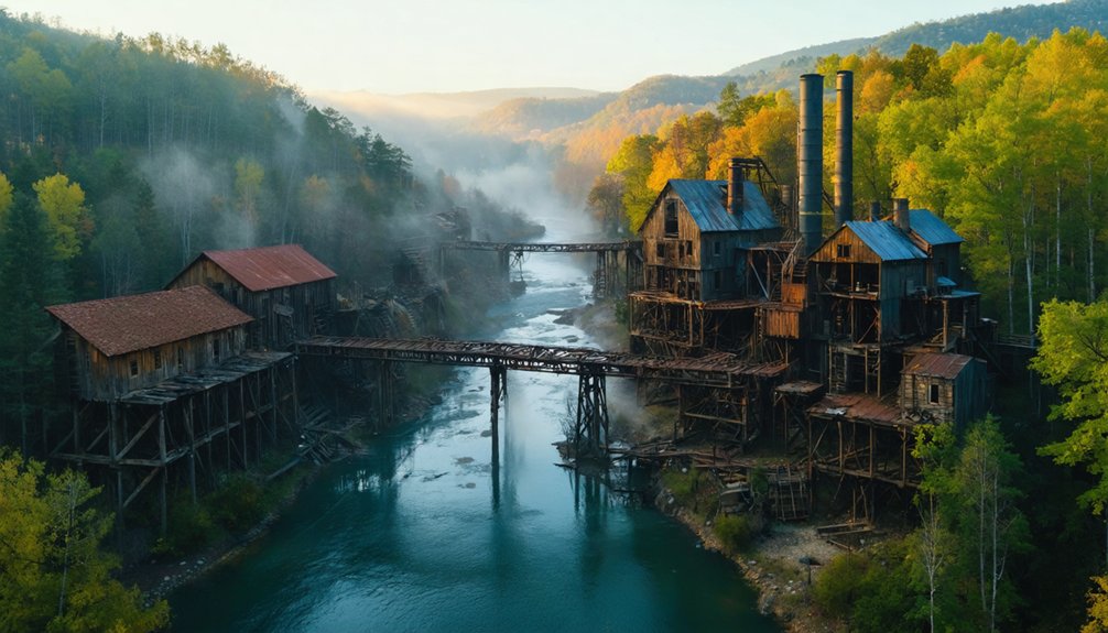
While Arkansas’s ghost towns offer diverse photographic opportunities, several locations stand out for their exceptional drone compositions. Monte Ne’s submerged ruins create dramatic waterline reflections, while the Rush Historic District’s mining remnants deliver compelling industrial textures from above.
For capturing unique drone perspectives with historical significance, you’ll find these locations particularly rewarding:
- Monte Ne’s concrete towers and flooded foundations – perfect for low-angle reflection shots
- Rush’s preserved stone structures and mine tailings – ideal for overhead geometric patterns
- Calico Rock’s dense cluster of abandoned buildings – excellent for tight architectural framing
- Beaver Lake shoreline remnants – prime for symmetrical compositions and mirror effects
Each location offers distinct architectural elements and natural features that’ll challenge your technical skills while providing freedom to explore various altitudes and angles.
Reaching these photogenic ghost towns requires strategic planning and precise navigation.
You’ll find most access routes unmarked on standard maps, so rely on local landmarks and GPS coordinates. For Peppersauce, start at Calico Rock’s historic district bridge, while Rush demands following trailhead markers from the designated parking lot.
Navigation challenges at Monte Ne center around water levels – you’ll need to scout the boat ramp area for the best vantage points.
Okay Ghost Town’s scattered structures require careful coordination with roadside Americana markers, while Booger Hollow’s position along Scenic Highway 7 offers straightforward access.
Consider combining sites like Okay with nearby Millwood Lake to maximize your expedition. Always check for no trespassing signs and respect local boundaries when plotting your approach routes.
Safety Considerations When Flying in Abandoned Areas
Before launching your drone at Arkansas ghost towns, you’ll need to navigate a complex web of regulations and safety protocols. Always inspect abandoned structures from a safe distance before flight, watching for unstable walls, hidden drop-offs, and potential wildlife habitats that could pose risks to your operation.
Flying drones at ghost towns requires careful preparation, safety awareness and full compliance with regulations to protect both structures and operators.
When flying near deteriorating buildings, maintain extra buffer distances and stay alert for:
- Sudden wind gusts through openings that can destabilize your aircraft
- Exposed metal, wires, or debris that could entangle props
- Bat colonies or bird nests that require legal distance compliance
- Structurally compromised roofs or walls that may collapse
Remember to document all property permissions, carry proper certifications, and verify airspace restrictions through B4UFLY.
Keep clear of posted “no trespassing” areas unless you’ve secured explicit authorization from the landowner.
Advanced Techniques for Historic Structure Photography
As you venture into advanced drone photography of historic structures, mastering specialized techniques will dramatically enhance your documentation quality.
For ideal historic facade techniques, capture high-overlap imagery with at least 70% forward and 60% side overlap, flying both nadir and oblique patterns. You’ll want to operate at multiple altitudes and execute circular flight paths to fully document intricate masonry details.
For advanced imaging methods, utilize HDR bracketing in shadowed areas to reveal hidden textures and employ cross-polarization techniques when shooting reflective surfaces.
Consider scheduling your flights during golden hour or overcast conditions to maximize surface detail capture.
Don’t forget to integrate GCPs or RTK/PPK GNSS systems for centimeter-level accuracy, ensuring your documentation meets conservation standards.
Frequently Asked Questions
Are There Any Paranormal Activity Reports at These Ghost Towns?
Like footprints in fading mist, you won’t find documented ghost sightings or haunted histories at these locations. While they’re rich in historical remnants, there’s no verified paranormal activity reported at Rush, Monte Ne, Eros, or Booger Hollow.
Which Ghost Towns Have Cell Phone Coverage for Drone Controller Connectivity?
You’ll find reliable cell signal strength at Graysonia when using Verizon, while Rush has spotty AT&T connectivity issues. Bring a signal booster to Zinc and Eros for safer drone operations.
How Close Are the Nearest Camera Repair Shops to These Locations?
You’ll need to download your “camera maintenance options” like a 90s modem – local repair services aren’t close. Expect 10-80 mile drives, with Rogers/Bentonville best for Monte Ne, Mountain Home for Calico Rock.
Do Any Locations Offer Guided Drone Photography Tours or Workshops?
You won’t find official guided drone photography tours or workshops at these locations. You’re free to explore independently with your drone, following FAA regulations and local flight restrictions.
Which Ghost Towns Allow Nighttime Drone Photography for Light Painting Effects?
Like moths to a flame, you’ll find Monte Ne and Peppersauce most accommodating for nighttime drone light trails. While there aren’t posted restrictions, exercise stealth and respect during your nocturnal creative sessions.
References
- https://www.onlyinyourstate.com/experiences/arkansas/ar-ghost-towns
- https://arkansasfrontier.com/ghost-towns-in-arkansas/303766/
- https://www.youtube.com/watch?v=ToQlvasj_ow
- https://www.youtube.com/watch?v=l4g8nwzMZ4s
- https://www.youtube.com/watch?v=TkFqw7GehFY
- https://www.youtube.com/watch?v=3n_57upBhLU
- https://www.jasperarkansas.com/jasper-blog/exploring-arkansas-from-above
- https://www.onlyinyourstate.com/experiences/arkansas/abandoned-and-reclaimed-by-ar
- https://www.worldatlas.com/cities/6-most-photogenic-towns-in-arkansas.html
- https://www.youtube.com/watch?v=p48YILwhGX0