You’ll find exceptional drone photography opportunities at Michigan’s haunting ghost towns, with Fayette’s 19 preserved buildings along Big Bay de Noc offering prime aerial shots. The Keweenaw Peninsula’s 100+ abandoned copper mining sites provide dramatic perspectives, while Port Oneida’s status as America’s largest National Rural Historic District delivers unique architectural compositions. Pack your drone gear between late May and September for ideal conditions and extended daylight hours. There’s a whole world of forgotten places waiting to reveal their secrets from above.
Key Takeaways
- Fayette Historic State Park offers 19 original buildings along Big Bay de Noc, providing exceptional drone photography opportunities of preserved 19th-century structures.
- The Keweenaw Peninsula hosts nearly 100 ghost towns from the copper mining era, offering diverse aerial photography locations.
- Port Oneida, America’s largest National Rural Historic District, features abandoned homesteads and historic structures perfect for aerial shots.
- Central Mine provides sweeping valley views and historic mining structures, with excellent vantage points from above rock piles.
- Whitefish Point’s lighthouse complex allows for dramatic low-altitude drone passes while capturing Lake Superior’s shoreline.
Experience Michigan’s Coastal Ghost Towns From Above
While Michigan’s rugged coastlines have long drawn photographers to their shores, exploring the state’s coastal ghost towns by drone reveals an enthralling new perspective of 19th-century industrial ruins against the backdrop of the Great Lakes.
Michigan’s coastal ghost towns offer haunting aerial views, where industrial remnants of the past meet the timeless beauty of the Great Lakes.
You’ll find prime aerial opportunities at Fayette, where 19 original buildings hug the shoreline of Big Bay de Noc, creating dramatic compositional lines for your drone.
Whitefish Point’s lighthouse complex offers spectacular low-altitude passes, while De Tour Village’s harbor ruins shine during golden hour.
The often overlooked residences on the west side of town provide unique architectural subjects for aerial photography.
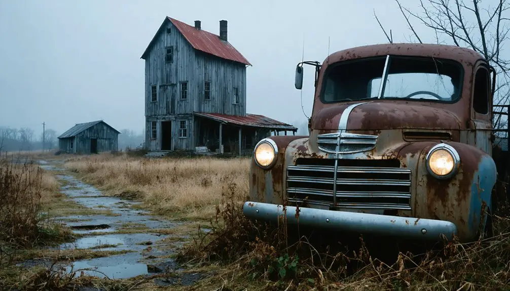
The ghost town of Clifton, which once boasted a bustling peak of 700 residents in 1877, offers haunting views of abandoned mining structures.
Before launching, though, you’ll need to navigate drone regulations – many sites require permits and have seasonal restrictions to protect coastal ecosystems.
Check for federal airspace limitations near lighthouses and research local access points.
Time your flights during the softer light of dawn or dusk when these weathered structures cast their longest shadows.
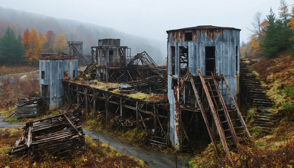
Deep within Michigan’s remote Keweenaw Peninsula, where nearly 100 ghost towns scatter across the rugged landscape, you’ll discover an aerial photographer’s paradise of abandoned mining settlements from the 1800s copper boom.
When planning your drone flights, consider the marshy terrain and late spring conditions that can affect visibility and access. The region’s economic decline led to widespread abandonment during the Great Depression.
Before launching at sites like Clifton, Delaware, or Mandan, scout locations where summer residents still occupy buildings. You’ll need to respect private property while capturing aerial shots of collapsed structures, old foundations, and historic churches.
At Central Mine, position your drone above the rock piles for sweeping valley views.
The historic town of Fayette, nestled along the Garden Peninsula coast, offers scenic overlooks of Lake Michigan and Big Bay de Noc.
Historical Remnants Through an Aerial Lens
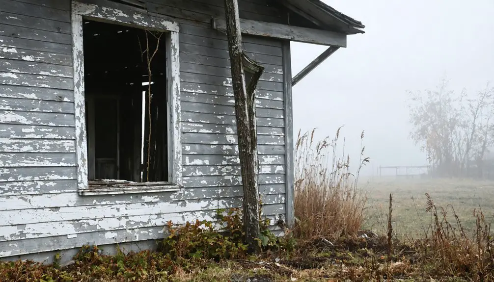
You’ll discover Michigan’s ghost towns take on a haunting new dimension when viewed through your drone’s camera, with abandoned structures casting long shadows across empty streets and overgrown lots.
The intrigue deepens when you explore the abandoned movie sets in Michigan, remnants of a bygone era that tell stories of cinematic dreams. Each decaying façade and rusting prop invites you to imagine the scenes that once played out in these desolate locations. These sites not only capture the imagination but also serve as a reminder of nature reclaiming what was once created by man.
Through your aerial lens, you can capture the weathered rooflines of Fayette’s 19 original buildings or the cluster of deteriorating tourist cabins along M-28’s forgotten settlements. Among these sites, The Pines establishment anchors the landscape of old Creighton, offering a rare intact structure from the area’s vibrant past. Spectacular shots can be achieved at the Big Bay De Noc waterfront location.
Your drone’s perspective reveals hidden patterns in these historic sites, from the systematic layout of mining towns in Keweenaw County to the strategic positioning of coastal communities like Fayette along Lake Michigan’s shore.
Ruins From Above
As Michigan’s abandoned settlements reveal their secrets from above, drone photographers discover an entirely new perspective on the state’s ghost towns through their camera-equipped quadcopters.
You’ll find striking drone angles at Fayette’s preserved industrial village, where nineteen original buildings create compelling architectural symmetry against the backdrop of Lake Michigan’s Big Bay De Noc.
The Keweenaw Peninsula offers a treasure trove of nearly 100 ghost towns, where you can capture dramatic aerial shots of mine shafts, tailings, and forgotten street grids.
Southern Hillsdale County’s Buckeye postal station, which operated for just four years until 1902, now offers haunting aerial views of its vanished footprint.
In winter, Fayette’s snow-covered ruins create stark contrasts perfect for moody compositions. Your drone’s eye view will reveal hidden patterns in Upper Peninsula village remains, from exposed foundations to nature’s slow reclamation of once-bustling communities through every season.
Modern drone footage provides birds-eye views that help document these historically significant sites while respecting any remaining residents who still call these places home.
Capturing Time’s Decay
Drone photographers have become time travelers, documenting Michigan’s historical remnants through their aerial equipment. You’ll witness architectural nostalgia unfold as you capture Fayette’s 19 surviving structures, from the weathered blast furnace to the skeletal remains of residential homes along Lake Michigan’s shore.
Time lapse decay reveals itself dramatically across the Keweenaw Peninsula’s nearly 100 ghost towns. Your drone footage will expose once-bustling streets of Calumet and Hancock, now silent amid 300 waterfalls and pristine wilderness.
For striking compositions, explore the UPGhostTownExhibit’s 15 featured communities, where each abandoned building tells a story. From Mackinaw City’s seasonal emptiness to Buckeye’s forgotten postal station, you’ll document Michigan’s vanishing history from perspectives previously impossible to achieve.
Capturing Abandoned Architecture From New Heights
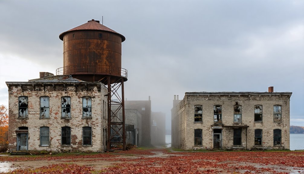
Michigan’s ghost towns offer a treasure trove of aerial photography opportunities, where weathered foundations and abandoned structures tell stories from unique vantage points. These locations primarily showcase former industrial sites from Michigan’s rich logging and railroad history.
For those seeking to capture the night sky, the state also boasts an array of astrophotography spots in Michigan, where the absence of light pollution reveals stunning celestial displays. Locations such as the Keweenaw Peninsula and the Porcupine Mountains provide breathtaking backdrops for star trails and Milky Way photography. With clear evenings, these areas allow photographers to explore both the natural beauty of the landscape and the wonders of the universe above.
You’ll find striking aerial perspectives at Port Oneida, America’s largest National Rural Historic District, spanning 2,000 acres of architectural remnants frozen in time.
At Clifton, you can capture 146-year-old mining-era structures alongside a historic cemetery, while Central Mine’s accessible location lets you frame deteriorating buildings against the rugged Keweenaw landscape.
Discover the haunting beauty of Clifton’s mining relics and Central Mine’s decaying structures against the untamed Keweenaw wilderness.
For textural variety, seek out Good Harbor’s weathered dock pilings emerging from Lake Michigan or track down hidden copper mine remnants masked by overgrowth. Aral’s abandoned site near Otter Creek presents remnants of its bustling lumber operations from the 1880s.
Don’t miss the old apple trees marking former homesteads – they create compelling patterns when shot from above.
Seasonal Drone Photography in Michigan Ghost Towns
Capturing ghost towns from above requires careful timing throughout Michigan’s four distinct seasons.
You’ll find ideal conditions during late May through early September, with extended daylight hours and stable weather, though you’ll need to navigate around peak tourist traffic.
Winter offers dramatic snow-covered scenes but demands specialized gear – pack battery warmers and expect 20-50% reduced flight time in freezing temperatures.
Fall’s spectacular foliage creates stunning contrast against weathered structures, though you’ll work with shorter golden-hour windows.
Consider seasonal access restrictions: spring thaws can limit road access, while winter closures might affect permit processing.
Before launching, you’ll need to verify current regulations and secure necessary permits, especially near wildlife areas where seasonal restrictions protect nesting habitats.
Hidden Gems: Overlooked Ghost Town Perspectives
While mainstream photographers flock to well-known attractions, you’ll discover fascinating hidden perspectives throughout Michigan’s lesser-known ghost town locations. Your drone’s aerial exploration will reveal secrets like Fayette’s overlooked residential houses along Lake Michigan’s shore and remote Keweenaw mining sites where once-thriving cities now stand silent.
- Capture isolated west-side homes at Fayette that most photographers miss, offering unique angles of pristine shoreline away from tourist hotspots.
- Explore the M-28 ghost cluster’s four forgotten towns, including Walsh’s lumber heritage and Pine’s vintage 1920s structures.
- Document Keweenaw County’s network of nearly 100 abandoned copper mining settlements, featuring eerie empty streets and untouched wilderness views.
Pack your drone and venture beyond the obvious – these hidden perspectives await your lens.
Frequently Asked Questions
What Drone Permits Are Required for Filming Michigan Ghost Towns?
You’ll need TRUST certification if flying recreationally or Part 107 for commercial filming. Follow drone regulations like Remote ID broadcasting, and guarantee you’ve registered your drone over 0.55 pounds.
Are There Restricted Areas or No-Fly Zones Around These Sites?
You’ll encounter restricted airspace near airports, state parks, and wildlife refuges. Don’t miss checking B4UFLY app for drone regulations, especially around Fayette Historic Site and Mackinac Bridge’s no-fly zones.
How Close Can Drones Legally Fly to Historical Ghost Town Structures?
You’ll need to maintain 300 feet from historical structures per Michigan law, though you can fly up to 400 feet high. Always check local permits and prioritize site preservation when planning your shots.
What Are the Best Weather Conditions for Ghost Town Drone Photography?
Like a ghost emerging from shadows, you’ll want clear skies, low winds, and ideal lighting during golden hours. Track seasonal changes and shoot during overcast days for soft, diffused illumination.
Can You Camp Overnight Near These Locations for Dawn/Dusk Shots?
You’ll find dispersed camping allowed in surrounding national forests near most sites. Check local camping regulations, but you can legally set up nearby for epic dawn/dusk drone photography sessions.
References
- https://witl.com/ixp/691/p/drone-photos-of-fayette/
- https://www.youtube.com/watch?v=BNE-z7oJozk
- https://99wfmk.com/michigan-roadtrip-four-michigan-ghost-towns-along-m28/
- https://www.youtube.com/watch?v=7-vjuqiGWJU
- https://beaumier.nmu.edu/ghosttowns/
- https://99wfmk.com/drone-photos-of-fayette/
- https://www.youtube.com/@timelessaerialphotography.
- https://www.visitkeweenaw.com/things-to-do/museums-history/ghost-towns/
- https://www.uptravel.com/things-to-do/attractions/fayette-historic-state-park-townsite/
- https://exploringthenorth.com/ghost/towns.html