You’ll find Ohio’s most compelling ghost towns concentrated in the southeastern region, with Moonville, Helltown, and Sprucevale offering prime aerial photography locations. Deploy your drone during golden hour (sunrise +20 minutes) when stable air currents enhance control around abandoned structures. Pack a professional quadcopter with a 1-inch sensor, stabilized gimbal, and ND filters for ideal exposure control. The secrets to capturing these haunting locations extend far beyond basic flight mechanics.
Key Takeaways
- Moonville’s haunted tunnel and cemetery offer mysterious shadows and historic pathways perfect for atmospheric drone photography.
- Helltown in Cuyahoga Valley National Park features abandoned structures and the famous “Highway to Hell” for dramatic aerial shots.
- Sprucevale’s historic canal locks surrounded by forest provide unique perspectives of Ohio’s transportation history from above.
- Oreton’s scattered mining ruins against rugged hillsides create compelling compositions for aerial documentation and storytelling.
- Providence’s riverside ruins offer dynamic shooting opportunities with flood-prone structures along the Ohio River’s dramatic landscape.
While exploring Ohio’s ghost towns with your drone offers incredible photographic opportunities, you’ll need to navigate a complex web of federal, state, and local regulations before taking flight.
Verify you’ve met basic FAA requirements like registration, Remote ID compliance, and TRUST certification for recreational flights or Part 107 certification for commercial work.
Flying your drone legally means having proper FAA certifications and compliance in place before your first takeoff.
Check current drone regulations at both state and local levels, as House Bill 77 and pending legislation affect where you can fly, especially near critical facilities. Violators of these regulations could face fines up to $500 and potential jail time.
You’ll need explicit permission for private property access and may require specific permits from local parks or municipalities for launching and filming. Remember that shooting down drones is illegal and dangerous, so maintain positive relationships with property owners to avoid confrontations.
Watch for restricted airspace and maintain awareness of evolving local ordinances that could impact your shoot locations.
Essential Gear and Equipment for Aerial Ghost Town Exploration
Three core equipment categories form the foundation of successful ghost town drone photography in Ohio: a capable flight platform, essential support gear, and specialized imaging tools.
You’ll need a compact quadcopter with a 1-inch or larger sensor, stabilized gimbal, and 20+ minute flight time. Pack essential drone equipment like spare batteries, props, and a multi-charger hub for extended field sessions. For maximum stability in challenging conditions, bring a sturdy tripod to calibrate your drone’s sensors before takeoff.
Your flight safety gear should include a GPS unit, visual observer equipment, and fail-safe hardware components. For imaging, carry ND filters, polarizers, and multiple high-endurance memory cards. A Panasonic 4K camera mounted as a secondary angle can capture detailed ground footage while the drone operates.
Transport everything in a weatherproof case with custom foam inserts, and don’t forget personal protective gear – steel-toe boots, gloves, and eye protection are vital when exploring deteriorating structures.
Top Ghost Town Locations in Ohio’s Landscape
As abandoned settlements dot Ohio’s diverse landscape, five prime ghost town locations offer exceptional opportunities for aerial photography enthusiasts.
Among these intriguing sites, photographers can also explore the best locations for astrophotography in Ohio, taking advantage of dark skies away from city lights. Each site presents a unique backdrop, allowing for stunning star trails and celestial phenomena to be captured in breathtaking detail. This blend of history and natural beauty makes Ohio a hidden gem for both aerial and astrophotography.
Among the lesser-known treasures are abandoned movie locations in Ohio, where the remnants of film history lie waiting to be discovered. Adventurous photographers will find the decaying structures and forgotten backlots provide perfect settings for both stills and video explorations. These sites not only offer a glimpse into the past but also spark creativity, making them ideal for those seeking unique narratives through their lenses.
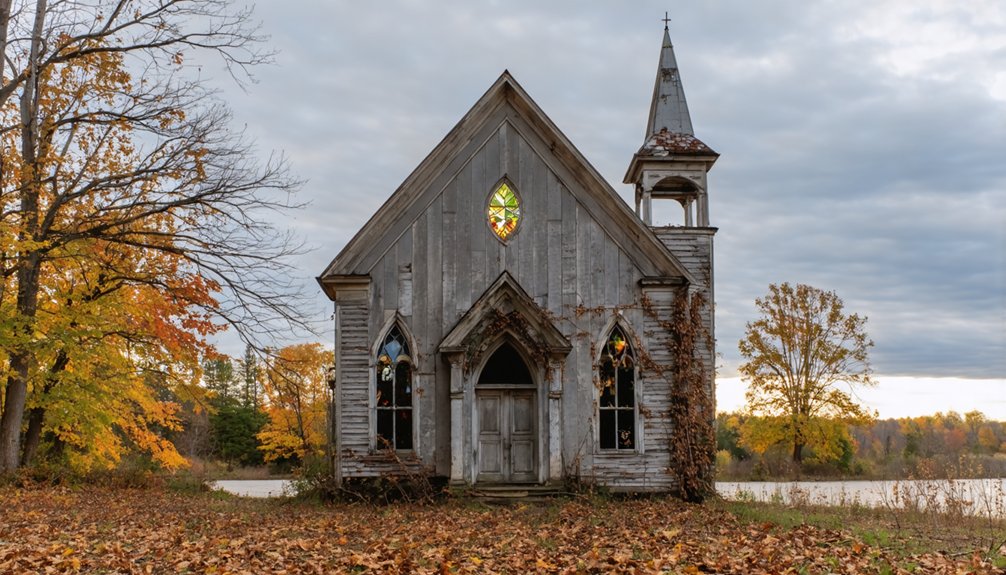
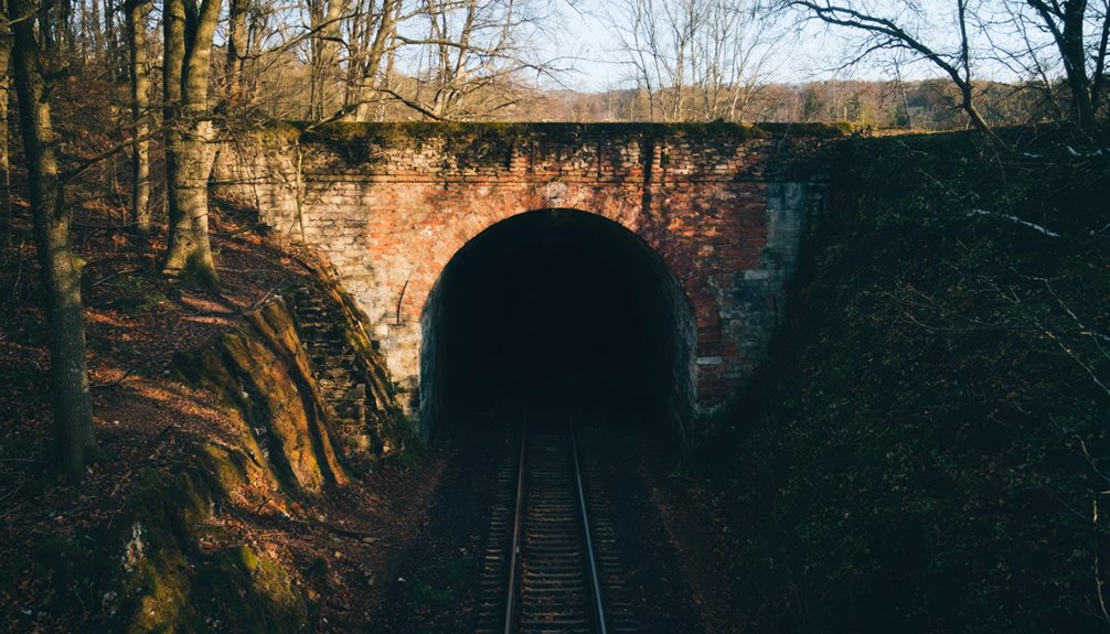
You’ll find Moonville’s haunted tunnel and cemetery nestled in Vinton County’s terrain, perfect for capturing mysterious shadows and historic pathways.
Helltown’s abandoned structures in Cuyahoga Valley National Park provide striking compositions along the infamous “Highway to Hell.”
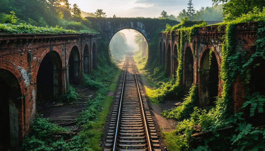
Sprucevale’s canal locks emerge from forest surroundings, offering unique landscape perspectives of Ohio’s transportation history.
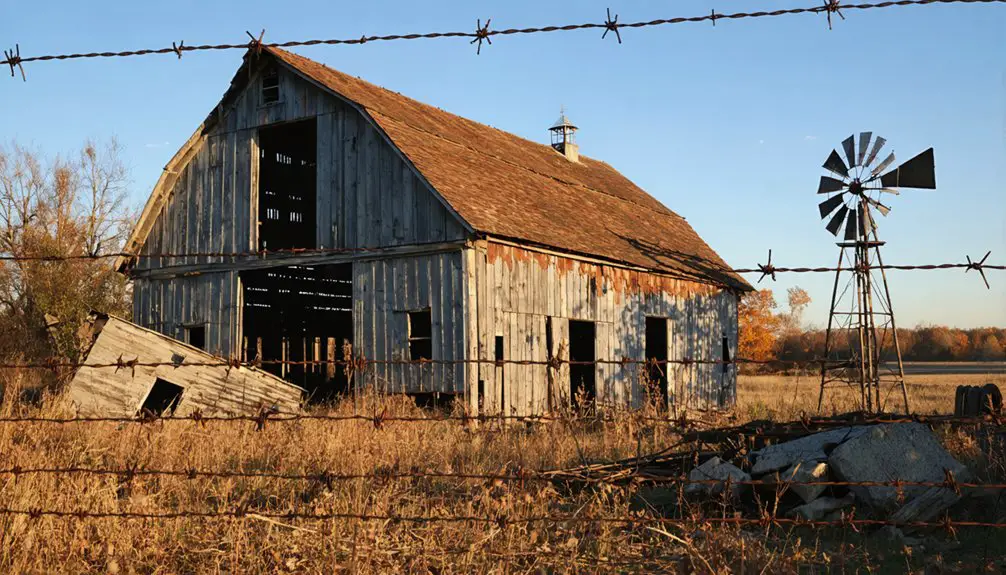
At Oreton, your drone can document scattered mining ruins against southeastern Ohio’s rugged hillsides.
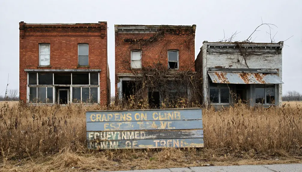
Providence’s riverside location presents compelling ghost town history through aerial views of flood-prone ruins along the Ohio River.
Each location delivers distinct architectural remnants and natural reclamation patterns that’ll enhance your portfolio of aerial documentation.
The remnants of Atwood showcase how flood control efforts transformed entire communities, as the town was abandoned to create Atwood Lake.
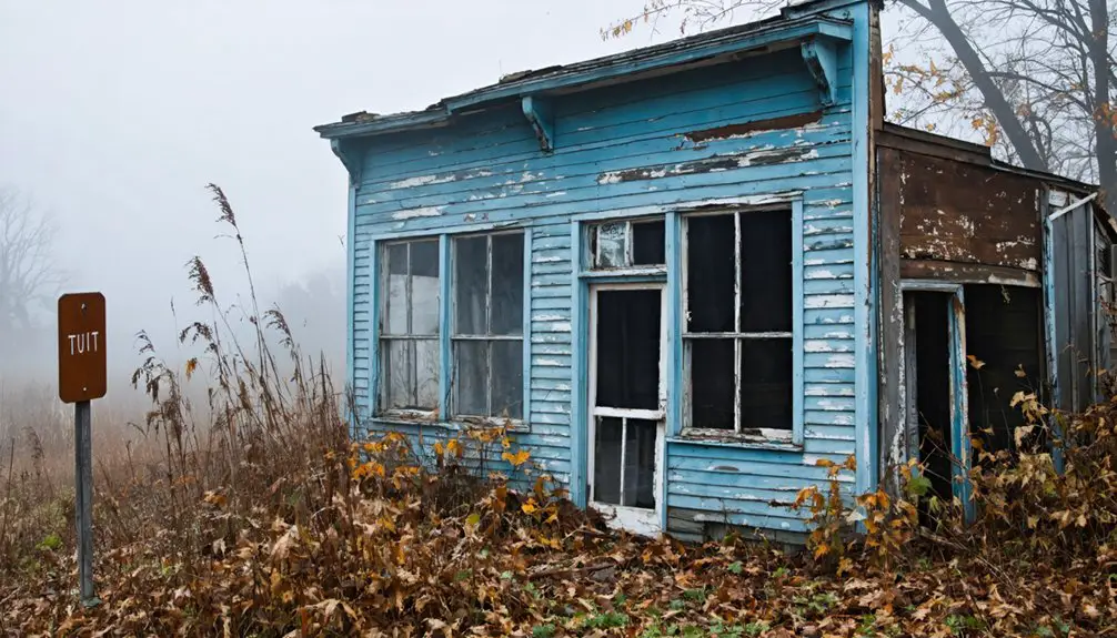
The Buckeye Trail near Taylorsville MetroPark reveals canal-era ruins that highlight the devastating impact of the 1913 flood.
Best Times and Seasons for Ghost Town Drone Shots
You’ll want to align your ghost town drone flights with golden hour’s warm directional light during the first hour after sunrise or last hour before sunset, when long shadows emphasize architectural textures and structural details.
Similar to the Albuquerque Box wind patterns in New Mexico, Ohio’s stable morning air currents create optimal conditions for controlled drone navigation around abandoned structures.
Ohio’s mid-October peak foliage creates stunning color contrasts between vegetation and weathered buildings, especially when paired with early morning valley fog that adds ethereal layers to your compositions. A professional Part 107 certification is legally required for any commercial drone photography of ghost towns.
For ideal results, pack neutral density graduated filters to control the dramatic golden hour contrast, and plan your shoots during calmer morning conditions when wind interference is minimal.
Golden Hour Magic
While capturing Ohio’s ghost towns through a drone’s eye requires technical precision, understanding golden hour timing transforms ordinary ruins into extraordinary compositions.
You’ll find the most magical light diffusion during the first and last 90 minutes of daylight, when the sun’s low angle bathes abandoned structures in warm, dimensional light. The ten-minute battery life of most drones means carefully planning your golden hour shots.
- Position your drone during early golden hour (sunrise +20 minutes) to capture long shadows that reveal textures and architectural details.
- Maximize mid-golden hour’s balanced illumination for HDR-friendly exposures that preserve both highlight and shadow detail.
- Exploit late golden hour’s dramatic backlighting to create silhouettes of building remains against the richly colored sky.
For peak results, schedule your flights during late spring and early autumn when atmospheric conditions enhance clarity and extend your shooting window. The historic Vinton Furnace remnants provide exceptional drone photography opportunities with their still-visible industrial structures amid the forest canopy.
Moody Fall Conditions
When Ohio’s ghost towns transform during peak fall color from late September through early November, drone photographers can capture uniquely moody compositions that blend architectural decay with seasonal atmospherics.
You’ll find ideal moody atmospheres during overcast days with light mist or patchy fog, especially in the pre-dawn blue hour when human activity is minimal.
To maximize atmospheric effects, shoot when wind speeds stay under 10mph to preserve fog layers and fallen leaves. Time your flights for post-cold-front conditions when thin high clouds diffuse directional light across weathered structures.
Keep your ISO low (100-400) and slightly underexpose (-0.3 to -1.0 EV) to deepen the mood while preserving highlight detail.
Consider microclimate variations in river valleys and north-facing slopes, which can shift peak color timing by up to three weeks from regional averages.
Technical Tips for Capturing Abandoned Structures
Three essential components form the foundation of capturing abandoned structures: technical precision, creative composition, and equipment mastery.
Mastering the art of photographing abandoned places requires precision, artistry, and complete command over your gear.
When photographing abandoned architecture, you’ll need to balance exposure settings while managing challenging lighting conditions typical of deteriorating buildings. Master your drone composition by utilizing leading lines and dramatic perspectives to showcase the scale of these forgotten places.
- Mount LumeCubes on your drone for light-painting multiple passes, then composite the images to achieve even illumination across vast spaces.
- Use GPS-assisted hover and automated waypoint modes to capture smooth, repeatable cinematic passes around structures.
- Capture bracketed exposures at f/8-f/16 for focus stacking, ensuring edge-to-edge sharpness while retaining vital architectural details in both shadows and highlights.
Safety Precautions When Flying at Historical Sites
Operating drones at historical sites demands meticulous attention to legal compliance and safety protocols. Before launching your drone, you’ll need to verify FAA airspace restrictions, obtain necessary site permissions, and complete required certifications like TRUST or Part 107.
For peak flight safety, conduct thorough site assessments to identify obstacles, map your intended flight paths, and establish emergency procedures. You’ll want to maintain safe distances from fragile structures and avoid low passes that could damage historic masonry through rotor wash.
To guarantee site preservation, coordinate with site stewards to identify sensitive areas and maintain appropriate standoff distances. Keep your flights brief to minimize disturbance, and never land on historic structures.
Remember to check local ordinances, as many ghost towns have specific drone restrictions beyond federal regulations.
Preserving Ohio’s Ghost Towns Through Aerial Documentation
You’ll maximize heritage documentation value by capturing both orthogonal and oblique aerial imagery with 70% overlap, ensuring complete coverage for photogrammetric processing and GIS integration.
Your drone’s GPS-tagged RAW files need careful metadata logging, including flight parameters, weather conditions, and necessary permits to maintain archival integrity.
To support long-term preservation efforts, you should coordinate with local historical societies while sharing standardized deliverables like orthomosaics and 3D meshes that enable accurate dimensional analysis and condition monitoring.
Digital Heritage Protection Methods
As aerial documentation of Ohio’s ghost towns becomes increasingly essential for preservation, robust digital heritage protection methods have emerged to safeguard these historical records.
You’ll need to implement proper digital preservation standards while ensuring heritage management protocols are followed to protect these valuable assets for future generations.
- Utilize standardized geospatial formats like GeoTIFF and GeoJSON to maintain compatibility with GIS systems
- Apply archival metadata standards including Dublin Core for long-term accessibility and tracking
- Store imagery in non-proprietary formats such as TIFF for photos and LAS/LAZ for point clouds
You’ll want to leverage legal tools like local preservation ordinances and zoning controls while establishing clear data governance frameworks that define ownership rights and access levels for your documented sites.
Aerial Documentation Best Practices
Professional aerial documentation of Ohio’s ghost towns demands meticulous planning and precise execution to capture these historical sites effectively.
You’ll need to deploy high-end equipment like the Phantom 4 Pro for superior results, ensuring sharp resolution for ghost town preservation efforts. When shooting, combine ground and aerial perspectives at key locations like Moonville Tunnel and Boston Mills.
Log precise GPS coordinates during your flights to map structural remnants accurately. At Serpent Mound and Miamisburg Mound, use cinematic drone sequences for immersive documentation.
Remember to obtain FAA registration for drones over 0.55 pounds and secure Part 107 certification for commercial work. Respect no-fly zones at national parks and wildlife areas, launching from approved access points like Hope-Moonville Road or designated parking areas.
Frequently Asked Questions
How Do You Handle Encounters With Other Photographers or Explorers?
You’ll want to establish encounter etiquette by signaling your presence, suggesting photographer collaboration through shared timing slots, and maintaining clear communication about flight paths and shooting zones.
What Wildlife Should Drone Pilots Watch Out for Near Ghost Towns?
Your drone’s a shining beacon in a sea of wildlife! Keep watch for bears and bobcats below, while avoiding eagles and hawks above. Don’t disturb nesting areas—ethical considerations come first.
Are There Guided Drone Photography Tours Available for Ohio Ghost Towns?
You won’t find regular guided tours, but you can hire local drone operators for custom ghost town shoots. They’ll handle FAA regulations and site permissions while providing expert flight instruction.
How Accurate Are GPS Coordinates for Finding These Abandoned Locations?
You’ll find GPS accuracy within 3-5 meters for most abandoned locations with clear skies, though dense forest cover and hilly terrain can degrade precision to 10-20 meters when exploring.
Can Drone Footage Be Sold or Licensed for Historical Documentation Purposes?
You can license drone footage for historical documentation if you’ve obtained proper FAA certification, location permits, and copyright clearances. Your historical footage needs clear ownership agreements and releases for commercial use.
References
- https://www.youtube.com/watch?v=cdAJFTmc0ek
- https://ohioghosttowns.org/top-10-ghost-towns/
- https://www.youtube.com/watch?v=QWTtG6njIDs
- https://ohioghosttowns.org
- https://www.youtube.com/watch?v=ScXylJkH3fo
- https://www.youtube.com/watch?v=EPO9PzwMK1g
- https://www.aerialagents.com/willoughby-ohio-aerial-photos
- https://www.daytondailynews.com/news/see-eerie-drone-footage-abandoned-ohio-amusement-park/zKtat00QbV3zgk4xXPnApJ/
- https://www.journal-news.com/news/see-eerie-drone-footage-abandoned-ohio-amusement-park/jn6DcTKDlrslicqT67g0vN/
- https://farmoffice.osu.edu/blog/wed-04302025-902am/new-drone-laws-effective-ohio