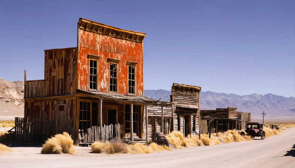
You’ll find exceptional drone photography at Rhyolite’s preserved railroad depot and Bottle House, offering dramatic compositions against the Mojave Desert backdrop. The Tonopah Historic Mining District delivers compelling aerial shots of preserved headframes and processing mills, while Nelson’s mining structures create stark industrial contrasts. Launch from stable zones near landmarks like the Cook Bank Building for ideal angles. Pack your sub-250g drone with ND filters and extra batteries – there’s much more to explore in Nevada’s forgotten corners.
Key Takeaways
- Rhyolite Ghost Town offers exceptional drone photography opportunities with its preserved railroad depot, bottle house, and dramatic desert backdrop.
- Tonopah Historic Mining District features well-preserved headframes and mill sites perfect for aerial industrial photography.
- Chloride City provides stunning drone shots with its Montana Station Mill set against the majestic Funeral Mountains.
- Panamint Valley ghost towns combine abandoned Wells Fargo offices and mining remnants for compelling aerial compositions.
- Mexican Camp in the Bullfrog area showcases historic timber trails and mining structures ideal for dramatic aerial perspectives.
Essential Drone Photography Gear for Ghost Town Exploration
When venturing into ghost towns with your drone, assembling the right gear setup will make the difference between capturing stunning aerial imagery and missing essential shots.
Pack a sub-250g drone with obstacle sensing and a 3-axis gimbal to navigate tight spaces while maintaining professional image quality. You’ll need at least three batteries and a portable power station for extended shooting sessions.
Hereませ635
Don’t forget ND filters and auxiliary lighting for creative control over exposure and night shots. The versatile DJI Mavic Pro provides excellent aerial footage capabilities for abandoned locations. Using polarizing filters helps reduce glare and enhances image quality when photographing reflective surfaces in ghost towns.
Smart battery management is vital – store cells in an insulated pouch and monitor their performance in extreme temperatures. Keep your drone maintenance kit handy with spare props and basic tools.
A GPS unit, flight planning app, and offline maps will help you confidently explore remote locations while staying within legal airspace boundaries.
Getting Started: Flight Permits and Legal Requirements
Before you lift off to capture ghost town aerials, steering through the regulatory landscape requires careful attention to federal, state, and local requirements.
You’ll need your Part 107 certification for commercial shoots, or TRUST certification for recreational flights. Don’t forget to register your drone if it’s over 0.55 pounds and guarantee Remote ID compliance.
In Nevada, you’re legally required to maintain distance from critical facilities and airports. Drones must remain in visual line-of-sight while operating. The B4UFLY app will help you identify no-fly zones in your planned ghost town locations.
Most ghost towns require specific permissions – check if they’re on BLM, NPS, or state park land, as each has distinct rules. For state parks, you’ll need a special use permit for takeoffs and landings.
Remember to verify local ordinances and private property boundaries, as flying below 250 feet over private land could trigger trespass violations.
Flight safety and legal compliance start with proper permits.
Golden Hour Shooting at Rhyolite’s Concrete Ruins
You’ll find ideal drone launch positions near the Cook Bank Building ruins, where gentle slopes provide stable takeoff zones while keeping line-of-sight to your aircraft during golden hour.
The concrete ruins cast dramatic shadows between 6:30-7:30 AM, letting you capture compelling aerial compositions as the light rakes across weathered walls and fallen structures. A telephoto lens setup through fence gaps can capture stunning detail shots while maintaining a safe distance from the structures. The area once housed 5,000 miners during its peak as a bustling gold rush town.
Position your drone on the western edge of the ruins during sunset to maximize the warm light hitting the facades, while using the desert floor as a natural reflector for fill light.
Optimal Drone Launch Sites
Finding the ideal launch site at Rhyolite’s concrete ruins can make or break your golden hour drone footage. While drone regulations allow for unrestricted access during daylight hours, you’ll want to focus on four key launch zones for optimum results.
The Cook Bank Building area offers elevated vantage points with stable concrete platforms, perfect for capturing the marble details and mahogany finishes. Near the 1907 jail, you’ll find clear spaces for dramatic ascents showcasing the historic door and bent bars. By 1914, essential services ceased, leaving these remarkable structures perfectly preserved for aerial photography. The empty streets and roaming wild burros create compelling compositions for drone shots.
The Bottle House vicinity provides unobstructed airspace for sweeping panoramas, while the Union Pacific Caboose zone enables clean tracking shots. For the best launch techniques in Rhyolite’s notorious winds, utilize the flat concrete sidewalks as takeoff points to minimize propwash interference.
Light and Shadow Patterns
The golden hour’s unique lighting conditions at Rhyolite’s concrete ruins demand precise timing and technical preparation.
You’ll get 30-50 minutes of prime light dynamics when the sun hovers 5-15° above the horizon, creating dramatic shadow play across the historic structures.
For best results, align your drone flights with the ruins’ orientation – east-facing surfaces at sunrise, west-facing at sunset.
The three-story Cook Bank building offers particularly striking opportunities for capturing light and shadow interplay.
You’ll want to capture the intricate patterns cast by window voids, exposed rebar, and deteriorating concrete surfaces.
Enable RAW capture and bracket your exposures (±1-2 EV) to handle the extreme contrast between bright skies and shadowed walls.
Position your drone at low oblique angles (10-30°) to emphasize the three-dimensional forms, or shoot straight down for abstract compositions of elongated shadows stretching across streets and courtyards.
Capturing Nelson’s Mine Structures and Movie Sets
Nestled along NV-165, Nelson’s diverse collection of mine structures and movie sets creates compelling aerial compositions for drone photographers.
You’ll capture the historic Techatticup Mine‘s multiple entrances and the restored 51-acre grounds, where original tunnels and mining equipment tell the story of Nevada’s richest gold strike.
Position your drone to frame the Old West filming locations, including weathered buildings and the iconic airplane wreckage that’s featured in “3000 Miles to Graceland.”
Capture cinematic history where weathered Western sets and the famous Graceland plane crash create perfect aerial storytelling opportunities.
For $20, you’ll get two hours of flight time to document these cinematic elements against the desert backdrop.
Remember to respect the marked restricted areas and obtain necessary permissions from the Werly family.
The site’s authentic mining remnants and carefully curated movie sets offer endless possibilities for dramatic aerial shots.
Stay alert for the eighteen rattlesnakes typically encountered annually while setting up your drone equipment.
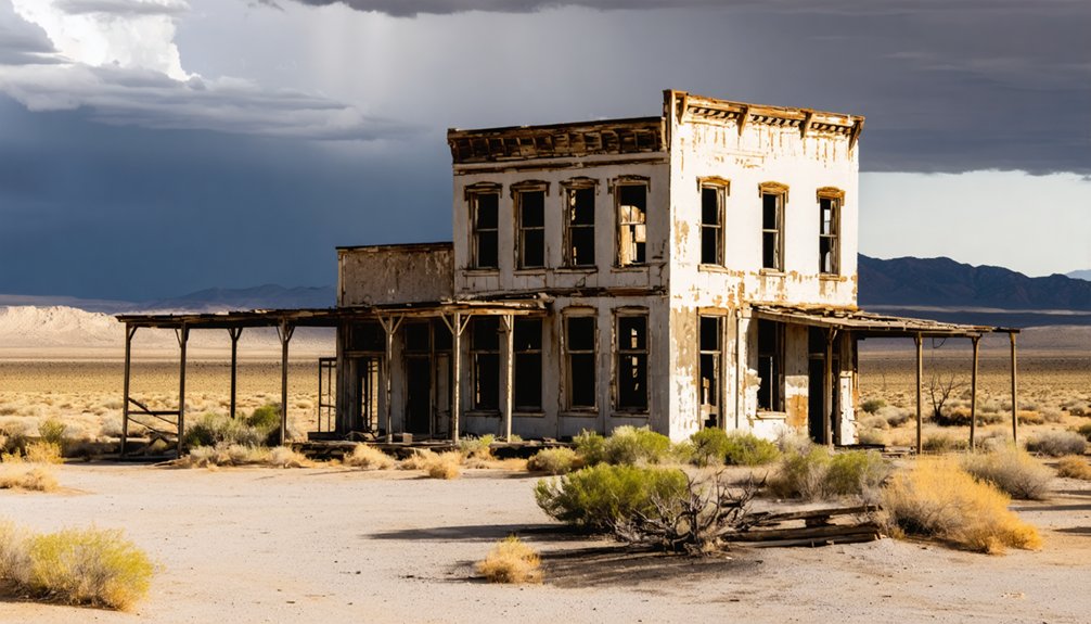
Dramatic Desert Landscapes Along Death Valley Corridor
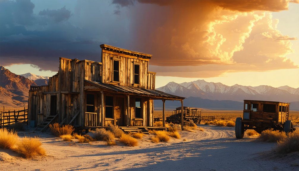
Spanning the remote Death Valley corridor, iconic ghost towns like Rhyolite and Panamint City offer drone photographers unparalleled aerial compositions against stark desert backdrops.
You’ll capture stunning desert reflections off weathered metal and glass amid Rhyolite’s railroad depot ruins and restored bottle house, while the surrounding Bullfrog area reveals hidden gems like Mexican Camp’s historic timber trails.
For epic ghost town vistas, launch your drone at sunrise over Chloride City’s Montana Station Mill, where the Funeral Mountains create dramatic shadows.
Navigate your aircraft through Panamint Valley to document the seven-mile stretch of mining remnants leading to Panamint City’s abandoned Wells Fargo office.
The unpaved streets of Rhyolite provide perfect flight paths for capturing the Goldwell Open Air Museum‘s haunting sculptures from above.
Advanced Techniques for Night Photography in Ghost Towns
You’ll need to master long-exposure techniques at night to capture stunning light trails and architectural features in ghost town photography, setting your drone’s camera to 13-second exposures at f/8 ISO 200 under moonlight.
For the most striking results, position your aerial light painting rig with LED tubes starting from the farthest point from your drone, working methodically through doors and along building sides while maintaining consistent altitude.
To illuminate historic details effectively, you can combine multiple lighting passes using handheld sources at varying angles, keeping your drone hovering steady while experimenting with both cool moonlight-matching gels and warmer artificial lights for dimensional contrast.
Long Exposure Light Trails
Capturing mesmerizing light trails in ghost towns requires mastering advanced long exposure techniques and precise camera settings.
You’ll need to set your camera to manual mode with ISO 100, using shutter speeds between 10-15 seconds and apertures from f/8 to f/16 to control light flow and depth of field.
Mount your camera on a sturdy tripod and use a cable release or 2-second timer to eliminate vibration. For ideal results, stack multiple 13-second exposures in Photoshop using the lighten blending mode – this creates dense trails without overexposing static elements.
Position yourself at low angles to maximize the dynamic impact of vehicle lights against historic structures. During peak traffic hours, experiment with different perspectives around ghost town features while maintaining a fixed camera position to guarantee perfect alignment across multiple shots.
Illuminating Historic Building Features
To master nighttime ghost town photography, proper illumination of historic building features demands a sophisticated blend of technical expertise and creative vision.
You’ll want to position your camera on a sturdy tripod and disable image stabilization to capture sharp architectural details during long exposures. Set your white balance to 3200K tungsten to accurately render the warm glow of any remaining incandescent lights.
Scout your locations before sunset to identify unique angles that highlight historic features like weathered facades and period-specific elements.
You can enhance depth by strategically capturing reflections from glass windows or wet surfaces. Layer multiple exposures to balance the illumination of both exterior details and any interior glow.
For the sharpest results, use your camera’s self-timer and maintain low ISO settings while extending shutter speeds to reduce noise in the final image.
Weather Considerations and Seasonal Planning
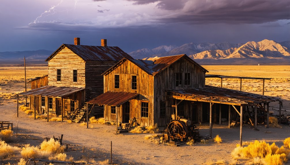
While Nevada’s ghost towns offer compelling aerial subjects year-round, the state’s dramatic weather patterns demand careful seasonal planning for ideal drone photography.
Exploring the best astrophotography spots in Nevada can lead to breathtaking captures of the night sky, especially in areas with minimal light pollution. Locations like the Valley of Fire and Great Basin National Park are known for their stunning celestial views and unique landscapes. Photographers often plan their trips around new moon phases to maximize stargazing opportunities.
Nevada’s abandoned settlements beckon drone photographers, but mastering the state’s extreme weather conditions requires methodical seasonal preparation.
The region’s seasonal challenges require strategic timing and equipment adaptation to capture favorable footage.
- Summer temps above 100°F reduce flight times by 20-30% – schedule shoots during golden hour to minimize heat stress on batteries and avoid thermal distortion.
- High-elevation sites (4,000-7,000 ft) decrease air density – factor in reduced lift and shorter hover times for your multirotor.
- Winter mornings below 40°F considerably impact battery performance – pre-warm your spares and use insulated storage.
- Basin-and-range terrain creates unpredictable wind patterns – monitor site-specific forecasts, especially near mountain passes and canyons where gusts exceed regional predictions.
Exploring Tonopah’s Historic Mining District
You’ll find exceptional drone compositions at Tonopah’s historic mill sites, where century-old industrial ruins create striking geometric patterns against the desert landscape.
The preserved headframes and deep mine shafts, particularly at locations like the Victor Shaft, offer dramatic vertical elements that you can capture through careful aerial positioning at sunrise or sunset.
When planning your shoot, coordinate site access permits in advance and pack emergency gear, as the remote location demands thorough preparation for drone operations in areas with limited cell coverage.
Dramatic Mill Site Ruins
As the drone ascends above Tonopah’s Historic Mining Park, the Montana-Tonopah mill ruins unfold in a striking industrial tableau spanning over 100 acres.
The site’s abandoned machinery and historical significance come alive through your lens, especially during golden hour when long shadows stretch across the weathered foundations.
For ideal aerial compositions, consider these key mill features:
- The 200-foot glory hole collapse creates dramatic negative space perfect for orbiting shots.
- Corroded boilers and stamp batteries offer geometric patterns for top-down captures.
- The preserved Mizpah Mine headframe provides scale reference against tailings piles.
- Linear elements of the Tonopah & Goldfield Railroad trestle frame wider establishing shots.
Fly low-altitude passes over the processing floors to reveal industrial textures, but maintain safe clearance above these fragile historical structures.
Mine Shafts From Above
Soaring over Tonopah’s Historic Mining District reveals an intricate network of mine shafts that showcase the region’s rich mining heritage.
You’ll spot the Victor Shaft’s impressive 2,375-foot depth marked by its weathered headframe against the desert landscape. Through your drone’s lens, you can trace the Belmont Mine’s dramatic history, where two devastating fires shaped its evolution, including the 1939 blaze that claimed its headframe.
For the best aerial mining photography, position your drone above the Halifax Fault Zone to capture the structural controls that guided Tonopah’s five-million-ton ore production.
The district’s peak operations from 1910-1914 left distinctive patterns of mine shaft exploration visible today – from the West End Consolidated’s historic foundations to the Tonopah Divide’s prominent waste dumps and pit configurations.
Desert Access Planning Tips
Before launching your drone over Tonopah’s historic mining sites, proper planning can spell the difference between stunning footage and equipment failure.
Desert terrain navigation requires strategic preparation, while site access protocols demand coordination with park management.
- Secure all necessary permits – check Tonopah Historic Mining Park policies, verify land ownership status, and carry your Part 107 certificate for commercial work.
- Schedule flights during ideal conditions – early morning or late afternoon to avoid thermal turbulence and maximize battery life.
- Pack essential gear – multiple batteries, charging solutions, first-aid kit, and satellite communication devices.
- Scout your launch zones – identify firm, level ground away from unstable surfaces and maintain safe distances from vertical hazards like headframes and open stopes.
Safety Tips for Remote Ghost Town Drone Operations
When operating drones in remote ghost towns, you’ll need to implement thorough safety protocols to protect both your equipment and the historic sites.
Start with a detailed risk assessment, scanning for hazards like crumbling structures, power lines, and unpredictable desert weather. You’ll want to maintain strict altitude control below 400 feet AGL while using the shielding concept to navigate safely around ruins.
Before flying your drone near abandoned structures, assess potential dangers and maintain consistent altitude control for safe navigation around obstacles.
Set up geofencing boundaries to prevent drift, and keep at least 50 feet away from structures. You’re responsible for following Part 107 rules and Remote ID requirements in these remote locations.
Always verify your drone’s battery life, calibrate the compass, and inspect for damage before launch. Remember to secure backup data storage and protect your gear from harsh desert conditions.
Best Camera Settings for Architectural Ruins and Artifacts
To capture stunning ghost town architecture, you’ll need to master both technical settings and environmental factors that affect image quality. Your camera settings and exposure techniques must be precisely calibrated for the challenging lighting conditions of abandoned structures.
- Shoot in RAW format with a 4:3 aspect ratio to maximize detail retention and post-processing flexibility – especially essential for shadowy interiors and sun-bleached exteriors.
- Set up automated flight paths with 60% image overlap at 45-degree angles for thorough 3D modeling.
- Use auto-focus with multiple exposure brackets (minimum three) for HDR processing, particularly during harsh midday light.
- Maintain a 6cm ground sample distance while shooting in partly cloudy conditions for best shadow control and architectural detail preservation.
Frequently Asked Questions
Which Ghost Towns Have Underground Tunnels Suitable for Drone Light Painting?
Like threading a needle through time, you’ll find Eureka and Tonopah offer the safest tunnel exploration potential. Their documented passages are wide enough for drone light painting, though you’ll need proper permissions.
Are There Guided Drone Photography Tours Available at Any Nevada Ghost Towns?
You’ll find guided tours at Nelson Ghost Town that accommodate drone flights, while other locations require advance permits. Check FAA regulations and book tours that specifically include drone photography permissions.
What Wildlife Should Drone Operators Watch for Around Ghost Towns?
Among sage-dotted hills, you’ll need to scan for bighorn sheep, wild horses, and pronghorn herds. Keep your drone clear of migratory birds, while following wildlife encounter regulations and airspace restrictions.
Which Ghost Towns Allow Commercial Drone Footage to Be Sold?
You’ll need permits for most accessible ghost towns since they’re on BLM land. Berlin-Ichthyosaur, Rhyolite, and Aurora allow commercial footage sales once you’ve secured proper permits and FAA certifications.
Can Drones Be Used to Map and Document Remaining Artifacts?
Like a digital archaeologist, you’ll find drones excel at mapping artifacts through LiDAR and thermal imaging. You can document remaining structures, create 3D models, and preserve site data without disturbing anything.
References
- https://www.youtube.com/watch?v=jA92S71PnbY
- https://www.youtube.com/watch?v=YrlMXspRXcs
- https://www.exploratography.com/blog-nv/rhyolite-nevada
- https://travelnevada.com/ghost-town/
- https://nvtami.com/2022/07/16/to-tonopah-beyond/
- https://mavicpilots.com/threads/ghost-towns-mines-blair-nv.71763/
- https://www.youtube.com/watch?v=1N3JL67OKHo
- https://blog.annemckinnell.com/2013/07/09/rhyolite-ghost-town/
- https://www.youtube.com/watch?v=P5raE760IZo
- https://www.theblondeabroad.com/beginners-guide-to-travel-drone-photography/


