You’ll find the Northeast’s most enchanting ghost towns at Sea Breeze’s Victorian resort ruins along Delaware Bay, where crumbling foundations and ghost roads create stunning aerial compositions. Gould Island’s abandoned military infrastructure offers dramatic coastal shots of concrete piers and hidden magazines. Don’t miss New England’s textile mills, like the Mohawk carpet factory, with their striking red-brick facades and rhythmic windows. These forgotten places hold secrets that your drone can help reveal.
Key Takeaways
- Sea Breeze in New Jersey offers Victorian resort ruins along Delaware Bay, with ghost roads and foundations perfect for aerial photography.
- Abandoned textile mills in Amsterdam, New York showcase striking industrial architecture with red-brick facades and rhythmic window patterns.
- Gould Island features dramatic military ruins, including concrete piers and hangars from its history as a naval torpedo testing site.
- Batsto Village presents well-preserved industrial ruins ideal for symmetrical aerial compositions and historical documentation.
- South Cape May’s drowned townscape provides unique opportunities to capture phantom street grids and coastal erosion patterns.
Sea Breeze: Capturing New Jersey’s Victorian Past From Above
A haunting Victorian resort awaits your drone’s lens along the Delaware Bay shoreline in Cumberland County, New Jersey.
Once a thriving summer destination, Sea Breeze’s ghost roads and crumbling foundations tell tales of the Warner Hotel’s grandeur and the speakeasy days of the Seabreeze Hotel. The popular John A. Warner steamboat brought countless visitors from Philadelphia to this scenic shore retreat.
Whispers of jazz and bootleg spirits echo through Sea Breeze’s abandoned streets, where two grand hotels once hosted summer’s finest revelers.
Your aerial shots will reveal the skeletal remains of Victorian architecture – abandoned docks stretching into the bay and phantom outlines where summer homes once stood.
Coastal erosion has transformed this former paradise into a photographer’s dream, especially after rainfall when flooded remnants mirror the sky.
Launch your drone at dawn to capture ethereal views of the sea wall’s failed battle against nature, or hover above centuries-old hotel sites where only memories of carousel music and clambakes remain. The area’s wildlife refuge status now provides a striking contrast between untamed nature and the ruins of human civilization.
Exploring The Hidden Military Legacy of Gould Island
While Sea Breeze echoes Victorian leisure, Gould Island in Rhode Island’s Narragansett Bay holds a darker military legacy waiting for your drone to uncover. As the U.S. Navy’s primary torpedo testing site from 1919 through the late 1940s, this forgotten outpost witnessed up to 100 torpedo launches per day during WWII’s peak. The facility’s breakthroughs in self-propelled underwater weaponry helped destroy over four million tons of enemy shipping during the war. Over 65,000 torpedo test firings were completed by the time World War II ended.
Your aerial shots can capture the geometric remains of concrete piers, torpedo storehouses, and seaplane hangars that once supported critical weapons development. Frame your compositions around the stark contrast between crumbling military infrastructure and encroaching nature.
Follow overgrown access roads that lead to hidden magazines, while salt marsh boundaries and rocky shorelines create compelling visual shifts. Just remember to secure proper permissions – the island’s split ownership between state wildlife sanctuary and Navy holdings requires careful flight planning.
Cinematic Mill Towns: New England’s Industrial Ruins
Towering above New England’s river valleys, abandoned textile mills offer drone photographers an endless canvas of industrial ruins to explore.
In Amsterdam, New York, the Mohawk carpet factory stands as a haunting reminder of the region’s manufacturing past.
You’ll discover striking mill history through your lens as you capture massive red-brick facades with rhythmic window patterns and dramatic rooflines. The water-powered turbines that once drove these manufacturing giants can still be found along rivers and brooks. Industrial architecture takes center stage when you frame sawtooth roofs and towering cupolas against golden-hour skies.
For the most cinematic shots, use waterpower features like millraces and dams to create reflective compositions during low-altitude passes.
Look for converging rail lines and weathered loading docks to add depth to your aerial storytelling. Just remember to scout safe landing zones and check local regulations – many sites contain hazards and require permits.
The contrast between restored lofts and decaying wings provides compelling visual narratives of preservation versus decline.
Aerial Views of Abandoned Coastal Resorts
You’ll find coastal resort ruins offer unmatched opportunities for dramatic aerial compositions, especially when shooting at golden hour as the sun’s rays cut across weathered boardwalks and skeletal piers.
The abandoned Poconos resorts showcase a haunting decline that began in the late 1990s, creating compelling opportunities for aerial photography.
When filming over ocean ruins, you’ll need to monitor tide tables, wind speeds, and maintain safe distances from waves that could impact your drone’s performance.
Your technical preparation should include fully charged batteries, calibrated compass readings to counter coastal magnetic interference, and careful pre-flight checks of your drone’s water-resistance rating. Atlantic City’s once glittering hotel district provides stark visual contrasts between abandoned grandeur and modern casino developments.
Dramatic Coastal Light Techniques
Dramatic coastal lighting transforms abandoned seaside resorts into hauntingly beautiful subjects for drone photography.
You’ll capture windswept curtains dancing in broken windows as coastal sunsets cast eerie shadows across decaying structures. At Rhode Island’s Windswept Estate, the isolated carriage house creates striking silhouettes against the beachfront backdrop. The resort’s grand dining hall, once bustling with early 1900s socialites, now provides an atmospheric focal point for aerial shots.
For ideal shots at Connecticut’s summer resort ruins, position your drone to catch late-day light streaming through collapsed sections of the guest house. The play of natural light through fire-damaged areas adds depth to your compositions. The property was once home to the infamous Pain Killer company that blended opium with alcohol.
Frame your aerial shots to emphasize how overgrown vegetation interacts with the structures, creating mysterious patterns in the shifting coastal light. Time your flights during golden hour when long shadows amplify the haunting atmosphere of these forgotten coastal properties.
Safety Over Ocean Ruins
While exploring these majestic coastal ruins from above, you’ll need to maintain strict safety protocols due to structural instability and ocean conditions.
At sites like Windswept Estate and Connecticut’s abandoned summer resort, collapsed buildings and fire damage create hazardous zones that require careful drone navigation.
You’ll want to keep your distance from the burned-out guest houses where unstable walls could shift without warning.
Even seemingly intact structures, like those frozen-in-time rooms with their curtains still swaying in the breeze, can pose unexpected risks.
When filming near the ocean, pay close attention to sudden wind gusts that could affect your drone’s stability.
Focus on capturing dramatic aerial shots of these abandoned structures from safe angles, especially around remaining features like Windswept’s surviving carriage house near Scarborough Beach.
Jersey Shore Ghost Sites: A Drone Photographer’s Guide

Along New Jersey’s storied coastline, abandoned settlements and forgotten beach towns offer drone photographers an atmospheric canvas of decay and resilience.
At Sea Breeze in Fairfield Township, you’ll find a haunting collection of abandoned cottages gradually surrendering to Delaware Bay’s tides. Time your shots during low tide for dramatic textures of exposed seawalls and meandering sand channels.
South Cape May presents an eerie drowned townscape where phantom street grids emerge from marsh mosaics, while Little Egg Harbor’s isolated fishing shacks create striking minimalist compositions against reflective tidal creeks.
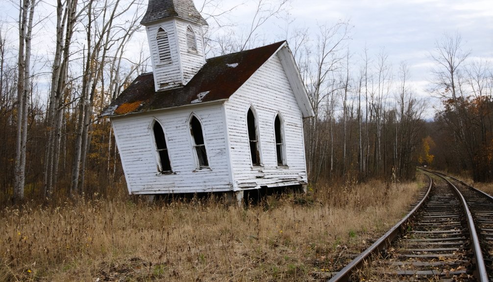
For a change of pace, Batsto Village’s preserved industrial ruins in Wharton State Forest offer well-maintained historic structures perfect for symmetrical aerial frames.
Remember to respect wildlife zones, check local regulations, and plan your tidal photography around ideal light conditions.
Before you venture toward these mysterious military ruins and forbidden islands with your drone, you’ll need to comply with FAA Remote ID requirements and thoroughly map out local no-fly zones using authorized flight tracking apps.
You must maintain a safe distance from restricted military areas like northern Gould Island while staying within visual line of sight of your aircraft over challenging water crossings.
For the best structural photography of overgrown sites like North Brother Island, plan your flights during fall or early spring when minimal foliage reveals more architectural details.
Safety First, Plan Always
Since abandoned military sites beckon with their haunting ruins and rich history, you’ll need to navigate a complex web of regulations and safety protocols before launching your drone.
Start with thorough pre-flight assessments, checking current FAA TFRs, NOTAMs, and military boundaries that might restrict your access to these enthralling locations.
Don’t forget that even decommissioned sites can harbor hidden dangers like unexploded ordnance or active sensors.
Set up clear emergency protocols before takeoff, including lost-link procedures and recovery plans for potential equipment failures.
Keep a ready list of essential contacts – local law enforcement, base security, and FAA offices.
Essential Flight Requirements
The three core requirements for flying drones at military ruins and forbidden islands in the Northeast demand your full attention.
You’ll need proper flight permits, including FAA Part 107 certification for commercial shoots or documentation for recreational flights.
Next, secure airspace regulations clearance through LAANC or direct authorization, especially critical within 2km of airports or near restricted military zones.
Finally, obtain specific site permissions – many ghost towns sit on federal, state, or private land requiring explicit approval from landowners or agencies.
Don’t let the allure of abandoned coastal fortifications or mysterious islands tempt you into unauthorized flights.
Military installations, even decommissioned ones, often fall under strict federal oversight.
You’ll face hefty fines or criminal penalties for flying without proper clearance, so always verify your legal status before launching.
Frequently Asked Questions
What Insurance Coverage Do I Need for Drone Photography of Abandoned Sites?
Fortune favors the bold, but you’ll need drone liability insurance with personal injury and hull coverage options. Get at least $500,000 in protection for abandoned site risks and equipment damage.
How Do I Handle Encounters With Security Guards While Filming Ruins?
Stay calm and professional when you meet guards. Show your permits, ID, and insurance papers right away. Explain your filming goals clearly, and if asked to leave, don’t argue—follow up officially later.
Can I Sell Footage of Restricted Locations to Documentary Filmmakers?
Like maneuvering through a minefield, you’re taking big risks. Without proper permits and rights clearances, you can’t legally sell restricted location footage – liability and copyright issues will haunt you later.
Which Drones Perform Best in Coastal Salt Air Conditions?
You’ll get superior coastal durability from the SwellPRO SplashDrone 4, DJI Matrice M30T, and PowerVision PowerEgg X – these drone models feature marine-grade sealing and corrosion-resistant materials for salt air missions.
Are Night Flights Permitted for Capturing Light-Painted Abandoned Buildings?
With lights visible from 3 miles away, you can legally capture light-painted buildings at night, but you’ll need anti-collision lighting, maintain VLOS, and master your drone’s long exposure settings.
References
- https://www.youtube.com/watch?v=dSZKOic0xzY
- https://www.youtube.com/watch?v=7X7TXuB8Pk4
- https://highseasaerial.com/f/10-breathtaking-aerial-drone-photography-locations-northeast-us
- https://www.geotab.com/ghost-towns/
- https://www.youtube.com/watch?v=xK9McmZ-T_s
- https://www.youtube.com/watch?v=MmKyEc9aHJ0
- https://www.youtube.com/playlist?list=PLyFv15pqj3DAeVFjvA9bjMSFJDjzEki6M
- https://www.cbsnews.com/video/drone-expert-unpacks-mysterious-sightings-across-northeast/
- https://www.onlyinyourstate.com/experiences/new-jersey/abandoned-beach-town-nj
- https://thedigestonline.com/new-jersey/the-forgotten-beach-town-of-nj-sea-breeze/


