You’ll discover Vermont’s most intriguing ghost towns scattered across its rugged landscape, from mysterious Glastenbury with its unexplained disappearances to Ricker Basin’s submerged mill ruins beneath Waterbury Reservoir. Each site tells a unique story: Greenbank’s Hollow’s textile legacy, Lewiston’s vanished coal operations, and Somerset’s abandoned logging community. These forgotten settlements offer tangible connections to Vermont’s industrial past, where stone foundations and weathered cemeteries await your exploration.
Key Takeaways
- Glastenbury stands out as Vermont’s most mysterious ghost town, featuring four unexplained disappearances and earning the nickname “Bennington Triangle.”
- Ricker Basin offers well-preserved stone foundations and mill ruins along the Winooski River, partially submerged beneath Waterbury Reservoir.
- Greenbank’s Hollow preserves Vermont’s largest historical textile operation, with marked trails through industrial ruins and a fascinating fire-destruction story.
- Lewiston and Somerset showcase different abandonment tales, with Lewiston’s 1967 razing and Somerset’s logging boom-to-bust transformation.
- Smithfield represents Vermont’s agricultural ghost towns, though few physical traces remain of this enigmatic settlement’s past.
The Mysterious Legends of Glastenbury
Once home to nearly 250 residents, Glastenbury’s dark reputation stems from centuries of mysterious occurrences. The Abenaki tribe first warned of the mountain’s dangers, refusing to hunt there due to a malevolent presence and a legendary man-eating stone.
The town’s decline accelerated after two murders in the 1890s, but it’s the Glastenbury legends of the 1940s that truly captivate. Four inexplicable disappearances occurred between 1945-1950, including seasoned guide Middie Rivers and Paula Welden, whose red jacket spawned local superstitions. Today, visitors can explore the mountain’s eerie atmosphere by hiking the Long Trail that traverses its peak.
With its abandoned railroad, defunct post office, and mere eight current residents, Glastenbury’s mysterious disappearances have earned it the ominous nickname “Bennington Triangle,” where some claim a supernatural vortex still lurks. The town’s demise began when a devastating flood in 1898 destroyed vital infrastructure and severed transportation links to the outside world.
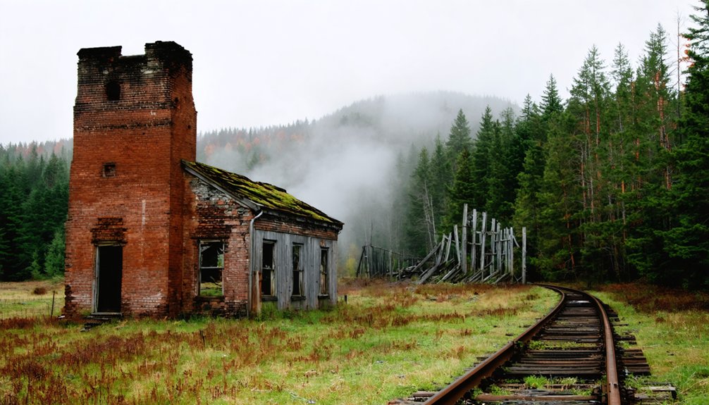
Exploring the Ruins of Ricker Basin
As you venture into Ricker Basin today, you’ll discover the stone foundations of multiple sawmills that once powered this 19th-century settlement’s bustling timber industry along the Winooski River.
These mills, which sustained nearly 50 families through the mid-1800s, met their demise in the catastrophic flood of 1927 when waters rose more than 13 feet above normal levels.
Severe rainfall of seven inches in six hours triggered the devastating flooding that destroyed the community.
While most of the settlement now lies beneath the Waterbury Reservoir, constructed in 1938 as a flood control measure, you can still examine the remaining cellar holes and cemetery that mark this once-thriving community’s existence. The area became established when Joseph Ricker founded the farming community in 1816.
Mill History and Floods
While the humble mills of Ricker Basin once powered local industry along Vermont’s Winooski River, their vulnerability to flooding ultimately sealed their fate. Today, beneath the tranquil surface, remnants of this once-thriving community rest in silence.
The steam-powered sawmill’s closure in 1922 marked the end of an era, but nature would deliver the final blow in 1927 during Vermont’s worst natural disaster. The flooding caused an estimated 30 million dollars in damages across the state.
If you’re exploring Ricker Basin’s industrial past, you’ll discover:
- Mill foundations submerged beneath the Waterbury Reservoir since 1938
- Remnants of flood recovery efforts visible in scattered debris fields
- Original mill sites that showcase early settlers’ reliance on waterpower
- Evidence of the devastating 13-foot river surge that destroyed all hopes of mill renovations
The 1927 flood’s destruction led directly to the Waterbury Dam’s construction, forever changing the basin’s landscape and preserving its industrial ruins underwater.
Community Life and Remains
The bustling community of Ricker Basin once supported nearly 50 families at its peak, creating an unofficial settlement known as Ricker Mills.
You’ll find evidence of their rural lifestyle in the cellar holes and stone foundations that dot the landscape today, marking where homesteads once stood. The community dynamics centered around essential facilities – a local school, trading post, and multiple sawmills that processed lumber from the surrounding forests. The remnants of stone walls along the trails serve as testament to the farmers’ endless toil clearing fields. The area encompassed 4,000 acres of challenging terrain that tested the settlers’ resilience.
Today, you can explore the haunting remains of this once-thriving settlement. A weathered cemetery stands as a silent memorial to former residents, while a single dilapidated structure still rises above ground.
Below the Waterbury Reservoir’s surface, additional roads and foundations lie preserved, creating an eerie underwater archive of Vermont’s vanished past.
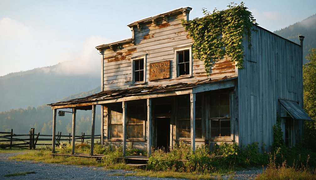
Historical Legacy of Greenbank’s Hollow
When you visit Greenbank’s Hollow today, you’ll find the haunting remnants of what was once Vermont’s largest textile operation, where Benjamin Greenbank’s five-story woolen mill dominated the landscape until its destruction by fire in 1885.
The surviving architectural features, including foundation stones and water-power infrastructure, offer tangible evidence of the hamlet’s industrial prominence during the mid-19th century. The mill employed 45 workers at its peak, making it one of the region’s most significant employers.
The facility once produced 700 yards of cloth daily to support local families and the region’s numerous sheep farmers.
Beyond its physical remains, Greenbank’s Hollow stands as a poignant symbol of Vermont’s forgotten industrial heritage, preserved through local historical documentation and drawing visitors who seek to understand the region’s complex economic past.
Mill Operations and Industry
Originally established by H. Bolton, the Vermont Valley Woolen Mill transformed into a powerhouse of woolen production after Benjamin Greenbank’s 1849 acquisition.
You’ll find the mill’s remarkable expansion reflected its growing industrial might, evolving from modest beginnings into a five-story manufacturing complex.
At its peak, the operation’s key features included:
- Water-powered machinery driven by the local brook
- An extensive mill store integrated into the complex
- Multiple worker residences supporting the workforce
- A five-story main factory building dominating the landscape
The mill’s success drove the surrounding village’s development until December 1885, when a devastating fire consumed the entire complex.
This catastrophic event marked the beginning of industrial decline, leading to the area’s eventual abandonment and transformation into one of Vermont’s most notable ghost towns.
Architectural Remnants Today
Scattered across Greenbank’s Hollow today, architectural remnants tell a compelling story of the devastating 1885 fire that forever changed this industrial village.
You’ll discover massive stone foundations of the former five-story woolen mill, with its ingenious dam system and mill race channels still visible along the brook.
As you explore the hollow’s historical significance, you’ll encounter a grid of stone walls and foundations marking where worker housing and the village store once stood.
Nature’s steady reclamation adds a haunting dimension to the site’s architectural preservation, with moss-covered stones and persistent tree roots gradually reshaping these industrial ruins.
Well-placed markers guide you through the hollow’s protected grounds, helping you piece together the layout of this once-thriving enterprise that time hasn’t fully erased.
Cultural Impact and Memory
The enduring legacy of Greenbank’s Hollow serves as a poignant reminder of Vermont’s industrial past and the fragility of company-dependent communities.
The cultural significance of this ghost town resonates through generations, preserving important insights into Vermont’s industrial heritage and the rise and fall of company-owned villages.
You’ll discover how memory preservation efforts highlight four key aspects of Greenbank’s story:
- The transformation from a thriving economic hub to abandoned ruins
- The devastating impact of the 1885 fire on community sustainability
- The essential role of hollow villages in Vermont’s rural development
- The cautionary tale of single-industry dependence in mountain communities
These elements collectively illustrate how Greenbank’s Hollow embodies the broader narrative of Vermont’s lost industrial communities, making it an integral piece of the state’s cultural tapestry.
Lost Coal Town: Uncovering Lewiston
Located across from Dartmouth College on the Connecticut River, Lewiston emerged as an essential transportation hub when settlers first arrived in 1765.
You’ll find its early success stemmed from strategic river crossings that generated toll revenues until the mid-1800s. The town’s fortunes soared with the arrival of the Passumpsic and Connecticut Railroad in 1848, establishing a crucial freight depot that even served Dartmouth’s coal needs until the late 1920s.
What you’re seeing today bears little resemblance to Lewiston’s heyday. The once-thriving village, which hosted presidential visits and housed everything from dairy farms to speakeasies, met a swift end in 1967.
Vermont’s state government razed nine buildings in just 15 minutes, erasing over 200 years of history and leaving only an overgrown coal trestle as evidence of its existence.
Somerset: A Forgotten Mountain Settlement
Deep within southern Vermont’s unbroken wilderness, Somerset stands as a reflection of humanity’s failed attempts to tame one of the state’s most challenging terrains.
Somerset settlement, spanning 36 square miles of mountainous landscape, exemplifies the harsh realities early pioneers faced when trying to establish communities in remote locations.
If you’re exploring Vermont’s ghost towns, Somerset’s history offers these compelling features:
- Peak population of 321 residents in the 1880s during the logging boom
- Railroad infrastructure built specifically for timber and charcoal transport
- Complete deforestation of mountain ranges by determined loggers
- Official disincorporation in 1937 due to population decline
Today, with only six residents remaining, Somerset’s abandoned buildings and overgrown paths reveal how nature ultimately prevailed over human ambition in this unforgiving mountain wilderness.
Hidden Stories of Smithfield
While many Vermont ghost towns boast well-documented histories, Smithfield remains one of the state’s most enigmatic abandoned settlements. Unlike its better-known counterparts such as Somerset and Sterling, you’ll find Smithfield’s origins shrouded in historical ambiguity, with no clear records indicating its exact location or the timing of its decline.
What’s known suggests Smithfield agriculture played a central role in the community’s development, possibly connected to the Smith Family Farms that once operated in the region.
You can trace parallels between Smithfield’s fate and those of other Vermont ghost towns, where changing economic conditions led to abandonment. While sites like Greenbank’s Hollow preserve tangible remnants, Smithfield’s physical traces have largely vanished, leaving researchers to piece together its story through scattered historical references and local folklore.
Planning Your Vermont Ghost Town Adventure
For those seeking to explore Vermont’s rich tapestry of ghost towns, careful planning guarantees both safety and historical enrichment. When mapping your ghost town logistics, focus on the extensive network of trails and historical sites scattered across counties like Bennington, Orange, and Windham.
- Select your season carefully – summer offers ideal conditions for exploring preserved mining sites and hiking trails.
- Research access points through Vermont State Parks and Green Mountain National Forest maps.
- Prepare for wilderness hiking with appropriate gear and emergency supplies.
- Contact property owners and historical societies for permissions and detailed site information.
The Slate History Trail and Ricker Basin provide excellent starting points for your adventure, with well-documented ruins and marked trails that showcase Vermont’s abandoned settlements while ensuring responsible exploration of these historical treasures.
Frequently Asked Questions
Are There Any Guided Tours Available to These Ghost Towns?
Like footprints in untouched snow, you’ll find these towns largely unguided. You’re free to explore independently through hiking trails and public roads, though no official guided tours exist at these historically significant sites.
What Is the Best Time of Year to Visit Vermont Ghost Towns?
Visit during early September through mid-October when you’ll experience peak fall foliage enhancing the historical significance of these abandoned settlements. You’ll find fewer crowds and perfect temperatures for exploring architectural remains.
How Accessible Are These Ghost Towns During Winter Months?
You’ll find winter accessibility ironically challenging – deep snow conditions limit access to most ghost towns, though Ricker Basin remains reachable via maintained park roads for snowshoeing and cross-country skiing adventures.
Can Visitors Legally Collect Artifacts From These Abandoned Sites?
You can’t legally collect artifacts without proper permissions. Most ghost towns sit on state or private land, where artifact preservation laws and legal regulations strictly protect historical remains from unauthorized removal.
Are Overnight Camping Permits Required Near These Ghost Town Locations?
While 90% of Vermont’s ghost towns sit on public lands, you’ll only need permits for groups. Standard camping regulations apply – stay within 3 nights, 200 feet from water, below 2,500 feet elevation.
References
- https://www.vermonter.com/abandoned-places-in-vermont/
- https://happyvermont.com/2014/10/23/glastenbury-ghost-town/
- https://www.onlyinyourstate.com/experiences/vermont/ghost-town-vt
- http://freepages.rootsweb.com/~gtusa/history/usa/vt.htm
- https://thebridgevt.org/2022/10/ghost-towns-of-new-england/
- https://kids.kiddle.co/List_of_ghost_towns_in_Vermont
- https://en.wikipedia.org/wiki/List_of_ghost_towns_in_Vermont
- https://www.youtube.com/watch?v=YrQNbrIrNT8
- https://myfamilytravels.com/supposedly-boring-vermont-towns-hiding-some-truly-strange-landmarks
- https://anna-kasper.com/2025/10/29/my-fuller-ancestors-one-of-six-families-in-glastenbury-vermont-52-ancestors-week-44-rural/


