You’ll find Wisconsin’s most fascinating ghost towns scattered across the state’s historic landscape. Notable sites include Gratiot’s Grove, a former lead mining powerhouse that produced $600,000 in ore annually, and Voree, an abandoned Mormon settlement that once housed 2,000 residents. Don’t miss Belmont’s preserved territorial capitol building or Pleasant Ridge, a pioneering African-American farming community. Each abandoned settlement holds unique architectural treasures and compelling stories waiting to be discovered.
Key Takeaways
- Gratiot’s Grove showcases Wisconsin’s lead mining history, featuring the preserved Gratiot House Farm and remnants of its prosperous mining era.
- Voree contains visible remains of a Mormon settlement, including original structures and the historic Strangite meetinghouse along Mormon Road.
- Belmont offers visitors the restored First Capitol Historic Site, preserving Wisconsin’s territorial history from 1836.
- Pleasant Ridge represents a pioneering African-American settlement with historical markers and recreation opportunities at Old World Wisconsin.
- Pendarvis features well-preserved Cornish mining cabins and architectural elements that highlight Wisconsin’s early mineral extraction industry.
The Rise and Fall of Gratiot’s Grove: A Lead Mining Legacy
When lead ore was discovered near Shullsburg, Wisconsin in 1826, brothers Henry Gratiot and Jean Pierre Bugnion Gratiot established what would become one of the region’s most significant mining settlements.
After securing mining rights from the Winnebago tribe through Catherine Myott’s help, they built six furnaces and employed 60 Frenchmen, transforming the grove of virgin timber into a bustling mining community that produced over $600,000 worth of lead annually.
Henry’s role as U.S. Indian agent to the Winnebagos helped maintain peaceful relations during the settlement’s development. During the Black Hawk War of 1832, the settlement was transformed into Fort Gratiot to protect local residents. You’ll find Gratiot’s legacy reflected in its peak population of 1,500 and its role as an essential transportation hub between Galena and Chicago.
Though the settlement thrived through the 1840s with its schools, stores, and mills, the end of the lead mining boom by the 1890s led to its abandonment, leaving only the historic Gratiot House Farm as evidence of this once-prosperous frontier town.
Voree: The Lost Mormon Settlement of Walworth County
You’ll find the remarkable Mormon settlement of Voree along today’s Mormon Road, where James Jesse Strang established his “Garden of Peace” on 200 acres in 1844 following Joseph Smith’s death.
At its peak, the community featured stone buildings, a tabernacle, and the Hill of Promise where Strang claimed to have unearthed ancient brass plates containing divine revelations. The settlement generated income through a profitable ferry service for non-Mormon travelers. The settlement ultimately fell into decline after Strang was fatally shot by disaffected followers in 1856.
The settlement’s influence waned after Strang relocated his followers to Beaver Island in 1849, though you can still see remnants of the original stone structures and a Strangite meetinghouse at the historic site.
Mormon Settlement Origins
The lost Mormon settlement of Voree traces its origins to February 1844, when James J. Strang joined The Church of Jesus Christ of Latter Day Saints through baptism by Joseph Smith Jr. himself.
Within weeks, Smith dispatched Strang to Wisconsin to establish a new settlement, where he purchased 200 acres along the White River in what would become Voree.
After Smith’s murder in June 1844, Strang’s leadership emerged through controversial means:
- He produced a disputed letter claiming Smith had appointed him as successor
- He established Voree as the next divinely chosen Mormon settlement
- He gathered followers from Nauvoo, including prominent church members
Though Voree would eventually grow to over 2,000 residents, Strang’s legacy became complicated by his excommunication by Brigham Young and his subsequent relocation to Beaver Island in 1849. Most residents lived in crude log cabins and simple wooden structures during the settlement’s peak. In 1845, Strang claimed to have discovered three golden plates buried beneath an oak tree, which he said contained divine revelations.
The Hill of Promise
Rising prominently above the White River valley, Voree’s Hill of Promise served as the spiritual and architectural focal point of James Strang’s Mormon settlement in 1840s Wisconsin.
You’ll find the site of an ambitious temple project where construction began in 1847, marked by a 38-foot square “Tower of Strength” that reached only one-and-a-half stories before halting due to resource constraints.
The hill’s sacred significance extends beyond its architectural remnants – it’s where the controversial Voree Plates were allegedly discovered in 1845, four feet beneath an oak tree. Four witnesses accompanied Strang to unearth the tiny metal plates from beneath the undisturbed ground.
While the temple’s limestone blocks, quarried from nearby operations, never fulfilled their intended purpose, the Hill of Promise remains a pilgrimage site for modern Strangites who believe it’s where the biblical Daniel will herald Christ’s return. The site holds special importance as the first Strangite community, established after James Strang claimed divine succession following Joseph Smith’s death.
Religious Community Exodus
Founded in 1844 by James Jesse Strang, Voree emerged as an independent Mormon settlement at the intersection of Mormon Road and State Highway 11 near Wisconsin’s White River.
The communal living experiment attracted between 300-500 followers who built a self-sustaining community centered on religious devotion. Most settlers relocated from Nauvoo, Illinois to join Strang’s movement.
Congregationalists and Baptists had already established churches in the area when Strang arrived.
You’ll find that daily life in Voree revolved around strict practices:
- Complete ban on coffee, tea, liquor, and tobacco
- Mandatory tithing system, including eggs from henhouses
- Free temporary housing and meals for newcomers at The Tavern
Sinipee’s Battle Against Nature and Disease
You’ll find Sinipee’s tragic downfall began with the spring floods of 1839, which left behind stagnant pools that became perfect breeding grounds for mosquitoes during the summer heat.
The resulting malaria epidemic devastated the young settlement, claiming at least 60 lives—approximately a quarter of the population—and forcing most survivors to flee.
Deadly Mosquito Breeding Grounds
The spring floods of 1839 transformed Sinipee into a breeding ground for disaster when the swollen Mississippi River’s waters receded, leaving behind shallow, stagnant pools across the settlement.
The slimy ponds created perfect conditions for one of Wisconsin’s deadliest mosquito outbreaks, as summer heat accelerated larvae development in the flood remnants.
You’ll find the disease impact was swift and devastating for this river town:
- Malaria-carrying mosquitoes swarmed the Driftless Area’s bluff country
- Nearly every citizen fell ill from the “ague” fever
- At least sixty residents – a quarter of the population – perished
The epidemic turned the bluff into an impromptu burial ground, with most graves remaining unmarked.
Population’s Swift Fatal Decline
Despite its promising commercial beginnings and prime riverfront location, Sinipee’s destiny took a catastrophic turn in 1839 when environmental disasters and disease converged to decimate the settlement’s population.
You’ll find that Sinipee’s resilience was tested beyond measure when malaria struck with unprecedented force, claiming approximately one-quarter of the town’s citizens. The disease impact was swift and merciless – at least sixty residents perished, their bodies laid to rest in unmarked graves atop the overlooking bluff.
The epidemic’s devastating scope overwhelmed the community, with numerous inhabitants falling ill simultaneously. By early 1840, what was once a bustling frontier town had virtually vanished, as all but two families fled in search of safer havens, leaving their commercial dreams behind.
Pleasant Ridge: Wisconsin’s Progressive African-American Community

Founded in 1850 by formerly enslaved Charles Shepard and his extended family, Pleasant Ridge emerged as one of Wisconsin’s most remarkable integrated farming communities near Beetown in Grant County.
This progressive African American community thrived through land ownership, education, and social institutions, reaching a peak population of about 100 residents split evenly between Black and white families.
Key elements that defined Pleasant Ridge’s success:
Pleasant Ridge’s pioneering spirit flourished through land ownership, integrated education, and strong community institutions, marking a unique chapter in Wisconsin’s history.
- Black residents owned nearly 700 acres of prosperous farmland by 1895
- Built one of the nation’s first integrated schools in 1873
- Established essential community institutions including a church, cemetery, and community hall
The community’s legacy lives on through historical markers and a recreation at Old World Wisconsin, preserving the story of these pioneering families who created a haven of freedom and opportunity.
Belmont: The Failed Dream of a Territorial Capital
You’ll find Wisconsin’s first territorial capitol building still standing in Belmont, where the original two-story council house has been restored to its 1836 condition after serving multiple roles over nearly 200 years.
Despite John Atchison’s ambitious development of four government buildings, the lack of adequate housing for legislators and staff during the territory’s first 46-day session contributed to Belmont’s eventual abandonment.
James Doty’s successful campaign to relocate the capital to his land holdings in Madison sealed Belmont’s fate, transforming this once-promising seat of government into a ghost town within decades.
Capitol Building Still Stands
Standing as a representation of Wisconsin’s territorial beginnings, the original council house from Belmont’s brief stint as the territorial capital remains preserved at First Capitol Historic Site.
You’ll find this historic structure, where legislators passed 42 foundational laws in 1836, carefully restored to its original glory through preservation efforts that began in the early 1900s.
The site’s remarkable features include:
- The two-story council house with its distinctive square battlement front
- The relocated Supreme Court building, added to the site in 1956
- The original dimensions of 42 by 25 feet, maintained through careful restoration
What you’re seeing today exists thanks to the Wisconsin Federation of Women’s Clubs’ fundraising and the legislature’s $3,000 appropriation in 1917, ensuring this vital piece of Belmont history endures for future generations.
Failed Legislative Housing Crisis
The hastily constructed village of Belmont faced immediate challenges when it became Wisconsin Territory’s temporary capital in 1836.
You would’ve witnessed John Atchison’s ambitious but failed housing plan unfold as he quickly erected just four public buildings to accommodate the territory’s entire government.
The legislative failures became apparent when these structures – a council house, lodging house, governor’s residence, and supreme court house – proved woefully inadequate for the territory’s needs.
When Madison was selected as the permanent capital, Belmont’s population immediately declined.
The town’s brief moment as a government center ended after just 46 days of legislative sessions, and you can trace its rapid descent as businesses and residents abandoned the area, leaving Belmont to slowly fade into Wisconsin’s ghost town history.
Doty’s Madison Power Play
While Belmont’s brief tenure as territorial capital crumbled, James Doty orchestrated one of Wisconsin’s most ambitious land schemes.
You can trace Doty’s influence through his masterful manipulation of the territorial legislature, transforming 1,200 acres of swampland into Wisconsin’s future capital.
Madison’s founding emerged from Doty’s calculated strategy:
- He shrewdly named streets after Constitution signers and the city after recently deceased President Madison
- You’ll find he distributed buffalo robes to cold legislators while pushing his surveyor’s map
- He offered prime real estate deals to key officials, including Governor Dodge’s son
Through political maneuvering and strategic lobbying, Doty secured Madison’s selection over 15 competing sites by a single vote, despite the city existing only on paper.
His vision would transform an untamed isthmus into Wisconsin’s seat of power.
Imalone: From Bustling Recreation Hub to Quiet Memory
Located in northern Wisconsin’s logging country, Imalone emerged as a distinctive community when gas station owner Snowball Anderson established the town in the early 20th century.
A quirky Wisconsin town born from a gas station, Imalone stands as a testament to northern logging heritage.
The peculiar town name originated when Bill Granger’s response of “I’m alone” was misheard and recorded as “Im A Lone” on a salesman’s invoice, though some credit Anderson with naming it after his solitary existence.
You’ll find the town’s heyday marked by vibrant community life, centered around the Imalone Bible Camp and Church founded in 1940.
The area once boasted two taverns, a dance hall, post office, and grocery store.
But like many small logging communities, Imalone couldn’t escape the tide of community decline.
Cheyenne Valley’s Integration Story
Nestling among Wisconsin’s rolling hills, Cheyenne Valley emerged as a remarkable experiment in racial integration during the 1850s when nearly 150 African American settlers established roots alongside European immigrants.
What made this community extraordinary was its genuine interracial cooperation, where cultural heritage transcended racial boundaries.
- You’d find families like the Shivers working alongside Norwegian, Irish, and Bohemian neighbors, sharing tools and labor without regard for color.
- Your children would have attended Wisconsin’s first integrated schools, while families worshipped together in mixed-race churches.
- You could have witnessed the construction of innovative round barns by Alga Shivers, marking the community’s progressive spirit.
Though the community dispersed by the 1940s, its legacy of racial harmony continues through annual reunions celebrating this unique piece of Wisconsin history.
Railroad Era Ghost Towns of the Badger State
As railroad companies carved their iron pathways through Wisconsin’s landscape in the late 1800s, they wielded unprecedented power over the fate of countless settlements.
You’ll find the stark evidence of railroad expansion’s impact in towns like Dover, which withered after being bypassed in favor of Mazomanie. The same pattern of settlement decline played out in Imalone, where Snowball Anderson’s once-vibrant community faded into obscurity.
Even established communities weren’t immune. Gratiot’s Grove, despite its prosperous lead-mining heritage, couldn’t sustain itself when transportation routes shifted elsewhere.
Once-thriving Gratiot’s Grove exemplifies how shifting transport routes could doom even prosperous mining settlements to eventual decline.
While some towns adapted – like Argon, which benefited from the Minneapolis-to-Soo line – others simply vanished.
Today, these ghost towns tell a compelling story of how railroad companies’ routing decisions could either breathe life into communities or condemn them to abandonment.
Preserving Wisconsin’s Abandoned Settlement History
While Wisconsin’s ghost towns faced decades of deterioration, dedicated preservationists have worked tirelessly to safeguard these historic settlements for future generations.
You’ll find remarkable examples of preservation success stories that highlight the historical significance of these abandoned towns across the state.
- Pendarvis near Mineral Point showcases meticulously restored Cornish mining cabins, offering you a glimpse into the region’s rich mineral extraction heritage.
- The lumber ghost towns along the Namekagon River, like Veazie, reveal preserved railroad beds and mill sites that tell the story of Wisconsin’s logging era.
- Religious structures such as St. Augustine’s Church in New Diggings demonstrate the cultural legacy of early settlers, with unique architectural features that have been carefully maintained.
The Wisconsin Historical Society continues leading these essential preservation efforts, ensuring these irreplaceable historic sites remain accessible for exploration and education.
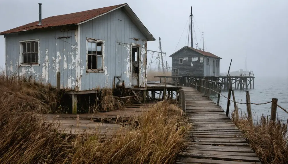
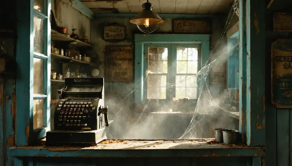
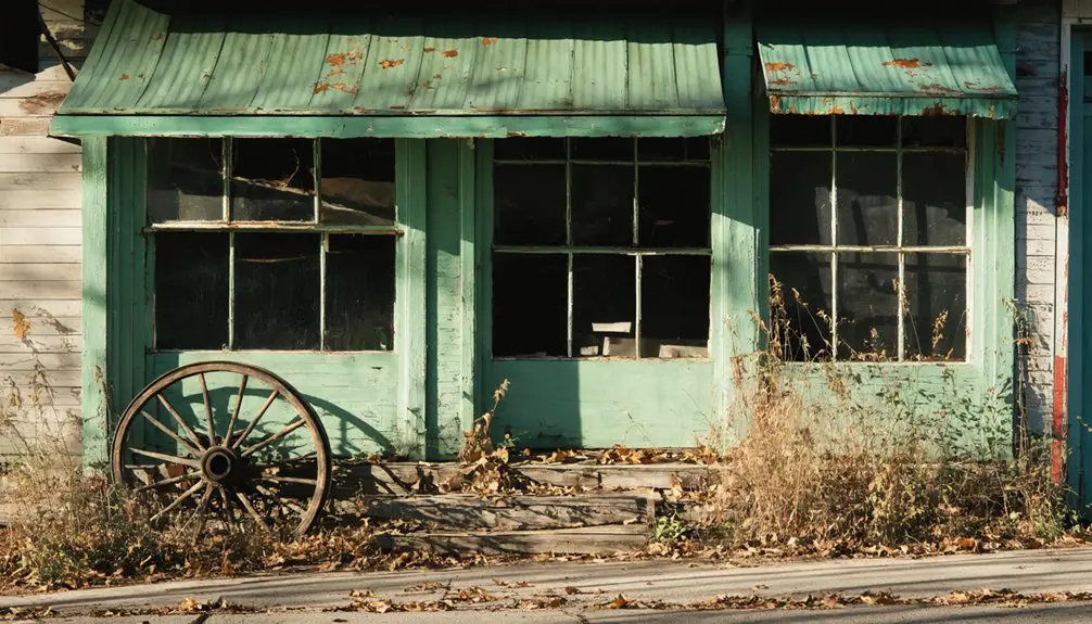
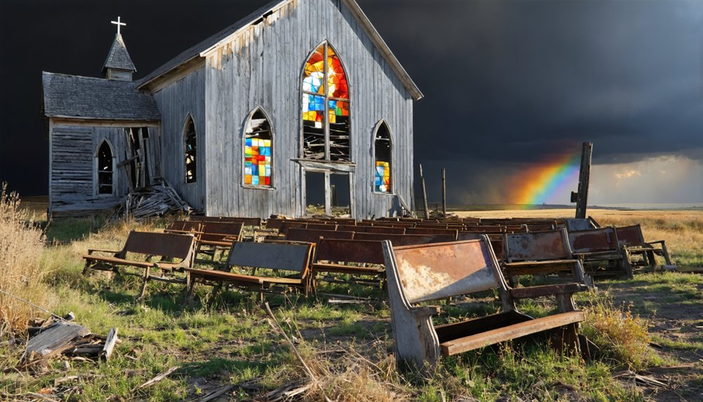
Hidden Architectural Treasures in Wisconsin’s Ghost Towns
The architectural remnants of Wisconsin’s ghost towns offer silent evidence to the diverse cultural influences that shaped the state’s early settlements.
Exploring the ghost towns in Wisconsin reveals stories of prosperity, decline, and the human experience intertwined with the land. Many of these locations now serve as a canvas for artists and historians alike, who seek to capture the essence of a bygone era. Visitors are often drawn to the mysterious allure of these abandoned places, eager to uncover the narratives that time has obscured.
Abandoned structures across Wisconsin’s ghost towns speak volumes about the cultural mosaic that built this state’s foundations.
You’ll find distinctive architectural adaptations throughout these forgotten communities, from Pendarvis’s Cornish mining heritage displayed in its restored stone and timber structures to Cooksville’s unique blend of Norwegian and New England building traditions.
In these abandoned settlements, you can explore concrete foundations, stone wells, and protective metal mesh that now safeguard deteriorating windows.
At Helena, the shot tower stands as a evidence of industrial ingenuity, while Dover’s residential ruins reveal the prosperity of railroad-era Wisconsin.
Each site showcases the remarkable ways settlers adapted their traditional building methods to the Wisconsin climate, creating a fascinating architectural legacy that continues to intrigue history enthusiasts and preservation advocates.
Frequently Asked Questions
Are Wisconsin Ghost Towns Safe to Explore Without a Guide?
You shouldn’t explore Wisconsin’s ghost towns alone, as they lack essential safety precautions. Take a guided tour instead – self-guided exploration puts you at risk of hazards and legal issues.
Can Visitors Legally Collect Artifacts From Wisconsin Ghost Town Sites?
Want to preserve history for future generations? You can’t legally collect artifacts from Wisconsin ghost towns. State legal regulations protect these sites, and removing items destroys their scientific and cultural value.
What’s the Best Season to Photograph Wisconsin’s Abandoned Settlements?
You’ll capture the most striking shots during fall, when autumn colors frame weathered structures dramatically. Winter landscapes offer stark secondary options with bare trees revealing hidden architectural details.
Do Any Wisconsin Ghost Towns Have Reported Paranormal Activity?
You’ll encounter ghost stories around several deserted settlements, especially near Big Bull Falls’ haunted locations, where loggers’ spirits linger. The abandoned asylums and old hospitals also harbor unexplained paranormal phenomena.
Are There Camping Options Near Major Ghost Town Locations?
You’ll find regulated camping at White Mound County Park’s 46 sites, but you’ll need to venture to nearby state parks or Hipcamp locations when exploring Imalone, Veazie, and other historic ghost settlements.
References
- https://en.wikipedia.org/wiki/List_of_ghost_towns_in_Wisconsin
- http://freepages.rootsweb.com/~gtusa/history/usa/wi.htm
- https://pbswisconsin.org/news-item/southern-wisconsins-ghost-towns-leave-behind-vital-stories/
- http://shunpikingtoheaven.blogspot.com/2016/05/a-wisconsin-ghost-town.html
- https://grantcountyhistory.org/wp-content/uploads/2016/01/GhostTownsGrantCountyTLundeen.pdf
- https://townofgraftonwi.gov/town-history/
- https://www.youtube.com/watch?v=hyvSTpgwddA
- https://kids.kiddle.co/List_of_ghost_towns_in_Wisconsin
- https://www.gratiot.us/community/history
- https://www.galena2026.org/gratiot/