You’ll find Bon Homme along the Missouri River in southeastern South Dakota, where settlers first arrived in 1858 despite legal challenges from the Yankton Sioux Treaty. The settlement flourished as a frontier trading post, featuring distinctive chalk rock buildings and a diverse community of Scottish, Canadian, and Russian immigrants. After decades of prosperity, changing transportation patterns and a devastating 2003 tornado led to its abandonment, though its original structures still stand as silent witnesses to Dakota Territory’s pioneering spirit.
Key Takeaways
- Bon Homme, established in 1859, became one of South Dakota Territory’s earliest white settlements following the Yankton Sioux Treaty.
- A devastating tornado in June 2003 destroyed most buildings in Bon Homme, accelerating its transformation into a ghost town.
- The town declined when transportation methods evolved, with trucks replacing trains and diminishing its importance as a trade center.
- Original chalk rock structures and trading buildings still stand as historic remnants of Bon Homme’s frontier past.
- Bon Homme began as a thriving trading post in 1794, attracting diverse settlers including Scottish, Canadian, and Russian immigrants.
Early Settlement Challenges and Legal Restrictions
When the first white settlers arrived at Bon Homme Island in 1858, they faced immediate legal challenges due to the Yankton Sioux Treaty‘s settlement restrictions. You would’ve found these pioneers camping near Devil’s Nest in Nebraska, crossing the Missouri River by canoe to establish their presence on the island despite the legal barriers that prohibited settlement until 1859.
The settler hardships intensified when U.S. Army troops from Fort Randall enforced the treaty by burning their cabins and evicting them from the island. Led by John Shober’s group from Minnesota, these early settlers had originally intended to seek gold at Pike’s Peak before deciding to establish a settlement at Bon Homme instead.
These determined settlers wouldn’t give up – they weathered the winter at Devil’s Nest camp, waiting for their chance to return legally. When restrictions finally lifted in 1859, they established the Village of Bon Homme on the mainland shore, marking a new chapter in the region’s settlement. Years later, the area would welcome Hutterite refugees fleeing religious persecution in Russia, who purchased 2,500 acres to establish their colony.
The Role of Yankton Sioux Treaties in Shaping Bon Homme
The 1858 Yankton Sioux Treaty fundamentally shaped Bon Homme’s development by orchestrating one of the largest land transfers in Dakota Territory history.
You’ll find the treaty’s implications reached far beyond mere land exchange – it redefined settlement patterns and cultural boundaries across the region, including the establishment of a 475,000-acre reservation along the Missouri River.
The treaty’s provisions directly impacted Bon Homme’s early growth through strict settlement restrictions until 1859. One notable outcome was the 640-acre land grant to Zephyr Rencontre near the future townsite. French traders like Rencontre often married Indigenous women, creating métis families that enriched the cultural fabric of the region.
The agreement also pushed for cultural integration through agricultural education and industrial training, forever altering the relationship between settlers and the Yankton Sioux.
These changes would influence everything from land use to jurisdiction, setting legal precedents that continue to shape South Dakota’s landscape today. The agreement ultimately led to the cession of 11 million acres between the Des Moines and Missouri Rivers.
Notable Pioneers and Cultural Intermediaries
Notable cultural intermediaries laid the groundwork for Bon Homme’s multicultural development, starting with Louisel Registre’s arrival in 1794.
You’ll find Emanuel Disaul’s 1815 trading post at Emanuel Creek marked the beginning of permanent non-native settlement, establishing essential cultural exchange between tribes and traders.
Zephyr Rencontre emerged as a pivotal figure, bridging Yankton Sioux and U.S. interests during the 1858 treaty negotiations. His 640-acre land grant and subsequent sale to Walter Burleigh and Andrew Faulk transformed native holdings into settler territory. Mrs. Francis Rounds served as the first postmistress of the town, contributing to its early communication infrastructure.
Trading dynamics flourished as French trappers, Native Americans, and American settlers converged at posts along the Missouri River.
John Shober’s 1859 wagon train settlement, followed by General Campbell’s leadership in mail routes, established Bon Homme’s foundational community structure, while entrepreneurs like John Stafford sustained its economic growth.
Building the Frontier Community
Emerging from scattered frontier settlements, Bon Homme’s community took shape after the crucial 1858 Yankton Sioux Treaty opened legal pathways for non-Indigenous settlement.
You’ll find the settlement patterns were influenced by early pioneers like Zephyr Rencontre, who established a trading post on Bon Homme Island in 1828.
The community dynamics evolved rapidly as diverse groups arrived, creating a rich cultural tapestry:
- The Hutterites founded Bon Homme Colony in 1874, fleeing Russian military service requirements
- Russian-German settlements like Odessa and Worms sprang up, adding to the region’s growth
- The Dakota Southern railroad’s 1873 completion accelerated development
Despite initial challenges of illegal settlements and subsequent evictions, the frontier community persevered, establishing essential infrastructure and fostering economic opportunities through farming and trade.
Early settlers like Christ Bangert contributed to the region’s agricultural development after filing for homesteads in the 1870s.
Natural Resources and Architectural Heritage
Built from locally quarried chalk rock, Bon Homme’s architectural heritage stands as a tribute to frontier ingenuity and resourcefulness.
You’ll find the buildings constructed from sand-colored stone blocks, roughly 12 inches thick, bonded with mortar and complemented by cottonwood lumber harvested from nearby riverbanks. This natural resource sustainability shaped the town’s distinctive character, creating structures of remarkable architectural resilience.
The trading post and remaining buildings, dating to at least 1874, showcase the durability of local materials. Similar to the restored schoolhouse in Mystic, these structures serve as windows into frontier life.
You’ll notice how thick chalk rock walls have withstood time, with some underground cellars so strong they’ve resisted heavy machinery.
Today, these historic structures continue serving the colony’s extensive agricultural operations, housing facilities for thousands of livestock while preserving the authentic craftsmanship of frontier builders.
The colony’s carpenter and storage building exemplifies the multi-purpose use of chalk rock construction methods.
From Territorial Hub to Abandonment
You’ll find that Bon Homme’s origins as an essential river trade center began in 1859, when settlers legally established the village after earlier attempts had been thwarted by U.S. Army evictions.
The settlement flourished initially as the Bon Homme County seat, with its strategic Missouri River location supporting both commerce and territorial governance. A proposal to rename the county to Jefferson was rejected in 1865.
Your visit today would reveal how the town’s decline accelerated after losing county seat status to Tyndall in 1885, while flooding and the eventual creation of Lewis and Clark Lake submerged the historic Bon Homme Island that had first drawn settlers to the area.
Early River Trade Center
The strategic location along the Missouri River propelled Bon Homme into an essential trade center, beginning with a French trapper’s post in 1794.
You’ll find evidence of robust river commerce in the carefully constructed buildings made from local chalk rock limestone, quarried directly from the Missouri bluffs.
The trade dynamics centered around several key operations:
- Blacksmith and carpenter shops supporting transportation infrastructure
- Storage cellars stocked with canned goods and dried meats
- Communal dining facilities serving traders and settlers
You can trace the settlement’s economic foundation to the fur trade and agricultural commerce that flourished along the riverbank.
The area’s cottonwood timber resources proved invaluable for construction, while the shared facilities highlighted the cooperative spirit that defined early trading life at Bon Homme.
Ghost Town’s Steady Decline
As transportation methods evolved in the early 20th century, Bon Homme’s position as an essential Missouri River trade center began to crumble.
You’ll find that trucks gradually replaced trains for cattle hauling, triggering a chain of economic shifts that weakened the town’s commercial significance. Following a pattern seen in towns like Dewey and Strool, many businesses shuttered as transportation needs changed. The once-bustling general store and post office lost their importance as fewer travelers stopped by.
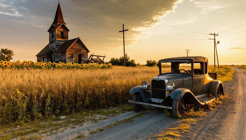
The town’s decline accelerated through demographic changes, with younger generations seeking opportunities in urban areas. A devastating tornado in June 2003 delivered the final blow, destroying most buildings and hastening abandonment.
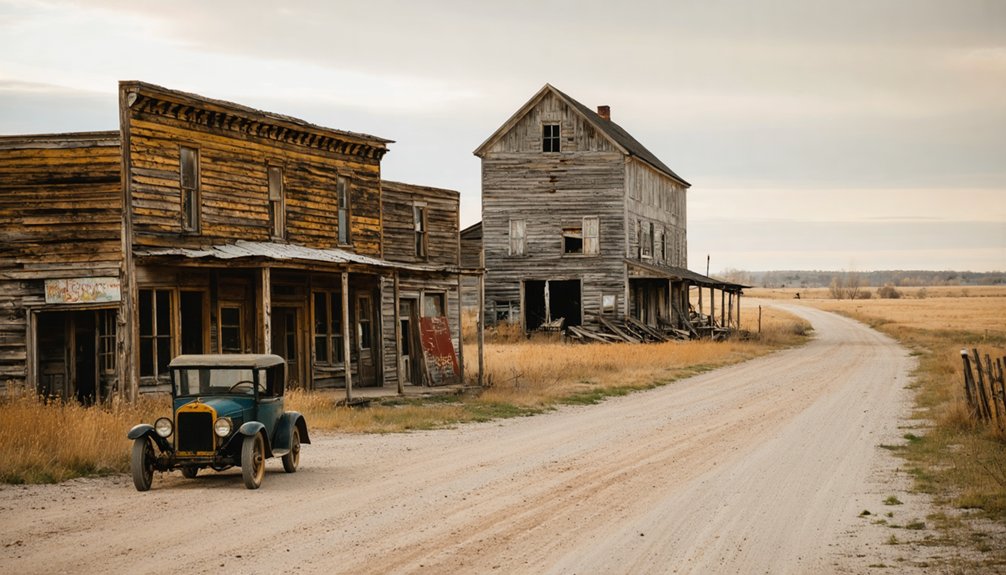
Today, you can still see some original chalk rock structures standing as silent witnesses to Bon Homme’s past glory, while the nearby Hutterite Colony maintains a few historical buildings from the town’s heyday.
Legacy of a Missouri River Settlement
Situated strategically along the Missouri River, Bon Homme emerged as one of South Dakota Territory’s earliest white settlements in 1859, following a brief period of illegal occupation and military eviction.
Through settlement struggles and cultural integration, this pioneering community left an enduring mark on the region’s development.
The settlement’s rich legacy includes:
- A thriving trading post dating back to 1794, established by French trappers on Bon Homme Island
- A diverse population that included Scottish, Canadian, and Russian immigrants who shaped the local culture
- Prime real estate that initially sold for $10 per acre to Hutterite settlers, now valued at up to $8,000 per acre
You’ll find remnants of this historic river town 80 feet above the Missouri, where an original trading building still stands as a monument to the frontier spirit that defined early Dakota Territory.
Frequently Asked Questions
What Was the Population of Bon Homme at Its Peak?
You’ll find historical context suggests the population dynamics never exceeded a few dozen residents at its peak, though exact figures aren’t documented beyond the 18 inhabitants recorded in 1890.
Are There Any Remaining Structures Still Standing in Bon Homme Today?
Like footprints in shifting sand, you won’t find many standing structures today. Ghost town tourism reveals only scattered ruins, as historic preservation efforts haven’t maintained any significant buildings in the area.
Among these remnants, the stories of once-thriving communities can be pieced together, highlighting the allure of ghost towns in South Dakota. Each site tells a story of ambition, hardship, and eventual abandonment, drawing the curious and adventurous alike. Exploring these forgotten places can feel like stepping back in time, inviting reflections on the life that once filled these now-silent streets.
What Transportation Routes Connected Bon Homme to Other Frontier Settlements?
You’d find Missouri River ferries, gravel wagon roads, and nearby railroad expansion linked Bon Homme to trade networks, while farm-to-market roads connected local settlements and state highways followed historic trails.
Did Any Famous Historical Events or Incidents Occur in Bon Homme?
Like a fading echo of frontier dreams, you’ll find few dramatic incidents here, though famous residents like Zephyr Rencontre shaped history through the 1858 Yankton Treaty and founding of America’s first Hutterite colony.
When Was the Last Permanent Resident Recorded Living in Bon Homme?
You won’t find specific records of the last resident in public archives, though this ghost town’s population gradually dispersed through the early-to-mid 1900s as residents moved to larger nearby communities.
References
- https://www.sdpb.org/rural-life-and-history/settlement-stories-bon-homme-county-in-the-moment
- https://www.sdpb.org/rural-life-and-history/the-history-of-bon-homme-county-a-native-perspective
- https://newstandardag.com/2022/11/30/bon-homme-colony-south-dakota/
- https://core.ac.uk/download/pdf/345016075.pdf
- http://files.usgwarchives.net/sd/bonhomme/history/spghost.txt
- https://en.wikipedia.org/wiki/List_of_ghost_towns_in_South_Dakota
- http://www.hervoiceonline.com/news/throughthelens530.html
- https://b1027.com/south-dakota-has-an-abundance-of-ghost-towns/
- http://genealogytrails.com/sdak/bonhomme/CoHx.html
- https://www.calvin.edu/hh/Immigrant Letters PDFs/Zylstra-Rein.pdf


