You’ll discover Bourne, Oregon nestled in the Blue Mountains at 5,374 feet elevation, where gold’s discovery in 1888 sparked a thriving boomtown. Named after future U.S. Senator Jonathan Bourne Jr., the settlement grew to 1,500 residents and produced $8 million in gold and silver between 1894-1916. After surviving a major investment swindle in 1906 and devastating flood in 1937, this fascinating ghost town holds countless stories within its weathered remains.
Key Takeaways
- Bourne was established in 1888 as a gold mining town in Oregon’s Blue Mountains, reaching a peak population of 1,500 residents.
- The town’s major mines produced $8 million in gold and silver between 1894-1916, with the North Pole Mine being particularly productive.
- A massive investment fraud scheme in 1906 by F. Wallace White triggered the town’s initial decline and exodus of residents.
- A catastrophic flood in 1937 destroyed most remaining infrastructure, leading to the town’s final abandonment by 1950.
- The ghost town sits at 5,374 feet elevation along Cracker Creek within Wallowa-Whitman National Forest, surrounded by dense pine forest.
The Rise of a Mining Boomtown
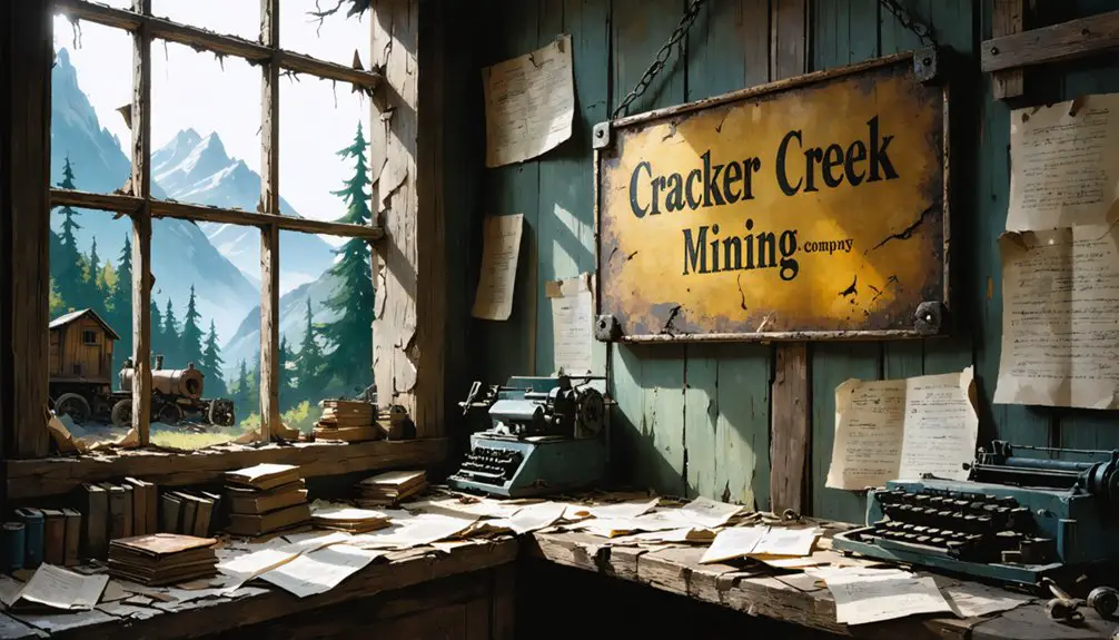
When gold was discovered along Cracker Creek in 1888, a small settlement called Cracker City quickly emerged to support the burgeoning mining operations.
You’ll find that this gold rush community started modestly with 20-30 structures, anchored by the E&E mine which employed about 80 men.
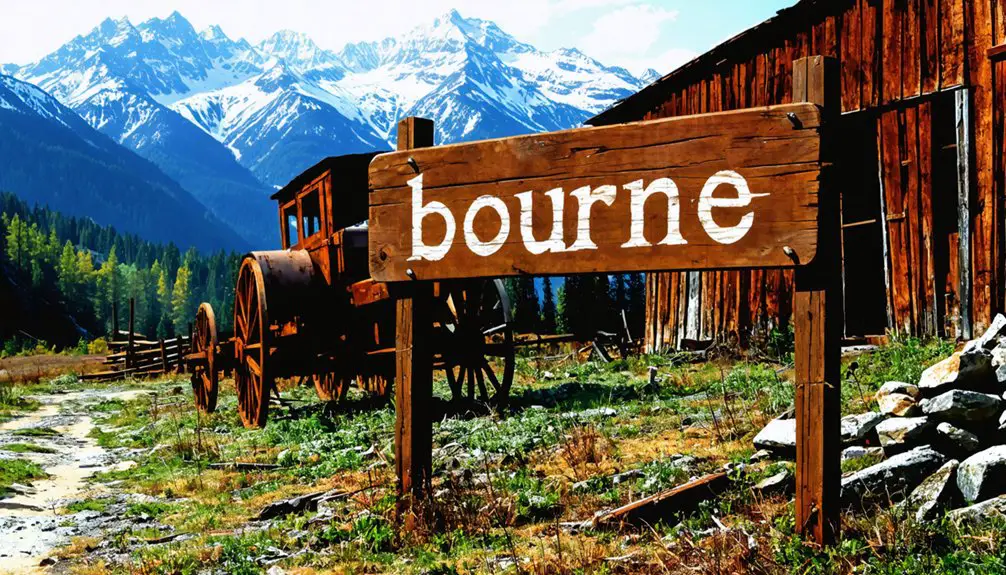
By 1895, the settlement had grown enough to warrant a post office, and you’d have seen the town renamed to Bourne after Jonathan Bourne, Jr., a Massachusetts lawyer who later became a U.S. senator.
In 1895, Bourne shed its old name of Cracker City, honoring the Massachusetts lawyer who would later serve in Congress.
The community spirit flourished as the population exploded to around 1,500 by the mid-1890s.
Within a decade, you’d have witnessed thousands of residents calling Bourne home, with commercial buildings and residences lining Cracker Creek, marking its transformation from a simple mining camp into a structured boomtown.
The town’s prosperity attracted renowned mines like the North Pole and Golconda, which further established Bourne as a significant mining hub.
Unfortunately, the town’s success was undermined by fraudulent schemes orchestrated by F. Wallace White, who swindled millions from investors.
Location in the Blue Mountains
You’ll find Bourne nestled in a forested mountain valley within Oregon’s Blue Mountains, specifically along Cracker Creek about 7 miles north of Sumpter.
The ghost town‘s remote setting, at coordinates 44.82444°N, 118.19750°W, places it deep within the Wallowa-Whitman National Forest‘s protected boundaries. Like the historic Bourne Abbey Church in England, the site represents an important piece of local heritage. Due to the numerous uses of the name, a disambiguation page helps visitors locate information specific to this Oregon location.
The history of Jimtown, Oregon ghost town unveils a narrative of once-thriving mining activities and the eventual decline that led to its abandonment. Today, remnants of old structures can still be found among the surrounding dense forest, reflecting the challenges faced by early settlers. Exploring this ghost town offers a fascinating glimpse into the past, inviting history enthusiasts to uncover stories long forgotten.
Access requires traveling west on Highway 410 from Sumpter, then turning onto Cracker Creek Road, which shifts from pavement to dirt as you wind uphill for approximately 6 miles through the mountainous terrain.
Mountain Valley Setting
Nestled within Oregon’s Blue Mountains, the ghost town of Bourne sits at an elevation of 5,374 feet (1,638 meters) along the banks of Cracker Creek, approximately 7 miles north of Sumpter.
The history of Boyd, Oregon ghost town is a fascinating tale of early settlers and their struggles for survival in a harsh environment. Once a bustling mining hub, it has transformed into a quiet reminder of the past, with remnants of buildings and artifacts scattered throughout the area. Visitors often come to explore the ghostly remains and imagine what life was like during the town’s heyday.
You’ll find the town positioned in a steep, narrow valley where the surrounding mountain ecology thrives with dense stands of pine and fir trees. The rugged volcanic terrain creates dramatic ridgelines that offer sweeping views of the forested landscape below.
The valley wildlife includes elk, deer, and black bears that roam freely through the Wallowa-Whitman National Forest. The area once bustled with activity during its time as a gold mining boomtown. Originally known as Cracker City, the settlement was later renamed to honor Senator Jonathan Bourne Jr.
The mountain setting creates distinct microclimates, with thin, rocky soils supporting native forest species rather than agriculture. You’ll experience significant temperature variations between day and night due to the clear mountain skies and elevation effects.
Forest Road Access
The primary access route to Bourne ghost town leads through Forest Road 53, which begins at the North Fork John Day campground junction and extends northwest for 65 miles to Heppner.
You’ll find the road unpaved but maintained by forest services, though seasonal access is limited due to winter closures and snow conditions. The route connects to the Blue Mountain Scenic Byway, offering views of the North Fork John Day Overlook and access to historic sites. The Umatilla National Forest encompasses much of the surrounding area, providing expansive natural scenery. The scenic drive typically takes 3 hours minimum to complete when traveling without extended stops.
- Forest road maintenance varies throughout the year, with best conditions during summer and fall months
- You’ll need to navigate through multiple National Forest areas, with directional signs marking routes to trail swales and interpretive sites
- The road network provides strategic access points to old Oregon Trail remnants, ghost town areas, and designated wildlife viewing locations
The Jonathan Bourne Jr. Legacy
Born into a prominent Massachusetts whaling family in 1855, Jonathan Bourne Jr. would establish himself as one of Oregon’s most influential political and business leaders during the late 19th and early 20th centuries.
After surviving a shipwreck near Formosa in 1877, he arrived in Portland the following year, where he’d practice law before diving into mining and industrial ventures.
A young Bourne found his way to Portland after cheating death at sea, launching his path to business success.
His extensive real estate speculation and mining ventures throughout Oregon helped build his fortune and influence in the region.
You’ll find the Bourne family’s legacy preserved in the town that bears their name, but Jonathan Jr.’s most lasting impact stems from his political reforms.
While serving as chairman of the Committee on Post Offices, he authored the crucial Parcel Post Act during his Senate tenure.
As a U.S. Senator from 1907 to 1913, he championed progressive causes, including direct election of senators and presidential preference primaries.
He founded the National Progressive Republican League and orchestrated significant changes to Oregon’s political landscape that would reshape the state’s democratic processes.
Gold Mining Operations and Production
You’ll find that Bourne’s mining infrastructure was substantial, featuring power ditches constructed to operate Burleigh drills and support tunnel excavation efforts.
The district’s mines employed roughly 80 men by 1888, splitting their labor between tunnel development and infrastructure construction.
From 1894 to 1916, the mines along the North Pole Columbia Lode achieved remarkable production figures, yielding approximately $8 million in gold and silver output.
Mining Infrastructure and Equipment
Mining operations at Bourne’s North Pole Mine relied on sophisticated infrastructure, including a 1.5-mile tramway system that transported ore using 200 buckets suspended from a 7/8-inch cable. Each bucket could carry 250 pounds of ore to the stamp mill operations, where advanced crushing and processing equipment extracted gold from raw materials.
The processing setup achieved up to 51% gold extraction rates when ore was crushed through 50-mesh screens.
- Jaw crushers and hammer mills pulverized the ore into a fine slurry
- Shaker tables separated gold and heavy minerals using water flow and gravity
- Portable equipment allowed for flexible operations, with some units transportable by pickup truck
The infrastructure included essential water supplies, tailings ponds, and processing plants to support continuous mining operations, demonstrating the complex requirements of early 20th-century gold extraction methods.
Gold Production Statistics
While the infrastructure and equipment enabled efficient gold extraction at Bourne, the actual production statistics reveal the mine’s considerable impact on Oregon’s mineral wealth.
You’ll find that early gold output from the Cracker Creek district ranked among Oregon’s top producers in the 1890s, with mines like North Pole, E&E, Golconda, and Columbia leading production. The district yielded approximately 82,000 ounces valued at $1,687,400 in 1901 dollars.
Mining techniques primarily focused on lode mining, with crews of up to 80 men working single operations. Though modest compared to modern standards like Nevada’s 5 million ounces in 2014, Bourne’s production was notable for its time.
The district’s output contributed considerably to Baker County’s position as one of Oregon’s premier gold-producing regions.
The Great Mining Swindle of 1906
Although Bourne’s mining operations yielded some profitable claims along Cracker Creek, the town’s legacy became forever tarnished by one of Oregon’s most notorious gold mining swindles.
F. Wallace White orchestrated fraudulent investments through his Sampson mining company around 1904, convincing investors worldwide to pour millions into worthless claims. You’ll find that his elaborate scheme included hosting potential investors at his mansion while promoting non-existent riches through aggressive marketing campaigns.
- White’s mining scams relied on sophisticated promotional materials and a local printing press to maintain the illusion of legitimacy.
- The swindle’s collapse in 1906 triggered a mass exodus, transforming Bourne into a ghost town virtually overnight.
- White fled just hours ahead of law enforcement, leaving behind devastated investors and millions in losses that would never be recovered.
Life During the Golden Years
Before F. P. Bourne’s mines ushered in the boom years, you wouldn’t have found much along Cracker Creek.
But during the peak years between 1895 and 1916, you’d have witnessed a vibrant community where several thousand residents forged strong community bonds through shared mining endeavors.
Your daily routines would’ve centered around the North Pole-Columbia Lode‘s operations, where $8 million in gold and silver emerged from the earth.
You’d have received your mail at the local post office, caught up on news from the continuously running printing press, and lived in a timber cabin along the rugged mountainside.
Despite harsh Blue Mountain winters and challenging road conditions, you’d have found yourself part of a determined populace united by the promise of striking it rich in this remote frontier outpost.
Natural Disasters and Abandonment
Since the early mining operations had already begun to falter by 1906, Bourne’s fate was sealed by a devastating flood in 1937 that destroyed much of the town’s remaining infrastructure.
The flood impact proved catastrophic, washing out roads and making mining operations unsustainable. You’ll find that without any meaningful disaster recovery efforts, the few remaining residents abandoned their homes, accelerating the town’s decline into ghost status.
- Environmental challenges, including the mountainous terrain and unstable creek systems, had always posed risks to the community’s survival.
- By 1940, only one inhabitant remained in Bourne, though a brief revival occurred in 1942 due to dredging activities.
- The absence of modern flood control measures and deteriorating infrastructure left the town vulnerable to nature’s forces, ultimately leading to its complete abandonment by 1950.
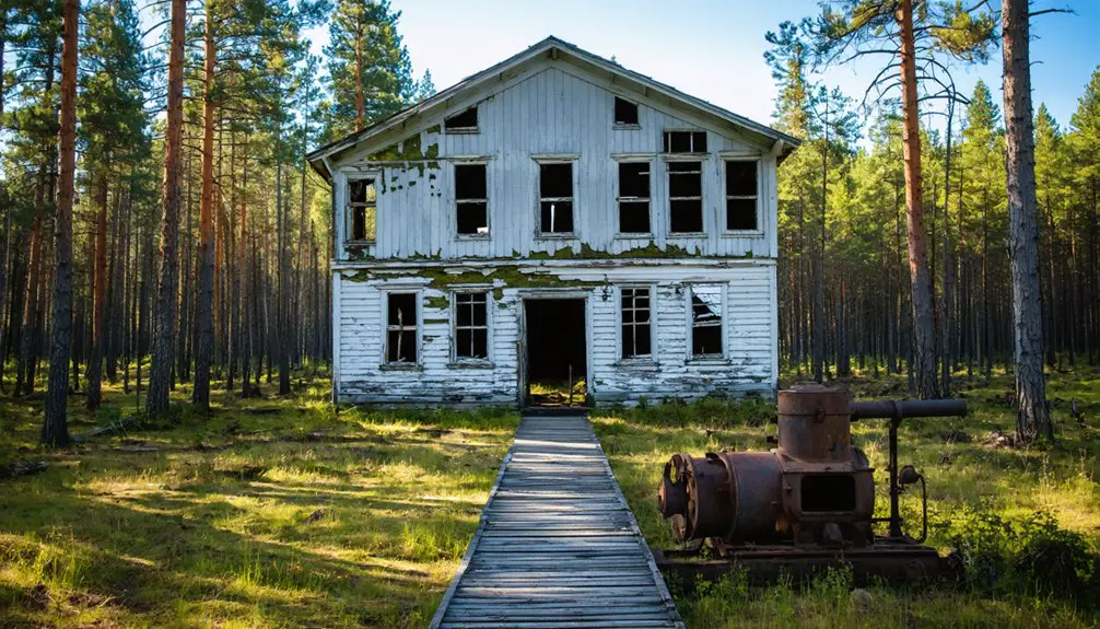
Exploring the Ghost Town Today
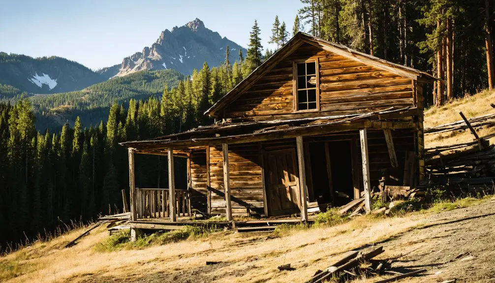
When venturing into Bourne today, you’ll find a remote ghost town situated 6 miles north of Sumpter along Cracker Creek, where dilapidated mining structures and weathered cabins stand as evidence to its gold rush past.
A haunting relic of Oregon’s mining era, Bourne’s skeletal remains whisper tales of gold fever along lonely Cracker Creek.
Your ghost town exploration requires careful planning, as access is limited to one challenging route with rough, potentially hazardous terrain. You’ll need to prepare for minimal cell service, with only limited T-Mobile text capabilities available.
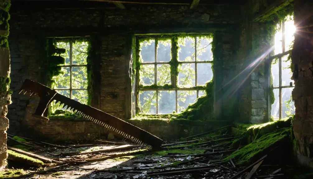
For historical photography enthusiasts, the abandoned structures offer compelling subjects against the backdrop of Wallowa-Whitman National Forest.
However, you must remain vigilant of environmental risks, particularly during fire season. Without formal visitor services or amenities, you’ll want to bring essential supplies and maintain awareness of your limited evacuation options.
Preserving Bourne’s Historical Heritage
As a tribute to Oregon’s rich mining heritage, Bourne’s historical preservation encompasses multiple facets of documentation, physical conservation, and educational initiatives.
You’ll find dedicated community engagement through local historical societies and nearby towns like Sumpter, which actively promote the region’s mining legacy.
While preservation challenges include natural decay, vandalism, and limited accessibility, various institutions work tirelessly to protect this valuable piece of history.
- State heritage programs and historical societies maintain photographic archives and documentation of Bourne’s estimated $8 million gold production era
- Original structures, though impacted by the 1937 flood, still stand as evidence of the town’s mining heyday
- Educational outreach programs promote responsible ghost town visitation while fostering awareness of Bourne’s historical significance through interpretive signs and guided tours
Frequently Asked Questions
Are There Any Paranormal or Haunted Locations Reported in Bourne?
You won’t find documented ghost sightings or haunted history in official records. While abandoned structures might seem eerie, there’s no verified paranormal activity beyond the town’s gold mining legacy.
the history of bridal veil town reveals a rich narrative beyond the supernatural. Nestled in the mountains, it boasts tales of early settlers and the challenges they faced during the gold rush era. As one explores the remnants of the past, the town’s legacy comes alive through its breathtaking landscapes and the stories etched in its historic buildings.
What Wildlife Can Visitors Commonly Encounter Around the Ghost Town?
You’ll commonly spot black-tailed deer, raccoons, and various birds during wildlife sightings. While exploring, you might encounter black bears, coyotes, and elk in surrounding forest areas.
When Is the Best Season to Photograph the Remaining Structures?
You’ll feel like you’ve struck photographic gold in summer, when you’ll get the absolute best lighting conditions, longer days, safer access, and gorgeous seasonal colors to frame those historic structures perfectly.
Are Metal Detectors Allowed for Treasure Hunting in Bourne?
You’ll need explicit permission since metal detecting regulations protect this historic site. Don’t attempt treasure hunting without first securing proper authorization from landowners or relevant historical preservation authorities.
What Survival Supplies Should Visitors Bring When Exploring the Site?
Ready to explore freely? Pack survival gear including GPS, maps, flashlights, first aid kit, emergency food, water, weather-appropriate clothing, and signaling devices. Don’t forget insect repellent and sun protection.
References
- https://offbeatoregon.com/1011a-gold-mining-swindle-left-bourne-a-ghost-town.html
- https://www.historicsumpter.com/bourne-oregon-ghost-town/
- https://en.wikipedia.org/wiki/Bourne
- https://westernmininghistory.com/towns/oregon/bourne/
- https://www.loc.gov/item/2017789212/
- https://emich.primo.exlibrisgroup.com/discovery/fulldisplay?docid=cdi_dpla_primary_7bf60452fe5d56638765c15c04835e51&context=PC&vid=01EMU_INST:EMU&lang=en&search_scope=MyInst_and_CI&adaptor=Primo+Central&tab=Everything&query=sub,equals,+Baker+County+,AND&mode=advanced&offset=0
- https://kids.kiddle.co/Bourne
- https://dbpedia.org/page/Bourne
- http://wikimapia.org/30528453/Bourne-Oregon
- https://www.houseofhighways.com/campgrounds/usa/west/oregon/bourne


