Today you’ll find just two abandoned structures marking what was once Brink, West Virginia – a ghost town founded in 1865 by Brinkley M. Snodgrass along the Greenbrier River. The settlement thrived initially through farming and timber operations, later boosted by the arrival of the C&O Railway in 1899. After 1923, Brink vanished from USGS maps as residents departed. The town’s haunting remains tell a deeper story of rural America’s transformation.
Key Takeaways
- Founded in 1865 by Brinkley M. Snodgrass, Brink was established along the Greenbrier River, four miles northwest of White Sulphur Springs.
- The town flourished initially due to timber operations and railroad connectivity through the Chesapeake & Ohio Railway’s Greenbrier Branch.
- Only two abandoned structures remain today: a house and church building, dating back to the 1860s original settlement.
- Brink disappeared from USGS maps after 1923, marking its decline due to economic shifts and rural depopulation.
- Located at coordinates 37°50′42″N 80°20′46″W, the ghost town site has no preservation efforts and has returned to its natural state.
The Birth of a Rural Settlement
As the American Civil War drew to a close in 1865, Brinkley M. Snodgrass established a new settlement along the Greenbrier River, just four miles northwest of White Sulphur Springs.
You’ll find that this strategic location attracted early rural demographics consisting of farming families seeking opportunities in post-war West Virginia.
The settlement’s birth reflected the pioneering spirit of the era, with settlers facing typical settlement challenges of the mountainous terrain. They built a church and homes near what’s now known as Loopemount, creating a small but determined community. Like the Dutch settlements in northeastern Pennsylvania, the area drew families seeking fertile land.
Determined pioneers carved out a humble mountain settlement, building their church and homes amid the rugged Appalachian wilderness.
The Greenbrier River served as their lifeline, providing transportation and resources essential for survival. While infrastructure remained limited, these early residents sustained themselves through agriculture and local trade, marking the beginning of Brink’s brief but notable existence. The Snodgrass family would later become one of several notable families to carry the Brink surname through generations.
Life Along the Greenbrier River
You’ll find that Brink’s early settlers relied heavily on the Greenbrier River as their primary trade route, using it to transport timber and agricultural goods downstream to larger markets.
The river’s course carved natural pathways that Indigenous peoples had used for centuries, creating established routes that newcomers would follow as they formed permanent settlements in the late 1700s. The rich limestone soils in the valley made it an ideal location for farming operations.
These riverside communities, including Brink, developed strong social and economic ties through their shared dependence on the waterway, with residents often coordinating seasonal log drives and maintaining informal river ports for local commerce. The same river that sustained these communities would later become a focal point for Great Greenbrier Race, an annual event celebrating the region’s resilience.
River Trade Routes
Life along the Greenbrier River centered on two major transportation arteries that shaped local commerce: the river itself and the Chesapeake & Ohio Railway‘s Greenbrier Branch.
Before the railroad’s arrival, you’d find the river bustling with timber operations. Workers navigated massive log rafts downstream, sometimes living on floating “arks” equipped with bunkhouses and dining halls. The fertile Greenbrier Valley soil supported thriving livestock farms that relied on river trade.
River navigation demanded skill as teams maneuvered around rocks and swift currents, freeing logs that became lodged along the way. The Greenbrier’s gentle course made it ideal for timber rafting compared to steeper West Virginia streams. Multiple sawmills and tanneries flourished along the railway line during this industrial era.
Once the C&O Railway arrived in 1899, you’d see a transformation in shipping methods. The rail line carried coal, livestock, farm products, and quarried stone, connecting local producers to eastern markets with unprecedented efficiency.
Early Settler Communities
When European settlers first ventured into the Greenbrier Valley around 1740, they encountered land previously used as Shawnee and Cherokee hunting grounds.
You’ll find that early settler experiences centered around establishing homesteads along the Greenbrier River, where they built rudimentary cabins and cleared forest for farming.
The river provided essential resources – water, fertile bottomlands, and transportation routes.
Yet frontier life demanded community resilience as families faced profound isolation and vulnerability to attacks.
You’d see settlers like Jacob Marlin and Stephen Suel living in separate dwellings due to personal conflicts, illustrating the harsh realities of frontier life.
Most families relied on a combination of hunting, trapping, and small-scale agriculture for survival.
Indian attacks in 1755 forced many settlers to abandon their newly established homes and flee the area.
They acquired land through purchase or lease, sometimes from colonial proprietors like Lord Fairfax.
By 1771, the area saw extensive trade develop between European settlers and native populations, though this would soon lead to tensions over territory.
From Farming Community to Abandonment
Unlike many of West Virginia’s ghost towns that emerged from coal mining, you’ll find that Brink began as an agricultural settlement founded by Brinkley M. Snodgrass in 1865-66.
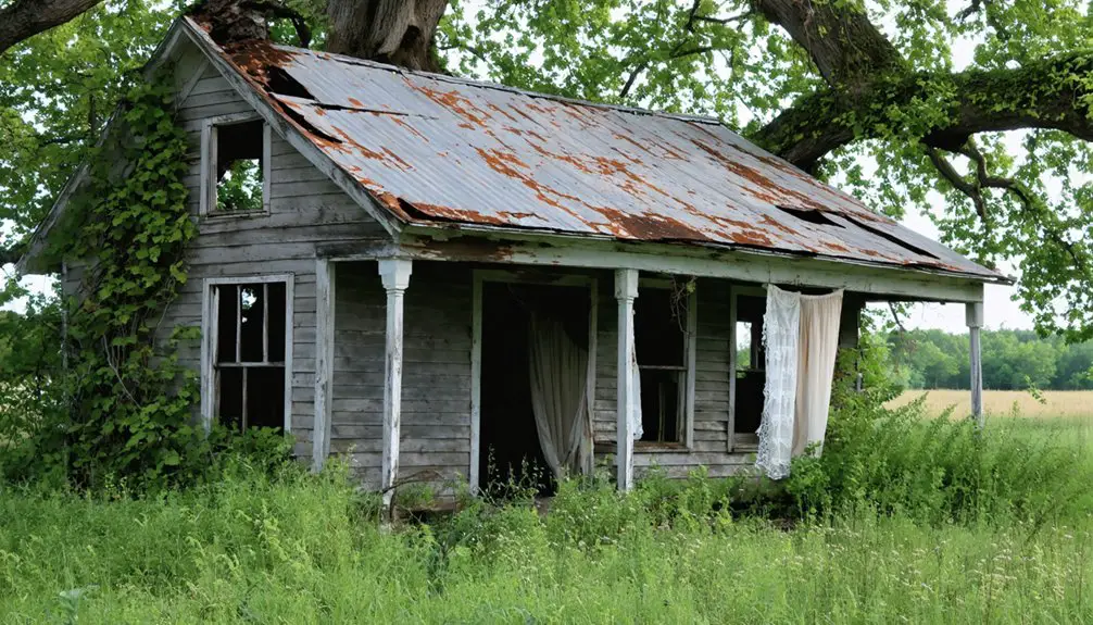
The community’s residents sustained themselves through farming along the fertile Greenbrier River, with several small farms contributing to a self-sufficient local economy during the late 19th century. Similar to the post-apocalyptic setting of the video game Brink, the area became a dystopian landscape as buildings fell into disrepair.
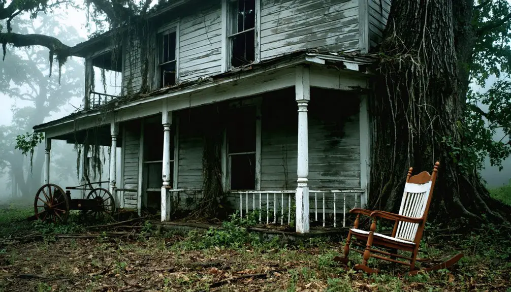
Today, like other abandoned communities, its empty deteriorating buildings tell stories of the past. You can trace Brink’s gradual decline through its disappearance from USGS maps after 1923, as economic shifts and rural depopulation drew residents away from agricultural communities toward industrial centers.
Agricultural Settlement Origins
Throughout the mid-18th century, the fertile limestone soils of the Allegheny Valley attracted settlers to what would become Brink, West Virginia. Virginia’s 1730 land law incentivized westward migration, bringing German and Scotch-Irish families who established farms along the Greenbrier River’s rich banks.
You’ll find that these early settlers created a diverse agricultural foundation, combining crop cultivation with livestock husbandry. The region’s natural advantages – abundant water, upland pastures, and productive soils – supported wheat, corn, rye, and other staple crops.
The Fairfax estate’s influence shaped land ownership patterns, while natural grasses enabled extensive livestock grazing. By the time Brinkley M. Snodgrass founded Brink in 1865-66, the area’s agricultural potential had been well-established through generations of farming expertise.
Population Decline Patterns
The vibrant agricultural foundation that sustained Brink’s early community began to erode in the late 19th century, marking the start of its gradual decline.
You’ll find that economic migration played a decisive role, as younger generations abandoned farming life for opportunities in larger towns and cities.
The pattern of rural depopulation accelerated as essential services disappeared – from postal facilities to local commerce.
By 1923, Brink had vanished from USGS maps, reflecting the exodus of its residents.
While no formal census data exists for Brink itself, surrounding Greenbrier County’s population trends paint a clear picture of rural decline.
The community’s social fabric unraveled as churches closed and gatherings ceased, leaving only scattered remnants of what was once a thriving farming settlement.
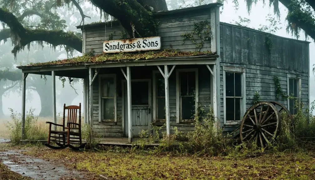
Remaining Structures and Historical Sites
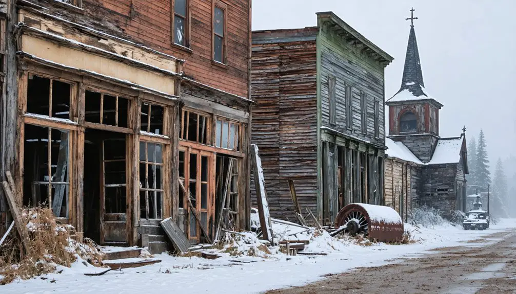
Standing as silent witnesses to Brink’s past, only two abandoned structures remain near the community of Loopemount: a deteriorating house and church building.
Two forgotten sentinels – a crumbling house and church – stand watch over Brink’s ghostly remains at Loopemount.
You’ll find these remnants of abandoned architecture approximately 4 miles northwest of White Sulphur Springs, positioned at 37°50′42″N 80°20′46″W along the Greenbrier River.
The historical significance of these structures stems from Brink’s original settlement in the 1860s, though they’ve since fallen into severe disrepair.
You won’t find any preservation efforts or visitor facilities at the site, and the surrounding area has largely returned to its natural state.
While other West Virginia ghost towns often maintain multiple preserved buildings, Brink’s physical legacy rests solely in these two decaying structures, which disappeared from USGS maps after 1923.
The Legacy of Brinkley M. Snodgrass
Behind these weathered structures lies the story of Brinkley M. Snodgrass, a Virginia-born settler who founded Brink in 1865-66. Born to Elisha Snodgrass and Eleanor Batten around 1813, he established this settlement along the Greenbrier River during the post-Civil War reconstruction period.
The Snodgrass legacy in Brink represents a crucial chapter in West Virginia’s development.
- Strategic placement of the town near White Sulphur Springs showcased Snodgrass’s vision for community growth.
- His choice of location along the Greenbrier River provided essential water access and transportation routes.
- Town establishment included fundamental infrastructure like a church and homes, reflecting his commitment to building a sustainable community.
- His family’s regional prominence and land holdings enabled the successful founding of Brink, which remained on maps until 1923.
Ghost Towns of West Virginia’s Countryside
Within West Virginia’s rugged landscape, more than 60 ghost towns dot the New River Gorge alone, offering a haunting tribute to the state’s industrial past.
You’ll find these abandoned communities concentrated in coal-rich counties like McDowell, Fayette, and Mercer, where nature now reclaims old mining equipment and ivy-covered structures.
Through ghost town exploration, you can discover places like Winona with its historic pool hall, Thurmond’s railroad remnants, and Kaymoor’s extensive mining tunnels.
Historical preservation efforts, particularly within the New River Gorge National Park, protect these time capsules of early 20th-century life.
While some towns like Gad now rest beneath Summersville Lake’s waters, others like Nuttallburg and Sewell still showcase their company stores, coke ovens, and miners’ houses, letting you step back into West Virginia’s coal mining era.
Frequently Asked Questions
What Was the Total Population of Brink During Its Peak Years?
You’ll find that Brink’s history shows no documented peak population figures, though based on remaining structures and typical settlement patterns, it’s estimated fewer than 100 people lived there before population decline.
Are Visitors Allowed to Explore the Remaining Structures in Brink?
You’ll want to proceed with caution, as there aren’t official exploration guidelines for these structures. Due to safety concerns and unclear property status, it’s best to obtain permission first.
Did Any Notable Events or Disasters Contribute to Brink’s Abandonment?
You won’t find any major mining accidents or catastrophic events behind this town’s downfall – it was purely economic decline when coal reserves depleted and mining companies shuttered operations, forcing residents elsewhere.
What Happened to the Descendants of Brinkley M. Snodgrass?
You’ll find Snodgrass descendants moved northward and westward, expanding their family legacy through political and professional roles while maintaining social prominence in West Virginia and neighboring states through several generations.
Were There Any Businesses or Stores Operating in Brink?
You won’t find documented businesses in historical landmarks there, though ghost stories suggest small trading may have occurred. Available records don’t confirm any established stores operated in this settlement.
References
- https://en.wikipedia.org/wiki/Brink
- https://kids.kiddle.co/List_of_ghost_towns_in_West_Virginia
- https://www.youtube.com/watch?v=tMUZo73TSMg
- https://en.wikipedia.org/wiki/List_of_ghost_towns_in_West_Virginia
- https://raregoldnuggets.com/?p=4235
- https://ancestorsinaprons.com/tag/brink-family-in-ohio/
- https://ancestorsinaprons.com/tag/abraham-brink/
- https://ruralhome.org/wp-content/uploads/2021/05/rvmarch2016-9.pdf
- https://pocahontascountywv.com/the-power-of-moving-forward-the-history-behind-the-great-greenbrier-river-race/
- https://www.wvencyclopedia.org/entries/23