You’ll find Calista nine miles west of Kingman, Kansas, where it began as Maud in 1881 before adopting its Greek-inspired name in 1886. After floods threatened the original settlement, the Atchison, Topeka & Santa Fe Railway’s expansion forced the town to relocate in 1896. The new site thrived as an agricultural community until its dissolution in 1955. Today, only scattered foundations, a cemetery, and old railbeds remain to tell Calista’s fascinating story of resilience and transformation.
Key Takeaways
- Calista was established in 1881 as Maud before relocating and being renamed Calista in 1886 near the Ninnescah River in Kansas.
- The Atchison, Topeka & Santa Fe Railway expansion in 1896 forced the town to relocate, marking the beginning of its decline.
- The community operated as a farming settlement until 1955, when it was officially dissolved and students merged with larger districts.
- Few structures remain today except for a cemetery, with most of the original town site reclaimed by surrounding farmland.
- Located nine miles west of Kingman, Kansas, Calista’s environment features river ecosystems, wetlands, and mixed grass prairie landscapes.
The Greek Origins Behind the Name
While many Kansas ghost towns have Native American or pioneer-derived names, Calista’s origins reach back to ancient Greece.
You’ll find the name’s roots in the Greek word “kallistos,” which serves as the superlative form of “kalos,” meaning it translates to “most beautiful.” These Greek influences showcase the ambitious hopes early settlers had for their community.
The name’s significance stems from its connection to “kallos,” the Greek noun for beauty, and shares linguistic ties with the mythological figure Callisto, a nymph who became immortalized as a constellation. The story tells of how Zeus placed Callisto and her son among the stars as the Great and Little Bear.
When founders chose this name for their Kansas settlement, they weren’t just picking something that sounded pleasant – they were drawing upon centuries of classical tradition that associated Calista with supreme beauty, nobility, and divine favor. Due to potential confusion with other places named Calista, modern researchers often need to specify this location as Calista, Kansas ghost town when conducting historical searches.
From Maud to Old Calista: The Early Years
Before becoming known as Calista, the settlement began as a modest community called Maud in 1881. The early settlers established their homes and buildings near the south bank of the Ninnescah River, creating a small but determined frontier outpost that would last for five years.
Along the Ninnescah River’s south bank, pioneers built Maud in 1881, creating a determined frontier settlement that flourished briefly.
In 1886, you’d have witnessed a remarkable shift as the entire Maud community picked up and relocated, officially adopting the name Calista – derived from the Greek word meaning “most beautiful.” Similar to other Kansas settlements like Columbia, the community faced numerous destructive floods that challenged their survival. Like the town of State Line, which later became Opolis, the evolution of its name marked a significant period of change.
The settlement, which became known as Old Calista, maintained its position as an unincorporated rural community until 1896. During this decade, life centered around basic frontier amenities, with residents engaging in farming and local trade.
The community’s story took another turn when the Atchison, Topeka and Santa Fe Railway prompted its final relocation.
Railroad Impact and Community Relocation
You’ll find that Calista’s history took a dramatic turn in 1896 when the Atchison, Topeka & Santa Fe Railway’s expansion forced the entire community to relocate two miles west-southwest.
The railroad’s need for right-of-way transformed not just the town’s location but its economic foundation, as new rail facilities and grain shipping capabilities emerged at the relocated site. The Santa Fe Railway would later demonstrate its dominance of the region with its record-breaking run of the Scott Special in 1905. The rail line’s influence mirrored developments in Ottawa, where the Leavenworth, Lawrence & Galveston acquisition in 1878 reshaped the town’s growth.
This railway-driven migration exemplifies a common pattern across Kansas during the late 19th century, where railroad companies wielded significant influence over community development and settlement patterns.
Railway-Driven Town Migration
The power of railroad expansion fundamentally shaped Calista’s destiny in 1896, forcing the entire town to relocate two miles west-southwest of its original site. When the Atchison, Topeka and Santa Fe Railway needed to build tracks through Old Calista, residents faced a stark choice: move or lose their economic lifeline.
The local post office operations were directly impacted by this upheaval, as evidenced by the example of nearby Maud post office which had to relocate to Calista after its closure in 1886. This move presented considerable logistical challenges as the community worked to rebuild homes, businesses, and essential services in New Calista.
Despite the community’s resilience in establishing a new settlement, complete with a grain elevator and supporting infrastructure, the relocation marked the beginning of a slow decline.
Tracking Economic Transformation
Railway-mandated relocation marked only the beginning of Calista’s economic metamorphosis. You’ll find that when the Atchison, Topeka & Santa Fe Railroad demanded the town’s move in 1896, it set off a chain of transformations that would reshape the community’s destiny.
While the railroad initially brought promise of growth, deeper economic shifts were already in motion. Much like the town of South Haven, which was built for larger capacity but never reached its potential, Calista’s development stalled despite early optimism. The rise of modern farming technology allowed fewer workers to manage vast tracts of land, diminishing the need for local businesses.
As agricultural mechanization took hold, you’d have witnessed the consolidation of smaller farms into larger operations, weakening community cohesion. The local cooperative elevator‘s replacement by a distant concrete silo reflects this centralization.
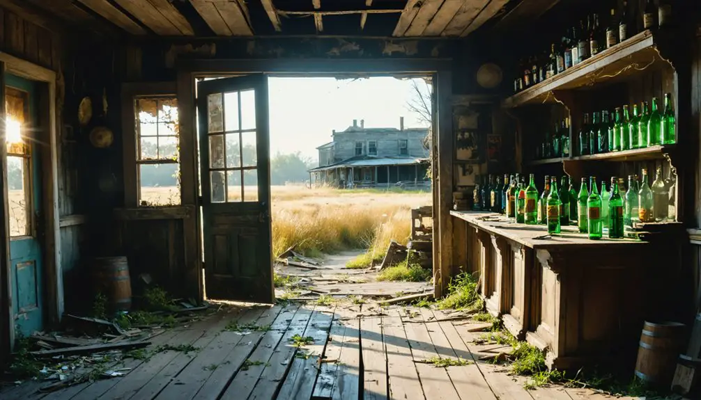
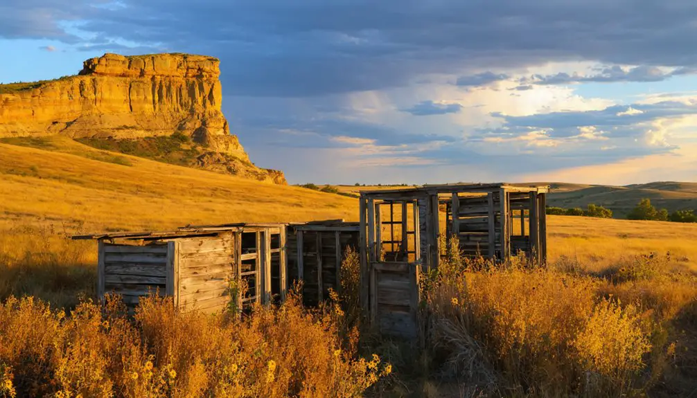
Today, you’ll see only scattered remnants of Calista’s former vigor – a few homes and a blacksmith shop stand where thriving businesses once served the farming community. The town’s story mirrors countless others where railway decisions triggered lasting economic reverberations.
Life in New Calista (1896-1955)
Following its establishment in 1896, New Calista emerged as a vibrant agricultural community centered around the newly constructed Atchison, Topeka and Santa Fe Railway line.
You’d have found a tight-knit society where community dynamics revolved around essential services, including a grain elevator, general stores, and a post office.
Life in New Calista reflected the interdependence of its residents. You’d have experienced social gatherings like harvest festivals and town fairs that brought neighbors together.
Community spirit flourished in New Calista through vibrant harvest festivals and town fairs that wove neighbors into a close social fabric.
Children attended local schools within the Kingman-Norwich district, while adults focused on farming and small business operations. The railway connection facilitated you could transport goods and access wider markets.
The town maintained operations until Calista ceased existence in 1955.
The town’s infrastructure included homes, public services, and community buildings that supported daily life until its official dissolution in 1955.
Geographic Features and Natural Surroundings
You’ll find Calista nestled in the Ninnescah River valley, approximately nine miles west of Kingman, Kansas.
The town’s location near the river’s south bank provided settlers with access to water resources essential for early development.
The surrounding terrain consists primarily of agricultural land, where farmers have historically cultivated crops like wheat and maintained pastures for livestock grazing.
River Valley Setting
The gently rolling terrain of Calista nestles along the south bank of the Ninnescah River, approximately nine miles west of Kingman, Kansas. Here, at an elevation of 1,011 meters, you’ll find a rich river ecosystem shaped by seasonal flows and periodic flooding that have created fertile alluvial soils throughout the valley floor.
The location’s cultural significance stems from its strategic position within the floodplain, where early settlers gained access to essential water resources for domestic use, livestock, and irrigation.
The river valley’s natural features include tributary streams and wetland areas, while native vegetation shifts from riparian woodlands along the riverbanks – dominated by cottonwood, willow, and hackberry trees – to mixed grass prairie on the higher terraces.
This diverse landscape supports wildlife typical of Kansas riverine environments.
Agricultural Land Usage
Beyond the river valley’s rich ecosystem lies Calista’s agricultural heartland, where gently rolling plains stretch across the horizon.
You’ll find typical Kansas soils here – a mix of loam and sandy textures perfect for growing wheat and sorghum. Early farmers practiced crop rotation and natural fallowing to maintain soil fertility on their smaller family farms.
Today’s landscape tells a different story. Through decades of land consolidation, family farms have given way to vast mechanized operations.
Where numerous homesteads once dotted the prairie, you’ll now see expansive fields of row crops managed by just a handful of farmers. The flat to gently rolling terrain that made Calista ideal for early settlement now serves modern agriculture, though remnants of the original tallgrass prairie survive only in scattered patches near abandoned buildings.
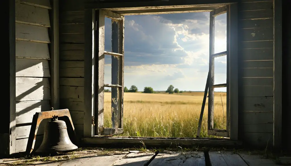
Surviving Structures and Modern Landmarks
While modern-day New Calista retains only a handful of buildings, its original site from 1896 has virtually disappeared into Kansas’s agricultural landscape.
You’ll find the town’s remnants scattered across two locations – the original settlement and its relocated site about two miles away, where the railroad expansion drove the community to move.
Today, you can explore surviving buildings at New Calista, though they’re few in number.
The most enduring landmarks in the area include the cemetery, which serves as a crucial connection to the former community.
While most physical structures have vanished, you’ll discover traces of the town’s railroad heritage through remaining foundations and old railbeds.
The surrounding farmland has largely reclaimed the original town plots, with only occasional road signs hinting at the bustling community that once existed here.
Educational Legacy and District Changes
As Calista evolved through its early years, educational services fell under the jurisdiction of what would become the Kingman-Norwich USD 331 public school district.
When the town relocated in 1896 to accommodate the Atchison, Topeka & Santa Fe Railway, this move disrupted educational continuity, forcing significant community adaptations in school boundaries and student access.
You’ll find that Calista maintained educational services until its dissolution in 1955, after which the area’s students were absorbed into larger district structures.
The railway’s influence sparked changes in district planning and resource allocation, while the town’s eventual decline mirrors a broader pattern of rural school consolidations.
Today, the region’s educational needs continue through USD 331, which serves as a reflection of the area’s commitment to maintaining schooling despite demographic shifts.
Ghost Towns of Kingman County
Though Calista stands as one of Kingman County‘s most well-documented ghost towns, it shares the region’s landscape with several other extinct communities that met similar fates.
For ghost town tourism enthusiasts and historical preservation advocates, Kingman County offers a fascinating glimpse into Kansas’s pioneering past through these vanished settlements:
Travelers can explore ghost towns in Kansas such as the once-thriving community of Visser, where remnants of old buildings tell stories of a bygone era. Each site offers unique insights into the lives of early settlers and the challenges they faced in this rugged landscape. Guided tours often bring these histories to life, making for an unforgettable adventure into the heart of American history.
- Carntyne’s brief existence from 1883 to 1887 represents the shortest-lived of these communities.
- Cleveland thrived until 1957, boasting modern amenities like telephone service and a money order post office.
- Claim operated from 1884 to 1887 before joining the county’s roster of extinct towns.
- Calista itself relocated twice, with both “Old” and “New” versions marking distinct chapters in local history.
These ghost towns paint a compelling picture of how railroad development and agricultural changes shaped settlement patterns in southern Kansas.
Frequently Asked Questions
What Was the Peak Population of Calista During Its Most Prosperous Years?
You’ll find that Calista’s demographics and growth patterns suggest a peak population between 50-250 residents, though exact numbers aren’t documented in census records during its railroad and farming heyday.
Were There Any Notable Crimes or Major Incidents in Calista’s History?
You won’t find any documented unsolved mysteries or criminal activities in the historical records. The town’s most significant disruption was its 1896 relocation due to railroad development.
What Businesses and Services Operated in Calista Before Its Decline?
With 3 general stores at its peak, you’d find essential businesses like grocery stores and a blacksmith shop, plus railroad-linked grain services and a post office serving until 1955.
Did Any Famous or Notable People Come From Calista?
You won’t find any documented famous residents or notable events from Calista’s history, as historical records don’t mention any significant individuals who emerged from this small Kansas community.
What Caused the Final Exodus of Residents From Calista?
While natural disasters weren’t a direct cause, you’ll find economic decline drove the final exodus, as residents sought better opportunities when local businesses closed and grain operations moved six miles away.
References
- https://en.wikipedia.org/wiki/Calista
- http://kansasghosttowns.blogspot.com/2010/10/calista-kansas.html
- https://www.hhhistory.com/2019/05/ghost-towns-of-kansas.html
- https://www.youtube.com/watch?v=Td_gmiDMfI4
- https://legendsofkansas.com/kingman-county-extinct-towns/
- https://legitimatebabynames.com/2009/10/16/callistus-callista/
- https://www.etymonline.com/word/Callisto
- https://www.behindthename.com/name/calista
- https://crestsandarms.com/pages/calista-family-crest-coat-of-arms
- https://kids.kiddle.co/Calista


