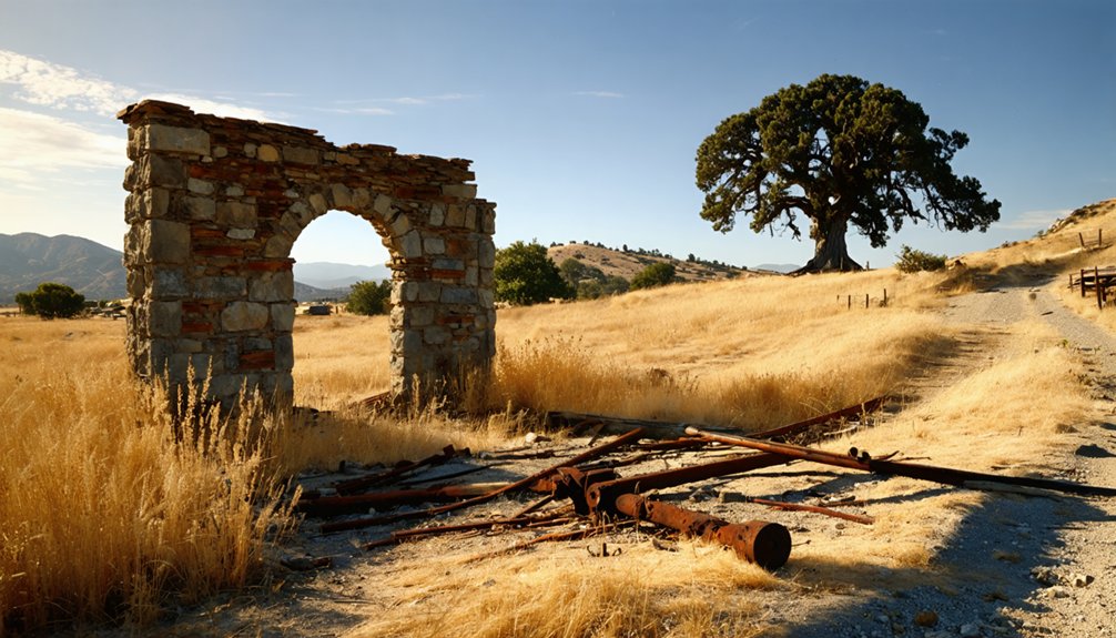
Camanche was a thriving Gold Rush town founded by Irish immigrants in 1849 along the Mokelumne River. You’ll find it had a peak population of 1,500 residents with bustling mining operations at Cat Camp, Poverty Bar, and Sand Hill. The town declined in the late 1860s as gold deposits dwindled, eventually becoming a ghost town before being submerged beneath Camanche Reservoir in the 1960s. Its story continues through artifacts preserved at the Calaveras County Historical Society Museum.
Key Takeaways
- Camanche was a Gold Rush town founded in 1849 by Irish immigrants along the Mokelumne River in Calaveras County.
- The town declined in the late 1860s as gold mining decreased, further damaged by an 1873 fire and the Great Flood of 1862.
- Camanche became a ghost town by the 1960s when remaining residents were evacuated for the Camanche Dam project.
- The entire settlement was submerged beneath Camanche Reservoir waters in the early 1960s.
- California Historical Landmark No. 254 commemorates Camanche’s history, with a plaque at South Camanche Shore Park.
The Irish Settlement That Became Camanche
Before the waters of Camanche Reservoir covered its streets, Limerick began as a modest settlement of Irish immigrants who’d journeyed westward during the California Gold Rush of the mid-19th century.
These settlers, fleeing economic hardship and land ownership restrictions under English rule, brought their Irish Heritage to this small community along the Mokelumne River.
Carrying dreams of freedom across oceans, these Irish immigrants planted their heritage in California’s fertile riverbank soil.
In 1849, pioneers from Iowa renamed the settlement Camanche, after their hometown (though ironically misspelling the Comanche tribe’s name).
Despite this change, the town’s Settlement Dynamics remained heavily influenced by its Irish Catholic roots.
Situated at about 220 feet elevation in what’s now Calaveras County, Limerick-turned-Camanche became a vibrant community where Irish families maintained their cultural traditions while building new lives in California. The town continued to exist until the early 1960s when it was emptied and submerged for the East Bay Municipal Utility District’s dam project. This historic location is one of several places named Camanche, requiring careful disambiguation for researchers studying California’s ghost towns.
Gold Rush Prosperity Along the Mokelumne
Gleaming just beneath the riverbanks and surface gravels, gold transformed the Mokelumne River region into one of California’s most prosperous mining areas following its 1848 discovery.
Charles Weber found the first gold here, though he soon departed to establish Stockton as a supply hub downstream.
At Mokelumne Hill, discharged soldiers from Stevenson’s Regiment uncovered extraordinarily rich deposits, leading to strict regulations on gold claims—just sixteen feet square per miner.
You’d have witnessed fortune-seekers from across the globe rushing to stake their claims, with some yielding up to $20,000. One lucky Frenchman even discovered a $2,150 nugget while hunting frogs!
Mining techniques evolved from simple placer operations to more complex methods, with local districts creating their own regulations allowing miners one wet and one dry claim. The Calaveras River also became a significant mining site as the Gold Rush expanded throughout the county. The town attracted a diverse population of Americans, Europeans, Chileans, Mexicans, and Chinese who all sought their fortunes in the gold-rich hills.
Daily Life in a Booming Mining Community
If you’d walked through Camanche during its heyday, you’d have encountered a rich tapestry of daily life shaped by its diverse Chinese, Irish, and other immigrant populations, each bringing their cultural traditions to the town’s businesses and social gatherings.
Your shopping options would have included general stores selling mining supplies, foodstuffs, and household goods, while entertainment might’ve meant visiting one of the saloons or attending community events after exhausting days of labor.
The miners’ routines involved backbreaking work from dawn to dusk, battling the constant challenges of water management, equipment failures, and the ever-present danger of cave-ins that characterized life in this bustling gold rush community. The town, named after a town in Iowa, became a central hub for mining operations stretching along the Mokelumne River. After the initial gold extraction, Chinese miners would often be seen methodically reworking the old tailings to recover any remaining precious metal.
Commerce and Entertainment Options
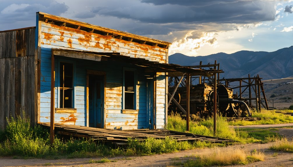
Commerce bustled through the streets of Camanche during its mining heyday, transforming what might’ve been a simple camp into a thriving commercial center.
You’d find general stores stocked with mining supplies, clothing, and necessities for daily life. Merchants happily accepted gold dust as payment alongside traditional currency. The discovery of placer deposits in 1849 fueled the rapid growth of commercial establishments throughout the district.
After a grueling day at the diggings, you could unwind at one of the town’s lively saloons, where local entertainment flourished.
Dance halls featured live music, while gambling establishments tempted your luck with faro and poker. For overnight stays, you’d have your choice of hotels or affordable boarding houses.
When hunger struck, restaurants and cookhouses served hearty meals, while bakeries offered fresh bread. The iron doors of businesses would close with a distinctive clang of locking bars each evening, marking the end of the trading day.
The town’s infrastructure included a post office, schools, and medical services—everything needed for a self-sufficient community.
Diverse Cultural Influences
Beneath the surface of Camanche’s gold-driven economy thrived a remarkable tapestry of cultures, each weaving distinct threads into the town’s social fabric.
You’d encounter the Irish influence in the town’s original name “Limerick” and their placer mining techniques. Chinese residents established a vibrant Chinatown where cultural exchange flourished until fire ravaged it in 1873.
Walking through town, you’d hear a symphony of languages—English, Gaelic, Spanish, and Chinese dialects—reflecting the multicultural population.
Mexican settlers contributed fandango halls and unique commerce styles, while Native Miwok people maintained their presence amid the newcomers.
Each group preserved their mining traditions while adopting hybrid practices born of necessity.
Despite living in separate neighborhoods, these diverse communities shared common challenges, creating a resilient frontier society with distinctive cuisine, music, and social customs. By the 1960s, the once-thriving town with peak 1,500 residents was completely submerged by the construction of Camanche Reservoir.
Mining Routine Challenges
The daily grind of mining life in Camanche stood in stark contrast to the cultural vibrancy that enriched the town’s social landscape.
You’d endure grueling labor challenges—10 to 12-hour days of backbreaking work, shoveling and operating machinery six days weekly in all weather conditions.
Environmental risks surrounded you constantly: cold river water causing hypothermia, dust destroying lungs, and mercury poisoning your body slowly.
Resource management meant endless maintenance of water systems and securing timber for operations.
Economic pressures weighed heavily as your wages depended on fluctuating gold prices and daily yield measurements.
The transition from simple placer mining to more complex hydraulic and hard-rock methods demanded new skills and increased physical demands.
Meanwhile, community infrastructure struggled to support your needs—housing shortages forced you into cramped quarters, medical care remained scarce, and sanitation systems were primitive at best.
Freedom came at a steep price.
The Church of the Immaculate Conception
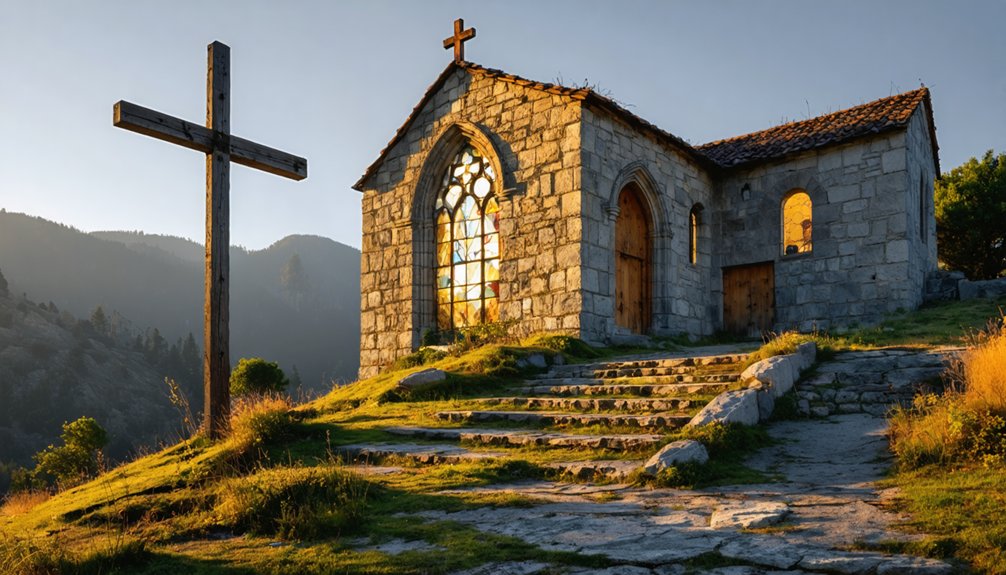
If you’d visited Camanche in 1887, you would’ve witnessed the completion of the Church of the Immaculate Conception, a wooden sanctuary that became the spiritual heart of this Gold Rush community.
Before the town’s submergence beneath Camanche Reservoir, parishioners gathered for a final service and salvaged sacred artifacts including altar pieces and religious icons.
These treasured religious items now reside in the Calaveras County Historical Society Museum, the only physical remnants of a once-vibrant Catholic community that provided stability to miners and settlers throughout the region.
Final Sacred Gathering
Standing as a spiritual beacon for the mining community, the Church of the Immaculate Conception hosted its final sacred gathering shortly before Camanche’s submersion beneath the waters of the newly created reservoir in the mid-20th century.
This final gathering significance extended beyond a mere church service—it represented the community closure of a once-thriving mining town established in 1849.
As you explore Camanche’s history, you’ll appreciate how this last congregation symbolized faith amid loss, as residents said farewell to their spiritual home built in 1887.
The solemn occasion marked the end of decades of Catholic worship that had united the diverse population of miners and their families.
Today, only a historical marker remains, preserved through efforts by the Calaveras County Historical Society, commemorating this poignant chapter in California’s Gold Rush legacy.
Rescued Religious Treasures
Prior to Camanche’s complete submersion beneath the reservoir waters in the 1960s, local historical societies and community members initiated a careful effort to document and preserve what little remained of the Church of the Immaculate Conception.
Though no photographs of the 1887 church structure have survived in historical records, the East Bay Municipal Utility District guaranteed the church’s cultural heritage wasn’t entirely lost. In 1968, they relocated and rededicated the historical marker originally placed in 1956.
The California Historical Landmark No. 254 plaque now resides at the Calaveras County Historical Society Museum in San Andreas, where it stands as proof of the community’s Catholic roots.
While no evidence suggests specific religious artifacts were rescued before flooding, the preservation of historical markers honors the spiritual legacy of the mainly Catholic immigrant population who once worshipped there.
Spiritual Community Lost
As Camanche developed into a thriving Gold Rush community in the mid-19th century, spiritual needs of its diverse population became increasingly important to the town’s social fabric.
In 1887, the Church of the Immaculate Conception was established, serving as both a religious sanctuary and community hub for the 1,500 residents seeking stability in the rough mining environment.
The church embodied the town’s spiritual heritage, providing religious rites and fostering community resilience amid the transient nature of frontier life.
However, as mines depleted and population dwindled—accelerated by the devastating 1873 fire—the congregation gradually dispersed.
The church’s physical presence ended when Camanche was submerged beneath Camanche Reservoir, but its legacy continues as California Historical Landmark No. 254, preserving the memory of a spiritual community lost to time.
Decline of a Once-Thriving Town
While Camanche began as a bustling Gold Rush settlement in the mid-1800s, its prosperity proved short-lived. At its peak, this town—originally called Limerick before settlers from Iowa renamed it—boasted around 1,500 residents, with mining operations at Cat Camp, Poverty Bar, and Sand Hill driving Camanche’s heritage and economy.
The economic shifts became evident by the late 1860s as gold deposits dwindled. Even attempts at diversification, like the Buhach insect powder manufacturing at nearby Hill Ranch, couldn’t stem the decline.
Natural disasters accelerated the town’s fate—a devastating 1873 fire destroyed the large Chinatown, while the Great Flood of 1862 had already damaged surrounding settlements.
As mining activities ceased, residents steadily abandoned Camanche, relocating to more promising areas. By the 1960s, few remained in what had become a ghost town.
The Dam Project and Forced Evacuation
You’d have felt the growing anxiety as news of the Camanche Dam project spread throughout the remaining community in the early 1960s.
EBMUD officials delivered evacuation notices to the few lingering residents, giving them limited time to gather belongings and relocate before their homes would disappear beneath the rising waters.
As the reservoir began filling in 1963-1964, families took final walks through streets where gold rush pioneers had once bustled, knowing their town would soon exist only in memory and historical records.
Imminent Waters Approaching
The idyllic existence of Camanche’s residents came to an abrupt end in 1963 when construction began on the massive Camanche Dam across the Mokelumne River.
Despite generations of flood preparedness and community resilience, you couldn’t fight this man-made disaster.
As the 171-foot earthfill dam took shape just 20 miles from East Lodi, anxiety gripped the town.
You watched helplessly as construction crews worked tirelessly, knowing each completed section brought the inevitable closer.
EBMUD officials calculated precisely how the 431,000 acre-feet reservoir would swallow your homes, businesses, and memories.
Community Uprooting Experience
As construction crews finalized the Camanche Dam project in late 1962, EBMUD officials delivered the inevitable evacuation orders that would forever alter the fate of your community.
You watched as generations of cultural heritage faced submersion beneath rising reservoir waters, with minimal compensation for your sacrifice.
The evacuation process unfolded in three distinct phases:
- Official notifications requiring residents to abandon homes and businesses
- Forced dismantling of community structures and institutions
- Permanent dispersal of families to surrounding areas
Despite officials framing the displacement as necessary for regional water security, the uprooting shattered community resilience.
Your tight-knit rural lifestyle disappeared as neighbors scattered.
While EBMUD established the Mokelumne River Hatchery to address environmental impacts, no comparable efforts addressed cultural preservation, leaving only memories of the once-thriving gold rush settlement.
Last Goodbyes
While community bonds were splintering under government pressure, 1963 marked the final chapter in Camanche’s physical existence.
You’d have witnessed EBMUD’s methodical acquisition of properties as your neighbors packed lifetimes of belongings and departed one by one. The bureaucratic machinery of mid-century dam-building allowed no room for resistance—your community heritage sacrificed for regional water infrastructure.
The evacuation proceeded without documented protests, a reflection of the era’s unchallenged authority over rural communities.
As waters rose behind the completed Camanche Dam, they erased not just buildings but the physical markers of generations. Your town’s geography exists now only in historical documentation, with California Historical Landmark No. 254 serving as the sole official acknowledgment of what was lost when progress demanded your home.
Salvaging History Before the Flood
Before Camanche vanished beneath the waters of the reservoir in the early 1960s, local residents and historical societies launched a race against time to preserve what they could of the town’s rich history.
The Catholic Church of the Immaculate Conception became a focal point for salvaging artifacts, with its final Mass held on July 29, 1962. You can still connect with these rescued items at the Calaveras County Historical Society in San Andreas.
The cultural preservation efforts prioritized:
- Religious relics including statues and the church’s pipe organ
- Documentation of the town’s mining heritage dating back to the Gold Rush
- Historical records that would become California Historical Landmark #254
Unlike earlier reservoir projects, preservation took a backseat to infrastructure needs, limiting what could be saved.
Beneath the Waters: What Remains Today
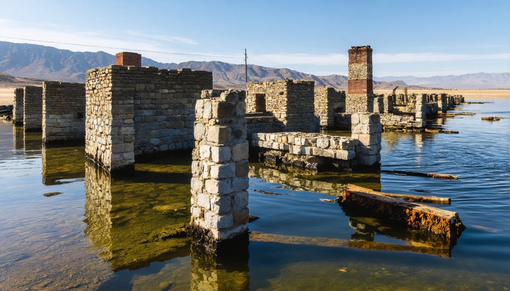
Hidden beneath the azure waters of Camanche Reservoir lies the remnants of a once-thriving Gold Rush community, submerged since 1963 when the dam’s completion flooded the valley.
When water levels drop considerably, you’ll glimpse a ghostly town emerging from its watery tomb. Original foundations, brickwork, and small concrete bridges temporarily resurface, offering rare windows into California’s pioneer past. This accidental underwater archaeology presents a preserved street grid and building footprints approximately 220 feet below normal reservoir levels.
The town’s remains include homes, a church, post office, and the site of a former Chinatown district destroyed by fire in 1873.
While historical preservation remains challenging, artifacts recovered during low-water periods continue telling Camanche’s story. Some religious relics and notable items were salvaged before flooding and now reside in local museums.
Visiting California Historical Landmark No. 254
If you’re planning to pay homage to Camanche’s historic past, California Historical Landmark No. 254 offers a tangible connection to this submerged Gold Rush settlement.
You’ll find the commemorative plaque in South Camanche Shore Park’s picnic area, mounted on hand-hewn mortise stones from the original Westmoreland suspension bridge—authentic remnants of Camanche history.
The past lives in these mortise stones—tactile connections to Camanche’s submerged legacy.
When visiting this ghost town memorial, you can:
- Enjoy panoramic views of Camanche Reservoir, beneath which lies the original town
- Read about how the settlement evolved from “Limerick” to a thriving community of 1,500 residents
- Discover fascinating ghost town stories, including the 1873 fire that destroyed Camanche’s Chinatown
The site is easily accessible via Camanche Parkway South, approximately 3 miles northwest of Burson.
Legacy and Memory in Calaveras County
Though the original Camanche settlement now lies submerged beneath reservoir waters, its legacy lives on through Calaveras County’s dedicated preservation efforts.
You’ll find organizations like the Calaveras County Historical Society working tirelessly since 1952 to collect and share stories that highlight the region’s unique Gold Rush contributions.
The Irish influence on early mining settlements remains an important narrative thread in local archives and museums.
Preservation groups collaborate with fire protection agencies to identify endangered historic properties, ensuring the economic impact of 19th-century mining towns isn’t forgotten.
When you explore the county today, you’re benefiting from Title 17 ordinances that protect landmarks while balancing growth with heritage conservation.
Through community-driven projects like the restored Altaville Schoolhouse, Calaveras County maintains tangible connections to its submerged past.
Frequently Asked Questions
What Artifacts Have Divers Found in Camanche Reservoir?
Like time travelers beneath the waves, you’ll find diver discoveries include building foundations, bridge remnants, church and post office artifacts. Underwater archaeology reveals household items and intact structures preserved since the 1962 flooding.
How Deep Is the Town Site Beneath the Water Today?
You’ll find the town site approximately 100-150 feet beneath today’s water, depending on location. Current elevation around 219-220 feet MSL creates varying depths for buried history awaiting underwater exploration.
You won’t find documented evidence of living former residents engaging in memory sharing today. No resident interviews are publicly available, as the town emptied over 60 years ago, dispersing its final inhabitants.
What Caused the 1873 Fire That Destroyed Chinatown?
The exact cause of Chinatown’s 1873 fire isn’t documented in historical records. You’ll find no conclusive fire investigation results, though wooden structures and dense building conditions likely contributed to its rapid spread.
Can Reservoir Levels Ever Drop Enough to Expose Town Ruins?
You’d think ghost town exploration would be impossible, but yes! During extreme droughts like 2011-2015, Camanche Reservoir dropped to 19.6% capacity, potentially exposing ruins. Future reservoir restoration won’t guarantee this freedom again soon.
References
- https://www.calaverashistory.org/camanche
- https://ohp.parks.ca.gov/listedresources/Detail/254
- https://www.youtube.com/watch?v=1ud-F2TR0Sk
- https://www.sfchronicle.com/bayarea/article/Reservoir-ghost-towns-offer-glimpse-of-history-6677377.php
- https://nvtami.com/2024/02/11/blind-spring-hill-partzwick/
- https://sierranevadageotourism.org/entries/camanche-no-254-california-historical-landmark/d6f1d573-1531-4bd9-8633-715bfb5ff97b
- https://en.wikipedia.org/wiki/Camanche
- https://americeltic.net/california-celts/
- https://mc2ct.org/trail-status-maps/camanchepardee-segment/calaveras-amador-history/
- https://visittrivalley.com/blog/irish-roots-in-the-tri-valley/


