You’ll find Carrigain in New Hampshire’s White Mountains, a lumber town established in 1891 by entrepreneurs who secured logging rights to the Cutts Grant region. The community thrived briefly around Fred Garman’s sawmill and the Saco Valley Railroad, with families and laborers living in homes and boarding houses. After timber resources depleted in 1898, Carrigain swiftly became a ghost town. Today, stone foundations, cellar holes, and railway artifacts hold untold stories of this industrial settlement’s rise and fall.
Key Takeaways
- Carrigain was established in 1891 as a lumber town in New Hampshire’s Mount Washington River valley, operating until its abandonment in 1898.
- The town centered around Fred Garman’s sawmill and the Saco Valley Railroad, which transported timber to broader markets.
- Economic decline occurred rapidly after logging operations ended, transforming Carrigain into a ghost town within just a few years.
- Stone foundations, cellar holes, and railway artifacts remain scattered throughout the forested landscape as evidence of the former town.
- The site is accessible via hiking trails near Livermore, though most structures are now obscured by regrown forest.
The Birth of a Lumber Town
The founding of Carrigain in 1891 marked the establishment of a purpose-built lumber town in New Hampshire’s Mount Washington River valley.
You’ll find its origins tied to three visionary entrepreneurs – Hazen L.D., Benjamin Garfield, and Charles H. Stevens – who secured logging rights to the Cutts Grant region.
What set Carrigain apart from typical lumber industry impacts of the era was its commitment to conservative logging practices, established through a unique 10-year contract.
The town’s strategic location near Livermore and the Dry River positioned it perfectly for timber operations. The bustling community soon featured Garmans mill, a railroad station, and multiple boarding houses.
Situated between Livermore and the Dry River, Carrigain’s prime location made it an ideal hub for New Hampshire’s timber industry.
With the incorporation of the Saco Valley Railroad that same year, you’ll appreciate how the founders guaranteed efficient lumber transport by connecting the sawmill to the Maine Central Railroad line.
This infrastructure proved vital for Carrigain’s rapid development. The town grew to include several hundred residents during its peak logging years.
Life in Early Carrigain
During Carrigain’s peak years, several hundred residents called this logging town home, with daily life centered around Fred Garman’s bustling sawmill and the Saco Valley Railroad operations. The town was named after Philip Carrigain, who served as New Hampshire’s Secretary of State and was known for his detailed mapping of the region.
You’d find a close-knit community where conservative logging practices helped preserve the surrounding forests – a forward-thinking approach for that era. The town’s beating heart included a company store, church, and school, where community events brought everyone together. The region benefited from an extensive network of turnpike roads that facilitated commerce and travel.
- Worker families lived in single-family homes, while transient laborers stayed at the boarding house.
- The railroad station, staffed by a full-time agent, connected you to the outside world.
- Daily life revolved around seasonal logging cycles, with workers splitting time between mill operations and forest work.
The Railroad’s Vital Role
Since its incorporation in April 1891, the Saco Valley Railroad (SVRR) transformed Carrigain from a remote wilderness into a thriving logging community.
You’d find the railroad’s significance extended far beyond timber transport – it became the town’s lifeline, spawning essential infrastructure around its tracks. The Sawyer River Station served as a crucial connection point for transporting logs to broader markets.
Like many timber barons of the era, the railroad operators wielded considerable influence over the region’s development and economy.
The SVRR’s presence spurred remarkable community development. A bustling station with a full-time agent anchored the town’s commercial heart, while homes, a company store, boarding house, school, and church sprouted nearby.
The railroad station breathed life into Carrigain, transforming it from wilderness into a vibrant community with homes, businesses, and social institutions.
You’ll appreciate how the railroad connected to the Maine Central line, opening broader markets for Carrigain’s timber.
Unlike many contemporary operations, the SVRR promoted conservative logging practices through a unique 10-year contract, demonstrating an early commitment to sustainable forest management.
Behind the Town’s Name
While the railroad brought physical development to the area, Carrigain’s identity stems from its namesake, Mount Carrigain, a prominent peak in New Hampshire’s White Mountains.
The naming significance reflects a common 19th-century practice of associating towns with geographic landmarks or influential figures. You’ll find historical context in the mountain’s own namesake, Phillip Carrigain, who served as New Hampshire’s Secretary of State from 1805 to 1810. Similar to how Nash & Sawyer Location became part of Crawford Notch, the area’s geography played a crucial role in its development. Standing at 4,700 feet elevation, Mount Carrigain dominates the landscape of the Pemigewasset Wilderness.
When you explore Carrigain’s origins, you’ll discover three key aspects:
- The town’s 1891 incorporation coincided with local logging operations.
- The name connected the settlement to the Mount Washington River valley’s rugged terrain.
- The geographic reference helped define the town’s role in forest resource management.
The Swift Economic Decline
Because Carrigain’s economy relied almost exclusively on timber extraction, the town’s fate was sealed when logging operations concluded in February 1898. The town’s economic vulnerability became immediately apparent as the railroad, which operated under a five-year lease agreement, discontinued its services once resource depletion eliminated the need for timber transport.
You’ll find that Carrigain’s swift decline stemmed from its lack of economic diversification. The town’s essential services – the company store, church, boarding houses, and school – existed solely to support the logging workforce. The town’s isolation is evident in Phillip Carrigain’s map from 1816, showing its remote location in the White Mountains.
Unlike the Boston and Maine Railroad which adapted to changing markets, Carrigain’s rail line had no alternative purpose once logging ceased.
Without alternative industries or agricultural development to sustain the population, Carrigain’s residents had no choice but to leave. Within just a few years, this once-bustling logging settlement transformed into a ghost town, leaving only foundation ruins and cellar holes as evidence of its brief existence.
What Remains Today
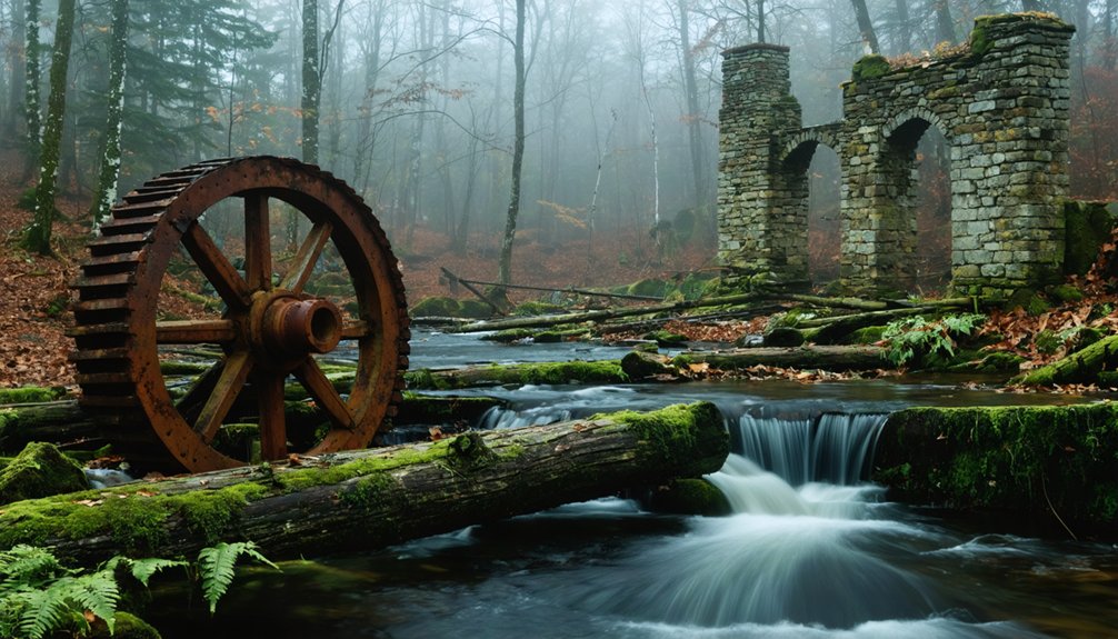
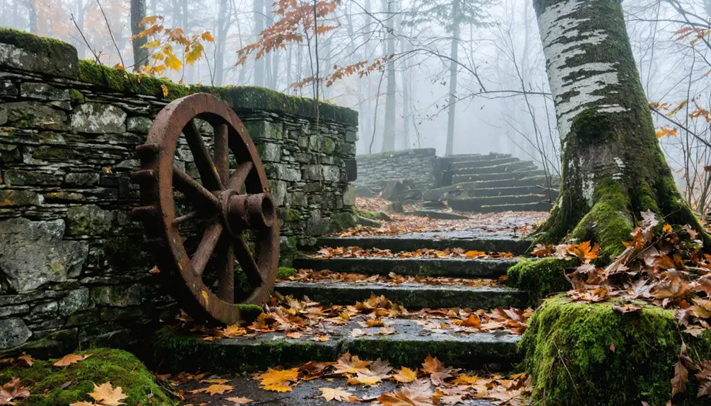
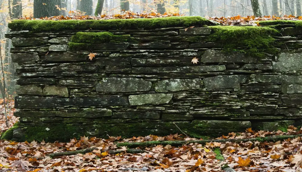
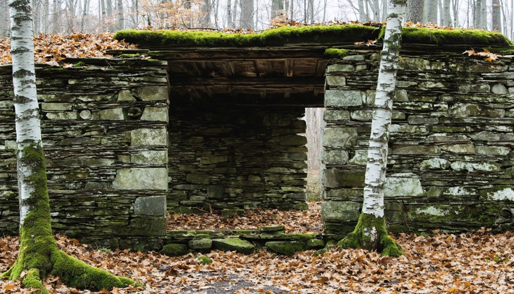
Today you’ll find a collection of stone foundations and cellar holes scattered across Carrigain’s former townsite, marking where homes, the company store, and the station house once stood.
The abandoned Saco Valley Railroad‘s path remains visible through surviving rail beds and embankments, while a piece of machinery still rests near the old sawmill’s foundation.
You can explore these historical remnants via hiking trails that wind through the naturally reclaimed landscape, though no formal markers or interpretive signs exist to guide visitors.
Physical Site Features Today
Although time has erased most visible traces of Carrigain’s once-bustling lumber community, several key features remain at this abandoned New Hampshire settlement.
You’ll find foundation remnants scattered throughout the forested landscape, including stone cellar holes from former homes and company buildings. Railway artifacts from the Saco Valley Railroad, like old track beds and occasional tie fragments, trace the paths where lumber once traveled.
- Stone foundations and rubble walls mark the original mill and residential building locations
- Railroad earthworks show where the Saco Valley line branched from the Maine Central Railroad
- Regrown forest paths follow historic roadbeds through gentle valleys once home to the town
Today, you’re free to explore these subtle remnants, though modern development and forest growth have reclaimed much of the original site.
Archaeological Discoveries
Despite decades of weathering and forest reclamation, archaeological surveys have revealed significant remnants of Carrigain’s brief industrial heyday.
You’ll find stone and wood foundations marking where mills, boarding houses, and churches once stood, offering clear evidence of the town’s original layout. The site’s archaeological significance lies in its well-preserved industrial artifacts, including machinery bases, logging equipment, and railroad infrastructure from the Saco Valley line.
Through careful excavation techniques, researchers have uncovered tools, metal fragments, and wooden crates that tell the story of 1890s lumber operations.
These discoveries match historical records and confirm how resource depletion led to the town’s abandonment. While nature continues to reclaim the site, the remaining features serve as vital evidence of New Hampshire’s industrial heritage.
The allure of abandoned sites in New Hampshire draws urban explorers and historians alike, eager to uncover the stories hidden within. Each decaying structure offers a glimpse into a bygone era, revealing the challenges faced by communities as they navigated economic shifts. Preserving these remnants allows for a deeper understanding of the region’s past and the resilience of its people.
Visitor Access Information
Located in New Hampshire’s White Mountains near Livermore, Carrigain’s remnants offer glimpses into its brief industrial past through scattered structural foundations and railway artifacts.
You’ll find the site accessible via hiking trails, though you’ll need to navigate carefully as there aren’t any visitor facilities or informational markers. The area’s partly private property requires respect for local regulations while conducting historical exploration.
- Stone walls and cellar holes mark former building locations throughout the forested landscape.
- About 7 miles of abandoned Saco Valley Railroad tracks remain traceable.
- Company store and station house foundations persist, though they’re increasingly obscured by natural growth.
The site’s primarily used for hiking and historical interest, with most ruins now blending into the surrounding forest environment.
Frequently Asked Questions
Were There Any Major Accidents or Disasters During Carrigain’s Logging Operations?
While you’ll find common logging accidents during operations, no major disasters are recorded at Carrigain. The town’s brief logging period from its founding until 1898 shows no significant disaster impact.
What Happened to Fred Garman After the Mill Closed?
You won’t find definitive records of Fred Garman’s fate or later life after the mill’s closure. Historical documents don’t track his movements, leaving his post-mill activities and eventual destination a mystery.
Did Any Families Choose to Stay in Carrigain After Its Abandonment?
Like a Netflix-style exodus, you won’t find evidence of families remaining in town after 1898. Historical records show the community dynamics completely dissolved when the mill closed and railroad service ended.
Were There Any Competing Lumber Towns Nearby During Carrigain’s Operation?
You’ll find several competing towns dotted the White Mountains during Carrigain’s 1890s heyday, including Livermore, Zealand, Johnson, and Beebe River – all vying for control of the lumber industry’s valuable timber resources.
What Was the Average Wage for Lumber Workers in Carrigain?
Money doesn’t grow on trees, and you won’t find exact wages recorded. In the lumber industry during Carrigain’s era, wage fluctuations likely ranged between $1-3 per day for typical workers.
References
- https://newenglandwithlove.com/ghost-towns-in-new-hampshire/
- https://www.whitemountainhistory.org/abandoned-towns/carragain
- https://www.cowhampshireblog.com/2007/05/19/new-hampshire-how-the-granite-state-got-its-name/
- https://www.geographicus.com/P/ctgy&Category_Code=carrigain
- https://raregoldnuggets.com/?p=4270
- https://en.wikipedia.org/wiki/Livermore
- https://www.whitemountainhistory.org/abandoned-towns
- https://www.nhhistory.org/finding_aids/finding_aids/Carrigain_Philip_Papers_1955.003.pdf
- https://www.jaffreyhistory.org/06maps/historic/1816Carrigain/1816Carrigain.php
- https://bostonraremaps.com/inventory/antique-map-carrigain-new-hampshire/