Charleston, Arizona was a silver boomtown founded in 1877 along the San Pedro River that processed ore from nearby Tombstone mines. You’ll find it reached its peak with 400 residents in the early 1880s, generating $1.4 million in silver bullion annually. The town declined after the 1887 Great Sonoran Earthquake and flooding of Tombstone’s mines. Today, its ruins rest within a protected conservation area, waiting to reveal their historical secrets.
Key Takeaways
- Charleston was a silver-mining town founded in 1877 along the San Pedro River that processed ore from nearby Tombstone.
- At its peak in the 1880s, Charleston had 400 residents with miners earning $4-$7 daily and produced $1.4 million in silver bullion.
- The town’s decline began with Tombstone mine flooding in 1886 and was accelerated by the devastating 1887 Sonoran Earthquake.
- Only stone foundations remain today of the once-thriving community and its neighboring mill town of Millville.
- The ghost town is now protected within the San Pedro Riparian National Conservation Area, accessible by a 2.5-mile hike.
The Rise of a Silver Boomtown (1879-1886)
While the discovery of silver in the Arizona Territory transformed numerous locations into bustling settlements, Charleston emerged with a distinct purpose that tied its fate inextricably to Tombstone’s mining fortunes.
You’ll find Charleston’s origin directly linked to practical necessity—the San Pedro River provided water that Tombstone lacked for processing silver ore.
By 1880, several stamp mills lined the riverbank, processing ore day and night. The economic impact was substantial, with mills producing approximately $1.4 million in silver bullion during 1881-1882 alone.
The relentless stamp mills transformed raw ore into fortune, pouring $1.4 million of gleaming silver into Arizona’s economic veins.
Founder Amos Stowe initially offered free lots to attract settlers, provided they made improvements to the property.
Workers earned respectable wages—$4 daily for miners and up to $7 for mill specialists—supporting a diverse community that reached 400 residents at its peak.
This prosperity, however, remained entirely dependent on Tombstone’s silver mining operations, a connection that would ultimately seal Charleston’s fate.
The town’s vibrant social scene centered around numerous establishments where the smallest currency in circulation was a quarter, making every purchase a significant transaction.
Life Along the San Pedro River
The San Pedro River you’d encountered in Charleston’s heyday featured extensive beaver-created wetlands that sustained the town’s ecosystem and provided critical water resources for ore processing operations.
You wouldn’t recognize this historical landscape today, as the trapped-out beaver populations and subsequent dam destruction fundamentally altered the riparian ecosystem, transforming once-lush cienegas into the more arid environment now protected within the conservation area.
Your life in Charleston depended entirely on this river system, evidenced by the numerous water rights disputes that erupted among settlers when drought conditions stressed the already modest flow that sometimes barely allowed mill operations to continue. Historical court records from the Hill vs. Herrick case of 1889 reveal these struggles were common among farmers and ranchers facing limited water availability.
Today, visitors can explore these historical sites within the San Pedro Riparian NCA, which preserves the cultural and natural heritage of the region.
Riparian Ecosystem History
Although many visitors today marvel at the lush gallery forest that lines the San Pedro River, this verdant riparian ecosystem represents a relatively recent ecological development. What you see established itself primarily after 1955, a dramatic transformation from the river’s historical appearance.
Before the 1890s, you’d have encountered a shallow-channeled river meandering through marshy, treeless grasslands—nothing like today’s towering cottonwoods.
The landscape underwent radical changes when arroyo cutting between 1890-1908 carved deep channels with steep banks, fundamentally altering the hydrology. Historical photographs clearly document this transition from barren sandbars to the vegetated corridor we see today. This ecological restructuring continued until mid-century, when riparian restoration began naturally as channel stabilization allowed trees to establish.
The ecological significance of this transformation is evident in what were once marshy floodplains now standing as elevated terraces covered with dense mesquite thickets. As the last undammed desert river in the Southwest, the San Pedro provides a crucial glimpse into how riparian systems naturally evolve.
River-Town Symbiotic Relationship
Founded in 1877 along the banks of the San Pedro River, Charleston exemplifies the symbiotic relationship between human settlements and water sources in the arid Southwest.
You’ll find that river resources dictated nearly every aspect of the town’s existence—from mining operations that used water for ore processing to agricultural activities that sustained its populace.
The river shaped community dynamics in profound ways. Residents gathered along its banks for social events and recreation, while the water corridor facilitated transportation and communication networks that connected Charleston to Tombstone and beyond.
This interdependence defined daily life as the river provided for domestic needs and powered economic enterprises. Like other settlements in the region, Charleston participated in the logging of the Huachuca Mountains for lumber to support construction and industry. Dramatic changes in the landscape occurred when seasonal flooding transformed the normally tranquil river into torrents reaching depths of up to 10 feet during monsoon season. As river conditions changed, so too did Charleston’s fortunes, ultimately contributing to its abandonment and transformation into the ghost town you can explore today.
Millville: Charleston’s Industrial Twin
Situated on the east bank of the San Pedro River, Millville emerged in 1878 as Charleston’s industrial counterpart, establishing itself as the essential milling center for Tombstone’s booming silver mines.
Richard Gird strategically selected this location where water power could drive the massive stamp mills necessary for processing silver ore.
While Charleston housed families and businesses, Millville focused exclusively on industrial operations. Its transient workforce operated the 10-stamp Gird Mill and 15-stamp Corbin Mill, processing ore from mines like Toughnut and Lucky Cuss. Unlike its rowdier neighbor Charleston, Millville maintained strict order under Gird’s supervision, with alcohol strictly prohibited. Modern visitors can still view the stone building ruins that remain at the site after a 2.5-mile trek from the main road.
These Millville mills produced over $1.3 million in bullion during 1881-1882 alone. Despite this productivity, Millville’s existence was brief.
When Tombstone mines flooded in 1886, operations ceased, leaving only stone foundations that you can still explore today.
The Great Sonoran Earthquake of 1887
When you visit Charleston today, you’ll find little evidence of the catastrophic Sonoran Earthquake that struck the region on May 3, 1887, but this powerful 7.5 magnitude temblor devastated communities on both sides of the Arizona-Mexico border, including significant damage to Charleston’s remaining structures.
The earthquake’s epicenter in Mexico’s Batepito Valley created a massive 62-mile surface rupture with vertical displacements reaching 16 feet, triggering landslides, fires, and widespread destruction throughout southeastern Arizona and northern Sonora.
Scientists still study this seismic event as the largest historical earthquake in the Basin and Range Province, with its remarkably long recurrence interval of approximately 100,000 years making it an essential case study for understanding regional fault systems and seismic hazards.
Earthquake’s Devastating Impact
The Great Sonoran Earthquake of 1887 delivered a catastrophic blow to Charleston, Arizona, forever altering both its physical landscape and historical trajectory. This event exposed the settlement’s seismic vulnerability as buildings cracked, walls shifted, and infrastructure crumbled along the San Pedro River.
Though miraculously no injuries were reported, residents abandoned their homes for weeks, sleeping outdoors amid persistent fear.
Charleston’s experience highlights three critical impacts:
- Dramatic surface deformation created fault scarps up to 15 feet high with maximum displacement reaching 16 feet.
- Secondary hazards included rockfalls, brush fires, and dramatic changes to water conditions.
- Permanent psychological trauma lingered in historical memory, contributing to the town’s eventual abandonment.
This devastating event represents the most destructive earthquake in Arizona’s recorded history, accelerating Charleston’s shift from thriving settlement to ghost town.
Cross-Border Destruction Zone
While Charleston experienced localized devastation, the 1887 Great Sonoran Earthquake‘s true scale emerges only through examination of its cross-border destruction zone.
You’d find evidence of seismic impacts spanning both nations, with destruction radiating outward from the Batepito Valley epicenter. The earthquake’s massive energy release destroyed every building on John Slaughter’s ranch east of Douglas and left Bavispe, Sonora with 42 fatalities.
Despite reaching Modified Mercalli intensity X near the epicenter, total casualties remained surprisingly low at 51 due to sparse population.
The cross-border destruction manifested uniquely in each locale: Arizona saw shifted railroad embankments, altered water tables, and panicked prison evacuations, while Mexico experienced deadlier structural collapses.
Rockfalls ignited brushfires visible from Bisbee to Sierra Nacozari, visually marking the earthquake’s transnational reach.
Geological Significance Today
Despite occurring more than a century ago, the Great Sonoran Earthquake of 1887 continues to provide modern geologists with exceptional insights into normal fault mechanics and crustal extension processes.
The 100-kilometer rupture zone, with vertical displacements of up to 5 meters, represents the largest historical normal-faulting event in the Basin and Range Province.
When you visit Charleston today, you’ll encounter landscape features that highlight why ongoing geological monitoring remains essential:
- Fault scarps remain visible, serving as field laboratories for seismic hazards assessment
- Hydrological changes from the quake still influence regional water resources
- Long recurrence intervals (10,000-100,000 years) suggest similar faults may pose unrecognized risks
This benchmark event fundamentally shapes our understanding of potential earthquake impacts across the southwestern United States.
Ghosts and Remnants: What Time Left Behind
Standing amid the arid landscape of southeastern Arizona, Charleston’s ghostly remnants tell a poignant story of frontier ambition and inevitable decline.
The history of Piedmont ghost town reveals a similar narrative of dreams turned dusty, where hopes of prosperity faded alongside the empty buildings. As settlers moved in search of opportunity, they left behind echoes of their ambitions, now whispered by the winds that sweep through the ruins. Exploring these remnants offers a glimpse into a bygone era, rich with tales of resilience and loss.
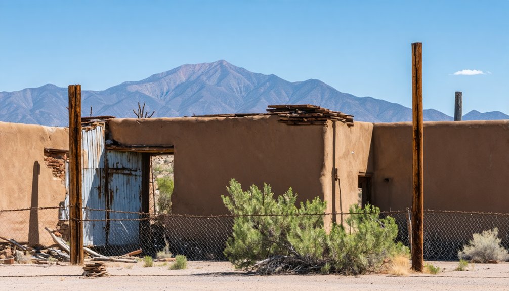
You’ll find little beyond foundational stones and scattered rubble where a boisterous boomtown once served Tombstone’s silver industry. The pioneer cemetery, lying 1.5 miles north, offers the most tangible connection to former inhabitants, its weathered markers reflecting Apache spiritual beliefs about mortality and divine retribution.
Archaeological findings reveal glimpses of daily life through mill equipment fragments and domestic artifacts, though most have vanished through scavenging, military exercises, and the San Pedro River‘s persistent erosion.
This same river that once powered Charleston’s mills now simultaneously preserves and destroys its memory.
Today, the site rests within protected conservation land, where ghostly legends persist alongside physical remnants slowly returning to the desert.
Military Training Ground: The “Little Tunisia” Years
The abandoned streets of Charleston found unexpected new purpose during World War II, when the ghost town transformed into a critical military training ground nicknamed “Little Tunisia.”
After decades of silence following its mining heyday, Charleston’s arid landscape and geographic features caught the attention of U.S. military strategists preparing troops for North African campaigns.
If you’d visited during this period, you’d have witnessed:
- Live-fire desert warfare exercises replicating combat conditions soldiers would face in Tunisia
- Temporary military infrastructure including barracks, training ranges, and command posts
- Troops practicing survival techniques, tactical maneuvers, and interoperability drills in the harsh environment
The military exercises conducted here directly influenced U.S. combat readiness in North Africa, with Charleston’s legacy continuing to shape American military training doctrine for arid environments long after the war ended.
Finding Charleston Today: Visitor’s Guide
How can travelers access this vanished piece of Arizona’s frontier past? Charleston’s accessibility requires deliberate effort—no paved roads lead directly to this freedom-filled relic.
Finding Charleston demands intention—its whispered history lies beyond pavement, rewarding only the determined seeker.
You’ll need to park at the Fairbank Historic Townsite and commence on a 2.5-mile hike along the San Pedro River. The journey cuts through cottonwood groves and desert brush, demanding sturdy footwear and long pants.
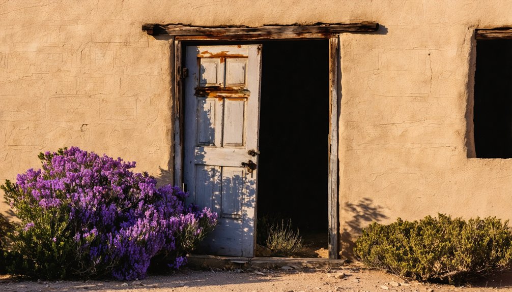
What remains are sparse historical artifacts: crumbling adobe walls, scattered bricks, and foundation stones slowly surrendering to nature. The tavern ruins, with their rumored smuggler tunnels, offer the most distinctive remnant.
Visit in the morning for cooler temperatures and better photography conditions. Bring water and sun protection—no facilities exist at this raw, uncommercialized site where solitude enhances the atmospheric decay of this once-notorious boomtown.
Preservation Efforts and Environmental Challenges
While visitors encounter Charleston’s crumbling remains along the San Pedro River trail, behind the scenes an ongoing battle against time and nature unfolds. The Bureau of Land Management implements preservation techniques within the San Pedro Riparian National Conservation Area, working alongside community organizations like Friends of the San Pedro River to document and protect this pioneer settlement.
- Environmental monitoring reveals accelerating challenges: adobe structures crumbling under seasonal rains, mesquite overgrowth concealing ruins, and river erosion washing away archaeological resources.
- Conservation strategies balance public access with habitat protection through educational outreach and limited-impact visitation policies.
- Limited funding and remote location complicate regular maintenance efforts, leaving the site vulnerable to natural succession processes.
These preservation challenges represent the delicate balance between allowing nature to reclaim human settlement and maintaining our connection to frontier history.
Frequently Asked Questions
Were There Any Famous Gunfights or Notable Outlaws in Charleston?
While famous outlaws like John Ringo and Ike Clanton frequented Charleston, no single definitive gunfight occurred there, though the town’s violent gunfight history featured regular shootings during the Earp-Cowboy feud.
What Was the Peak Population of Charleston During Its Boom Years?
Like shadows of peak prosperity now visible only in ghostly sightings, Charleston reached 400-500 residents during the early 1880s. Census data confirms approximately 350 people in 1880, with estimates suggesting higher numbers.
Are There Any Haunting Legends Associated With Charleston Today?
Yes, you’ll find Charleston’s ruins steeped in local folklore about Apache curses. After the 1887 earthquake, ghostly sightings have been reported, with disembodied voices echoing through the abandoned cemetery and tavern ruins.
What Items Have Archaeologists Recovered From the Charleston Site?
Artifact analysis has revealed stone foundations, adobe wall remnants, water-control structures, privy contents, and cemetery evidence. You’ll appreciate the historical significance of these items reflecting Charleston’s 19th-century frontier existence.
How Did Charleston Compare to Tombstone in Terms of Lawlessness?
You’d think famous Tombstone had the wildest West, but Charleston’s lawlessness was proportionally more intense—featuring corrupt lawmen pocketing fines, round-the-clock saloons, and frequent daylight killings visible throughout the smaller settlement.
References
- https://www.wyattearpexplorers.com/-charleston–millville-at.html
- https://www.arizonan.com/ghost-towns/charleston/
- https://en.wikipedia.org/wiki/Charleston
- https://www.youtube.com/watch?v=l_ogVgvyw7Y
- https://westernmininghistory.com/towns/arizona/charleston/
- https://southernarizonaguide.com/a-hike-to-the-ghost-town-of-charleston-arizona-territory/
- https://www.airial.travel/attractions/united-states/whetstone/charleston-ghost-town-ruins-35a1WFK0
- https://www.van-tramp.com/wp/charleston-az-ghost-town/
- https://www.youtube.com/watch?v=uHIgtb2SqIA
- https://www.destination4x4.com/charleston-arizona-cochise-couty-ghost-town/


