You’ll discover Cherry among Arizona’s best-preserved ghost towns, nestled in the Mingus Mountains 45 miles from Phoenix. This former boomtown flourished from 1860s gold, silver, and copper discoveries before gradually declining, with its post office closing in 1943 and final mine shuttering in 1982. Original wooden structures, including the jail and mercantile building, stand alongside remains of 40+ mines. Access requires traversing unpaved Forest Service Road 372, where history awaits around every corner.
Key Takeaways
- Cherry was a mining boomtown in Arizona’s Mingus Mountains that transitioned to a ghost town after gold and silver mines played out.
- The town reached a population of 400 before declining, with the post office closing in 1943 and the final gold mine shutting in 1982.
- Several original wooden structures from the late 1800s remain standing, including the post office, mining buildings, and town jail.
- Located 45 miles northwest of Phoenix, Cherry is accessible via 8 miles of unpaved Forest Service Road 372 requiring high-clearance vehicles.
- The site features approximately 65 documented cemetery memorials and foundations from over 40 historical mines that reveal the area’s mining heritage.
The Mining Boom Years (1863-1879)
As gold fever spread across the American West in the mid-19th century, Arizona Territory emerged as a promising frontier for ambitious prospectors.
The 1863 discoveries by Weaver, Peebles, and Swilling at Rich Hill, along with Henry Wickenburg’s fortunate vulture encounter, triggered the region’s first mining rush.
Prospecting challenges didn’t deter determined miners who employed various mining techniques from simple placer methods to more organized operations. The richness of these lands continued to draw prospectors despite the inherent dangers, particularly from hostile Native American tribes. The discovery of valuable gold, silver, and copper in the Mingus Mountains eventually led to Cherry’s establishment as a mining community.
Reaching Cherry: Travel Tips and Road Conditions
While the mining boom brought prospectors flocking to Arizona Territory in the 1860s and 1870s, today’s visitors seeking Cherry’s ghost town remnants face different challenges.
You’ll need to navigate Forest Service Road 372 from Exit 278, traversing 8 miles of unpaved terrain that demands careful vehicle preparation.
High-clearance or four-wheel-drive vehicles are essential for road safety on these rugged routes. Cherry sits approximately 45 miles northwest of Phoenix and 16-20 miles southeast of Prescott, accessible via SR 89A connections. Like its namesake fruit that requires specific chilling hours to thrive, the town’s climate varies dramatically with elevation.
When planning your journey, consider seasonal conditions—winter brings snow at 5,000 feet elevation, while summer monsoons can cause flash flooding. The town’s name shares nothing with actual cherry cultivation, as these fruit trees need 3-4 years to produce their first crop and wouldn’t thrive in Arizona’s harsh climate.
Prepare thoroughly: carry emergency supplies, use offline maps where cell service fails, and inform others of your plans.
The freedom of exploring this remote ghost town requires respecting the wilderness that has reclaimed it.
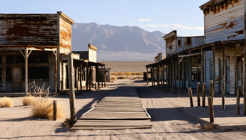
Historic Buildings and Structures Still Standing
Unlike many ghost towns that have completely vanished, Cherry offers visitors a rare opportunity to see several original wooden buildings that still stand among the ponderosa pines.
You’ll find some of these historic structures now serve as full-time or seasonal residences, creating an unusual blend of mining-era architecture and modern habitation. The town’s current semi-abandoned status places it among several Arizona ghost towns that maintain partial occupancy while preserving their historical character.
While commercial establishments like saloons and hotels have disappeared, you can explore foundational remains from the town’s mining operations, including traces of the over 40 mines that once fueled Cherry’s economy.
The scenic dirt road leading to this hidden gem requires visitors to navigate many switchbacks during the 14-mile journey, but the historical experience is well worth the effort.
Original Buildings Preserved
Despite the passage of time since Cherry’s mining heyday, several original wooden structures from the late 1800s and early 1900s remain standing throughout the former boomtown.
These weathered buildings, constructed primarily of local timber, face ongoing restoration challenges due to Arizona’s harsh climate and decades of exposure.
- The historic Cherry post office (1884-1943) stands as a symbol of the town’s official recognition.
- Original mining structures including assay offices and warehouses remain in their authentic locations.
- The town jail, built with more durable cement walls and steel door, exemplifies evolving building materials.
- The old mercantile building, site of a notorious 1920s double murder, maintains its cultural significance.
- Several original residences now serve as vacation or retirement homes, ensuring continued preservation.
The mercantile has a particularly dark history with four murders occurring there during the 1920s, adding to its haunting allure for ghost town enthusiasts. Similar to how iHeartRadio faces access restrictions based on geographic location, Cherry’s historic sites have visitation limitations to protect their fragile structures.
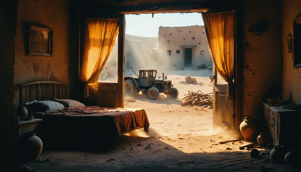
Adapted Historic Structures
Although mining operations eventually ceased in Cherry, many of its historic structures remain standing today, repurposed to serve the needs of the small community that persists.
You’ll find original miners’ homes now functioning as private residences or vacation retreats, their historic exteriors preserved while interiors boast modern amenities—a demonstration of successful adaptive reuse practices.
The former firehouse occasionally hosts community events, while water towers and outbuildings have been converted to storage spaces and workshops.
Though no longer in use, the original schoolhouse stands as a landmark, embodying the town’s commitment to historic preservation despite its tiny population of about 75 full-time residents.
These structures form a living museum where contemporary needs blend seamlessly with historical significance, allowing visitors to experience authentic mining-era architecture without the sterility of conventional preservation approaches.
A notable addition to Cherry’s preserved structures is a bed-and-breakfast that welcomes visitors looking to experience the town’s historical mining context.
Mining Remnants Visible
When you explore Cherry’s landscape today, you’ll encounter a rich tapestry of mining remnants that tell the story of its industrial past. The Federal, Bunker, Sunnybrook, Logan, and Gold Bullion mines defined this district, showcasing various mining techniques from the late 19th century through the 1930s.
Several original structures stand as monuments to Cherry’s industrial heritage:
- Machinery related to tungsten and uranium extraction at the Hillside mine
- Foundations from the Howell site’s two-stack smelter and quartz mill
- The post office building (operational 1884-1943)
- Boarding houses and saloons that served the 400-person community
- Mining shafts and ore-processing equipment revealing extraction methods
These archaeological treasures offer insights into the technological evolution, economic conditions, and community organization that characterized Arizona’s mining towns during their operational heyday. Similar to Castle Dome Museum which contains 50 restored buildings, Cherry’s preserved structures serve as an outdoor museum of Arizona’s mining history.
The Cherry Cemetery: Stories Etched in Stone
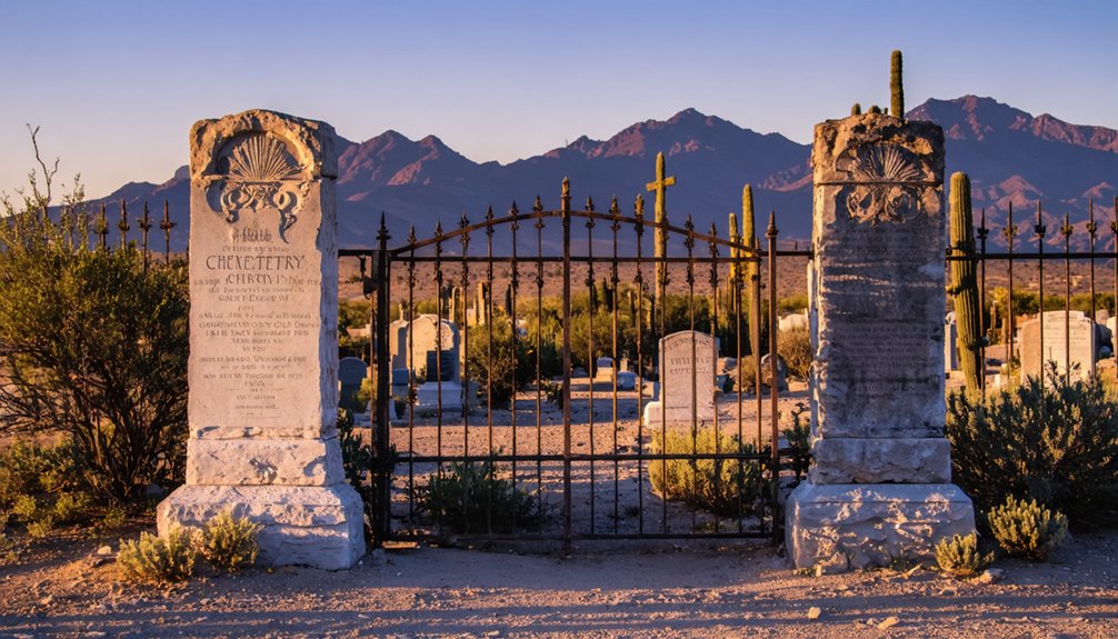
When you visit the Cherry Cemetery, you’ll find weathered pioneer grave markers ranging from simple local stone and improvised wooden crosses to more elaborate stones bearing names, dates, and occasional epitaphs.
The cemetery’s remote location in the Mingus Mountains has naturally protected many original markers from vandalism, though time and elements have rendered some inscriptions illegible.
Recent preservation efforts have included restoring certain grave markers to maintain the cemetery’s historical record, ensuring that these physical reminders of Cherry’s mining community aren’t lost to future generations.
Pioneer Grave Markers
Perched on a gentle slope overlooking what was once the heart of Cherry, the modest cemetery serves as a poignant archive of the community’s history.
The weathered markers reveal burial patterns typical of frontier mining communities, with family groupings indicating strong kinship bonds despite harsh conditions.
You’ll find grave symbolism expressed through locally sourced materials—wooden crosses and simple stone markers reflecting both economic constraints and cultural traditions of remembrance.
- Markers exhibit varying legibility, from clear inscriptions to faded initials
- High frequency of infant and child burials reflects frontier-era healthcare challenges
- Mining accident victims and disease outbreak casualties document community hardships
- Handwritten additions on some markers show efforts to preserve fading memories
- Approximately 65 documented memorials provide demographic insights into Cherry’s social makeup
Cemetery Preservation Efforts
Despite the relentless forces of nature and human neglect, the Cherry Cemetery has become the focus of dedicated preservation initiatives since the late 1990s.
You’ll find descendants and historical societies organizing regular cleanup events to combat vegetation encroachment and repair damaged markers—direct responses to the preservation challenges posed by Arizona’s harsh climate and the site’s remote location.
Documentation efforts have proven essential, with volunteers meticulously recording inscriptions and mapping burial plots before weathering renders them illegible.
Community involvement remains the cornerstone of these preservation activities, with families sharing oral histories that complement physical restoration work.
While funding limitations restrict large-scale preservation, the collective determination to maintain this tangible link to Cherry’s past guarantees the cemetery continues as a silent witness to the town’s pioneer heritage.
Life in a Mountain Mining Community
Life in Cherry, Arizona centered around a delicate balance of opportunity and hardship as the small mountain mining community flourished in the late 19th and early 20th centuries.
At 5,000 feet elevation among ponderosa pines, you’d experience tight community dynamics shaped by mining culture. The rhythm of work at small operations like Federal and Cherry King mines dictated daily schedules.
- Physical demands of ore extraction dominated working hours
- Social activities revolved around family and workforce relationships
- Limited infrastructure and transportation restricted economic growth
- Community institutions rose and fell with mining prosperity
- Population diversity remained narrow, primarily miners and their families
As copper production declined, some residents shifted to ranching while others departed.
The community’s adaptation to mountain climate, seasonal challenges, and isolation revealed a resilient population determined to carve out existence despite dwindling economic prospects.
Cherry’s Transition From Boomtown to Ghost Town
Once a bustling center of mineral extraction and frontier commerce, Cherry, Arizona gradually transformed from a thriving boomtown into the quiet ghost town you’d recognize today.
The decline began in the late 1870s when the mines that formed Cherry’s economic dependencies started to play out. Though the population held at roughly 400 residents until 1929, the community’s importance steadily diminished.
Cherry clung to population numbers even as its economic heartbeat slowed to a whisper in the decades following 1870.
The 1943 discontinuation of the post office marked an official recognition of Cherry’s fading significance.
After the last gold mine closed in 1982, the town completed its metamorphosis from mining hub to historical enclave. Now home to approximately 75 year-round residents, Cherry preserves its cultural heritage through original structures and a historic cemetery—tangible connections to the boom-and-bust cycle that defined Arizona’s territorial mining communities.
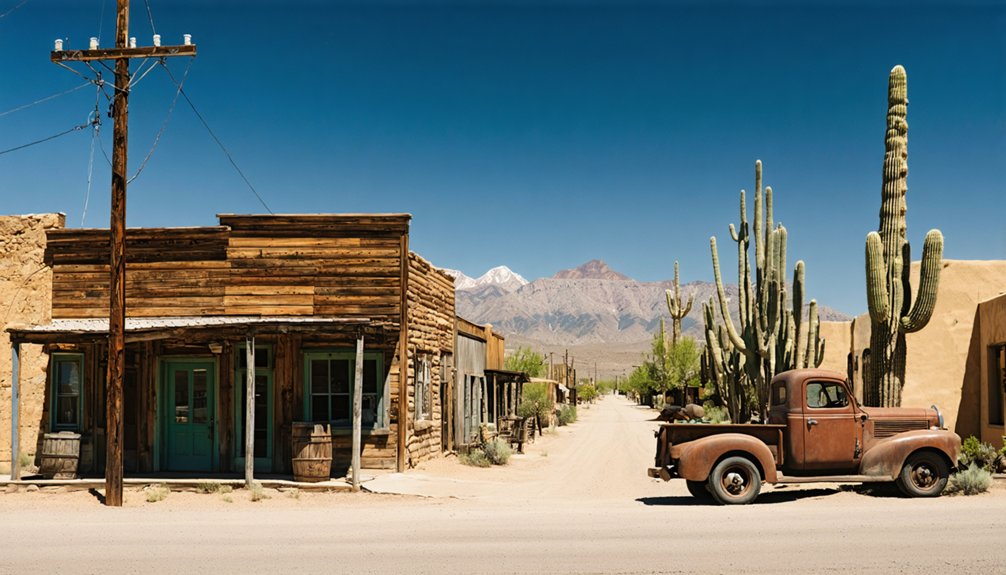
Photography Opportunities in an Authentic Arizona Ghost Town
When photographers venture into Cherry, Arizona, they discover a visual time capsule that offers unparalleled opportunities for authentic ghost town photography. The preserved wooden storefronts, weathered homes, and rusting mining equipment create compelling narratives of the past through your lens.
Historical storytelling thrives in the interplay between crumbling structures and the encroaching wilderness.
- Morning fog and afternoon golden hour create dramatic lighting across textured surfaces
- Undisturbed cemetery scenes offer poignant symbolism for temporal compositions
- Ponderosa pines and juniper trees frame architectural elements in natural contrast
- Clear night skies allow for remarkable astrophotography with ghost town silhouettes
- Elevated vantage points provide panoramic views connecting the town to its mountain setting
The absence of crowds and modern intrusions enables contemplative photography sessions where you’ll capture authentic decay without the disruption of contemporary elements.
Nearby Attractions and Day Trip Planning
Cherry’s photographic allure extends beyond its weathered buildings and historic artifacts to encompass a wider exploration of Arizona’s mining heritage and natural wonders.
When planning your visit, consider incorporating nearby attractions into extensive ghost town tours that highlight the region’s historical significance. From Cherry, you can venture to Jerome in Verde Valley for copper mining history and haunted experiences, or explore Bisbee’s labor dispute legacy.
The surrounding Mingus Mountains offer hiking trails through ponderosa pines, while the Arizona Trail provides mountain biking opportunities with expansive desert views.
For a complete day trip from Phoenix, combine Cherry with Tortilla Flat and Canyon Lake. Alternatively, create a Route 66 loop including Oatman and Goldfield. Evening ghost tours at these locations deliver immersive historical encounters beneath Arizona’s star-filled skies.
Frequently Asked Questions
Is Cherry, Arizona Privately Owned or Can Visitors Freely Explore?
Cherry is primarily privately owned with residences. You can’t freely explore most buildings, but you’ll find some areas accessible to visitors, including the cemetery and visible structures from public paths.
Are There Any Paranormal Reports or Ghost Sightings in Cherry?
Unlike 75% of Arizona ghost towns, Cherry lacks documented ghost stories or haunted locations in public records. You’ll find no mainstream paranormal reports when exploring this quiet former mining community’s historical remains.
What Wildlife Encounters Are Common Around Cherry?
While exploring nature trails around Cherry, you’ll likely encounter white-tailed deer, black bear, and coyotes. Riparian zones offer chances for wildlife photography of native fish species and numerous bird varieties, including migratory raptors.
Do Any Descendants of Original Miners Still Live in Cherry?
Like scattered desert seeds without soil, family ties have faded. You won’t find documented historical lineage connecting current residents to original miners—Cherry’s retirement community consists mainly of newcomers seeking freedom from urban confines.
Can Metal Detecting or Artifact Collecting Be Done in Cherry?
You shouldn’t metal detect in Cherry without explicit permission. Metal detecting regulations restrict collection on private property, and artifact preservation concerns make removal from this semi-populated area both legally problematic and ethically questionable.
References
- https://www.arizonan.com/ghost-towns/cherry/
- https://en.wikipedia.org/wiki/Cherry
- https://azgw.org/yavapai/ghosttowns.html
- https://www.ghosttowns.com/states/az/cherry.html
- https://kids.kiddle.co/List_of_ghost_towns_in_Arizona
- https://www.azghosttowns.com/towns/cherry.html
- https://www.legendsofamerica.com/az-lostmines/
- https://digitalrepository.unm.edu/cgi/viewcontent.cgi?article=2351&context=nmhr
- https://www.oakrocks.net/blog/the-history-of-mining-in-arizona/
- https://www.azcentral.com/story/travel/arizona/road-trips/2018/09/10/arizona-mining-history-wild-west/953080002/


