Coso is an abandoned mining settlement in California’s Coso Range that boomed briefly after silver discoveries in the 1870s. You’ll find crumbling ruins and hollow building shells scattered across a harsh volcanic landscape that requires high-clearance 4×4 vehicles to access. The town’s population once reached 1,000 residents before declining after an 1878 smallpox epidemic. The site presents serious exploration hazards including unstable structures and contamination. These weathered remnants hold untold stories of California’s challenging mining frontier.
Key Takeaways
- Coso ghost town emerged from an 1870s mining district but never matched Comstock Lode’s success despite reaching 1,000 residents by 1874.
- Located near Death Valley National Park, Coso requires 4×4 vehicles and navigational expertise to access its remote ruins.
- A smallpox epidemic in 1878 triggered Coso’s decline, causing population collapse and abandonment of mining operations.
- Visitors will find crumbling structures, contaminated areas, and unstable ruins with no facilities or safety measures.
- The ghost town produced gold, silver, and mercury, contributing to California’s mining history despite isolation and technological limitations.
The Silver Rush That Birthed a Boomtown
While the California Gold Rush of 1849 dominates popular historical narratives, the lesser-known silver discoveries in the Coso Range around 1870 catalyzed their own significant mineral boom.
If you’d ventured to this remote corner of Inyo County in the 1870s, you’d have witnessed the rapid transformation of barren landscape into a hub of silver mining activity.
The establishment of the New Coso Mining District in 1874 formalized what began as scattered prospecting efforts. Unlike the massive Comstock Lode operations in neighboring Nevada, Coso’s development remained relatively modest but still significant enough to generate boomtown culture typical of western mining frontiers. Similar to Virginia City, miners in Coso faced dangerous working conditions that included high temperatures and flooding risks. The area experienced a massive surge when 500 miners arrived by June 1860, following the promising ore discoveries in the region.
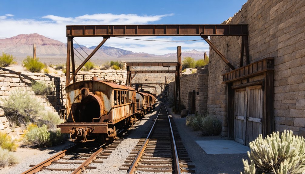
The economic ripple effects extended beyond ore extraction, creating supply chains, transportation networks, and settlement patterns that would shape this region’s development for decades to come.
Journey to the Eastern Edge of the Coso Range
You’ll need a high-clearance 4×4 vehicle to navigate the unmarked desert roads that lead to Coso’s remains at the eastern edge of the range.
The journey requires careful navigation using topographical maps and GPS coordinates, as shifting sands and washouts regularly alter the few established routes.
Summer temperatures exceeding 110°F and winter storms can quickly transform passable terrain into impassable hazards, necessitating thorough preparation and contingency planning. The region’s cross-country travel challenges hikers due to the Coso Range’s lack of established trails. The area sits within a distributed deformation zone between the Pacific plate and stable North America, explaining its complex terrain features.
Desert Roads Challenge
Journeying to the eastern edge of the Coso Range demands exceptional preparation and navigational skills due to its formidable accessibility challenges.
You’ll need a high-clearance, four-wheel-drive vehicle to tackle the few dirt roads that exist in this remote wilderness.
Your desert navigation abilities will be thoroughly tested, as no designated trails exist. Instead, you’ll navigate cross-country through volcanic formations and washes using topographical maps and GPS.
The terrain alternates between loose, sandy sections prone to soil deflation and rocky passages that challenge even experienced drivers.
Located four hours from Bakersfield, you’ll find yourself truly alone amid creosote bushes and Joshua trees. This area lies just north of Death Valley National Park, which spans over 5,270 square miles as the largest national park in the contiguous United States.
Pack abundant water and emergency supplies—this freedom comes with responsibility, as help remains distant and the unforgiving landscape offers no second chances.
Planning ahead is essential when visiting this wilderness area, as proper preparation directly impacts both your safety and enjoyment of the experience.
Maneuvering the eastern edge of the Coso Range requires expert geological reading skills as you traverse a complex landscape shaped by half a million years of volcanic activity. Rhyolite domes and steep volcanic ridges create navigational challenges that demand your full attention.
Your most reliable navigational tools include topographic maps and a compass—electronic devices often fail amid the jagged peaks and deep canyons. Watch for terrain hazards like unstable volcanic substrate and sudden elevation changes up to 8,166 feet at Coso Peak.
The old tracks through Joshua Flat provide limited access, but you’ll often need to rely on natural washes as pathways.
Plan meticulously for water scarcity and extreme temperature fluctuations. The volcanic terrain offers freedom rarely found elsewhere, but demands respect and preparation to navigate successfully.
Daily Life in a 19th Century Mining Community
Daily life in 19th century mining communities like Coso revolved around three harsh realities: grueling labor conditions, primitive living arrangements, and limited social diversions.
You’d toil ten to twelve hours daily in dangerous mines, risking your life for uncertain rewards amid toxic metals and unstable shafts. Miner’s camaraderie emerged from shared daily hardships, creating bonds forged in the crucible of survival. After the Gold Rush, many continued as placer miners, working small claims with diminishing returns.
After exhausting shifts, you’d return to overcrowded accommodations—perhaps a modest cabin if established, or a tent if newly arrived. Most miners lived in basic wooden shacks with stone fireplaces for cooking meals and providing warmth during cold nights.
Social life centered around barbershops, saloons, and gambling tables where monte games could claim your hard-earned wealth. During economic downturns, destitution loomed, forcing difficult choices.
Meanwhile, your presence contributed to the displacement of Native Americans whose traditional lifestyles succumbed to the mining industry’s environmental devastation.
The Rise and Fall of Coso’s Population
The population dynamics of Coso mirror the boom-and-bust cycle common to mining settlements throughout the American West. Following the 1860 silver discovery, demographic shifts occurred rapidly as Coso transformed from barren landscape to bustling hub with potentially 1,000 residents by 1874.
You can visualize the town’s evolution through:
- Hundreds of miners frantically staking 90 claims within months of discovery
- A commercial center emerging with multiple businesses and saloons
- Stone houses and weathered buildings gradually surrendering to the desert
The area experienced a devastating smallpox epidemic in 1878 that contributed significantly to the population decline and eventual abandonment of many mining operations.
The surrounding landscape features dense pinyon pine forests that provided natural resources for the mining community during its brief period of prosperity.
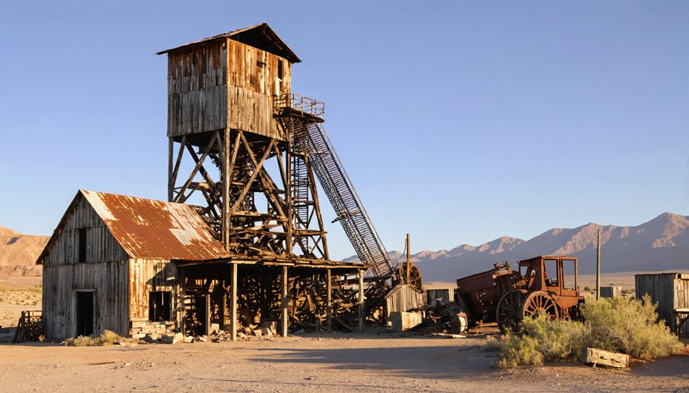
Mining Operations and Economic Impact
When Dr. E. Darwin French discovered gold and silver deposits in the Coso Range around 1860, he sparked a brief period of mining prosperity. The mining techniques employed were primitive—companies like New Coso Mining Company operated without horsepower, relying on manual windlasses and failing to roast ore properly before processing.
Economic fluctuations defined Coso’s mining history. Despite the establishment of the Coso Mining District in 1874, financial troubles consistently plagued operations. The region’s isolation imposed exorbitant transportation costs and limited access to advanced equipment.
The Coso quicksilver district produced 231 flasks of mercury between 1935-1939, while the nearby Cargo Muchacho Mine yielded over 25,700 ounces of gold valued at $852,000. These sporadic successes never recaptured the initial 1860s fever, as companies faced frequent shutdowns due to logistical and financial challenges.
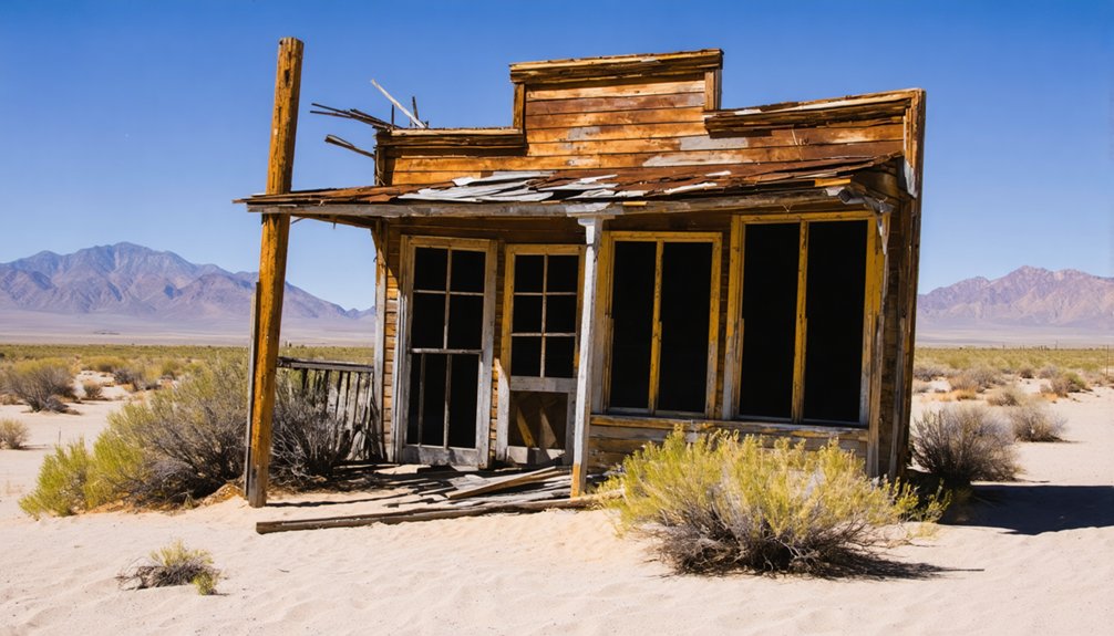
What Remains: Exploring the Ghost Town Today
Crumbling ruins scattered across the landscape are all that remain of Coso today, a stark reminder of California’s ephemeral mining history.
You’ll find architectural remnants consisting mostly of hollow building shells with collapsed walls and deteriorated basements. Visitor safety is compromised by toxic contamination, rusted railings, and removed caution tape.
- Empty building frameworks partially reclaimed by tumbleweeds and desert vegetation
- Dangerous underground sections accessible through decayed infrastructure
- Bullet casings, mining remnants, and debris scattered throughout unpaved streets
When exploring, you’re on your own—no facilities, security, or amenities exist.
The absence of preservation efforts means you’ll witness raw decay rather than curated history. The ghost town offers unrestricted access but demands caution as you navigate its hazardous, contaminated terrain.
The Legacy of Coso in California’s Mining History
Discovered in 1860 by Dr. E. Darwin French, Coso represents California’s boom-and-bust mining legacy. The formation of the New Coso Mining District in 1874 marked the region’s recognition for gold, silver, and lead deposits, though isolation and crude extraction methods limited sustained success.
Coso’s historical significance extends beyond its early mineral pursuits. The quicksilver production between 1935-1939 yielded 231 flasks, with operations centered at Devil’s Kitchen using Johnson-McKay retorts and later a Herreschoff furnace. This mercury proved essential for processing precious metals throughout California.
You’ll find Coso’s story emblematic of mining towns that battled technological limitations, harsh desert conditions, and capital shortages.
Despite these challenges, Coso contributed meaningfully to California’s mineral development, leaving an indelible mark on the state’s mining history.
Frequently Asked Questions
Why Is Coso Not Accessible to the Public Today?
You can’t visit Coso’s history because it’s located inside Naval Air Weapons Station China Lake, a restricted military zone where public access is prohibited for security and safety reasons.
What Happened to Residents When the Mining Boom Ended?
You’d witness economic decline forcing resident migration as miners left for other boom areas. They’d seek alternative employment in railroads or agriculture while communities collapsed and infrastructure deteriorated around them.
Were There Any Significant Conflicts With Native American Tribes?
Yes, you’ll find limited direct records of Coso conflicts, though Native American history reveals regional tensions similar to nearby Owens Valley where violent clashes occurred between Indigenous peoples and settlers.
How Did Extreme Desert Conditions Affect Mining Operations?
Fortune favors the bold, but desert mining proved otherwise. You’d face constant water scarcity hampering operations, heat exhaustion debilitating workers, equipment failures, transportation nightmares, and resource shortages that devastated profitability.
What Natural Resources Besides Silver Were Found in Coso?
Beyond silver, you’ll find mercury (extracted as cinnabar), copper deposits, gold, lead, uranium, siliceous sinter, kaolin clay, and obsidian. The area’s geothermal energy potential remains significant for modern development.
References
- https://nvtami.com/2024/04/26/owens-valley-ghost-towns/
- https://freepages.history.rootsweb.com/~gtusa/usa/ca/darwin.htm
- https://www.mindat.org/loc-256001.html
- http://www.owensvalleyhistory.com/stories/Brand Book12_from coso to carracut_REDUCED.pdf
- https://www.youtube.com/watch?v=mNZLkuaObTI
- https://digital-desert.com/darwin/
- https://agmr.ca/silver-rush-history/
- https://pubs.usgs.gov/bul/0936q/report.pdf
- https://parks.sbcounty.gov/opinion-beyers-byways-a-brief-history-of-calico-ghost-town/
- https://capitolmuseum.ca.gov/state-symbols/silver-rush-ghost-town-calico/


