You’ll find Elko, New York beneath the waters of the Allegheny Reservoir – a ghost town with a fascinating but brief history. Established in 1890 as Cattaraugus County’s 33rd and final township, this former lumber boomtown thrived with over 2,000 residents until timber resources depleted. In 1965, the Kinzua Dam project forced its remaining 95 residents to evacuate, submerging their homes forever. The town’s rich heritage of Quaker influence, lumber operations, and river life holds deeper stories beneath the surface.
Key Takeaways
- Elko became a ghost town in 1965 when the Kinzua Dam project forced the evacuation of 95 residents due to rising reservoir waters.
- The town’s 14,393 acres, established in 1890 as Cattaraugus County’s final township, now lies submerged beneath the Allegheny Reservoir.
- Before its flooding, Elko thrived as a lumber town with multiple sawmills, reaching a peak population of over 2,000 residents.
- The $125 million Kinzua Dam project submerged the entire community, displacing hundreds of families and transforming the area into protected parkland.
- Though physically gone, Elko’s legacy continues through landmarks like Quaker Bridge and the preserved history within Allegany State Park.
The Birth of Cattaraugus County’s Last Township
While most of Cattaraugus County‘s townships were established in the early 1800s, Elko emerged as its 33rd and final township on November 26, 1890.
You’ll find that Elko’s creation wasn’t just about adding another dot to the map – it was the result of calculated political maneuvering to shift power southward. The township carved out 14,393 acres from South Valley’s eastern portion, with supporters hoping this new jurisdiction would help relocate the county seat to Salamanca.
Though they won a narrow victory of 18-15 in the county board of supervisors, the public wasn’t convinced. When put to a referendum, voters rejected the move, keeping the seat in Little Valley. Quaker settlers established the first permanent settlement in the area, founding an Indian mission along the Allegany River in 1798.
The township’s name came from F. M. Blackwell, an agent of oil tycoon Amasa Stone, who owned substantial property in the area. Due to multiple locations sharing the name, Elko became part of several place name disambiguation pages in historical records.
Quaker Heritage and Early Settlement Years
Before Elko Township came into existence, Quakers from the Philadelphia Society of Friends established a pivotal presence in the region by founding a mission on the Allegany Indian Reservation in 1798. Under the blessing of Seneca diplomat Cornplanter, they built a thriving community focused on peaceful coexistence and Quaker education.
You’ll find the Quakers’ influence reflected in these significant developments:
- Joel Swayne, Halliday Jackson, and Henry Simmons founded an Indian mission school in 1803.
- A 464-acre mission farm supported local saw and grist mills.
- The construction of Quaker Bridge in 1867 marked their established presence.
The Quakers’ commitment to protecting Seneca land rights during treaty negotiations fostered lasting relations, though sometimes tense, throughout the early 19th century. The Friends Boarding School opened in 1848 to accommodate 30 Indian pupils. In 1838, the Quakers played a crucial role when they prevented Ogden Land Company from taking Seneca territory.
Their educational efforts, while occasionally meeting resistance, remained central to their philosophy of sustainable community development.
Rise and Fall of the Lumber Industry
After the Quakers established their early presence, Elko Township emerged during a transformative lumber boom that swept through southwestern Cattaraugus County in the 1890s.
The U.S. Forest Bureau provided crucial guidance on sustainable forestry methods during this period. You’d find bustling sawmills along Quaker Run, Hotchkiss Hollow, and Wolf Run, where hydropower initially drove the local lumber economics. As steam power took over, the industry evolved rapidly, and Elko’s population swelled to over 2,000 residents.
The area’s prosperity wouldn’t last, though. The familiar pattern of timber depletion that had already affected the Adirondacks played out here too. Local mills adopted scientific forestry practices to manage their operations more sustainably.
Mills had harvested the prime white pine and later shifted to other species, but by the late 19th century, the resources were exhausted. Like many boom towns before it, Elko’s fortunes faded as the lumber industry moved westward.
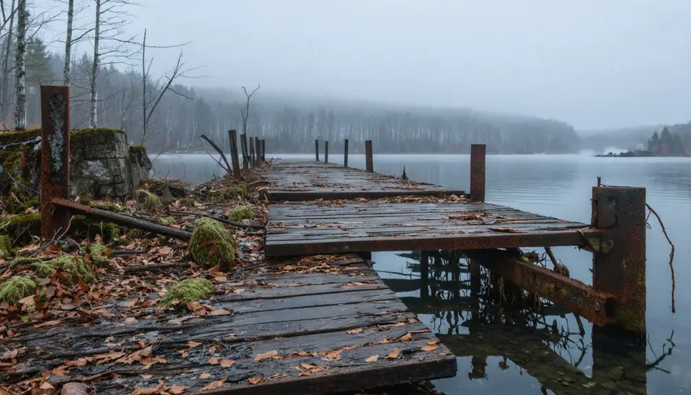
Life Along the Allegany River
If you’d lived in Elko during the late 1800s, you’d have witnessed the bustling river traffic of ferries and boats maneuvering the Allegany River’s seasonal changes at key crossing points like Quaker Mill.
The river’s unpredictable flooding patterns challenged early bridge construction efforts until 1867, when a permanent structure finally replaced the ferry service that had been operated jointly by Quakers and Native Americans.
Riverside communities gathered for social events, mail collection at the Tunesassa post office, and commerce at the lumber yards near the Western New York & Pennsylvania Railroad station at Quaker Bridge.
River Transportation Routes
During the early 1800s, the Allegany River served as an essential transportation artery, with keelboats and canoes dominating upstream cargo movement until 1830.
You’d face significant river navigation challenges, including unpredictable water levels and the high cost of shipping goods upstream – about ten times more expensive than downstream transport. The river’s legal designation as a public highway in 1807 opened opportunities for westward expansion. Many destitute settlers had to stay in the area when their funds ran out. The journey from Pittsburgh to Warren was particularly arduous, typically requiring ten to twelve days to complete.
If you’d ventured along these routes, you’d encounter:
- Complex transportation networks combining canals, inclined railways, and steamboats
- Primitive camps where you might wait days for suitable water conditions
- Strategic landing points like Olean Point, where inflated food prices could drain your travel funds
Despite these transportation challenges, the river remained essential for lumber transport and settlement expansion until railroads revolutionized regional travel.
Seasonal Flooding Challenges
While seasonal flooding was a constant threat along the Allegany River, the devastating floods of 1889 marked one of the region’s most catastrophic natural disasters.
You’d have witnessed entire bridges swept away, with floodwaters destroying miles of fencing and threatening to tear houses from their foundations. In Belmont alone, four iron bridges were completely destroyed. The disaster’s seasonal impacts paralyzed local industry, including Owens’ tannery, and buried railroad tracks under 15 feet of earth.
The severe flooding from Tropical Storm Agnes in 1972 brought record-breaking water levels that devastated communities throughout the region.
Flood management became an ongoing challenge as heavy rains combined with spring snowmelt repeatedly overwhelmed the region’s infrastructure.
Throughout the 1800s, you’d have seen families forced to retreat to their upper floors or evacuate entirely, while watching their livestock, crops, and equipment wash away in the surging waters.
These patterns of destruction continued until the Kinzua Dam’s construction in the 1960s.
Riverside Community Activities
From its earliest days, the Allegany River served as the beating heart of local commerce and community life, drawing settlers who established essential transportation routes through Allegany County.
You’d find the riverbank gatherings were central to the community’s social fabric, with the historic Allegany Council House hosting pivotal debates and meetings. The river’s bounty supported generations of fishing traditions, providing both sustenance and trade opportunities for local families.
- Seneca Nation members utilized these waters for hunting, fishing, and sacred ceremonies
- Irish Catholic railroad workers settled along the shores, building tight-knit communities
- St. Bonaventure University’s Franciscan missionaries established religious institutions that shaped local culture
The riverside activities reflected a rich blend of Indigenous practices, immigrant traditions, and evolving American frontier life.
The Kinzua Dam Project and Town’s Final Days
As the massive Kinzua Dam project took shape in 1960, Elko’s fate was sealed by the U.S. Army Corps of Engineers. You would’ve found 95 residents living in this small Cattaraugus County town, all of whom faced forced evacuation by 1965. Their homes, farms, and community would soon lie beneath the rising waters of the Allegheny Reservoir.
You’ll discover that Elko wasn’t alone in this tragedy. The Kinzua Dam project, costing $125 million, displaced over 600 families, including nearly 700 Seneca people who lost their ancestral lands protected by the 1794 Pickering Treaty.
While the dam brought flood control and hydroelectric power to Pittsburgh, it came at an enormous cost – submerging 9,000 acres of reservation land and forever changing the lives of those who called this region home.
Legacy of a Lost Community
Though Elko’s physical structures now lie beneath the Allegheny Reservoir’s waters, the town’s legacy endures through its rich cultural and historical footprint. The community’s resilience lives on through oral histories and descendants who maintain connections to their ancestral home.
- The Quaker legacy remains visible through landmarks like Quaker Bridge and the former hamlet of Frecks, testifying to the early European settlement that shaped the region.
- Cultural memory persists in the stories of the once-thriving lumber industry and the 2,000+ residents who called this area home.
- The town’s transformation from a political powerhouse in Cattaraugus County to protected parkland reflects broader themes of progress versus preservation.
You’ll find Elko’s spirit preserved in Allegany State Park, where former sawmill streams and historic paths continue to shape the landscape.
Historical Impact on Regional Development
When Elko emerged as Cattaraugus County’s final township in 1890, it represented more than just a new administrative boundary – it marked a calculated political maneuver to shift regional power southward toward Salamanca.
Though the county seat remained in Little Valley, Elko’s formation coincided with significant economic trends driven by the lumber industry boom.
You’ll find that Elko’s early prosperity reflected broader regional demographic shifts, with over 2,000 residents calling the area home in 1890 – a stark contrast to modern times.
The town’s development faced unique challenges, as much of its usable land sat within the Allegany Indian Reservation.
Multiple sawmills along Quaker Run and Wolf Run powered the local economy until steam power’s arrival signaled changing industrial demands.
Frequently Asked Questions
Are There Any Remaining Structures or Ruins Visible During Low Water Periods?
You won’t find any documented remaining buildings or historical landmarks during low water periods here – research doesn’t confirm any structures becoming visible when water levels drop in this location.
What Happened to the Cemetery Sites After the Town’s Evacuation?
You’ll find no definitive records of cemetery preservation efforts, though burial site exploration suggests graves were likely relocated or submerged during the 1965 evacuation, following typical dam project protocols.
Did Any Original Elko Families Relocate Together to Maintain Their Community?
You won’t find evidence that original families stayed together to preserve their community bonds or family histories. Historical records suggest residents dispersed individually after the forced 1965 evacuation.
Were There Any Notable Crimes or Mysteries Associated With Elko?
You’d expect a ghost town to have spooky mysteries, but research shows no documented Elko crimes or notable mysteries. The town’s most dramatic moment was its planned evacuation for the Kinzua Dam.
What Native American Artifacts Have Been Discovered in the Former Elko Area?
You’ll find significant Native artifacts around Elko, including 35 fluted spear points from 11,300 years ago, clay pots with diagonal incisions, and stone tools of archaeological significance near ancient caribou hunting grounds.
References
- https://travelnevada.com/ghost-town/the-metropolis-that-wasnt/
- https://nvtami.com/2025/01/16/exploring-elko-county-ghost-towns/
- https://en.wikipedia.org/wiki/Elko
- https://nevadamagazine.com/issue/november-december-2019/11696/
- https://historicpath.com/article/elko-youngest-township-county-no-longer-exists-108
- https://kids.kiddle.co/Elko
- https://historicpath.com/history/south-valley
- https://www.cattco.gov/museum/history
- https://southvalleyny.com/?page_id=315
- https://dchsny.org/wp-content/uploads/2019/01/Upton-Quakers-1970.pdf