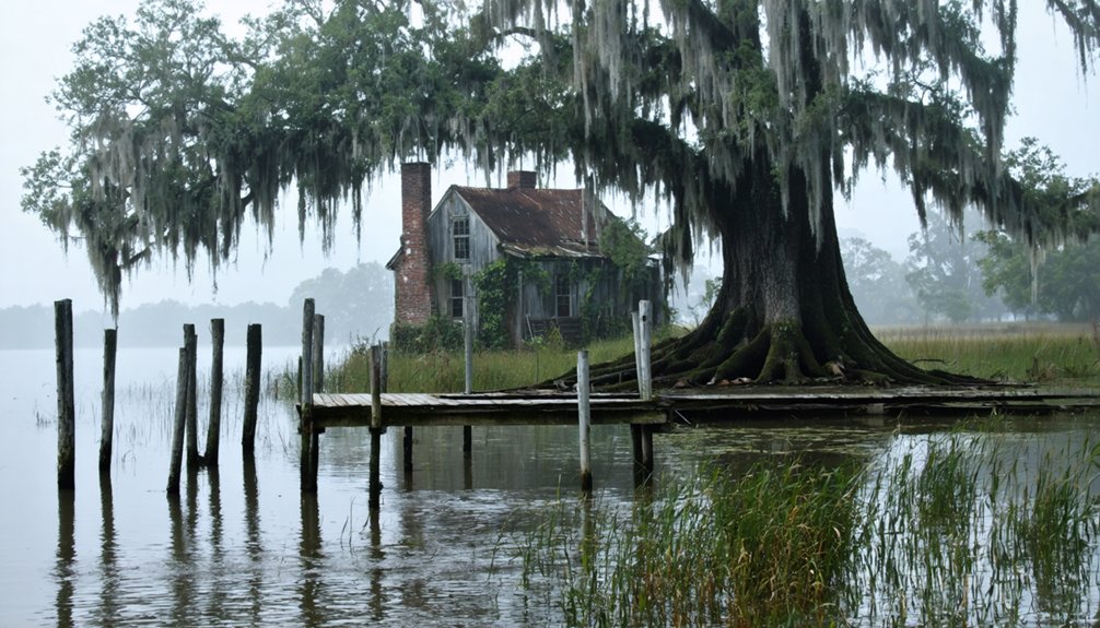
You’ll find Elliot City about 6 miles west of Livonia in Pointe Coupee Parish, where it once thrived as an agricultural settlement along the Atchafalaya River in the early 1900s. The community faced devastating floods in 1912 and 1913, with the final blow coming in 1939 when federal authorities ordered a complete evacuation for flood control measures. Today, the ghost town lies submerged beneath U.S. Route 190, though artifacts still surface during road maintenance, revealing glimpses of its past.
Key Takeaways
- Elliot City was a river settlement in Pointe Coupee Parish that became a ghost town after forced evacuation in 1939.
- The town’s abandonment was triggered by catastrophic floods, including the Great Flood of 1927 and earlier levee breaks.
- Federal authorities used eminent domain to evacuate residents for flood control purposes related to the Morganza Spillway construction.
- The former townsite now lies submerged beneath U.S. Route 190 and the Atchafalaya River floodplain.
- Archaeological findings and artifacts continue to emerge during road maintenance, revealing early 20th-century life in Elliot City.
The Rise and Fall of a Louisiana Settlement
While many Louisiana settlements thrived along major waterways in the early 1900s, Elliot City’s story stands as a reflection of nature’s dominance over human ambition.
You’ll find this rural community’s settlement patterns followed typical regional development, establishing itself about 6 miles west of Livonia in Pointe Coupee Parish. Located along the Atchafalaya River region, the town became a vital river settlement. During World War II, the area gained strategic importance due to its proximity to an inactive bombing range used for military training.
The town’s community resilience was tested early, as devastating floods in 1912 and 1913 from the Atchafalaya River’s levee breaks repeatedly threatened its existence.
Despite these challenges, residents persisted until 1939, when government flood control priorities sealed their fate.
Even as nature tested their resolve, it was human decisions that finally forced Elliot City’s residents from their homes.
The construction of the Morganza Spillway forced an entire community to abandon their homes, transforming a once-hopeful settlement into a sacrifice zone for Louisiana’s broader flood management strategy.
Geographic Location and Natural Landscape
Located at coordinates 30°33’21″N, 91°39’44″W in Pointe Coupee Parish’s 10th Ward, Elliot City’s remains lie beneath modern U.S. Route 190, about 6 miles west of Livonia.
You’ll find this ghost town’s site within the vast Atchafalaya River floodplain, surrounded by rich wetland ecosystems and swamp habitats. The area became one of Louisiana’s 17 ghost towns after its abandonment.
The natural landscape exemplifies the challenges of urban planning in Louisiana’s dynamic river basin. The terrain’s low-lying, flat characteristics made it particularly vulnerable to flooding, ultimately proving that flood resilience wasn’t achievable here. The area experienced devastating floods during the Torras crevasse of 1912, marking the beginning of the town’s eventual demise.
Today, the area serves as part of the Morganza Floodway system, deliberately allowing controlled flooding to protect downstream communities.
The site sits near several notable landmarks, including the Atchafalaya National Wildlife Refuge (12 km away) and False River (17 km away).
Early Community Life and Development
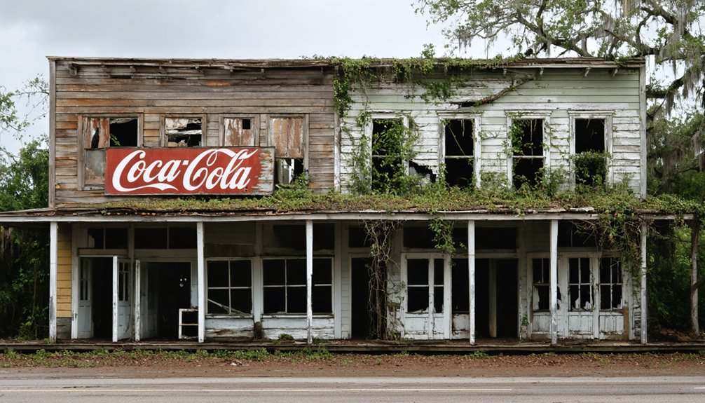
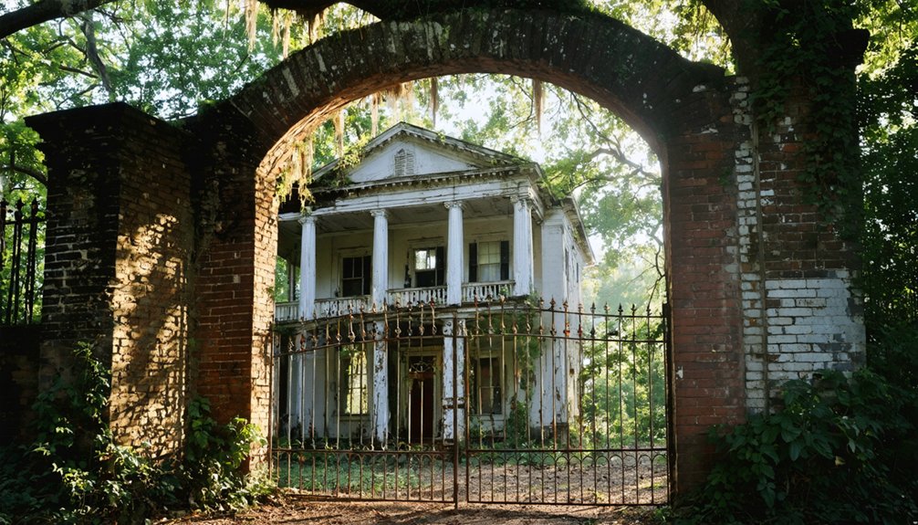
Despite its eventual fate, Elliot City emerged as a modest agricultural settlement in Pointe Coupee Parish during the early 20th century, where residents built their lives around farming and local trade.
You’ll find that community dynamics revolved around self-sufficiency, with families relying on the fertile soil from river floods to grow their crops. Like the thriving steamboat trade in Gainesville, Mississippi, the waterways provided essential transportation for local farmers to move their goods. The social fabric was tightly woven through church gatherings and community events, typical of river parish life.
Located just 6 miles west of Livonia, the town’s residents maintained essential connections with neighboring communities while developing their own local services and crafts.
The Atchafalaya River played a significant role in daily life, providing transportation routes and market access that supported the town’s agricultural economy and helped sustain its growing population.
The Great Floods That Shaped Destiny
As natural disasters reshaped Louisiana’s landscape in the early 20th century, Elliot City faced a series of catastrophic floods that would ultimately seal its fate. The 1912 Torras c. The Great Flood of 1927 brought devastation as fourteen inches fell on Good Friday, April 15, overwhelming local infrastructure and displacing residents. The disaster’s impact stretched across fifty miles wide through Northeast Louisiana, transforming communities and prompting urgent evacuations.
Morganza Spillway: Engineering vs. Township
The Morganza Spillway stands as one of the most ambitious engineering responses to Elliot City’s flooding crisis, marking a turning point in the region’s battle against the Mississippi River’s destructive force.
With 125 gated openings spanning nearly 4,000 feet, you’ll find a structure designed to divert up to 600,000 cubic feet per second of floodwater through a 20-mile-long floodway. The Vital Engineering Solutions implemented here demonstrate the Corps’ commitment to flood control.
When flood protocols activate, you’re witnessing a rare event that’s only occurred twice since 1954. The Flood Control Act of 1928 authorized its construction as a direct response to prevent another devastating flood like the one in 1927.
The engineering challenges are immense – maintaining 25-ton gates, monitoring scour indicators, and coordinating with railways and highways that cross the structure.
While protecting downstream cities like Baton Rouge and New Orleans, the spillway’s activation means flooding privately owned land, forever changing the landscape of rural communities in its path.
Forced Exodus: The 1939 Relocation
When federal authorities ordered the complete evacuation of Elliot City in 1939, residents faced an unprecedented forced relocation to make way for the Morganza Spillway flood control project. The government mandates came after devastating levee breaks in 1912 and 1913 had already demonstrated the area’s vulnerability to flooding.
You’ll find that this wasn’t a voluntary migration – the federal and state agencies enforced their flood control plan through eminent domain actions, prioritizing downstream protection over local autonomy.
The community displacement fractured longstanding social bonds as families scattered to urban centers and safer regions. While officials portrayed the exodus as necessary for public safety, it represented a broader pattern of government infrastructure projects reshaping Louisiana’s rural landscape, forever altering the cultural fabric of river communities. Much like the construction of Bailey’s Dam during the Civil War, these infrastructure changes permanently transformed the region’s waterways.
Modern-Day Remnants Under US Route 190

Located beneath modern-day US Route 190 at coordinates 30°33’20″N 91°35’56″W, Elliot City‘s physical remnants lie buried under layers of pavement and soil.
The town’s transformation into a ghost settlement occurred through a series of events: devastating floods in 1912-13 and 1939, military use as a WWII bombing range, and finally, the construction of major transportation infrastructure.
Today, you won’t find any visible structures from the original townsite. However, archaeological findings occasionally surface during road maintenance work, offering glimpses into early 20th-century life.
The site’s location beneath US 190 severely limits extensive excavation possibilities, though foundations and artifacts continue to emerge from beneath the highway.
The construction of the Morganza Spillway downstream sealed the town’s fate, ensuring its permanent place beneath modern development.
Environmental Impact and Flood Management
Beneath the highway’s modern surface lies a story of environmental forces that shaped Elliot City’s fate. The town fell victim to devastating floods from the Atchafalaya River in 1912, 1913, and 1927, before its final abandonment in 1939 during construction of the Morganza Spillway.
Today, flood management through the Morganza Spillway system intentionally submerges the former townsite when necessary to protect downstream communities.
You’ll find the area has undergone significant ecological restoration, with former residential zones reverting to natural wetlands. When officials opened the spillway gates in 1973 and 2011, the site was completely inundated, demonstrating how engineered flood control systems can reshape entire landscapes.
The town’s story serves as a stark reminder of nature’s power and humanity’s ongoing struggle to manage Louisiana’s dynamic waterways.
Preserving the Memory of Lost Communities
You’ll find Elliot City’s past preserved through oral histories, photograph collections, and detailed architectural records maintained by the Howard County Historical Society since 1958.
Your understanding of this former mining community deepens through personal accounts from multi-generational families who witnessed its transformation from a bustling mill town to its current state.
Local heritage initiatives now focus on digitizing these memories while encouraging current residents to contribute their stories, creating an evolving archive that connects past and present community experiences.
Historical Documentation Methods
Through systematic documentation efforts, historians and preservationists have developed thorough methods to record and preserve the memory of Elliot City’s transformation into a ghost town. Using advanced archival techniques and digital documentation, they’ve created a detailed record of this lost community.
Key documentation methods include:
- Examination of property records, architectural plans, and historical photographs to establish the city’s development timeline.
- Creation of detailed photographic archives capturing structural features and architectural elements before further deterioration.
- Implementation of GIS mapping and virtual tours to help visualize the town’s layout and significant landmarks.
These methods haven’t just preserved Elliot City’s physical remains – they’ve captured the essence of a once-thriving community while respecting property rights and preservation ethics. This ensures future generations can understand this important piece of regional history.
Personal Stories Matter
While physical structures and documentation tell part of Elliot City’s story, personal narratives form the heart of its preservation efforts. You’ll find that former residents’ stories reveal social dynamics and cultural elements that official records often miss, making memory preservation essential before firsthand accounts disappear.
Through local gatherings and oral history projects, you can witness how storytelling significance extends beyond mere nostalgia. These personal accounts help mobilize preservation initiatives, particularly for the city’s cemetery – now a critical anchor point for displaced families.
Digital archiving efforts guarantee these stories reach future generations, while community-led interviews capture the nuanced experiences of those who lived through Elliot City’s decline. In the face of environmental threats and population dispersal, these personal narratives serve as powerful tools for maintaining the town’s cultural identity.
Community Heritage Initiatives
Since the decline of Elliot City, community-led preservation efforts have become the cornerstone of protecting its historical legacy. Through dedicated community engagement, local volunteers have transformed abandoned structures into living museums of the region’s past.
Preservation workshops now equip residents with essential skills for maintaining these historic treasures.
The community’s commitment to heritage preservation is evident through:
- Monthly volunteer restoration events focusing on architectural authenticity
- Documentation initiatives capturing oral histories from former residents
- Seasonal heritage tourism programs generating funds for ongoing preservation
You’ll find these grassroots efforts haven’t only safeguarded Elliot City’s physical structures but have also created a sustainable model for heritage conservation.
Local leadership continues to secure grants and coordinate with state preservation organizations to guarantee long-term protection of this historic site.
Frequently Asked Questions
What Happened to the Original Buildings and Structures of Elliot City?
You’ll find no building preservation today – the original structures were destroyed by repeated flooding, buried under Route 190’s roadbed, or submerged underwater, erasing their historical significance completely.
Were Residents Financially Compensated for Relocating From Elliot City?
You’ll find no definitive records showing whether residents received relocation assistance or financial impact compensation, though Louisiana typically offers buyout programs and displacement aid for similar community relocations.
Did Any Families Return to Live Near the Former Town Site?
You won’t find any documented family returns to the area since the 1939 evacuation. The flood control designation, military range history, and ongoing risk of intentional flooding have prevented resettlement near the site.
What Businesses and Industries Operated in Elliot City Before Abandonment?
You’d find farmers working fertile delta land, small general stores serving locals, timber industry operations processing regional lumber, and railroad operations supporting transportation between larger Louisiana markets.
Are There Any Surviving Photographs of Elliot City Before 1939?
You won’t find any confirmed surviving photographs in visual archives or historic documentation from pre-1939 Elliot City. Multiple floods and the town’s rural nature likely destroyed or prevented preservation of photographic records.
References
- https://en.wikipedia.org/wiki/Elliot_City
- http://wikimapia.org/37768832/Elliot-City-Louisiana-Ghost-Town
- https://en.wikipedia.org/wiki/List_of_ghost_towns_in_Louisiana
- https://www.loquis.com/en/loquis/6737988/Red+Cross+Louisiana
- https://www.onlyinyourstate.com/trip-ideas/louisiana/underwater-ghost-town-la
- https://www.shreveporttimes.com/story/news/2025/09/04/does-louisiana-have-any-ghost-towns-how-many-are-there-where-to-find-abandoned-towns/85972403007/
- https://www.wikiwand.com/en/map/Elliot City
- https://www.famousfix.com/list/ghost-towns-in-pointe-coupee-parish-louisiana
- https://www.crt.state.la.us/Assets/OCD/hp/nationalregister/historic_contexts/The_Louisiana_Lumber_Boom_c1880-1925.pdf
- https://gulfghosttowns.org