Eureka ghost town, located in Colorado’s San Juan Mountains at 9,862 feet elevation, emerged during the 1870s mining boom. You’ll find the restored jail as the only intact structure among foundations along the Animas River. Access requires a 4WD vehicle on the Alpine Loop Byway, primarily during summer and fall months. This remote site offers glimpses into mining life where the Sunnyside Mine once provided economic stability amid challenging mountain conditions. The rugged landscape tells a deeper story.
Key Takeaways
- Eureka was a mining town in Colorado’s San Juan Mountains, now abandoned with only the jail remaining intact at 9,862 feet elevation.
- Established after Charles Baker’s mineral discoveries in 1860, Eureka’s economy centered around the Sunnyside Mine before eventual decline.
- The ghost town sits along the Animas River with visible foundations, offering insight into Colorado’s mining history.
- Located 20 miles northwest of Silverton, Eureka is accessible via the Alpine Loop Byway, requiring 4WD vehicles.
- Visitation is primarily limited to summer and fall months due to harsh mountain weather and lack of facilities.
The Rise and Fall of a Mining Settlement
Although Captain Charles Baker’s mineral explorations in 1860 marked the beginning of Eureka’s story, the settlement’s development unfolded as part of broader mining booms sweeping Colorado between 1858-1860.
While Baker’s 1860 explorations birthed Eureka, the settlement emerged within Colorado’s larger gold rush narrative.
As you explore Eureka’s history, you’ll find that early camps like Baker’s Park served as essential outposts for ambitious prospectors seeking fortune. Economic struggles similar to Eureka’s would later affect Leadville, Silverton, and Aspen due to silver market fluctuations in 1894.
The Brunot Treaty of 1873 was a pivotal moment that opened the land to mining after the Ute Indian Tribe ceded their lands to the U.S. Government.
The community dynamics transformed dramatically after John Terry’s rich ore discovery in 1896-1897, triggering rapid infrastructure expansion.
Mining technology advanced considerably, particularly with the 1917 implementation of selective flotation at Sunnyside mine—a breakthrough that processed complex lead-zinc ores efficiently.
When the Terry family sold to USSRMC that same year, corporate consolidation introduced industrial-scale operations, including plans for a 500-ton daily processing capacity.
This ownership change marked both Eureka’s peak development and the beginning of its eventual decline.
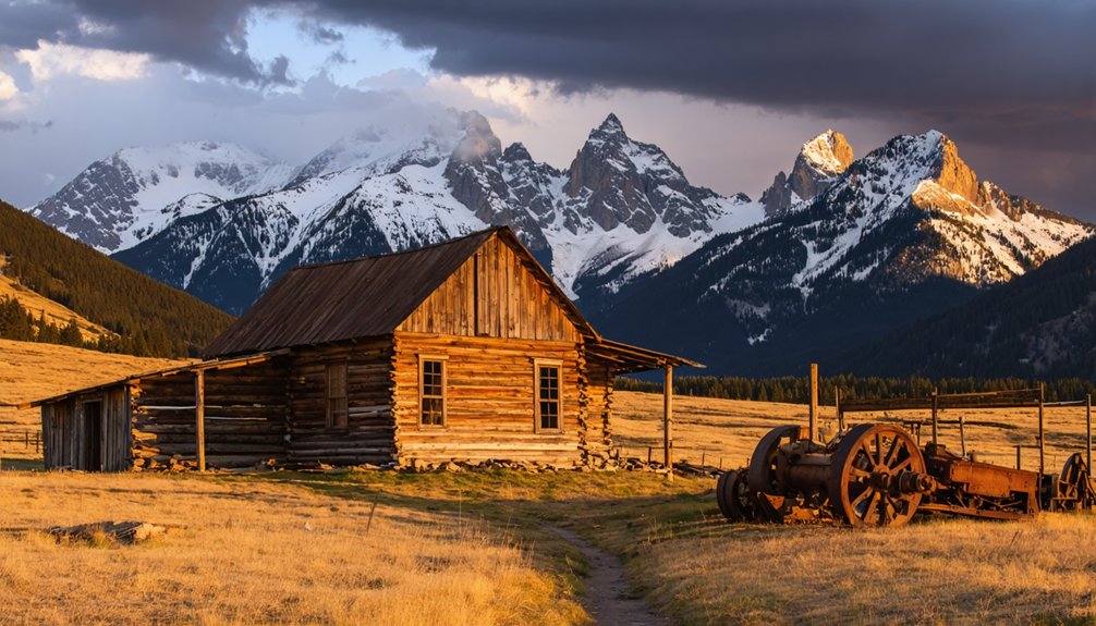
Life at 9,862 Feet: Geography and Natural Setting
Perched at a breathtaking 9,862 feet above sea level, Eureka occupies a dramatic position within the rugged San Juan Mountains, a subrange of the Rockies known for its spectacular alpine terrain.
This remote location presents distinctive high altitude challenges that shaped life for its inhabitants. You’ll find yourself in an alpine ecosystem where oxygen is scarce and weather patterns can shift dramatically within hours. Today, the area attracts adventurers seeking winter recreation on routes like First Gully, a popular ice climbing destination that ascends the east face of Peak 12,896. The town serves as a perfect example of why Wikipedia maintains disambiguation pages to distinguish it from numerous other locations sharing the Eureka name.
- Survival here meant adapting to brutal winters with heavy snowfall and potential isolation for months.
- Thin mountain air increases physical exertion and risk of altitude sickness.
- The surrounding landscape presents constant hazards—avalanches, rockfalls, and flash floods.
- Limited natural resources forced reliance on imported goods, making self-sufficiency difficult.
Gold, Silver, and Survival: Economic History
You’ll find that unlike other mining settlements that experienced meteoric rises to wealth, Eureka maintained a more modest economic trajectory despite its gold and silver resources.
The arrival of the Denver & Rio Grande railway in the region transformed Eureka’s prospects by providing essential transportation for ore shipments and supplies, connecting this remote mountain settlement to larger markets.
This infrastructure investment proved significant for Eureka’s economic sustainability through the volatile boom-bust cycles that defined Colorado mining towns, particularly after the devastating Silver Panic of 1893. The collapse of silver prices following the Sherman Act repeal in 1893 devastated many mining communities throughout Colorado.
The Sunnyside Mine became the economic backbone of the community, with its impressive run as Colorado’s leading gold producer in 1930 before operations halted during the Great Depression.
Boom Without Bonanza
While many mining towns throughout Colorado’s history boasted incredible riches and legendary bonanzas, Eureka’s story follows a more nuanced economic path.
Unlike the spectacular wealth found in Leadville or Camp Bird Mine near Ouray, Eureka experienced mining challenges that limited its prosperity despite mineral potential.
You’ll find Eureka’s economic resilience centered around:
- The Sunnyside Mine, which provided stability when other operations failed
- A gold-focused economy that predated Colorado’s more famous silver boom
- The Old Hundred Mine that, despite rich mineralization, never turned a profit
- A community sustained through fluctuating mineral markets without experiencing the “get-rich-quick” fortunes seen elsewhere
This modest boom without true bonanza explains why Eureka developed differently than more opulent mining communities, ultimately shaping its eventual transformation into today’s ghost town.
Unlike other prosperous towns in the San Juan Mountains that benefited from the Bland-Allison Act of 1878 which boosted silver prices, Eureka’s economy remained modest.
Railroad’s Economic Impact
The economic transformation of Eureka, though modest compared to Colorado’s legendary boomtowns, took a dramatic turn with the arrival of the railroad in the 1880s.
Before rail access, you’d face arduous journeys on primitive trails until the 1884 toll road provided minimal improvement.
Otto Mears, the “Pathfinder of the San Juans,” spearheaded narrow gauge railway development that revolutionized Eureka’s prospects.
The railroad benefits were immediate and far-reaching—bulk ore shipment became feasible, smelters accessible, and broader markets opened. Transportation efficiency slashed costs for mining supplies while attracting new investment to the Sunnyside Mine operations.
The Silverton Northern Railroad reached the town in 1896, further accelerating economic development.
This infrastructure sparked growth beyond mining alone, as lumber businesses, machinery suppliers, mercantile shops, and boarding houses flourished throughout Eureka and neighboring settlements, creating an interconnected economic network where none had existed before.
The Sunnyside mine’s closure in 1991 marked the end of significant production in the Silverton mining district, which had once been a cornerstone of Colorado’s gold economy.
What Remains Today: Exploring the Ghost Town
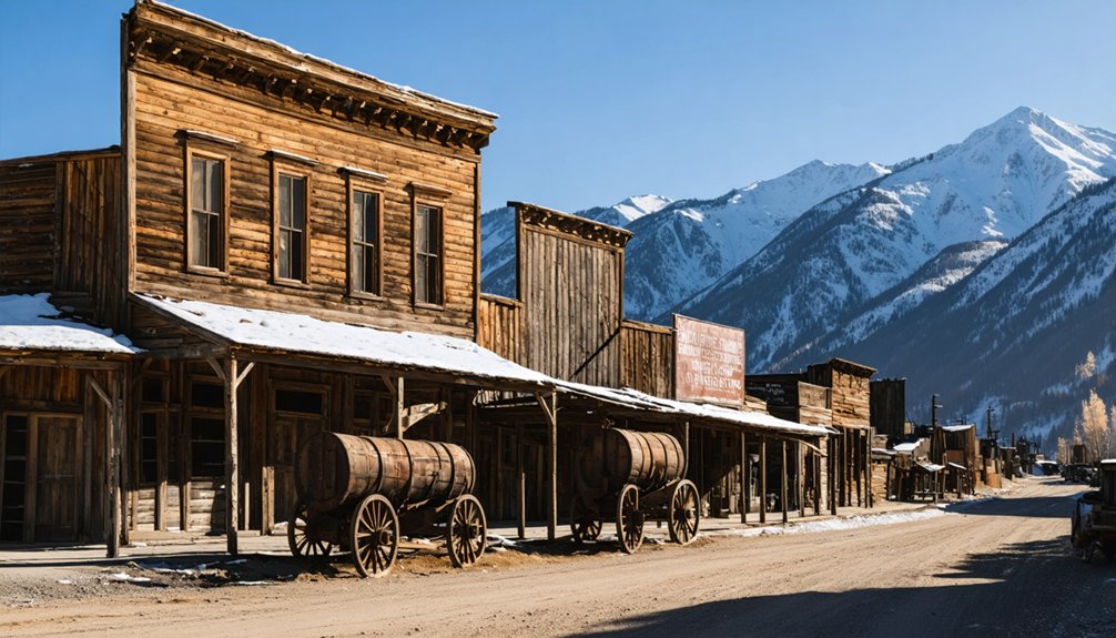
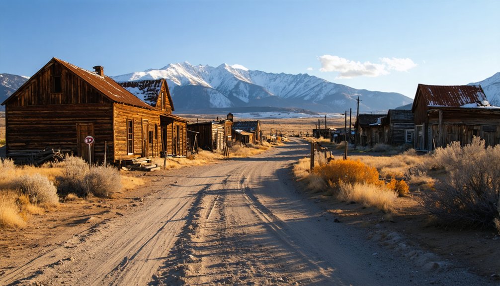
As visitors approach the remote mountain settlement of Eureka today, they’ll encounter a ghost town reduced largely to foundations and memories, with the restored jail standing as the sole intact building from its mining heyday.
Nestled along the Animas River at 9,862 feet elevation, the site’s structural remains offer glimpses into its historical significance within Colorado’s mining narrative.
When exploring the ghost town, you’ll discover:
- The restored Eureka jail – the centerpiece that illustrates 19th-century mining justice
- Sunnyside Mill foundations on the hillside – marking where machinery once processed ore
- Scattered building foundations throughout the former townsite – revealing the community’s layout
- Gravel roads winding through the site – following original pathways used by residents
This land was originally part of territory awarded to Utes before mining interests transformed the landscape.
Getting There: Access and Visitor Information
You’ll need to navigate the rugged terrain of the Alpine Loop Byway to reach Eureka, located 20 miles northwest of Silverton at 9,862 feet elevation.
The unpaved roads beyond County Road 2 require a 4WD vehicle capable of handling rocky sections and switchback curves, particularly near Eureka Gulch where the main trailhead is situated.
Access is primarily limited to summer and fall months when weather conditions permit travel, and you should come prepared with maps, proper gear, and supplies as cell service is unreliable in this remote wilderness area.
Remote Mountain Access Routes
Traveling to Eureka requires traversing the challenging Alpine Loop, a 65-mile network of unpaved mountain roads that connect Silverton, Ouray, and Lake City through some of Colorado’s most rugged terrain.
Most visitors begin their journey in Silverton via County Road 2, following the Animas River through historic mining territory. Remote navigation demands high-clearance 4×4 vehicles or OHVs, as standard passenger cars can’t manage the mountain terrain. The route is typically accessible from late May through October, weather permitting.
- Check current road conditions before departing, as they change rapidly with weather
- Watch for landmarks like the Mayflower Mine shortly after leaving Silverton
- Follow the graded but rough road along the Animas River valley
- Prepare for steep sections and narrow passages that require technical driving skills
Preparation For Wilderness Journeys
Before commencing on a journey to Eureka’s ghostly remains, visitors must prepare thoroughly for the high-altitude wilderness experience that awaits. At 9,862 feet elevation, you’ll need proper wilderness gear including water, food, and wag-bags, as no facilities exist at the site.
Cell service disappears beyond Silverton, necessitating self-sufficiency. Safety protocols are essential given the remote location. Bring weather-appropriate clothing for sudden mountain storms, and guarantee your vehicle is suitable for unpaved roads.
Four-wheel drive is recommended, though two-wheel vehicles may navigate during dry conditions. Pack emergency supplies and inform others of your itinerary.
Remember that the closest amenities—restrooms, food, and fuel—are in Silverton. The Bureau of Land Management provides informational resources, but you’ll need to bring everything required for a day in isolated alpine terrain.
Seasonal Travel Considerations
Access to Eureka ghost town fluctuates dramatically with the seasons, requiring visitors to plan their journeys accordingly. The Alpine Loop Byway’s weather patterns greatly influence road conditions and accessibility.
From late May through October, you’ll find ideal driving conditions with snow-free, stable roads suitable for two-wheel drive vehicles. Winter months transform the landscape, necessitating snowmobiles or 4×4 vehicles with chains for the adventurous traveler willing to navigate through heavy snowfall.
- Late spring to early fall (May-October): Prime visiting season with dry, maintained roads
- Winter (November-May): Heavy snow restricts access to specialized vehicles only
- Spring thaw: Expect muddy, potentially unstable conditions
- Year-round: Alpine elevation at 9,862 feet creates rapid temperature changes and intense sun exposure
Remember that mountain weather patterns can shift unexpectedly, requiring flexible planning and appropriate vehicle preparation.
Photography Tips and Best Times to Visit
For photographers seeking to capture Eureka’s haunting beauty, mastering the right techniques and timing your visit strategically will dramatically improve your results.
Employ HDR photography to balance the challenging contrast between bright skies and shadowy structures by bracketing 3-7 exposures. You’ll want both wide-angle shots showcasing the town’s isolated setting and telephoto compositions highlighting weathered architectural details.
The ideal photography window extends from late June through early October, when roads are accessible and temperatures range from 40-70°F.
Plan your Eureka photography expedition during the summer-fall sweet spot when access is clear and temperatures comfortable.
Visit during golden hours at sunrise or sunset when dramatic lighting creates rim effects on structures like the mill pads and jailhouse. Early mornings deliver crisp clarity before heat haze develops.
While afternoon monsoons create atmospheric conditions, they require extra preparation and caution. Bring a tripod for low-light situations and consider polarizing filters to enhance sky contrast.
Frequently Asked Questions
Were Indigenous Artifacts or Settlements Found Near Eureka?
Where there’s smoke, there’s fire – but regarding indigenous history at Eureka, you’ll find no confirmed artifact discoveries. Historical records suggest Ute presence regionally, but no documented settlements at the townsite itself.
How Did Winter Conditions Affect Mining Operations?
You’d face significant operational slowdowns as snow challenges halted digging and transportation. Resource shortages became common when supply delivery was impeded, forcing you to retreat to lower elevations during harsh periods.
What Did Residents Do for Entertainment and Social Activities?
You’d binge-watch the social scene at saloons, becoming the hub of your frontier networking. Dance halls hosted community gatherings where you’d court potential partners, while campfire storytelling and outdoor exploration satisfied your craving for entertainment.
Did Any Infamous Outlaws or Notable Figures Visit Eureka?
You won’t find documented evidence of infamous outlaws visiting Eureka. Notable visitors were primarily mining figures like Charles Baker and Reubin McNutt, not the outlaw encounters popularized in modern ghost stories.
Were There Significant Accidents or Disasters in Eureka’s History?
No significant Eureka mining accidents or natural disasters appear in historical records. You’ll find the town’s decline stemmed from economic factors rather than catastrophic events in San Juan County’s mining region.
References
- https://kekbfm.com/colorado-ghost-towns-eureka-and-the-sunnyside-mine/
- https://www.durango.com/colorado-ghost-towns/
- https://en.wikipedia.org/wiki/Eureka
- https://www.uncovercolorado.com/ghost-towns/eureka/
- https://jwdurango.com/unlock-eureka-road-easy-access-ghost-town-tips-epic-photos/
- https://www.youtube.com/watch?v=gwNitfYDPOE
- https://westernmininghistory.com/towns/colorado/eureka/
- https://www.legendsofamerica.com/eureka-colorado/
- https://www.epa.gov/sites/default/files/2015-08/documents/1260035.pdf
- https://www.denvergazette.com/2022/06/19/starting-in-1858-heres-a-look-at-the-timeline-of-colorados-mining-past-20bc26e4-e4d3-5eae-8520-8fa197554111/


