You’ll find False River tucked away in Louisiana, where a dramatic 1722 Mississippi River course change created this 22-mile oxbow lake. French pioneers built plantations and Creole cottages along its banks, establishing a vibrant river trade network connected to New Orleans. Today, while some historic structures like the LeJeune House still stand, the area faces challenges with an aging population and 18% poverty rate. The stories of its transformation from bustling colonial settlement to quiet waterfront community reveal fascinating layers of Louisiana history.
Key Takeaways
- False River faces population decline and economic challenges, with an 18% poverty rate threatening to transform vibrant areas into ghost towns.
- Historical settlement patterns along False River have diminished, leaving behind architectural remnants of French colonial and plantation heritage.
- Limited public transportation and infrastructure development contribute to the area’s isolation and reduced population growth.
- The community maintains cultural vitality through historic preservation efforts, despite demographic shifts and economic pressures.
- Many original waterfront properties and historic structures remain, though some face deterioration without sufficient maintenance and population support.
The Birth of an Oxbow Lake
When the Mississippi River dramatically changed course in 1722, it created one of Louisiana’s most remarkable oxbow lakes – False River.
You’ll find that this natural wonder began taking shape between 1713 and 1722, when seasonal flooding carved a shorter path eastward through the meandering river’s banks.
The oxbow formation process left behind a 22-mile stretch of water that’s now separated from the Mississippi’s main channel. Explorer Pierre Le Moyne d’Iberville and his group chose to bypass this area to find a faster route upriver.
This dramatic separation from the Mississippi created a winding 22-mile waterway, forever changing Louisiana’s aquatic landscape.
What you’re looking at today is a 3,000-acre lake that’s part of a larger 37,000-acre watershed in Pointe Coupee Parish. Unfortunately, since the 1980s, the lake has experienced a decline in fisheries and overall habitat quality.
This river course change didn’t just reshape the landscape – it created a unique ecosystem that’s become essential to Louisiana’s natural heritage.
The resulting oxbow lake stands as a symbol of the Mississippi River’s dynamic power to transform the landscape.
Early French Pioneer Settlements
If you’d visited False River in the early 1700s, you’d have found French pioneer families constructing their distinctive raised cottages and plantation homes along the waterfront, many featuring wraparound galleries and steep hip roofs characteristic of colonial Louisiana architecture.
Today, these historic sites in Red River Landing serve as a testament to that vibrant era, attracting history enthusiasts and tourists alike. Visitors can explore the remnants of these early structures, gaining insight into the lives of those pioneering families. Additionally, guided tours often highlight the architectural significance and historical context that shaped the region.
The settlement patterns followed the natural curve of the oxbow, with French colonists strategically positioning their homesteads to maximize access to river trading routes. Like other early Louisiana settlers, they faced severe food shortages and relied heavily on supply ships from France to sustain their community. The local economy operated as a frontier exchange economy, with settlers depending heavily on Native American trade and resources for their survival.
These pioneering families established a bustling river trade network, connecting False River to New Orleans through a system of boats and barges that transported agricultural goods and supplies.
French Colonial Architecture Remains
The architectural legacy of French colonial settlement in False River stands as a tribute to early pioneers’ ingenuity and adaptability.
You’ll find surviving structures built with local materials like cypress wood and bousillage, a unique mixture of mud, moss, and animal hair that protected against the harsh Louisiana elements. These architectural styles showcase practical innovations, including raised foundations to combat flooding and deep porches that provided essential shade in the subtropical climate.
Notable examples like the Pointe Coupee Parish Museum, originally an Olivo family home, demonstrate the distinctive pièce sur pièce construction method. The museum’s construction occurred in two distinct phases, with the first phase built around 1800 using notched-log techniques.
The buildings feature brick basements for storage, while upper floors utilized lighter timber frames. Many structures incorporated clever design elements to capture breezes, a vital consideration in pre-air-conditioning times. Early settlers adopted Caribbean building practices to better suit the region’s similar hot, humid conditions.
Pioneer Family Settlement Patterns
French pioneer families established distinct settlement patterns across Louisiana’s vast territory during the early 18th century, driven by both colonial policies and survival necessities. Communication with French-Canadian settlers played a vital role in establishing successful communities across Upper Louisiana.
You’ll find that pioneer family dynamics centered around strategic waterway locations, allowing easy access to trade and communication networks while maintaining strong kinship ties. The Pelican State settlers faced numerous challenges as they worked to establish permanent communities in the region.
- Settlement locations were carefully chosen near missions and forts, providing protection while facilitating cultural integration with Native Americans.
- Families relied on subsistence farming, trapping, and hunting, often struggling due to limited supplies and harsh conditions.
- Land grants along rivers shaped community development, with plots organized for ideal farming and transport access.
- Pioneer families formed extensive kinship networks that influenced settlement continuity, creating lasting bonds through intermarriage and shared resources.
River Trade Establishment Era
Building upon these early settlement patterns, river trade quickly emerged as the driving force behind False River’s development during the early 18th century.
You’d find about 500 white residents and 700 enslaved people working the plantations that stretched along the natural levees, cultivating indigo, tobacco, corn, and cotton.
The region’s river commerce flourished due to False River’s strategic oxbow location near a straight Mississippi channel, making it ideal for docking and trading.
The construction of Chemin Neuf in 1776 enhanced agricultural trade by connecting the Mississippi River to False River’s northern bank.
While Stack Island served as a crucial transshipment point, it also brought navigational challenges and attracted unsavory characters.
In 1682, the area underwent significant change when the meander began breaking off from the Mississippi River during Robert La Salle’s expedition.
Spanish authorities issued strategic land grants to stabilize settlement, recognizing the area’s significance for defense and trade.
Like other settlements in Lower Louisiana, False River’s development was overseen by a governor-general who maintained control over the territory’s expansion and commerce.
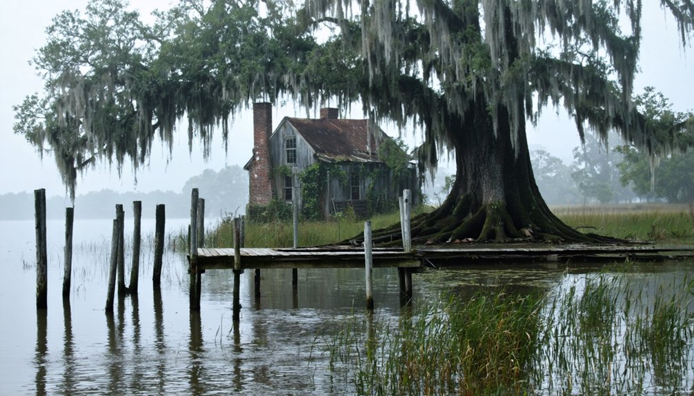
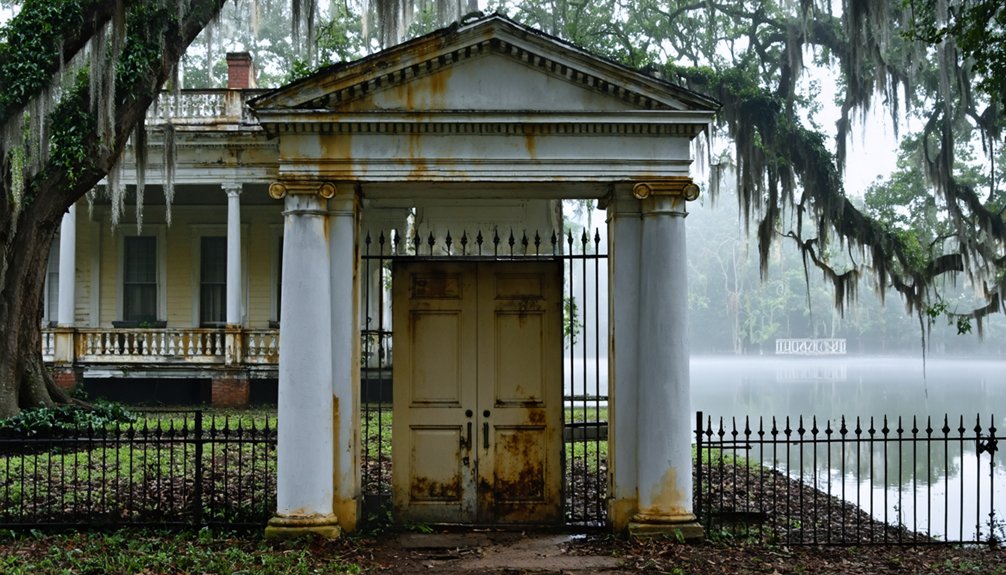
The LeJeune House Legacy
You’ll find one of Louisiana’s most remarkable architectural treasures in the LeJeune House, which uniquely blends Creole and Greek Revival styles after its 19th-century transformation.
The historic home features salvaged mantles from the de Marigny plantation near New Orleans, while measured drawings of its distinctive architecture are preserved in the Library of Congress’s Historic American Building Survey.
As the first property in New Roads to earn National Register status in 1978, the LeJeune House continues to stand as a symbol of preservation efforts that have maintained its historical integrity through generations.
Historic Architecture Features
Standing as a hallmark to early 19th-century Louisiana architecture, the LeJeune House masterfully blends Creole vernacular with Greek Revival elements. Its historic preservation showcases the architectural significance of regional building traditions, featuring materials sourced from Pointe Coupee Parish.
You’ll find documented structural features in the Historic American Building Survey, with detailed drawings housed in the Library of Congress.
- Interior woodwork includes salvaged pieces from the de Marigny plantation near New Orleans
- Traditional columned porches and symmetrical facades reflect both Creole and Greek Revival influences
- Two-acre grounds showcase a centuries-old live oak tree with a 20-foot girth
- Original plantation layout maintains period-accurate spaces for family living and oversight
Preservation Through Time
Since its designation as the first property in New Roads to achieve National Register status in 1978, the LeJeune House has remained a cornerstone of Pointe Coupee Parish’s preservation efforts.
You’ll find its legacy carefully documented through measured drawings in the Library of Congress, while Randy Harelson and Richard Gibbs have stewarded its preservation since their 2006 purchase.
The house’s survival depends on robust community engagement and ongoing funding efforts through organizations like the Pointe Coupee Historical Society.
While environmental challenges and land-use changes have transformed the surrounding area from agricultural fields to a resort community, the LeJeune House continues to tell the story of False River’s rich heritage, dating back to when the Mississippi River changed course in 1722.
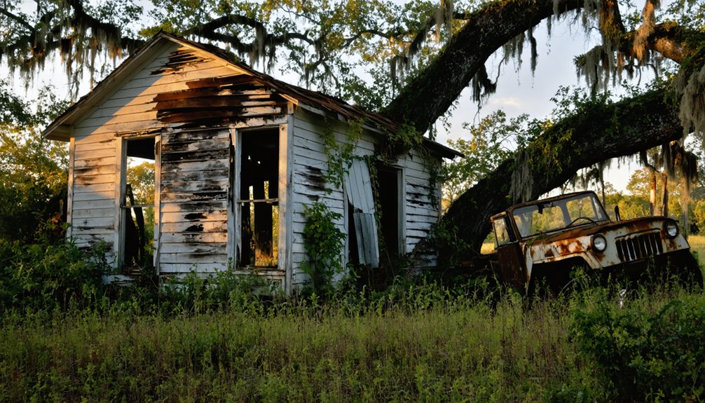
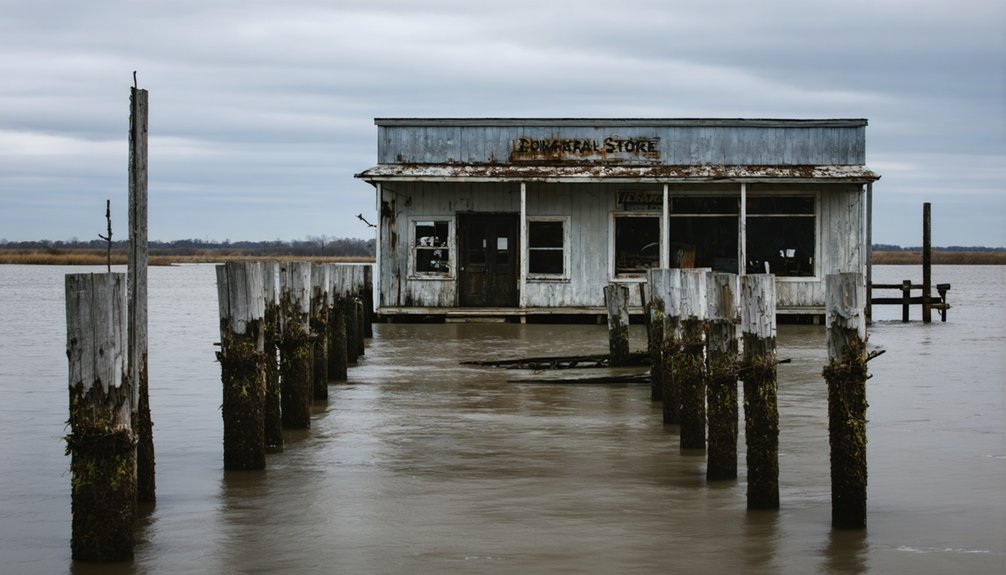
Torras: A Vanished Community
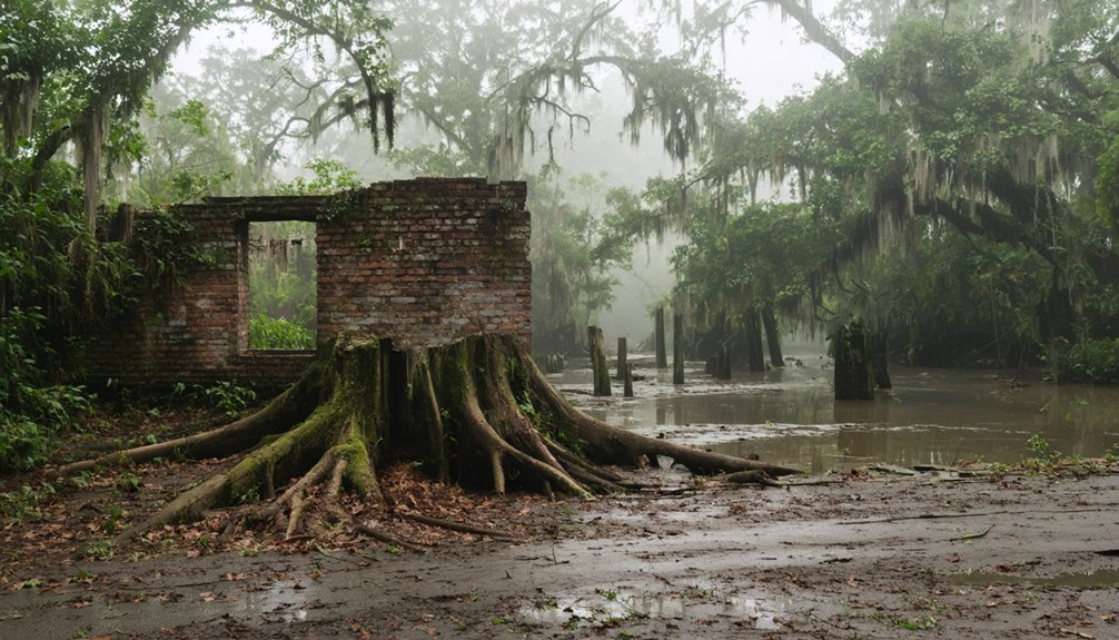
While many Louisiana ghost towns faded slowly into obscurity, Torras emerged and vanished within a remarkably short period.
You’ll find its story marked by community resilience in the face of nature’s fury. Founded in 1902 by Joseph Torras, this strategic settlement at the crossroads of essential waterways and rail lines promised a bright future.
The Torras history reflects the harsh realities of life along the Mississippi:
- Two devastating floods (1912 and 1927) tested the town’s resolve
- The community rebuilt after the first flood, showing remarkable determination
- Loss of the railroad sealed the town’s fate after the 1927 disaster
- By mid-20th century, nothing remained of this once-promising commercial hub
Today, only historical records preserve the memory of this vanished community in Pointe Coupee Parish.
Water Management and Engineering
You’ll find the False River Outfall Channel, constructed in 1947, was an essential engineering project that connected the lake to Bayou Grosse Tete and Bayou Cholpe.
Before this construction, the lake’s natural drainage patterns were influenced by its formation as an oxbow lake when it separated from the Mississippi River in 1722.
Today’s flood control infrastructure includes a spillway completed in 1948 and modified in 1991, which can discharge up to 1,400 cubic feet of water per second.
Early Outfall Channel Construction
As False River faced mounting water management challenges in the 1940s, engineers commenced on an ambitious drainage project in 1947 to construct the False River-Bayou Grosse Tete Spillway Canal.
The construction techniques required rapid excavation through Greve’s Swamp‘s challenging terrain while maintaining structural integrity.
Engineering innovations focused on these critical aspects:
- Excavating through sediment-heavy swampland while preventing channel collapse
- Integrating the channel with existing levee systems and highway infrastructure
- Managing water flow rates to protect aquatic habitats and wetlands
- Implementing erosion control measures for long-term channel stability
You’ll find this project transformed the region’s hydrology from an isolated oxbow lake to a controlled drainage system, connecting False River to Bayou Grosse Tete and ultimately the Gulf Intracoastal Waterway near Brusly.
Natural Drainage System Evolution
The natural formation of False River between 1713 and 1722 marked a significant hydrological transformation in Louisiana’s landscape. When the Mississippi River cut off its meander loop, it created a 3,000-acre oxbow lake that would develop a complex drainage history spanning 62 square miles.
Today, you’ll find a sophisticated drainage system where Patin Duke Slough and False Bayou feed the lake, while the Lighthouse Canal’s spillway controls water levels with a capacity of 1,400 cubic feet per second.
The lake’s connection to Bayou Grosse Tete and Bayou Cholpe plays an essential role in regional water management. However, sediment impact has become a major concern since the 1980s, leading to declining water quality and habitat loss.
This has prompted extensive studies and restoration efforts to preserve the lake’s ecological balance.
Modern Flood Control Infrastructure
Modern flood control infrastructure along False River represents a complex network of engineered solutions designed to protect the region from devastating water events.
You’ll find an integrated system of drainage canals, including Bayou Pond, Ditch One, and Ditch Two, working alongside the False River Outflow Channel for effective water management.
Key components of the flood risk management system include:
- Real-time monitoring systems tracking water levels and potential flooding
- Advanced levee systems incorporating I-Walls and anchored sheet pile walls
- Controlled gates and spillways managing water flow during high-risk events
- Environmental restoration projects balancing protection with ecosystem preservation
The U.S. Army Corps of Engineers oversees these infrastructural developments, ensuring they meet Louisiana Flood Protection Design Guidelines while maintaining navigational controls that restrict motorized travel when water levels exceed 18 feet ASL.
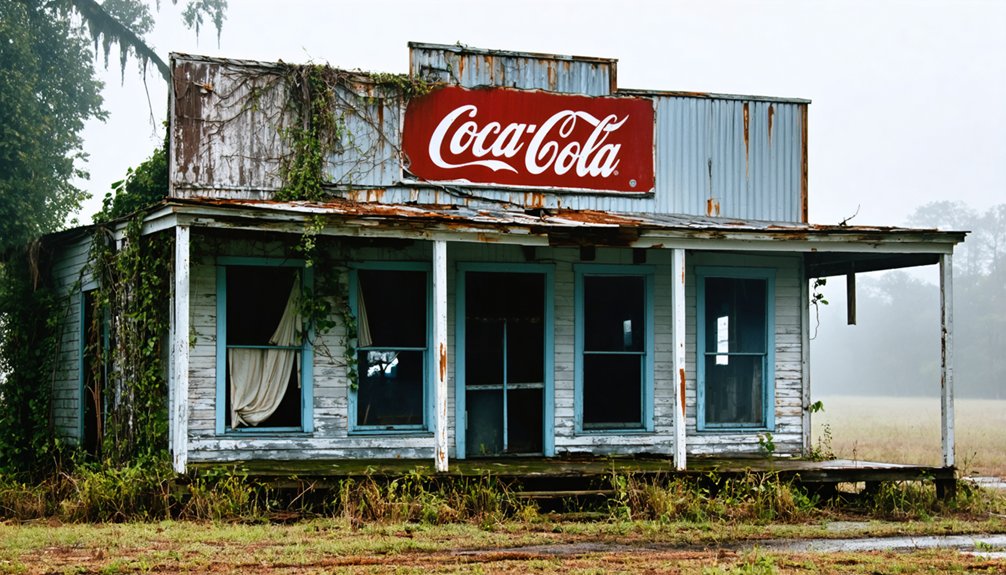
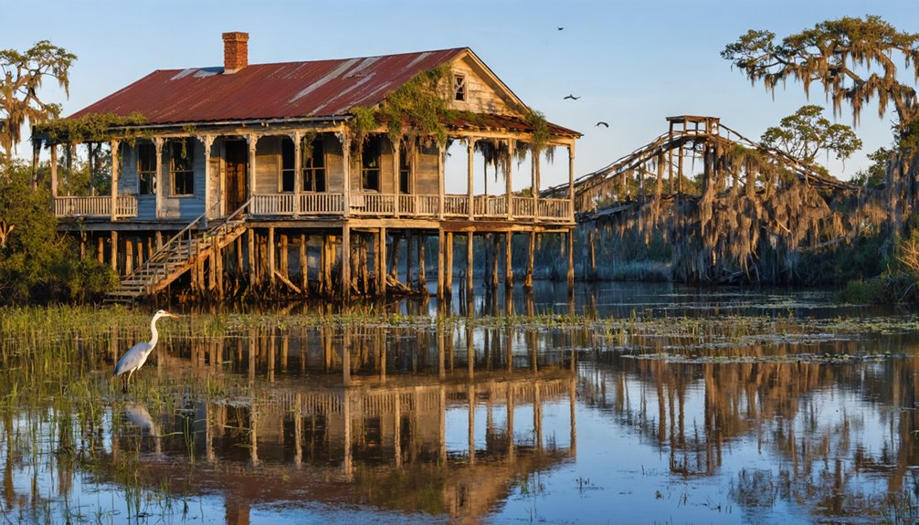
Cultural Heritage Along the Banks
Rich French heritage flows through False River’s cultural landscape, where historic Creole architecture and centuries-old traditions remain deeply rooted along its banks.
You’ll discover the region’s cultural traditions through the Pointe Coupée Parish Museum and community festivals that celebrate the area’s unique history dating back to 1713.
The LeJeune House stands as a symbol of the area’s architectural legacy, showcasing both Creole and Greek Revival styles.
You’ll find this National Register site among other historic buildings that line the former Mississippi River channel.
Through guided walking tours, you can explore the settlement’s evolution from its early French roots to its renaming as New Roads in 1888.
Local preservationists continue to protect these cultural treasures, ensuring they’ll inspire future generations.
Impact on Regional Development
While False River’s cultural heritage remains a treasured part of its identity, changing environmental and economic conditions have reshaped the region’s development trajectory.
You’ll find the area’s economic sustainability challenged by declining fisheries and tourism, with ripple effects throughout the local economy.
The path to community resilience faces significant hurdles that you need to understand:
Building resilient communities requires confronting and overcoming major obstacles that impact their long-term survival and success.
- Your regional infrastructure faces increased vulnerability to storms, potentially disrupting supply chains and causing billions in economic losses
- You’re seeing degraded aquatic habitats drive away both commercial fishing operations and recreational visitors
- Your local communities bear disproportionate environmental and health burdens while receiving limited economic benefits
- You’ve watched as once-thriving recreation-based economies struggle, threatening to transform vibrant areas into ghost towns
Natural Landscape Transformations
Through a remarkable geological transformation spanning 1713 to 1722, False River evolved from a main channel of the Mississippi River into the oxbow lake you’ll find today. This change showcases the geological significance of river meandering, where waterways naturally extend from their primary channels until finding shorter paths to the sea.
You’ll notice the dramatic ecological balance shifts that have occurred since then. The lake now averages 22 feet deep, with more than half its surface exceeding 20.3 feet.
While the natural formation process took decades, today’s landscape faces rapid changes from erosion and sediment loss. You can observe the effects in declining native vegetation, increasing water turbidity, and altered wetland conditions.
The False River Outfall Channel now connects the lake to Bayou Grosse Tete and Bayou Cholpe, fundamentally changing its hydrology.
Historic Preservation Efforts
Despite the challenges of natural decay and flood risks, False River’s historic preservation efforts center on protecting significant structures like the LeJeune House, which earned National Register status in 1978.
You’ll find that community restoration projects have transformed many historic buildings, blending Greek Revival and Pointe Coupee vernacular styles while preserving their authentic character.
Key aspects of local preservation include:
Preservation efforts in False River thrive through local leadership, innovative funding, modern conservation methods, and strong community support.
- Dedicated preservationists like Randy Harelson and Richard Gibbs leading restoration initiatives
- Creative solutions for preservation funding through tax incentives and state programs
- Implementation of modern conservation techniques while maintaining historical integrity
- Active community engagement in protecting cultural heritage sites
You can experience the area’s rich history through preserved architecture, which reflects diverse cultural influences and serves as a reflection of False River’s significant past.
Modern Life Around False River
Although False River’s population has declined in recent years, the area maintains a distinct lifestyle centered around its waterfront attractions and outdoor recreation.
You’ll find a diverse community where 61% of residents are White and 32% are Black, with a median household income of $59,351. The lake serves as the hub of community engagement, offering recreational opportunities like fishing, boating, and waterskiing.
While public transportation is limited, you’ll appreciate the dedicated lanes for walking and cycling, plus ample parking for lake activities.
The area draws both homeowners and retirees who value its peaceful, rural character. Despite an 18% poverty rate, many families thrive here, with married households earning around $89,073 annually.
Local events and festivities keep the community spirit alive, even as the population trends older.
Frequently Asked Questions
What Fish Species Can Be Found in False River Today?
You’ll find largemouth bass for prime bass fishing, plus several catfish species including blue, channel, and flathead. White perch, common carp, native minnows, and freshwater eels also inhabit these waters.
Are There Guided Historical Tours Available Around False River?
You’ll find guided tours highlighting historical significance at Pointe Coupee Museum daily, plus self-guided options on the 10-mile False River Historical Trail where you can explore local legends independently.
What Happened to the Original Native American Settlements Near False River?
You’ll find that native American settlements declined dramatically as French colonists expanded in the early 1700s, forcing indigenous peoples from their ancestral lands through displacement, enslavement, and forced assimilation near False River.
Can Visitors Rent Boats or Access False River for Recreational Activities?
You can access False River for boat rentals, including pontoons and jet skis, plus enjoy fishing opportunities. Daily rates start around $400, with equipment and safety gear provided through local outfitters.
How Deep Is False River at Its Deepest Point?
Imagine peering into crystal-clear waters as they plunge into darkness. You’ll find the deepest point reaches 62 feet, where the water clarity diminishes and the temperature drops noticeably lower.
References
- https://falseriver.la/en/false-river-history
- https://www.crt.state.la.us/Assets/OCD/archaeology/discoverarchaeology/virtual-books/PDFs/Bayou_Sara_Booklet.pdf
- https://k945.com/these-3-louisiana-ghost-towns-are-just-a-road-trip-away/
- https://www.louisianalife.com/true-history-on-false-river/
- https://en.wikipedia.org/wiki/List_of_ghost_towns_in_Louisiana
- https://louisiane.cheminsdelafrancophonie.org/en/at-pointe-coupee-the-oxbow-lake-is-still-alive/
- https://en.wikipedia.org/wiki/False_River_(Louisiana)
- https://www.fenstermaker.com/projects/false-river-watershed-study-2/
- https://wise.er.usgs.gov/dp/pdfs/WRI_99-4193.pdf
- https://64parishes.org/river-meanders