You’ll find Hawaii’s most famous ghost towns include Honoka’a, a former sugar plantation hub established in 1876 that declined after the 1946 tsunami, and Waipi’o Valley, once home to 5,000 Hawaiian royalty in the 1700s before disaster struck. Kalapana disappeared entirely when Kilauea’s lava buried 168 structures under 80 feet of molten rock between 1986-1992. Military installations across Oahu, sugar plantation ruins on Molokai, and ancient refuge sites complete Hawaii’s haunting collection of abandoned settlements that reveal the islands’ dramatic history.
Key Takeaways
- Kaimū was completely buried by lava in 1990 during Kīlauea’s eruption, erasing an entire fishing village.
- Waipi’o Valley housed 5,000 ancient Hawaiians until the 1946 tsunami left only 50 residents.
- Honoka’a Sugar Plantation thrived from 1876 until the devastating 1946 tsunami caused major decline.
- Laupahoehoe plantation peaked at 12,000 tons annually before the 1946 tsunami destroyed the community.
- Kalapana’s seaside community and famous black sand beach were buried under 80 feet of lava.
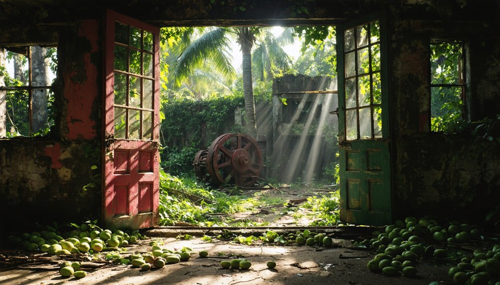
Honoka’a: From Sugar Boom to Tourist Destination
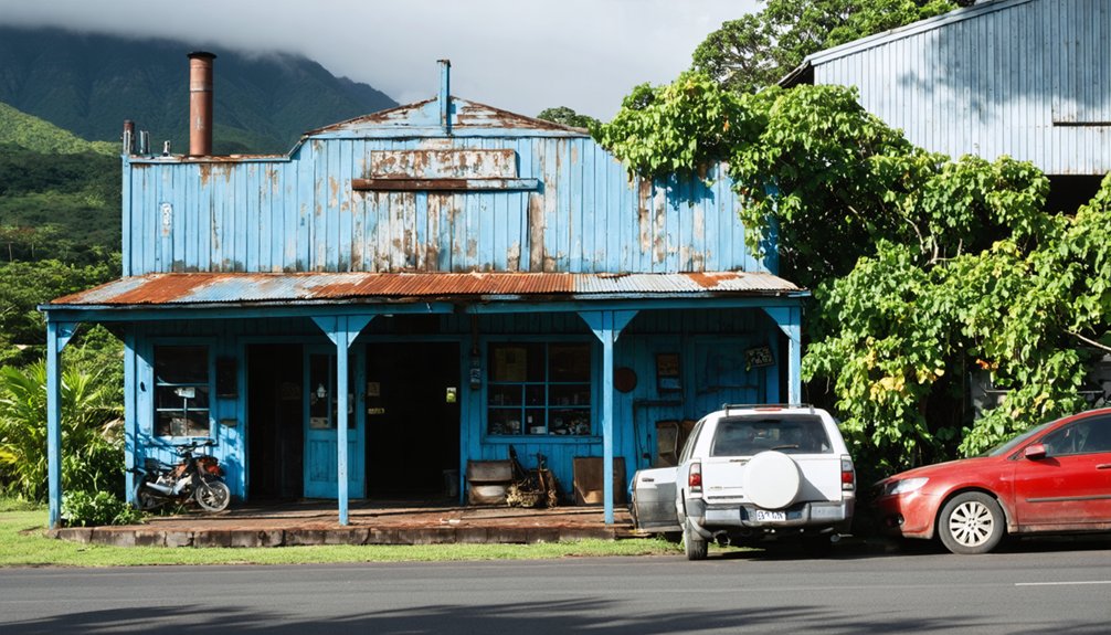
Honoka’a’s transformation from a thriving sugar plantation hub to a heritage tourism destination spans over a century of dramatic change on Hawaii’s Big Island.
You’ll discover this remote town’s origins trace to 1876 when J.F.H. Siemsen and J. Marsden established the Honoka’a Sugar Plantation on 500 acres. The sugar industry flourished through technological innovations like nine-roller mills and wire rope transport systems that loaded ships directly from clifftops.
Multi-ethnic immigrant workers from China, Japan, Philippines, and Portugal shaped the community’s unique cultural identity. However, the 1946 tsunami destroyed vital railroad infrastructure, beginning the plantation’s decline.
The 1946 tsunami marked the beginning of the end for Honoka’a’s multicultural sugar plantation community.
The plantation became renowned as the world’s oldest commercial producer of macadamia nuts, first planted in 1916. After final closure in 1994, you can explore preserved historic buildings and experience authentic Honoka’a heritage that celebrates this diverse plantation legacy. Today, the town hosts the Hamakua Music Festival at the historic People’s Theater, breathing new life into this former plantation community.
Waipi’o Valley: The Valley of the Kings Lost to Time
Deep within Hawaii’s Big Island lies Waipi’o Valley, where ancient Hawaiian royalty once ruled from grass palaces and stone temples before time and natural disasters transformed this sacred center into one of Hawaii’s most haunting ghost towns.
You’ll discover remnants of a civilization that housed 5,000 Hawaiians in the 1700s. Kings lived among four sacred 20-foot nioi trees until Kahekili II’s raids and later destruction.
The devastating 1946 tsunami wiped out most structures, leaving only 50 residents today.
Waipiʻo Legends permeate every corner—from Shark-Man Nanaue’s execution to Night Marchers guarding ancient secrets. The valley serves as a portal between the world of the living and Lua-o-Milu, the Hawaiian underworld where souls leap from sacred cliffs into Milu’s realm.
The Cultural Significance remains profound through dozen temple ruins and burial caves scattered throughout. Towering above the mystical landscape stands Hiilawe Falls, Hawaii’s tallest waterfall plunging over 1,000 feet into the valley below.
You can’t stay overnight unless invited, and spirits reportedly turn trespassers to stone, preserving this valley’s mysterious legacy.
Pu’uhonua O Honaunau: Ancient Hawaiian Refuge Preserved in Stone
Along Hawaii’s rugged south Kona coastline, Pu’uhonua O Honaunau stands as one of the Pacific’s most sacred ghost towns—a 180-acre stone sanctuary where ancient Hawaiians once fled to escape death sentences until 1819’s abolition of the kapu system silenced its life-saving purpose forever.
You’ll find massive lava stone walls marking where kapu lawbreakers, defeated warriors, and noncombatants crossed into sanctuary. The puʻuhonua history reveals desperate souls swimming through dangerous currents to reach safety, where kahuna priests absolved their crimes.
Sacred practices centered around Hale o Keawe temple, housing twenty-three aliʻi remains that empowered the refuge with protective mana. The guardian priest maintained constant vigilance over these deified bones to preserve the temple’s sacred power. The complex traces its origins to 1475 under aliʻi nui ʻEhu-kai-malino, establishing a foundation that would endure for centuries. Today’s preserved foundations and archaeological features tell stories of a civilization where crossing stone boundaries meant the difference between execution and redemption—freedom’s most literal interpretation.
Laupahoehoe: Sugar Plantation Ruins Reclaimed by Nature
Towering sugarcane stalks once swayed across Laupahoehoe’s fourteen ahupua’a, where Abel Harris and FB Swain’s 1859 venture transformed coastal lowlands into Hawaii’s most innovative plantation before nature reclaimed its ruins.
You’ll discover Laupahoehoe history through groundbreaking engineering feats—the first Hawaiian plantation to lift water 750 feet using high-lift pumps, transporting cane through extensive flume systems across 22 gulches.
The 1875 reciprocity treaty launched prosperity, with annual yields reaching 12,000 tons by 1918. However, the devastating 1946 tsunami destroyed railroad infrastructure, accelerating the plantation’s decline. The disaster’s human toll included the tragic loss of 25 school children from Laupāhoehoe School who perished in the massive waves.
Today, you’ll find concrete platforms where hula dancers once entertained tourists, while the Train Museum preserves this sugar plantation legacy in the former superintendent’s home amid nature’s gradual reclamation. The plantation’s most remarkable feature was its steam hoist system that lifted cane an incredible 1100 feet at Maulu Gulch until equipment failure destroyed it in 1943.
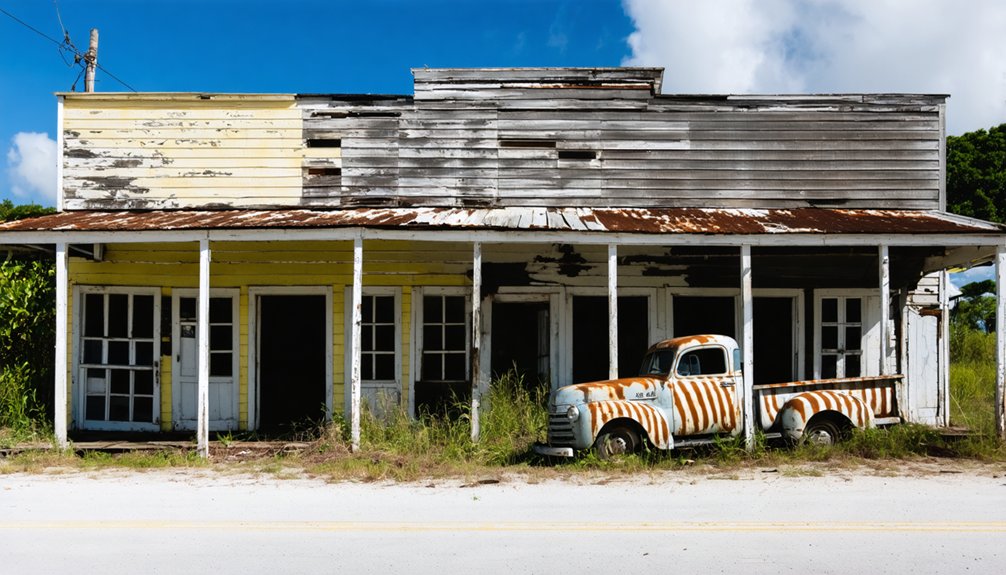
Honuapo: Mill Town Remnants of Hawaii’s Industrial Past
Ancient fishponds and taro fields marked Honuapo’s beginnings 500 years ago, where Native Hawaiians shaped the natural estuary into productive agricultural land before industrial transformation arrived in 1883.
You’ll find this ghost town’s Honuapo history fascinating—translating to “caught turtle,” it evolved from subsistence farming into a thriving port with warehouses, mills, and railroad connections serving the Hutchinson Sugar Plantation established in 1890.
Industrial decline began when road improvements shifted cargo to trucks, reducing railroad dependency. Caterpillar infestations created track slime, hindering train operations.
The devastating 1946 tsunami destroyed much infrastructure, with 1957’s additional tsunami damage prompting complete abandonment. An earlier 1868 earthquake and tsunami had previously destroyed the original Hawaiian fishing village.
Today, you can explore Whittington Park off Highway 11, where old wharf remains, warehouse foundations, and plantation ruins on the ridge preserve this industrial heritage for adventurous visitors. Summer months provide the ideal conditions for exploring this remote ghost town location.
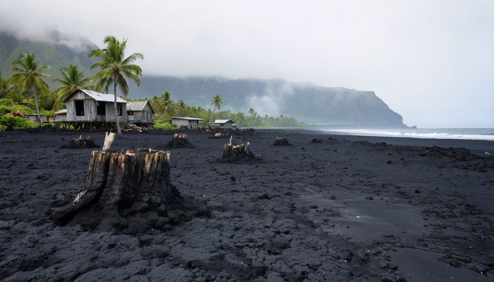
Kaimū: The Village That Lava Claimed
While most ghost towns succumb to economic decline or natural disasters, Kaimū represents something far more dramatic—a thriving Hawaiian fishing village completely erased by volcanic forces in 1990.
A Hawaiian paradise turned geological graveyard when Kīlauea’s fury buried an entire fishing village beneath rivers of molten rock.
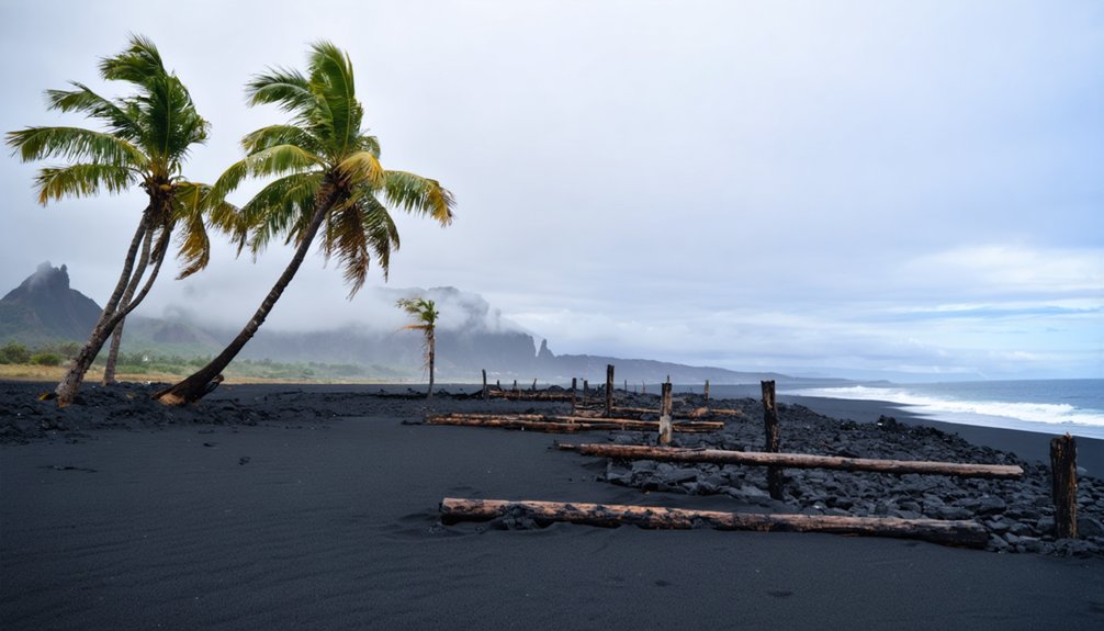
You’ll find this former paradise once attracted surfers to its world-famous black sand beach and supported families through fishing and traditional salt-making.
When Kīlauea’s Puʻu ʻŌʻō eruption turned destructive in March 1990, lava buried 100-150 homes, the church, and store under 50-85 feet of molten rock.
The flow filled Kaimū Bay entirely, extending the shoreline nearly 1,000 feet seaward.
Today’s Kaimū resilience shines through replanted coconut groves and emerging vegetation that transforms the volcanic aftermath into Hawaii’s youngest black sand beach.
Kalapana: Black Sand Beach Community Buried by Volcanoes
Kalapana’s destruction unfolded over decades rather than in a single catastrophic event like its neighbor Kaimū.
You’ll find Kalapana history marked by repeated volcanic threats, beginning with the September 1977 eruption that brought lava within a quarter-mile of the village. Civil Defense evacuated over 100 families to Pahoa School as National Guard troops secured the area.
The volcanic impact intensified during the 1983-2018 Pu’u ‘Ō’ō eruption, Kilauea’s longest in 500 years.
From 1986-1992, unstoppable flows buried the entire seaside community under 80 feet of lava. You’d witness 168 primary structures vanishing along with Royal Gardens subdivision, schools, and the famous black sand beach.
One defiant resident held out until 2014 before lava finally claimed his home, completing Kalapana’s transformation into volcanic wasteland.
Molokai’s Kaunakakai Plantation: Isolated Island Abandonment
Unlike Kalapana’s dramatic volcanic burial, Kaunakakai’s ghost town story unfolds through economic abandonment on Molokai’s isolated shores.
Kaunakakai history began when Bernice Pauahi Bishop‘s parents claimed this land in 1848. You’ll discover how Kamehameha IV established Molokai Ranch in 1859, creating the foundation for future agricultural ventures.
The town flourished during sugar operations in the 1880s, then transformed dramatically when pineapple companies arrived in the 1920s.
The pineapple boom reshaped everything:
- Island population quintupled from 1,117 to 5,677 between 1920-1935
- 11,000 acres supported massive pineapple cultivation operations
- Concrete wharf replaced wooden infrastructure for shipping demands
Pineapple decline eventually strangled the economy.
Molokai Ranch’s 2008 closure completed the abandonment cycle.
Today, you’ll find preserved 1920s-1930s structures standing as silent witnesses to Hawaii’s forgotten agricultural empire.
Maui’s Haleakala Ranch Towns: High Altitude Ghost Settlements
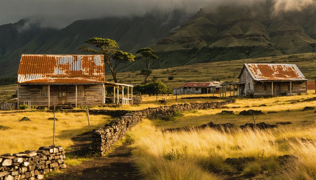
You’ll find Maui’s most isolated ghost settlements scattered across Haleakalā’s slopes, where ranching operations established in 1888 created clustered communities that couldn’t withstand the mountain’s harsh climate and economic pressures.
The Baldwin family’s Haleakalā Ranch once supported multiple high-altitude settlements near Kula and Makawao, but mechanization in the mid-20th century eliminated the labor demand that sustained these remote outposts.
Today, you can explore remnants of worker cabins, homesteads, and ranch infrastructure around Puʻu Pahu and the Upper Kula corridor, where foundations and ruins mark former communities abandoned to conservation efforts and consolidated land management.
Ranch History and Abandonment
When H.P. Baldwin purchased that modest 16½-acre parcel for $500 in 1869, you’re witnessing the birth of what would become Maui’s largest cattle operation.
The ranch expanded dramatically to over 30,000 acres, stretching from shoreline to Haleakala’s uplands where remote settlements housed workers and their families.
The ranch legacy spans six generations of Baldwin family control until 2000, but several factors created abandonment reasons for high-altitude settlements:
- Major land transactions transferred thousands of acres to government and conservation groups
- Economic shifts from pure cattle ranching to diversified agriculture reduced workforce needs
- Geographic isolation made maintaining remote settlements increasingly impractical
You’ll find these ghost settlements scattered across Haleakala’s slopes, remnants of Hawaii’s paniolo heritage that once thrived in Maui’s volcanic highlands.
High Elevation Climate Challenges
At Haleakala’s extreme elevations, ranch settlements faced brutal environmental conditions that made year-round habitation increasingly difficult.
You’ll find these abandoned communities scattered between 6,000 and 8,000 feet, where near-freezing temperatures and severe elevation challenges forced residents to abandon their homesteads. Ranch families couldn’t adapt to the dramatic atmospheric pressure drops and constant shortness of breath that plagued sea-level transplants.
Climate adaptation proved impossible as trade winds brought unpredictable weather patterns, alternating between bone-dry conditions and sudden cloud cover.
The 10,000-foot elevation gradient created multiple hostile climate zones that tested human endurance. Watershed conservation efforts eventually displaced remaining ranchers, while the barren, steep-walled terrain made sustainable agriculture unfeasible.
These ghost settlements now stand as monuments to humanity’s struggle against Haleakala’s unforgiving high-altitude environment.
Remaining Structures and Ruins
Scattered remnants of Haleakala Ranch‘s high-altitude settlements still dot the volcanic slopes, offering tangible evidence of ambitious ranching ventures that once thrived above 6,000 feet.
You’ll discover traces of Haleakala architecture that reflect the Baldwin family’s century-long commitment to sustainable ranching operations across 30,000 acres of diverse terrain.
The surviving ranch infrastructure tells stories of adaptation and perseverance:
- Kaluanui mansion – Harry Baldwin’s 1918 residence near Makawao, now housing the Hui No’eau Visual Arts Center
- Kalahaku rest house – 1894 summit shelter built for crater visitors, demonstrating early tourism infrastructure
- Hosmer’s Grove timber stands – 1909 experimental plantings that remain visible today as living monuments
These structures represent Hawaii’s ranching heritage, where paniolo culture flourished alongside innovative land management practices that shaped Maui’s agricultural landscape.
Oahu’s Abandoned Military Installations: War Era Relics
You’ll discover Oahu’s military ghost sites scattered across the island, from Fort DeRussy’s massive concrete batteries on Waikiki Beach to Diamond Head’s hidden gun emplacements that once protected Honolulu Harbor.
These abandoned installations represent over a century of coastal defense evolution, beginning with early 1900s fortifications and expanding dramatically during World War II when the island bristled with radar stations, airfields, and anti-aircraft positions.
Today you can explore remnants of this military network, including decommissioned fighter strips at Haleiwa, crumbling concrete hangars at former MCAS Ewa, and Battery Randolph’s 12-foot-thick walls that proved too resilient for demolition crews.
WWII Bunker Networks
Following the Pearl Harbor attack in December 1941, military engineers transformed Oahu’s coastline into a fortress of concrete bunkers and gun batteries that would define the island’s wartime defense strategy.
You’ll discover remarkable bunker architecture ranging from Battery Cooper’s 150-foot tunnels carved into volcanic cliffs to Battery Arizona’s three-gun turret positioned 70 feet above underground magazines. These coastal defenses created an interconnected network protecting strategic locations like Kāne’ohe Bay and Kaneohe Marine Base.
Key defensive installations include:
- Battery 405: Two 8-inch salvaged guns with 20-mile range capability
- Pink Bunker: Fire control station coordinating 16-inch gun operations
- Camp Pālehua: High-tech scanning equipment monitoring ocean approaches
Today, you can explore these abandoned fortifications that showcase America’s rapid military mobilization following Pearl Harbor.
Coastal Defense Batteries
Five major coastal defense batteries transformed Oahu into an impregnable fortress during World War II, with each installation strategically positioned to create overlapping fields of fire around the island’s vital military assets.
You’ll find Battery Cooper’s innovative tunnel design carved into volcanic cliffs near Kualoa Ranch, protecting Kāneʻohe Bay with 6-inch guns.
The revolutionary 8-inch naval turret batteries at Brodie and Salt Lake marked America’s first shore-based use of carrier gun mounts, delivering devastating 360-degree coverage.
Battery Randolph’s 12-foot concrete walls at Fort DeRussy required 115 soldiers to operate, while Battery Harlow’s mortars crowned Diamond Head’s slopes.
These coastal artillery installations represent essential historical preservation efforts, showcasing how military engineers created an impenetrable “Ring of Steel” defending Hawaii’s strategic waters.
Radar Station Ruins
Beyond the massive gun emplacements that formed Oahu’s defensive perimeter, a network of radar stations provided the electronic eyes that would scan Hawaii’s skies for approaching threats.
The Opana history began when Colonel Wilfred Tetley ordered six mobile SCR-270 radar installations across Oahu in 1941. These revolutionary radar technology stations represented America’s first line of electronic defense.
Today, you can explore remnants of these essential installations:
- Opana Radar Site – Where Privates Elliot and Lockard detected incoming Japanese aircraft at 7:02 AM on December 7, 1941
- Koko Head Station – Accessible ruins featuring viewing platforms amid deteriorating WWII equipment and pillboxes
- Schofield Barracks – Original radar location before Thanksgiving 1941 relocation to Opana’s 532-foot elevation
These abandoned sites mark America’s first operational wartime radar deployment.
Frequently Asked Questions
Are Hawaii’s Ghost Towns Safe to Visit Without a Guide?
You shouldn’t explore Hawaii’s ghost towns alone—ancient paths hold spiritual dangers and physical hazards. Safety precautions include respecting cultural protocols, while guided tours provide essential knowledge about sacred sites and protective measures.
What’s the Best Time of Year to Explore Hawaiian Ghost Towns?
You’ll find April through October offers ideal conditions for ghost town exploration. Dry weather guarantees safer terrain navigation, while avoiding hurricane season and peak seasonal events that intensify reported supernatural activities throughout Hawaii’s abandoned settlements.
Do You Need Special Permits to Visit Abandoned Sites in Hawaii?
Freedom rings across most Hawaiian ghost towns—you won’t need special permits for abandoned site regulations. National parks require standard fees, while military bunkers and tsunami-damaged villages follow general public access without specific permit requirements.
Which Hawaiian Ghost Town Is Easiest to Reach by Car?
You’ll find Pali Lookout most accessible via Pali Highway from Waikiki in twenty minutes. These accessible locations offer scenic routes through paved mountain tunnels, connecting you directly to windward viewpoints without hiking requirements.
Can You Camp Overnight Near Any of Hawaii’s Ghost Towns?
You can’t camp near Hawaii’s ghost towns due to strict camping regulations requiring designated sites with permits. These remote locations lack ghost town amenities and legal camping infrastructure, forcing you to stay elsewhere.
Exploring abandoned towns on the big island offers a unique glimpse into Hawaii’s history, but the journey requires careful planning. Many of these sites are best accessed by guided tours that highlight their cultural significance while ensuring safety. Visitors should also prepare for the rugged terrain and limited resources available in these remote areas.
References
- https://nvtami.com/2023/04/26/big-island-hawaii-ghost-towns/
- https://www.ghosttowns.com/states/hi/hi.html
- https://www.mysteries-of-hawaii.com/blog
- https://www.youtube.com/watch?v=q56mo4VCXtE
- https://www.atlasobscura.com/things-to-do/hawaii/abandoned
- https://freepages.rootsweb.com/~gtusa/history/usa/hi.htm
- https://www.onlyinyourstate.com/experiences/hawaii/abandoned-hi
- https://kids.kiddle.co/List_of_ghost_towns_in_Hawaii
- https://hamakua.org/honokaa-sugar-company/
- https://www.hawaiilife.com/blog/sugar-king-heyday-hamakua-coast/