You’ll find Louisiana’s most famous ghost towns shaped by hurricanes, industry collapse, and coastal erosion. Ruddock housed 900 residents before the 1915 hurricane completely obliterated this cypress lumber town. Frenier vanished the same year amid local folklore of voodoo curses. Cheniere Caminada disappeared in 1893’s deadly Category 4 storm that killed 779 residents. Bayou Chene’s floating community succumbed to 1937 flooding, while Taft transformed from agriculture to industrial abandonment. Each settlement reveals unique stories of Louisiana’s vanished communities.
Key Takeaways
- Ruddock was a thriving cypress lumber town with 900 residents until completely destroyed by the Hurricane of 1915.
- Frenier became legendary for voodoo priestess Julia Brown’s curse before a 1915 Category 4 hurricane killed sixty residents.
- Cheniere Caminada was obliterated by America’s deadliest hurricane in 1893, killing 779 of its 1,471 fishing village residents.
- Bayou Chene housed 500 residents in flood-adapted homes until buried under twelve feet of sand in 1937.
- Taft declined from 700 residents to zero by 2000 after industrial transformation replaced the original agricultural community.
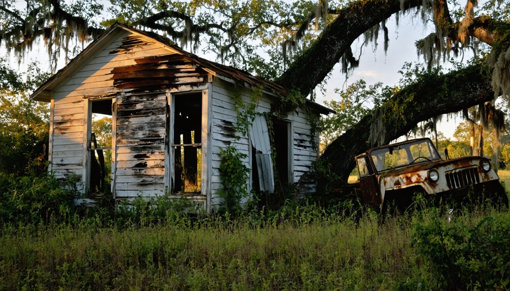
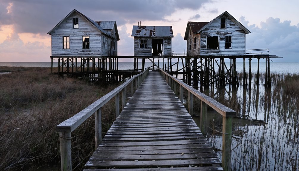
Ruddock: The Cypress Lumber Town Destroyed by Hurricane
In the early 1800s, German colonists established a settlement along Lake Pontchartrain’s shores, ten miles north of what’s now LaPlace, creating what would become one of Louisiana’s most prosperous lumber towns.
By 1854, railroad connections transformed this modest community into a timber powerhouse when C.H. Ruddock and William Burton formed the Ruddock Cypress Company in 1891.
Railroad connections in 1854 launched this modest settlement’s transformation into a major timber powerhouse through the Ruddock Cypress Company partnership.
Ruddock history reveals a self-sufficient town housing 900 residents at its peak.
You’d find everything from telegraph offices to hospitals, all supporting the massive sawmill that employed 1,200 workers.
The cypress industry generated millions of board feet annually throughout the 1890s, making fortunes from Louisiana’s abundant wetland forests.
The entire town was constructed on stilts above the swamp waters to accommodate the challenging wetland environment.
However, the Hurricane of 1915 obliterated this thriving community completely, leaving only an Interstate 55 exit sign marking where prosperity once flourished. The catastrophic storm brought 145 mph winds that devastated the town beyond recovery.
Frenier: Home of the Voodoo Priestess Curse
Just twenty-five miles from Ruddock’s devastation, another Louisiana community would face an equally catastrophic fate, though this ghost town’s story became entangled with supernatural folklore that persists today.
Frenier sat isolated on an isthmus between Lake Pontchartrain and Lake Maurepas, accessible only by railroad.
You’ll find Frenier folklore centers on Julia Brown, a local healer who allegedly predicted the town’s destruction through voodoo curses.
However, historical records reveal Brown was actually a respected landowner and mother who served her community as a folk healer. Brown had three educated children who survived the devastating storm that claimed her life and destroyed their community.
Brown was known for playing eerie songs on her guitar, including one that foretold her own death and the demise of everything with her.
When the Category 4 hurricane struck September 29, 1915, with 145-mph winds and 13-foot storm surge, it obliterated Frenier completely, killing sixty residents and transforming Brown’s tragic death into enduring supernatural legend.
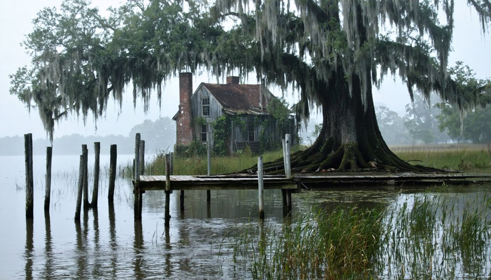
Bayou Chene: The Floating Community of the Atchafalaya Basin
While most Louisiana settlements clung to solid ground, Bayou Chene embraced the rhythms of rising and falling waters deep within the Atchafalaya Basin. This floating settlement emerged in the 1830s, forty miles north of Morgan City, where families built homes with raised floors to dance with the floods rather than fight them.
By the early 1920s, 500 residents had carved out remarkable lives in this watery wilderness. The Mississippi River’s constant sediment deposits had originally helped build the land beneath their community, demonstrating water’s dual role as both creator and destroyer:
- Self-sufficient economy – They raised sugar cane, corn, livestock, and built cattle rafts during high water.
- Complete isolation – Only boat access connected them to the outside world.
- Thriving infrastructure – Church, school, and store served 100 students by the 1930s.
The lumber industry transformed the area after 1876, as swampers and lumberjacks moved in to harvest massive cypress trees that often measured over ten feet across. This Atchafalaya History ended when the 1937 flood and spillway construction buried their floating settlement under twelve feet of sand.
Cheniere Caminada: Victim of America’s Deadliest Hurricane
Long before anyone tracked hurricanes with satellites or named them alphabetically, a monstrous Category 4 storm roared ashore at Cheniere Caminada on October 2, 1893, transforming a thriving barrier island community into Louisiana’s most devastating natural disaster.
You’ll find where this once-prosperous fishing village stood near Grand Isle, though little remains of its vibrant Cheniere history. Francisco Caminada’s namesake community housed 1,471 residents who’d built 180 structures, including Catholic churches, stores, and resort boarding houses that attracted New Orleans Creole families via weekly steamers.
The 18-foot storm surge killed 779 residents—over half the population—wiping the settlement from existence. Among the few structures to withstand the catastrophe, the Curole house was later moved 40 miles north to Cut Off, Louisiana, where it stood for over a century. The devastating storm also contaminated the community’s rainwater supplies with seawater, leaving survivors without drinkable water.
Today’s Hurricane memorials consist of a sinking oak tree and crumbling cemetery graves, marking Louisiana’s deadliest natural disaster.
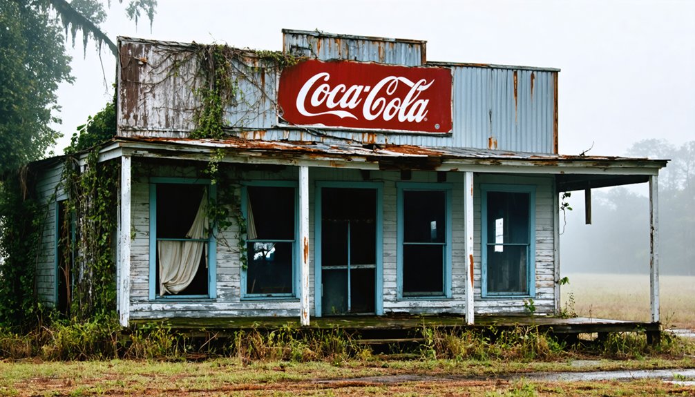
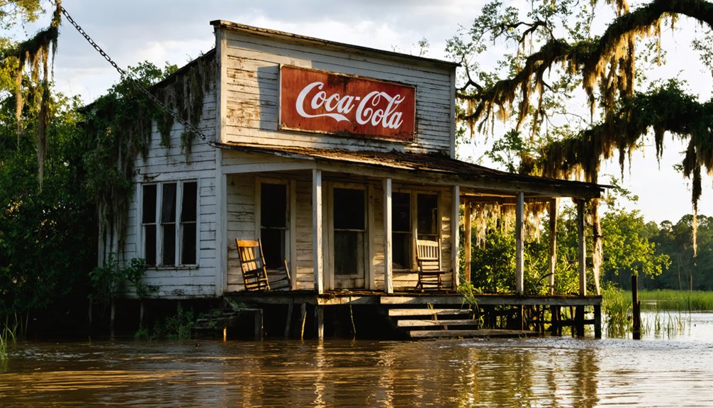
Taft: The Industrial Ghost Town of St. Charles Parish
You’ll find Taft’s transformation from a thriving agricultural community to an industrial ghost town uniquely tied to the relocation of Our Lady of the Most Holy Rosary Catholic Church in 1963-1964.
The church’s move to Hahnville marked the end of Taft’s role as a community center, while industrial expansion consumed the remaining residential areas for pipeline development. Taft was located in Saint Charles Parish, which encompasses multiple locations and topics that share the same name throughout Louisiana’s history.
What remains today is only the original cemetery, now surrounded by Dow pipelines, serving as the sole remnant of a town that once housed 700 residents when its post office opened in 1905. The 2000 Census recorded zero population for Taft, officially confirming its status as a complete ghost town.
Church Relocation History
Although Taft’s transformation into a ghost town erased most traces of its former community, the relocation of Our Lady of the Most Holy Rosary Catholic Church provides a detailed chronicle of the town’s gradual decline. Founded in 1866 by Rev. Gustave Jobard, this church’s significance extended far beyond Taft’s borders, operating four mission chapels until 1900.
The church’s relocation timeline reveals systematic community resilience:
- 1940s-1957: Leaders recognized shifting demographics and acquired property near Hahnville
- 1963-1964: Physical relocation completed to current site between Hahnville and Flaggville
- Post-1967: Taft’s post office closed, confirming the town’s abandonment
You’ll find the original cemetery still operates at the Taft site, surrounded by industrial pipelines—a haunting reminder of the community that once thrived there.
Industrial Transformation Impact
When the lumber industry abandoned Taft in 1918, few residents could’ve predicted that industrial giants would systematically transform their agricultural community into Louisiana’s most concentrated chemical manufacturing zone.
You’d witness this economic transformation accelerate through the 1960s as Union Carbide, Hooker Chemical, and other corporations acquired virtually every acre of residential and farming land.
The industrial decline of community life was swift—your neighbors’ population dropped from 200 residents in 1958 to zero by 2000.
Today, you’ll find heavy industrial zoning has completely replaced the sugar cane fields and dairy farms that once sustained families.
While industry enriched St. Charles Parish economically, it depleted Taft entirely, leaving only a cemetery surrounded by Dow chemical facilities as evidence of the vibrant river community that once thrived here.
Laurel Valley: Hollywood’s Famous Sugar Plantation Ruins
Since Etienne Boudreaux first received a land grant in 1783, Laurel Valley has evolved from a modest farming operation into one of Louisiana’s most historically significant and cinematically famous plantation ruins.
This sugar plantation expanded dramatically under Joseph Tucker’s ownership from 1832-1865, growing from 500 to 5,000 acres.
You’ll discover three remarkable aspects when visiting:
- Surviving Infrastructure – Over 60 of the original 105 buildings remain standing, including slave cabins, a schoolhouse, and church.
- Industrial Innovation – Tucker’s dummy railroad system connected fields to processing facilities, while Lepine invented tractors in 1915.
- Hollywood Legacy – The atmospheric ruins serve as popular filming locations for major motion pictures.
Today, you can explore America’s largest surviving sugar plantation complex through guided tours at 10:30 AM and 2:00 PM daily.
Grand Isle’s Lost Settlements Along the Gulf Coast
When you visit Grand Isle today, you’re standing on the remnants of once-thriving settlements that nature has systematically reclaimed since the 1890s.
The devastating 1893 Chenier Caminada hurricane killed over 2,000 people and destroyed entire resort communities, while repeated storm surges have steadily eroded the coastline for more than a century.
You’ll find traces of Caminadaville and other maritime settlements that housed 180 buildings, luxury hotels, and Acadian fishing villages before hurricanes and coastal erosion transformed them into Louisiana’s most haunting coastal ghost towns.
Hurricane Devastation and Abandonment
Along Louisiana’s vulnerable Gulf Coast, hurricane devastation has repeatedly transformed thriving communities into abandoned settlements, creating some of the state’s most haunting ghost towns.
Explorers and photographers are drawn to these abandoned places in Louisiana, seeking to capture the eerie beauty and stories left behind. Each site, from deserted plantations to crumbling structures, offers a glimpse into the region’s rich history and the resilience of its former inhabitants. As nature slowly reclaims these spaces, they serve as poignant reminders of the challenges faced by communities in the wake of disaster.
You’ll discover how these catastrophic storms fundamentally altered coastal settlement patterns across generations.
The historical record reveals three devastating patterns:
- The 1893 Cheniere Caminada Hurricane – Nearly wiped out an entire community of 1,471 residents, killing approximately half and establishing early abandonment precedents.
- Hurricane Katrina’s 2005 Impact – Destroyed 400 homes on Grand Isle, though hurricane recovery efforts enabled quick reconstruction due to tourism dependency.
- Recent Storm Succession – Hurricane Rita damaged Leeville in 2005, while Hurricane Ida delivered the fatal blow in 2021, leaving only three families.
These repeated disasters demonstrate how Gulf Coast communities face an ongoing cycle of destruction and difficult recovery decisions.
Coastal Erosion Impact
While hurricanes deliver sudden devastation, coastal erosion operates as a relentless force that’s gradually erasing Louisiana’s barrier islands and the settlements they once supported.
You’ll find that the Isles Dernieres have lost 77% of their area since 1890, shrinking from 3,360 to just 771 hectares. At Whiskey Island, beaches have retreated over 2,500 meters at an average rate of 26 meters yearly.
Pelto Island has completely submerged, leaving only wooden pilings as ghostly markers of former habitation.
Louisiana’s coast has lost 1,900 square miles since the 1930s, with 25-35 square miles disappearing annually.
Despite coastal restoration efforts and improved marshland management following the 1990 Coastal Wetlands Act, rising seas continue claiming settlements that once thrived along these vulnerable shores.
Maritime Community Remnants
Though hurricanes and erosion have claimed much of Louisiana’s coastal heritage, Grand Isle’s maritime legacy stretches back to the 1780s when Spanish colonial administrators divided the barrier island into four strategic land grants.
You’ll discover layers of maritime heritage embedded in this Gulf Coast community’s evolution from indigenous settlements to modern fishing operations.
The island’s community resilience manifests through distinct historical phases:
- Chitimacha foundations – Native tribes established the first sustainable fishing and hunting practices.
- Plantation transformation – Spanish grantees like Jacques Rigaud converted coastal resources into profitable sugar and cattle operations.
- Resort renaissance – Post-Civil War developers replaced failing plantations with steamboat-accessible hotels serving New Orleans elite.
Despite devastating hurricanes in 1893 and 1965, Grand Isle’s maritime traditions endure through Filipino and Chinese immigrant fishing communities.
Manchac: The Cursed Swampland Community
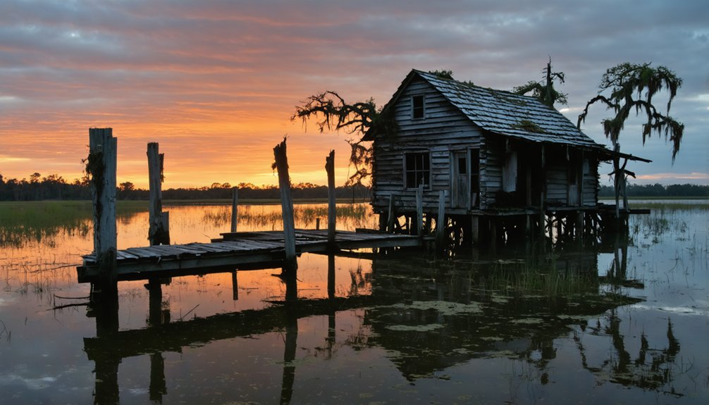
The same day, a Category 4 hurricane with 145 mph winds obliterated Frenier, killing 50-60 residents.
Today’s cursed folklore includes ghostly apparitions, mysterious lights, and echoing cries through cypress trees.
You can explore this haunted swampland where Julia’s isolated grave and a mass burial site remain hidden among alligator-infested waters.
Carencro Bayou: Remnants of the Timber Industry
- Sagging mill foundations and graying lumber piles marking abandoned sites
- Logging canals and dredge remnants carved through the Atchafalaya Basin
- Steam-powered machinery remnants from operations that processed millions of board feet
Lake Hermitage: The Vanishing Fishing Village
You’ll find Lake Hermitage transformed from a thriving plantation settlement into a disappearing fishing village through decades of relentless coastal erosion.
Hurricane Katrina accelerated this vanishing process in 2005, devastating what remained of the community’s fishing infrastructure and forcing out most residents.
Today, you can witness only scattered remnants of abandoned docks, boat launches, and weathered pilings that once supported a vibrant fishing economy before rising waters claimed the marsh.
Hurricane Katrina’s Devastating Impact
When Hurricane Katrina made landfall as a Category 3 storm on August 29, 2005, the small fishing village of Lake Hermitage in Plaquemines Parish faced complete annihilation.
You’d witness sustained winds exceeding 115 mph and storm surges over 20 feet that swallowed this community whole, transforming it into one of Louisiana’s newest ghost towns.
The devastation unfolded through three catastrophic phases:
- Immediate Destruction – Storm surge flooded the entire basin within hours, submerging homes under 15-20 feet of water.
- Complete Displacement – All 200 residents evacuated permanently, with zero documented returns.
- Economic Collapse – The commercial fishing fleet was destroyed, eliminating millions in vessels and gear.
Despite community resilience efforts, the village’s elevation below five feet above sea level sealed its fate, converting habitable land to open water by 2010.
Abandoned Fishing Infrastructure Remains
Today’s Lake Hermitage bears haunting evidence to its former life as a thriving fishing community, where skeletal remnants of infrastructure pierce the waterline like maritime tombstones.
You’ll discover three documented houses surrounded by rising waters, proof of nature’s relentless advance against human settlement. The abandoned homes tell stories of families who once called this protected bayou sanctuary home, their structures gradually surrendering to the encroaching lake.
The fishing infrastructure that supported generations has largely vanished beneath the surface. What remains visible serves as stark reminders of a community that couldn’t withstand environmental pressures.
Limited property information exists for these submerged dwellings, their histories swallowed alongside their foundations. This transformation reflects the broader struggle of Louisiana’s coastal communities against subsidence and rising waters.
Coastal Erosion Acceleration
Since 1932, Lake Hermitage’s surrounding marshlands have surrendered 38% of their area to advancing waters, transforming this once-stable fishing community into Louisiana’s most dramatic example of coastal erosion‘s destructive power.
You’re witnessing coastal vulnerability accelerated by multiple environmental forces that’ve overwhelmed the region’s natural environmental resilience.
Three primary drivers fuel this relentless destruction:
- Relative sea-level rise combines global ocean rise with local land subsidence, drowning marshes faster than they can rebuild.
- Mississippi River alterations starve wetlands of sediment needed to maintain elevation against rising waters.
- Intensified storm activity delivers episodic overwash events that fragment remaining marsh areas.
Canal dredging and saltwater intrusion further destabilize vegetation, reducing soil cohesion.
Without intervention, projections indicate continued marsh loss through mid-century, potentially erasing Lake Hermitage’s final traces.
Frequently Asked Questions
Are Any of Louisiana’s Ghost Towns Safe to Visit Without a Guide?
You can safely explore Sherburne and Ruddock-Frenier without guided tours. Take basic safety precautions like sturdy footwear and insect repellent. Avoid Taft’s industrial zones and Bayou Chene’s flooding risks unless you’re experienced.
What’s the Best Time of Year to Explore Louisiana’s Abandoned Settlements?
You’ll find fall exploration ideal from October through February when humidity drops, vegetation recedes, and flooding risks diminish. Spring visits work too, though summer’s heat and storms make winter your safest, most comfortable window.
Do Any Ghost Towns Still Have Original Buildings Standing Today?
Yes, you’ll find original structures at several Louisiana ghost towns. Church ruins near Cheneyville showcase architectural significance, while cemeteries at Taft demonstrate ongoing preservation efforts. Masonry buildings survive better than wooden structures in Louisiana’s climate.
Which Louisiana Ghost Town Has the Most Paranormal Activity Reported?
Ironically, you’ll find the most haunted ghost town isn’t abandoned at all—St. Francisville’s Myrtles Plantation reports constant ghostly sightings from Chloe’s apparition and Winter’s murder, making it America’s most haunted house.
Can You Legally Metal Detect or Collect Artifacts in These Locations?
You can’t legally metal detect at Louisiana’s ghost towns without written landowner permission. Metal detecting laws prohibit activity on public lands, while artifact collecting regulations require permits and mandate surrendering historical finds to authorities.
References
- https://www.ezhomesearch.com/blog/ghost-towns-in-louisiana/
- https://kids.kiddle.co/List_of_ghost_towns_in_Louisiana
- https://thebayouinsider.substack.com/p/ghost-towns-and-forgotten-roads-louisianas
- https://etsn.fm/ixp/33/p/7-louisiana-ghost-towns/
- https://710keel.com/discover-70-ghost-towns-from-across-louisiana/
- https://www.ghosttowns.com/states/la/la.html
- https://lobservateur.com/2015/09/30/ruddock-washed-away-100-years-ago/
- https://www.crt.state.la.us/Assets/OCD/hp/nationalregister/historic_contexts/The_Louisiana_Lumber_Boom_c1880-1925.pdf
- https://kids.kiddle.co/Ruddock
- https://manchacgreenway.org/ruddock/