You’ll discover Maryland’s most compelling ghost towns include Conowingo, deliberately flooded in 1928 for hydroelectric power, and Daniels, destroyed by Hurricane Agnes after economic collapse. Port Tobacco transformed from Maryland’s second-largest port to a town of just fifteen residents due to river siltation and railroad competition. Frenchtown thrived as a steamboat hub before transportation changes rendered it obsolete. Each location represents different forces—natural disasters, technological shifts, and human intervention—that can transform thriving communities into haunting reminders of Maryland’s complex past.
Key Takeaways
- Port Tobacco Village declined from Maryland’s second-largest port to just fifteen residents due to river siltation and railroad competition.
- Conowingo was completely submerged in 1928 when Philadelphia Electric Company flooded the area to create a hydroelectric reservoir.
- Daniels mill town was abandoned after economic collapse in 1972, then Hurricane Agnes destroyed remaining buildings that same year.
- Frenchtown thrived as a steamboat transportation hub before declining when railroads and canals diverted traffic through other routes.
- St. Mary’s City, Maryland’s original colonial capital, was dismantled after 1695 and now operates as a living historical museum.
Conowingo: A Town Swallowed by Progress
While most ghost towns fade gradually through economic decline or natural disasters, Conowingo met its end through deliberate human intervention.
You’ll find this Cecil County community was thriving with 350 residents, two doctors, and essential businesses when Philadelphia Electric Company decided the Susquehanna River’s power potential outweighed the town’s existence.
Construction began in 1926, requiring massive infrastructure changes including relocating 16 miles of Pennsylvania Railroad.
On January 18, 1928, the final floodgates closed, creating a 9,000-acre lake that erased generations of town memories.
The flooding destroyed the downstream Conowingo archaeological site’s significance, washing away materials spanning from 3750 BC to AD 1600.
Residents relocated nearby, but their original community vanished beneath progress’s inexorable march. Today, the site represents a completely gone ghost town, with no remnants visible above the reservoir’s surface. Eyewitnesses described the emotional devastation as villagers watched helplessly while their homes disappeared under the rising waters.
Frenchtown: Rise and Fall of a Steamboat Hub
You’ll find Frenchtown’s transformation from bustling transportation hub to ghost town represents one of Maryland’s most dramatic economic collapses driven by technological change.
The village thrived during the steamboat era when its strategic location at the western end of the Delmarva Peninsula portage route made it essential for north-south travel between Baltimore and Philadelphia. Early settlers included French Acadians who established the community before the American Revolution, giving the town its distinctive name and cultural character.
Frenchtown’s importance peaked when the Chesapeake steamboat began regular cargo transfers there, connecting railroad cars bound for New Castle, Delaware. However, you can trace its rapid decline to two devastating blows: the opening of the Chesapeake and Delaware Canal that diverted traffic away from the portage route, followed by the 1837 completion of a direct rail line through Elkton that eliminated the need for steamboat connections entirely.
Steamboat Era Prosperity
As the young United States expanded its commercial networks in the early 19th century, Frenchtown emerged as a critical transportation nexus that would define steamboat-era prosperity on the Chesapeake Bay.
You’d witness the *Chesapeake*, costing $40,000, revolutionize travel between Baltimore and Philadelphia through integrated transport systems connecting waterways and overland routes.
Frenchtown’s steamboat operations created unprecedented commercial activity:
- Steam vessels completed 140-mile round trips in 24 hours at steady 5 mph
- Cargo transferred seamlessly from steamboats to railroad cars for 16-mile Delaware journeys
- Railroad passengers paid 75 cents for one-hour trips starting 1831-1832
- Multiple competing steamers joined lucrative routes within one year
- Stagecoaches, wagons, rail cars, and steamers converged simultaneously at shorelines
This bustling scene represented American entrepreneurial spirit, where private enterprise freed commerce from wind-dependent sailing schedules.
Canal Competition Impact
Though Frenchtown’s steamboat operations had created unprecedented prosperity, the Chesapeake and Delaware Canal‘s construction threatened to eliminate the town’s fundamental economic advantage.
You’ll understand that New Castle merchants recognized this existential threat early, fearing massive trade disruptions as the canal provided direct water passage between the Chesapeake Bay and Delaware River.
The canal advantages were undeniable—shippers could bypass Frenchtown’s overland portage entirely.
Where you’d previously seen cargo unloaded from steamers, transferred to the railroad, then reloaded onto Delaware River vessels, the canal offered seamless water transport.
This transportation revolution began eroding Frenchtown’s role immediately upon opening.
Railroad’s Final Blow
While the Chesapeake and Delaware Canal dealt a severe blow to Frenchtown’s prosperity, the railroad industry delivered the final, decisive strike that transformed this bustling intermodal hub into a quiet backwater.
You’ll understand Frenchtown’s railroad decline by examining how transportation evolution fundamentally altered regional commerce. The New Castle & Frenchtown Railroad initially strengthened the town’s position, providing reliable 16-mile connections to Delaware.
However, technological progress ultimately doomed the multimodal system:
- Completion of through-rail routes via Elkton in 1837 bypassed Frenchtown entirely
- Continuous rail travel eliminated steamboat transshipment requirements
- Direct corridors offered faster, more efficient freight and passenger service
- Combined infrastructure improvements reduced Frenchtown’s strategic necessity
- Traffic volumes plummeted as alternate routes matured through the 1850s
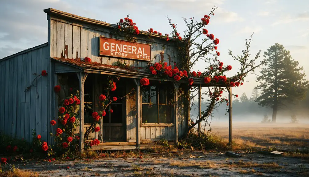
Port Tobacco Village: From Maryland’s Second Largest to Smallest Town
Where the Port Tobacco River once bustled with international commerce, Maryland’s smallest town now stands as a remarkable symbol to colonial America’s rise and fall.
You’ll discover Port Tobacco’s extraordinary transformation from Maryland’s second-largest port to a settlement housing just fifteen residents in 0.16 square miles.
Founded on the Potopaco Native American village site, this colonial powerhouse exported tobacco and corn worldwide while importing European luxuries.
The town’s historical significance extends beyond commerce—patriots like John Hanson and Thomas Stone called it home, shaping America’s founding.
River siltation from deforestation ultimately strangled the port’s lifeline.
When railroads arrived in 1895, the county seat moved to La Plata.
Today, you can explore this preserved ghost town, designated a historic district where America’s entrepreneurial spirit once thrived. The town’s decline ironically preserved many archaeological sites, allowing historians to conduct important studies of the region’s Native American and colonial past. The reconstructed 1819 Courthouse serves as a focal point for understanding the community’s governmental heritage and architectural history.
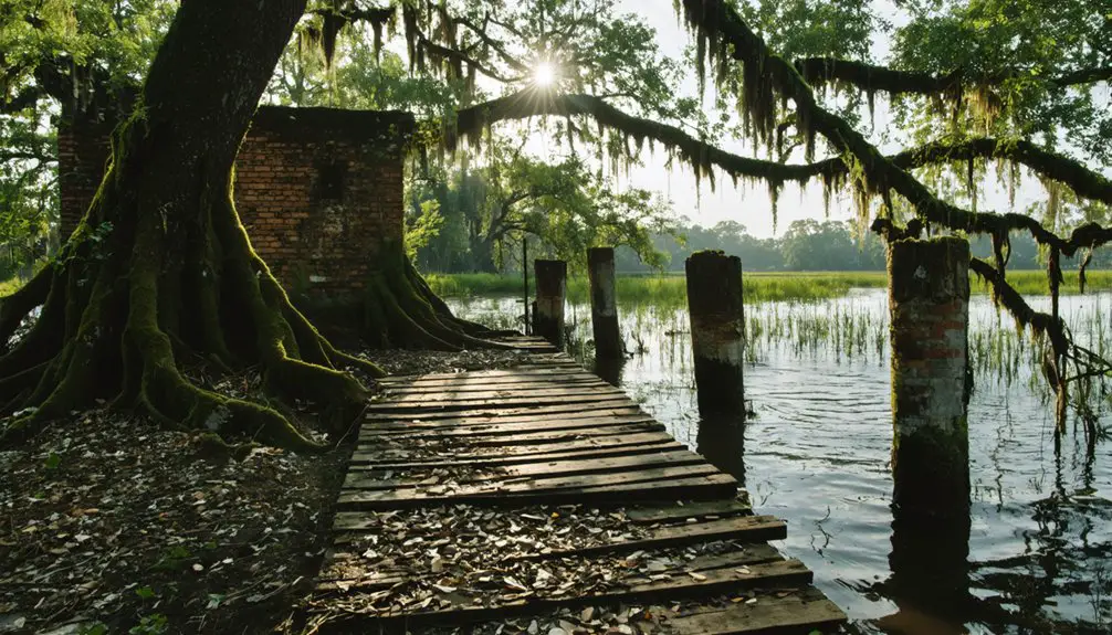
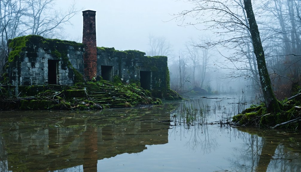
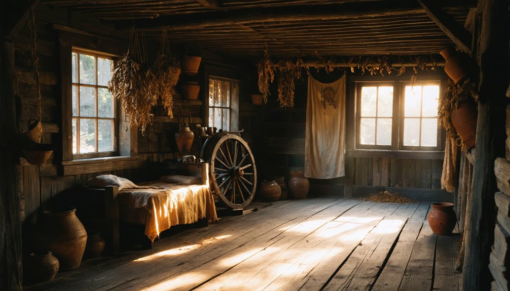
Daniels: The Mill Town That Hurricane Agnes Claimed
You’ll find Daniels represents one of Maryland’s most dramatic ghost town transformations, where a thriving 19th-century textile community met its ultimate demise through both economic collapse and natural disaster.
The settlement evolved from Elysville in 1810 to Alberton in 1853, then finally to Daniels in 1940, sustaining itself for over a century through mill operations along the Patapsco River until closure forced complete abandonment by 1972.
Hurricane Agnes delivered the final blow in June 1972, flooding the valley and destroying the remaining empty buildings that once housed nearly 90 families in this industrial mill town. Among the most recognizable remnants still standing are the Saint Stanislaus Kostka Church and the Pentecostal Holiness Church, their structures marking what was once the spiritual heart of the community. Today, visitors can explore the ruins through a 4.5-mile hike along the old road that winds through what is now part of Patapsco River Valley State Park.
Elysville’s Industrial Mill Heritage
Though Elysville’s name changed multiple times throughout its 140-year existence, its identity remained anchored to textile manufacturing from Thomas Ely’s original 1810 settlement through the Daniels Company’s final closure in 1968.
Elysville’s Economy developed around cotton textile production, creating a self-contained industrial community. The Ely brothers’ mill became the economic foundation, later evolving under Alberton Manufacturing Company before C.R. Daniels purchased everything in 1940.
Millworker Life centered on company-provided housing and steady employment:
- Seven industrial buildings formed the manufacturing core by 1973
- Worker housing constructed during the first decade of growth
- 279 residents lived in company-owned homes by 1968
- Post office established as Elysville in 1860 census records
- Community operated under single company ownership for three decades
The mill’s distinctive gray granite construction used locally quarried stone that gave the industrial complex its imposing appearance. Tropical Storm Agnes in 1972 destroyed the remaining abandoned buildings, completing the transformation of this once-thriving mill town into Maryland’s most documented ghost town.
Hurricane Agnes Destruction
While Elysville had survived over a century of economic changes and industrial shifts, it couldn’t withstand the devastating force of Tropical Storm Agnes that struck the Patapsco River Valley in June 1972.
The massive flooding destroyed remaining empty buildings, washed away cemetery tombstones, and tossed vehicles around like toys. This catastrophic event forced the last holdouts to permanently abandon their homes.
The flood aftermath left a landscape of stone ruins, scattered foundations, and decaying wood where a thriving mill town once stood. The main 1833 mill building was reduced to rubble.
Today, you’ll find ghostly remnants including partial church structures, an old dam, bridge remnants, and a hidden cemetery. Maryland’s acquisition transformed this devastated area into Patapsco Valley State Park.
Harmony Grove: Lost Beneath the Highway
Before Route 15’s concrete ribbons carved through Frederick County’s rolling landscape, the bustling mill town of Harmony Grove anchored itself along what’s now Worman’s Mill Road in western Maryland.
This 19th-century industrial settlement thrived until resources depleted and economic pressures mounted during the Great Depression.
Industrial decline devastated the community through the mid-20th century, culminating in the mill and post office’s closure during the 1960s.
Highway expansion sealed Harmony Grove’s fate as demolition crews systematically erased structures to accommodate Route 15’s corridor development.
Today, you’ll find only fragments of this former milling community:
- Visible railroad tracks crossing the area
- Scattered mill foundations along Worman’s Mill Road
- Remnants of the old post office foundation
- No complete structures surviving demolition
- Infrastructure development obliterating historical traces
St. Mary’s City: Colonial Capital Turned Living Museum
Unlike the industrial settlements that vanished beneath modern development, Maryland’s most significant ghost town transformed into something far more remarkable than mere ruins.
St. Mary’s City, founded in 1634 as America’s fourth permanent English settlement, once served as Maryland’s colonial capital for sixty-one years. You’ll discover where religious freedom first took root in North America, protecting both Catholics and Protestants from persecution.
When the capital relocated to Annapolis in 1695, residents dismantled buildings and abandoned the site entirely. Today’s archaeological significance spans over 300 excavated sites revealing 10,000 years of human occupation.
The colonial architecture has been meticulously reconstructed, creating a living museum where costumed interpreters demonstrate how America’s earliest freedom-seekers built their haven.
What Defines a Maryland Ghost Town
Abandonment transforms thriving communities into Maryland’s ghost towns when their economic foundation crumbles and residents flee permanently.
You’ll find these settlements defined by T. Lindsay Baker’s principle: their reason for existence no longer exists. Understanding abandonment causes helps you identify authentic ghost towns versus temporarily declining areas.
Maryland’s ghost towns exhibit varying degrees of decay and historical significance:
- Completely gone sites – Nothing remains, destroyed by floods or development
- Mostly ruined locations – Dilapidated buildings and partial structures survive
- Abandoned settlements – Foundations, cemeteries, and tangible remnants persist
- Partially abandoned towns – Skeleton populations with visible historical elements
- Historic communities – Preserved remnants blended with tourism functions
You’ll distinguish ghost towns from historic properties by their lack of ongoing economic function, despite maintaining physical remnants.
Transportation Changes That Shaped Maryland’s Abandoned Places
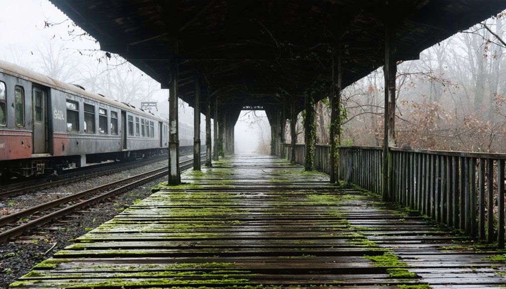
Canal openings accelerated this transportation evolution. The Chesapeake and Delaware Canal diverted traffic from overland routes, while the C&O Canal created Four Locks village before devastating floods in 1889 and 1924 triggered its economic decline.
Railroad expansions delivered the final verdict. The 1837 rail line through Elkton eliminated steamboat connections entirely.
When the Western Maryland Railway abandoned service, entire communities lost their lifelines, transforming thriving settlements into Maryland’s characteristic ghost towns.
Preserving the Stories of Maryland’s Lost Communities
While transportation changes doomed many Maryland settlements to abandonment, dedicated preservation efforts now protect these lost communities’ stories for future generations.
Maryland’s abandoned settlements find new life through passionate preservation efforts that safeguard their heritage for tomorrow’s storytellers.
You’ll discover how Maryland’s Heritage Areas Program has certified 13 areas since 1997, covering all counties while preserving cultural significance and supporting local economies through authentic experiences.
The state’s collaborative approach demonstrates remarkable community resilience:
- Mallows Bay’s Ghost Fleet became a National Marine Sanctuary in 2014, protecting over 200 shipwrecks
- Local organizations like Historical Society of Kent County actively collect artifacts and documents
- Montgomery Preservation restored Silver Spring’s B&O Station after 1997 damage
- Heritage areas have generated $175 million in matching funds from $74 million in grants
- Conservation groups partner with communities to maintain sustainable tourism
Frequently Asked Questions
Are Any of These Ghost Towns Safe to Visit and Explore?
Yes, you can safely visit Daniels, St. Mary’s City, and Four Locks with proper safety precautions since they’re within managed state/national parks. Fort Ritchie requires careful urban exploration due to unclear access status.
What Artifacts or Ruins Can Still Be Found at These Locations?
You’ll discover diverse artifacts through dedicated exploration – colonial pottery, 17th-century tools, and 1950s abandoned cars. Ruins preservation varies: church foundations, mill remnants, brick chimneys, and stone walls remain accessible for adventurous investigators.
Do Any Ghost Towns Have Reported Paranormal Activity or Supernatural Sightings?
You’ll find extensive paranormal investigations document supernatural folklore at Maryland’s ghost towns. Dr. Mudd House reports disembodied voices, Point Lookout Lighthouse harbors thirteen spirits, and Decoursey Bridge witnesses Big Lizz’s headless apparition seeking treasure.
Which Maryland Ghost Town Had the Largest Population at Its Peak?
Port Tobacco Village reached Maryland’s second-largest town status, contrasting sharply with today’s smallest incorporation. You’ll find its historical significance overshadowed by dramatic population decline, making it the peak performer among these abandoned settlements.
Are There Guided Tours Available for Visiting These Abandoned Places?
You’ll find limited guided exploration options for Maryland’s abandoned places. St. Mary’s City offers formal state tours, while Four Locks provides ranger-led visits. Most sites require self-guided hikes for historical insights.
References
- https://kids.kiddle.co/List_of_ghost_towns_in_Maryland
- https://mdhistoricaltrust.wordpress.com/2024/10/31/spooky-sketches-tales-of-marylands-haunted-historic-buildings/
- https://www.tripadvisor.com/Attraction_Review-g41131-d10035193-Reviews-Daniels_Ghost_Town-Ellicott_City_Maryland.html
- https://www.youtube.com/watch?v=sbFq0i5w0-c
- https://www.atlasobscura.com/things-to-do/maryland/abandoned
- http://freepages.history.rootsweb.com/~gtusa/usa/md.htm
- https://cecilcountyhistory.com/a-susquehanna-river-village-that-vanished-conowingo/
- https://www.youtube.com/watch?v=kpb8Fs3-jjc
- https://en.wikipedia.org/wiki/List_of_ghost_towns_in_Maryland
- https://www.youtube.com/watch?v=qShnoumydKI