You’ll discover Fort Rock’s unique origin when you learn it wasn’t named for natural rock formations, but for a child’s stone playhouse that saved lives during an 1866 Hualapai attack. J.J. Buckman’s stage station became the site of an hours-long battle where his son Thad’s one-foot-high playhouse served as an unexpected fortress against over 50 warriors. Located in Yavapai County near Interstate 40’s Exit 91, this ghost town’s story reveals how frontier ingenuity and determination shaped Arizona’s territorial history.
Key Takeaways
- Fort Rock was renamed from Buckman Station after a 1866 battle where defenders used a stone playhouse as fortress against Hualapai warriors.
- The ghost town is located in Yavapai County, Arizona, accessible via Interstate 40 Exit 91 in northern Arizona.
- Visible remnants include scattered foundations, crumbling structures, and cemetery markers from the late 19th-century mining community abandoned in the 1920s.
- The historic battle lasted hours with heavy Hualapai casualties, demonstrating effective defensive tactics despite overwhelming odds against settlers.
- Site deterioration occurred due to WWII military training damage and natural erosion, leaving three main structural categories of ruins.
The 1866 Hualapai Attack on Buckman Stage Station
When dawn broke on that Saturday morning in 1866, J.J. Buckman stepped outside his stage station to harness horses and mules for another day’s operations.
By 8 o’clock, more than 50 Hualapai warriors descended upon the outpost, their motivations rooted in broader conflicts with encroaching settlements. You’d witness J.J., his son Thad, and one companion retreating into young Thad’s stone playhouse as their only defense against overwhelming odds.
The battle raged for hours, with defenders firing from their improvised fortress while Hualapai warriors pressed their assault. Legal disputes among miners in the region often affected the viability of nearby settlements during this tumultuous period.
Despite facing just three men, the attackers suffered heavy casualties. Eventually, mounting losses forced the Hualapai withdrawal.
The Buckman legacy endured through this desperate stand, transforming their humble station into Fort Rock—forever commemorating young Thad’s playhouse that saved their lives. Today, visitors can access this historic site via 2WD roads from Exit 91 on Interstate 40.
Thad Buckman’s Playhouse: An Unlikely Fortress
Although it stood merely one foot high, Thad Buckman’s stone playhouse would prove more defensible than anyone could’ve imagined when the twelve-year-old constructed it near his father’s stage station.
You’d find it hard to believe that such a simple playhouse design could withstand a Hualapai raid, yet it saved lives during the 1866 attack.
When warriors struck the Buckman station, Thad’s father J.J. and another defender retreated into the small stone structure. Despite his wounds from being shot through both legs, Thad himself continued to fight from this makeshift fortress. Despite its modest size, the playhouse enabled them to exchange gunfire for several hours, successfully repelling the attackers.
This unlikely fortress demonstrated remarkable defensive capabilities that transformed a child’s innocent creation into a symbol of frontier survival.
The historical significance of this humble structure eventually led to renaming the entire settlement Fort Rock. The rock formations that surrounded the area provided the perfect namesake for this frontier outpost.
Battle Details and Defensive Strategy
You’ll find that Thad Buckman’s playhouse provided unexpected tactical advantages during the 1866 Hualapai raid, as its solid construction offered effective cover against more than 50 attacking warriors.
The two defenders maintained their position inside the structure and exchanged continuous gunfire for many hours, demonstrating remarkable endurance against overwhelming odds.
This prolonged resistance ultimately forced the Hualapai to withdraw after sustaining heavy casualties, proving that strategic positioning could overcome numerical disadvantage. Like many Arizona settlements that experienced population decrease after conflicts or resource depletion, Fort Rock would later transform from an active community into a historical remnant. Similar to other Mohave County communities, the area’s mining activities in the late 19th century would eventually contribute to the region’s development patterns.
Playhouse Fortification Advantages
Since the Hualapai warriors outnumbered the defenders twenty-five to one during the November 1866 assault, Thad Buckman’s playhouse proved critical in leveling the tactical disadvantage at Buckman stage station.
The playhouse design inadvertently created effective defensive architecture by limiting enemy access points while providing enclosed shelter for sustained fire exchanges. You’d find that this improvised fortification enabled two men to withstand over fifty attackers for many hours, inflicting heavy casualties on the Hualapai forces.
The structure’s compact design prevented complete encirclement and forced warriors into exposed positions during their assault attempts. Similar to other Arizona settlements established during mining booms, Fort Rock’s defensive needs reflected the broader pattern of frontier fortifications built to protect valuable resources and transportation routes. This tactical advantage ultimately deterred a full overrun, allowing the defenders to hold their ground until the attackers withdrew after suffering substantial losses.
Prolonged Exchange Tactics
The battle began at first light on November 19, 1866, when fifty to one hundred Hualapai warriors launched a surprise assault on Buckman stage station as the occupants prepared for departure to Prescott.
You’d witness tactical endurance as defenders sustained fire from their covered positions throughout the daylight hours. The initial volley wounded J.J. Buckman above the hip, but seven defenders entered the main house while others positioned behind rocks and Thad’s stone playhouse.
Mail carrier WG Poindexter and his three-soldier escort demonstrated defensive resilience against overwhelming odds. The prolonged firefight tested both sides’ ammunition and resolve.
Warriors pressed repeated assaults without breakthrough, while defenders maintained disciplined fire from their improvised breastworks, forcing the raiders’ eventual withdrawal.
Warrior Loss Impact
When Hualapai warriors exposed themselves to take aim from their positions, disciplined rifle fire from the defenders exacted a devastating toll that would ultimately force their withdrawal.
You’d witness how each time attackers raised their heads above cover, well-aimed shots found their mark, leaving blood-stained breastworks as grim evidence.
The mounting Hualapai losses created three critical developments:
- Casualty escalation – Blood among warrior positions indicated 15-20 deaths
- Tactical breakdown – Exposure became increasingly hazardous for attackers
- Withdrawal timing – Heavy losses forced retreat around 2pm
Despite facing ten-to-one odds, defender morale remained strong throughout the engagement. Similar to Apache tactics at Fort Apache, the Hualapai fighters maintained long range positions to minimize their exposure while attempting to inflict maximum damage.
Your determination to protect the stage stop proved effective against superior numbers, as disciplined marksmanship transformed every warrior movement into a calculated risk they couldn’t sustain. The defenders employed hit-and-run tactics that had proven successful in previous territorial conflicts, striking quickly before withdrawing to covered positions.
From Mount Hope to Fort Rock: The Renaming
The transformation from Buckman Stage Station at Mount Hope to Fort Rock honored the very rocks that provided salvation.
This wasn’t merely symbolic—it acknowledged how geography became destiny. The surrounding rock formations had proven their worth as military defenses, earning the settlement its permanent new name that survives today. These natural fortifications served similar purposes to the established military posts throughout Yavapai County during the ongoing conflicts with Native American tribes.
Location and Access in Modern Yavapai County
You’ll find Fort Rock’s remains in Yavapai County, one of Arizona’s four original counties established in September 1864.
The ghost town sits southeast of Interstate 40’s Exit 91, making it accessible via modern highway infrastructure that wasn’t available during its 19th-century stagecoach era.
Yavapai County’s boundaries encompass this historic site along with the county seat of Prescott and numerous other ghost towns from Arizona’s territorial period.
Interstate 40 Proximity
Approximately 359 miles of Interstate 40 stretch across northern Arizona, and Fort Rock’s location places it within easy reach of modern travelers using Exit 91.
This modern highway transformed access to historical sites that were once isolated along the frontier. The interstate’s construction represents significant interstate history improvements over the dangerous US Route 66 alignment it replaced.
Fort Rock’s proximity to I-40 offers several advantages:
- Direct Access: Exit 91 provides immediate 2WD road connection to the ghost town site
- Safety Enhancement: The $69.1 million construction project improved highway safety over the high-fatality US 66 section
- Year-Round Accessibility: Standard vehicles can reach Fort Rock during any season via the improved route
You’ll find Fort Rock southeast of Exit 91, where Thad Buckman’s stone house remains stand as proof to Arizona’s territorial period.
Yavapai County Boundaries
When Arizona achieved statehood in 1912, Fort Rock already sat within well-established Yavapai County boundaries that had been finalized two decades earlier in 1891.
You’ll find that Yavapai history reflects significant boundary evolution during territorial expansion. The county’s original territory stretched east of longitude 113°20′ and north of the Gila River, covering a massive area before officials carved out Apache, Coconino, Maricopa, and Navajo counties.
Today’s Yavapai County encompasses 8,128 square miles, bordered by Mohave County west, Coconino County north, and Maricopa County south.
You can access detailed boundary maps through the county’s GIS system at gis.yavapaiaz.gov, which displays parcels, ownership records, and election precincts.
This boundary evolution created the framework that preserved Fort Rock’s location within Yavapai County jurisdiction.
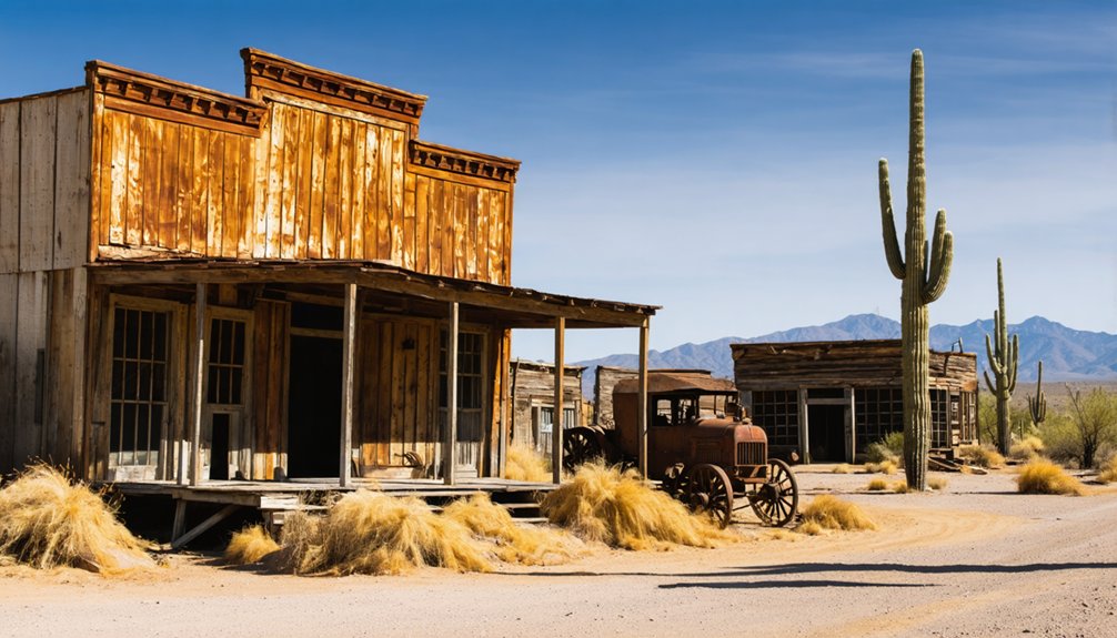
What Remains Today at the Ghost Town Site

Though decades of abandonment and natural forces have taken their toll, Fort Rock’s ghost town site still holds tangible remnants of its late 19th-century mining community. Your exploration reveals scattered foundations and crumbling structures that survived since the 1920s abandonment.
The remnants analysis shows significant deterioration from WWII military training damage and ongoing river erosion.
Decades of military bombardment and relentless water erosion have accelerated the structural decay throughout the abandoned settlement.
You’ll discover three primary structural categories:
- Commercial foundations – General store’s stone base remains visible amid debris piles
- Industrial ruins – Mill structure walls stand partially intact with scattered machinery remnants
- Residential traces – Adobe and wood fragments mark former dwelling sites
The cemetery’s nearly erased, though iron cribs from children’s graves and rock pile markers persist.
Despite neglect and natural overgrowth, these weathered remnants maintain their historical significance as evidence of Arizona’s mining heritage.
Frequently Asked Questions
What Other Ghost Towns Are Located Near Fort Rock in Arizona?
You’ll find Fort Misery, Fritsche, Gillett, and Goodwin as nearby ghost towns in Yavapai County. These abandoned mining settlements from the 1800s offer you authentic exploration opportunities within the same regional area as Fort Rock.
Among these forgotten sites, the history of twin buttes ghost town stands out due to its intriguing tales of the gold rush and the people who once called it home. Exploring the remnants of its structures and mining equipment allows visitors to step back in time and witness the challenges faced by early settlers. Each ghost town in the region tells a unique story, making the exploration a captivating journey through the past.
Were There Any Other Indian Attacks on Stage Stations in the Area?
Yes, you’ll find several documented stagecoach incidents involving native conflicts. September 1867 brought attacks near Prescott, while Yavapai warriors targeted wagon trains and closed the Prescott-Fort Mohave road after escalating tensions.
What Happened to the Buckman Family After the 1866 Attack?
Like scattered tumbleweeds, you’ll find the Buckman family dispersed after 1866. John continued operating the renamed Fort Rock station until his bull-goring death in 1900, while Thad mysteriously vanished from historical records post-attack.
Are There Any Artifacts or Relics That Can Be Found at the Site?
You won’t find documented artifacts discovery at Fort Rock since no recorded explorations exist. However, regional patterns suggest potential mining relics preservation. Remember, you can’t legally remove any artifacts without proper permits.
What Role Did Fort Rock Play in Arizona’s Territorial Development After 1866?
You’ll find that territorial expansion accelerated dramatically after 1866, with Fort Rock’s military significance protecting the critical Prescott-Hardyville corridor, enabling safe passage for settlers, mail, and supplies across Arizona’s developing frontier.
References
- https://www.arizonahighways.com/article/arizona-ghost-towns
- https://www.ghosttowns.com/states/az/fortrock.html
- https://azgw.org/yavapai/ghosttowns.html
- http://genealogytrails.com/ariz/mohave/ghost-towns.html
- https://en.wikipedia.org/wiki/List_of_ghost_towns_in_Arizona
- https://www.youtube.com/watch?v=x_DwjflLuV4
- http://prescottazhistory.blogspot.com/2018/01/the-indian-raid-that-gave-fort-rock-its.html
- https://www.msavhcc.org/hidden-arizona-history
- https://mohavecountyhighways.com/i-40/exit-91/index.htm
- https://www.arizonahighways.com/archive/issues/chapter/Doc.963.Chapter.6


