You’ll find Fry Canyon’s abandoned remnants along Utah State Road 95 in San Juan County, where a uranium mining boomtown flourished from 1955 through the Cold War. The settlement once bustled with nearly 3,000 miners, featuring a lodge, store, and post office at 5,372 feet elevation. Today, only scattered ruins and a silent dirt runway remain, surrounded by ancient Pueblo sites and dramatic sandstone formations. The site’s uranium legacy holds deeper stories of both prosperity and peril.
Key Takeaways
- Fry Canyon was established in 1955 as a uranium mining boomtown during the Cold War, with a thriving community of nearly 3,000 miners.
- The town featured essential amenities including a lodge, general store, post office, school, and was known for high alcohol sales.
- Mining operations ceased when uranium prices collapsed, leading to the town’s abandonment and leaving behind scattered ruins and structures.
- Today, the ghost town serves as a destination for outdoor enthusiasts, offering canyoneering opportunities and guided tours from April to October.
- Environmental contamination from uranium mining remains a significant concern, with ongoing cleanup efforts addressing groundwater pollution.
The Birth of a Mining Boomtown
Three powerful forces converged to birth Fry Canyon in 1955: the Cold War’s uranium demand, southeastern Utah’s rich mineral deposits, and the region’s strategic location along State Route 95.
You’ll find a reflection of community resilience in how quickly the settlement grew, transforming from rugged canyon country into a bustling mining hub.
As mining techniques evolved to extract uranium, copper, and vanadium from the labyrinthine landscape, essential infrastructure sprouted up to support the operations. The ancient pueblo ruins near the town served as silent witnesses to this modern development.
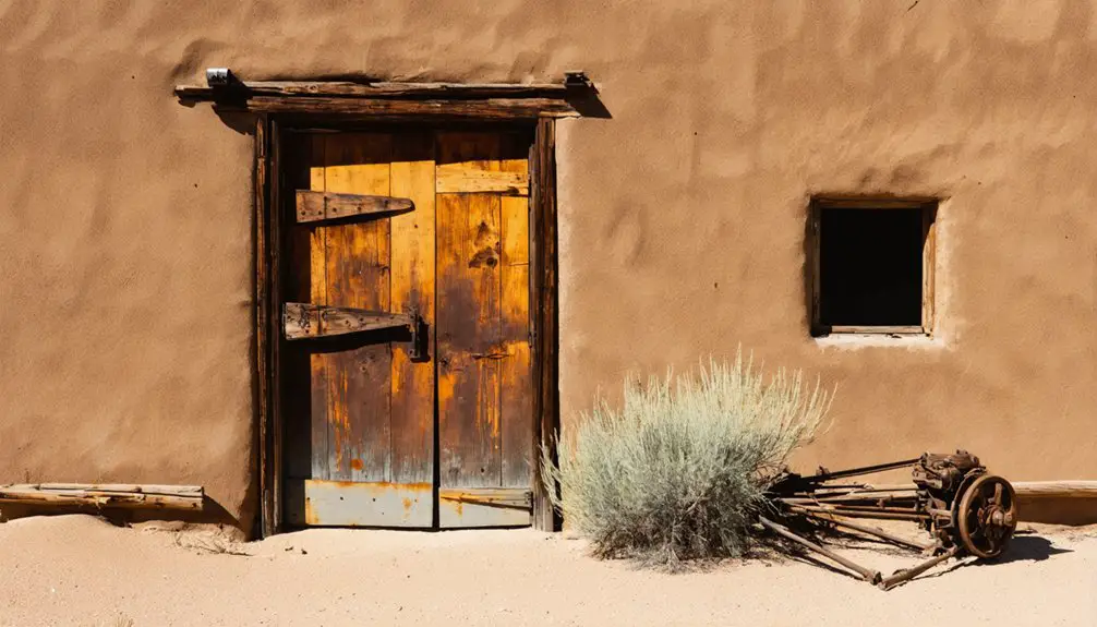
A lodge became the town’s heart, while a general store, post office, and school served the miners’ families. Today, these buildings stand empty as a ghost town with only a handful of residents remaining.
Visitors often come to explore the historic sites in Garfield, Utah, drawn by tales of its once-bustling mining community. As they wander through the remnants of the town, they can imagine the lively atmosphere that filled the streets in its prime. Each crumbling structure tells a story, offering a glimpse into the lives of those who called this remote place home.
The rough-hewn roads that connected these facilities to the surrounding slot canyons weren’t just pathways – they were lifelines for the ambitious prospectors who’d made this untamed corner of Utah their home.
Life During the Uranium Rush
While the promise of uranium wealth drew workers to Fry Canyon between 1957 and 1968, the harsh realities of mining life quickly emerged.
You’d find a largely male workforce tackling labor-intensive shifts, operating drills and hauling ore from the region’s rich uranium deposits. The mining culture revolved around demanding schedules, with crews facing radiation and chemical hazards that weren’t fully understood at the time. Environmental concerns would later surface as uranium tailings and ponds contaminated local groundwater. Workers often relied on Geiger counters to locate promising deposits in the surrounding sandstone formations.
The workforce challenges shaped daily existence in this remote outpost.
You’d see temporary housing springing up to accommodate the influx of miners, geologists, and mill operators. Despite the basic services available, leisure activities remained limited.
The community’s social fabric centered entirely on the mining operations, with workers and their families adapting to a transient lifestyle dictated by uranium market demands.
Geographic Features and Natural Wonders
Beyond its mining history, Fry Canyon’s dramatic landscape features a complex network of sandstone formations and deep channels carved over millions of years.
You’ll find stunning geological formations like Comb Ridge, a monocline fold created 40-70 million years ago during the Laramide orogeny. The canyon’s unique ecosystem includes slot canyons with 80-foot rappel drops and swimming holes, all shaped by persistent water erosion through ancient Cedar Mesa and Navajo sandstone layers. The ridge creates an impressive 80-mile natural wall stretching from Utah’s Abajo Mountains to Kayenta, Arizona. The area’s 5372-foot elevation creates challenging conditions for both aircraft and ground vehicles.
The canyon’s hydrology reveals a shallow colluvial aquifer system that’s just 1-6 feet deep, slowly moving groundwater northwest toward Fry Creek.
You’ll experience extreme temperature swings here, with summer highs reaching 110°F, while freeze-thaw cycles continue sculpting the terrain’s distinctive features, from smooth-walled narrows to towering cliffs and ledges.
Ancient Pueblo History and Archaeological Sites
You’ll discover Ancient Pueblo ruins throughout Fry Canyon, where cliff dwellings and ceremonial kivas dating from 750-1220 A.D. showcase the remarkable masonry skills of Ancestral Puebloan peoples.
Low ancient doorways standing only 4 feet high served as entryways to these fascinating structures.
The area’s archaeological treasures include intricate pottery, watertight baskets, and carved Moki steps that provided access to defensive positions along canyon walls.
Multiple steep drop-offs and unmarked hiking paths make accessing these remarkable ruins challenging for modern-day visitors.
These sacred sites require careful preservation, as they’re accessible only via rough dirt roads and informal trails off Utah State Road 95, demanding visitors practice Leave No Trace principles while exploring these fragile cultural resources.
Ancestral Dwellings and Artifacts
Tucked within the rugged landscape of Fry Canyon, ancient Puebloan settlements reveal a rich archaeological legacy spanning from 300 BCE to 1300 CE.
You’ll find multi-room stone and adobe structures strategically built into canyon walls and rock alcoves, showcasing ancestral architecture that maximized both protection and climate control.
When exploring these sites, you’ll discover ceremonial kivas accessed by ladders, carved Moki steps, and granaries that highlight the ingenuity of these ancient builders. Visitors can climb down into a 1,000-year-old kiva to experience authentic Puebloan architecture firsthand.
The area’s cultural artifacts include the Four Corners’ largest public collection of Ancestral Puebloan pottery at Edge of the Cedars Museum. The corrugated cooking jars and painted white ware vessels found here date to the Pueblo II period.
You can examine stone tools, bone implements, and woven goods that paint a vivid picture of daily life.
Evidence of maize agriculture, water management, and animal domestication demonstrates how these communities thrived in this challenging environment.
Sacred Sites and Preservation
While exploring Fry Canyon’s archaeological treasures, you’ll encounter sacred sites that were integral to Ancient Puebloan spiritual practices from 300 BCE to 1300 CE. The area’s rock art, petroglyphs, and water sources hold deep cultural significance, offering glimpses into their religious beliefs and ceremonial activities.
Today, these sacred sites face ongoing challenges from vandalism, looting, and increased tourism. You’ll notice preservation efforts by the Utah State Historic Preservation Office and local volunteer programs working to protect these irreplaceable resources.
Through controlled access points and interpretive signage, you can learn about the sites while respecting their integrity. The “take nothing, leave nothing” approach helps maintain site authenticity as you explore the roughly 13,000-year legacy of human occupation in this culturally rich landscape.
The Peak Years: A Thriving Desert Community
During Fry Canyon’s peak years in the late 1950s, you’d find uranium miners spending their hard-earned wages at the town’s bustling general store, motel, and lodge along State Route 95.
Beyond the mines, families carved out a community life centered around the local school, where miners’ children attended classes while their parents worked the uranium-rich deposits 50 miles west of Blanding.
You would’ve witnessed the town’s social scene reaching such heights that by 1959, its discreet alcohol sales topped all other outlets in Utah, despite the state’s strict liquor laws.
Mining Money Flows Freely
As uranium production surged in Utah’s White Canyon Mining District, Fry Canyon transformed into a bustling economic hub between 1949 and 1970. You’d have witnessed mining profits flowing freely during the peak years, especially 1958, when over 150,000 tons of ore yielded nearly 63,000 pounds of U3O8.
The economic ripple touched every corner of the community, from workers’ wages to equipment purchases and infrastructure development.
The desert mining town’s wealth generation mirrored earlier Utah mining successes, where valuable mineral shipments had generated millions. Mining operators reinvested their earnings into new claims, while substantial capital funded vital smelting operations.
The financial flows didn’t just line company coffers – they built housing, expanded supportive businesses, and helped diversify the local economy beyond mineral extraction.
Life Beyond The Mines
Despite its remote desert location, Fry Canyon bustled with vibrant community life at its peak in the late 1950s.
You’d find the heart of social gatherings at the Fry Canyon Motel and Lodge, where miners converged after long shifts underground. The town’s spirit wasn’t just about uranium – it was about building connections in the harsh desert environment.
- The lodge hosted community events and served more beer than any other establishment in Utah.
- Local families gathered at the small schoolhouse, making education possible for miners’ children.
- The general store and post office created a semblance of normal daily life.
- Despite lacking standard utilities, residents powered their own amenities and maintained a self-sufficient community.
All these elements wove together to create a thriving desert community, even if temporary.
From Bustling Hub to Abandoned Settlement
Once a remote outpost in Utah’s rugged desert landscape, Fry Canyon transformed into a vibrant uranium mining hub in the 1950s, located 50 miles west of Blanding near White Canyon.
In Utah’s harsh desert, Fry Canyon emerged from isolation to become a thriving uranium mining center during the atomic era.
You’d find nearly 3,000 miners maneuvering the community dynamics despite mining dangers and radiation risks, drawn by the government’s Cold War uranium demands.
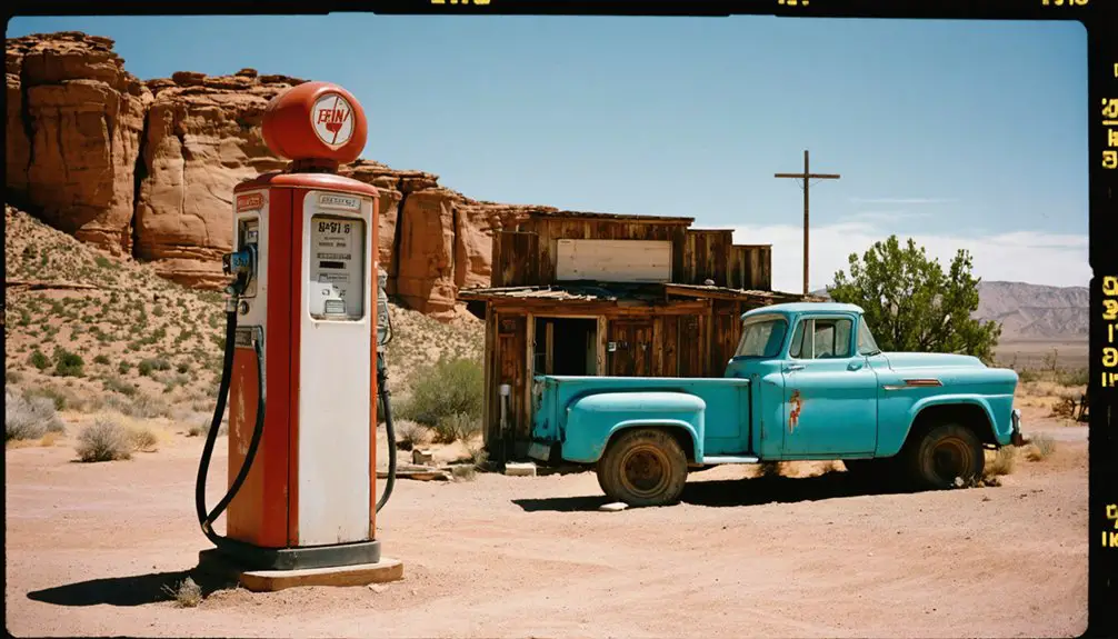
The settlement’s liveliness was evident in its twin diesel generators powering the town, a busy motel, and remarkably high beer sales that defied Utah’s strict Mormon culture.
But when uranium’s value plummeted, Fry Canyon’s prosperity vanished. The once-bustling motel closed, generators fell silent, and buildings were left to crumble in the desert heat.
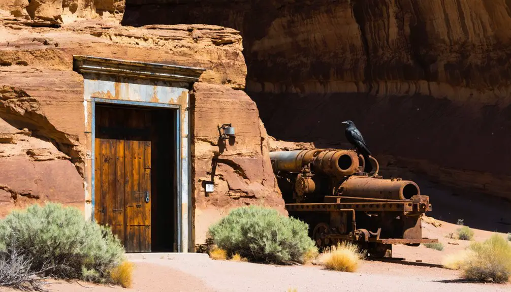
Today, you’ll only find scattered ruins and an abandoned dirt runway – remnants of a boomtown that flourished and faded with the atomic age.
Modern-Day Exploration and Tourism
Today’s visitors to Fry Canyon find adventure where uranium miners once toiled, with the area now serving as a premier destination for canyoneering and outdoor exploration.
You’ll discover a perfect blend of cultural tourism and thrilling canyoneering adventures along Utah State Road 95. The canyon’s accessibility and short duration make it ideal for both guided tours and independent exploration.
- Join seasonal guided tours from April to October, featuring 60-foot rappels into water-filled caverns.
- Explore ancient Puebloan ruins and carved moki steps visible throughout the canyon.
- Navigate the slot canyon’s challenging terrain with ropes up to 165 feet for rappelling sections.
- Cool off in natural swimming holes that once served as Native American drinking water sources.
No permits are required for day trips, giving you the freedom to explore this remarkable blend of natural wonder and archaeological treasure.
Cold War Legacy and Mining Heritage
When the U.S. government launched its aggressive uranium procurement program in the early 1950s, Fry Canyon transformed from a quiet desert outpost into a bustling mining hub supporting nearly 3,000 workers.
From sleepy desert town to uranium boomtown, Fry Canyon’s transformation reflected America’s Cold War uranium rush of the 1950s.
The Atomic Energy Commission’s Cold War demand drove extensive uranium and copper mining operations from 1957 to 1968, while concealing radiation dangers from miners.
Today, you’ll find the lasting impacts of this era in Fry Canyon’s environmental challenges.
Mining regulations weren’t strict enough to prevent contamination from waste ponds and tailings piles, which continue to affect local groundwater systems.
Though cleanup efforts like permeable reactive barriers have been implemented since the 1990s, uranium contamination remains in the bedrock fractures of the Permian Cedar Mesa Sandstone, serving as a stark reminder of the area’s Cold War legacy.
Frequently Asked Questions
Where Is the Closest Medical Facility to Fry Canyon?
You’ll find Blue Mountain Hospital in Blanding, UT, just 20-30 miles away, offering extensive medical services. For your peace of mind, they’re equipped with 24/7 emergency care when you’re exploring.
Are There Any Dangerous Animals or Wildlife to Watch For?
You’ll need wildlife awareness for mountain lions, black bears, rattlesnakes, and coyotes. During animal encounters, stay alert, especially near rocky areas where snakes bask and predators may roam.
What Permits Are Required to Explore the Abandoned Mining Sites?
You’ll need BLM land use permits and Utah Division of Oil, Gas and Mining exploration permits. Don’t forget environmental assessments and safety clearances due to uranium contamination under federal mining regulations.
Is There Cell Phone Coverage or Emergency Communication in the Area?
You won’t find any cell service in the area – it’s completely dead. For emergencies, you’ll need to rely on the motel’s satellite phone or bring your own emergency signals device.
Can Visitors Collect Uranium Minerals or Artifacts From the Site?
You can’t legally collect uranium minerals or artifacts at this site. Uranium collection regulations strictly prohibit removal due to contamination risks, and mineral safety precautions require special permits and protective equipment.
References
- http://www.southwestbrowneyes.com/2013/08/state-route-95-canyons-hite-and.html
- http://www.swaviator.com/html/issuejf02/FryJF02.html
- https://www.destinationwest.org/home-page/fry-canyon-ruins-utah
- https://www.scribd.com/document/361763710/Dddd
- https://www.familysearch.org/en/wiki/Utah_Ghost_Towns
- http://www.southwestbrowneyes.com/2016/03/fry-canyon-mines-and-petrified-wood.html
- https://pubs.usgs.gov/publication/sir20105075
- https://utahmining.org/our-history/
- https://ugspub.nr.utah.gov/publications/misc_pubs/MP-93-3.pdf
- https://frtr.gov/costperformance/pdf/frycanyon.pdf


