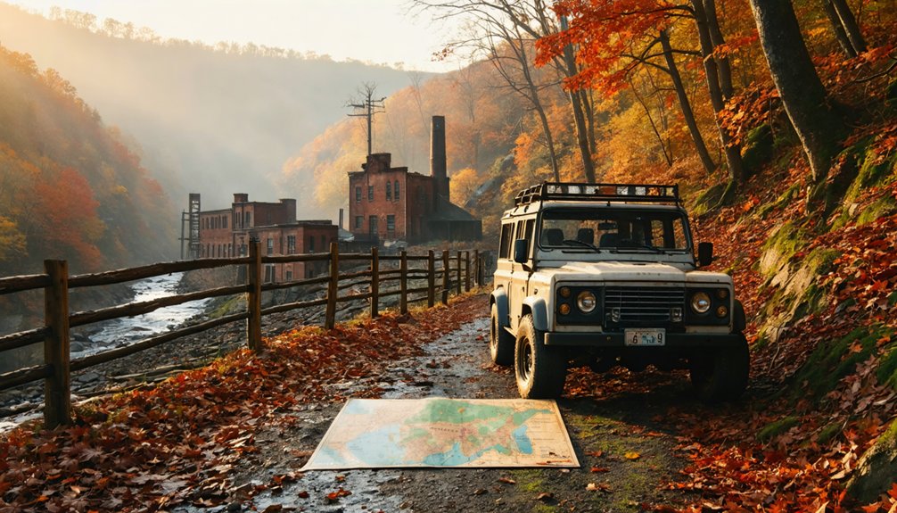
You’ll find Kaymoor’s haunting ruins off Route 19 between Beckley and Fayetteville, near the New River Gorge Bridge. The trailhead leads you down 821 stairs to a ghost town split across two levels—Kaymoor Top along the rim and Kaymoor Bottom squeezed against the river, 560 feet below. What awaits is extraordinary: 202 beehive coke ovens, crumbling mine portals, twisted metal frameworks, and a preserved powder house from an operation that employed 1,500 men. The complete story of this vertical company town reveals even more remarkable details.
Key Takeaways
- Access Kaymoor via Route 19 between Beckley and Fayetteville, using Interstate 64’s Mossy or Sandstone exits.
- Stop at Sandstone Visitor Center for trail conditions and historical context about the coal mining operation.
- Explore Kaymoor Bottom’s ruins including 202 beehive coke ovens, powder house, and collapsed mining structures.
- Climb the historic 821 stairs connecting Kaymoor Bottom to Top, spanning 560 feet of vertical elevation.
- Exercise caution when exploring the ungated ruins; structures are deteriorating and potentially hazardous.
Getting to Kaymoor in New River Gorge National Park
Tucked into the rugged folds of Fayette County’s Appalachian terrain, Kaymoor sits at roughly 1,835 feet above sea level where the New River carved its spectacular gorge through ancient rock. You’ll reach this abandoned coal camp via Route 19 between Beckley and Fayetteville, using the iconic New River Gorge Bridge as your landmark. Take Interstate 64’s Mossy or Sandstone exits to connect with regional highways threading through these mountains.
The Kaymoor Trail trailhead (38.00°N, 81.03°W) marks your entry point into decades-frozen history. Park rangers at Sandstone Visitor Center (330 Meadow Creek Road, Meadow Bridge) provide current trail conditions and insights about mining equipment history scattered throughout the site. Restoration efforts ongoing preserve what remains of this ghost town, though nature’s steadily reclaiming what coal barons abandoned.
The Story Behind a 62-Year Coal Mining Community
The weathered remnants of Kaymoor tell the story of a coal mining operation that defied the odds, lasting 62 years when most Appalachian coal towns barely made it to 25. You’ll discover a place where 1,500 men once conquered labor challenges through sheer determination, operating 202 coking ovens at peak production.
The Low Moor Iron Company established this mining camp in 1899, extracting premium Sewell Seam coal from the gorge’s south side. Transportation logistics proved brutal—rugged terrain forced the creation of two separate communities, Bottom and Top, connected by treacherous paths.
Understanding the Two-Level Town Layout
Kaymoor’s most striking feature hits you when you peer over the gorge rim: this wasn’t one town but two communities stacked 560 feet apart like geological layers. Site development challenges forced this radical split—there simply wasn’t enough river-bottom land for everything.
The mining company built homes wherever terrain allowed: Kaymoor Top perched along the rim with its company store and ball field, while Kaymoor Bottom squeezed between cliffside and river with processing plants and 200 coke ovens.
The mines themselves occupied a bench level between both worlds. You’ll discover segregated residential areas defined not just by race but by vertical geography—families divided between upper and lower spheres, connected only by steep tramways and 821 punishing stairs that miners climbed daily.
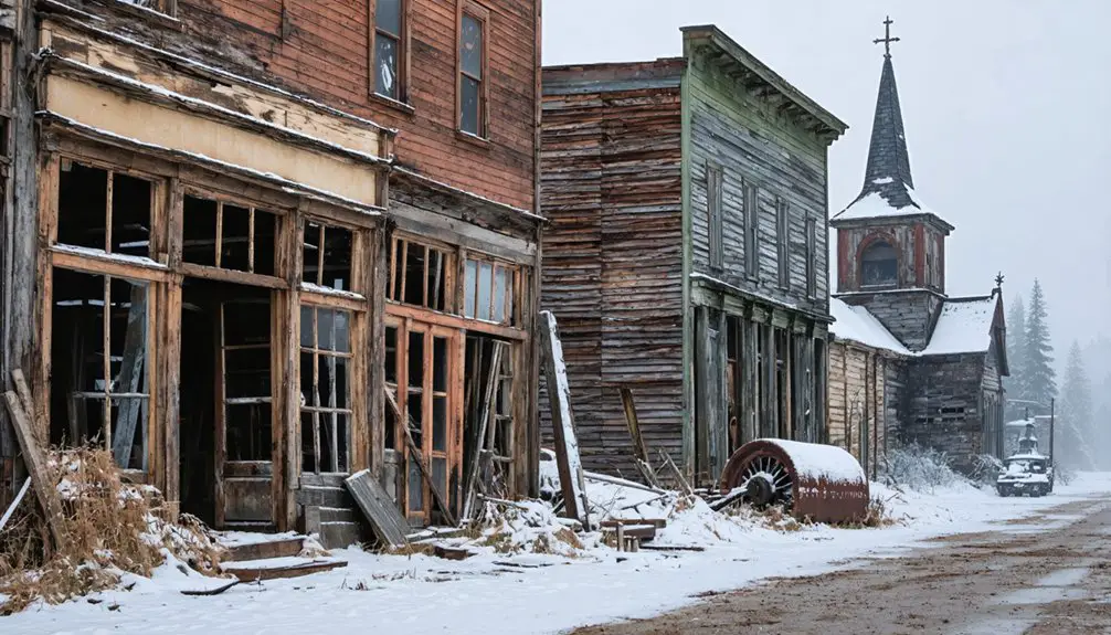
What Remains at Kaymoor Bottom Today
After scrambling down those 821 steps, you’ll find yourself standing among skeletal ruins that barely hint at Kaymoor Bottom’s former significance. The 1960 fire devastated this once-thriving operation, leaving twisted metal frameworks where coal processing plants once stood. You’re free to explore the deteriorating mining equipment slowly being reclaimed by forest—though you’ll need to bushwhack through thick foliage to reach some remnants.
The preserved powder house stands as the site’s crown jewel, its sturdy walls still intact from storing explosives. You’ll spot the fallen tipple at the bottom, scattered machinery, and the power station’s crumbling foundation. Water tank remains dot the staircase route. The National Park Service maintains safety warnings, but most ruins remain ungated—exploration’s your choice.
Exploring the Coke Ovens and Mine Structures
You’ll find the haunting remains of over 200 beehive-shaped coke ovens stretching along the hillside, their brick shells still standing after nearly a century of abandonment.
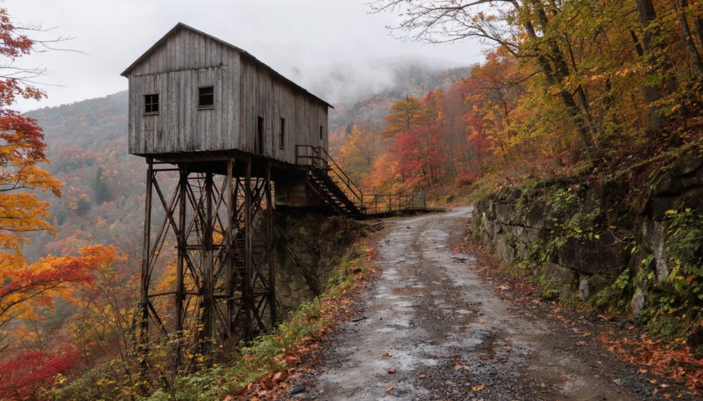
The crumbling mine portals emerge from the mountainside nearby, where coal cars once emerged before traveling down the canyon on a massive cable system. Behind these dark openings, you can spot the skeletal ruins of the lamphouse and mine office, their weathered foundations marking where miners gathered before descending into the earth.
Over 200 Coke Ovens
The fuel production scale here was staggering—over 16 million tons of coal mined and 1 million tons of coke processed between 1899 and 1962.
At peak operation during World War I, all 202 ovens burned simultaneously, employing 1,500 men who hand-loaded coal up the thousand-foot incline. You can still walk among these beehive-shaped ruins, tangible proof of an era when independence meant backbreaking labor in Appalachia’s industrial heartland.
Remaining Mining Infrastructure
Decay and defiance define what remains at Kaymoor today, where crumbling structures cling to the mountainside like stubborn monuments to industrial ambition. You’ll discover the tipple laying on its side, buildings held together by rust and time’s relentless grip. Mine decay rates accelerate in West Virginia’s humid climate, yet these ruins persist.
The coal processing plant and power station stand as skeletal reminders of mining community culture that once thrived here. You can still trace the double-track incline route where coal descended 1,000 feet at a 30° angle. Room-and-pillar passageways created a vast underground grid, though Kaymoor 2’s entrance was sealed with concrete to support the New River Gorge Bridge pylon. Every rusting beam tells stories of the thousand workers who carved wealth from these mountains.
Life in a Company Town: Schools, Stores, and Daily Routines
Standing at the rim of the New River Gorge, you can imagine how isolated life must have been in Kaymoor’s two segregated camps. Nearly 130 houses sheltered families split between the river bottom and gorge rim, connected only by steep tramways that hauled workers up 560 feet of cliffside each day.
The company controlled everything—stores where you’d spend your script, schools without competing churches or town halls, and a pool hall for brief escapes. Cultural diversity thrived despite constraints, as miners recruited from distant lands built community amid the canyon’s dramatic terrain.
Best Time to Visit and What to Bring
When planning your descent into Kaymoor’s abandoned mining complex, timing can mean the difference between an exhilarating adventure and a grueling ordeal. Spring and fall deliver moderate temperatures that won’t compound the health risks of tackling 821 wooden steps deep into the gorge.
Summer’s oppressive humidity transforms the climb into a punishing test of endurance, while winter ice creates serious accessibility challenges on the wooden staircase.
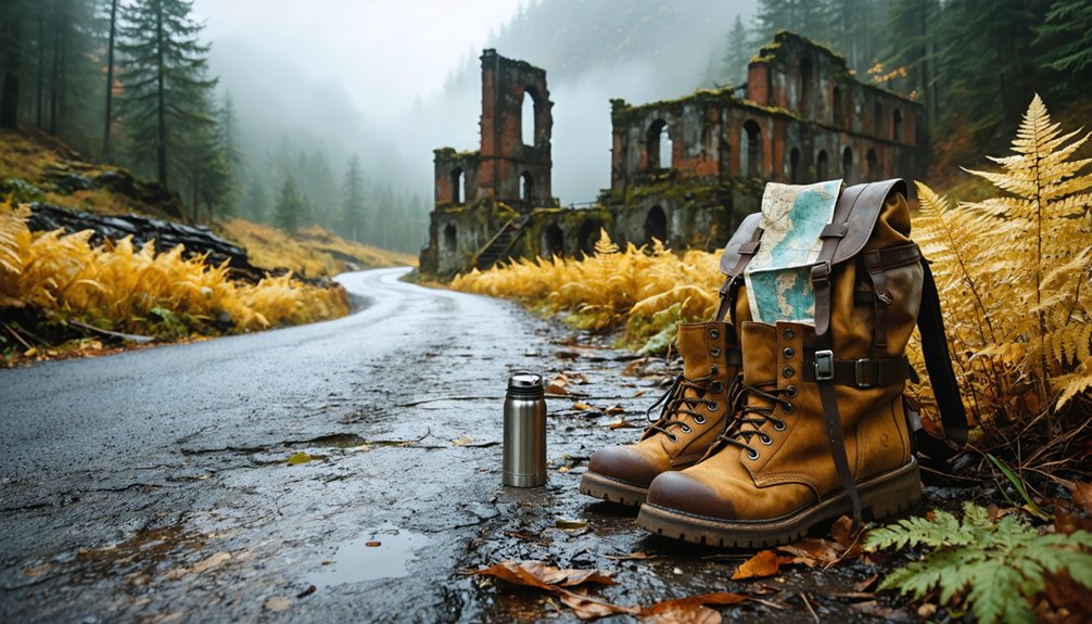
Pack substantial water—you’ll need every ounce during the return ascent. Sturdy hiking boots with aggressive tread are non-negotiable for the switchbacks and potentially unstable terrain. Bring moisture-wicking layers to handle temperature swings within the gorge, plus sun protection for exposed sections.
Remember: you’re entering a remote historic site where self-reliance matters. The trail remains open year-round, but your preparation determines whether you’ll conquer it.
Hiking the Kaymoor Trail to the Ruins
From the trailhead at 1,969 feet, the Kaymoor Miners Trail plunges you into a landscape where industrial ambition carved deep into West Virginia’s wilderness. This 1.0-mile descent tests your mettle with 900 feet of elevation loss through unforgiving terrain.
Where industrial ambition carved deep into wilderness, this unforgiving descent tests your mettle through 900 feet of raw Appalachian history.
Trail conditions challenge even experienced hikers:
- Rocky switchbacks and steep forest paths lead to the mine site
- 821 wooden steps descend from operations to the processing plant ruins
- 30% grade haulage rail remnants mark the miners’ dangerous commute
- Moss-covered machinery and rusted buildings emerge through thick vegetation
- The Sewell bench at 0.6 miles displays a haunting steel safety sign
Your hiking experience intensifies as you navigate frightening rock sections where miners once toiled. Budget 2-3 hours round trip—the ascent demands multiple breaks. These ruins aren’t sanitized history; they’re raw freedom from modern constraints.
Nearby Attractions in New River Gorge
The New River Gorge National Park stretches across 70,000 acres of Appalachian wilderness, transforming your Kaymoor visit into a multi-day adventure. Start at Canyon Rim Visitor Center near Route 19, where you’ll catch sunrise over the iconic New River Gorge Bridge—an architectural marvel once holding the world’s longest single-span record.
Drive upriver to Sandstone Falls, where 1,500 feet of cascading water creates dramatic scenic river views perfect for photography. Explore Thurmond’s ghost town via its one-way bridge, wandering past the preserved train depot and coal mining exhibits.
Don’t miss Grandview Area’s trails winding through wildflowers and rock formations, offering sweeping natural landscapes. Each stop reveals different facets of this Appalachian treasure, letting you explore untamed country at your own pace.
Frequently Asked Questions
Are There Any Guided Tours Available at Kaymoor Ghost Town?
No commercial guided tours availability exists at Kaymoor currently. You’ll explore independently using the National Park Service’s self-guided walking tour. Tour operator options aren’t listed, giving you complete freedom to discover this abandoned mining site at your own pace.
Is It Safe to Enter the Mine Openings and Coke Ovens?
Don’t enter—these abandoned structures are death traps. Hazards of exploration include collapsing timbers, toxic gases, and unstable ground. You’ll find no mine safety precautions here. Experience Kaymoor’s haunting beauty from outside, where freedom doesn’t mean risking your life.
Can I Camp Overnight Near the Kaymoor Ruins?
You can’t camp at Kaymoor Ruins—it’s a protected historic area. However, primitive campsites available throughout New River Gorge’s backcountry offer wild freedom just beyond the 100-foot boundary. Nearby lodging options include Fayetteville’s welcoming inns.
Are Pets Allowed on the Kaymoor Trail?
You’ll absolutely love this—yes, pets are welcome! The pet friendly policies let you explore Kaymoor’s haunting ruins together. Just follow visitor regulations: keep your furry companion leashed under six feet and pack out waste responsibly.
How Long Does It Take to Hike the Entire Trail?
You’ll need approximately 3 hours to complete the 10.9 km hike, though hiking difficulty and trail conditions greatly impact your pace. The southern sections present rockier terrain that’ll slow you down compared to gentler northern stretches.