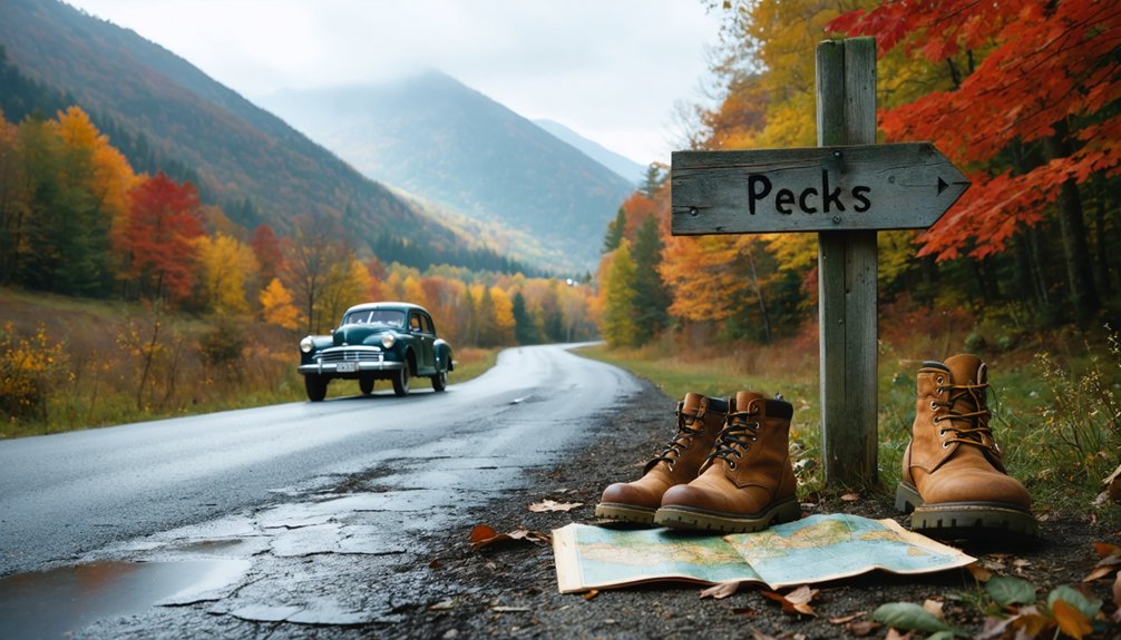
You’ll want to start your Pecks ghost town adventure from Bennington, taking Route 7 to primitive forest roads that lead to trailheads in the Green Mountain National Forest. The journey requires solid wilderness skills—expect 2,000-foot climbs through blow-downs and swamps where fog can disorient even experienced hikers. Once there, you’ll wander among cellar holes, crumbling stone walls, and a vandalized cemetery that mark where 241 residents once thrived before mysterious disappearances and economic collapse erased this settlement from Vermont’s maps.
Key Takeaways
- Access Pecks via Route 7 from Bennington, then take primitive roads to trailheads in Green Mountain National Forest.
- Choose from multiple hiking routes: 1-mile mountainside trail, Bald Mountain spur, or challenging Bolles Brook to Glastenbury summit.
- Explore cellar holes, stone walls, and an abandoned cemetery marking the settlement that peaked at 241 residents in 1880.
- Bring wilderness navigation aids and avoid solo trips due to remote terrain, 2,000-foot climbs, and area’s history of disappearances.
- Plan timing around weather conditions, as fog can make navigation dangerous on trails with blow-downs and swamps.
The History Behind Pecks Ghost Town
The story of Pecks begins with the kind of scheme only a colonial governor could concoct. New Hampshire’s governor founded this settlement that’d struggle for over a century to reach even triple-digit population numbers.
You’ll find two distinct communities formed Glastenbury’s core—Fayville around the 1790s and the logging settlement that’d later become a short-lived trolley resort. Post-Civil War charcoal-making brought brief prosperity before 1898 flooding destroyed the railroad beyond repair. The resort vanished after one season.
What Happened to the Population
At its 1880 zenith, Pecks housed 241 residents who’d carved out existence from Vermont’s unforgiving mountains. You’d have witnessed population trends over time mirror the town’s economic heartbeat—logging crews, charcoal burners, and sawmill workers swelling numbers when timber money flowed freely.
But economic factors leading to decline hit hard: clear-cutting stripped mountains bare by the late 1880s, coal replaced charcoal demand, and the 1898 floods obliterated railroad access permanently. By 1920, fewer than 20 souls remained. Murders in 1892 and 1897 had already tarnished Pecks’ reputation, pushing families toward safer prospects.
Subsequent floods in 1927 and 1934 delivered final blows. The last residents abandoned their remote homesteads during the 1930s, chasing opportunity elsewhere before Vermont officially disincorporated the town in 1937.
Getting to Pecks in Vermont’s Wilderness
Finding Pecks means plunging into Vermont’s second-largest wilderness, where 22,425 acres of Green Mountain National Forest swallow the ghost town whole. You’ll navigate from Bennington via Route 7, watching Glastenbury Mountain‘s ridgeline rise before turning north onto primitive roads that lead to scattered trailheads. Don’t expect trailhead amenities—this federally designated wilderness prohibits development, leaving you with basic parking accommodations at spots like Grout Pond Recreation Area.
The terrain fights back: 2,000-foot climbs, blow-downs blocking your path, swamps that’ll soak your boots. Dense forest obscures everything. Locals warn against solo trips through these 300 square miles where five people vanished in the 1940s. You’ll need wilderness skills and cairns when fog rolls in. The observation tower’s closed now, leaving you nothing but raw mountain and ruins.
Best Trails and Hiking Routes
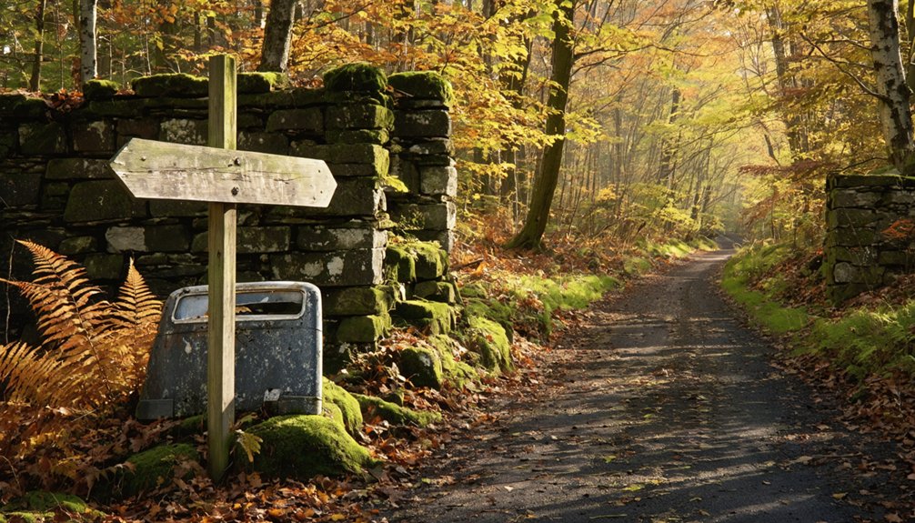
You’ll find Pecks most accessible via the 1-mile mountainside trail heading north from Route 9, where stone walls emerge from the forest like skeletal fingers marking where sheep once grazed.
For summit seekers, the Bald Mountain spur branches off from the main settlement site, climbing through the Green Mountain National Forest wilderness before descending toward Woodford Hollow.
If you’re approaching from the south, locate fire road 71 near Route 9 for the alternate Glastenbury Mountain access, though locals warn this route demands serious navigation skills through dense, unmarked wilderness.
Long Trail Access Points
The Long Trail’s southern gateway begins where Massachusetts meets Vermont, offering two distinct approaches that couldn’t feel more different from each other. From Williamstown, you’ll tackle either the 3.8-mile Appalachian Trail route from RT 2 or the shorter 3.3-mile Pine Cobble Trail—each delivering you to Vermont’s legendary 273-mile backbone.
Trail difficulty considerations favor heading northbound, where those first 104 Appalachian Trail miles ease you into Vermont’s rhythm before the route splits. The northern terminus access options grow sparse at Journey’s End Road near North Troy, requiring 1.3 miles of approach hiking through increasingly remote territory. Here, towns vanish and self-reliance becomes non-negotiable.
Between Mount Mansfield’s 4,394-foot summit and countless muddy inclines, you’ll navigate by white blazes, GPS-enabled maps keeping you oriented when civilization feels wonderfully distant.
Glastenbury Mountain Summit Route
At 3,748 feet, Glastenbury Mountain delivers none of the panoramic payoffs you’d expect from Vermont’s 29th highest peak—its wooded summit conceals views behind a thick canopy that only relents during stick season’s brief window.
You’ll face challenging trail conditions on the unmarked Bolles Brook route—six miles of steady climbing that rewards your independence with solitude. Cross the wooden bridge and push four hours uphill to Goddard Shelter where it meets the Long Trail.
The marked routes range from 11.6 to 24 miles, but don’t let distance fool you—multiple stream crossings demand boots-off commitment, and certain approaches like Lilly Direct throw extremely steep pitches at you. Winter hiking precautions become critical here; those unmarked old woods roads turn treacherous when ice-glazed and snow-buried.
Patch Hollow Wilderness Path
Hidden among Glastenbury’s satellite ridges, Patch Hollow’s wilderness paths slice through Champion International’s former logging empire where ghost town foundations still emerge from the forest floor. You’ll find no groomed trails here—just primitive trail conditions that’ll test your navigation skills through rugged terrain managed by Green Mountain Club volunteers since 2000.
For those looking to explore this wild region, a road trip itinerary for Russell Gulch can help you uncover hidden gems and local secrets. As you navigate through the winding roads, keep an eye out for scenic overlooks that provide breathtaking views of the landscape. This journey promises to be an adventure filled with rich history and the allure of nature’s untouched beauty.
The backcountry scenery rewards your effort: weathered rock walls marking abandoned farmsteads, clifftop vistas overlooking southern Green Mountains, and silent meadows reclaimed by wilderness.
Access the trailhead off Route 9 near Bennington, then prepare for challenging climbs exceeding 1,500 feet elevation gain. These old-school paths connect to broader Kingdom Heritage networks, letting you extend day hikes into multi-mile epics. Pack essentials—you’re entering genuine backcountry with zero facilities, just honest wilderness hiking.
What to See at the Abandoned Settlement
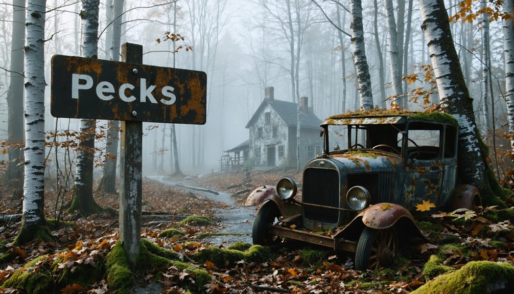
When you arrive at Pecks, cellar holes emerge from the forest floor like stone wounds in the earth, each depression marking where a settler family once cooked meals, told stories, and survived brutal Vermont winters. You’ll find remnant architectural features scattered throughout—stone walls snaking through second-growth forest, defining boundaries that no longer matter. The house S.L. Peck’s grandfather built still stands, a rare survivor among the ruins.
Look for remaining farm elements: field stones piled deliberately, not randomly. The abandoned family cemetery holds vandalized shards where the dead once rested. These aren’t museum pieces behind velvet ropes—you’re free to explore, touch the cold stone foundations, trace the outlines of vanished lives. Each cellar hole tells its own story of ambition, endurance, and ultimate abandonment.
Local Legends and Mysterious Tales
The stones and cellar holes preserve physical evidence of abandonment, but Vermont’s ghost towns harbor something harder to measure—stories that refuse to die with their tellers.
You’ll find Pecks situated uncomfortably close to the Bennington Triangle, where five people vanished without trace between 1945-1950. The Abenaki warned of a man-eating stone that swallows those who step upon it. Early settlers reported unexplained phenomena: strange lights dancing through trees, unidentifiable odors drifting from nowhere, monstrous animals lurking at forest edges.
Even Glastenbury’s ghost town of Fayville hosts haunted apparitions and Bigfoot sightings. Carl Herrick was found squeezed to death in 1943, massive bear-like prints surrounding his body. Local elders still warn visitors away from these forbidding woods where something ancient watches.
Essential Gear and Safety Tips
Before you venture into these haunted hollows where five souls vanished without explanation, you’ll need to prepare like your life depends on it—because in Glastenbury’s unforgiving wilderness, it genuinely might. Pack sturdy boots for traversing terrain hazards around abandoned settlements, plus trekking poles for Glastenbury’s steep slopes. Temperatures swing wildly from 20°F to 60°F, so layer up.
GPS devices and topographic maps are non-negotiable—disoriented hikers have misjudged distances by miles in these unmarked woods.
Unexpected weather conditions bring flash floods and fierce winds that create eerie sounds through the peaks. Carry bear spray (tracks appear near disappearance sites), water purification tablets, and a satellite communicator where cell service dies. Tell someone your itinerary. Search parties failed here before—don’t become Glastenbury’s sixth mystery.
Nearby Attractions Worth Exploring
After leaving Pecks’ crumbling foundations behind, you’ll discover Vermont’s gentler side waiting just beyond the Bennington Triangle’s shadowy reputation. The state’s natural wonders offer stunning contrasts to abandoned settlements.
Vermont’s wild beauty emerges where ghost towns fade, revealing nature’s triumph over humanity’s forgotten dreams.
Essential stops for adventurers:
- Quechee Gorge – Vermont’s 165-foot “Grand Canyon” carved by ancient glaciers, offering dramatic scenic viewpoints along rim trails where wildlife sightings include soaring hawks and deer traversing rocky terrain
- Mount Mansfield – Scale Vermont’s highest peak for panoramic vistas across forested valleys, where profile-shaped ridges challenge hikers seeking summit freedom
- Lake Champlain Waterfront – Paddle kayaks along pristine shorelines with Adirondack backdrops, or bike the Island Line Trail’s causeway cutting through open water
- Stowe Recreation Path – Wind through 5.5 miles of wooded bridges and farmland, perfect for spotting beavers and songbirds year-round
Frequently Asked Questions
Can I Camp Overnight at Pecks Ghost Town Site?
You can’t camp directly at Peck’s ghost town site due to its historical significance, but you’ll find camping amenities nearby at established campgrounds. These offer freedom to explore while respecting the preserved ruins during your Vermont adventure.
Are There Any Remaining Structures or Foundations Still Visible Today?
You’ll discover moss-covered cellar holes and crumbling stone foundations scattered through the forest—tangible remnants of Pecks’ historical significance. These abandoned buildings’ bases emerge from overgrowth, offering you authentic glimpses into Vermont’s forgotten past waiting for exploration.
Is Cell Phone Service Available in the Pecks Area?
Cell phone service remains spotty in Pecks’ wilderness. You’ll find limited cell tower coverage here, with wireless connectivity fading as you venture deeper into Vermont’s backcountry. Download maps beforehand—this remote ghost town exists beyond modern networks’ reach.
What Months Offer the Best Weather for Visiting Pecks?
Summer’s absolutely perfect for your Pecks adventure, offering ideal temperatures in the mid-60s to low 80s and low precipitation around 3.5 inches monthly. You’ll experience maximum freedom exploring with extended daylight and minimal weather interruptions throughout your journey.
Are Pets Allowed on Trails Leading to Pecks Ghost Town?
Yes, you can bring your dog! Green Mountain National Forest’s pet policies allow leashed companions on these trails. Trail accessibility welcomes four-legged adventurers through the wilderness, though you’ll need to keep them leashed to protect wildlife roaming freely.


