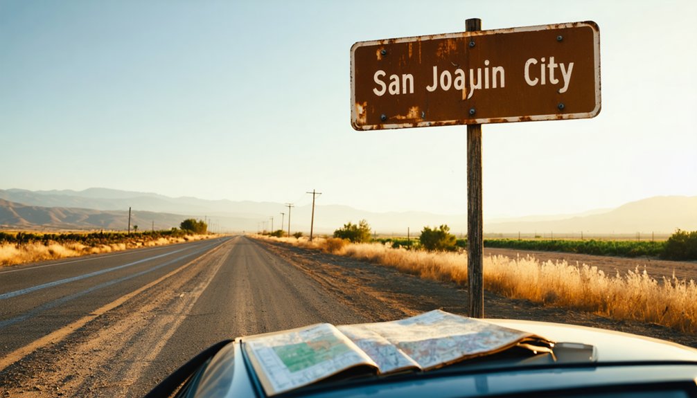
You’ll find California Historical Landmark #777 at 31167 Kasson Road in Tracy, where San Joaquin City once thrived as a Gold Rush gateway. Drive 0.4 miles south of Durham Ferry Road on County Highway J3—the same route pioneers traveled in 1849. Today, only a replacement plaque marks where hundreds of riverboats docked along the San Joaquin River’s bustling waterfront. Spring and fall offer the best visiting conditions for this ghost town site, and there’s much more to discover about the area’s vanished settlements.
Key Takeaways
- The historical landmark is at 31167 Kasson Road in Tracy, 0.4 miles south of Durham Ferry Road on County Highway J3.
- Spring and fall offer the best weather conditions for visiting this rural agricultural area with frequent farm vehicle traffic.
- Only a replacement historical plaque remains at the site; no original structures survive from the 1849 gold rush town.
- Nearby landmarks include Woodbridge’s 1858 bridge, Stockton’s historic riverfront, and Durham’s Ferry crossing point from 1849.
- San Joaquin County features 24 other state historical landmarks and Bodie State Historic Park offers a more preserved ghost town experience.
The Rise and Fall of a Gold Rush River Port
When James W. Marshall discovered gold at Sutter’s Mill on January 24, 1848, you’d witness California’s transformation unfold rapidly.
The San Joaquin River became your 250-mile highway to fortune, with Stockton emerging as the gateway 90 miles inland. You’ll find San Joaquin City thrived at this crossroads, where hundreds of riverboats hauled supplies worth today’s equivalent of $25 billion in extracted gold. The navigable channel connected these bustling river ports to San Francisco Bay, making freight shipping and passenger transportation vital to serving the Mother Lode country. Before the 1849 gold rush, the Valley was used primarily for cattle ranching.
Getting to San Joaquin City Historical Landmark
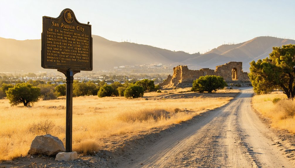
You’ll find California Historical Landmark #777 at 31167 Kasson Road in Tracy, positioned along the old River Road where nineteenth-century travelers once headed toward the bustling port. The marker stands 0.4 miles south of Durham Ferry Road on your left if you’re driving southbound, about 1.4 miles north of the San Joaquin County line on County Highway J3.
Though the original bronze plaque was stolen in 2005, a replacement now marks this spot near the west bank of the San Joaquin River, guiding you to where a thriving Gold Rush city once stood. Established in 1849, San Joaquin City served as a vital terminal for riverboats during the region’s early development. San Joaquin County is home to 24 other state historical landmarks that chronicle the region’s rich past.
Driving Routes and Directions
Tucked along the west bank of the San Joaquin River, this forgotten Gold Rush settlement sits 1.4 miles north of the county line on Kasson Road (County Highway J3), directly opposite the address 31167.
You’ll find the California Historical Landmark #777 marker 0.4 miles south of Durham Ferry Road‘s intersection—watch for it on your left when traveling southbound. The route follows the same corridor pioneers used reaching Durham’s Ferry in 1849, though today’s pavement replaced muddy wagon tracks.
Check real time traffic updates before departing, as agricultural vehicles frequently use this rural stretch. Road conditions remain straightforward year-round, with wide shoulders along J3. The ghost town occupies high ground where riverboats once docked, accessible via the same county highway that connects Tracy to Stockton Metropolitan Airport. This riverboat terminal once served the flourishing west side grain farming and cattle raising operations that defined the region’s agricultural economy. The original bronze plaque, placed at the site on November 3, 1962, was stolen in October 2005 after standing for 43 years.
Nearby Landmarks as Guides
Several regional landmarks form a historical constellation around San Joaquin City, each serving as a wayfinding beacon for your ghost town expedition. You’ll navigate through Stockton’s riverfront where Thomas Lindsay’s 1844 tule hut marked the shift from native american settlements to pioneer commerce.
Woodbridge’s 1858 bridge spans the Mokelumne River along your route, commemorating the critical Stockton-Sacramento corridor that fed San Joaquin City’s bustling trade. Durham’s Ferry—directly opposite your destination at 31167 Kasson Road on County Highway J3—stands as your final landmark. This 1849 crossing point channeled gold seekers and freight wagons into the vanished river town.
Lodi’s 1907 arch celebrates early agricultural development that eventually supplanted the mining economy, framing your journey through California’s transformative frontier era. The California Historical Resources Information System maintains detailed records of these landmarks to assist preservation efforts and provide researchers with comprehensive documentation of the region’s historic sites.
Parking and Site Access
From Tracy, California, your journey to San Joaquin City Historical Landmark follows County Highway J3 southeast for approximately 1.4 miles beyond the county line, cutting through open grasslands where Gold Rush optimism once collided with California’s unforgiving interior heat.
You’ll find vehicle accessibility straightforward—standard cars handle these rural routes without issue. The landmark itself offers no formal parking lot, just roadside pullouts where asphalt meets wild terrain. Parking options remain conveniently uncomplicated: pull over, kill the engine, step out into history. No fees. No gates. No attendants watching clocks.
The 1962-designated plaque stands exposed to elements and visitors alike, accessible whenever you arrive. This remoteness demands self-reliance—bring water, check fuel levels, respect the isolation that both killed and defined this ghost town. The Tesla coal mine, located 4 miles to the west, once fueled the brick and pottery operations that gave this settlement its industrial purpose. For those seeking deeper regional context, the San Joaquin County Historical Society & Museum in Lodi offers extensive exhibits covering the area’s settlement history and pioneer life.
What Remains at the Ghost Town Site Today
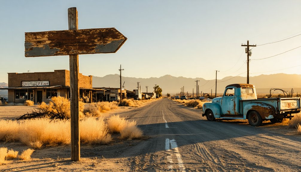
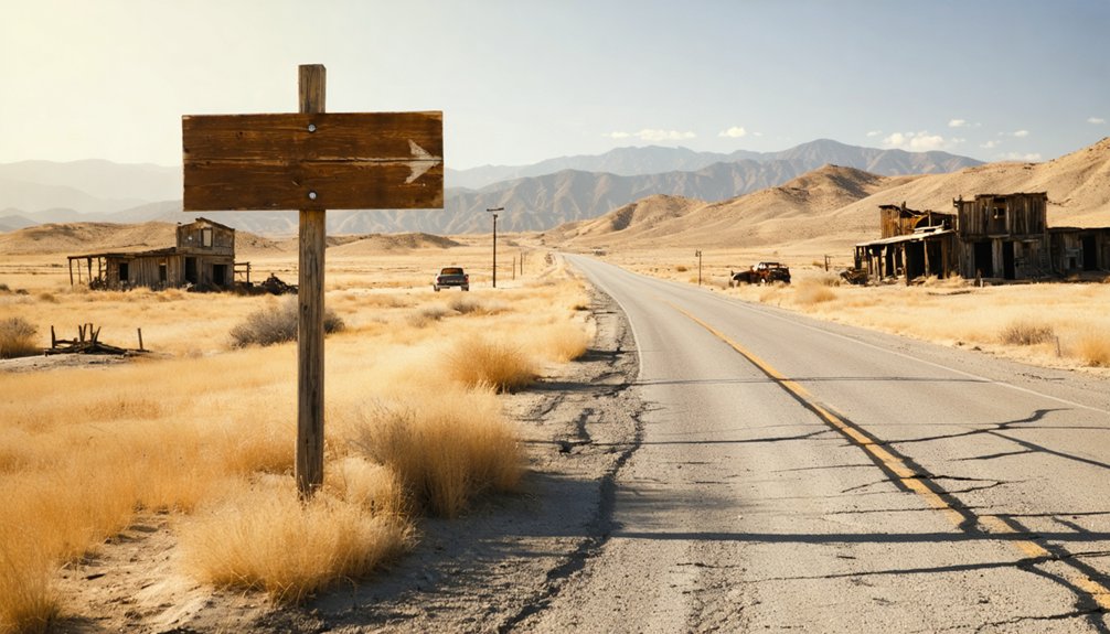
Unlike California’s more celebrated ghost towns where weathered buildings still stand sentinel over dusty streets, San Joaquin City has vanished almost entirely from the landscape. You’ll find no remnant historical structures—no crumbling storefronts, no foundations marking where pioneers once built their dreams. The site offers limited on-site amenities, just a California Historical Landmark plaque standing along Kasson Road marking where this Gold Rush transportation hub once thrived.
That plaque, replaced in February 2020 after thieves stole the original 1962 marker, is your only tangible connection to the past. The San Joaquin River flows nearby, reminding you why settlers chose this spot in 1849. While 1915 maps showed five structures lingering at the site, even those final holdouts have surrendered to time, leaving you with raw earth and imagination. For a different ghost town experience where you can explore preserved structures, consider visiting Bodie, which maintains fewer than 200 buildings from its mining heyday as a California state park.
Best Times to Visit the Historical Marker
The historical marker stands accessible year-round along Kasson Road, but you’ll extract the most from your visit during California’s temperate spring and fall months when mild temperatures transform what could be a brief photo stop into a contemplative exploration. Summer’s intense heat makes lingering uncomfortable, while winter rains can limit your freedom to explore the surrounding remnants.
Consider coordinating your ghost town visit with the San Joaquin County Historical Museum‘s operating schedule:
You can also explore abandoned sites in Orange County, where remnants of the past provide a fascinating glimpse into history. Be sure to check out local guides who can share stories about these locations, adding depth to your experience. Visiting these sites can be an exciting way to appreciate the heritage of the region.
- Museum hours run Thursday through Sunday, 10:00 AM to 4:00 PM
- Closed December 24 through January 1
- Hours may shift during seasonal events and park closures
- Admission costs $5 for adults, creating an affordable pairing
This combination lets you ground marker observations in documented regional history, enriching your understanding beyond roadside interpretation.
Photography Tips for Your Ghost Town Experience
Although San Joaquin City’s physical structures have vanished into California’s agricultural landscape, your camera can still capture the haunting essence of abandonment through the historical marker and surrounding remnants.
Even ghost towns leave traces—your lens can resurrect San Joaquin City’s vanished soul through weathered markers and the stubborn earth beneath.
Begin your location scouting during golden hours when dramatic shadows transform ordinary fields into storytelling landscapes. You’ll find depth through leading lines in fence rows and agricultural paths that once carried prospectors.
Focus on weathered details—rusted farm equipment, forgotten foundations, and cemetery headstones that survived when everything else disappeared. Shoot from unusual angles, ground-level or elevated perspectives that break conventional boundaries.
In post production techniques, enhance contrasts subtly to preserve the ghostly atmosphere without overpowering authenticity. Converting to monochrome amplifies textures and emotions that color conceals, letting viewers feel the weight of history through your lens.
Nearby Abandoned Settlements Worth Exploring
Within a thirty-mile radius of San Joaquin City, five forgotten settlements whisper their own tales of boom and abandonment across California’s transformed landscape. You’ll discover Elliott, founded in 1846 and quietly surrendering after 1901, alongside Carnegie (Tesla), where industrial decline claimed another mining community.
These sites offer genuine tourism potential beyond sanitized attractions:
- Empire City – washed clean by the 1862 flood, leaving bare earth
- Allensworth – America’s first African American self-governed township
- Locke – Sacramento Delta’s preserved Chinatown with boarding house museum
- Carnegie – remote Tesla ruins demanding off-road capability
While local businesses remain scarce in these abandoned zones, you’re free to explore genuine history without tourist traps. Pack provisions, respect private property, and embrace the solitude these settlements offer adventurous souls.
Essential Items to Pack for Your Road Trip
Your ghost town adventure demands reliable navigation tools—pack both a detailed paper map and a fully charged GPS device, since cell service around San Joaquin City can be spotty at best.
The harsh Central Valley sun will beat down relentlessly on these exposed, shadeless ruins, so you’ll need multiple water bottles, electrolyte packets, and SPF 50 sunscreen to prevent dehydration and burns.
Don’t forget your camera with extra batteries and memory cards; these crumbling structures and weathered facades create hauntingly beautiful shots you won’t want to miss, especially during golden hour when the light transforms the abandoned buildings into something almost ethereal.
Every ghost town photographer needs three core essentials before hitting the road to San Joaquin City: reliable navigation tools, proper lighting equipment, and a camera setup that handles extreme low-light conditions.
Your camera support starts with a quality tripod—Peak Design’s Travel model excels in abandoned environments, while alternatives with ballheads enable those critical 30-second exposures. Pack your Nikon Z7ii or Sony A7 II with wide-angle glass around 24mm to capture haunting emptiness.
For lighting techniques, you’ll need:
- Bright torch for autofocus assistance in pitch-black interiors
- Headlamp for hands-free corridor navigation
- Flashgun with red gel for atmospheric light painting
- EL-wire string lights for creative fog effects
GPS mapping guarantees you’ll locate key structures—the jail, saloon, church—while avoiding restricted areas in this forgotten California settlement.
Water and Sun Protection
Beyond capturing the perfect shot of crumbling facades and weathered doorways, you’ll face California’s unforgiving desert heat on your journey to San Joaquin City. Pack one gallon of water per person daily—essential for drinking, cooking, and staying alert behind the wheel.
Water filtration systems like the LifeStraw Peak Gravity or Sawyer Squeeze transform questionable sources into safe hydration when you’re miles from civilization. Store containers in shaded spots using emergency foil blankets as portable sun shelters over your gear.
Don’t skip sunscreen; UV rays penetrate windshields during those long desert stretches. A Coleman 5-Gallon Carrier with spigot serves groups well, while CamelBak’s insulated bottle keeps reserves cold. Keep everything dark and cool—algae-free water tastes better when exploring forgotten California outposts.
Combining Your Visit With Other Central Valley Attractions
While San Joaquin City offers a compelling glimpse into California’s Gold Rush past, the surrounding Central Valley brims with similar historical treasures worth exploring during your visit. You’ll discover authentic pioneer settlements and historic trade routes that shaped California’s destiny.
Consider these nearby attractions:
- Mokelumne City Ghost Town – Another abandoned port near Thornton where floods erased a once-thriving river community
- Juan Flaco Burial Site – Honor the legendary rider who galloped from Los Angeles to San Francisco with life-saving messages
- Durham Ferry Crossing – Stand where freight wagons once rolled onto ferries bound for the Southern Mines
- Old River Road (Kasson Road) – Follow the original route that connected these frontier outposts
Each location reveals how quickly fortune shifted in early California, creating the perfect ghost town circuit.
Frequently Asked Questions
Are There Any Guided Tours Available for San Joaquin City?
No guided tours exist specifically for San Joaquin City ghost town, so you’ll need to create your own adventure. You’re free to explore through self-guided tours and historical walking tours, discovering abandoned structures at your own pace.
Is Camping Allowed Near the San Joaquin City Historical Site?
Camping isn’t permitted at the historical site itself, but you’ll find nearby campgrounds with designated public facilities availability. Check out San Joaquin River Gorge’s affordable campsites where you can pitch your tent and explore freely.
What Safety Precautions Should Visitors Take at the Ghost Town?
You’ll need to bring appropriate footwear for uneven terrain and pack adequate water supplies since desert conditions are unforgiving. Stay with your vehicle if trouble strikes, and always tell someone your route before venturing out.
Are There Entrance Fees to Visit San Joaquin City Landmark?
You won’t pay entrance fees at San Joaquin City—it’s completely free to explore. There aren’t any visitor parking fees or official site operating hours either, so you’re free to adventure on your own schedule.
Can Visitors Access the San Joaquin River From the Site?
No river access exists at this vacant roadside site. You’ll find only the historical marker along Kasson Road, with no trails or permissions for reaching the riverbank. Recreational activities require visiting designated public access points elsewhere.
References
- https://commons.wikimedia.org/wiki/File:San_Joaquin_City_marker.jpg
- https://ohp.parks.ca.gov/?page_id=21483
- https://www.camp-california.com/california-ghost-towns/
- https://www.visitcalifornia.com/road-trips/ghost-towns/
- https://en.wikipedia.org/wiki/San_Joaquin_City
- https://elkgrovehistoricalsociety.com/early-towns-south-of-eg/
- https://cityofsanjoaquin.org/home/about/
- https://stocktonhistoricalmaritimemuseum.org/stocktons-maritime-history/
- https://sanjoaquinriverpartnership.org/for-river/rich-history.php.html
- https://www.parks.ca.gov/?page_id=1081


