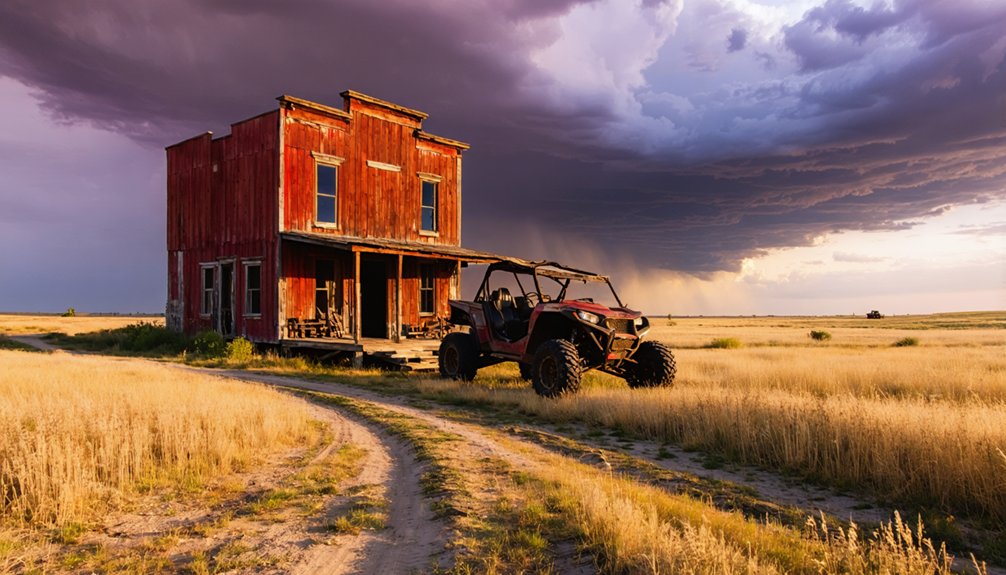
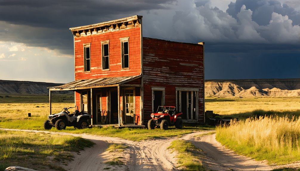
You’ll find dozens of authentic ghost towns scattered across the Great Plains, from Nebraska’s abandoned mining communities like Minersville to Kansas prairie settlements along scenic byways. Your ATV can navigate the network of gravel roads connecting 1890s cattle towns, while North Dakota’s Roughrider Trail spans 22 miles through historical corridors. Pack essential safety gear, GPS navigation, and recovery equipment for these remote expeditions where crumbling homesteads tell America’s westward expansion story through landscapes that’ll challenge your off-road skills.
Key Takeaways
- Nebraska offers accessible ghost towns like Minersville and Forest City via old stage roads, with 788 mining claims providing exploration opportunities.
- Kansas Prairie Trail Byway connects historic settlements including Ellsworth, Kanopolis, Castleton, and Irving with designated ATV trails at Cooper Creek.
- Oklahoma’s K-Trail in Ouachita National Forest provides access to territorial remnants and near-ghost towns like Eldorado and Tipton.
- North Dakota’s 22-mile Roughrider Trail connects abandoned towns like Alkabo and Charbonneau through historical prairie corridors.
- South Dakota Badlands features scattered ghost towns accessible via 3,600 miles of motorized trails requiring Black Hills permits.
Essential ATV Equipment for Great Plains Ghost Town Exploration
When you’re threading your ATV through the wind-carved canyons and crumbling foundations of Great Plains ghost towns, the difference between an epic adventure and a dangerous predicament often comes down to what’s strapped to your machine.
Essential safety gear starts with your helmet and first aid kit, because these forgotten settlements don’t offer cell towers or emergency services.
Pack navigation tools like a Garmin GPS with spare batteries and onX Offroad maps—prairie landscapes blur together, making ghost towns surprisingly easy to lose. Include a tracking device to help locate your ATV if it becomes lost or stolen in these remote areas.
Your repair arsenal should include tire kits, zip ties, and basic wrenches for trail fixes.
Don’t forget recovery gear like tow straps and shovels, plus survival supplies including fire starters, water, and shelter tarps for Plains weather’s notorious mood swings. Remember that many areas require proper sticker registration for off-highway vehicles, so verify your ATV’s documentation is current before hitting remote ghost town trails.
Nebraska’s Abandoned Mining Communities and Access Routes
Although Nebraska’s reputation centers on agricultural heritage, the state’s 788 mining claims tell a different story—one of forgotten communities that sprouted around chalk quarries, lead prospects, and speculative mineral ventures before vanishing into prairie grass.
Beneath Nebraska’s cornfields lie the skeletal remains of mining boomtowns, their stories buried deeper than any prospector’s dream.
You’ll find authentic abandoned settlements like Minersville, where mining history carved temporary scars across the landscape. Scout the graded streets and angled grain elevators using historic railroad maps—they’re your roadmap to freedom on four wheels.
Dawes County’s three active claims hint at larger forgotten operations nearby. The Happy Jack Chalk Mine near Scotia offers the clearest glimpse into Nebraska’s mining past, though entrance requires permission. These operations provided essential products like whitewash and chicken feed before abandonment claimed most sites by the 1950s.
Forest City’s remains lie 1.5 miles west of Gretna, accessible via old stage roads that make perfect ATV routes through Nebraska’s hidden industrial heritage. Knox County preserves remnants of general stores that once served local communities before evolving into today’s ghost town destinations.
Kansas Prairie Ghost Towns Reachable by Four-Wheeler
You’ll discover Kansas’s forgotten prairie settlements along scenic byways that connect cattle shipping points like Elgin with restored gems such as Beaumont’s converted hotel B&B.
The Prairie Trail Byway opens access to historic Ellsworth and Kanopolis, where you can explore Fort Harker remnants and even spot a Cold War missile silo between ghost town stops.
Your four-wheeler handles the gravel roads leading to atmospheric locations like Castleton, which resembles a movie set, and Irving near Carbondale, where you’ll find a natural spring with drinkable water. For designated ATV riding areas, Cooper Creek near Deepwater offers 400 acres of trails and hills specifically managed for off-road vehicles. Kansas’s flat terrain makes these prairie ghost towns particularly accessible for novice ATV riders exploring the region’s forgotten settlements.
Prairie Trail Routes
Stretching across Kansas’s windswept prairies, a network of gravel roads and historic trails opens up access to forgotten cattle towns that once thrived during the state’s booming 1890s beef trade.
You’ll discover multiple routes connecting these abandoned settlements, each offering unique perspectives on ghost town history and rugged terrain perfect for ATV exploration.
The Prairie Spirit Trail spans 53 miles through three counties, while Halifax Road provides GPS-mapped trail navigation across tallgrass landscapes. Many of these routes follow the same paths that led to Coffeyville’s famous 1892 Dalton Gang shootout, where local citizens defended their town against the notorious outlaws.
You’ll encounter:
- Century-old barns and limestone building remnants from peak cattle shipping days
- Wildlife sightings including deer and eagles along historic Big Blue River routes
- Connected ATV networks linking multiple ghost towns through deep gravel backroads
These trails follow paths once traveled by ranchers and cowboys, giving you authentic access to Kansas’s wild frontier heritage. For those seeking unique terrain challenges, the Syracuse Sand Dunes offer an entirely different landscape experience with their rolling hills and fast flat areas across 1,300 acres.
Historic Mining Remnants
Beneath Kansas’s rolling prairie lies evidence of a different kind of boom-and-bust cycle, where mining operations carved deep scars into the earth and left behind ghost towns that tell stories of coal, lead, zinc, and oil.
You’ll discover Minersville’s abandoned coal pits where thirty mines once extracted lignite for seventy-six years, reaching depths up to seventy-five feet. Miners used buckets and rope to transport the coal from these shallow excavations to waiting wagons above.
Empire City’s crumbling foundations mark where three thousand souls chased lead dreams near Galena. The town was officially incorporated in June 1877 during the height of its mining prosperity.
Treece stands as mining history’s darkest chapter—evacuated due to lead poisoning, its empty streets await environmental cleanup.
Your four-wheeler can navigate these forgotten settlements where ghost town exploration reveals both triumph and tragedy.
Each site offers tangible connections to Kansas’s resource extraction past.
Oklahoma Territory Settlements Accessible via Off-Road Trails
Dozens of forgotten settlements dot Oklahoma’s rugged backcountry, where territorial dreams once flourished before fading into prairie grass and red clay memories.
You’ll discover these Oklahoma settlements through extensive off road trails that wind through diverse terrain, from the rolling Kiamichi Mountains to the windswept Red River border.
The Oklahoma Adventure Trail connects you to historical sites like Cheyenne near the Washita Massacre Visitors Center, while detours lead to Pond Creek’s family homesteads via ranch roads.
Winding ranch roads reveal family homesteads and massacre memorials where territorial history intersects with Oklahoma’s forgotten frontier past.
Along the Red River, near-ghost towns like Eldorado and Tipton showcase abandoned structures amid horse pastures.
- 89-mile K-Trail in Ouachita National Forest accesses remote territorial remnants
- Red River border towns feature empty downtowns and isolated red clay corners
- Kiamichi Mountains 4WD routes connect frontier outposts through forested terrain
North Dakota Frontier Towns Connected by ATV Pathways
You’ll discover North Dakota’s vast prairie trail networks offer unique access to frontier settlements scattered across the windswept landscape, where 22-mile routes like the Roughrider Trail connect you to remnants of America’s western expansion.
As you navigate these established ATV pathways, you’re exploring the same terrain where abandoned towns like Alkabo and Charbonneau once thrived along vital transportation corridors.
The state’s mining heritage becomes tangible when you encounter ghost settlements near historical extraction sites, though you’ll need to respect private property boundaries while experiencing these authentic pieces of frontier history.
Prairie Trail Networks
Five major trail networks crisscross North Dakota’s prairie landscape, connecting historic frontier settlements through hundreds of miles of ATV-accessible pathways that wind past abandoned homesteads, military outposts, and forgotten trading posts.
You’ll discover uncharted territories where buffalo soldiers once rode and cattle drives carved deep ruts into virgin grasslands.
The Roughrider OHV Trail stretches 22 miles between Fort Abraham Lincoln and Fort Rice, while Sheyenne National Grassland offers 58 miles of connected routes.
Trail navigation becomes intuitive as you follow these established corridors through diverse prairie landscapes.
- Little Missouri National Grasslands: Over 1,000 miles of country roads through badlands and ranch territory
- Pembina Gorge: 15+ miles of scenic trails with dramatic gorge overlooks
- Turtle Mountain: 10 miles of heavily wooded trails unique to North Dakota’s topography
Abandoned Settlement Exploration
Beyond the established trail networks, North Dakota’s most compelling destinations emerge where frontier dreams met harsh reality—ghost towns that tell stories of ambition, hardship, and eventual surrender to the unforgiving prairie.
You’ll discover abandoned architecture that speaks volumes about pioneer resilience. Josephine’s twin grain elevators stand sentinel over empty grasslands where 24 residents once thrived.
Arena’s preserved St. John’s Lutheran Church anchors a settlement reduced to two homes and a relocated schoolhouse.
Ghost town lore runs deepest at Sims, where the “Gray Lady Ghost” reportedly haunts the Scandinavian Lutheran Church—compelling enough to draw Laura Bush’s 2008 visit.
Nanson offers the ultimate frontier experience: four crumbling homes in Rolette County’s absolute isolation, unreachable by anything but your ATV through trackless grassland.
Historical Mining Remnants
Mining towns scattered across North Dakota’s coal country offer a different kind of ghost town experience—one where industrial ambition carved deeper scars into the landscape than failed farming communities ever could.
You’ll discover mining artifacts embedded in the earth around Coal Harbor, where Sioux raids once threatened early operations along the Missouri River. Your ATV can navigate the rough terrain to Stanton and Washburn, where underground lignite extraction left lasting impressions.
These sites showcase ghost town preservation at its most authentic:
- Sims townsite remnants – Northern Pacific’s 590-acre development from 1882
- Davis Mine loading platforms – Railroad infrastructure frozen in time
- Beulah’s industrial foundations – Commercial operations spanning 1873-1945
You’ll find freedom exploring these industrial graveyards where coal veins once promised prosperity.
South Dakota Badlands Ghost Towns and Riding Conditions
When you venture into South Dakota’s rugged Badlands and Black Hills region, you’ll discover a network of ghost towns scattered across 3,600 miles of motorized trails spanning 1.2 million acres of diverse terrain.
You’ll need a Black Hills Motorized Trail Permit—$20 for seven days or $25 annually—to explore these forgotten settlements legally.
Navigate to Scenic Ghost Town near the Badlands, where you’ll find a partially abandoned church-jail building, or head to Maitland Ghost Town via Maitland Road.
Understanding ATV regulations protects both riders and ghost town preservation efforts, as many sites sit on private property requiring road-only viewing.
The terrain challenges you with moderate to difficult trails featuring limestone exposures and mountain weaves, while 21 motorized trailheads provide ample parking for your adventure-seeking spirit.
Eastern Wyoming Plains Communities Accessible by ATV
From the eastern Wyoming plains, you’ll discover some of the state’s most spectacular high-elevation ghost towns accessible through dramatic ATV ascents that climb thousands of feet into the mountains.
Kirwin Ghost Town exemplifies this ghost town accessibility, sitting over 9,000 feet in Shoshone National Forest. You’ll navigate 40 miles of rugged terrain that climbs 3,000 feet from Meeteetse’s paved roads.
The ATV trail conditions challenge you with:
- Creek crossings and steep technical grades through mountain canyons
- Remote high-elevation terrain requiring four-wheel drive capability
- Over 75 miles of scenic connecting roads for extended exploration
Wyoming’s 640+ miles of national forest ATV trails open these mountain ghost towns to freedom-seekers.
Unlike other regions, eastern access points like Cody provide rental options and guided tours for reaching these preserved mining remnants.
Eastern Colorado Ghost Towns Beyond the Rockies
You’ll find eastern Colorado’s ghost towns scattered across windswept plains where prairie grasses now claim abandoned storefronts and crumbling foundations.
Your ATV can easily navigate the flat terrain to reach settlements like Dearfield and Firstview, where refurbished 1920s structures tell stories of failed farming communities and broken dreams.
These accessible ruins offer perfect stops for exploring Colorado’s mining and agricultural heritage without the challenging mountain trails found elsewhere in the state.
Plains Mining Settlement Ruins
Beyond the towering peaks and alpine meadows that define Colorado’s mining legacy, the state’s eastern plains hold their own collection of abandoned settlements where fortune-seekers once chased different dreams.
You’ll discover places like Keota, where plains mining operations carved out brief prosperity before economic realities forced abandonment. These eastern ghost town sites offer a stark contrast to their mountain counterparts, with windswept foundations and scattered debris telling stories of resilience against harsh prairie conditions.
- Sparse remains challenge exploration skills – You’ll need keen observation to spot foundations and artifact scatters across vast grasslands
- Weather exposure accelerated decay – Unlike sheltered mountain sites, plains settlements faced relentless wind and temperature extremes
- Different mining focus – These communities often supported coal, oil, or agricultural operations rather than precious metals
Prairie ATV Trail Access
While Colorado’s mountainous ghost towns capture most attention, the state’s eastern plains offer equally compelling ATV adventures to forgotten settlements scattered across windswept grasslands.
For those seeking a different experience, explore ghost towns in Michigan where the remnants of once-thriving communities tell stories of resilience and abandonment. Unearth the hidden history among the crumbling facades and rusted machinery, offering a glimpse into times past. Each location holds its unique charm, perfect for adventurers eager to capture the haunting beauty of these forgotten places.
You’ll discover Depression-era farmhouses crumbling beside modern oil pumps and wind turbines, creating haunting juxtapositions across vast prairies.
Essential ATV navigation tips include downloading onX Offroad before venturing onto crisscrossing dirt roads where GPS signals weaken.
Start with a full gas tank—these expansive routes demand preparation.
Keota’s ghost town history unfolds 11 miles south of Pawnee Buttes, featuring a cemetery 1.5 miles east through deteriorating homesteads.
Your four-wheel drive ATV handles rough terrain beyond main roads, accessing prairie settlements that tell Colorado’s agricultural story.
These windswept ruins offer solitude impossible to find near crowded mountain destinations.
Texas Panhandle Abandoned Settlements and Trail Networks
Scattered across the windswept Texas Panhandle, abandoned settlements tell stories of dreams deferred and communities claimed by drought, economic shifts, and the relentless march of progress.
You’ll find exceptional ATV access through these forgotten places, where open plains and rolling hills create natural trail networks connecting multiple ghost towns in single expeditions.
Glenrio straddles the Texas-New Mexico border, offering intact structures from its Route 66 heyday before Interstate 40’s bypass devastated the community.
Medicine Mound’s crumbling college and Hicks-Cobb General Store provide haunting backdrops for your off-road adventures.
Key exploration highlights include:
- Glenrio’s preserved gas station and motel complex from the Interstate 40 bypass era
- Medicine Mound’s abandoned bank and drugstore buildings accessible via open prairie routes
- Natural trail networks connecting multiple settlements through drought-resistant terrain
Trail maintenance remains minimal, supporting ghost town preservation through limited vehicular impact.
Safety Considerations for Great Plains ATV Ghost Town Adventures
Remote ghost town exploration across the Great Plains demands meticulous preparation, as you’ll venture into isolated terrain where cell towers disappear and the nearest mechanic sits hours away.
Your safety gear becomes your lifeline—pack DOT-compliant helmets, protective clothing, first-aid kits, and emergency communication devices. Check your ATV’s oil, tire pressure, and spare before departure; mechanical failures in abandoned settlements aren’t romantic adventures.
When venturing into remote ghost towns, proper safety equipment and pre-departure ATV maintenance checks aren’t optional—they’re survival essentials.
Route planning separates successful expeditions from dangerous ordeals. Scout trail conditions, inform someone of your detailed itinerary, and never ride alone—groups of three provide essential backup when recovery gear becomes necessary.
Monitor weather patterns religiously; Great Plains storms transform dusty trails into impassable mud. Carry earth anchors for self-recovery since trees are scarce. Your freedom depends on thorough preparation, not reckless spontaneity.
Frequently Asked Questions
What Permits or Permissions Are Needed for ATV Access to Ghost Towns?
Like modern-day prospectors seeking treasure, you’ll need state-specific ATV regulations compliance. Colorado requires registration cards, South Dakota demands trail permits, Montana needs passes. Each state’s permit requirements grant you your freedom to explore abandoned settlements.
Are There Guided Tour Options Available for Great Plains Ghost Town Exploration?
You’ll find guided exploration through local guides who know hidden prairie routes and forgotten settlements. They’ll navigate you past weathered homesteads and abandoned main streets, sharing stories while you experience true backcountry freedom.
What Is the Best Time of Year to Visit Ghost Towns by ATV?
Picture golden leaves crunching beneath your tires—fall’s your prime window. Best seasons offer cooler temps and stunning foliage, while weather considerations include avoiding winter’s harsh closures and spring’s unpredictable mud.
Can Vintage ATVS Handle Great Plains Terrain and Weather Conditions Effectively?
Vintage ATVs offer limited terrain adaptability for Great Plains ghost town exploration. You’ll struggle with basic suspension, poor weather protection, and vintage performance issues on rough grasslands requiring frequent maintenance stops.
Are Camping Facilities Available Near Great Plains Ghost Town ATV Trail Systems?
Like tumbleweeds finding shelter against prairie winds, you’ll discover scattered camping amenities near ghost town trails—from basic dispersed sites to small-town RV parks—though trail accessibility often means embracing primitive camping under endless skies.
References
- https://thearizonabucketlist.com/ghost-town-trail-atv/
- https://www.tripadvisor.com/Attraction_Review-g60519-d8454008-Reviews-Kirwin_Ghost_Town-Meeteetse_Wyoming.html
- https://www.durangorivertrippers.com/blog/exploring-colorado-ghost-towns/
- https://www.visitouray.com/ghost-towns
- https://www.onxmaps.com/offroad/blog/ghost-towns-off-roading
- https://axlengear.com/1150-2/
- https://www.colorado.com/articles/colorado-ghost-towns
- https://www.youtube.com/watch?v=w-aGYEP9fiY
- https://www.youtube.com/watch?v=fn1XNn-jrB8
- https://www.bertsmegamall.com/blog/the-ultimate-off-road-guide-to-calico-ghost-town–26797


