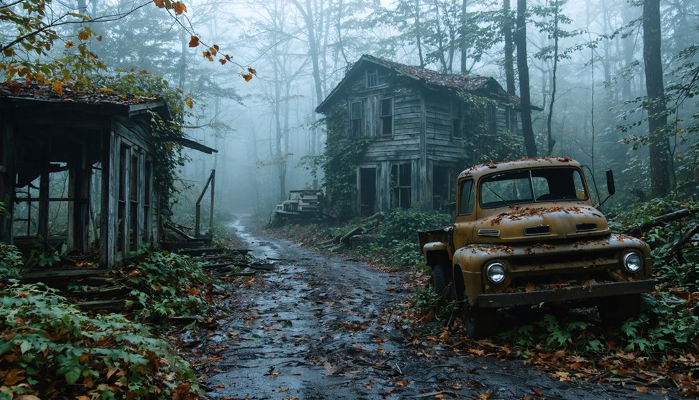
You can explore Kentucky’s haunting past by riding your ATV through abandoned coal camps like Blue Heron Mine 18 in McCreary County and Barthell Coal Camp near Stearns, both featuring preserved mining structures and company houses. Golden Pond Ghost Town sits within Turkey Bay OHV Area, offering easy trail access to moonshine-era remnants. Six Gun City’s abandoned theme park ruins await discovery along Eagle Falls Trail, while Black Mountain’s 7,000 acres provide high-elevation access to mining ghost sites and historic lookout towers throughout the challenging backcountry terrain.
Key Takeaways
- Blue Heron Mine 18 in McCreary County features preserved mining structures and audio recordings from former miners.
- Barthell Coal Camp offers fifteen restored company houses from the early 1900s with overnight stays available.
- Golden Pond Ghost Town remnants can be explored within Turkey Bay OHV Area in Land Between the Rivers.
- Six Gun City Ruins along Eagle Falls Trail showcase abandoned 1990s theme park structures and buildings.
- Bells Mines Cemetery provides access to abandoned settlement remains within Big Rivers Wildlife Management Area.
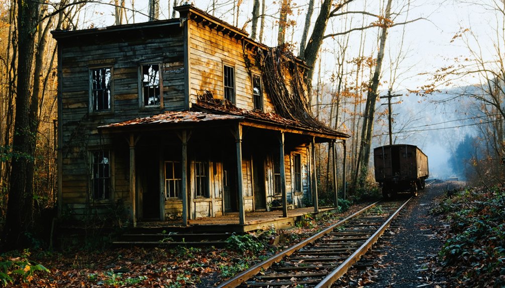
Blue Heron Mine 18 and Steam-Like Atmosphere in McCreary County
Deep within McCreary County’s rugged canyon walls, Blue Heron Mine 18 stands as Kentucky’s most atmospheric ghost town, where the echoes of industrial coal mining still whisper through reconstructed timber structures and rusted railway cars.
You’ll discover authentic mining history dating back to 1937, when Stearns Coal & Lumber Company carved this operation from wilderness alongside the Big South Fork of Cumberland River.
The preserved tipple structure and Joy Loader remnants create an eerily authentic atmosphere. Steam seems to rise from quiet tram tracks while ghostly coal cars sit frozen in time. Visitors can experience the living history through audio recordings that share authentic stories from former miners and residents who once called this remote camp home.
You can explore the slope mine’s reconstructed façade, experiencing three distinct phases of coal extraction. The interpretive center reveals superintendent duties and mining technology through compelling oral histories, making Blue Heron an unforgettable journey into Kentucky’s industrial past. The site’s ghost structures represent former buildings including the original church and school that once served the mining community.
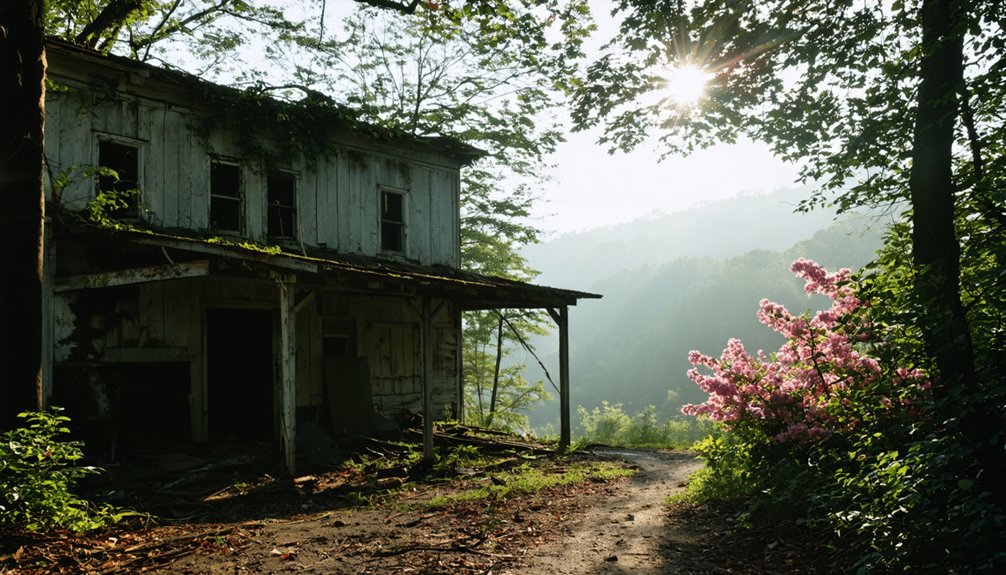
Barthell Coal Camp’s Restored Company Houses Near Stearns
Fifteen meticulously restored company houses await your exploration at Barthell Coal Camp, where Kentucky’s first Stearns Coal and Lumber Company operation springs back to life through an extraordinary $500,000 restoration effort.
You’ll discover authentic Barthell history dating back to 1902, when this pioneering settlement housed 350 residents at its peak. These company houses offer overnight stays, letting you experience coal camp life firsthand rather than just observing from behind barriers.
The Koger family’s dedicated restoration preserves original structures including the company store, schoolhouse, and doctor’s office. You can tour the motor house, bath house, and tipple remnants while staying in genuine miner housing. Mining operations continued until the Kogers purchased Barthell from Stearns Coal & Lumber Company in 1930. The camp’s decline accelerated after a devastating fire struck Mine No. 1 in 1943, leading to its eventual closure.
Located near Stearns, Barthell serves as the destination for the Big South Fork Scenic Railway, combining historical immersion with modern adventure accessibility.
Six Gun City Ruins and Eagle Falls Trail Access From Cumberland Falls
You’ll find the Eagle Falls Trail at Cumberland Falls State Resort Park on the McCreary County side via Highway 90, where a steep, winding path leads through Cumberland Forest to the abandoned Six Gun City ruins.
The trail starts from the Eagle Falls trailhead parking area and climbs up the mountainside past old posts that once connected the theme park to the state park. After hiking approximately three-tenths of a mile, you’ll reach a trail sign that provides directions to either continue straight to Six Gun City or turn left toward Eagle Falls.
Watch for unstable structures, graffiti-covered buildings, and steep terrain as you explore the weathered jail, sheriff’s office, and other remnants of this failed 1990s western attraction. The park was originally planned to open on May 18, 1998 following the devastating fire that destroyed the nearby Tombstone Junction amusement park in 1991.
Eagle Falls Trail Route
Although Trail #9 spans just 2.1 miles as a lollipop loop, you’ll tackle 653 feet of elevation gain while discovering some of Kentucky’s most spectacular waterfall views and forgotten ruins.
Starting from the blazed trailhead, you’ll pass remnants of an old CCC shelter and theme town before reaching the main loop. Turn left west through dense forest toward Eagle Creek Cascades, then continue to Eagle Falls via stone and metal stairs. The trail may experience periodic closures during high water conditions, so check with park officials before your visit. Eagle Falls Trail #9 accommodates hikers of various skill levels with its moderate difficulty rating.
Trail Features you’ll encounter:
- Ridgetop views – Follow cliff lines for 1.8 miles with Cumberland Falls vistas
- Rock scrambling – Hop downstream rocks at Eagle Falls base
- Behind-the-falls access – Navigate slick rock for unique perspectives
- Red trail markings – Well-marked route through challenging terrain sections
Six Gun City Hazards
While exploring the Eagle Falls Trail offers breathtaking waterfall views, venturing off the marked path to discover Six Gun City’s ruins demands serious caution and preparation.
You’ll face steep, winding terrain leading to decaying Wild West structures perched high on Cumberland’s mountainside. The ruin stability remains questionable after decades of abandonment and weather exposure.
Multiple devastating fires throughout the 1980s and 1990s destroyed the original park, creating potential fire hazards from unstable debris and compromised building materials. The site contains structures with metal roofs that have helped preserve some buildings in relatively good condition despite the harsh elements. Visitors once reached this mountaintop destination via a steam engine train that transported guests from the main Tombstone Junction park below.
The remote forest location amplifies risks—you’re miles from help if something goes wrong. Bring proper hiking gear, inform others of your plans, and proceed with extreme caution.
These ghostly remnants tell fascinating stories, but they’re dangerous to explore unprepared.
Golden Pond Ghost Town Within Turkey Bay OHV Area
For nearly a century, Golden Pond thrived as the largest settlement in Kentucky’s Land Between the Rivers region before vanishing completely beneath government acquisition and highway construction.
Today, you’ll find this ghost town‘s remnants within Turkey Bay OHV Area, where ATV trails lead through Land Between the Lakes National Recreation Area.
The town’s historical significance traces back to 1882, surviving major fires and earning notoriety for moonshine production during Prohibition.
What You’ll Discover:
- Two concrete horse mounting blocks from the original downtown
- Scenic overlook with precise building locations and family photos
- Golden Pond itself at the nearby Visitor Center
- Reports of ghostly sightings including underwater lights and mysterious voices
You’ll access this haunting location via designated ATV trails, experiencing freedom while exploring Kentucky’s buried past.
Black Mountain Off-Road Adventure at Kentucky’s Highest Elevation
You’ll find Kentucky’s most elevated off-road adventure at Black Mountain, where 7,000 acres of mountainous terrain reach 3,321 feet above sea level.
The area offers over 150 miles of marked trails ranging from beginner-friendly routes to extreme challenges that’ll test your skills on steep climbs and technical descents.
While exploring these high-elevation trails, you’re riding through regions steeped in Appalachian history, where abandoned mining communities once thrived in Kentucky’s rugged eastern mountains.
Highest Point Trail Access
Standing at 4,145 feet above sea level, Black Mountain claims the distinction of Kentucky’s highest peak, but reaching its summit requires traversing a complex mix of public trails and private property restrictions.
You’ll find summit access via Route 160 near Lynch, Kentucky, where an unmarked road leads toward the radio tower. However, “No ATVs” signs block motorized vehicles from the final approach, forcing you to park at the overlook and walk the remaining distance.
For ideal trail navigation to Kentucky’s roof:
- Winter conditions create icy roads requiring a 1.5-mile hike with 250-foot elevation gain
- Most seasons allow driving within 0.1 miles of the summit
- Coordinates 36.91426 / -82.89379 mark the exact high point
- Class I terrain offers very easy difficulty despite elevation
Easy to Extreme Routes
While Black Mountain’s summit represents Kentucky’s ultimate elevation goal, the real adventure begins when you tackle the extensive off-road trail system sprawling across 7,000 acres of rugged Harlan County terrain.
You’ll discover over 150 miles of marked trails designed for every skill level. Green beginner routes offer gentle introductions across former strip-mine roads, while blue intermediate trails challenge you with rolling climbs through elevations spanning 1,180 to 3,320 feet.
Red trails deliver advanced challenges featuring tight technical sections that’ll test your limits. For extreme adventurers, Level 1-5 obstacles push both rider and machine beyond comfort zones.
The rocky hardpack terrain demands respect, with occasional mud patches and minimal berms. You’ll share these rugged routes with ATVs, dirt bikes, and 4x4s, experiencing true freedom across maintained wilderness.
Historic Site Proximity
Beyond the challenging trails and technical obstacles, Black Mountain’s summit connects you directly to Kentucky’s mountaineering history through its abandoned fire lookout tower and remnants of early conservation efforts.
You’ll discover historic landmarks that tell stories of coal mining battles and conservation victories stretching back decades.
The summit’s ghost town history unfolds through these preserved elements:
- Abandoned metal fire tower – stairs removed, marking Kentucky’s highest point at 4,145 feet
- FAA radar dome – active infrastructure amid historical ruins
- Former Penn Virginia Resources ownership sites – remnants of industrial mining operations
- Conservation easement boundaries – visible markers of the 1999 state purchase preventing strip mining
You’re exploring more than terrain here – you’re riding through Kentucky’s fight for environmental freedom and mountain preservation.
Daniel Boone Backcountry Byway Through Historic Mining Territory

Over 100 miles of rugged backcountry roads wind through Kentucky’s historic mining territory, where the Daniel Boone Backcountry Byway delivers an authentic off-road adventure across five counties surrounding Red River Gorge.
You’ll navigate historic routes that trace former mining operations through Powell, Estill, Lee, Wolfe, and Menifee Counties. Mining remnants dot the landscape—old oil equipment lines Big Andy Road while weathered homesteads and barns tell stories of Kentucky’s resource extraction past.
Your street-legal 4WD vehicle tackles gravel farm roads, creek crossings, and technical rock fields where miners once worked. The terrain challenges you with 300-foot uphill climbs, deep water crossings on Lower Devil Creek Road, and boulder-strewn paths.
You’re experiencing freedom through landscapes shaped by mining history, where every turn reveals another piece of eastern Kentucky’s rugged heritage.
Bells Mines Cemetery and Roadbeds in Big Rivers Wildlife Management Area
Hidden deep within Big Rivers Wildlife Management Area’s 7,574 acres, the abandoned settlement of Bells Mines reveals its secrets through crumbling roadbeds and a weathered cemetery that marks where a river community once thrived.
Weathered tombstones and forgotten roads whisper tales of a lost river settlement buried within Kentucky’s wild backcountry.
You’ll find Cemetery Access by driving 8 miles from Marion to Highway 365, then turning left for 6.7 miles to Bells Mines Road. The ghost town’s remnants spread across diverse terrain between the Ohio and Tradewater Rivers, offering freedom to explore at your own pace.
Navigate this former mining community using these key points:
- GPS coordinates: N 37.5454, W -88.0287 for main entrance
- Elevation range: 330-600 feet across varied landscapes
- Habitat mix: 65.91% forest, 26.43% open land for exploration
- Contact info: (270) 374-3025 for area regulations
Haunted Forest ATV Trail Adventures Near Bell County Ghost Sites
While most ghost town explorers stick to crumbling foundations and weathered headstones, you’ll discover Bell County’s supernatural side through adrenaline-pumping ATV adventures at Wilderness Trail Off-Road Park near Pineville.
This 2-mile haunted trail winds through spooky woods where ghouls and demons lurk around every corner, creating an unforgettable forest navigation experience.
The annual Haunted Forest Ride draws fearless riders seeking thrills beyond traditional ghost hunting. You’ll navigate wooded terrain under cloud-covered skies, testing your survival instincts against both natural obstacles and supernatural scares.
Past events started with over 50 riders but ended with only 12 completing the grueling 45-mile challenge.
This unique attraction combines off-road excitement with Kentucky’s ghostly heritage, offering freedom-seekers an alternative way to explore Bell County’s haunted history through pure adventure.
Safety Considerations and Permit Requirements for Ghost Town Exploration
Before you fire up your ATV and head toward Kentucky’s abandoned settlements, you’ll need to navigate a complex web of safety regulations and permit requirements that can make or break your ghost town adventure.
As you continue your exploration, consider the allure of ghost towns submerged in Iowa, where remnants of the past linger beneath shimmering waters. These sunken sites tell stories of a bygone era, inviting adventurers and historians alike to uncover their mysteries. Just be sure to respect the local guidelines to preserve these unique underwater landscapes.
Essential Safety Equipment and Permit Regulations:
- DOT-approved helmets – Required for all riders unless you’re operating in fully enclosed metal cabs at designated areas.
- Property permissions – Secure landowner consent for private property exploration or governmental approval for public lands.
- Age restrictions – Operators under 16 need direct parental supervision and appropriate engine size limitations.
- Protective gear – Eye protection, boots, gloves, long pants, and long-sleeved shirts recommended for rugged terrain.
Frequently Asked Questions
What Is the Best Time of Year to Visit Ghost Towns by ATV?
Spring and fall are absolutely perfect best seasons for your ghost town adventures! You’ll enjoy ideal weather considerations with mild temperatures, reduced mud risks, and spectacular scenery that’ll make every trail ride unforgettable.
Are Camping Facilities Available Near These Ghost Town and ATV Locations?
You’ll find varied camping options across these locations. Cumberland Falls and Daniel Boone National Forest offer designated campgrounds, while Black Mountain provides nearby facilities. Ghost town amenities remain limited, requiring self-sufficient adventure planning.
Can Children Ride as Passengers on ATVS During Ghost Town Explorations?
While ghost towns whisper freedom’s call, safety regulations anchor reality—children can ride as passengers if you’re following child requirements: under-16s need helmets, direct supervision, and manufacturer passenger limits during your explorations.
What Should I Bring for Overnight ATV Trips to Remote Ghost Towns?
You’ll need thorough packing essentials including emergency shelter, repair tools, and navigation gear. Don’t forget critical safety gear like helmets, first aid supplies, communication devices, and sufficient food and water for extended wilderness exploration.
Are Guided Tours Available for Ghost Town ATV Adventures in Kentucky?
You’ll find guided experiences through tour operators like Cliffview Adventure Tours and Out the Top Adventures in Red River Gorge, offering expert-led ATV excursions that’ll take you deep into Kentucky’s remote wilderness territories.
References
- https://www.hauntworld.com/haunted-house-in-pineville-kentucky-haunted-forest-atv
- https://www.hannaheliseschultz.com/blog/waterfalls-amp-ghost-towns-eagle-falls-trail-in-cumberland-falls-state-park-corbin-ky
- https://everafterinthewoods.com/abandoned-ghost-towns-in-kentucky-that-still-hold-echoes-of-the-past/
- https://wbkr.com/off-roading-in-kentucky/
- https://www.tripadvisor.com/Attractions-g28938-Activities-c42-t226-Kentucky.html
- https://www.youtube.com/watch?v=NOhv6fv9PC4
- https://www.atvrider.com/story/ride/where-to-ride-atvs-kentucky/
- https://www.freakyfoottours.com/us/kentucky/
- https://parks.ky.gov/explore/big-bone-lick-state-historic-site-7807
- https://backyardknoxville.com/blue-heron-kentucky-mining-camp/