You can explore Vermont’s haunting ghost towns like Glastenbury in the Green Mountain National Forest, where 250 residents once thrived before abandonment, and Ricker Basin with its accessible cellar holes from 1839 families. ATV trails lead to Greenbank’s Hollow’s textile mill ruins and the challenging terrain of flood-destroyed Lewiston on Glastenbury Mountain. The Northeast Kingdom offers extensive trail networks connecting forgotten settlements through old logging roads and former rail beds, revealing Vermont’s forgotten mountain communities and their remarkable stories.
Key Takeaways
- Glastenbury ghost town in Green Mountain National Forest once housed 250 residents before abandonment after 1898 flooding.
- Ricker Basin contains 19th-century settlement ruins with cellar holes, cemeteries, and one surviving farmhouse structure.
- Greenbank’s Hollow features remains of Vermont’s largest textile operation, including a destroyed five-story woolen factory from 1849.
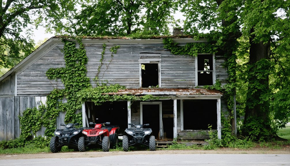
- ATV access requires proper registration, insurance, safety certificates, and operation only on designated public lands approved by Natural Resources.
- Northeast Kingdom trail networks follow old logging roads and rail beds connecting to abandoned settlements and isolated cemeteries.
Glastenbury: Remote Mountain Ghost Town With Forest Service Access
Deep in Vermont’s Green Mountain National Forest, Glastenbury stands as one of New England’s most haunting ghost towns, where crumbling foundations and overgrown logging roads tell the story of a once-thriving community that reached nearly 250 residents in 1880.
Deep in Vermont’s wilderness, Glastenbury’s crumbling foundations whisper tales of a once-thriving community that mysteriously faded into haunting legend.
You’ll navigate remote mountain terrain using old logging paths that wind through areas where sawmills and boarding houses once bustled with activity.
The town’s dramatic decline began when mature trees were depleted by the late 1880s, forcing the railroad’s closure in 1889. A major flood in 1898 destroyed railroad lines and bridges, sealing the community’s fate as residents gradually abandoned their homes. The area experienced two murders in the 1890s that further contributed to its abandonment.
Today, you can explore this mysterious location despite the Glastenbury legends surrounding unexplained mountain disappearances between 1945-1950.
Eight hardy souls still call this enigmatic place home year-round.
Ricker Basin: Mill Ruins Within Little River State Park
Within Little River State Park‘s boundaries, Ricker Basin conceals the haunting remains of a 19th-century settlement where 50 families once carved out hardscrabble lives from Ricker Mountain’s unforgiving slopes.
You’ll discover this forgotten community’s Ricker history through the Dalley Loop Trail, which leads counterclockwise to massive cellar holes marking Gideon Ricker’s 1839 farmstead. Mill artifacts scatter throughout the woods—scattered sawmill remains, rusted farm machinery, and even an old bed frame buried beneath decades of forest growth.
Stone walls snake across the mountainside, evidence of backbreaking labor clearing rocky fields. You’ll encounter three cemeteries containing Ricker family graves, while the ramshackle Almeran Goodell farmhouse stands as the basin’s sole surviving structure, accessible off-trail for those craving deeper exploration.
The community thrived when the railroad arrived in the mid-1800s, transforming the isolated mountain settlement into a more connected farming hub before its eventual abandonment. After exploring the historical sites, remember to check for ticks as they’re common in the area’s wooded trails and grassy clearings.
Greenbank’s Hollow: Former Mill Community in Caledonia County
Echoes of industrial ambition still whisper through Danville’s forgotten corners, where Greenbank’s Hollow once thrived as Northeast Vermont’s most formidable textile empire.
You’ll discover this ghost town nestled in Caledonia County, where Benjamin Greenbank transformed a modest mill into a towering five-story woolen factory in 1849. The brook-powered complex employed forty-five workers, processing wool from nearly 15,000 local sheep that grazed these hills by 1840.
This mill history reached its dramatic end on December 14, 1885, when flames consumed the entire village—factory, store, and homes vanishing in a single devastating night. The mill’s impressive output of 700 yards daily made its destruction particularly devastating to the regional textile industry. After the catastrophe, Greenbank made the strategic decision to relocate his operations to Enfield, NH rather than rebuild in the remote Vermont location.
Today, you can explore the accessible ruins of what was once a bustling hamlet, where nature’s reclaimed the site of Vermont’s greatest textile operation.
Lewiston: Washed-Out Village With Challenging Terrain
You’ll find Lewiston’s remains scattered across the rugged slopes of Glastenbury Mountain, where the devastating 1898 flood swept away the trolley route and much of the village infrastructure.
Today, you can reach the scattered cellar holes and train station remnants by following overgrown miners’ paths through dense forest, though the challenging terrain demands careful navigation. The former railway location made this settlement crucial for coal supply and regional trading until its eventual decline.
Lewiston’s coal industry flourished before giving way to the rise of oil and changing infrastructure needs that ultimately led to the town’s abandonment. Be prepared for high winds and the mountain’s notorious reputation for strange phenomena, as this remote corner of the Bennington Triangle tests even experienced explorers.
Historical River Damage
Although Lewiston once thrived as a Connecticut River settlement, catastrophic flooding transformed this Vermont community into one of the state’s most dramatic examples of river-driven destruction.
You’ll discover that historical floods devastated this area repeatedly throughout the 20th century, beginning with the deadly 1927 New England Flood that washed out bridges and killed dozens across Vermont’s river basins.
The catastrophic 1936 Connecticut River floods created widespread channel changes and ice jams that forever altered the landscape. The disaster prompted federal flood control legislation when President Franklin D. Roosevelt signed the Flood Control Act in June 1936, tasking the Army Corps of Engineers with building levees and flood walls across America.
River engineering projects like the Wilder Dam construction starting in 1947 delivered the final blow.
You’ll find that these dam operations flooded lower Lewiston’s buildings and farmland, submerging structures and destroying the river commerce that sustained the community, ultimately erasing this settlement from Vermont’s map. The town’s decline accelerated when the post office closed in 1954 and rail operations ceased just five years later.
Current Access Routes
Since no documented ATV trails lead directly to Lewiston’s submerged remains, you’ll need to explore the broader Northeast Kingdom trail networks that crisscross this region’s challenging terrain. Your access routes begin with the Northeast Kingdom Wheelers’ 75-mile network, offering easy to moderate difficulty across varied landscapes.
Three primary trail navigation options include:
- Lyndon ATV Trail System – Navigate wooded hills with skill-based difficulty variations.
- Lowell Mountain/Baily-Hazen Military Road – Explore historical routes with variable entry points near potential Lewiston sites.
- Lynch Hill Loop – Tackle 7.1 miles of Class 4 town roads through mild woods.
You’ll find OnX Offroad maps essential for GPS navigation through this remote territory.
The terrain demands respect—expect muddy, rocky conditions that’ll test both your machine and determination.
Safety and Hazards
When exploring Lewiston’s washed-out terrain, Vermont’s relentless moist climate creates treacherous conditions that’ll challenge even experienced riders.
You’ll encounter deepened ruts from continuous ATV traffic, unstable ground from erosion, and steep slopes that can send you sliding. These terrain hazards demand serious respect and preparation.
Ensure you’ve got proper ATV safety gear—helmets are strongly recommended, and riders under 18 must carry safety certificates.
You’ll need vehicle registration and tall visibility flags before venturing out. Stay alert for thin ice on frozen water bodies and potential flash flooding in low-lying areas.
Stick to designated trails to avoid unmarked washed-out sections and prevent environmental damage.
Limited regulations mean terrain degradation continues, so you’re riding at your own risk through increasingly challenging conditions.
Northeast Kingdom Abandoned Settlements and Trail Networks
Scattered across Vermont’s Northeast Kingdom, forgotten settlements emerge from the wilderness like whispers from another era.
Stone foundations and cellar holes mark where families once called these remote valleys home before time reclaimed the land.
You’ll discover abandoned settlements like Lewis, charted in 1762 but never permanently settled, and the mysterious “Momson” from regional folklore. These ghost towns connect through extensive ATV networks following old logging roads and former rail beds.
Trail connectivity varies greatly across the region:
- Gore Road access – Dead-end logging routes penetrating Avery’s Gore and Warren Gore’s unincorporated parcels
- Multi-use corridors – Seasonal snowmobile trails linking multiple derelict mill towns and factory hamlets
- Legacy township roads – Overgrown ROW passages accessing isolated cemeteries and foundation sites
You’ll encounter cellar holes, stone walls, and crumbling mill foundations as these trails wind through Vermont’s most remote abandoned communities.
Legal Requirements and Safety Considerations for ATV Ghost Town Exploration
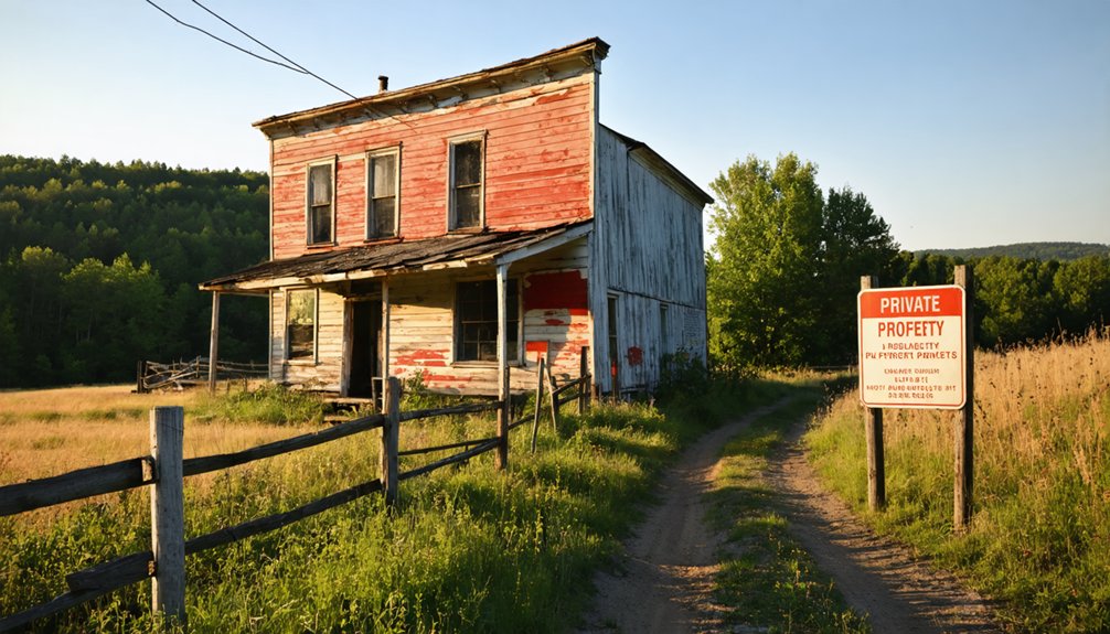
Before you fire up your ATV to explore Vermont’s forgotten settlements, you’ll need proper trail decals and permits to legally access the remote areas where these ghost towns hide.
Your adventure requires careful attention to environmental protection rules that safeguard the fragile ecosystems surrounding these abandoned places.
Most importantly, you must develop a thorough emergency preparedness plan since these isolated locations often lack cell service and sit miles from the nearest help.
Permits and Trail Decals
Since exploring Vermont’s ghost towns by ATV requires traversing both public roads and remote trails, you’ll need proper registration and permits before setting out on your adventure.
Vermont’s permit requirements mandate ATV registration through the DMV at $45, plus proof of insurance under current decal regulations. Your registration certificate serves as your trail passport to legally access designated areas.
Essential documentation includes:
- Valid ATV registration certificate proving legal ownership and compliance
- Insurance verification meeting Vermont’s mandatory coverage requirements
- Safety education certificate for riders under 18 years old
Remember that accessing different terrains requires specific approvals—town highways need municipal permission, state lands require Secretary designation, and private property demands owner consent.
Keep your documentation accessible during rides, as enforcement varies across Vermont’s remote regions where these abandoned settlements await discovery.
Environmental Protection Rules
While proper permits grant you legal access to Vermont’s abandoned settlements, environmental protection rules govern how you’ll explore these fragile historical sites.
Vermont’s moist climate makes these locations particularly vulnerable to environmental impact from ATV use, especially without major regulations in place. You’ll need to navigate carefully around water sources, as ATV regulations prohibit operation that causes water contamination or harassment of wildlife.
These ghost towns often sit on sensitive terrain where frequent ATV traffic can create deep ruts and channels up to six feet deep.
You’re required to operate only on designated public lands approved by the Secretary of Natural Resources. Most Vermont public lands remain off-limits to ATV operation, protecting these historical remnants for future generations while preserving their natural settings.
Emergency Preparedness Planning
When venturing into Vermont’s remote ghost towns by ATV, you’ll face unique emergency scenarios that demand thorough preparation and strict adherence to state safety regulations.
These abandoned settlements often sit in challenging terrain where cell service disappears and rescue becomes complicated.
Your emergency kits must contain essential survival gear for extended isolation:
- 72-hour water supply – one gallon per person daily plus purification tablets
- Communication tools – flares, reflective signals, and backup GPS devices
- Shelter materials – emergency blankets, tarps, and first aid supplies
Weather preparedness becomes critical when exploring these forgotten places.
Vermont’s mountain weather changes rapidly, turning sunny exploration into dangerous conditions.
Pack jumper cables, maps, and non-perishable food.
Know your ATV’s load limits and terrain capabilities before entering ghost town areas where help won’t arrive quickly.
Frequently Asked Questions
What’s the Best Time of Year to Visit Ghost Towns by ATV?
Summer offers you the driest, most stable trail conditions for exploring abandoned settlements. You’ll navigate old logging roads easily, while fall foliage enhances visibility and winter adventures require specialized snow-capable equipment.
Are There Guided ATV Tours Available for Vermont Ghost Towns?
You’re barking up the wrong tree – no guided tour options specifically target Vermont’s ghost towns for historical site exploration. You’ll need to arrange custom tours or explore independently through general ATV providers.
How Much Does a Vermont Trail Access Decal Cost and Where to Buy?
Vermont trail access decals cost $80 for in-state riders, $125 out-of-state. You’ll save with additional machines getting $20 discounts. Purchase online through VASA’s website or local clubs for ultimate decal purchase freedom.
Can I Camp Overnight Near Ghost Town Sites While ATV Exploring?
You can’t camp at most Vermont ghost towns due to strict camping regulations and private land restrictions. Respect ghost town etiquette by staying at designated campgrounds nearby, then ride out for day exploration adventures.
While exploring the ghost towns in Lake Champlain, be sure to capture the stunning views and rich history that these forgotten places offer. Many of these sites hold fascinating stories waiting to be uncovered, from the remnants of old structures to the legends of their past inhabitants. Consider bringing a camera to document the eerie beauty that surrounds these historic locations.
What ATV Modifications Are Recommended for Vermont’s Rocky Ghost Town Terrain?
Like armor for battle, you’ll need heavy-duty skid plates, steel guards, suspension upgrades for rocky terrain, plus aggressive tire recommendations with reinforced sidewalls to conquer Vermont’s unforgiving granite ledges and ghost town ruins.
References
- https://obscurevermont.com/off-the-beaten-path-in-southern-vermont/
- https://thumperfab.com/blogs/the-atv-utv-blog-with-thumper-fab/discover-the-top-atv-trails-in-vermont-the-ultimate-guide
- https://en.wikipedia.org/wiki/List_of_ghost_towns_in_Vermont
- https://www.alcomusa.com/blog/outdoor-adventure-in-vermont-with-alcom-aluminum-trailers-0
- https://vermontvacation.com/things-to-do/trip-ideas-itineraries/accessible-travel/
- https://www.vermonter.com/ricker-basin-vermont-ghost-town/
- https://www.tripadvisor.com/Attractions-g1196978-Activities-c47-t14-Northeast_Kingdom_Vermont.html
- https://www.onlyinyourstate.com/experiences/vermont/ghost-town-vt
- https://happyvermont.com/2014/10/23/glastenbury-ghost-town/
- https://anna-kasper.com/2025/10/29/my-fuller-ancestors-one-of-six-families-in-glastenbury-vermont-52-ancestors-week-44-rural/


