
You’ll encounter eight distinct ghost towns along California’s Highway 395, spanning from Bodie’s famous gold rush ruins at 8,379 feet elevation to Termo’s forgotten railway terminus. These settlements reflect different eras of regional decline: Bodie peaked with 10,000 residents before mining collapse, while Ravendale and Wendel succumbed to railway abandonment. Davis Creek lost relevance after Highway 395’s realignment, and smaller communities like Doyle showcase mixed preservation efforts. This 150-mile corridor reveals how economic shifts transformed thriving communities into atmospheric remnants of California’s frontier past.
Key Takeaways
- Bodie is California’s most famous gold rush ghost town, preserved in “arrested decay” at 8,379 feet elevation in the Sierra Nevada.
- The Nevada-California-Oregon Railway created multiple ghost towns along Highway 395, including Termo, Ravendale, and Wendel between 1908-1914.
- Termo served as the railway’s northern terminus until 1956, now home to only two seasonal ranchers among scattered foundations.
- Ravendale declined after its elementary school closed in 1939 and railway traffic decreased, though it maintains unincorporated status today.
- Davis Creek thrived from 1869-1960s with ferry operations and fruit cultivation until Highway 395 realignment eliminated through-traffic.
Bodie: California’s Most Famous Gold Rush Ghost Town
Bodie stands as California’s most authentic and well-preserved gold rush ghost town, frozen in time at 8,379 feet elevation in the Sierra Nevada’s high desert.
Perched high in the Sierra Nevada, this remarkably preserved ghost town offers visitors an authentic glimpse into California’s gold rush past.
You’ll discover a boomtown that exploded from dozens to 10,000 residents after William Bodey’s 1859 gold discovery sparked massive investment. During peak years, you’re witnessing what supported 2,000 buildings and produced $38 million in precious metals.
Bodie history reveals rapid decline through devastating fires and economic collapse, with final mine closures in 1942 ending the era. The town’s name serves as a place disambiguation example, as multiple locations and entities share the Bodie designation across different regions.
Today’s ghost town preservation follows “arrested decay” philosophy—you’ll find original furniture and goods exactly where residents left them. Visitors can explore historical relics including bottles and artifacts scattered throughout buildings like the original church, schoolhouse, and saloon.
California’s State Historic Park status protects approximately 110-200 surviving wooden structures, offering you unparalleled access to authentic Wild West architecture and artifacts.
Ravendale: Where Ravens Rule and Schools Close
You’ll find Ravendale’s ghost town status directly linked to the collapse of two critical institutions that once sustained rural communities along Highway 395.
The Nevada, California & Oregon Railway station that anchored the settlement’s economy around 1900 eventually succumbed to declining rail traffic, while Ravendale Elementary’s closure in 1939—when attendance dropped to zero—triggered legal disputes over teacher compensation that illuminate how quickly isolated communities could unravel. The town earned its name from the significant number of ravens in the area, reflecting the wildlife that dominated this remote landscape. The N-C-O actively encouraged Russian families to settle in Ravendale as part of their broader colonization efforts along the railway line.
These parallel institutional failures demonstrate the precarious nature of small railroad towns that depended on both transportation connectivity and sufficient population density to maintain basic services.
Railway Station History
While most Nevada-California-Oregon Railway stations faded into obscurity after the line’s abandonment, Ravendale’s February 1910 establishment five miles south of Termo marked the beginning of an unusually resilient community.
The station’s rapid construction as a new N-C-O stop positioned it strategically on the narrow-gauge line’s east side of Honey Lake, deliberately bypassing Susanville’s established route.
You’ll find Ravendale station’s historical significance extends beyond typical freight and passenger operations. The railway facilitated unique winter rabbit drives, loading captured bunnies onto trains bound for San Francisco tamale factories.
This economic diversity, combined with the N-C-O’s encouragement of Russian family settlement, created sustainable foundations that outlasted the line’s late 1990s discontinuation, distinguishing Ravendale from countless ghost towns. Today, the community maintains its unincorporated status while preserving essential services through volunteer organizations and county infrastructure.
School District Closure
When local tax bases evaporated alongside lumber industry jobs, even basic operations became impossible to maintain independently. Rural schools faced additional challenges from power outages that disrupted essential services and forced emergency closures. The closure ultimately led to the discontinuation of the school district’s name, following a pattern seen across rural communities when economic foundations collapse.
Termo: The Railway Terminus That Time Forgot
You’ll find Termo’s story written in the coordinates 40°44′N 120°22′W, where the Nevada–California–Oregon Railway reached its northern terminus on October 1, 1908.
The town’s Latin-derived name literally meant “end of the line,” and its population of nearly 200 residents by the 1910s supported the depot, roundhouse, and water tower that serviced steam locomotives carrying lumber and cattle. Like the Peruvian Central Railway that faced significant challenges from natural disasters including earthquakes and landslides, Termo’s railway infrastructure also succumbed to environmental and economic pressures over time. The railway’s conversion to diesel locomotives in later years couldn’t prevent the economic decline that ultimately sealed the line’s fate.
What began as a bustling railway hub transformed into one of Highway 395’s most authentic ghost towns after the NCO line’s abandonment in 1956, leaving behind scattered foundations and a current population of just two seasonal ranchers.
Railway Terminus Origins
As railroad surveyors plotted the Nevada-California-Oregon Railway‘s ambitious route northward in 1880, they couldn’t have anticipated that one of their most significant construction decisions would create a temporary terminus destined for obscurity.
When the N-C-O reached Oneida, California, by September 1882, you’d witness the beginning of a transportation revolution that would reshape regional commerce.
The Moran Brothers’ 1884 acquisition for $372,534.21 accelerated expansion plans, yet internal debates plagued route selection. By 1899, the railway had established Termo as a railroad construction site, creating what would become one of California’s most isolated settlements with fewer than five residents occupying a single house today.
Ghost Town Transformation
The Nevada-California-Oregon Railway‘s decision to extend its line fourteen miles north to Madeline in July 1901 transformed Termo from a bustling railroad terminus into California’s most forgotten ghost town.
This railroad expansion shifted economic activity northward, leaving behind what locals called the “$50,000 folly” freight house and triggering immediate community decline.
You’ll find minimal evidence of Termo’s brief glory days when exploring the site today.
The post office operated only from 1908 to 1914, reflecting the town’s rapid deterioration after losing its railhead status.
What remains tells a story of abandonment: decaying railroad infrastructure, scattered foundations from 1950s-era buildings, and an occupied home standing sentinel over California’s most remote ghost town, accessible only by dusty backroads fifty miles from civilization.
As we roam through these eerie landscapes, the thrill of discovering hidden gems intensifies. Exploring dogfriendly ghost towns offers a unique opportunity to connect with history while enjoying the company of our canine companions. Each abandoned building and forgotten path invites curious minds to wonder about the lives once lived in these now-silent places.
Davis Creek: From Ferry Landing to Highway Bypass
When settlers built Davis Creek’s first log cabin in 1869 on Goose Lake’s southern shore, they established what would become the Modoc Plateau’s most strategically positioned transportation hub for nearly a century.
You’ll find that ferry operations connecting to Lakeview, Oregon made this settlement essential during high-water years from 1908-1912, carrying cargo and passengers across the expansive lake.
The Nevada-California-Oregon Railway‘s 1911 arrival shifted regional transport patterns, diminishing the ferry’s importance.
While livestock and deciduous-fruit cultivation sustained the local economy, broader agricultural decline combined with infrastructure changes sealed Davis Creek’s fate.
Highway 395’s early 1960s realignment bypassed the business district entirely, eliminating through-traffic that once sustained commerce.
Today, you’ll discover cemetery markers and building remnants where Goose Lake’s receding waters left this former transportation nexus stranded inland.
Wendel: Debris-Covered Remnants of Railway Days

Railway ambitions transformed a collection of hot springs into Wendel, an important junction town that weathered eight name changes before settling on its final identity in honor of Nevada-California-Oregon Railway President Thomas Moran’s friend.
You’ll discover Wendel history reveals how railroad infrastructure made this settlement vital for crew switches and operations along the Modoc Line.
Wendel’s railway significance becomes evident when you explore:
- Strategic Junction Point – Connected the main Modoc Line with the Fernley & Lassen route, saving 210 miles to Utah
- Important Railroad Infrastructure – Featured engine houses, water towers, and powerhouses supporting daily operations
- Multiple Name Changes – Evolved through eight different identities before becoming Wendel in 1914
- Abandonment Timeline – Union Pacific removed the rails in 1996, three years after the post office closed
Today, debris-covered remnants and scattered railroad ties mark where this once-vital transportation hub thrived.
The Nevada, California, and Oregon Railway Legacy
Ambition drove New York bankers and Nevada investors to create one of the West’s most significant narrow-gauge railways when they organized the Nevada and Oregon Railroad in Reno during June 1880.
Ambitious eastern financiers and western investors united in 1880 to forge a transformative narrow-gauge railroad through Nevada’s challenging terrain.
You’ll find this railway’s legacy scattered throughout the ghost towns dotting Highway 395, where 3-foot narrow gauge engineering enabled cost-effective construction across the rugged Sierra terrain.
The Moran Brothers’ 1884 acquisition transformed operations, eventually creating the Nevada-California-Oregon Railway that reached Lakeview, Oregon by 1912.
This 238-mile network dominated the regional freight market, hauling cattle, grain, timber, and mining ores from isolated communities.
Though Southern Pacific’s mid-20th century acquisition ended the narrow-gauge era, you can still trace remnants of lighter rails, tighter curves, and abandoned depots throughout these forgotten settlements.
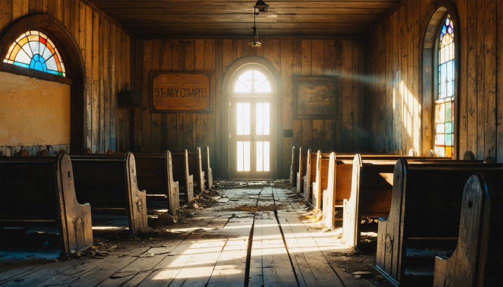
Doyle and St. Mary’s Chapel Constantia
Two miles of California rangeland separate the legacies of John W. Doyle, who settled in 1859, and Oscar Doyle, who established the town bearing their name in the 1870s.
This Lassen County community’s Doyle history reflects the broader pattern of railroad-dependent settlements that thrived then struggled as transportation evolved.
The chapel significance emerges through St. Mary’s Chapel Constantia, originally built by Henry Butters in Long Valley to serve the Catholic community.
After serving locals until 1920, it was relocated to Doyle in 1994.
Today’s remnants tell the story:
- Active railroad tracks still support farming and ranching operations
- A functioning bar anchors the struggling business district
- Abandoned gas station stands as evidence to highway bypass impact
- Relocated chapel sits beside the cemetery, preserving spiritual heritage
Susanville’s Roop’s Fort and the Sagebrush War
While Doyle’s railroad-dependent existence exemplifies one pattern of settlement along Highway 395, Susanville’s origins stem from an earlier era of westward migration and territorial ambiguity.
You’ll find Roop’s Fort in Memorial Park, where Isaac Roop’s 1854 log cabin trading post sparked a jurisdictional conflict that shaped regional governance.
The Sagebrush War erupted in 1863 when competing Nevada and California forces exchanged gunfire around Roop’s stronghold over boundary disputes and taxation authority.
You can still see bullet holes in the fort’s walls from this brief but significant skirmish.
The confrontation ended through negotiation rather than bloodshed, resulting in California’s creation of Lassen County in 1864.
This preserved local autonomy while resolving the territorial confusion that plagued frontier communities seeking self-determination.
Exploring the 150-Mile Ghost Town Corridor
Between Bridgeport and Lone Pine, a 150-mile stretch of Highway 395 concentrates the Eastern Sierra’s most accessible ghost town remnants into what amounts to a continuous archaeological corridor of boom-and-bust settlement patterns.
You’ll find everything from preserved structures like Bodie’s 170 buildings to scattered foundations marking forgotten tungsten camps. Most sites sit directly off the highway or require short unpaved detours, making ghost town exploration remarkably efficient compared to other Western regions.
Mining camp history unfolds through physical evidence: collapsed stamp mills, tailings piles, and abandoned railroad stops that chronicle both 19th-century gold rushes and 20th-century specialized metal extraction.
Physical remnants tell the complete story—from gold fever foundations to modern mineral workings scattered across centuries of Sierra Nevada extraction history.
- Plan 2-4 days for thorough exploration beyond basic highway driving
- Carry extra supplies—true ghost sites lack visitor services
- Check seasonal access restrictions for backcountry locations
- Combine multiple site visits with established stops in Bridgeport or Mammoth Lakes
Frequently Asked Questions
What’s the Best Time of Year to Visit These Ghost Towns?
You’ll find ideal conditions June through September when 100% of mountain passes open. Fall foliage peaks in early October, while winter adventures become impossible due to snow blocking high-elevation ghost town access completely.
Are Any of These Ghost Towns Accessible by RV or Motorhome?
Yes, you’ll find excellent RV accessibility and motorhome travel options at many Highway 395 ghost towns via paved routes, though remote sites like Bodie’s final miles require careful planning for larger rigs.
Do I Need Permits or Pay Fees to Explore These Sites?
Permit requirements absolutely vary wildly by location. You’ll pay fees at state sites like Bodie ($8+ adults), while most BLM ghost towns offer free access. Fee structures depend on land ownership and commercial activities.
Which Ghost Towns Have Camping Facilities or Nearby Accommodations?
You’ll find excellent camping options near Bodie with Paradise Shores Camp and Bridgeport Reservoir RV Park offering full hookups. Grover Hot Springs Campground provides dry camping with nearby attractions including hot springs and waterfall trails.
Are There Guided Tours Available for Any of These Locations?
Yes, you’ll find guided explorations at all four locations. Bodie offers daily tours, Calico provides ghost tours, while Shasta and Empire Mine feature structured visits. Local tour companies supplement state park programs.
References
- https://nvtami.com/2023/11/16/ghost-towns-highway-395-reno-to-lakeview/
- https://nvtami.com/2023/10/09/highway-395-explorations/
- http://cali49.com/mojave/tag/Ghost+Town
- https://www.youtube.com/watch?v=FEiWdlOSoiw
- https://wandering-through-time-and-place.com/tag/californias-highway-395/
- https://www.mattandkaren.com/california/california-highway-395/best-things-to-do/
- https://www.parks.ca.gov/?page_id=26330
- https://www.youtube.com/watch?v=E-yrznBe32c
- https://scenic395.com/towns/
- https://www.exploratography.com/blog-cal/tag/395


