You’ll find several fascinating ghost towns accessible from Interstate 10 exits in New Mexico, including Steins, a former Southern Pacific Railroad town that housed 1,000 Chinese laborers in the 1870s before its 2008 abandonment. Nearby, you can explore Hillsboro, which thrived from 1877’s gold discoveries, and Magdalena, once a cattle-drive hub until 1972. These abandoned settlements reflect the region’s mining boom and railroad expansion that shaped the Southwest’s development through boom-and-bust cycles spanning nearly a century of American frontier history.
Key Takeaways
- Steins ghost town is accessible directly from I-10 exits in Hidalco County on the Arizona-New Mexico border.
- I-10 provides strategic access points to multiple ghost towns through various state highway connections and exit routes.
- Former mining boom towns like those in the Black Range can be reached via I-10 connections to state highways.
- Navigation requires using state highway maps to locate defunct communities not marked on standard interstate guides.
- Some ghost towns like Taft have been completely lost beneath modern industrial development near I-10 corridors.
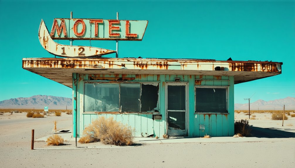
Steins: Railroad Junction in the Desert
Steins Pass cuts through the Peloncillo Mountains where the Southern Pacific Railroad blazed its westward route in the late 1870s, creating an unlikely desert community that would flourish and fade with the railroad’s fortunes.
You’ll find remnants of this railroad history scattered across the arid landscape near the Arizona-New Mexico border, where workers once quarried rock for track ballast and maintained a crucial junction stop.
During construction, nearly 1,000 Chinese laborers camped at Steins Peak’s base. By 1919, the town supported saloons, hotels, and stores serving transient railroad crews.
The harsh desert ecology demanded water shipments by rail—costing $1 per barrel. When quarry operations ceased around 1925 and Southern Pacific discontinued service after World War II, Steins joined the ranks of southwestern ghost towns dotting I-10’s corridor. The Garrison family purchased the remaining buildings in the 1970s and operated a tourist attraction until 2008, when the site was finally abandoned. The town’s wild west legacy includes the 1897 Black Jack Ketchum Gang robbery attempt on the Southern Pacific Sunset Limited, which left a trainman dead but netted no stolen money.
The Mining Boom That Built Hillsboro
While railroad towns like Steins depended on external transportation networks, other I-10 ghost towns owed their existence to what lay beneath the ground.
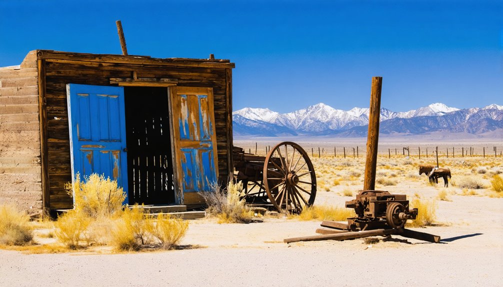
These abandoned towns in the American West often tell the story of boom and bust economies driven by mineral discoveries or agricultural surges. Many of these sites have become relics of history, captivating adventurers and historians alike with their tales of resilience and decline. As nature reclaims the landscape, remnants of past lives stand in stark contrast to the expansive desert backdrop.
You’ll find Hillsboro’s story began in 1877 when prospectors Dave Stitzel, Daniel Dugan, and Joe Yankie discovered gold around Percha Creek. Their first assay showed $160 per ton, quickly drawing fortune-seekers to the Black Range.
Gold worth $160 per ton at Percha Creek launched Hillsboro’s boom, drawing prospectors to the Black Range in 1877.
The camp’s mining techniques evolved from simple prospecting to organized ore processing with local mills and facilities.
Hillsboro’s economic impact extended far beyond its borders, becoming the commercial hub for nearby Kingston and Lake Valley camps. The town’s wealth from “millions of dollars” in combined gold and silver production enabled it to become Sierra County seat in 1884, centralizing government and legal functions until declining ore grades ended the boom. Unlike many silver-dependent communities that collapsed after the silver devaluation in 1893, Hillsboro’s gold-based economy proved more resilient. The 1892 courthouse became the site of the infamous Fountain murder trial, drawing national media attention when Oliver Lee and accomplices were acquitted in 1899.
Magdalena’s Role as a Transportation Hub
By 1910, you’d encounter a bustling town of 2,000 residents supporting this Mining Legacy through commerce rather than extraction.
Four saloons, multiple general stores, and livestock stockyards served cattle drives extending 80 miles west. The last cattle drive in the American West reached Magdalena in 1972, marking the end of an era for ranching transportation.
The Forest Service established its regional headquarters in 1910, creating the longest continuous business operation in the area. When the last train departed in 1973, Magdalena’s transportation empire ended, leaving behind its 1915 depot as a monument to southwestern commerce.
Duran and the Arrow Route Railroad
You’ll find Duran’s story intertwined with one of New Mexico’s most ambitious railroad failures, the Arrow Route Railroad, which began construction near this Socorro County settlement in late 1909.
The Arrowhead and Saint Louis Railroad Company initiated grading operations through the area as part of their planned transcontinental line from Kansas to California, but financial collapse halted work by spring 1910.
The railroad’s brief construction period coincided with the Durán brothers’ efforts to establish reliable water supplies for the anticipated rail traffic that never materialized. Like the modern Interstate 10 that would eventually span the continent, the Arrow Route Railroad envisioned connecting distant coasts through ambitious infrastructure development. The route would have passed through major urban centers similar to how Interstate 10 crosses through Phoenix and Tucson today.
Arrow Route Construction History
Before the interstate highway system transformed American transportation, ambitious railroad promoters launched the Arrow Route project in the early 1900s as part of broader regional development initiatives targeting small settlements along what would eventually become the I-10 corridor.
You’ll find that construction began with grading and earthworks around 1910, but the venture quickly encountered severe construction challenges.
Financial shortfalls halted progress by 1911 when speculative funding dried up. The Arrow project depended on private investors rather than secured contracts, making it vulnerable to economic downturns.
Workers completed only partial track laying and right-of-way clearing before abandonment. Modern interstate projects like the Katy Freeway reconstruction demonstrate how formal agreements between government entities ensure project completion where early railroad ventures failed.
The route utilized a former railway line that would later be adapted for contemporary transportation needs. Today, you can still trace abandoned segments and temporary structures that mark this failed railroad’s ambitious attempt to connect remote settlements.
Durán Brothers Water Supply
The Arrow Route’s operational success depended heavily on reliable water sources, and two brothers named Blas and Espiridón Durán controlled the most dependable wells along a critical stretch of track in central New Mexico.
Their Durán water supply positioned them as crucial partners in railroad logistics, transforming a remote location into the thriving town of Duran by 1902.
The brothers’ strategic water ownership created immediate opportunities:
- Railroad invested in repair shops and a wooden roundhouse near the wells
- Local population swelled to approximately 300 residents supporting rail operations
- Regional ranching operations relied on Duran as a crucial resupply hub
You’ll find that water scarcity made the Durán brothers indispensable to El Paso & Northeastern operations between El Paso and Santa Rosa, proving that controlling essential resources often matters more than government regulations.
Mogollon’s Wild West Legacy
When silver and gold discoveries along Silver Creek sparked Mogollon’s founding in the late 19th century, they released more than just a mining boom—they created one of New Mexico’s most notorious Wild West settlements.
You’ll find evidence of this lawless reputation in the canyon’s narrow confines, where 3,000 to 6,000 residents packed into saloons, gambling halls, and boarding houses during peak years.
The town’s cemetery tells the harsh reality: frequent mining accidents claimed lives alongside epidemics and violence.
Yet community resilience emerged through informal mutual-aid networks that supported families facing tragedy.
Transient miners, machinists, and immigrant workers created a volatile social mix that fueled Mogollon’s “wild” reputation well into the 20th century, leaving behind ruins that whisper tales of frontier excess.
Abandoned Towns of the Black Range
You’ll find the Black Range’s abandoned settlements scattered across southwestern New Mexico, where major silver and gold discoveries in the late 1870s triggered rapid town founding between 1877 and 1882.
These boomtowns reached their peak populations during this initial rush, with places like Lake Valley swelling to an estimated 1,000 to 4,000 residents before economic forces began their inevitable decline.
The collapse came through a combination of ore depletion, the devastating Silver Panic of 1893, and post-1896 silver price drops that transformed thriving mining camps into the ghost towns you can explore today.
Gold Rush Origins
Along the volcanic foothills of New Mexico’s Black Range, a series of mineral discoveries in the 1870s sparked one of the Southwest’s most dramatic mining booms.
The gold discovery began in April 1877 when prospectors Dave Stitzel and Daniel Dugan struck rich lodes along Percha Creek’s eastern slopes. Their Opportunity and Ready Pay mines ignited a mining impact that transformed the remote wilderness into bustling camps practically overnight.
The region’s mineral wealth extended beyond gold:
- Silver strikes at Lake Valley in 1876 launched a separate rush lasting decades
- Harry Pye’s 1879 silver discovery founded the town of Chloride
- The legendary Bridal Chamber mine yielded walls coated in pure native silver
You’ll find this wasn’t New Mexico’s first precious metal rush—Golden had preceded California’s famous 1849 boom by over two decades.
Mining Camp Decline
After nearly two decades of prosperity, the Black Range mining camps faced their inevitable decline when the U.S. adopted the gold standard in 1893, causing silver prices to crash overnight.
You’ll find that Lake Valley’s famous Bridal Chamber, which had yielded nearly $3 million in pure silver ore, suddenly became worthless. Stock promoters had sold five million dollars in mining companies before the crash devastated investors.
The silver decline triggered widespread mine closures throughout the region. Buildings were dismantled and carted to more promising towns like Hillsboro.
Even the ore that once assayed at $15,000 per ton couldn’t compete with the new economic reality. By 1922, most operations had ceased, leaving behind 300 abandoned sites that you can still explore today.
Accessing Ghost Towns From Interstate Exits

While Interstate 10 doesn’t directly serve every abandoned settlement along its route, several ghost towns remain accessible through strategic exits and connecting highways.
Ghost town exploration becomes feasible when you understand Interstate exit access patterns that connect to these forgotten communities.
Understanding highway exit patterns unlocks access to America’s forgotten settlements hidden just beyond the interstate’s reach.
Steins in New Mexico’s Hidalgo County offers the most direct access via I-10 exits. This 1880s railroad and mining town declined after quarry operations ceased in 1925 and rail service ended in 1944.
You’ll find surviving buildings that occasionally open as tourist attractions.
Consider these navigation strategies for ghost town exploration:
- Use state highway maps showing defunct communities like Louisiana’s Ruddock
- Follow connecting routes such as US 65 for Mississippi River settlements
- Research industrial zones where towns like Taft disappeared beneath chemical facilities
Preservation Efforts in New Mexico’s Historic Sites
Preservation challenges are addressed through technical assistance, archaeological permits, and the SiteWatch volunteer steward program—the nation’s second-largest.
County historic preservation advisory boards review modifications while university partnerships provide expertise.
Federal collaboration with agencies like BLM and NPS guarantees thorough protection across public lands, creating a robust preservation framework.
Frequently Asked Questions
Are There Any Ghost Towns Directly Visible From I-10 Without Taking Exits?
You’ll spot Steins, New Mexico directly from I-10’s roadside without exiting. This 1880s mining settlement’s structures serve as visible landmarks and roadside attractions, though most ghost towns require departures from the interstate highway.
What Safety Precautions Should Visitors Take When Exploring These Abandoned Sites?
You’ll need sturdy safety gear including boots, gloves, and respirators for asbestos protection. Maintain wildlife awareness for rattlesnakes and scorpions. Never enter deteriorated structures, carry emergency communication devices, and always explore with companions.
Do Any of These Ghost Towns Have Camping or Overnight Accommodation Options?
You’ll find camping amenities at Berlin-Ichthyosaur State Park and dispersed BLM camping near desert sites. Most ghost towns lack overnight facilities, but nearby towns offer developed campgrounds and historic lodging within driving distance.
Which Ghost Towns Require 4WD Vehicles or Have Difficult Road Conditions?
While modern highways offer smooth passage, you’ll need rugged remote access for these destinations. Vehicle recommendations include high-clearance 4WD for Delamar’s rocky terrain, while Odessa-Doran demands lifts, lockers, and specialized off-road equipment.
Are There Guided Tours Available for Any of These New Mexico Ghost Towns?
You’ll find guided ghost tours at Shakespeare with daily scheduled visits, plus commercial jeep tours accessing private sites like Hagan. These tours emphasize historical significance through professional interpretation and exclusive access.
References
- https://www.geotab.com/ghost-towns/
- https://www.newmexico.org/places-to-visit/ghost-towns/
- https://etsn.fm/ixp/33/p/7-louisiana-ghost-towns/
- https://www.youtube.com/watch?v=IECzqQ-jIEM
- https://freepages.history.rootsweb.com/~gtusa/ontheroad/us80a.htm
- https://backroadplanet.com/10-ghost-towns-in-the-west-that-tell-forgotten-stories/
- https://en.wikipedia.org/wiki/Lists_of_ghost_towns_in_the_United_States
- https://www.legendsofamerica.com/nm-steins/
- http://www.waltersrail.com/2022/12/union-pacific-steins-pass.html
- https://cityofdust.blogspot.com/2014/02/troubled-times-steins-new-mexico.html


