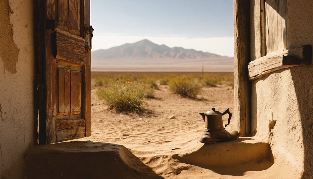
You’ll discover some of the Southwest’s most authentic ghost towns scattered along established desert hiking trails, where abandoned mining camps like Rhyolite near Death Valley and Ruby along the Arizona-Mexico border offer direct access to preserved 19th-century structures and mining infrastructure. White Oaks in New Mexico’s Lincoln National Forest and Fort Bowie at Apache Pass provide additional exploration opportunities with well-maintained trail access. Each location features unique historical significance, from gold rush prosperity to Apache War battlefields, creating compelling destinations for desert adventurers seeking authentic Wild West experiences.
Key Takeaways
- Rhyolite, Nevada features preserved ruins including Cook Bank Building, accessible via paved roads from Beatty with Bureau of Land Management maintenance.
- Ruby, Arizona offers nearly three dozen original structures as the state’s most intact ghost town, listed on National Register since 1975.
- White Oaks, New Mexico sits in Lincoln National Forest with abandoned mines and historic buildings from its 1880s gold rush peak.
- Keane Spring and Chloride City require four-wheel drive vehicles for access through Death Valley’s rugged terrain and washboard surfaces.
- Fort Bowie area combines ghost town exploration with Apache Wars history, accessible via 1.5-mile hiking trail to preserved military ruins.
Rhyolite: Desert Exploration Hub Near Death Valley
When Frank “Shorty” Harris and E.L. Cross discovered the Bullfrog mine in 1904, they triggered one of Nevada’s most dramatic boom-bust cycles.
You’ll find Rhyolite’s impressive ruins in Nye County, where 5,000 residents once thrived during the 1905 gold rush. The town’s Rhyolite history reflects rapid prosperity—generating over $1 million before declining after 1907’s financial panic.
Nye County’s Rhyolite once housed 5,000 gold rush residents, generating over $1 million before 1907’s financial collapse ended the boom.
Today, you can explore remarkable desert architecture including the three-story Cook Bank Building and Tom Kelly’s famous Bottle House. The community included 250 children who attended the local school during the town’s bustling peak years.
The Bureau of Land Management preserves these ruins as an official historic area, accessible via paved roads from Beatty. The town featured three railroad lines that connected this remote mining community to major transportation networks during its peak years.
You’ll discover railroad foundations, stone cabins, and cemetery remnants that tell stories of miners who sought fortune in this unforgiving landscape.
Keane Spring and Chloride City: Four-Wheel Drive Adventure
You’ll need a four-wheel drive vehicle to reach Keane Spring and Chloride City, as the route over Daylight Pass requires experienced off-road navigation through the Funeral Mountains.
These twin ghost towns from 1906 offer well-preserved mining infrastructure including aerial tramway towers, mill foundations, and pipeline remnants that showcase Death Valley’s gold rush era. Keane Spring served as a vital water supply for travelers and miners, supporting a community with a store, boarding house, and saloon until a devastating flash flood ended the town by 1909.
The challenging 2-4 hour adventure rewards you with panoramic views across Death Valley from the eastern rim while exploring authentic mining camps that operated profitably through the early 1900s. Both settlements were established by Homer Wilson but failed within months due to the harsh desert conditions and logistical challenges of sustaining communities in this remote location.
Rugged Access Road Requirements
Accessing these remote Death Valley ghost towns demands serious four-wheel drive capability and careful route planning.
Chloride City Road stretches 7.5 miles through increasingly challenging rugged terrain, requiring high-clearance vehicles for the first 2.2 miles before mandating 4WD for the remaining rough backcountry sections. The washboard surfaces, deep gravel, and rocky obstacles will test your vehicle’s limits.
Keane Wonder Mine Road presents a different challenge—while the 3-mile unpaved route allows some 2WD access initially, high-clearance remains essential for safe passage. The access fee is $25 per vehicle for a 7-day Death Valley pass. Keane Wonder Mine was successful from 1908-1916, with extensive remains from mining operations still visible at the site.
You’ll navigate from Beatty via NV-375 and Daylight Pass Road to reach the trailhead parking area. These vehicle requirements aren’t suggestions; they’re necessities for successfully reaching these isolated desert destinations without damaging your ride or getting stranded.
Historic Mining Site Exploration
Two distinct mining sites await exploration in this rugged section of Death Valley‘s Funeral Range, each telling different chapters of the region’s boom-and-bust mining history.
Keane Springs, established around 1906 during the South Bullfrog boom, served as an essential water source for surrounding operations. You’ll discover stone foundations, historic pipeline segments, and a 1935 Coen Corp. water tank that connected this settlement to the broader mining network.
Chloride City’s remnants trace back to A.J. Franklin’s 1871 silver claims at Chloride Cliff. You can explore the surviving “cousin Jack” cabin dug into the hillside, scattered structural debris, and James McKay’s isolated grave. The area once supported approximately 75 mines during its productive years. Franklin’s silver ore assayed remarkably high, ranging from $200 to $1,000 per ton during the initial mining operations.
Both sites showcase the harsh realities of desert mining, where expensive transport costs and flash floods ultimately determined success or failure.
Scenic Valley Overlook Views
Where else can you witness Death Valley’s stark beauty unfold from mining-era vantage points while traversing the same rugged terrain that challenged 1900s prospectors?
Keane Spring and Chloride City deliver unmatched scenic photography opportunities from 3,600-foot elevations. You’ll navigate maintained dirt 4WD routes to reach travertine formations and spring-fed rock features that frame sweeping valley landscapes.
Sunrise and late-afternoon light transform abandoned mine structures into dramatic silhouettes against cliff faces. Chloride Cliffs provide elevated viewing platforms where historical ruins combine with natural escarpments for layered visual compositions. The remnants of aerial tramway towers stand as testament to the ambitious engineering that once transported millions in gold ore across these mountainous slopes.
Your high-clearance vehicle becomes essential for accessing single-lane tracks and shelf roads leading to these panoramic overlooks. Winter months may introduce snow or ice conditions that further challenge navigation along these already demanding mountain routes. Pack recovery gear, extra water, and GPS waypoints—cell service disappears in these remote corridors between historic mining sites.
Swansea: Mining Remnants in the Arizona Desert
When Welsh metallurgist George Mitchell purchased 132 mining claims in the Arizona desert in 1908, he couldn’t have anticipated that his Clara Gold and Copper Company would create one of the region’s most significant boom-and-bust stories.
Named after Swansea, Wales, this copper mining town exploded from nothing to over 5,000 residents by the 1920s. You’ll find Swansea History fascinating—the operation produced 27 million pounds of copper and featured a massive 700-ton smelter generating $15,000 daily.
Today, you can explore authentic Mining Equipment scattered among building ruins, two historic cemeteries, and five BLM camping sites.
The Great Depression shuttered operations, leaving this ghost town perfectly preserved for desert freedom seekers.
Fort Bowie: Apache Pass Historical Battlefield
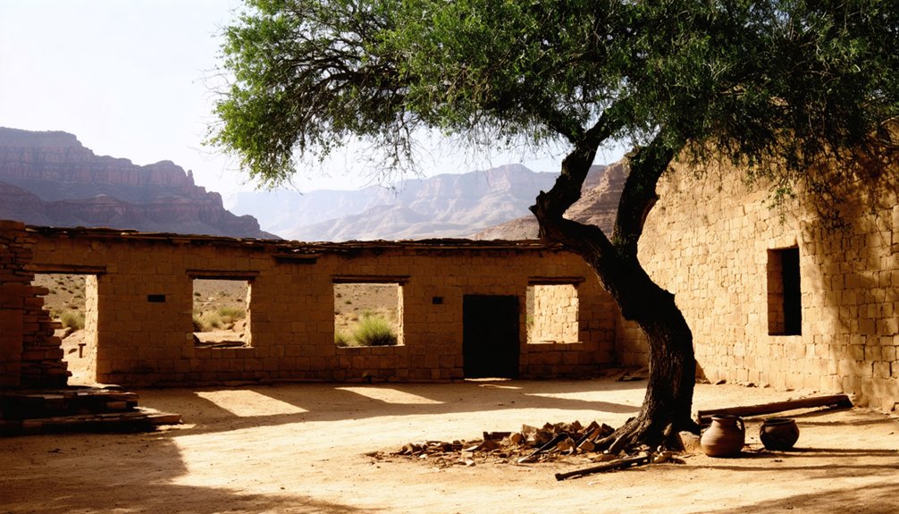
You’ll find Fort Bowie’s ruins perched on a hill overlooking Apache Spring, where the July 1862 Battle of Apache Pass fundamentally shifted the balance of power in southeastern Arizona.
The engagement erupted when Chiricahua Apache warriors led by Cochise ambushed a Union column, only to retreat when U.S. howitzers decimated their positions and forced their withdrawal from this crucial water source.
This decisive victory allowed the 5th California Volunteer Infantry to secure the spring and establish Fort Bowie as the Army’s primary base for twenty-four years of campaigns against the Chiricahua Apache.
Battle of Apache Pass
Although the abandoned Butterfield Overland Stage station at Apache Pass appeared deserted on July 15, 1862, nearly 500 Chiricahua Apache warriors lay concealed among the mesquite thickets and boulder-strewn ridges, waiting to ambush the approaching California Column.
You’ll discover how Apache tactics nearly succeeded against 96 California Volunteers. Cochise and Mangas Coloradas positioned their forces strategically, exploiting terrain knowledge and mobility.
However, Union strategy shifted when howitzers arrived, forcing the Apaches from their fortified positions.
The battle’s decisive elements included:
- Artillery fire that dislodged Apache defenders from ridges
- Infantry advancing in alternating dashes of ten men
- Bayonet charges breaking fortified Apache positions
- Apache mobility allowing tactical retreats to new positions
This confrontation cost at least nine American lives while inflicting 30-60 Apache casualties, ultimately securing the critical water source.
Protecting Apache Springs Water
Following their victory at Apache Pass, Union forces recognized that controlling the precious water source required permanent military presence.
You’ll find that soldiers from the 5th California Infantry constructed Fort Bowie within three weeks, positioning stone breastworks on hills overlooking Apache Spring. They’d learned that water meant survival in this unforgiving landscape.
The fort’s strategic placement guaranteed continued access to the spring’s unfailing flow, which had sustained Chiricahua Apaches for generations.
Today, you can witness how water conservation and ecological preservation efforts protect this crucial resource. The National Park Service maintains the spring’s perennial flow while preserving diverse habitats from desert cacti to mountain pines.
This 1.5-mile hike reveals how one precious water source shaped military strategy and continues supporting wildlife across multiple ecosystems.
Army Vs Chiricahua Conflicts
When Lieutenant George Bascom confronted Cochise at Apache Pass in January 1861 over a kidnapped boy, his botched attempt to detain the Apache leader shattered decades of relatively peaceful relations and ignited what historians recognize as the catalyst for the Apache Wars.
The subsequent Battle of Apache Pass in July 1862 demonstrated how Apache Warfare evolved into systematic resistance.
When California Volunteers under General Carleton entered the pass, Cochise and Mangas Coloradas’s forces used superior terrain knowledge to ambush the column:
- Concealed positions controlled access to crucial Apache Spring
- Marksmanship and numbers initially overwhelmed Army forces
- Artillery howitzers ultimately forced Apache withdrawal
- Nine Union soldiers died; Apache casualties reached 30-60
This engagement shaped Military Strategy for decades.
The Army immediately established Fort Bowie, transforming regional raids into prolonged guerrilla warfare.
Ruby: Best Preserved Ghost Town Near the Mexican Border

Ruby stands as Arizona’s most intact ghost town, preserving nearly three dozen original structures from its early 20th-century mining heyday in the remote hills of Santa Cruz County.
You’ll find this remarkable site five miles north of the Mexican border, where gold and silver discoveries in 1877 eventually built a community of 1,200 residents by 1912.
Ruby history includes the infamous “Ruby Murders” of 1920-1921, when Mexican bandits killed multiple store owners during robberies at the Ruby Mercantile.
These violent episodes, combined with cross-border lawlessness during Mexico’s revolutionary period, accelerated the town’s decline after mining operations ceased in 1944.
Ruby preservation efforts began in the 1960s when private owners purchased the townsite, leading to National Register listing in 1975.
You’ll need off-road vehicles to reach this protected site via unpaved roads.
White Oaks: Gold Rush Legacy in New Mexico
White Oaks emerged from New Mexico’s rugged Jicarilla Mountains in 1879 when prospectors John Wilson, Jack Winters, and Harry Baxter discovered gold in territory that had seen centuries of conflict between Piros Indians, Apache raiders, and Spanish colonizers since Don Juan de Oñate’s expedition named the harsh landscape “Malpais” in the late 1500s.
You’ll discover a town whose gold mining boom created New Mexico Territory’s second-largest city by 1882, with 4,000 residents and complete infrastructure including newspapers, hotels, and an opera house.
The historical significance becomes evident through:
- Billy the Kid’s frequent visits and dramatic 40-mile pursuit in 1880
- Deputy James Bell’s burial in Cedarvale Cemetery after Billy killed him
- Homestake mines’ prosperity lasting through the 1890s
- Railroad rejection that sealed the town’s fate
Today, you can explore historic buildings and abandoned mines scattered throughout Lincoln National Forest.
Trail Access Points and Hiking Recommendations

Five distinct trail networks across the American Southwest provide documented access to abandoned mining settlements, each requiring specific navigation skills and equipment preparations.
You’ll find Cerro Gordo ghost town after an 8.3-mile drive on Saline Valley Road, followed by a steep 5-mile climb gaining over 3,000 feet elevation.
Arizona’s Ghost Town Trail spans 34 miles connecting Gleeson, Courtland, and Pearce via back-road routes requiring water supplies and travel companions.
Colorado’s Independence Pass offers cemetery access through jeep trail CR 390A beyond the main townsite exploration.
Weather preparation becomes critical for high-country destinations, while Death Valley locations demand four-wheel-drive vehicles and advance tour appointments for complete access.
Wildlife and Stargazing Opportunities in Ghost Town Regions
Beyond the physical challenges of reaching these remote destinations, ghost towns offer exceptional opportunities for wildlife observation and astronomical viewing.
You’ll discover remarkable wildlife diversity in these desert oases, where ruins provide shelter and remaining water sources attract various species.
For ideal wildlife encounters, consider these stargazing tips that double as wildlife observation strategies:
- Visit during crepuscular hours when kit foxes, coyotes, and mule deer are most active
- Target spring and fall seasons when desert tortoises emerge and migratory birds pass through
- Focus on areas near water sources where feral burros and diverse species congregate
- Use red-filtered lights to preserve night vision while observing nocturnal mammals
Many ghost towns sit within Bortle scale 2-4 zones, delivering exceptional dark-sky conditions for astronomical viewing while you wait for dawn wildlife activity.
Frequently Asked Questions
What Permits or Fees Are Required to Visit These Ghost Towns?
You’ll encounter varied permit requirements and fee structures depending on location. National sites charge $5-35, BLM lands stay mostly free, while Coronado Forest demands $8 daily passes. Most ghost towns don’t restrict access.
Are These Ghost Town Trails Safe for Solo Travelers?
You’ll face significant solo safety risks including remote locations, extreme weather, limited cell service, and delayed rescue response. Essential trail precautions include redundant navigation, emergency communications, proper hydration, and detailed trip notifications to trusted contacts.
What Is the Best Time of Year to Visit Desert Ghost Towns?
Fall and spring are ideal seasons for visiting desert ghost towns. You’ll enjoy moderate temperatures, fewer crowds, and better road access. Weather considerations include avoiding summer’s extreme heat and winter’s unpredictable closures.
Can You Camp Overnight Near Any of These Ghost Town Locations?
Like finding water in the desert, overnight camping near ghost towns requires knowing where to look. You’ll navigate varying camping regulations depending on land ownership, with nearby attractions offering both primitive dispersed sites and developed campgrounds.
Are There Guided Tour Services Available for These Remote Ghost Towns?
Yes, you’ll find extensive guided tours for ghost town exploration throughout the Southwest. Companies like Pink Jeep Tours, Spirit of Arizona Tours, and Southwest Discovery Tours offer specialized excursions to remote locations.
Similar opportunities also exist for those interested in ghost towns in the great plains, where remnants of once-thriving communities tell stories of the past. Local guides can provide insights into the history and significance of these sites, making the experience both educational and captivating. Exploring these forgotten places can reveal the unique challenges faced by settlers in the heart of America.
References
- https://www.rhyoliteghosttownnevada.org
- https://www.desertusa.com/desert-nevada/nevada-ghost-towns1.html
- https://visitusaparks.com/parker-arizona/
- https://www.visittucson.org/blog/post/8-ghost-towns-of-southern-arizona/
- https://www.newmexico.org/places-to-visit/ghost-towns/
- https://www.youtube.com/watch?v=WiQ-_sCF0sk
- https://www.backpacker.com/stories/top-3-ghost-town-hikes-glorietta-ghost-town-nm/
- https://theadventureportal.com/in-search-of-nevada-ghost-town/
- https://www.rhyoliteghosttownnevada.org/explore/rhyolite-ghost-town
- https://www.nps.gov/deva/learn/historyculture/rhyolite-ghost-town.htm


