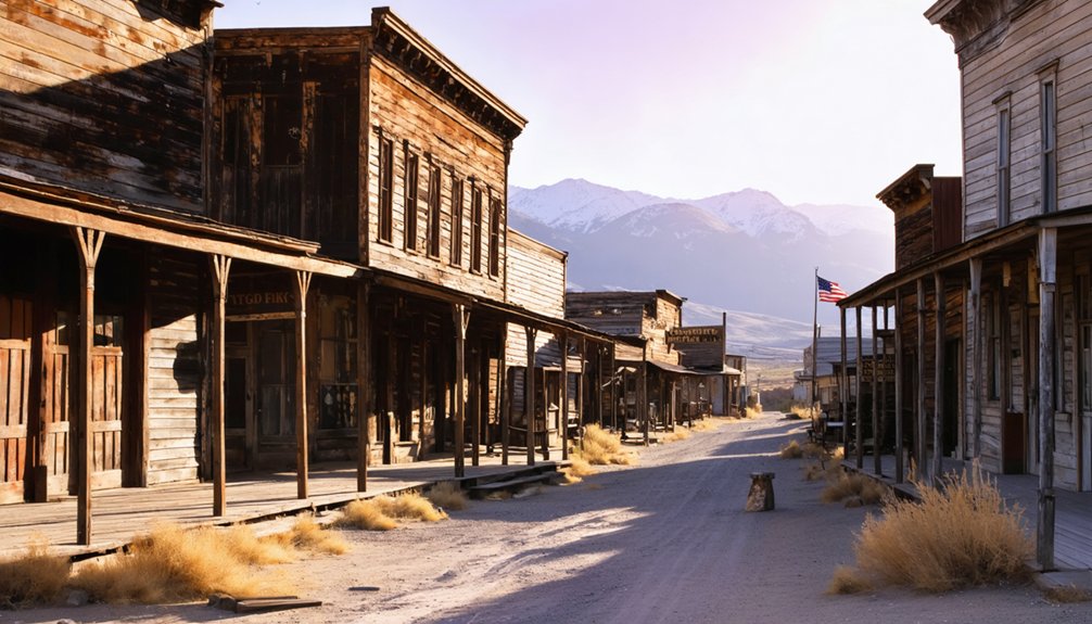
You’ll discover five authentic ghost towns within two hours of Reno, each preserving Nevada’s explosive mining heritage from the 1859 silver boom. Virginia City’s 25,000-resident peak left behind complete Victorian streetscapes, while Genoa showcases original 1850s territorial buildings. Lesser-known gems like Pine Grove feature intact stamp mills and schoolhouses from 1866, and Rockland offers dramatic hillside ruins cascading through high desert terrain. These weathered monuments reveal the harsh realities miners faced when entire communities vanished overnight as ore deposits depleted and speculative capital fled.
Key Takeaways
- Five ghost towns within two hours of Reno showcase Nevada’s mining boom, from complete ruins to semi-abandoned historic buildings.
- Virginia City, 26 miles southeast via paved roads, peaked at 25,000 residents during its legendary silver boom years.
- Genoa features original 1850s buildings as Nevada Territory’s first capital, while Fort Churchill displays Civil War-era military engineering.
- Fall offers ideal exploration with 70s temperatures, while summer requires dawn starts due to 110°F+ heat and dehydration risks.
- GPS becomes unreliable outside cellular coverage; pack offline maps, verify BLM land access, and travel only during daylight.
Historic Preservation Sites Within Day-Trip Distance
Within a two-hour drive of Reno, five remarkably preserved ghost towns offer tangible connections to Nevada’s mining boom and territorial origins.
You’ll discover Genoa’s historic significance as Nevada Territory’s first capital, where original 1850s buildings still stand despite the devastating 1910 fire.
Fort Churchill’s architectural features showcase military engineering from the Civil War era, now preserved as a state historic site accessible via US-95.
Pine Grove’s 600-resident peak left multiple structures intact from its 1866 founding. The town’s three distinct sections include the lower town with rock walls, middle town featuring a stamp mill and schoolhouse, and upper town containing a boarding house and livery.
Humboldt City’s extensive stone ruins reveal picturesque village life from 1861-1870.
Rockland’s smaller-scale remains tell stories of miners who ventured beyond Pine Grove in 1869. These sites rise from sagebrush and barren earth, symbolizing the unfulfilled dreams of countless prospectors who once called Nevada home.
Each site preserves authentic frontier architecture, allowing you to walk through Nevada’s untamed past without restriction or guided tours limiting your exploration.
Major Boom-and-Bust Mining Towns of Northern Nevada
You’ll discover that Northern Nevada’s mining towns experienced dramatic population swings, with Virginia City reaching 25,000 residents at its peak while smaller camps like Belmont and Tybo housed 2,000 and 1,000 respectively during their silver boom years.
These communities collapsed as quickly as they’d risen—Belmont’s mines shut down by 1887 after just two decades of production, while other camps faced similar fates when ore deposits played out or became unprofitable to extract. The region around Elko developed as a crucial support hub for these remote mining camps throughout the 19th century, providing essential supplies and transportation connections.
The archival records from newspapers like the Tybo Sun document how entire towns could transform from thriving commercial centers with banks, schools, and multiple businesses into abandoned settlements within a single generation. Virginia City’s wealth from the Comstock Lode helped fund the U.S. government during the Civil War, demonstrating how these mining operations influenced national affairs beyond their local regions.
Peak Population Numbers
Three major mining towns near Reno achieved staggering population peaks that rival modern cities, yet each collapsed within years of their boom.
These ghost town populations demonstrate how quickly mining boom demographics could explode and vanish in Nevada’s unforgiving landscape.
You’ll find these peak numbers reveal the scale of speculation that drove Nevada’s economy:
- Goldfield reached 20,000 residents around 1906-1907, briefly becoming Nevada’s largest city before crashing to 5,000 by 1910.
- Eureka peaked at 9,000 residents circa 1878, sustaining growth longer than most camps due to high-grade ore. G.J. Tannehill was among the initial discoverers who found the mining deposits that would transform the area into a major hub.
- Rhyolite hit 8,000 residents during 1905-1907, complete with concrete sidewalks and fifty saloons.
- All three towns collapsed rapidly when ore deposits depleted and speculative capital fled elsewhere. Today, these abandoned sites attract history buffs who explore the remnants of Nevada’s spectacular mining legacy.
Causes of Abandonment
Although Nevada’s boom towns achieved remarkable population peaks, their rapid abandonment followed predictable patterns that you can trace through archived company records and newspaper accounts from the era.
Economic factors dominated most closures—when silver prices crashed in 1893, towns like Aurora saw their populations vanish within months as mines couldn’t cover operating costs.
Geological challenges compounded these pressures as high-grade ore bodies depleted and water infiltration made deeper extraction prohibitively expensive.
You’ll find firsthand accounts in miners’ journals describing the brutal reality: remote locations with impossible supply lines, contaminated water sources, and infrastructure designed around single operations. Industrial disasters also claimed entire settlements, as dynamite cave-ins could permanently seal mine entrances and force immediate evacuation of surrounding communities.
When company owners pulled out, entire communities collapsed overnight, leaving behind the architectural skeletons that freedom-seeking explorers discover today scattered across Nevada’s unforgiving landscape. Empire’s gypsum mine finally closed in 2011, marking the end of a mining operation that once supported a community of 800 residents at its peak in the 1950s.
Hidden Gems and Lesser-Known Ghost Town Destinations
Where do the most intriguing ghost town discoveries lie hidden beyond Reno’s well-traveled tourist circuits?
You’ll find Nevada’s best-kept secrets scattered across remote valleys, accessible only to those willing to venture off beaten paths.
These lesser-known destinations offer authentic exploration experiences:
- Pine Grove – Once home to 600 residents, this 1866 settlement features multiple surviving structures from its days as a regional supply center before silver demonetization triggered its decline.
- Rockland – Accessible via Nevada’s rockiest roads, you’ll discover a surviving cabin and extensive mill ruins cascading down the hillside.
- Tunnel Camp – Built in 1927, this cyanide mill workers’ community retains its brick office, five-stamp mill, and worker housing.
- Sutro Tunnel Ghost Town – Long closed to visitors, this mysterious site remains shrouded in decades of secrecy.
Many of these ghost towns exhibit varying conditions, from complete desolation with only foundations remaining to semi-abandoned sites where historic buildings still stand against the desert landscape. The Nevada, California, and Oregon Railway once connected many remote settlements, with survey work beginning in 1880 before construction started in Reno the following year.
Planning Your Visit: Access and Safety Considerations
When you’re exploring Nevada’s remote ghost towns, you’ll quickly discover that cell towers don’t follow mining claims—expect dead zones that can last for hours once you leave major highways like US-95.
My GPS failed completely during a winter trip to Seven Troughs, where unexpected snow drifts had transformed familiar dirt roads into unrecognizable terrain that forced a dangerous backtrack in whiteout conditions.
Nevada’s high desert climate creates dramatic seasonal shifts that can turn a pleasant autumn visit into a life-threatening situation, with temperature swings of 40+ degrees between day and night even in spring and fall.
The ribbon of asphalt stretching from Reno toward Nevada’s forgotten settlements tells only half the story of reaching these remote destinations. Your GPS accuracy becomes questionable once you leave cellular towers behind, making offline maps essential for successful ghost town exploration.
Veteran explorers know that technology fails when you need it most.
Critical Navigation Essentials:
- Download offline maps before departure—cellular coverage vanishes rapidly beyond primary highways
- Mark waypoints for fuel, water, and emergency services using USGS topographic references
- Verify land access through BLM websites, as private gates and mine restrictions change frequently
- Plan daylight-only travel on unpaved segments—narrow washboard roads become treacherous after dark
Satellite messengers provide your only reliable emergency communication link in Nevada’s vast cellular dead zones.
Seasonal Weather Constraints
Although Nevada’s high desert climate creates four distinct seasons, each brings unique challenges that’ll determine whether your ghost town expedition succeeds or becomes a dangerous ordeal.
Summer activities require dawn starts when temperatures hover in comfortable ranges, avoiding midday heat that reaches the 90s. You’ll appreciate the dry conditions at 4,500 feet elevation, but pack layers for 30-35°F temperature swings between day and night.
Winter challenges intensify dramatically with Reno’s 22 inches of annual snowfall and mountain accumulations exceeding 300 inches. January’s 22°F morning lows can trigger hypothermia in Nevada’s rapidly cooling air.
Spring’s unpredictable swings demand flexible planning—April’s 64°F highs can plummet to freezing overnight.
Fall offers ideal conditions with pleasant 70s temperatures and minimal precipitation, making October your prime exploration window.
Driving Distances and Seasonal Travel Tips
Since Virginia City sits just 26 miles southeast of Reno via I-580 and NV-341, you’ll find it’s the most accessible ghost town for a quick afternoon adventure, requiring only 30-40 minutes of driving on well-maintained paved roads.
However, driving routes to more remote sites demand serious preparation and respect for seasonal conditions.
Consider these essential travel factors:
- Winter access becomes treacherous – mountain passes and dirt roads turn impassable without snow equipment between December and March.
- Summer heat threatens safety – desert temperatures reaching 110°F+ increase risks of overheating and dehydration on extended trips.
- Spring conditions create challenges – snowmelt generates muddy ruts and higher stream crossings requiring 4WD capability.
- Fall offers ideal exploration – cooler temperatures and stable weather provide perfect conditions for photographing remote locations.
The Rise and Fall of Nevada’s Mining Communities
Behind every weathered headframe and crumbling foundation you’ll encounter on these backcountry drives lies a story of explosive wealth followed by devastating collapse. Nevada’s mining communities erupted from desert dust whenever someone struck pay dirt—whether it was the Comstock Lode‘s silver bonanza in 1859 or Tonopah’s fortune in 1910.
You’d witness entire towns materializing overnight, complete with diverse populations including Chinese miners who shaped unique community dynamics in places like Golconda.
These settlements thrived on evolving mining techniques, from primitive arrastra methods to the sophisticated Washoe pan process, though operators lost up to 25% of ore value through inefficient processing.
When veins played out, these once-thriving communities became the ghost towns you’re now exploring—silent monuments to boom-and-bust cycles.
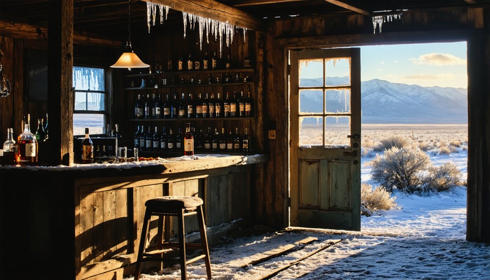
What Remains: Structures and Ruins You’ll Discover
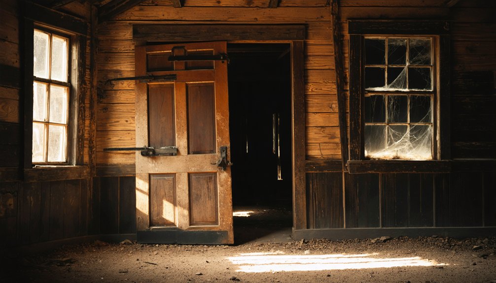
When you step into these abandoned settlements, you’ll find that Nevada’s harsh desert climate has become an unlikely preservationist, maintaining structures that would’ve crumbled decades ago in wetter climates.
These ghost towns offer remarkable architectural features that tell stories of boom-and-bust cycles.
Exploring the ghost towns in the midwest reveals remnants of once-thriving communities, now silent and overgrown. The stories embedded in their architecture speak of a time when prosperity flourished, making their decline all the more poignant. Visitors can uncover the history of these abandoned places, evoking a sense of nostalgia and curiosity about the past.
You’ll discover diverse remnants across these sites:
- Industrial relics – Five-stamp mills at Tunnel Camp and complete mill structures at Seven Troughs showcase mining technology.
- Residential foundations – Worker housing layouts reveal community organization and historical context.
- Civic buildings – Metropolis High School ruins and Fort Churchill’s adobe barracks demonstrate territorial ambitions.
- Transportation infrastructure – Sutro Tunnel’s preserved mule barn and carriage house illustrate 19th-century logistics.
Each location presents unique archaeological snapshots, from intact miner cabins to scattered vintage automobiles, creating an outdoor museum of Nevada’s mining heritage.
Research Resources for Ghost Town Enthusiasts
Where should you begin your thorough exploration into Nevada’s ghost town history? Start with Shawn Hall’s “Romancing Nevada’s Past,” your definitive guide to Eureka, Lander, and White Pine Counties’ abandoned settlements.
Begin your Nevada ghost town journey with Shawn Hall’s definitive guide to Eureka, Lander, and White Pine Counties’ abandoned settlements.
You’ll find extensive archival resources at the Nevada Historical Society, housing 500,000 photographs documenting mining towns like Goldfield and Tonopah since 1862. Their research library contains historical narratives spanning emigrant trails to atomic testing sites.
Don’t overlook University of Nevada’s Oral History Archive, featuring transcripts from 1964-2014 interviews with mining community survivors.
The Nevada State Museum displays authentic artifacts from Rhyolite and Belmont ghost towns.
Online, USGenWeb Sites provide genealogical tools while Smithsonianmag.com catalogs over 600 Nevada ghost towns.
Remember: the Nevada Historical Society’s collecting moratorium runs January 2025 through June 2026.
Frequently Asked Questions
Can I Camp Overnight at Ghost Town Sites Near Reno?
Yes, you can camp overnight at ghost town sites through dispersed camping on BLM lands or designated campgrounds at Fort Churchill and Berlin-Ichthyosaur State Parks, following specific camping regulations and overnight permits requirements.
Are Ghost Town Tours Available or Do I Need to Explore Independently?
You’ll find guided tours in Virginia City, but remote ghost towns require self-guided exploration. Downtown Reno offers nightly ghost walks, though authentic abandoned sites demand independent research and adventurous spirit to discover.
What Photography Equipment Works Best for Capturing Ghost Town Ruins?
Like capturing whispers from the past, you’ll need excellent tripod stability for those haunting long exposures and smart lens selection—wide-angle for expansive ruins, telephoto for intimate details—plus weather protection for dusty exploration.
Do Any Ghost Towns Have Restaurants or Gift Shops for Visitors?
Most ghost towns around Reno lack dining options or souvenir shops, preserving their authentic abandoned character. Virginia City’s your exception—it’s transformed into a tourist destination with saloons and commercial establishments serving visitors.
Which Ghost Towns Allow Metal Detecting or Artifact Collecting?
You’ll find “freedom” means maneuvering through bureaucratic mazes first! Metal detecting regulations prohibit most ghost town collecting—Virginia City, Berlin, and Sutro require permits. Artifact collecting tips: always secure written landowner permission before detecting anywhere.
References
- https://en.wikipedia.org/wiki/List_of_ghost_towns_in_Nevada
- https://nvtami.com/top-10-ghost-towns-nevada-northwest/
- https://www.dicksonrealty.com/2019/10/08/ghost-towns/
- https://nvtami.com/2023/11/16/ghost-towns-highway-395-reno-to-lakeview/
- https://www.visittheusa.com/experience/6-nevada-ghost-towns-explore-if-you-dare
- https://www.realgirlreview.com/virginia-city-nevada-ghost-town/
- https://www.youtube.com/watch?v=eMc3JzSbD6k
- https://cowboycountry.com/ghost-towns/
- https://usghostadventures.com/reno-ghost-tour/
- https://www.youtube.com/watch?v=LP6gKVpSfu8


