You’ll find remarkable ghost towns scattered across Northwest Arkansas, each preserving fragments of the region’s boom-and-bust history. Rush’s fourteen zinc mines once employed 5,000 workers before WWI oversupply triggered abandonment. Monte Ne’s grand resort hotels now rest beneath Beaver Lake, their ruins surfacing during droughts. Calico Rock’s “Peppersauce Alley” district stands frozen in time, while Bruno’s weathered buildings dot Marion County’s remote terrain. Mount Tabor and Pinnacle Springs offer additional glimpses into settlements that prosperity forgot, their stories waiting along backcountry trails.
Key Takeaways
- Rush became Arkansas’s premier zinc mining ghost town, peaking at 5,000 residents in 1916 before declining post-WWI.
- Monte Ne’s luxury resort now lies submerged beneath Beaver Lake, with ruins visible during low water levels.
- East Calico Rock remains frozen in time with twenty abandoned buildings from its zinc mining and timber era.
- Bruno features an operational church, post office, and 1800s cemetery alongside abandoned homes accessible off Highway 65.
- Marion County ghost towns including Eros, Bruno, and Rush offer walkable historical exploration opportunities.
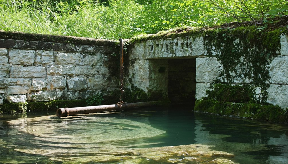
Rush: Arkansas’s Premier Zinc Mining Ghost Town
The discovery of zinc on Rush Mountain in 1880 began with a case of mistaken treasure.
You’ll find prospectors initially chased Indian legends of silver, building a rock smelter in 1886 along Rush Creek. When green zinc oxide fumes erupted during January 1887 testing, they’d found something different—but equally valuable.
World War I transformed Rush Mining into Arkansas’s most prosperous per-capita city by 1916.
Ten companies operated fourteen mines, while the population exploded from nothing to 5,000. The Morning Star Mine’s 6.5-ton smithsonite chunk won a gold medal in 1893.
Post-WWI zinc oversupply crushed the boom by 1919.
The room-and-pillar mining method involved horizontal excavation through the mineral deposits, leaving behind massive waste rock piles that visitors often mistake for natural hills. The post office closure in the mid-1950s marked the final loss of Rush’s community identity.
Today’s Historic Preservation efforts through Buffalo National River protect the mines, buildings, and waste piles—Arkansas’s last visible zinc mining remnants since 1972.
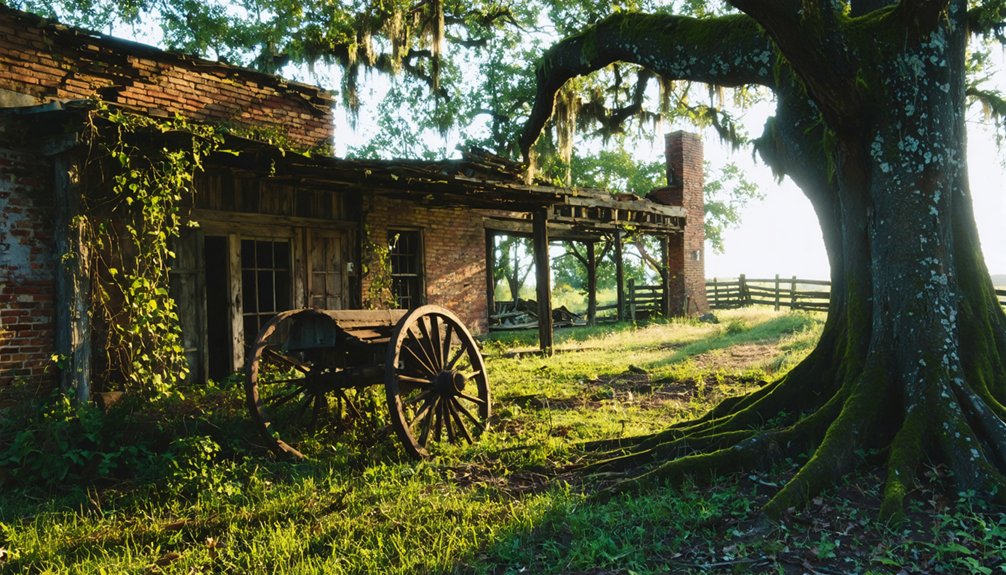
Monte Ne: The Sunken Resort Beneath Beaver Lake
You’ll find one of Arkansas’s most unusual ghost towns resting beneath the waters of Beaver Lake, where William Hope “Coin” Harvey’s grand resort Monte Ne once drew visitors from across the nation via dedicated Frisco railroad lines.
In addition to the allure of Beaver Lake, there are many other historic ghost towns in Arkansas that tell captivating stories of the past. Each site offers a glimpse into the rich history and culture that once thrived in these now-abandoned locations. Exploring these towns provides a unique opportunity for adventure and discovery, allowing visitors to connect with the state’s intriguing heritage.
As you delve deeper into the state, you might also stumble upon ghost towns for sale in Arkansas that offer a chance to own a piece of history. These properties can serve as a foundation for new stories, inviting imagination to fill in the gaps left by time. Whether you’re seeking a quiet retreat or an adventurous project, the remnants of these towns promise endless possibilities for the enterprising spirit.
Harvey transformed 320 acres at Silver Springs beginning in 1900, constructing elaborate hotels—including Missouri Row and Oklahoma Row, designated the world’s largest log hotels—alongside Arkansas’s first heated indoor pool, the region’s first golf course, and an Italian gondola that glided passengers across a scenic lagoon. The resort even issued its own scrip as currency to finance mercantile operations in the small downtown. The resort thrived as a popular destination until declining interest by 1920 led to financial struggles that would eventually seal its fate.
When Beaver Dam’s construction in the early 1960s flooded the valley, the resort’s remnants sank beneath the lake’s surface, where they emerge like Brigadoon during seasonal low water levels, revealing the concrete amphitheater Harvey built as the foundation for his never-completed civilization-preserving pyramid.
Resort’s Ambitious Beginnings
Harvey didn’t waste time. Construction started that same year, and by April 1901, the three-story Hotel Monte Ne stood complete with two 300-foot wings.
The grand opening on May 4th became what the Springfield Republican called “the most brilliant social event that has ever occurred in this section.”
The resort featured Arkansas’s first indoor swimming pool, along with a golf course and tennis courts. Harvey promoted the destination as “The only place in America where a gondola meets the train,” drawing travelers from the Frisco railroad line. This luxury development would soon attract visitors nationwide for over two decades.
Submersion Under Beaver Lake
By the late 1910s, financial troubles had drained Harvey’s once-considerable resources. The automobile age had transformed American travel—visitors preferred quick road trips over extended resort stays.
Harvey sold the property, which became Camp Joyzelle in 1923, then later an industrial college. In 1920, convinced civilization would collapse, he’d announced plans for a massive pyramid time capsule. Only the amphitheater foundation was completed before funds ran out.
The U.S. Army Corps of Engineers began constructing Beaver Dam in the 1960s. When Beaver Lake filled in 1965, it swallowed Monte Ne’s submerged history—hotels, lagoon, amphitheater, and Harvey’s unfulfilled vision. Harvey’s tomb was relocated to high ground as the original burial site faced submersion beneath the rising waters.
Missouri Row and Oklahoma Row initially rose above the waterline. Harvey had built these structures as part of a cluster of hotels named after surrounding states. Today, when lake levels drop, you’ll find ruins emerging: hotel foundations, amphitheater remnants, and fragments of Harvey’s drowned dream.
Ruins and Visibility Today
When Beaver Lake’s water levels drop during periodic droughts, the concrete skeleton of Monte Ne emerges from its watery grave like a ghost from Arkansas’s Gilded Age past.
You’ll find the 1923 amphitheater with its central island, two concrete chairs, and orchestra couch—where the Liberty Party once nominated William Hope Harvey for president in 1931.
The ruins visibility reveals Oklahoma Row’s foundation, once touted as the world’s largest log hotel when it opened in 1909 with electric lights and indoor plumbing.
Missouri Row’s remains stand nearby, along with the unfinished Arkansas Hotel foundation. Their historical significance earned National Register of Historic Places status in 1978.
The amphitheater was originally intended to serve as the foundation for a pyramid time capsule, though financial constraints led to bankruptcy before Harvey could complete his grander vision.
Rogers Historical Museum archives preserve what you’d have seen above water before 1948.
Monte Ne once featured Arkansas’s first indoor swimming pool, drawing visitors to this luxurious Ozarks destination.
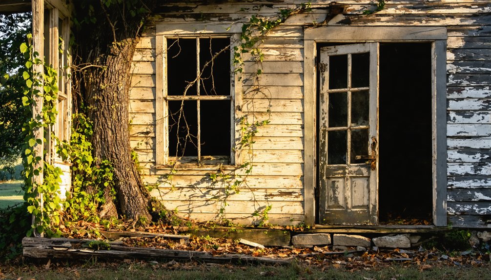
Calico Rock: A Fading Trade Town Split in Two
Along the White River’s winding banks in the 1800s, French traders and trappers established a modest trading post that would evolve into one of Arkansas’s most notorious settlements.
The Calico history began when fur traders named it for the distinctive patterned bluffs in the 1820s. By the 1900s, it thrived as a rail and river hub for zinc mining and timber.
The town’s wild reputation earned it the nickname “Peppersauce Alley,” where you’d find:
- Moonshine-serving shanty taverns along Calico Creek
- Knife fights and gunfights among thieves and vagabonds
- Bootleggers selling their wares behind Main Street
Trade decline came through fires, floods, and economic shifts.
Today, East Calico stands abandoned—twenty buildings frozen in time, including a jail that once held twenty prisoners, accessible within city limits.
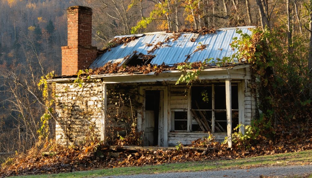
Bruno: Remote Remnants in Marion County
While Calico Rock drew notoriety from its lawless reputation, Marion County’s ghost towns tell quieter stories of isolation and gradual abandonment.
Bruno’s history began around 1840, when it thrived with 600+ residents serving travelers traversing Ten Mile Creek Bottoms. You’ll find it off Highway 65 to Junction 235, then following the left fork through increasingly remote terrain.
The town’s decline accelerated after its school district consolidated in 1974.
Today, Bruno structures include an operational church, a post office, and an 1800s cemetery where gravestones mark farmers and shopkeepers who built this community.
You can explore abandoned homes and weathered buildings that remain scattered across the landscape. It’s free to visit, though you’ll need patience for the long drive from Yellville through Marion County’s backcountry.
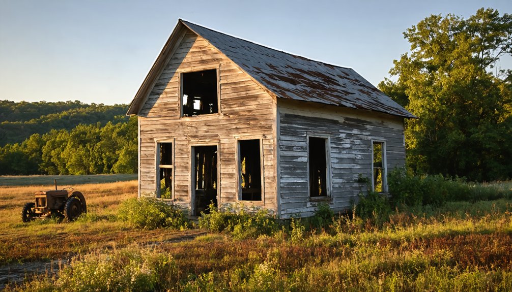
Mount Tabor: An Economic Casualty of Northwest Arkansas
The collapse of agricultural economies claimed Mount Tabor decades before most ghost towns in the region met similar fates. Founded in 1854 near Jessieville in Garland County, this farming community thrived modestly through the late 1800s with its church anchoring scattered homesteads.
Mount Tabor fell to economic ruin long before neighboring settlements, its church-centered farming community unable to survive agricultural collapse.
You’ll find its economic decline began when railroads bypassed the settlement entirely, cutting off market access. By the 1930s, three critical failures sealed Mount Tabor’s fate:
- Zero industrial diversification beyond crop cultivation
- Persistent farming viability challenges during national depression
- Regional population shifts toward connected transportation hubs
The Crow family’s 270-acre farm stood last, vacated during the worst of the downturn.
Today, only the church remains standing—a symbol of freedom-seeking pioneers whose agricultural dreams couldn’t withstand isolation’s harsh economics.
Pinnacle Springs: Healing Waters Lost to Time
Mount Tabor’s demise stemmed from isolation, Pinnacle Springs died despite accessibility—a cruel irony for a settlement built on promises of healing.
In 1880, cowhand Jeff Collier tasted water that’d transform Faulkner County’s wilderness. By the late 1880s, thirteen springs with supposed healing properties drew enough believers to sustain two hotels, twelve bathhouses, and fifty houses.
The Pinnacle Springs Land Company even lured Arkansas Christian College here in 1889, promoting the town’s saloon-free respectability. Yet permanence proved elusive.
When the post office shuttered in 1891, residents scattered, leaving their community legacy to fire and salvagers.
Today, you’ll find only carved names on rock walls—ghosts of visitors who once sought miracle cures in these forgotten waters.
Exploring Northwest Arkansas Ghost Towns Today
Unlike their vanished predecessors, northwest Arkansas’s ghost towns invite your boots onto their ground.
You’ll find genuine historical significance waiting along Buffalo National River trails at Rush, where zinc mine ruins stand evidence to World War I’s industrial hunger.
Marion County offers a cluster worth exploring:
- Eros – weathered schoolhouse and general store marking agricultural decline
- Bruno – remote farming settlement with minimal remains
- Rush – most intact site with confirmed standing structures
Monte Ne’s submerged ruins surface when Beaver Lake drops, rewarding patient observers.
For quirky Americana, Booger Hollow’s trading post and infamous two-story outhouse still welcome travelers on Highway 7.
Ghost town exploration here isn’t treasure hunting—it’s walking through Arkansas’s unvarnished past, accessible to anyone willing to venture down forgotten roads.
Frequently Asked Questions
Are Ghost Town Visits in Northwest Arkansas Safe and Legal?
Ghost town visits aren’t universally safe or legal—you’ll need to research specific ghost town regulations beforehand. Rush offers designated trails, but sites like Dogpatch USA remain private property. Always take proper safety precautions exploring deteriorated structures.
What Should I Bring When Exploring Abandoned Towns in Arkansas?
Like any frontier explorer, you’ll need essential gear: sturdy boots, flashlight, GPS device, first-aid kit, and water. Take safety precautions with maps, protective clothing, and whistle—then roam freely through Arkansas’s forgotten mining settlements.
Can I Take Artifacts From Ghost Town Sites?
No, you can’t take artifacts from ghost town sites. Federal laws protect Rush Historic District, prioritizing artifact preservation over personal collection. Ethical considerations demand you leave historical items untouched—hefty fines await those who don’t respect these freedoms-protecting heritage rules.
Which Ghost Towns Are Best for Photography?
You’ll hit the jackpot at Rush Historic District, where abandoned architecture frames incredible historical storytelling through decaying miners’ homes and zinc mill ruins. Calico Rock’s bluffs and Monte Ne’s watery remnants also deliver atmospheric shots capturing Arkansas’s vanished frontier.
Are There Guided Tours Available for Northwest Arkansas Ghost Towns?
You won’t find dedicated ghost town tours, but Fayetteville Haunts offers guided exploration of abandoned sites and local history through downtown’s haunted landmarks. Their archival research-based walks cover folklore from forgotten settlements and Northwest Arkansas’s vanished communities.
For those looking for more adventure, there are countless ghost towns to explore in Arkansas that showcase the state’s rich past. Enthusiasts can venture into places like Gilcrease and Sunset, where remnants of old homes and businesses tell stories of bygone eras. Exploring these eerie landscapes provides a unique glimpse into the history that shaped the region.
In addition to Gilcrease and Sunset, other ghost towns in Arkansas history await discovery for those curious about the state’s lesser-known tales. These locations not only house remnants of the past but also echo with the stories of the people who once thrived there. Each visit to these forgotten places offers a profound connection to the roots of Arkansas’s diverse heritage.
References
- http://freepages.rootsweb.com/~gtusa/history/usa/ar.htm
- https://www.axios.com/local/nw-arkansas/2024/01/02/arkansas-ghost-towns-mapped
- https://kkyr.com/arkansas-top-5-ghost-towns/
- https://www.youtube.com/watch?v=U4kJjjbcnMM
- https://aymag.com/arkansas-backstories-ghost-towns/
- https://abandonedar.com
- https://en.wikipedia.org/wiki/List_of_ghost_towns_in_Arkansas
- https://kids.kiddle.co/List_of_ghost_towns_in_Arkansas
- https://www.nps.gov/articles/rush-historic-district-500856.htm
- https://encyclopediaofarkansas.net/entries/rush-ghost-town-marion-county-1270/