You’ll find Madrid just 28 miles northeast of Albuquerque—a coal mining town that peaked at 2,500 residents before closing in 1954, then reinvented itself as an artists’ colony in 1975. Cerrillos, with turquoise deposits mined since A.D. 900, sits nearby and generated over $2 million during its 1890s heyday. Further south, Chloride preserves 27 original structures from its 1879 silver strike, including discoverer Harry Pye’s log cabin. Each town’s abandoned buildings and mining remnants reveal distinct chapters of New Mexico’s territorial past.
Key Takeaways
- Madrid, a former coal mining town 27 miles from Albuquerque, now thrives as an artists’ community with 250 residents.
- Cerrillos features ancient turquoise mining history dating to A.D. 900 and became a significant 1870s boomtown.
- Chloride preserves 27 original structures from its 1879 silver mining era, including discoverer Harry Pye’s log cabin.
- Glenrio, a Route 66 border town, declined after Interstate 40’s 1973 bypass and contains seventeen abandoned structures.
- Spring and fall offer ideal visiting conditions; bring three liters of water, GPS, and emergency supplies for exploration.
Madrid: From Mining Hub to Artistic Haven
Long before Madrid became a quirky artists’ colony along the Turquoise Trail, coal deposits beneath its rocky terrain attracted enterprising miners who’d discovered a 30-square-mile bed of hard and soft coal around 1835.
The Cerrillos Coal Company built this company town, originally called Coal Gulch, which peaked at 2,500 residents—exceeding Albuquerque’s population.
You’ll find remnants of its mining history everywhere: the iconic seven-story anthracite breaker (collapsed in 1983), wood-framed Kansas cabins transported by rail, and the Mine Shaft Tavern still serving cold beer.
After mines closed in 1954, Madrid nearly disappeared until 1975, when Joe Huber sold 150 buildings for $1,500-$2,000 each.
Within 16 days, artists and freedom-seekers snapped them up, sparking an artistic revival that’s transformed this ghost town into a vibrant creative community.
Today, approximately 250 residents call Madrid home, maintaining the village’s unique character as both a popular Turquoise Trail destination and a tight-knit community.
The town’s famous Christmas light displays, which once featured 150,000 lights powered by coal-fed generators in the early 1920s, have been revived with modern celebrations along the main street.
Cerrillos: Ancient Turquoise Mining Legacy
While Madrid’s coal seams drew 19th-century prospectors, Cerrillos’s turquoise deposits had already sustained mining operations for over a millennium.
You’ll find North America’s largest prehistoric turquoise source at Mount Chalchihuitl, where Native Americans began extraction around A.D. 900 using stone tools for surface pits and shallow shafts. This ancient mining network fueled a turquoise trade spanning from Canada to Central America.
Spanish colonists disrupted this system in the 1600s, exploiting silver-lead deposits while Puebloans maintained their traditional operations. The 1870s silver strike finally ended Pueblo control, transforming Cerrillos into a territorial boomtown. The Cerrillos Mining District was recognized for its cultural significance when it was placed on the New Mexico State Register of Cultural Properties in 1973. Modern operations recovered over $2,000,000 in turquoise during peak production in the 1890s.
Chloride: Silver Strikes and Wild West Tales
Harry Pye’s 1879 dash from Apache raiders into a remote gulch inadvertently revealed one of New Mexico’s richest silver strikes—a vein of silver chloride ore that would transform wilderness into a thousand-soul boomtown within five years.
You’ll find Pye’s original log cabin still standing, now rented to adventurers seeking authentic frontier accommodations. The town legends are documented in the Pioneer Store Museum, time-sealed since 1923, where you’ll discover artifacts from nine saloons and the 51-man militia that defended against Victorio’s warriors.
Silver mining crashed with the 1893 panic, dropping prices ninety percent overnight. The presidential election of 1896 dealt another blow to the struggling camp, accelerating its inevitable decline.
Today, twenty-seven original structures remain among a dozen residents who’ve chosen this remote outpost over conventional living—including the sobering-up tree still marking Main Street. Located five miles southwest of Winston off State Road 52, Chloride sits approximately 40 miles northwest of Truth or Consequences.
Glenrio: Route 66 Border Town Relic
You’ll find Glenrio’s skeletal remains straddling the Texas-New Mexico border at mile marker 0, where the Rock Island and Pacific Railroad established a siding in 1905 that grew into a border town capitalizing on quirks of state law.
When Interstate 40 bypassed the community in 1973, it strangled what Route 66 had sustained for nearly five decades—a thriving commercial strip where Texas-side service stations sold cheap gas while New Mexico-side establishments poured legal drinks.
The seventeen abandoned structures now comprising its National Register Historic District stand as monuments to how a highway realignment just hundreds of yards away can erase a town’s reason for existence. The town’s post office operated from the New Mexico side while mail was delivered from Texas, illustrating the administrative complexities of this border community. Among the deteriorating landmarks, the Little Juarez Diner from 1952 showcases Art Moderne design elements that once attracted travelers seeking roadside meals between states.
Historic Railroad Town Origins
By 1906, you’d witness a bustling station handling:
- Cattle shipments from surrounding ranches
- Freight operations serving wheat farmers
- Mail delivery between Texas and New Mexico sides
- Passenger traffic through the border community
Adobe buildings rose alongside the tracks, forming the settlement’s original core.
The Rock Island and Pacific Railroad renamed it from “Rock Island” to “Glenrio” in 1908, establishing the identity that would endure through boom and eventual abandonment. The settlement began as a Rock Island Railroad stop, serving travelers and commerce between the two states. By 1917, Glenrio became a stop for motorists on the Ozark Trail, marking its transition from a railroad town to a motorist destination.
Interstate 40 Bypass Impact
When Interstate 40‘s ribbons of concrete bypassed Glenrio in 1973, the town’s fate was sealed with the finality of a coffin lid closing.
The economic impact was immediate and devastating. You’d have watched entrepreneurs pack up their dreams, relocating to new exits where traffic actually flowed.
The transportation changes meant drivers now blasted from Point A to Point B without slowing for coffee at Little Juarez Cafe or gas at the Streamline Moderne Texaco station.
Straddling Two State Borders
Glenrio’s geographic identity crisis defined its character from the moment settlers arrived in 1903.
You’ll find this peculiar town split between Texas and New Mexico, where border dynamics created entrepreneurial opportunities locals exploited brilliantly. The federal government called it a Texas town, but residents knew better—they’d built a thriving economy on state-line arbitrage.
The historical significance of this division shaped daily commerce:
- Mail operations: Post office in New Mexico received deliveries from Texas-side depot
- Liquor sales: Bars clustered New Mexico-side (Deaf Smith County stayed dry)
- Fuel stations: Texas-side dominated due to lower gasoline taxes
- Business strategy: Merchants positioned establishments based on regulatory advantages
This border-straddling arrangement wasn’t bureaucratic hassle—it was freedom from single-state restrictions, letting Glenrio thrive where others merely survived.
Pinos Altos: Gold Rush Settlement in the Mountains
You’ll find Pinos Altos nestled in the mountains eight miles northeast of Silver City, where three 49-ers struck placer gold at Bear Creek in 1860 while stopping for water.
Within months, 700 miners flooded the district—mostly laborers and convicts from Santa Rita who worked the placers under armed guard, secretly preparing gold shipments in rawhide panniers for transport to Mexico.
Discovery and Early Boom
Three prospectors stopping for water at Bear Creek in 1860 stumbled upon placer gold that would transform the Pinos Altos Mountains into one of New Mexico’s most significant mining camps.
The gold discovery, located 8 miles northeast of Silver City, sparked immediate settlement despite constant Apache raids.
By September, you’d have found approximately 700 men working fortified encampments, concealing their diggings each night.
Early mining methods evolved rapidly:
- Placer operations dominated the first year
- Prospectors searched relentlessly for the mother lode
- Quartz grinding operations began despite Indian harassment
- Fortified camps protected miners and animals inside barricaded structures
Commercial infrastructure followed quickly—hotels, saloons, and merchandise dealers opened by 1861.
The camp ultimately produced an estimated $8 million in ore, establishing Pinos Altos as a genuine New Mexico gold rush settlement.
Historic Buildings and Landmarks
The mining camp’s rapid transformation from tent city to permanent settlement left physical evidence that still defines Pinos Altos today.
You’ll discover remnants of the fortified “Pinos Altos” encampment, where Mexican settlers built horseshoe-shaped walls from logs, rocks, and adobe around a living spring beneath a massive cottonwood.
When the town incorporated 320 acres in 1868, commercial establishments sprouted along the central creek—including the Pinos Altos Hotel and Samuel G. Bean’s merchandise dealership with its billiard table.
The mining heritage extends beyond town limits to the Pacific Mine, the district’s first lode claim, and Virgil Mastin’s 15-stamp mill from 1866.
These weathered structures mark where entrepreneurs like Thomas J. Marston ground quartz “despite Indian annoyances,” building Grant County’s first seat of government.
White Oaks: Victorian Elegance Frozen in Time
Gold fever gripped the Jicarilla Mountains in 1879 when prospectors John Wilson, Jack Winters, and Harry Baxter struck pay dirt in what Spanish explorers from the Oñate expedition had dismissed as “Malpais”—badlands—centuries earlier.
You’ll find White Oaks’ historical significance preserved in its Victorian architecture, a stark contrast to New Mexico’s typical adobe structures.
The town’s meteoric rise produced:
- Population expansion to 2,500 residents by the late 1800s
- New Mexico Territory’s second-largest city status
- More lawyers than miners on its streets
- Stage routes connecting Fort Stanton, San Antonio, and Roswell
The Hoyle House’s widow’s walk still overlooks abandoned dreams.
Billy the Kid’s 1878 shootout adds outlaw mystique.
Today, fifteen resilient souls maintain this frozen-in-time settlement three miles north of Carrizozo, where pitched roofs tell stories of prosperity lost to greedy landowners who blocked railroad access.
Planning Your Ghost Town Adventure
You’ll find spring and fall offer the most comfortable conditions for exploring New Mexico’s ghost towns, as summer heat can be punishing in desert locations like Chloride while winter snow may block mountain routes to sites such as Pinos Altos.
Pack emergency supplies including extra water, a detailed map (cell service disappears quickly), and sturdy boots for traversing crumbling structures and uneven terrain.
Before setting out, plot your route carefully using state roads like NM 54 and Road 52, but remember that many of these abandoned settlements sit in remote areas where you won’t see another soul for hours.
Best Times to Visit
Planning your ghost town adventure around Albuquerque demands careful consideration of seasonal timing, and I’ve learned through years of trailing these haunted sites that fall reigns supreme for atmospheric exploration.
September through October offers ideal conditions for fall adventures when desert temperatures cool and golden cottonwoods frame abandoned structures perfectly for photography and ghostly folklore encounters.
Optimal visiting windows include:
- Evening hours after sunset – cooler temperatures and enhanced eerie ambiance
- Weekday visits – avoid weekend crowds at popular sites
- Fall months (September-October) – comfortable 60-75°F range
- Early morning light – dramatic shadows reveal architectural details
Desert nights drop rapidly, creating spine-tingling atmospheres authentic to these locations’ haunted reputations.
You’ll avoid summer’s brutal heat while maintaining year-round accessibility—true freedom to explore on your schedule.
Essential Supplies and Gear
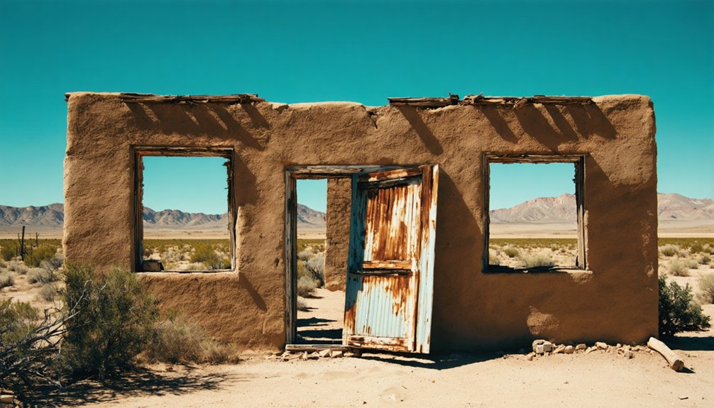
When I first ventured into the crumbling adobe ruins outside Madrid, New Mexico, I learned the hard way that ghost town exploration demands meticulous preparation—my single water bottle ran dry within two hours under the relentless desert sun.
You’ll need exploration essentials that honor both safety and self-reliance. Pack three liters minimum per person, plus electrolyte packets for hydration strategies in 100°F+ heat. Your GPS should have offline maps—cell towers don’t reach abandoned mining camps.
Carry a compass, paper topographic maps, and a headlamp for peering into dark shafts. Sturdy boots, long sleeves, and wide-brim hats protect against UV and rocky terrain.
Include an all-inclusive first aid kit with snake bite supplies, plus a personal locator beacon for truly remote sites where freedom meets wilderness reality.
Mapping Your Route
How do you transform a list of ghost towns into a coherent adventure when New Mexico’s abandoned settlements sprawl across 121,000 square miles of desert, mountain, and plain?
Start with regional clustering using the New Mexico Tourism map‘s five zones, then plot route options on Google Maps or Atlas Obscura’s GPS coordinates for seven key sites.
Essential travel tips for efficient routing:
- Northern Loop: Cerrillos (55 miles) and Madrid (45 miles) via I-25 and SR-14
- Eastern Circuit: Glenrio (170 miles) on I-40, then Cuervo and Montoya following historic Route 66 alignments
- Southern Run: Lake Valley (200 miles) and Shakespeare (250 miles) via US-54 and I-10
- Mountain Challenge: Mogollon’s winding Gila roads and Pinos Altos (8.5 miles from Silver City)
Cross-reference Wikipedia’s county listings with current road conditions before committing to remote sites like Chloride’s gravel SR-52.
Best Times to Visit New Mexico Ghost Towns
Although New Mexico’s ghost towns stand ready for exploration year-round, the state’s dramatic elevation shifts and desert climate create distinct windows of opportunity that separate memorable visits from uncomfortable ones.
Seasonal highlights emerge during April-May and September-October, when temperatures hover between 50-75°F—perfect for walking Lake Valley’s restored schoolhouse or photographing White Oaks without harsh midday glare.
Weather considerations prove critical: you’ll want to avoid July-August monsoons that turn arroyos near Hillsboro into flash-flood channels.
Winter offers solitude and clear skies, though snow may block Gila National Forest approaches.
Spring’s wildflowers along Route 52 to Chloride create stunning backdrops, while fall’s reduced crowds let you linger at Shakespeare Ghost Town without feeling rushed.
Madrid’s Christmas lights transform the former coal town into something unexpectedly magical.
Photography Tips for Abandoned Town Exploration
Timing your visit sets the stage for exploration, but capturing these decaying remnants requires specific technical knowledge that separates snapshot tourists from documentary photographers. Abandoned aesthetics demand deliberate photographic techniques that honor these structures’ stories.
Your essential gear setup includes:
- Wide-angle lens (24mm) to amplify spatial vastness
- Sturdy tripod for 30-second exposures at f/8
- Graduated neutral density filters managing window-to-interior contrast
- Headlamp for traversing electricity-free corridors
Bracket your exposures relentlessly—three stops above and below your meter reading. Morning’s angled light reveals textures flash destroys.
Frame compositions through doorways and windows; these borders direct attention while suggesting isolation. Document nature’s reclamation: rust meeting vine growth, cracked concrete hosting wildflowers.
Shoot upward from ground level to emphasize disorienting vastness. Black-and-white processing amplifies temporal disconnect.
Preserving History: Ghost Town Etiquette and Safety
Safety precautions demand respect for genuine hazards: collapsing mines, asbestos-laden buildings, unstable floorboards.
Metal detectors require explicit permission; artifacts stay put unless they’re clearly trash. Your actions determine whether these sites survive another century.
Obtain detailed maps beforehand—cell service won’t save you. Leave gates as found, fill any excavations, and remember: many ghost towns remain someone’s home.
Request permission before photographing residents or occupied structures.
Frequently Asked Questions
Are Ghost Towns Near Albuquerque Safe to Explore With Children?
Ghost town safety near Albuquerque requires caution—children exploration faces hazards from unstable structures, vandalized buildings, and remote terrain. You’ll find private property restrictions, toxic mining residues, and wildlife risks demanding constant supervision throughout these abandoned sites.
Can You Camp Overnight in New Mexico Ghost Towns?
Like a tumbleweed without roots, you can’t camp in ghost towns themselves—they’re private property. Follow ghost town etiquette and check nearby BLM lands’ camping regulations for legal overnight spots within driving distance.
Do Any Ghost Towns Charge Admission Fees or Require Permits?
Most ghost towns remain free to explore, but you’ll find admission fees at preserved sites like Shakespeare and Lake Valley. National forest locations may need standard recreation permits, though specific entry permits aren’t common.
If you venture beyond the mainland, exploring abandoned places in American Samoa can offer a unique glimpse into the past. These locations, often untouched by time, reveal stories of the island’s rich history and provide a serene backdrop for adventurous souls. As you trek through the remnants, be sure to respect the local environment and follow any guidelines to preserve the beauty of these hidden gems.
What Should I Bring on a Ghost Town Day Trip?
Pack your camera gear to capture crumbling adobes, plus hiking essentials like water, sun protection, sturdy boots, and navigation tools. I’ve learned offline maps prove invaluable since cell service vanishes beyond civilization’s reach.
Are Ghost Town Buildings Accessible or Off-Limits to Visitors?
Access varies dramatically—visitor-friendly towns like Madrid and Shakespeare welcome exploration with guided tours, while private properties demand visitor etiquette. Always respect building preservation efforts; some structures remain off-limits due to ownership, safety concerns, or historical protection requirements.
References
- https://www.newmexico.org/places-to-visit/ghost-towns/
- https://www.tripadvisor.com/Attractions-g28952-Activities-c47-t14-New_Mexico.html
- https://www.atlasobscura.com/things-to-do/new-mexico/ghost-towns
- https://santafe.com/new-mexico-road-trip-ghost-towns/
- https://www.newmexicomagazine.org/blog/post/abandoned-ghost-towns-new-mexico/
- https://en.wikipedia.org/wiki/List_of_ghost_towns_in_New_Mexico
- https://www.youtube.com/watch?v=pGPjU65CHeE
- https://www.newmexico.org/places-to-visit/ghost-towns/map/
- https://newmexiconomad.com/madrid/
- https://www.visitmadridnm.com/history


